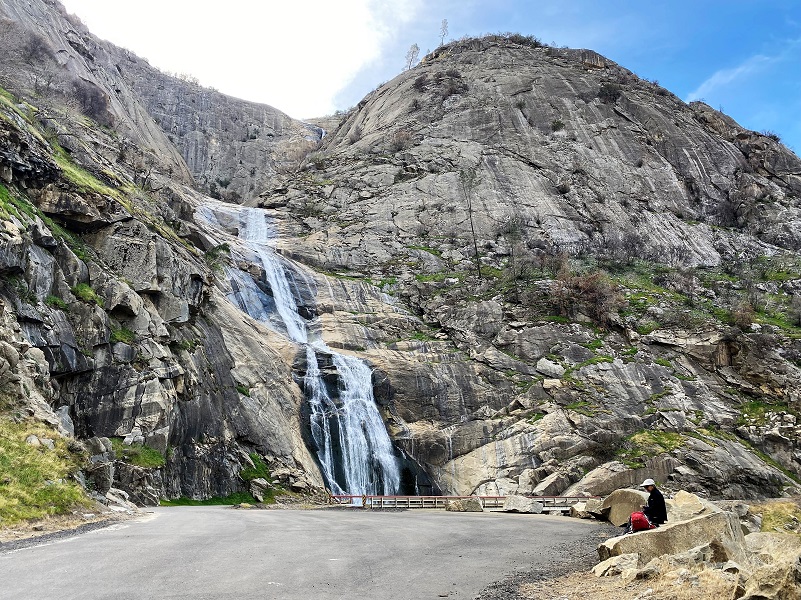
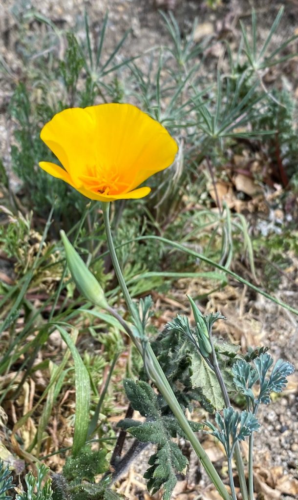
The Million Dollar Road led us to Stevenson Creek Falls, its water dropping 1,200′ as it leaped over the rocks down to the San Joaquin River. A few wildflowers along the way put smiles on our faces.
Where: Sierra National Forest, Southern California Edison
Distance: 12.44 Miles (About 7 miles roundtrip to Stevenson Creek Falls)
Difficulty: Moderate
Elevation Range: 1,186′ to 2,387′
Elevation Gain: 2,839′
Date: February 14, 2022
CALTOPO: CALTOPO: Hiking to Stevenson Creek Falls and Beyond
Dog Hike? Maybe
 We headed out from North Fork, drove down Road 225, crossed the new bridge over Redinger Lake, then we wound our way a couple of miles past Powerhouse 3 and the old Chawanakee School. As I drove, I glanced down to see the burned remains that were destroyed during 2020’s Creek Fire which started on September 4, 2020, near Shaver Lake. That fire burned 379,895 acres, destroyed at least 856 buildings and cost over $193 million in fire suppression costs.
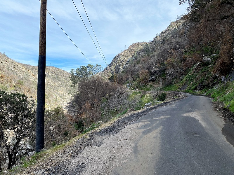
We drove to where the gate crosses the road, parking in a small turnout nearby, making sure we weren’t blocking any traffic then walked around the gate and up the paved road called “The Million Dollar Road.” This road was originally built in 1922 and they say the name is a reference to the cost per mile that it took to build.
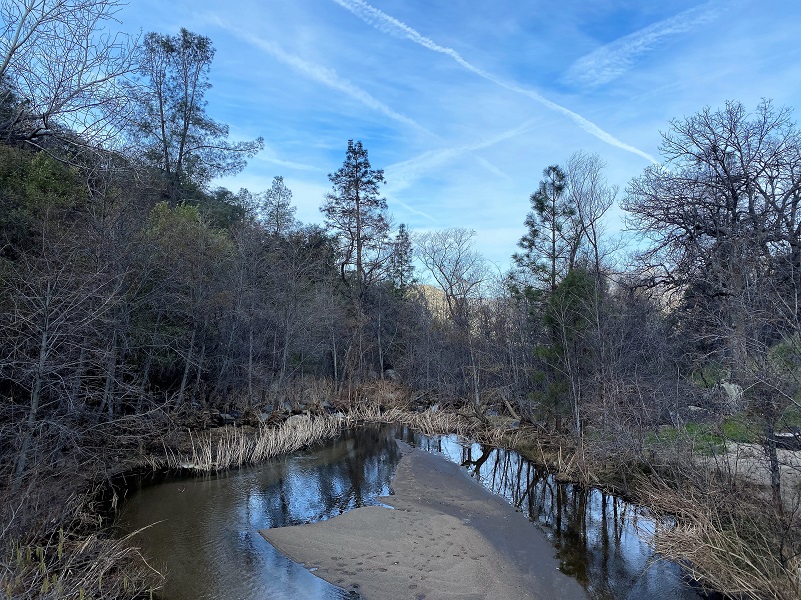
Crossing the metal grid bridge over Mill Creek, it reminds me that if you are hiking with a dog, you will need to carry your dog over this bridge. More about hiking this one with a dog toward the end.

There were pretty reflections in Mill Creek!
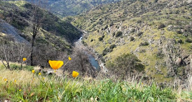
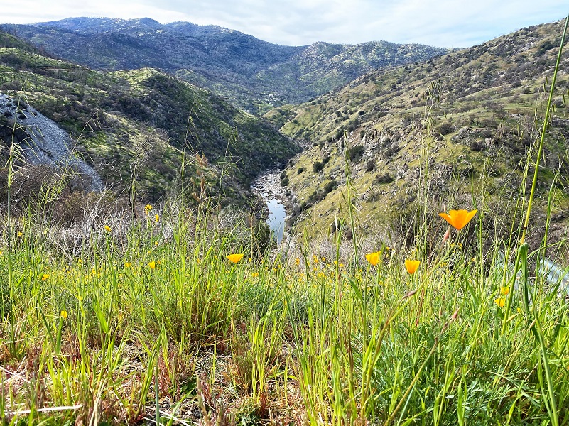
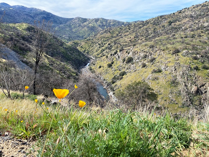
A few lupine were blooming along the road but we also noticed quite a few poppies that were still closed up in the morning which made us wonder what this area would look like in the afternoon when we returned.

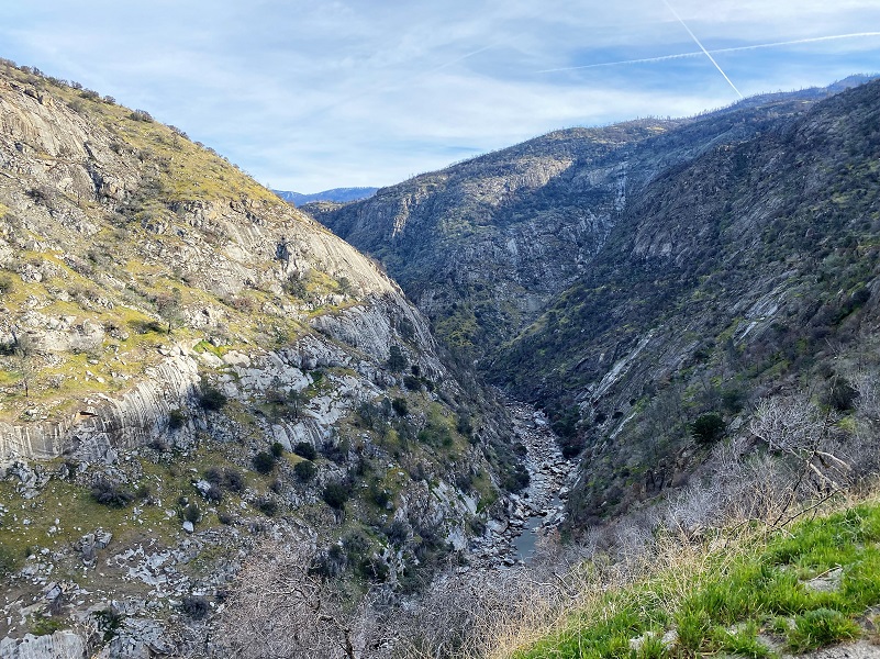
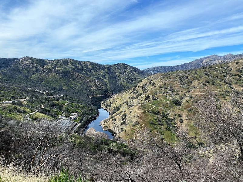
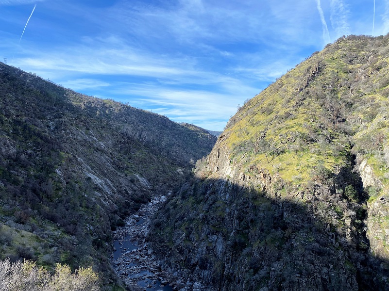
I took a look up the San Joaquin River Canyon and wow, not much water flowing down there.
And then we saw this. Did someone get hit by a falling rock at this spot or was it a warning to be watchful for falling rocks? Either way, it made me look uphill and I felt more at ease after I got through this stretch.
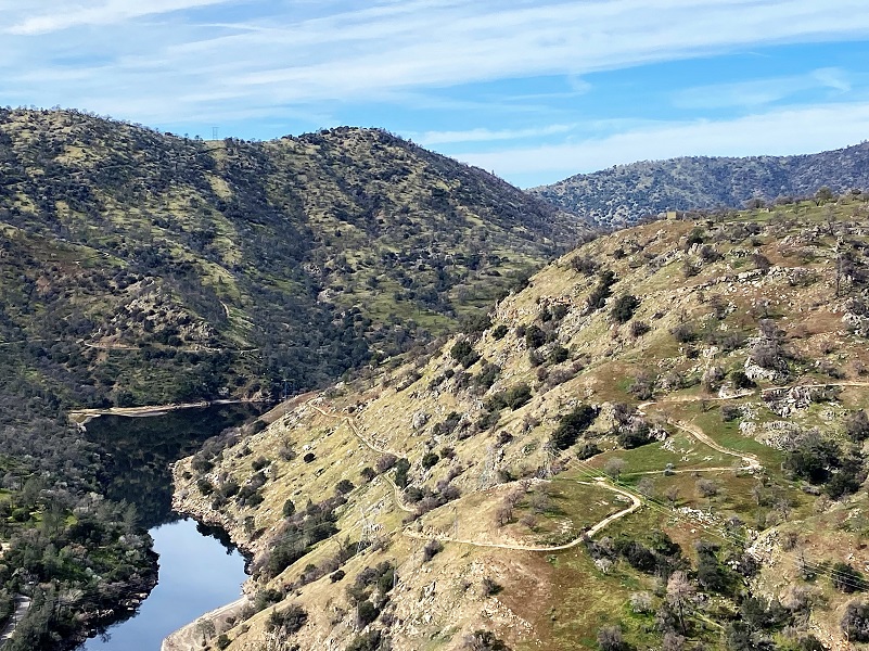
As the road worked its way uphill, we looked back at Powerhouse 3 and Redinger Lake.
When the Big Creek Hydroelectric Project was built, its primary purpose was to provide electrical power for the city of Los Angeles. California engineer John S. Eastwood was the principal designer of the system, which was initially funded and built by Henry E. Huntington’s Pacific Light and Power Company (PL&P).
Construction of the system’s facilities started in 1911, and the first power was transmitted to Los Angeles in 1913. After Southern California Edison (SCE) acquired PL&P in 1917, the system was gradually expanded to its present size, with the last powerhouse coming on line in 1987. Today, these facilities include 27 dams, miles of underground tunnels, and 24 generating units in nine powerhouses with a total installed capacity of more than 1,000 megawatts. Its six major reservoirs have a combined storage capacity of more than 560,000 acre feet.
Today, the Big Creek project generates nearly 4 billion kilowatt hours per year – about 90 percent of SCE’s total hydroelectric power, or about 20 percent of SCE’s total generating capacity. Big Creek accounts for 12 percent of all the hydroelectric power produced in California. The Big Creek reservoirs also provide irrigation and flood control benefits for the Central Valley, and are popular recreation areas. There are negatives though. Fish and animal migration have been disrupted and historical sites and traditional Native American lands have been flooded.
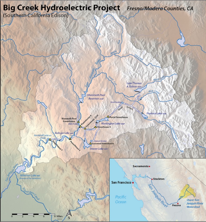
Big Creek Hydroelectric Project (Courtesy Wikipedia)
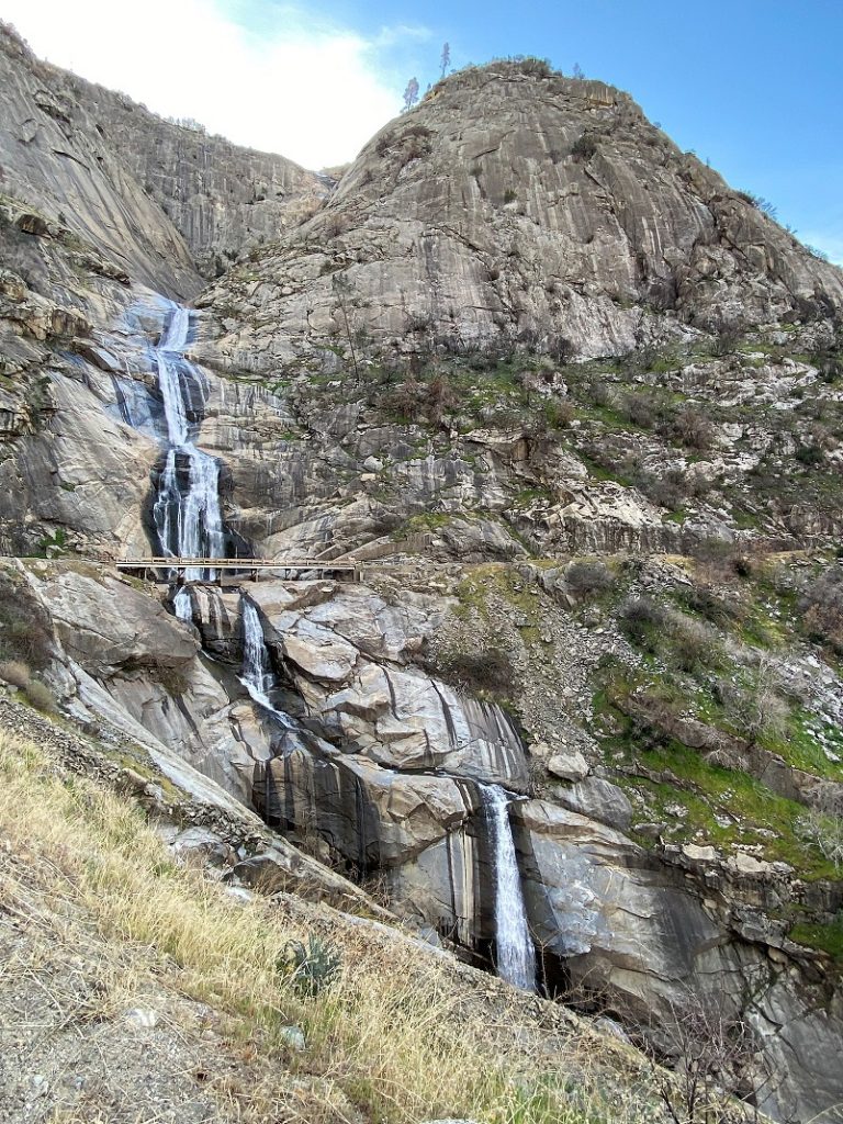
You can’t see Stevenson Creek Falls until you come around the last bend of the road but if it is really flowing heavily, you can hear it before you reach this point. We have seen it flowing so strong the road was closed at the bridge and the spray hit us when we rounded this bend… but not today.
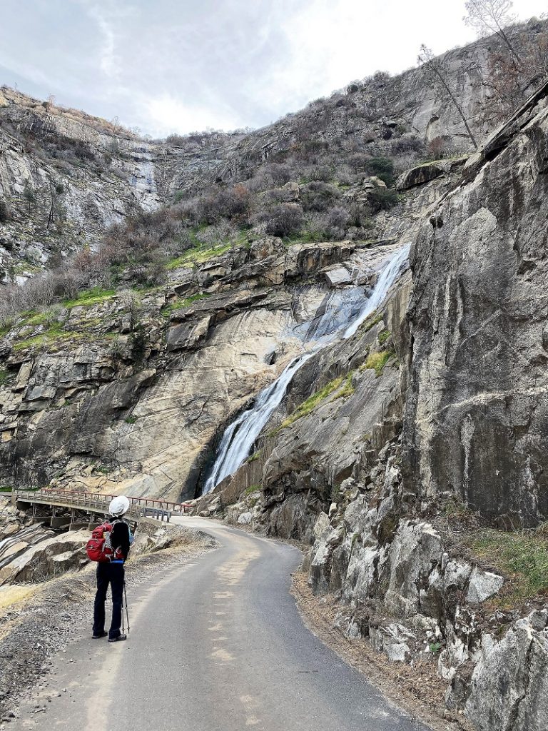
Stevenson Creek is incorporated into a hydroelectric project at Shaver Lake and as a result does not flow with the consistency that it once did. Before being regulated, the booming stream created what was perhaps the 3rd best waterfall in California – and even now with its inconsistent flow is still among the 10 best waterfalls in the state. The falls hurtle around 1,200 feet in four primary leaps of approximately 380, 260, 250 and 180 feet respectively, with multiple smaller slides and cascades in between each drop. With the regulation of the stream in place the falls run dry through most of the summer, but during the spring months the creek still swells to considerable size and creates a monstrous cataract as it thunders into the San Joaquin River canyon – during which time the Million Dollar Road, used to access the falls, is often closed at the bridge which crosses the falls because the falling water can actually fall directly onto the bridge.
As we walked along the road, we passed by several “tunnels”. These are called adits and only open at the road’s end. They provided access to the tunnels along the system as it was being built and used to drain excess water.
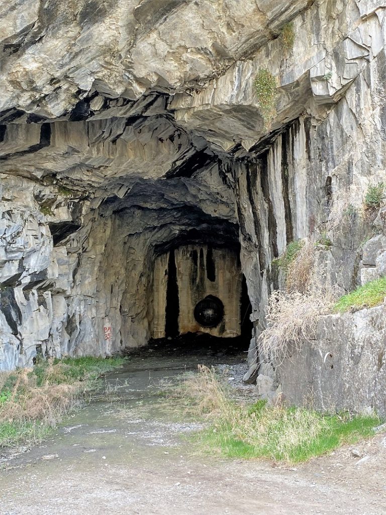
I located an interesting article in Compressed Air Magazine dated January 1924 that discusses and shares pictures of some of the adits being built. If you would like to read the entire article, here is a Google Books link.
Compressed Air Magazine January 1924
We took a short snack break, admiring the falls.
And of course, we took a few pictures.
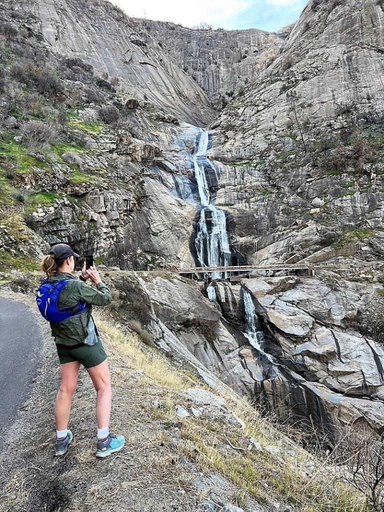
Photo by Gail Gilbert
We got as far away as we could in order to try and capture as much of the waterfalls as we could.
We continued walking up the road
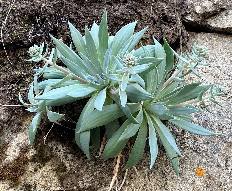
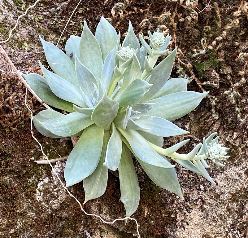
All along the road on rocky walls that were dripping with moisture, stonecrop were growing and almost ready to bloom.


We continued up the road another 2.4 miles. If we had continued up another 2.6 miles, we would have reached Big Creek Dam 6.
We finally felt that it was time to turn around and as we headed back down the road we made sure to check out those poppies we had spotted on our way up.
And we stopped to admire the reflections in Reddinger Lake.
There are many options on how you would like to hike or bike this road. You also want to pay attention while you are walking because vehicles and bikes can come around blind corners quickly and take you by surprise.
Dog Hike?
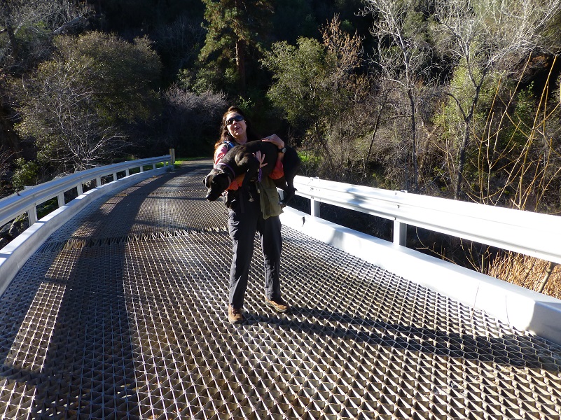 This hike could potentially be a good hike to take with your dog, if they are the type of dog that stays with you on the road. In addition to needing to carry your dog over the steel grid bridges, there are some steep drop-offs on this road. You can ask Deb how much fun she had carrying 65 pound Raven over the bridge a few years ago. My Sally dog would want to chase squirrels and I am afraid that Sally would dive off there while chasing some critter and hurt herself. This is also rattlesnake haven. There is only one fairly good watering spot at Mill Creek, so you would need to pack water for your dog. The hike is entirely paved and this can be tough on a dog’s paw pads if they aren’t toughened up to this type of use. That pavement can also be very hot in the summer.
Doarama:
What is a Doarama? It is a video playback of the GPS track overlaid on a 3 dimensional interactive map. If you “grab” the map, you can tilt it or spin it and look at it from different viewing angles. With the rabbit and turtle buttons, you can also speed it up, slow it down or pause it.
Stevenson Creek Falls and Beyond Doarama
Maps and Profile:
CALTOPO has some free options for mapping and here is a link to my hike this week: CALTOPO: Hiking to Stevenson Creek Falls and Beyond
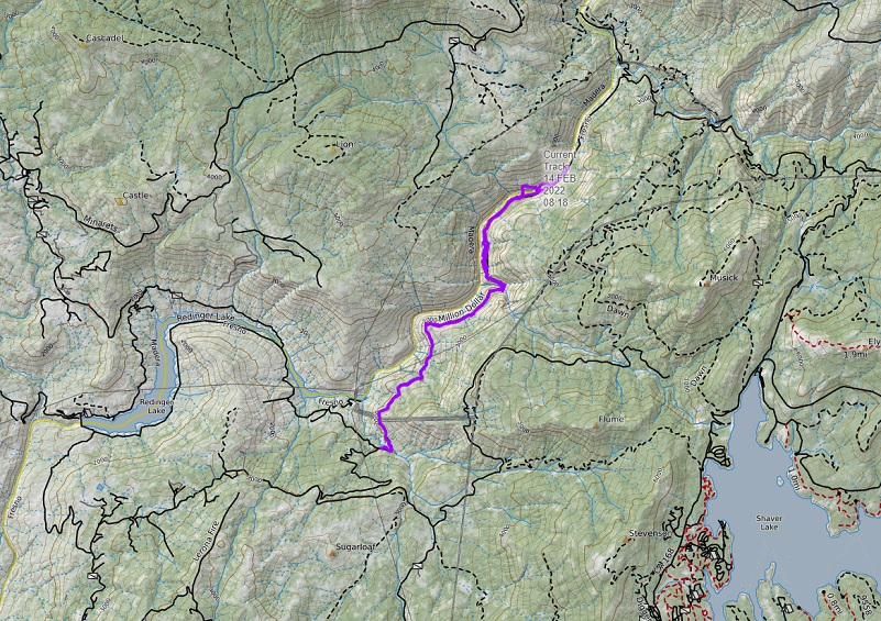
Hiking to Stevenson Creek Falls and Beyond Topographic Map
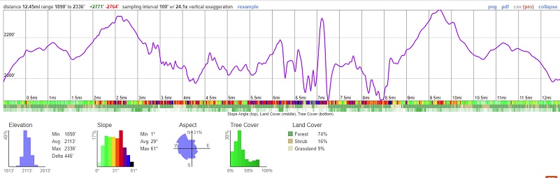
Hiking to Stevenson Creek Falls and Beyond Profile
Sources:
Big Creek Hydroelectric Project Wikipedia
Reddinger, David H., The Story of Big Creek, Pampamoa Press, 1949
Compressed Air Magazine, Volume 29
Big Creek Hydroelectric System California Water Board
Prior Blogs in the Area:
Hiking to Roaring Stevenson Creek Falls May 29, 2019
Hiking to Stevenson Fall through Recent Road Washouts February 13, 2017
Stevenson Falls Hike February 25, 2015


