We looked for a hike close by where we could get some exercise and see some views but we didn’t have much time. We came up with a dandy and we saw some critters!
Where: Yosemite National Park
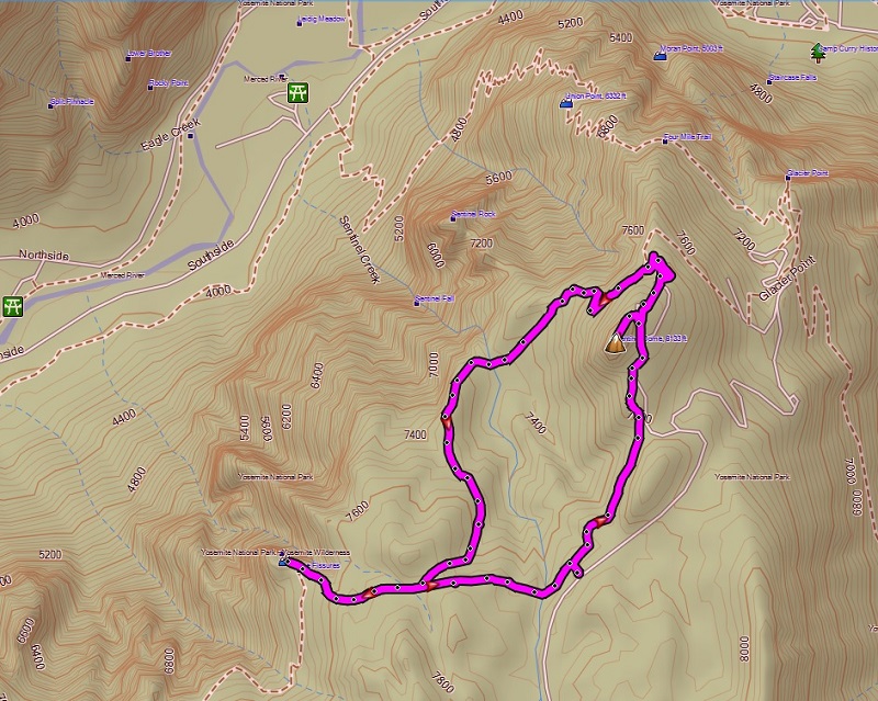
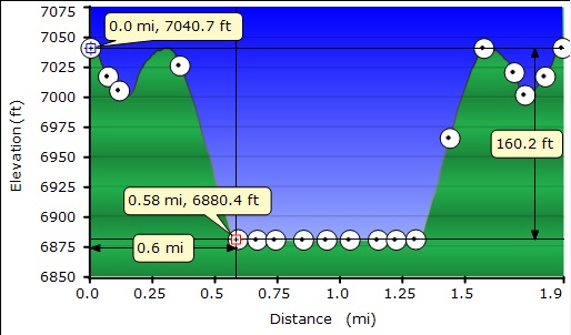
Distance: About 5.3 miles for the Sentinel Dome Taft Point Loop and about 1.9 miles for the McGurk Meadow.
Difficulty: Easy
Elevation Range: 6,880′ to 8,123′
Date: June 16, 2016
Map: El Capitan Topographic Quad
We headed up Highway 41 through the South Entrance to Yosemite near Mariposa Grove, then up Glacier Point Rd. We continued about 13 miles to the small parking area and an outhouse on the left. Since we were early, we were the second car but when we left the parking area was full and the Park had gone into their overflow parking plan of parking at Badger Pass, shuttling people to the Glacier Point Trailheads. Even though this was a weekday, it pays to arrive early. You can do this looped hike either direction but we decided to head to Sentinel Dome first to beat the crowds. We used the smelly bathroom at the parking lot and headed down the trail, which was well signed.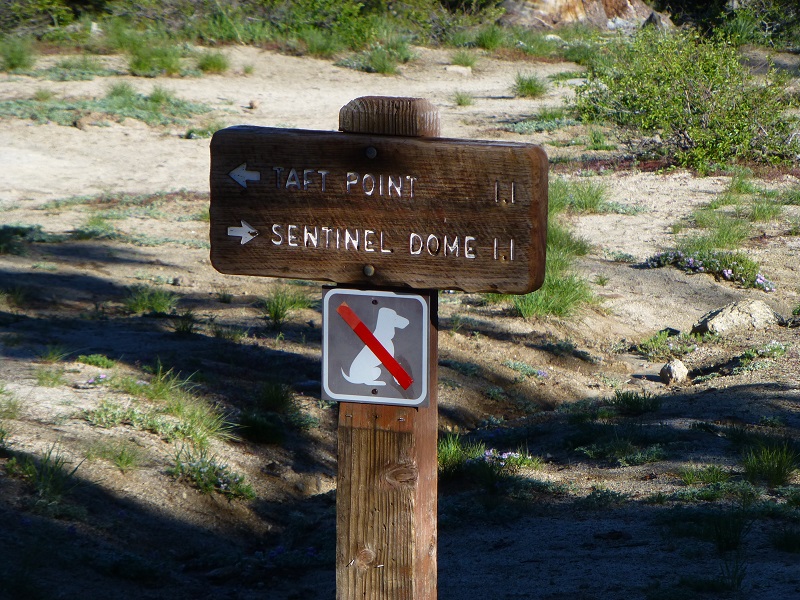
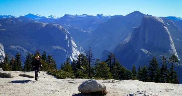
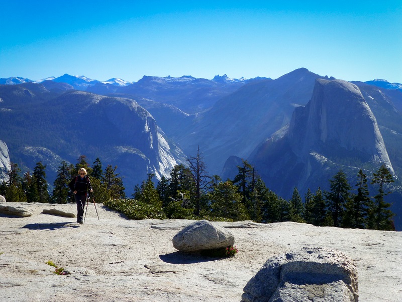
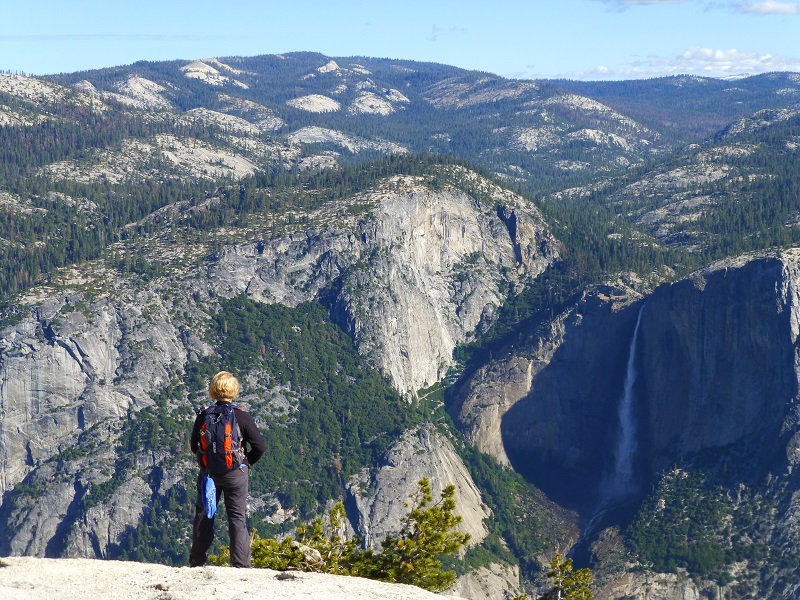
The views from Sentinel Dome are always gorgeous. Half Dome feels like you could reach out and touch it. I could look to the west and see Yosemite Valley and look down the Merced River Canyon. I could look north and see all of Yosemite Falls and I loved looking up the Tenaya Canyon to the high country at the snow on the higher mountains.
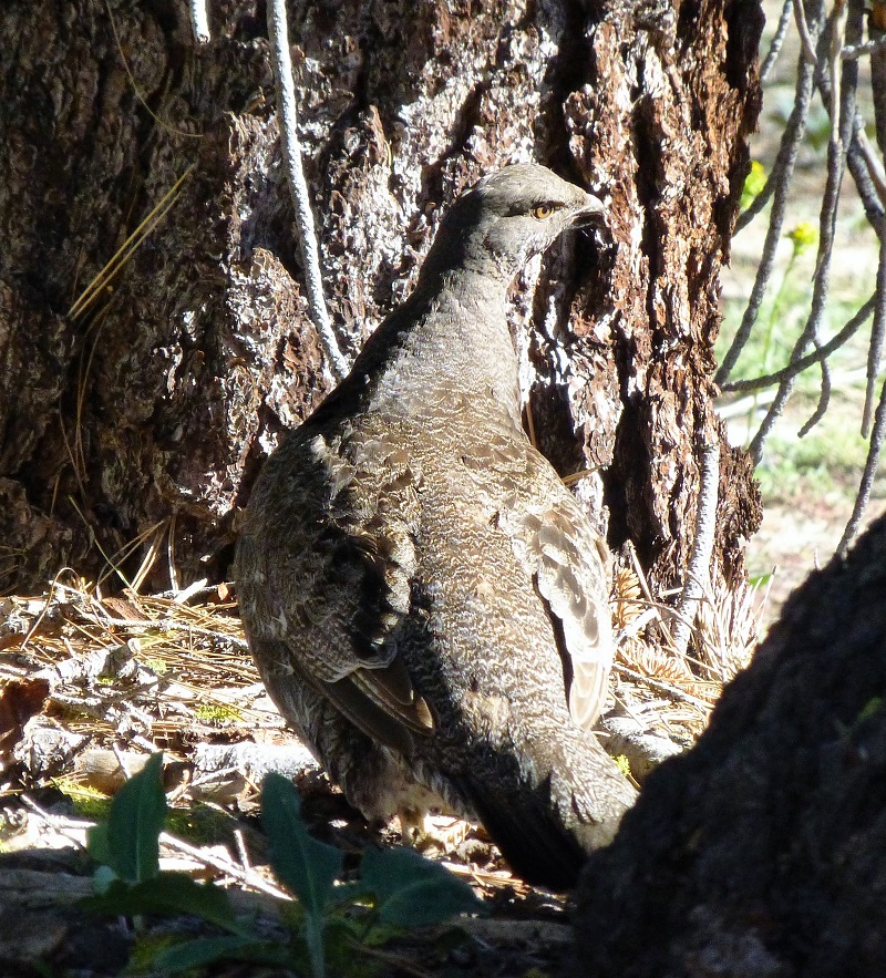
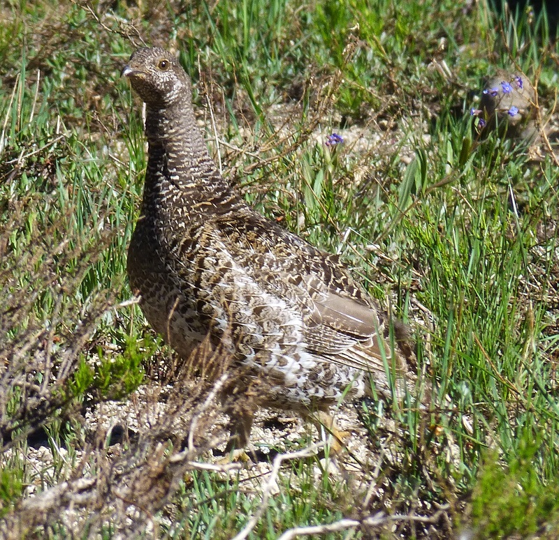
As we headed down the trail, Gail told us to stop. She had spotted something ahead of us. I believe this is called a Sooty Grouse. Earlier this year, we had heard the love song of the males and spotted them along the trail. This grouse did not have the bright orange markings that we had seen on those males. After breeding, the females are on their own to hatch their eggs and raise the chicks. This Sooty Grouse acted like she might have a nest nearby but we didn’t interrupt her, watching her from a distance. I uploaded a short 10 second video of her in action and you can watch it here.
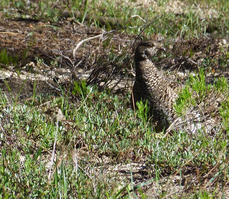
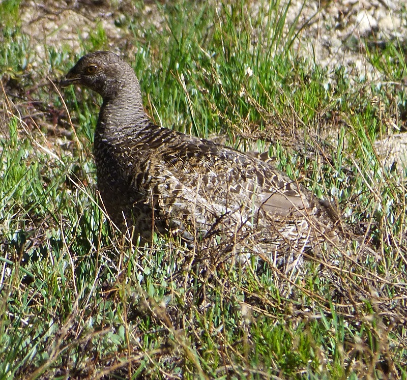
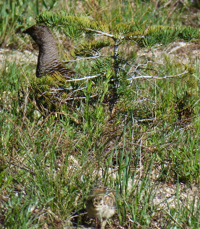
We hadn’t gone too far down the trail when Gail spotted another grouse and this one had chicks with her. We stopped and watched her for a while, counting at least 4 chicks but they blended so well in there could have been more. I did a little research and discovered that they normally lay 4-9 buffy, lightly speckled eggs and that the young leave the nest within a day of hatching. The females tend the young but do not feed them.
We headed down the trail, following the signs to Taft Point.
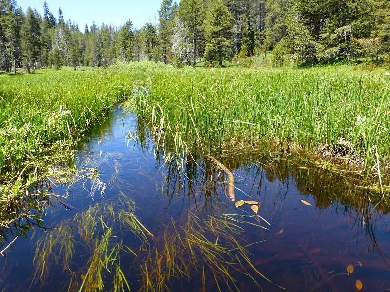
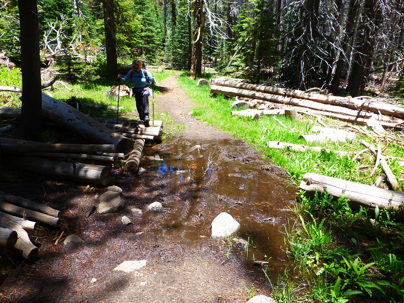
We had some areas where we had to use logs or rocks to get across small creeks or muddy spots.
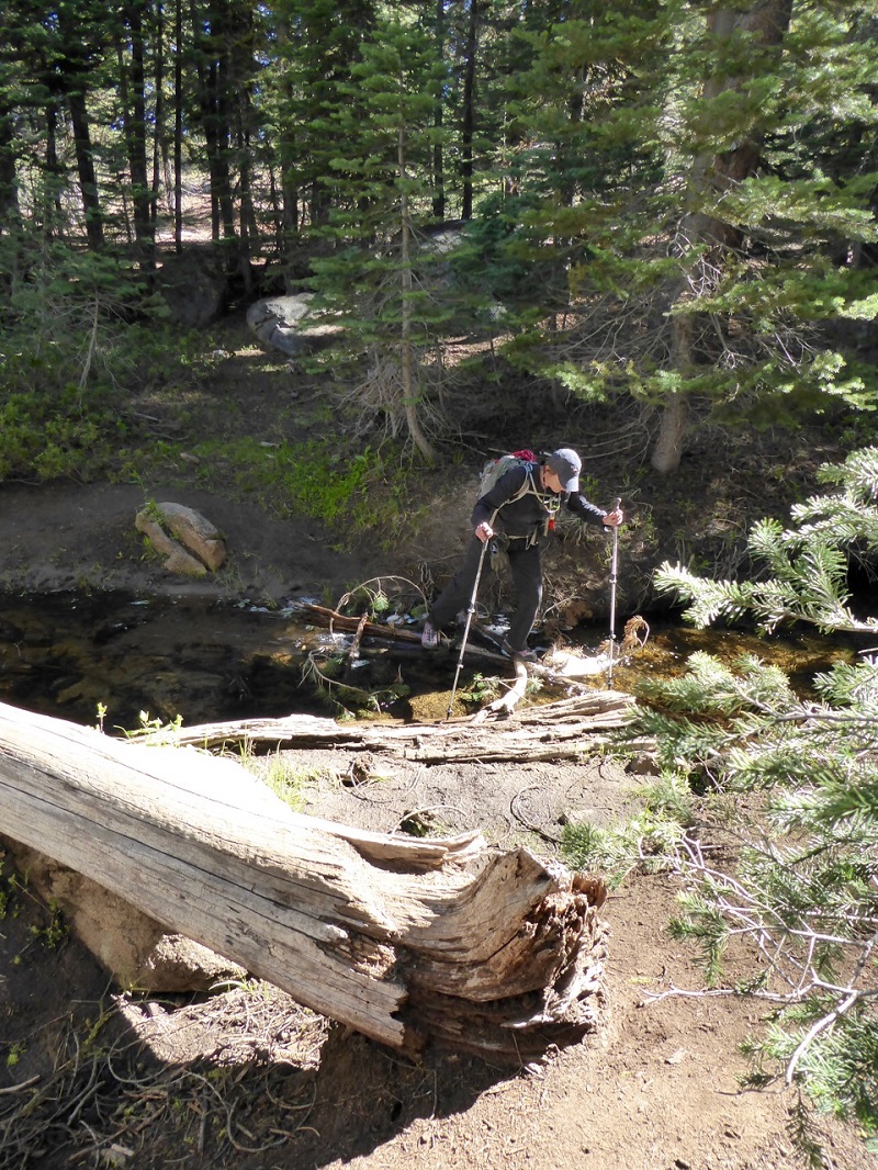
Photo by Gail Gilbert
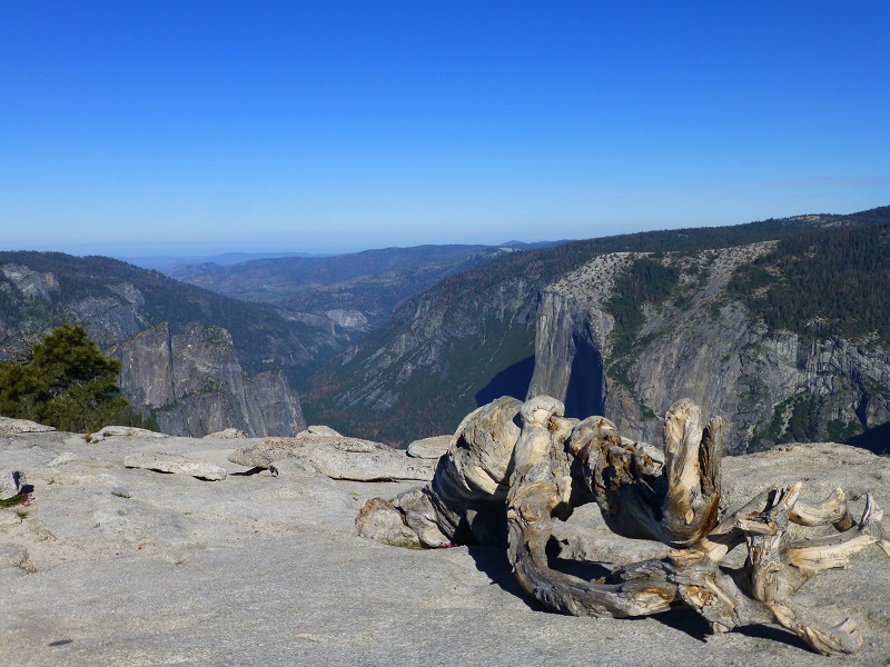
We came to the giant fissures just before we reached Taft Point. These cracks in the granite mountain that we were standing on drop straight off and just plain look weird. We cautiously approached them to get a picture . . . but not too close.


As soon as we arrived at Taft Point, I looked out at the beautiful view of Yosemite Falls. The point is named after President William Howard Taft, the 27th President of the United States. According to newspaper accounts, he came across this point when he visited Yosemite for three days hosted by John Muir in October 1909. The two hiked from nearby Glacier Point down to the valley floor. President Taft planned the trip by horseback, but the horses brought for his use were all too small for his 300 plus pounds. His staff set up a luncheon for the President’s party during the hike including fried chicken. The lunch spot may have been near the flat ledge that has since become known as Taft Point. Taft wrote of his hike: “While I am tired from the open air exercise, I feel greatly the better for it.” He was sweat drenched when he returned to the Sentinel Hotel in El Portal following the hike.

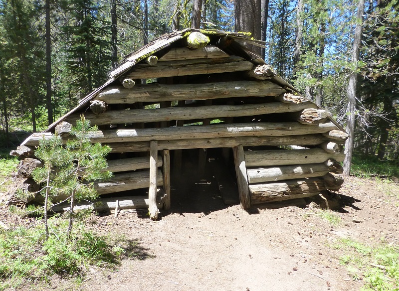
Since it was early, we had a snack then headed back to the car and drove about 8 miles west, back toward Yosemite Ski and Snow Area aka Badger Pass, to a small parking area with Bear Boxes and signed McGurk Meadow. A sign was out next to the road indicating the trail and we followed it down. We weren’t sure if any wildflowers would be in the meadow yet but were hoping to find a nice place for our lunch. It is only about a mile from the road to the meadow and we passed by the McGurk Cabin on the way. It was the seasonal home of Jack McGurk from 1895 to 1897, who was the third owner of this property. The original owner had filed for 160 acres, but the description in the county records indicated a claim in the next township, six miles away. McGurk built a cabin here but he was forced off the land by the US Army in 1897 when the invalid patent was discovered. The log cabin is a one-room structure, about 14 feet square, with saddle-notched peeled lodgepole pine logs. The only opening is a low door on the south side. The cabin was stabilized in 1958 by Sierra Club volunteers and it is one of the few structures left in the park that remain from the pre-park era. The cabin was listed on the National Register of Historic Places on June 4, 1979.
I got to wondering about this Jack McGurk. Where did he come from and where did he end up? I am pretty sure I located him but cannot be absolutely sure. Much fits on him and he was probably using the cabin for summer grazing from his main property that he filed for in 1887 below.
April 29, 1887: Land Patent John J. McGurk for 160 acres in Mariposa County.
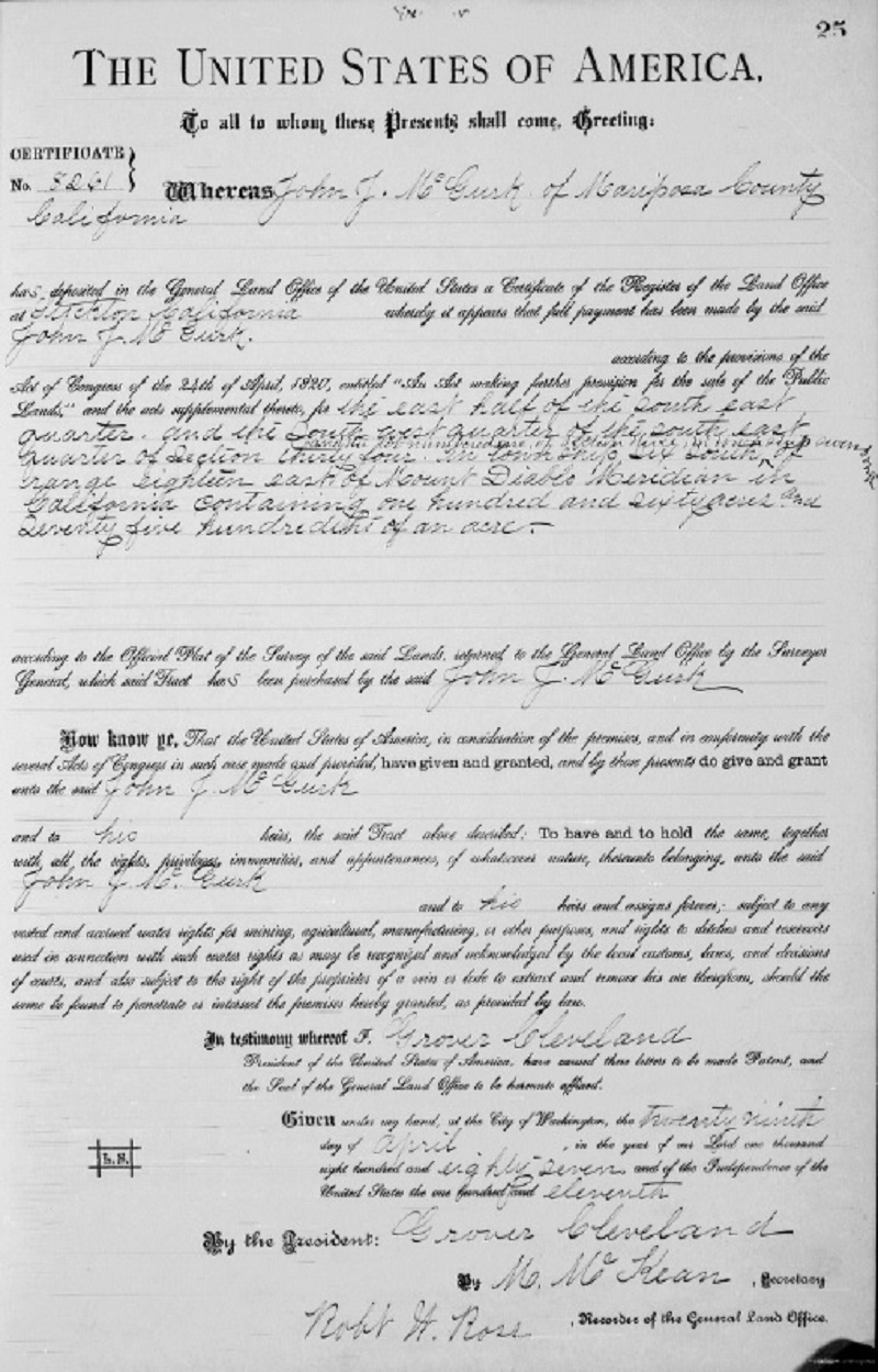
John J. McGurk Land Patent April 29, 1887

John J. McGurk Land Patent Map
1900 census, living in Mariposa County. His name is listed as John J. McGurk, born 1859 in California and both of his parents born in Ireland. He is single, a farmer and owns his own land.
1910 census, living in Madera County and married to a lady named May, (who was previously married, had 2 children but none were living) and his occupation is farmer in stock trading. They had been married 1 year.
1920 census, John J. and May are living in Madera County, working as a stockman on a stock farm.
1930 census, J.J. and May are living in Madera County on the Raymond Wawona Rd. working as a stockman on a stock farm.
1940 census, John J. McGurk is widowed, no occupation listed. He owns his own place and he lived at the same place 5 years ago.
California Death Index, John James McGurk is listed as being born May 1, 1856 and died August 18, 1944 in Madera County. He was 88 years old. He is buried in the Oakhill Cemetery at Oakhurst. Once I located his burial location, I found his wife May next to him. She had died in 1931.
I located a family tree online that states that John James McGURK was born May 1, 1856 to Patrick H. McGuirk and Mary Ann Connolly, both born in Ireland. They had at least 9 children, the first born 1856 in San Antonio Creek, Calaveras County, California, and the general area where they lived their lives. John James is living with his parents on the 1860 and 1880 census, but I cannot locate them on the 1870 census. On the 1860 census, Patrick is a Miner and on 1880 census, he is a Keeper of a Toll Bridge.

We crossed a small creek on a wooden bridge.
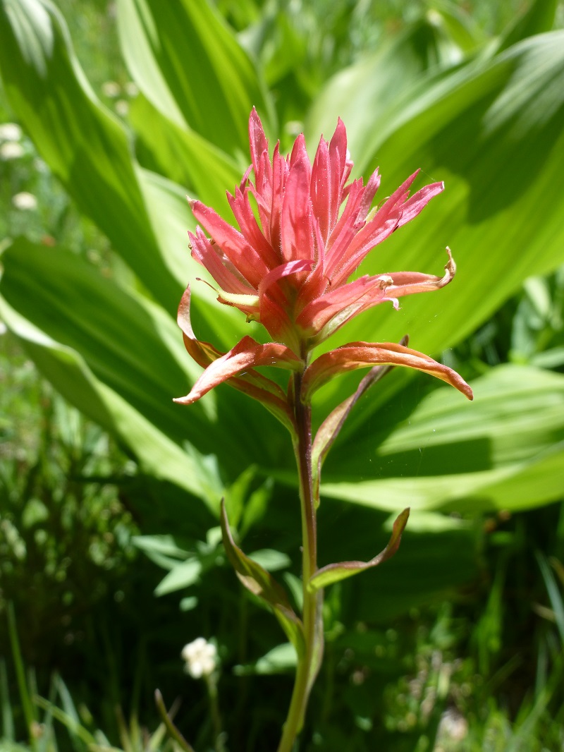
We started seeing those pink flowers known as shooting stars.
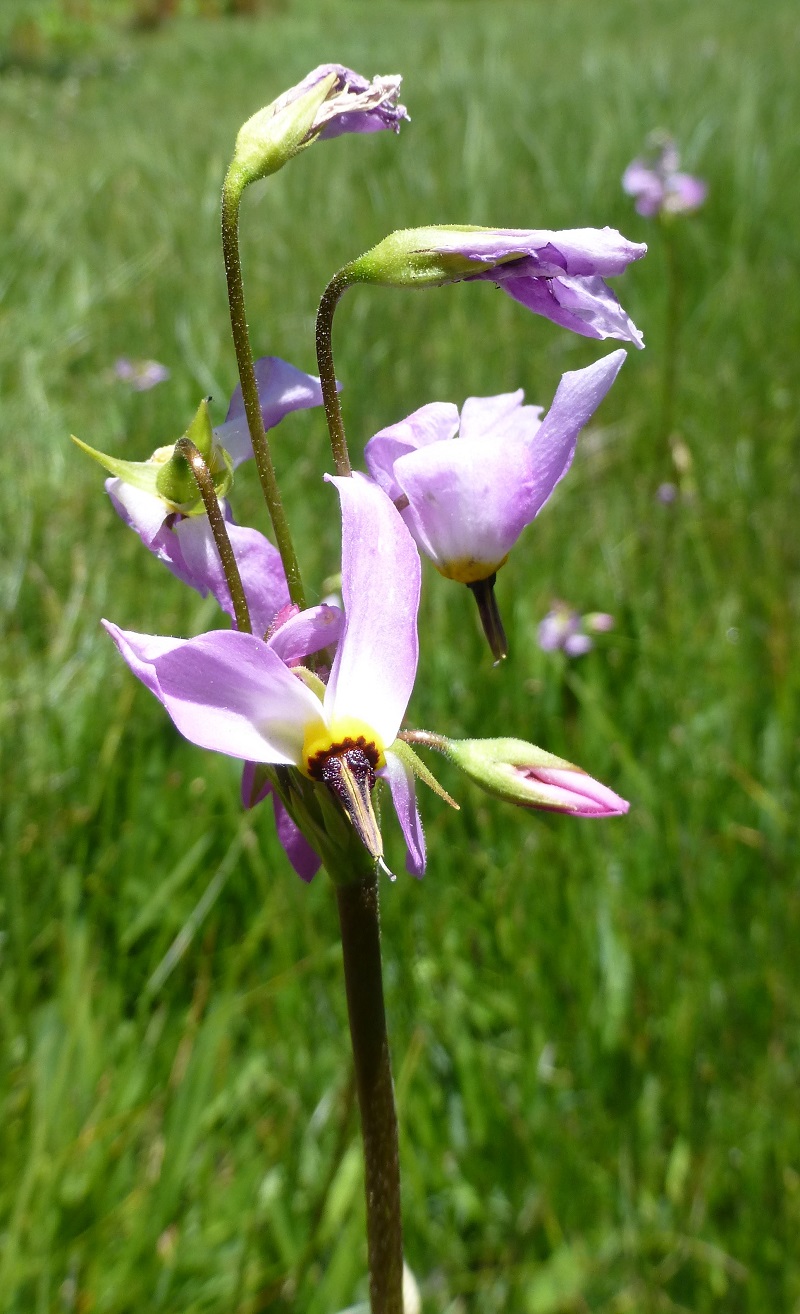
As we looking a little closer we could spot additional colors so we all got our cameras out.
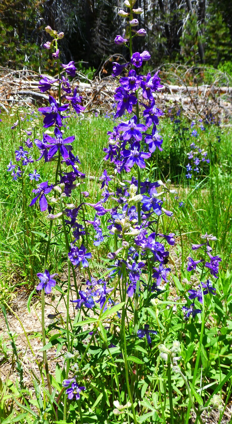
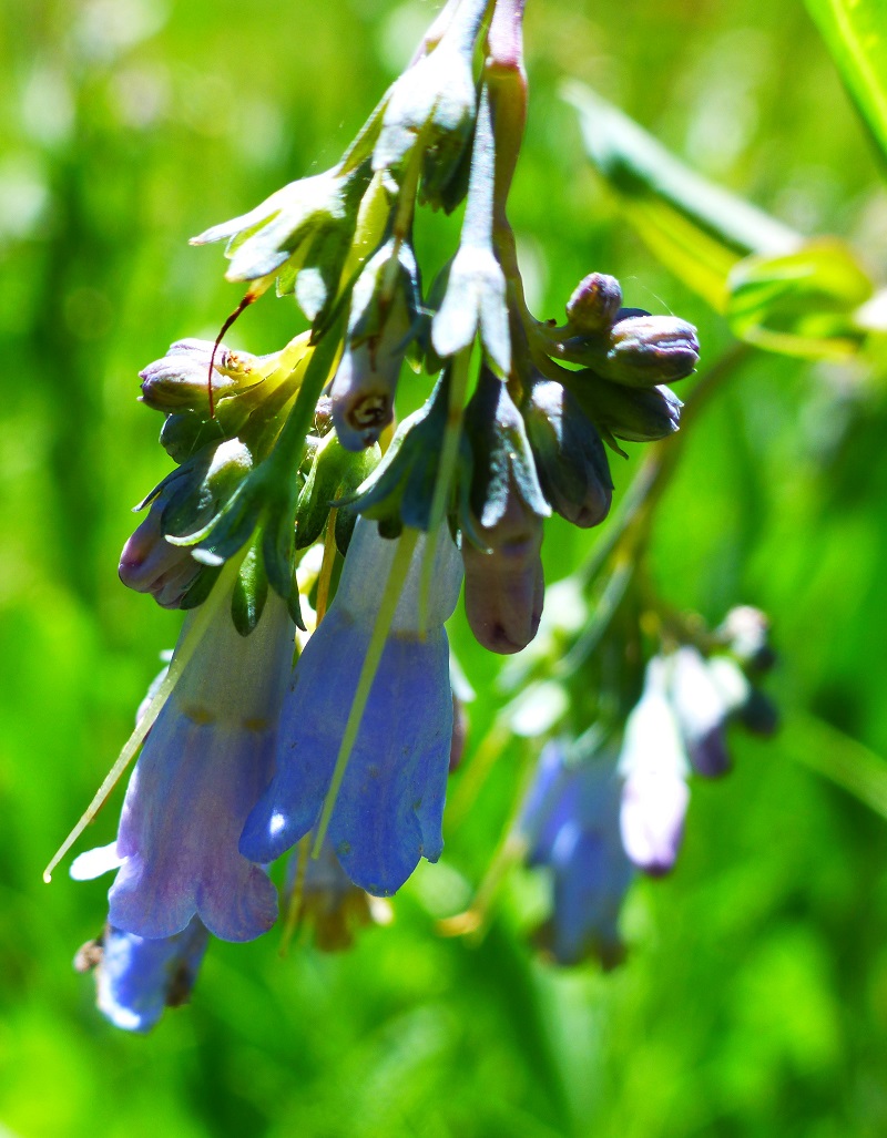
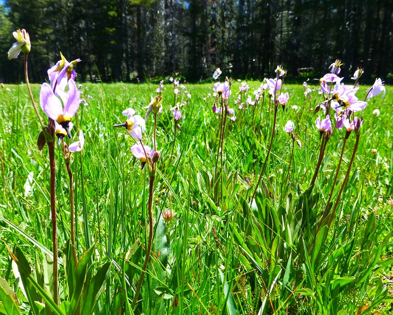
We did find a nice spot where we could look out on the meadow and eat our lunch. We couldn’t help but notice even more flowers.
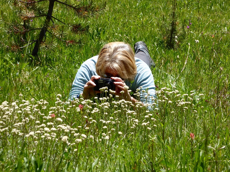
Taking Flower Close-ups (Photo by Gail Gilbert)
It was time to head back and we took the same trail that we came in on, along with making it through those wet spots without falling in.
I want to give a special thank you to my friend Kathy Russell Campbell, a professional photographer, who helped me with two of the pictures in this blog. The view is always amazing on top of Sentinel Dome but when I arrived in the early morning, the sun angle was a challenge getting any pictures to look good from there. She used her magic in helping bring out the pizazz in this picture, along with the picture of Yosemite Falls from Taft Point that is the Feature Photo for this blog. Thank you Kathy!
Maps and Profiles:
Sentinel Dome/Fissures/Taft Point Looped Hike

McGurk Meadow Hike
Sources:
Browning, Peter, Yosemite Place Names, LaFayette CA 1988


Just saw this from last year. Thanx for the great article and cool info on McGurk! We will definitely be doing this hike!
Thank you so much for your kind words. The spring should have some wildflowers but if you go real early in the spring, it might be a bit swampy in the meadows.Wishing you a wonderful adventure!