It had been 27 years since I walked the area around Foresta, not since I was assigned as a Strike Team Leader on Structure Protection at Foresta and El Portal on the lightening caused A-Rock Fire that burned 17,700 acres and 45 structures back in 1990. I was way overdue to spend some leisurely time exploring the waterfalls, old barns, cemetery and mortar rocks in the area.
Where: Yosemite National Park and a short stretch through Sierra National Forest
Difficulty: Easy to Moderate
Date: January 17, 2018
Maps: Buckingham Mountain Topographic Quad
Dog Hike? No
Little Nellie Falls:
Distance: 9.05 Miles
Elevation Range: 4,012′ – 4,822′
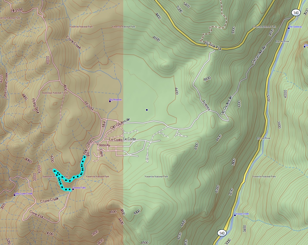
Foresta Falls:
Distance: 1.72 Miles
Elevation Range: 4,012′ – 4,315′
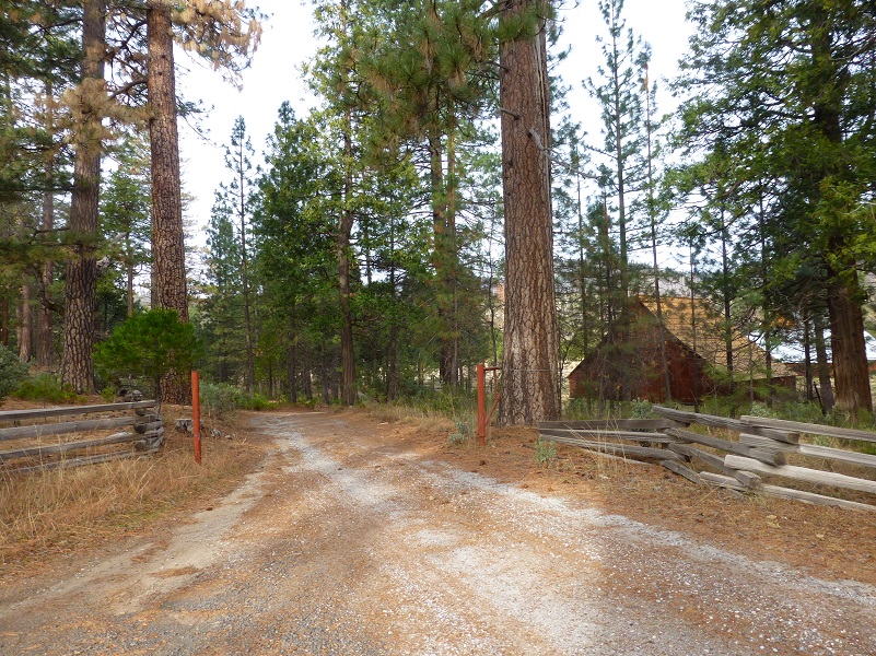
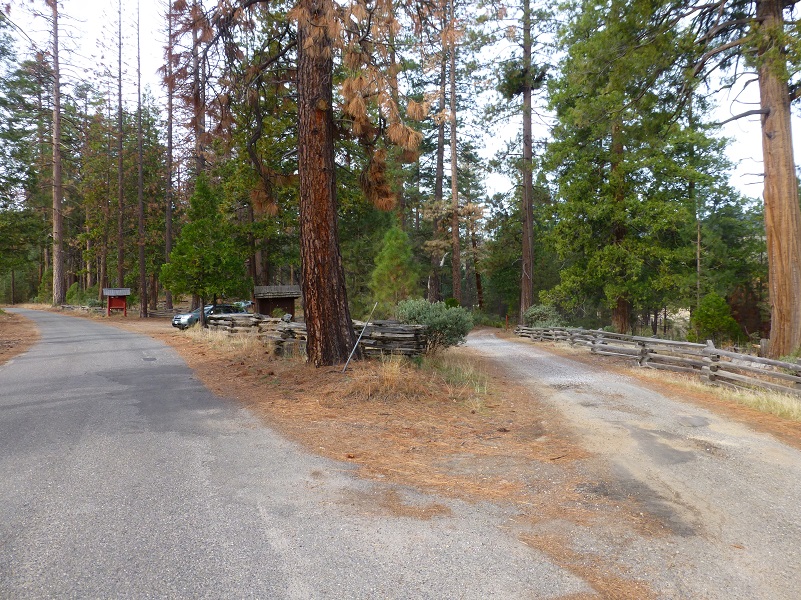 From Hwy 140 in Yosemite Valley, we took Big Oak Flat Road through the 3 tunnels and a little over 4 miles, there was a sign to Foresta on the left hand side of the road. We turned left and drove down to the fork at the Old Big Oak Flat Road where the split rail fences are. We parked so we were off the road and not blocking anyone. There is no trailhead marker and there are no bathrooms but there are picnic tables.
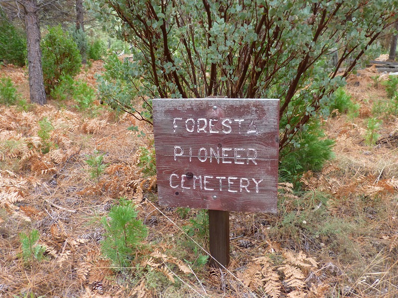
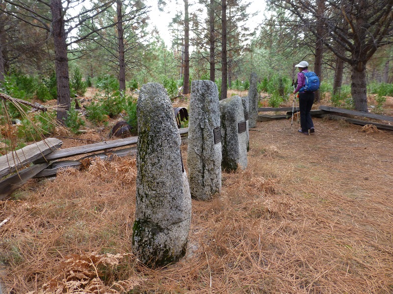
Before hitting the trail, we walked across the road to see the Foresta Pioneer Cemetery.
We then walked down the road toward the barns.
George Meyer, a ship carpenter who immigrated from Germany, took over his brother Henry’s homestead in Big Meadow in the 1870’s. Back then, the meadow was quite a bit smaller than its present size before George cut trees and cleared brush. He built one of the barns in the late 1870’s and the other barn in the early 1880’s. The walls of the latter barn were supposedly built flat on the ground and then raised in one piece. The National Park Service has owned the barns since 1974 and restored them in 1996.
Meyer’s ranch was a stage stop on the Old Coulterville Road and he supplied grains and vegetables to Yosemite Valley businesses. He died in San Francisco in 1917 and was buried there. Of course, I got a little curious about him and decided to do some more snooping. He was born in Aldenburg, Niedersachsen, Germany in April of 1848, census records say that he arrived in the United States 1874 and from the California Voter Registers, he was naturalized in April 27, 1881 in Tuolumne County. Another of George’s brother named John or Johan, born 1830, was living in Groveland in Tuolumne County when he died in 1924.
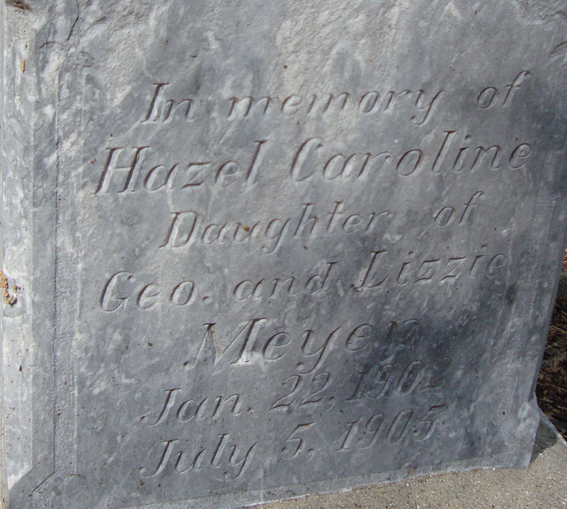
Photo of Hazel Caroline Meyer’s Tombstone from Find a Grave (Photo Contributed by John Church)
On April 29, 1901, he married Elizabeth Stewart McCauley in Sacramento. She was born 1866 in Liverpool, England and had arrived in the United States in 1884. It is said that she was a niece of James McCauley, pioneer Yosemite trailbuilder and innkeeper. They had three children but their first child, a daughter named Hazel Caroline, died of Scarlet Fever when she was just 2 years old. Her parents were unable to attend her funeral because they had the same illness. Hazel is buried in the Yosemite Pioneer Cemetery.
The largest barn measures about 50 feet square, with a hipped roof and the center consists of a 25-foot high saddle-notched log crib that supports the center of the steep roof. The crib was surrounded by stalls for livestock on three sides. The exterior wall is a frame structure covered in vertical board sheathing and the original log roof structure was covered with shingles, but that has replaced by sheet metal.
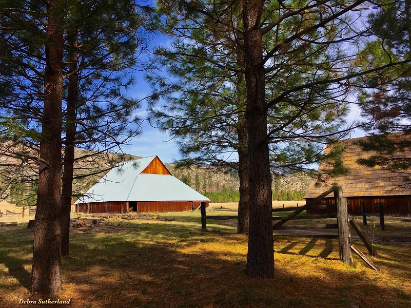
Photo by Debra Sutherland
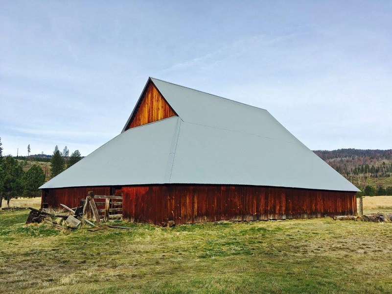
Photo by Debra Sutherland
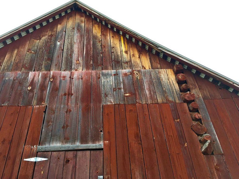
Photo by Debra Sutherland
We took a peek inside the barns.

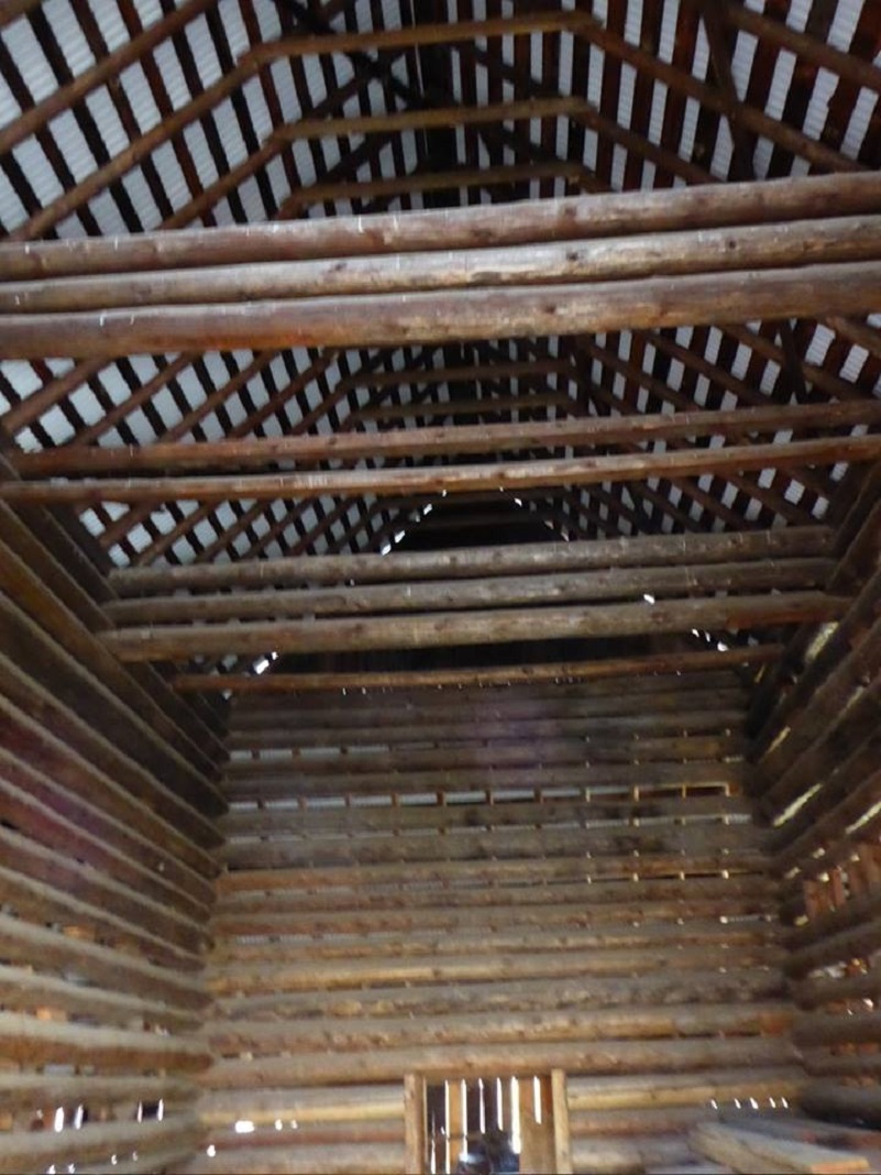
Photo by Gail Gilbert
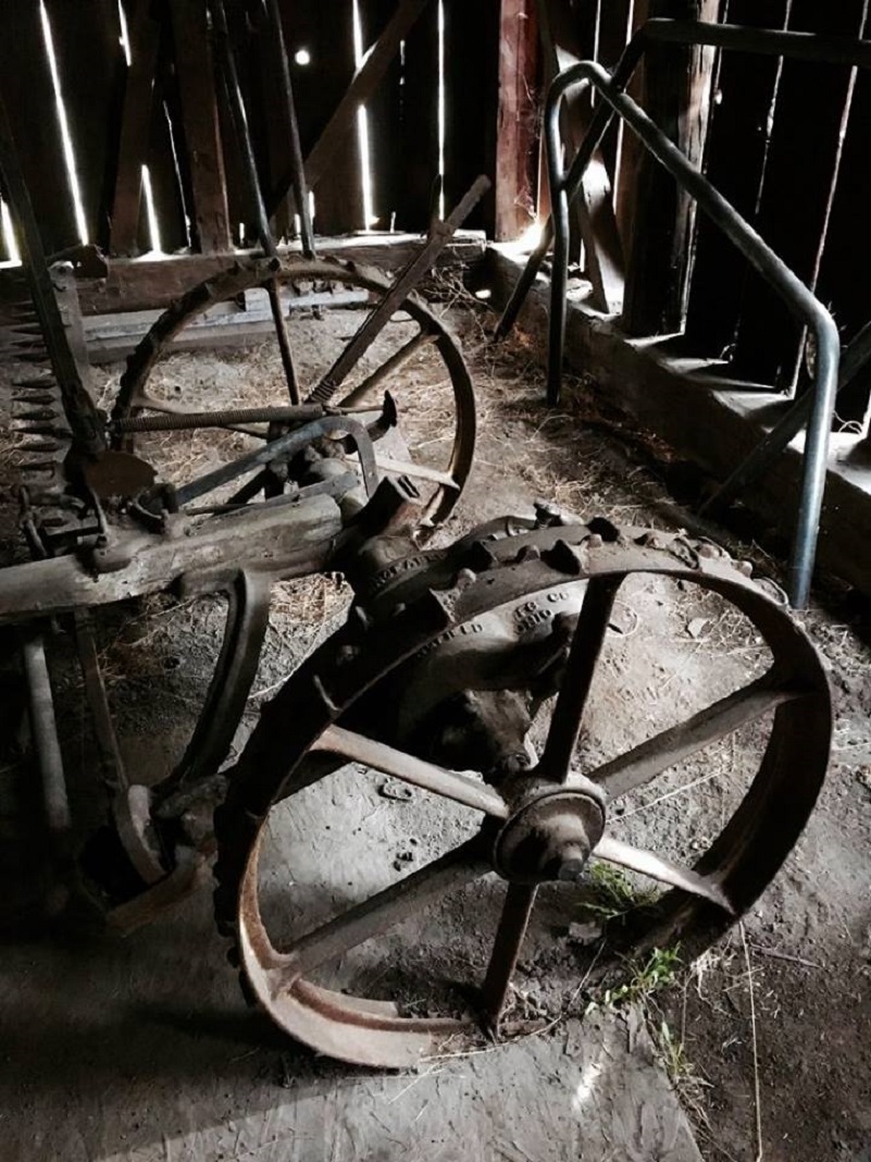
Photo by Debra Sutherland
It was time for us to get moving and we crossed the old bridge.
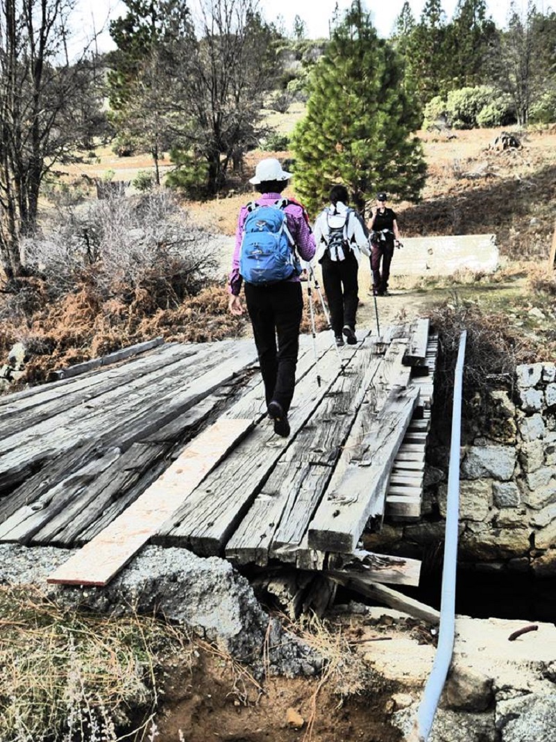
Photo by Debra Sutherland
The road we were walking on was actually the Old Coulterville Road.
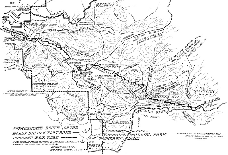
Approximate Route of the Early Big Oak Flat and Coulterville Roads (The Big Oak Flat Road (1955) by Irene D. Paden and Margaret E. Schlichtmann)
The Coulterville Road was the first stagecoach road that reached the Yosemite Valley floor. Before that, the only way to get there was by horse, mule or foot along treacherous trails. In 1870, the Coulterville and Yosemite Turnpike company was organized by Mariposa County citizens that lived on the north side of the Merced River and near Coulterville to build a wagon road from Bower Cave to the western boundary of the Yosemite Valley Grant. Remember, this was long before Yosemite National Park was created.
The road was constructed from Bower Cave to Big Meadow and up to Crane Flat in 1871. But there was competition. A Tuolumne County sponsored a road called known back then as the Big Oak Flat Route, running an additional 5 miles to Gentry’s Station near the top of El Capitan. The 13 miles from Crane Flat or 8 miles from the top of El Capitan were by horseback.
In 1869, the Yosemite Turnpike Company received permission to continue their road down into Yosemite Valley but ran into financial problems. Dr. John McLean took over the Yosemite and Coulterville Turnpike Company and received permission from the Yosemite Commissioners to build and exclusively operate a toll road into Yosemite Valley but a heavy winter in 1872-73 resulted in delays and an extension of the contract. The road was completed on June 18, 1874.
Meanwhile the Big Oak Flat Road had been completed, reaching the Yosemite Valley floor one month later. So, there were two routes into the valley, one over the top of El Capitan and down into the valley and other from Big Meadow to Crane Flat and then across to the Pohono Bridge in Yosemite Valley.
The routing of the roads has changed since those early days and the old Big Oak Flat route into the valley has had major rockslides on it but you can still hike it, if you are up to some boulder hopping.
The history is really much more complex that my shortened version and the map helps show the different roads back in the day. The Nomination of the Old Coulterville Road and Trail to the National Register of Historic Places back in 1977 provides some wonderful history but there are many other sources that have written about these roads in depth in case you are interested in learning more. A link to that nomination is under the sources at the end of the blog.
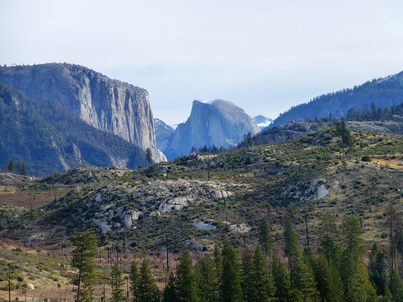
As we walked along the old road, we could look back through old burned areas and across Big Meadow to see Half Dome dusted in snow.

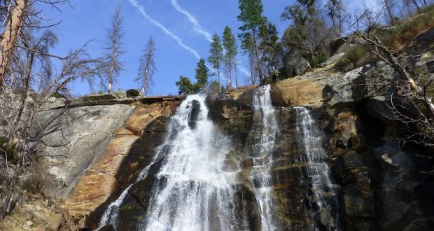
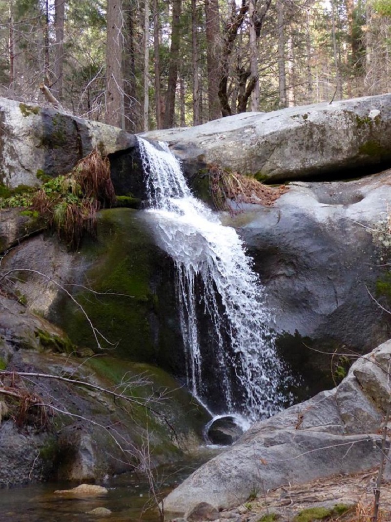
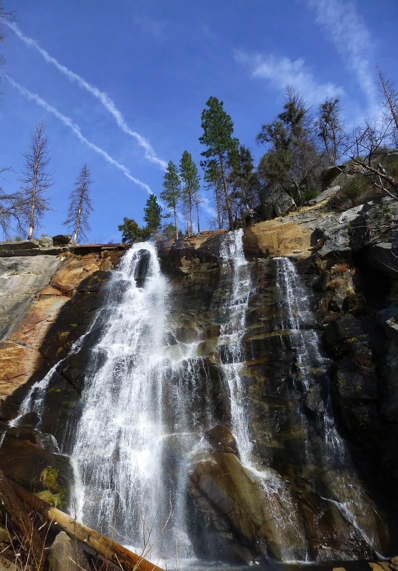
We reached Little Nellie Falls, right along the road, and it was very pretty.
Even though it was a little early for lunch, we sat down at the picnic table that had a plaque dedicated to “All of the Buck Hunters from 1920 to 2003.”
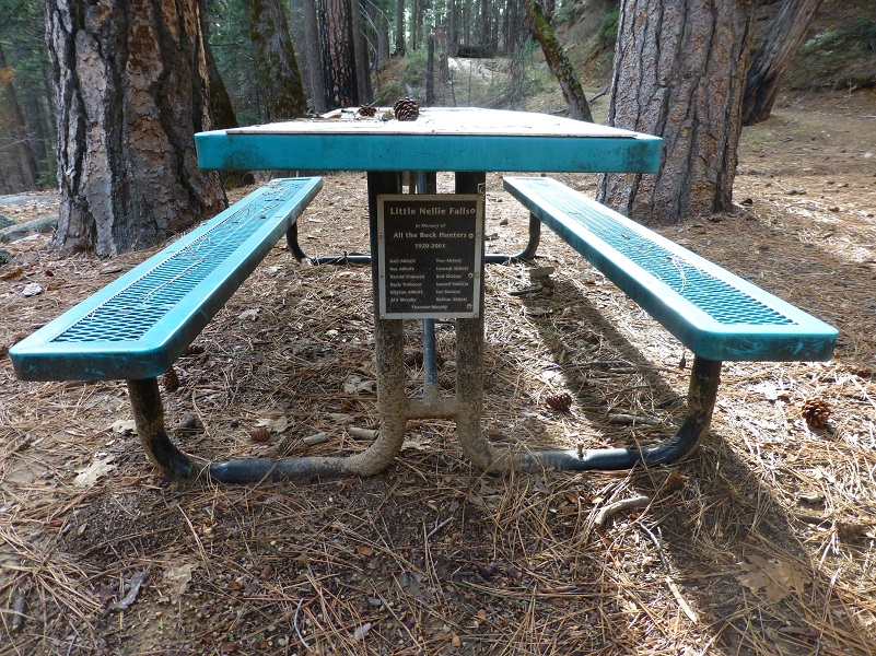

Photo by Debra Sutherland
After taking plenty of pictures and enjoying our lunch, we walked out the same way that we had walked in. After stowing our gear in the car, we realized that we could have walked to Foresta Falls but we got back in the car and drove through Foresta, down the Crane Flat Road that parallels Little Crane Creek. Yosemite Place Names by Peter Browning says that Foresta got its name when A.B. David purchased 200 acres in 1913 and called himself the Foresta Land Company.
He built a summer resort that was designed to appeal to people of culture, and seemed to promise “seminar discussions under the peacefully thought-provoking surroundings of Yosemite National Park.” It was a sort of summer Catauqua known as the “Foresta Summer Assembly.” But it didn’t pay off. Davis abandoned it in 1915 and returned to his home in New York. Three years later the main hotel building burned under mysterious circumstances. Foresta is now a subdivision, an inholding within the National Park, with a scattering of summer homes.
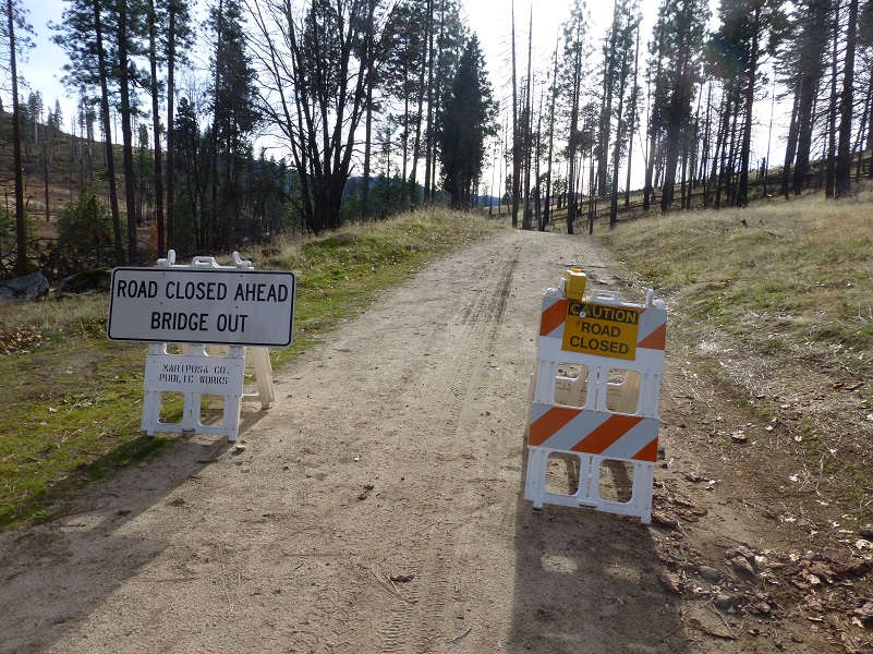
We drove down the road toward Foresta Falls and didn’t plan on the road being closed, so we parked and walked the short distance.
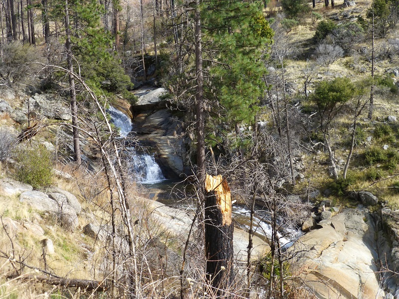
As we walked down the road, we couldn’t help but notice the very pretty cascades that Little Crane Creek’s water took as it made it’s journey to Foresta Falls.
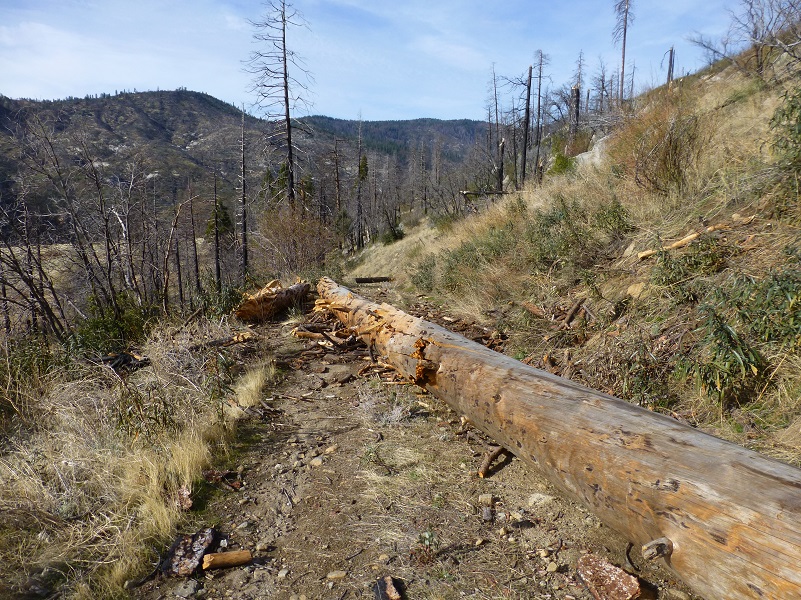
We discovered that the road was closed for more than one reason and the first one was that there were several down trees on it.
The road led us to the McCauley Ranch, which was built around 1883 by Irishman James McCauley, pioneer Yosemite trailbuilder and innkeeper. McCauley also built the Four Mile trail to Glacier Point in 1871 and the Glacier Point Mountain House in 1878. McCauley worked the ranch with his son, supplying beef to Yosemite Valley businesses, until his death in an accident on the old Coulterville Road in 1911. In 1923 his son, Fred, sold the property to Horace Meyer, son of George Meyer who built the Meyer barns. We should have stopped to check out the McCauley barn but I didn’t know about it until after I got home and researched our adventure. Next time!
We came around a bend and there it was: Foresta Falls!
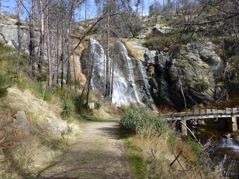
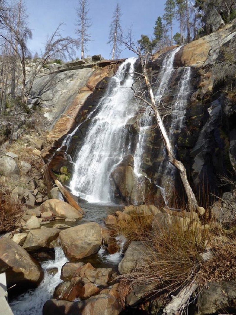
Photo by Debra Sutherland
We could also see that this bridge had lost a little of its original integrity at some point and wasn’t something that should be driven over.

We headed back up the old road to where we had parked our car, the walk not anywhere close to how scenic the waterfalls and barns were that we had visited on our adventure. On the drive back, we stopped to check out the mortar rocks that we had seen along the road just above Foresta. I could picture Native American families living in this area and women grinding acorns in those mortar rocks, talking and laughing with their friends while small children ran around. That pleasant vision stayed with me on much of the drive home.
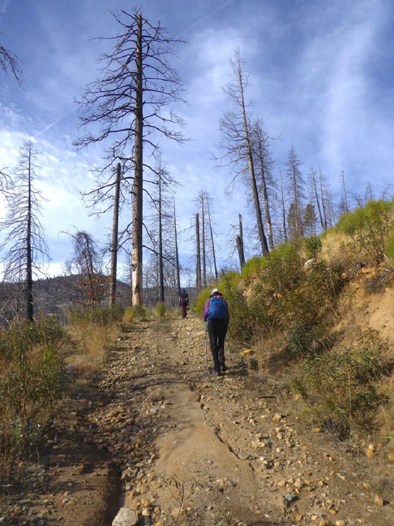
Photo by Debra Sutherland
Update: Eric, a SNO reader added some good points, that this is definitely a winter hike and in the summer, the temperatures in the Foresta area can hit over 100°. Since there are not many trees at all for shade, it can get hot. The last picture of the blog shows the many burned out hazard trees on the Foresta road down through the ranch area to the falls and you should be extra cautious of those on windy days.
Dog Hike? No
Dogs are not allowed on the Old Coulterville Road within Yosemite National Park, which is where the majority of our hike took place but they are allowed on the USFS section within the hike.
Where Pets Are Not Allowed in Yosemite National Park
- On trails, including the trail to Vernal Fall (however, pets are allowed on the Wawona Meadow Loop)
- On unplowed roads covered in snow
- In undeveloped and wilderness areas
- In public buildings
- On shuttle buses
- In lodging areas
- In all walk-in and group campgrounds/campsites, including Camp 4
- In any other areas, as signed
These regulations protect both pets and wildlife from disease and each other. The National Park Service has prohibited pets on trails for many years. In particular, some pets chase wildlife, pollute water sources, and can become defensive and dangerous in unfamiliar surroundings. Pet owners have the burden to assure their pet does not damage the park values for others in those areas where pets are allowed.
Yosemite Hospitality operates a dog kennel in Yosemite Valley from approximately late May through early September. Written proof of immunizations (rabies, distemper, parvo, and Bordetella) must be provided. Dogs must be at least 20 pounds (smaller dogs may be considered if you provide a small kennel). You can get more information about the kennel by calling 209/372-8326.
Maps and Profiles:

Little Nellie Fall Topographic Map
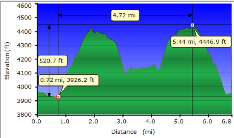
Little Nellie Fall Profile
Foresta Fall Topographic Map
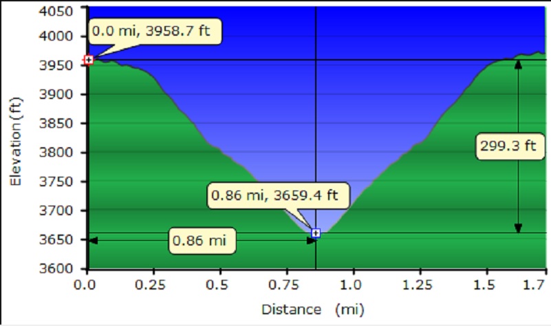
Foresta Fall Profile
Sources:
1900 Census; Township 5, Mariposa, California; Roll: 93; Page: 10B; Enumeration District: 0038; FHL microfilm: 1240093
Film Number 1302106, California, Marriages, 1850-1945. Salt Lake City, Utah: FamilySearch, 2013.
McCauley and Meyer Barns Wikipedia
McCauley and Meyer Barns National Registry of Places
McCauley and Meyer Barns National Registry of Historic Places Nominee Form
Hazel Caroline Myer Find a Grave
The Big Oak Flat Road (1955) by Irene D. Paden and Margaret E. Schlichtmann
Old Coulterville Road and Trail Nomination to National Register of Historic Places
Little Nellie Falls Yosemite National Park
Old Coulterville Road leads to Little Nellie Falls Sierra Star
The Old Coulterville Trail Auto Ramblings
Browning, Peter; Yosemite Place Names, Great West Books, Lafayette, California, 1988
Prior Blogs in the Area:
Hiking Along the Old Big Flat Road December 7, 2015
Hiking To Merced Grove and Beyond On The Old Coulterville Road November 6, 2017
