If you are up to a good workout to a land that escaped the glaciers, Dana Plateau is a good one. And if you go now, you will see beautiful columbine blooms which are at their prime in the bouldery wash as you hike up there. Those columbines don’t stick around very long though. And you just might get a glimpse of an American Pika if you listen and look.
Where: Ansel Adams Wilderness Area, Inyo National Forest
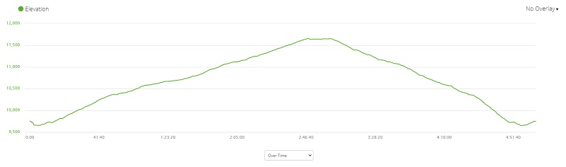
Distance: 5.86 Miles (5.69 miles to the Mono Lake overlook)
Difficulty: Strenuous
Elevation Range: 9,650′ – 11,652′
Date: July 13, 2020
Maps: Falls Ridge and June Lake Topographic Quads
Dog Hike? Probably not
I started this short but steep adventure at the trailhead at the west end of Tioga Lake on Tioga Road, just east of the Tioga Pass entrance to Yosemite National Park.The trailhead starts where the informational signs and restrooms are located.
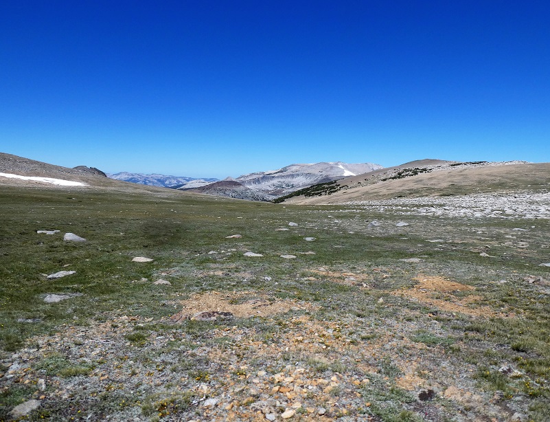
I followed the trail with signs toward Glacier Canyon into the Ansel Adams Wilderness. This hike is a fantastic one to really see how the glaciers shaped the land. In Glazner and Stock’s book, Geology Underfoot In Yosemite National Park, they discuss the most recent glaciation that occurred between 26,000 and 18,000 years ago known as the Tioga glaciation. These glaciers deposited a whole bunch of rocks and debris, also carving out the majority of glacial features that we see today.
A huge ice field formed over and around the Tuolumne Meadows, up to 2,000 feet thick in places. These glaciers smoothed the landscape under the ice, forming the domes and slabs in the Tuolumne Meadows area. A few peaks and ridges poked up above this sea of ice and they were called “nunataks.” They were a kind of bedrock island and some examples include Cathedral Peak and Unicorn Peak. Dana Plateau became a nunatak for short periods as the Tioga glaciers formed around them. These nunataks were sanctuaries for many plants and animals. It was an area that was free of ice where they could live and as the glaciers retreated, these species expanded outward from their nunataks to colonize the freshly deglaciated landscape.
 I easily crossed a small creek that had logs across it. This crossing always has logs to get across it but some years, those logs are a bit more wobbly than other years. The wobble factor this year was almost none.
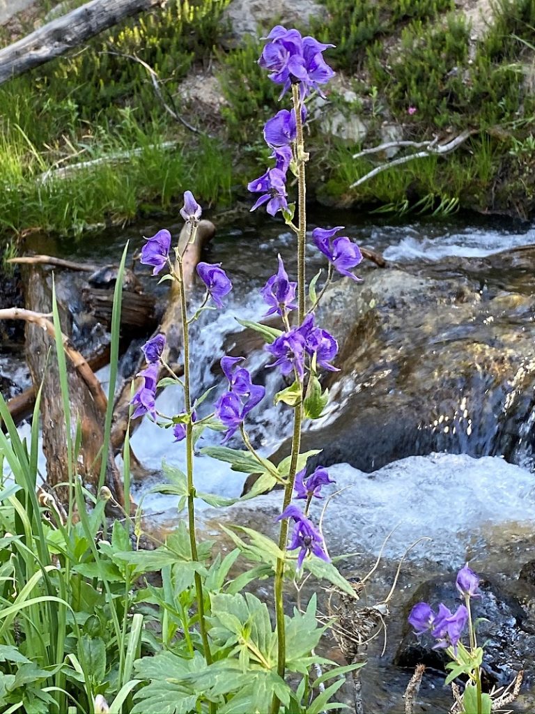
The trail along the creek has a wildflower show that changes through the upcoming month of so. It was a smidge early for some flowers but I saw one that I don’t remember seeing in this area. This is monkshood and is poisonous.
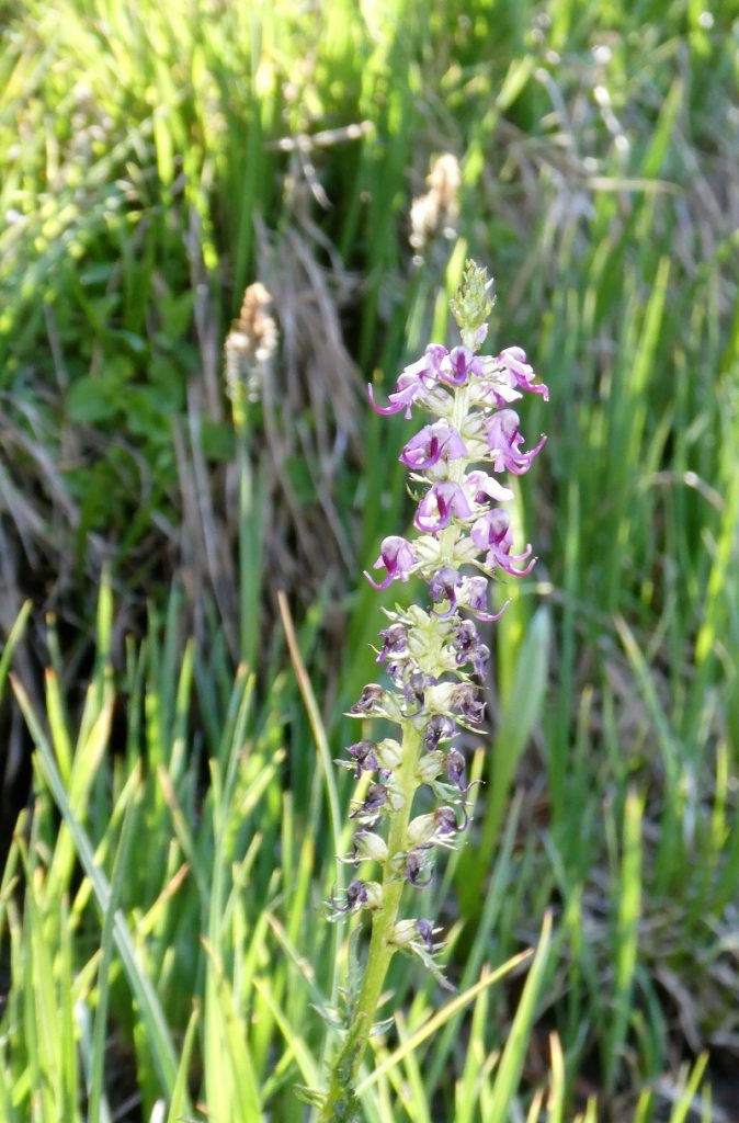
Elephant’s Head
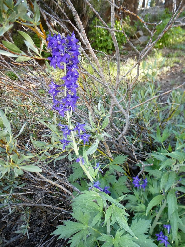
Larkspur
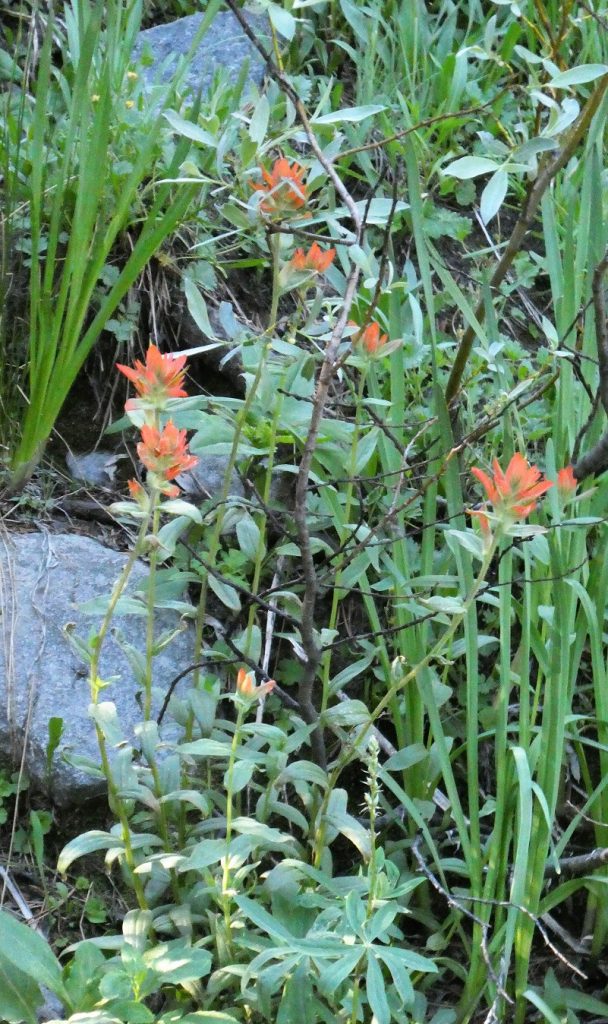
Paintbrush
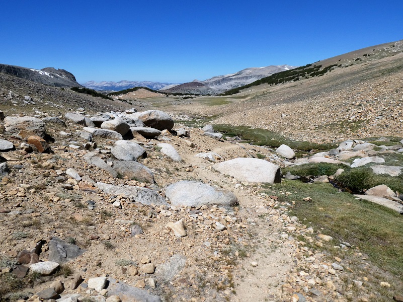
The trail continued following the creek up through some stretches with bouldery steps.
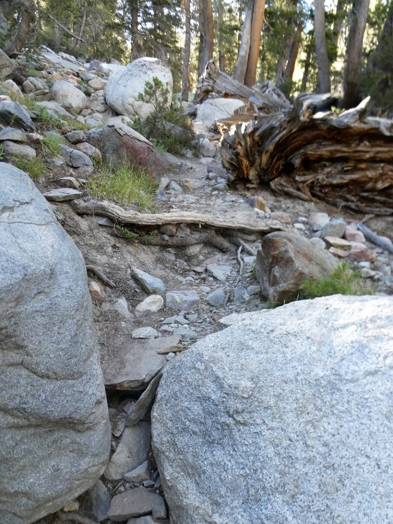
There were a few muddy spots in the trail that folks had strategically placed logs on. With my hiking poles, these were a piece of cake.

Then the trail reached a flatter area before another little gain.
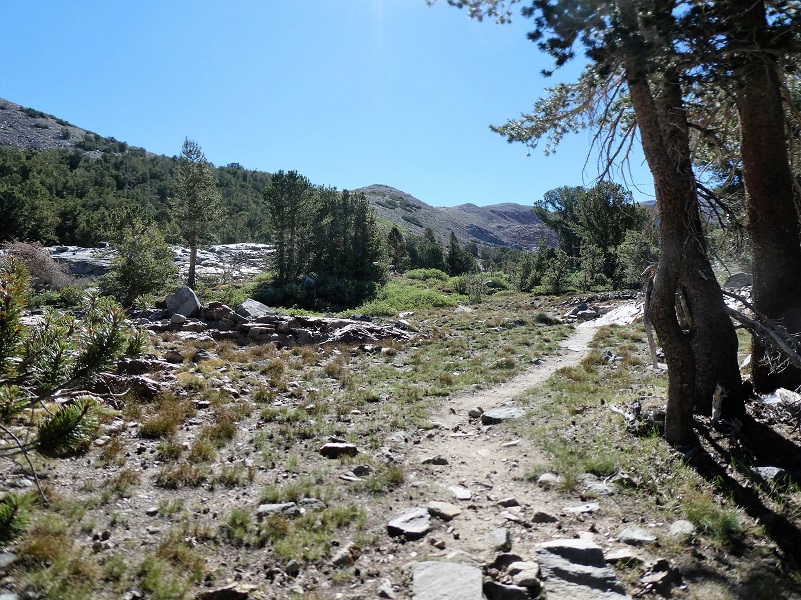
I followed the trail which left the creek and checked out the view to the north and up Mine Creek and toward Saddlebag Lake.

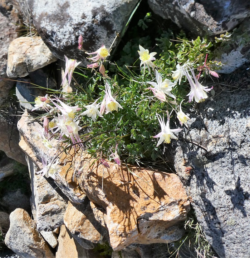
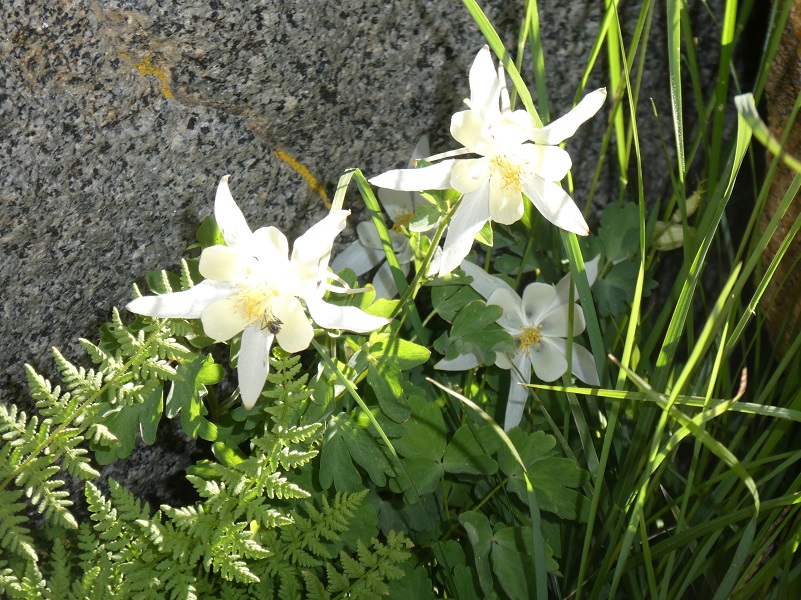
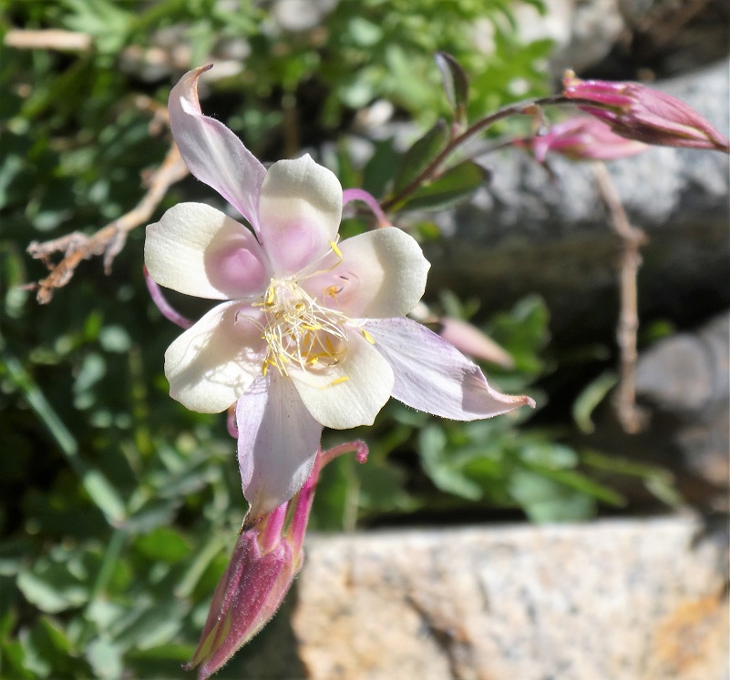
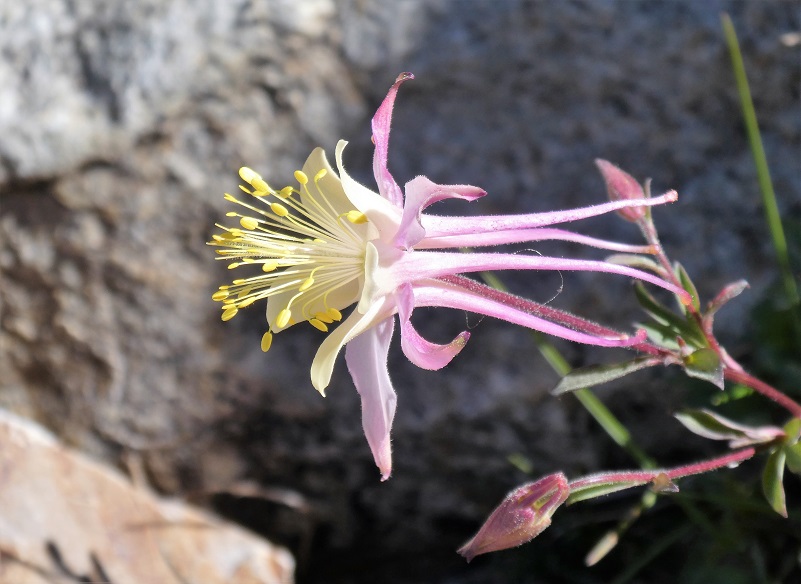
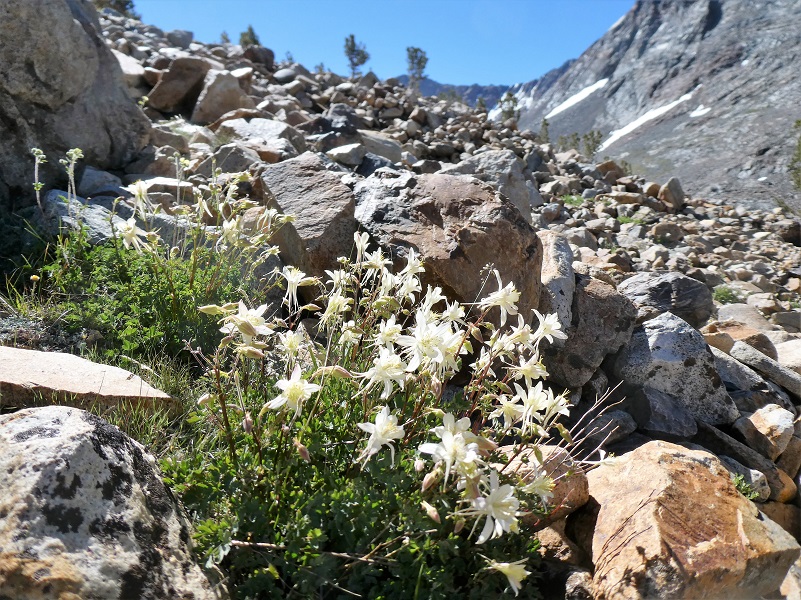
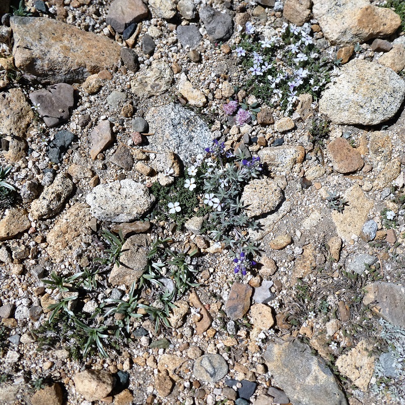
A big reason why I hiked this hike at this time was to see the blooming columbines in the wash. My hiking buddy Gail researched the columbines in this area a few years ago and located some very interesting information about the columbine in this specific area from Wildflowers of the Sierra Nevada & Central Valley Field Guide. Alpine columbine and crimson columbine grow in different habitats at different elevations and are visited by different pollinators, but there are a few places in Yosemite at 9500-10,000′ where these two columbines hybridize. The result of this hybridization is a large, glorious white columbine with tinges of pinks, purples and yellow.
It was soon time to start up the wash, which looks devoid of any life. But if you listen and look closer you may see a pika. I saw 3 different ones on this hike!
The American pika (Ochontona princeps) is considered an indicator species for detecting the ecological effects of a changing climate in mountainous regions. Results from recent studies suggest that in some areas, pikas are being lost from lower elevations in response to increased warming and less suitable habitat.
They are distantly related to rabbits and prefer rocky slopes. They graze on a range of plants, mostly grasses, flowers and young stems. In the autumn, they pull hay, soft twigs and other stores of food into their burrows to eat during the long cold winter but they do not hibernate.
American Pikas are small mammals, with short limbs and rounded ears. They are about 6 to 8 inches long and weigh about 6 ounces. They have small litters of 2 to 5 with the young born after a gestation period of about 30 days. Sometimes the females will have a second litter.

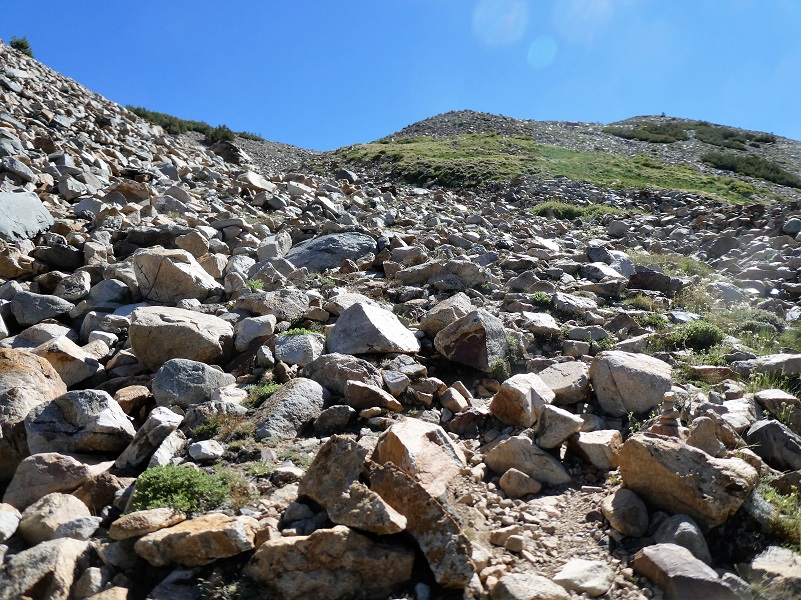
I continued up the wash, the trail was a bit like a snake track in some places but I knew where I was going–up. So, I picked my way through the rocks the easiest way I could see when I lost the trail.
This wash looks desolate when you first look at it but looking closer, columbine were tucked into rocky crevices all over the place.

The trail soon left he bottom of the wash and those beautiful columbines, then worked it’s way along the ridge. I took some looks back at where I had traveled.
And here is where I was headed.

Looking back.

And where I was headed.

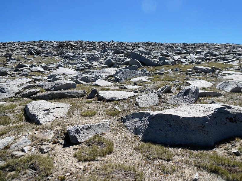
I had reached the plateau portion.
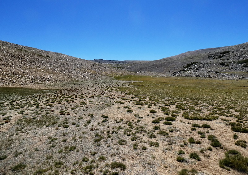
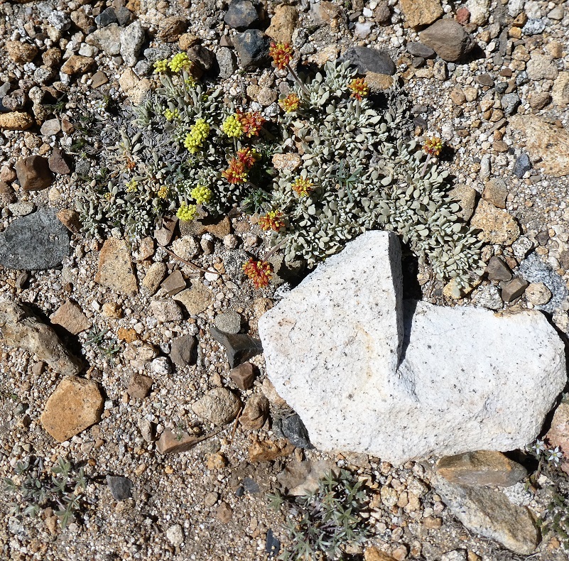
When you look across the Dana Plateau, it looks baron but when I looked closer, there were many tiny plants, many with flowers. They were tucked into small cracks and rocky areas.
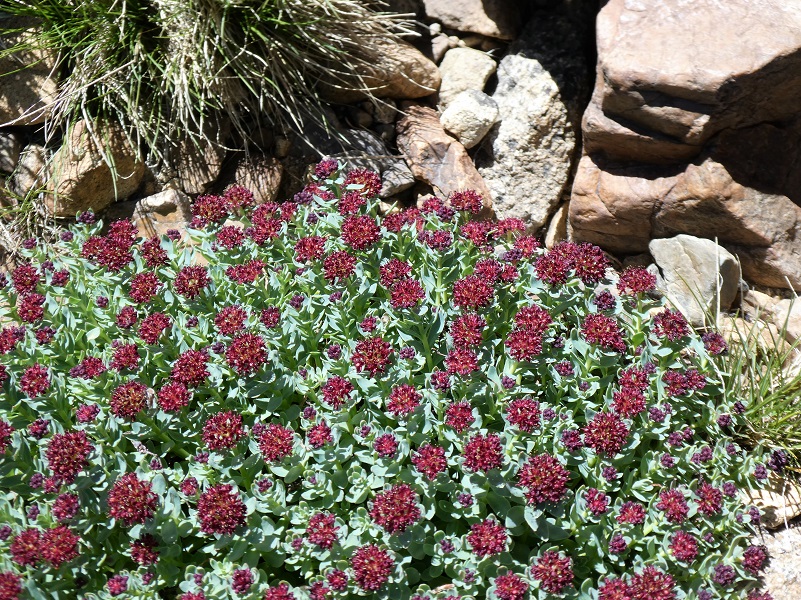
Rosy Sedum
It was time to make the final push to my destination, a high spot with a view. If you look in the middle of the picture at the tip top, there is a bit of a scraggly higher rocky area and that is it.
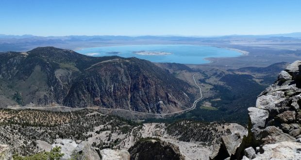
And what a view it is from this spot looking down at Mono Lake!
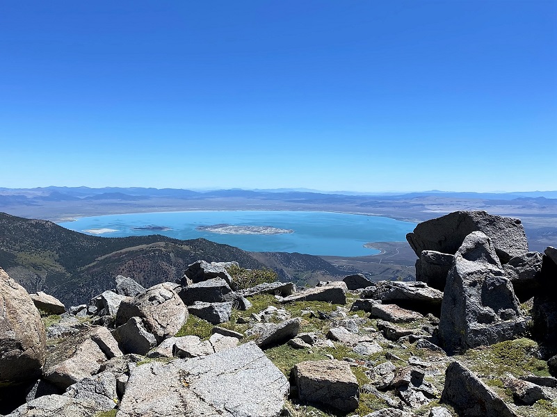
If I adjusted my spot, I could see the squiggly line that is Tioga Road/Hwy 120 down to where it meets Hwy 395.
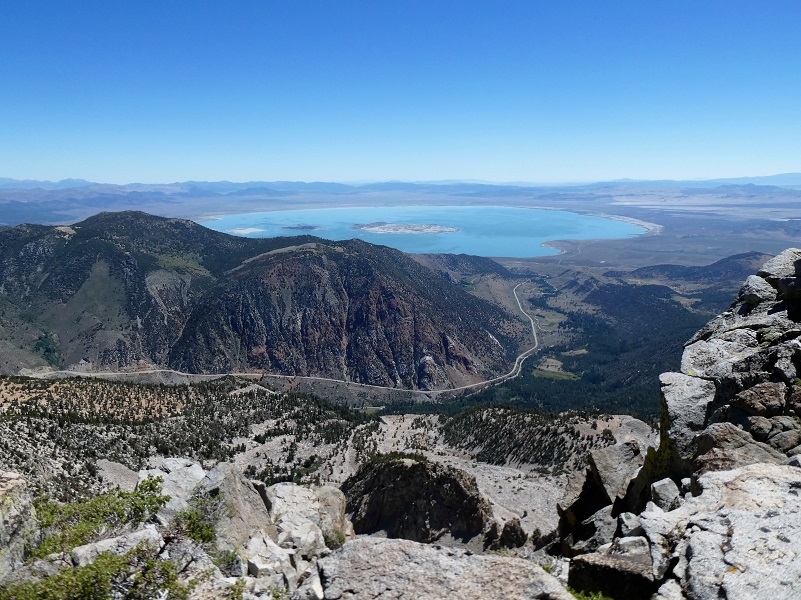
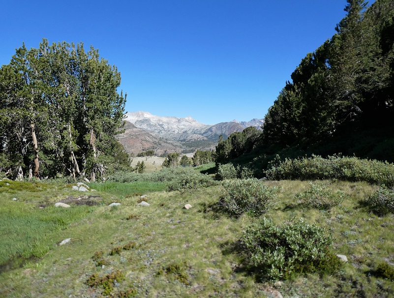
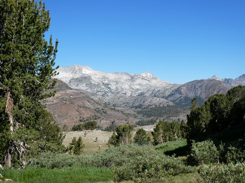
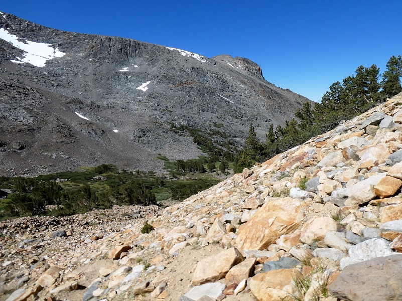
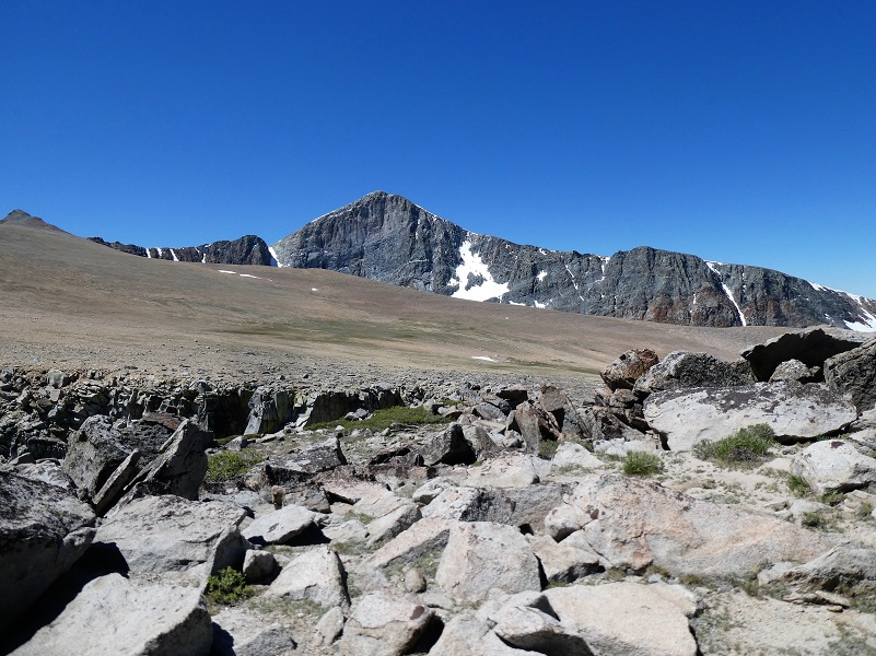
I had some mighty pretty views all around me though. I looked toward Mt. Dana, which towers over Glacier Canyon at 13,045′ elevation. It is the second highest mountain in Yosemite (after Mount Lyell) and is named after James Dwight Dana, who was a professor of geology at Yale College.

It was time for me to start heading down and I basically came down the same way I had come up.
Where the ground was damp on the plateau, there were many of these small butterflies which I think are Lupine Blue Butterfly.

As I worked my way back down the trail along the creek, I stopped to take some pictures of these beautiful white flowers that look similar to the Mariposa Lilies around my house but it could be a relative of them.

 Then 3 dogs with no apparent human supervision ran up to me barking. I yelled at them no and go home. Eventually they turned around and ran down the trail about 30 feet or so, then two of them turned around and came back to me barking and snapping at me. They were a foot or less away and I had my hiking pole out yelling no and go home. A man came up the trail and I told him his dog was biting at me. He called them, asked for some directions and they quickly walked down the trail. My legs were shaking from the encounter. I was afraid if I whacked the biting dog with my hiking pole, it would get meaner. And if I bent over to pick up rocks, I would be making myself smaller and it could attack me at face level. I have never had anything like this happen on the trail. As I walked down the trail, I came across the 3 dogs with 3 people along the creek and they were holding the dogs by their collars. I told the person holding the biting one about how that dog was snapping at me and barking but they didn’t say anything, not even a sorry.
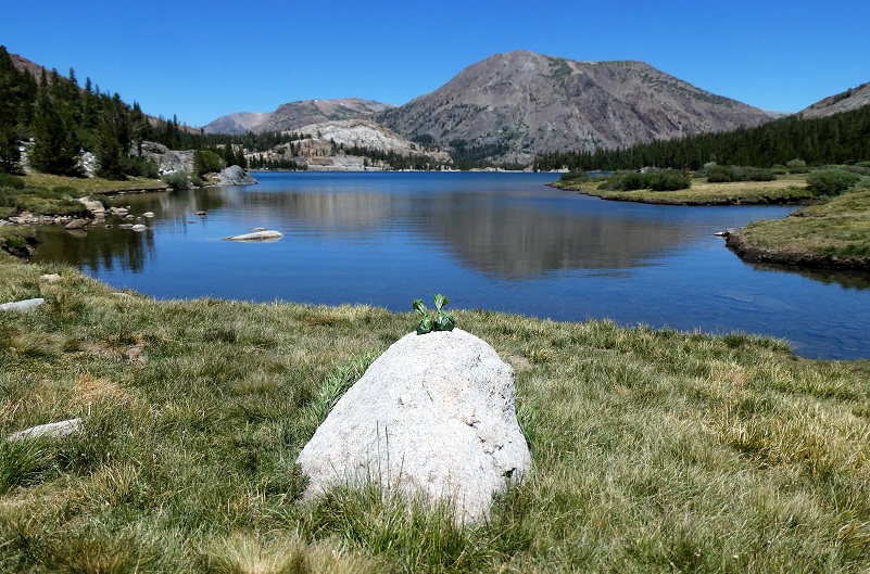 I made it down to Tioga Lake and I could see the lake was glassy, perfect for a nice picture but what was left on the rock by the lake? Doggy poop bags. Very picturesque.
I don’t want to make this hike seem too easy. Although it is short in length, there is a lot of elevation gain here and it is above 10,000′ elevation. It is important to be acclimated to hiking at this elevation and recognize the symptoms of altitude sickness when doing so. People do die of altitude sickness every year and this is a very real issue that people should be more aware of.
Altitude sickness occurs when you cannot get enough oxygen from the air at high altitudes. This causes symptoms such as a headache, loss of appetite, and trouble sleeping. It happens most often when people who are not used to high altitudes go quickly from lower altitudes to 8000 feet or higher, but it can occur to even a seasoned and conditioned hiker at times.
You can be adversely affected by the higher altitudes because the air is “thinner” at these high altitudes. When you go too high too fast, your body cannot get as much oxygen as it needs. This causes the headache and other symptoms of altitude sickness. As your body gets used to the altitude, the symptoms can go away.
These symptoms can include:
• A headache, usually throbbing, that gets worse during the night and when you wake up.
• Not feeling like eating.
• Feeling sick to your stomach. You may vomit.
• Feeling weak and lazy. In severe cases, you do not have the energy to eat, dress yourself, or do anything.
• Waking up in the night and not sleeping well.
• Feeling dizzy.
Your symptoms may be mild to severe. They may not start until a day after you have been at a high altitude. Some people say that having altitude sickness feels like having a hangover.
Altitude sickness can affect your lungs and your brain. When this happens, symptoms include being confused, not being able to walk straight, feeling faint, and having blue or gray lips or fingernails. When you breathe, you may hear a sound like a paper bag being crumpled. These symptoms mean the conditions are severe enough that they can be deadly.
Usually the best immediate treatment for altitude sickness is to go to a lower altitude. If your symptoms are mild, you may be able to stay at the elevation, take it easy, rest and make sure you keep yourself well hydrated.
If you are going to go on a hike at high altitude, learn about altitude sickness, the symptoms and how to treat it. It is very important that you look out for the other people in your group also. I have only briefly touched the subject of altitude sickness but felt it was important that it was on your radar should you decide to attempt a hike at elevations that are higher than you are used to. Altitude.org is a site where physicians who are knowledgeable about altitude sickness and associated illnesses have collected some information to share with the public. It has cautionary tales, a calculator where you can enter you’re your elevation to determine your percent oxygen that you will be breathing, along with detailed recommendations on the site. I used their calculator for our Dana Plateau hike and it showed that at our summit of 11,640′ elevation, we had 66% of normal oxygen at sea level. It even has a link that you can email them with questions if you have them. You can find them at Altitude Sickness .
Dog Hike?
Probably not. This hike is very steep through boulders and loose soil. For myself, it is difficult enough to climb up this trail without having to hold on to a dog. There are also sheer dropoffs at the top. This would not be a good hike for my dog Sally and I have never taken her up here for that reason. But you might be able to do the lower portion with your dog along the creek.
Here is some information from Inyo National Forest regarding their dog rules:
Traditionally, National Forests have welcomed dogs. However there are a few rules that apply to assure that you and other National Forest visitors have an enjoyable outdoor recreation experience. If you are camping with your pet, please practice the following:
General rules for dogs within the Inyo National Forest:
Doarama:
What is a Doarama? It is a video playback of the GPS track overlaid on a 3 dimensional interactive map. If you “grab” the map, you can tilt it or spin it and look at it from different viewing angles. With the rabbit and turtle buttons, you can also speed it up, slow it down or pause it.
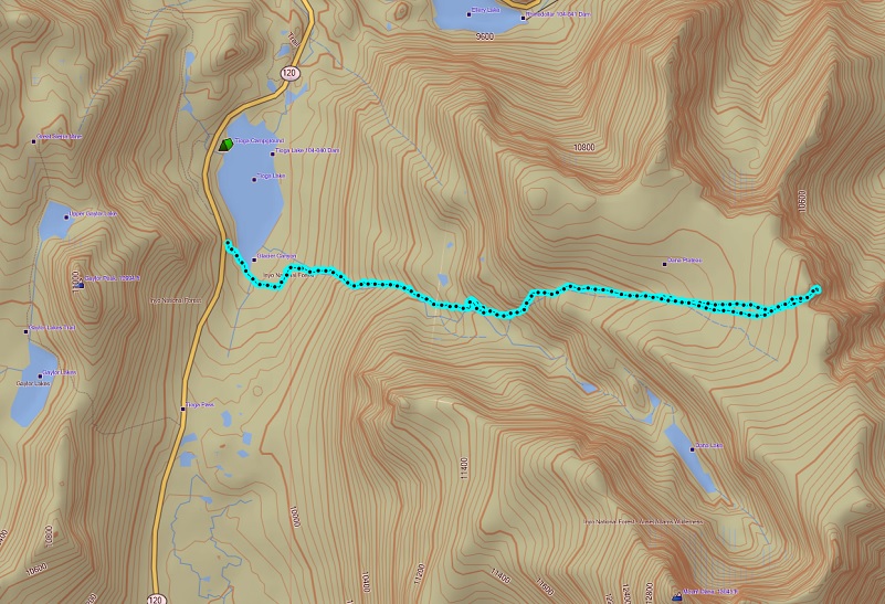
Map and Profile:
Dana Plateau Topographic Map Dana Plateau Profile Sources:
Ansel Adams Wilderness Wikipedia
Blackwell, Laird, Wildflowers of the Sierra Nevada & Central Valley Field Guide, Lone Pine Publisher, 1999
Monkshood Yosemite National Park
Glazner, Allen F. and Stock, Greg M., Geology Underfoot in Yosemite National Park, 2010.
Prior Blogs in the Area:
Hiking Up, Down and Around Dana Plateau July 31, 2019
Hiking up to and around Dana Plateau July 9, 2018
Hiking up the Glacier Canyon Trail to Dana Plateau August 28, 2017
Hiking up to Dana Plateau August 3, 2016