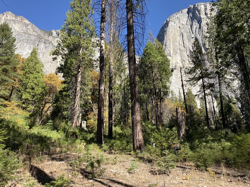
We hiked on a trail full of history that included an old wagon road and the old Civilian Conservation Corps camp known as CCC Co. 920, YNP 6. Camp Cascades started in 1933 and the men who worked there created many elements within Yosemite National Park that we pass by each time we visit. We also saw some fall color along our trail, reflecting in the Merced River.
Where: Yosemite National Park
Distance: 12.75 miles
Difficulty: Easy
Elevation Range: 3,869′ – 4,102′
Date: November 1, 2019
Maps: El Capitan and Hetch Hetchy Reservoir Topographic Quad
Dog Hike? No
Horseback Trail? Yes
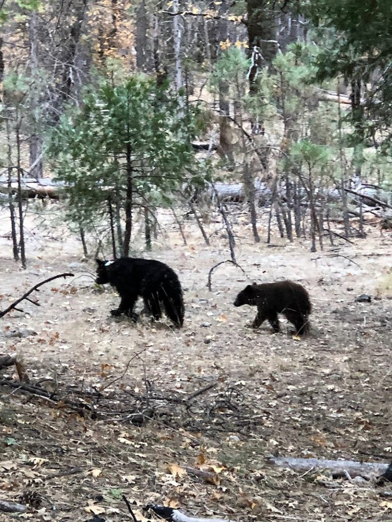
Photo by Jody Giorgi
As we headed in Yosemite Valley, we had a surprise right off the bat and lucky for us because it was at a pullout. We snapped some pictures of an American Black Bear mother and her cub then continued on.
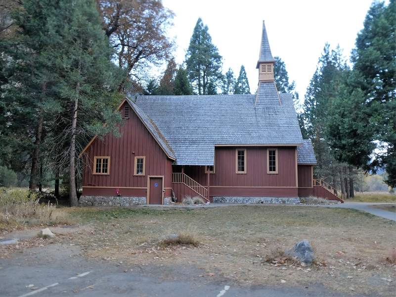
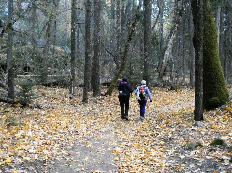
There is more than one way to hike the Yosemite Valley Loop Trail and we chose to start at the Yosemite Valley Chapel, the oldest structure in Yosemite Valley, built in 1879. You can also hike just about any part of this loop on its own if you don’t feel like hiking the 12 plus miles that we did. We debated starting on the north side of the Merced River because it was about 28 degrees when we parked. We knew it would be mighty chilly on the south shaded side in the morning but we had light jackets, layers and gloves, so we went for it.
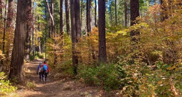
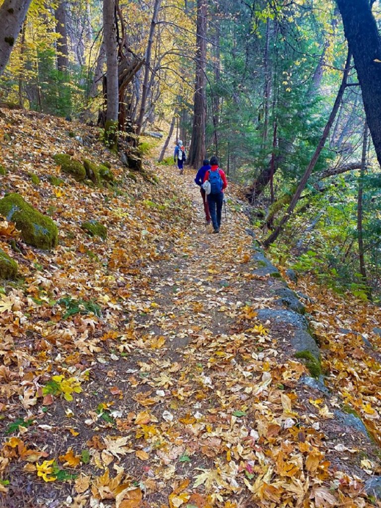
We knew that the fall colors wouldn’t be overwhelming but felt confident that we could find some pretty colors if the wind hadn’t blown those leaves off. As we walked west on the trail that long ago served as a wagon road, it was pretty level and in some areas golden leaves blanketed the trail.
As we crossed Bridalveil Creek, reflections accented with golden leaves asked us to check it out closer.

The trail crossed the road and followed along the Merced River for a while. Wow, were those colorful reflections magical.
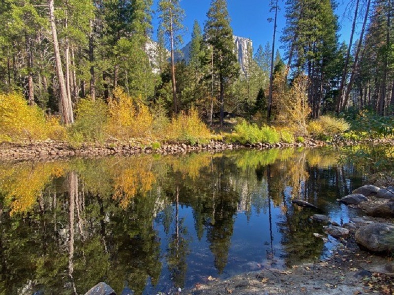
Photo by Debra Sutherland
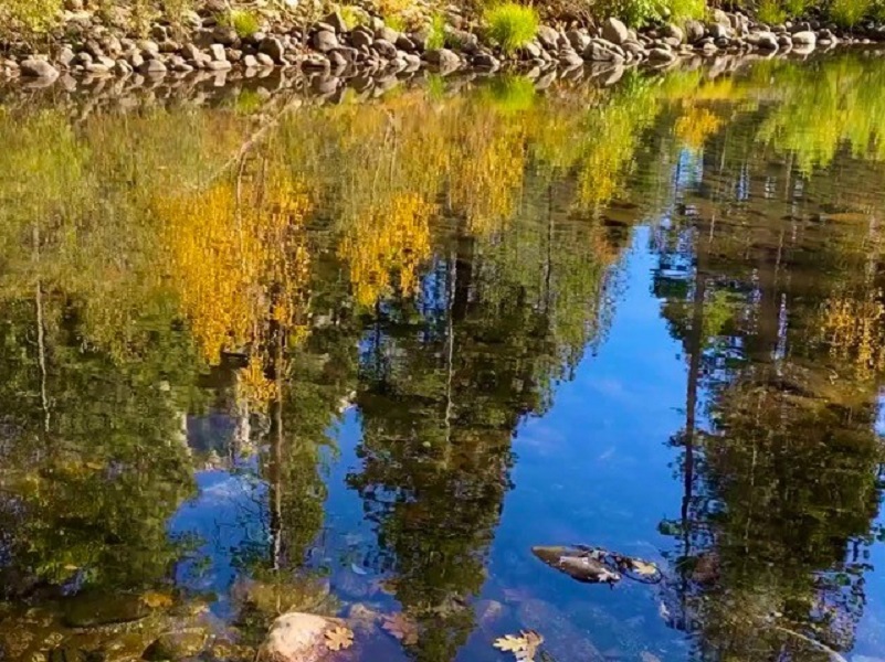
Photo by Debra Sutherland
We headed back to the trail and were blown away by this beautiful yellow oak, backlit by the morning sun.
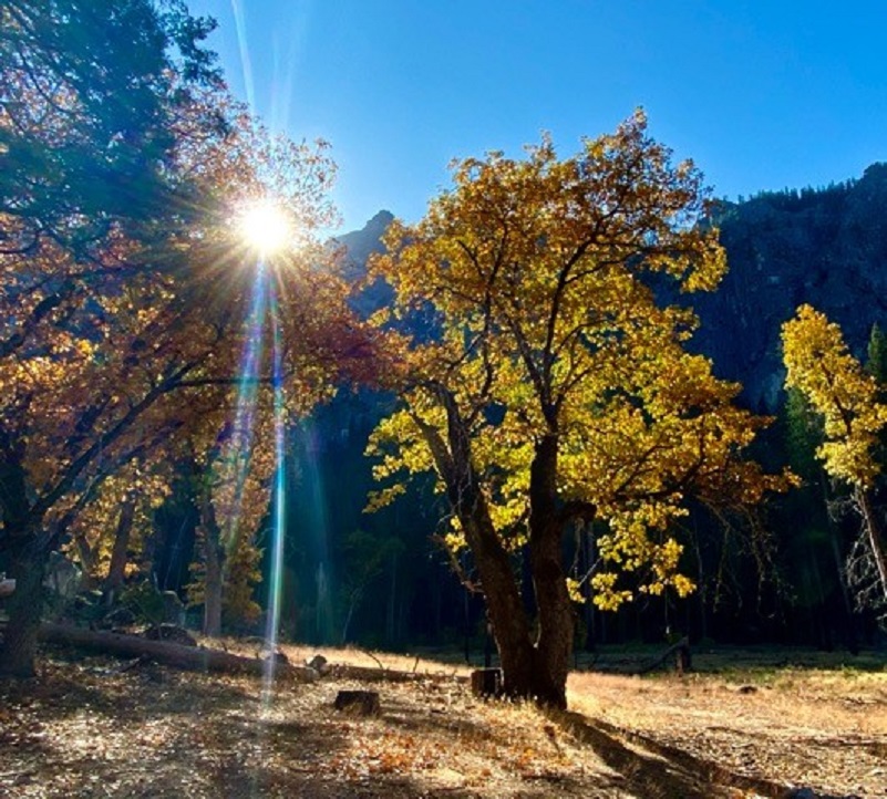
Photo by Debra Sutherland
I love the section on the trail before you reach Pohono Bridge and it was lined in a carpet of yellow leaves.
We crossed the road to check out Fern Springs.
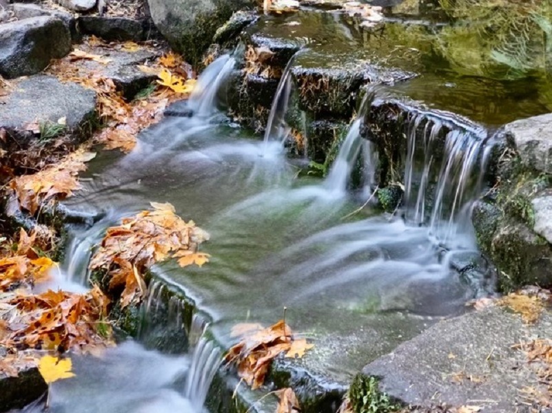
Photo by Debra Sutherland
They were doing a bit of construction near the Pohono Bridge and we were guided by the construction workers through the one lane of traffic and across, then the trail headed along the north side of the north road. We wandered through some pretty fall dogwoods.
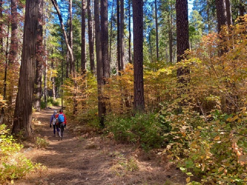
Photo by Debra Sutherland

Photo by Debra Sutherland
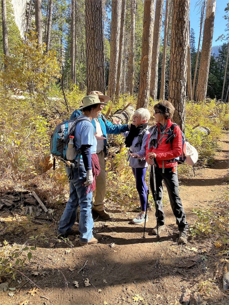
And you never know when you will run into old friends. They were doing the loop the opposite way than we were.
Deb guided us up to see an old standing chimney.
The rockwork was very special, loving that heart above the mantle.
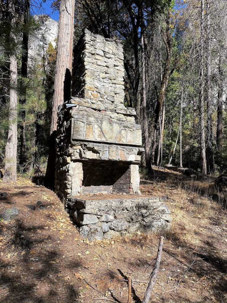
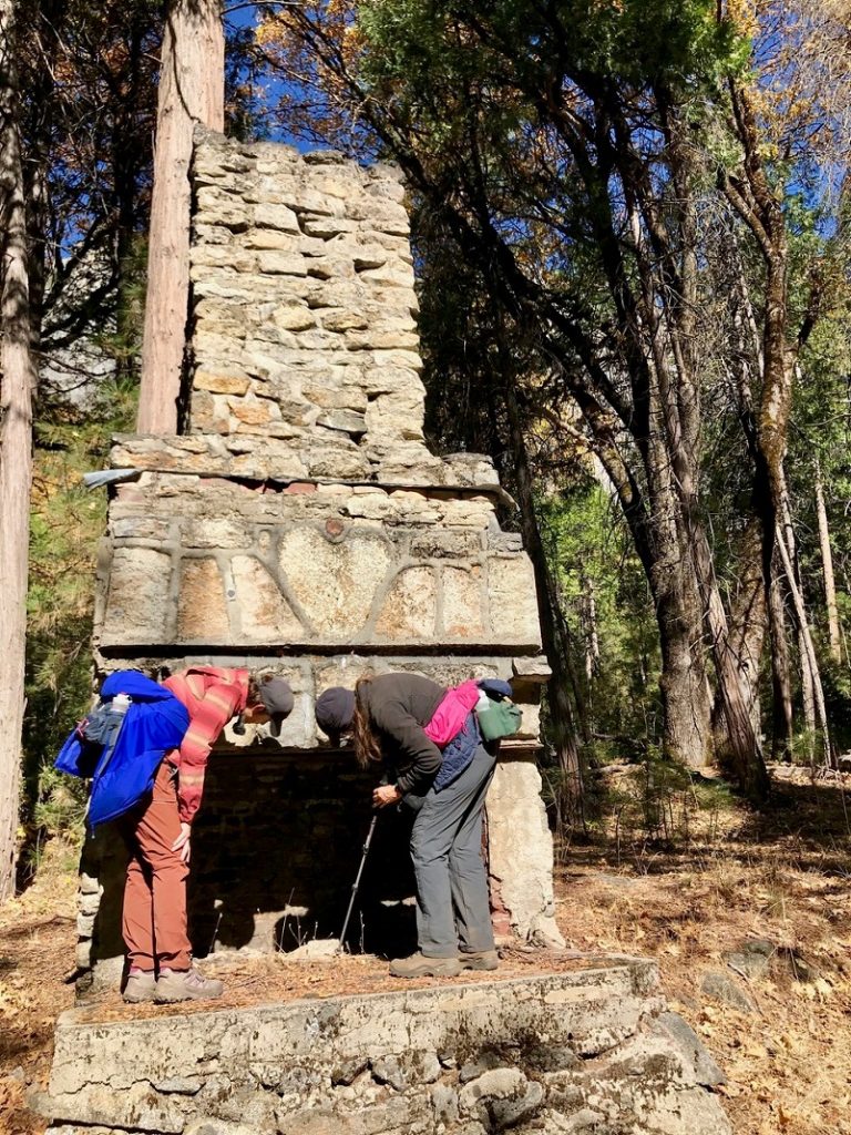
Photo by Gail Gilbert
When I returned from our hike, Sharon Giacomazzi shared the background of the structure. If you are not familiar with Sharon, she has written several hiking books that are the go-to books that many of utilize for our hikes. She has hiked and backpacked all over this country but even more importantly to me, she has researched the history related to these hikes. I don’t know of anyone who has such a depth of knowledge related to the historical uses of the Sierra. She also has written many articles for magazines and she shared an article that she wrote for the Union Democrat out of Sonora back in 2010 related to this remaining chimney. Her research led me to a couple of other sources of information related to this fireplace.
This chimney is one of the few remains of Camp Cascades, a former Civilian Conservation Corps (CCC) Camp. The CCC was the first of many recovery programs initiated by President Franklin D. Roosevelt to provide work for some of the millions of young men who couldn’t find jobs during the Depression.
A total of ten CCC camps were located in Yosemite National Park during the life span of the CCC (May 1933 to October 1940) with 6,816 CCC enrollees assigned. The Cascades Camp, first located at Cascade Creek on Highway 140, was wiped out in the 1937 flood. It was then relocated to the El Capitan area at the base of the Old Big Oak Flat Road.
Lois Orr wrote about the history of the Cascade Camp in the Yosemite Association Journal, Fall 2005 and there is a link to the article at the end of this blog. Here is a bit from that article:
One of the most outstanding achievements of the Cascade recruits was the rebuilding of the stairway ascending the eastern face of Half Dome in May 1934. The Half Dome cables, which had been installed about 1920 by the Sierra Club, were replaced and strengthened by the CCC. The objective was to replace 429 feet of 3/8-inch cable with 7/8-inch galvanized iron cable and also to replace thirty-nine pipe posts with stronger 1-inch pipe. A stub camp was established at the base of the dome. Workers drilled forty-one holes averaging seven inches in depth by hand in the rock for the new pipe posts. Each man was tied with a piece of rope to the pipe posts while he was drilling to prevent slipping or falling. New wooden steps were installed at the base of each pair of posts so that hikers could rest at these points. Although the weather had been perfect before work began, when enrollees set up camp and started the task, it suddenly changed. Every afternoon a storm blew in with rain, hail, or snow combined with high winds and work had to be discontinued. The stairway was eventually finished later that summer.
Cascade enrollees made many improvements at Yosemite Village. They installed log curbing and new paths, and planted ferns, trees, and shrubs along the foundations around the administration building, new hospi-tal, residences, and the Yosemite Museum. Native plants removed from various places outside the valley were trans-planted around government residences. CCC workers also revitalized the historic 250 apple trees planted by James Lamon, one of the first settlers in Yosemite Valley in 1868.
Village improvements continued as workers placed flagstones around the telescopes in front of the museum. Over a six-month period beginning in April 1935, 1,973 pine and cedar trees and thirty-six quaking aspens were planted in the barren areas fronting the road at Camps 7 and 15 (Lower and Upper River campgrounds). Under the direction of the park naturalist, enrollees from the Cascades Camp transformed the garden around the Yosemite Museum into a wildflower meadow featuring a spring and a stream.
CCC work in Yosemite also included rehabilitating springs to make them safe sources of drinking water. Enrollees turned Fern Spring (located just beyond the Pohono Bridge on the way into Yosemite Valley) into an attractive naturalistic rock garden by artistically arranging rocks at the site and planting a variety of ferns, wildflow-ers, and ground covers. A log guardrail was installed to define the parking area, and log seats were placed in the woods around the spring to improve the popular spot. To this day, Fern Spring is a traditional stopping point for Yosemite visitors.
The CCC worked on many other projects within Yosemite and you can still see them today. They include the native stone Glacier Point viewing hut, Arch Rock entrance station, developed trails, rest areas and protective barriers in the Giant Sequoia groves, and campground construction or upgrading. Did you know that the Badger Pass Ski Complex is among one of those? They also constructed the stone block Ostrander Lake Ski Hut which is still being used today.
We wandered around the old chimney and could make out old stone foundations and roads. We wondered if these roads tied in with the Old Big Oak Flat Road, originally a toll toad and the main road into Yosemite from the north. The entire road was built by hand, using picks, shovels and blasting powder. In 1874, this last stretch of Wagon Road was built from Big Oak Flat down to Yosemite Valley and was known as the “zigzag.” In 1899, the road was 30 miles long, averaging a width of 15 feet and a maximum average grade of .16%. If you would like to learn more about the Big Oak Flat Road, you can check out my prior blog Hiking Along the Old Big Flat Road.
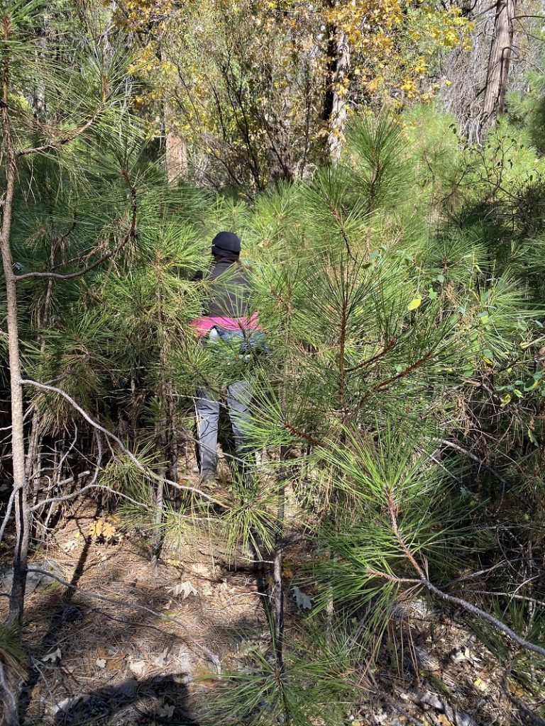
If you would like to pay a visit to this chimney, some of the older descriptions related to how to reach it may be a little off due to the tree removal work that has been done in this area. There are no signs or official trail up to the chimney. We left the trail about 1.4 miles east of the Pohono Bridge and headed up through a thick stand of young pines about 200 feet. You can see the chimney from the trail if you are looking and if you aren’t looking, you won’t see it because it is mostly hidden in the trees. We went back down to the trail by the huge deck of logs along the road and that would be an easier way because you wouldn’t need to bushwhack. You can follow the dirt road up from along the log deck, just west of Ribbon Creek.
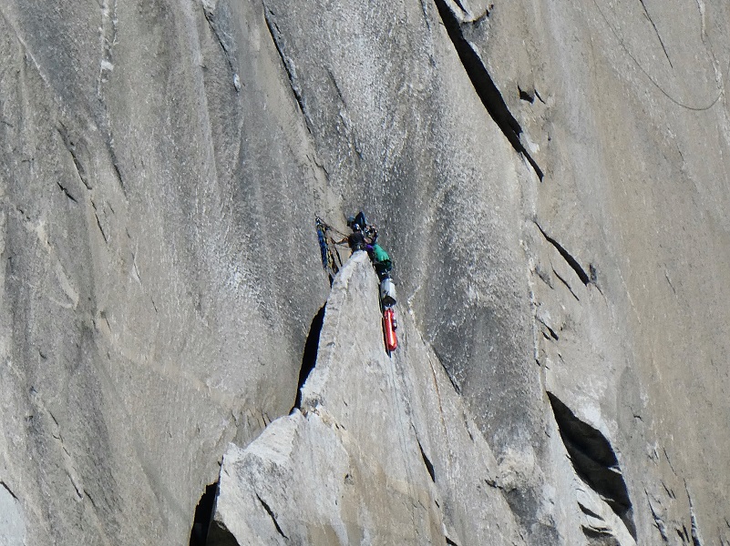
We continued back on the trail and when we reached a more open area on the trail and could see many climbers on El Capitan so stopped and watched them for a while.

Deb led us to a beautiful lunch spot along the Merced River with a view of Half Dome and reflections.
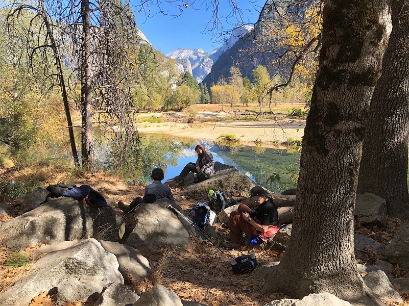
Photo by Jody Giorgi
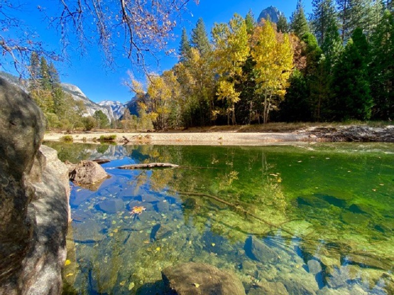
Photo by Debra Sutherland
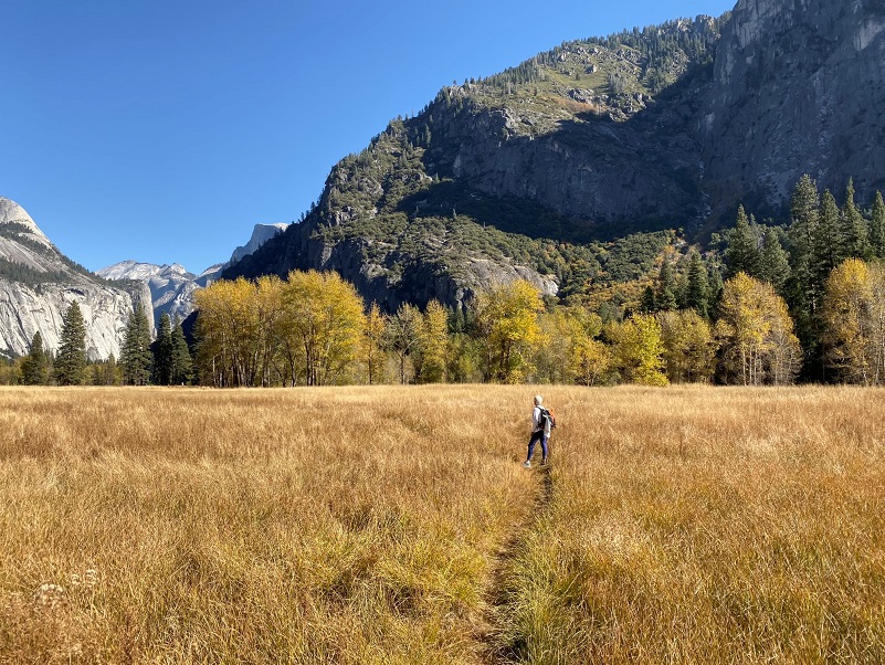
We left the trail where it crossed the road and took a trail along Leidig Meadow down to the river to tie in with the Swinging Bridge.
I feel really bad about us following this trail because when we reached the end of the trail by the Swinging Bridge, there was a sign on our trail saying it was closed due to the restoration they were doing in the area. I didn’t see a sign when we took the trail and hope you don’t make the same mistake that I did.
Dog Hike?
There are some areas along this leaf peeping route where dogs are allowed:
- In developed areas
- On fully paved roads, sidewalks, and bicycle paths (except when signed as not allowing pets)
- In all campgrounds except walk-in campgrounds (e.g., Camp 4) and in group campsites
Additionally,
- pets must be restrained on a leash not more than six feet long or otherwise physically restrained
- leashed pets may not be left unattended
- for the courtesy of other visitors, human companions are responsible for cleaning up and depositing pet feces in trash receptacles
- remember that pet food is also bear food: store pet food as if it were human food.
Where Pets Are Not Allowed
- On trails, including the trail to Vernal Fall (however, pets are allowed on the Wawona Meadow Loop)
- On unplowed roads covered in snow
- In undeveloped and wilderness areas
- In public buildings
- On shuttle buses
- In lodging areas
- In all walk-in and group campgrounds/campsites, including Camp 4
- In any other areas, as signed
These regulations protect both pets and wildlife from disease and each other. The National Park Service has prohibited pets on trails for many years. In particular, some pets chase wildlife, pollute water sources, and can become defensive and dangerous in unfamiliar surroundings. Pet owners have the burden to assure their pet does not damage the park values for others in those areas where pets are allowed.
Yosemite Hospitality operates a dog kennel in Yosemite Valley from approximately late May through early September. Written proof of immunizations (rabies, distemper, parvo, and Bordetella) must be provided. Dogs must be at least 20 pounds (smaller dogs may be considered if you provide a small kennel). You can get more information about the kennel by calling 209/372-8326.
Doarama:
What is a Doarama? It is a video playback of the GPS track overlaid on a 3 dimensional interactive map. If you “grab” the map, you can tilt it or spin it and look at it from different viewing angles. With the rabbit and turtle buttons, you can also speed it up, slow it down or pause it.
Map and Profile:

Yosemite Valley Loop Topographic Map
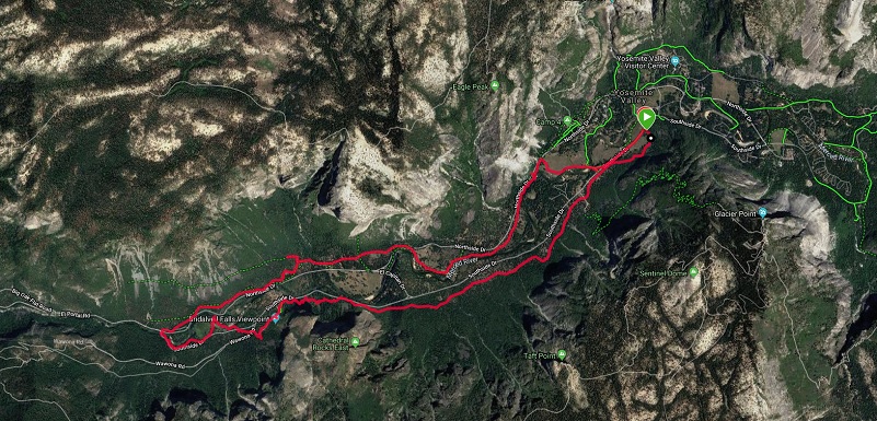
Yosemite Valley Loop Google Earth Image
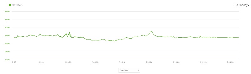
Yosemite Valley Loop Profile
Prior Blogs in this Area:
Leaf Peeping in Yosemite Valley and Hiking Mirror Lake Loop October 19, 2017
Mirror Lake Loop Hike April 26, 2016
Hiking Along the Old Big Flat Road December 7, 2015
Leaf Peeping in Yosemite Valley October 23, 2014
Mirror Lake Loop Hike November 7, 2012
Sources:
Giacomazzi, Sharon, CAMP CASCADES: Yosemite’s “Tree Army”, Union Democrat, August 30, 2010
The Civilian Conservation Corps (CCC) in Yosemite by Lois Orr
