A fitness hike with flowers along the way were what called us to the San Joaquin River Gorge area. We had a time we wanted to beat but could we do it without being distracted by all of those beautiful wildflowers? And how could we do this hike safely amid the early days of our COVID-19 pandemic?
Where: BLM, San Joaquin River Gorge Special Recreation Management Area
Distance: 7.73 Miles
Difficulty: Easy to Moderate, depending on how far you go
Elevation Range: 639′ to 1,862′
Date: March 13, 2020
Maps: Millerton Lake East Topographic Map

We started from North Fork and I drove my own car by myself. We drove past Kerckhoff Lake then to Smalley Road where we turned right at the BLM San Joaquin River Gorge Sign. We headed down Smalley Rd to the Ya-Gub-Weh-Tuh Trailhead and Campground. There is a well maintained outhouse here (not smelly) and picnic tables. There is a $5 for day use with a self service payment system but your America the Beautiful Pass will get you in. If you have a Lifetime Senior Pass, that will also get you in without additional fees. I had a pass with me so used that.
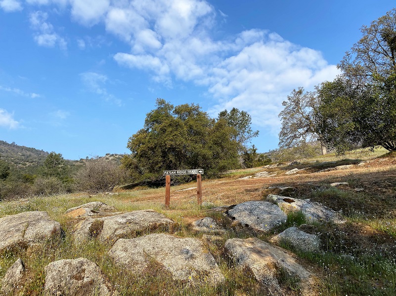
This trail gets its name from the Dumna and Kechayi Native Americans, who once lived in the area and the translation is pine nut. The Pa’san Ridge Trailhead started near the restrooms. We had a couple of gates to go through which we made sure we closed behind us.
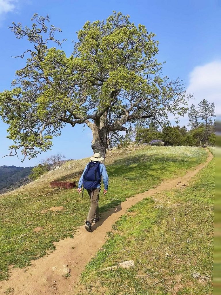
My friend Steve, who is a member of Fresno County Sheriff Office’s Search and Rescue Team, had a fitness hike that he needed to do. His mission was to complete the Pa’san Ridge Trail loop under 3 hours. I pulled up my last track that I did of this hike and we did it in 4 hours 46 minutes but we dilly dallied. We took pictures of flowers, stopped for snacks and lunch. I was not confident that we could do it under 3 hours but Gail and I were up for the challenge, planning on moving fast during the hike.
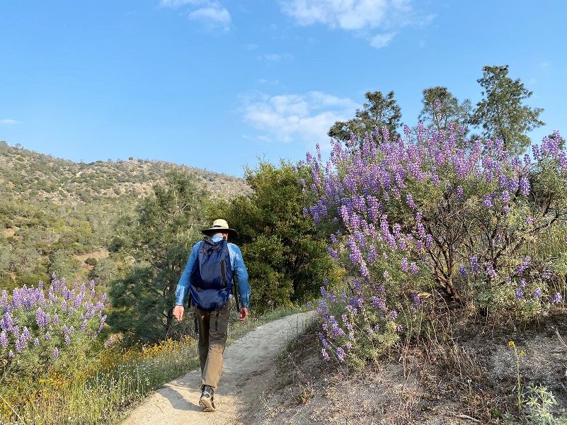
Steve set a fast pace, walking by lupine that were blooming crazy in this area.
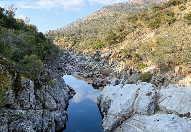
About a mile down the trail, we reached the bridge that crossed the San Joaquin River. We could look down river to clear reflections and up river at the rocky San Joaquin River Gorge and one of the two Kerckoff Powerhouses. Did you ever wonder how Kerckoff Lake got its name? Well, in the early 1900’s, W. G. Kerckoff was one of the major investors in hydroelectric power plants in Southern California and controlled almost half of the stock of Pacific Light & Power Company. Along with A. C. Balch, he purchased the assets of San Joaquin Electric Company (San Joaquin Powerhouse #1, transmission line to Fresno, water rights, etc.) and formed the San Joaquin Power Company.
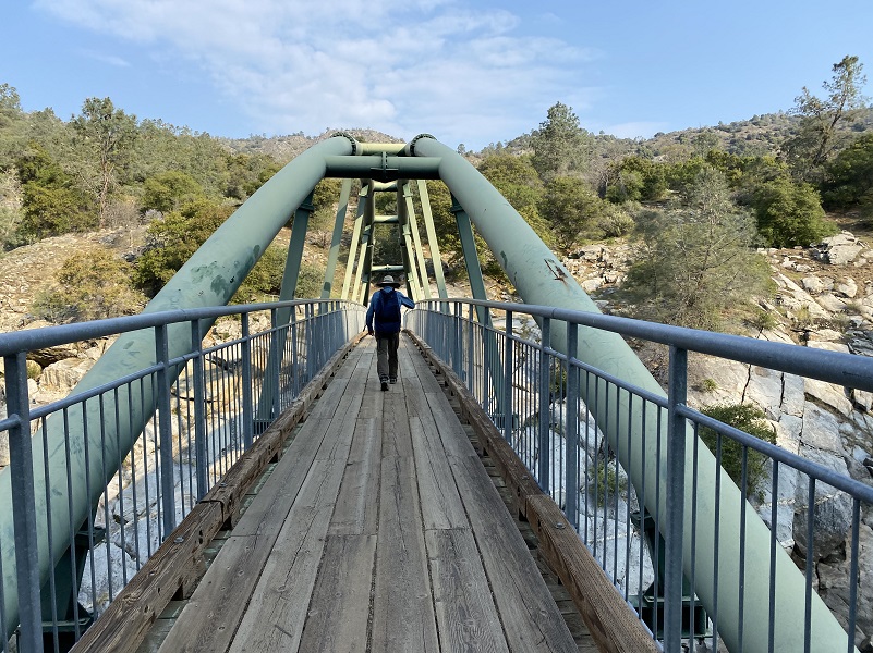
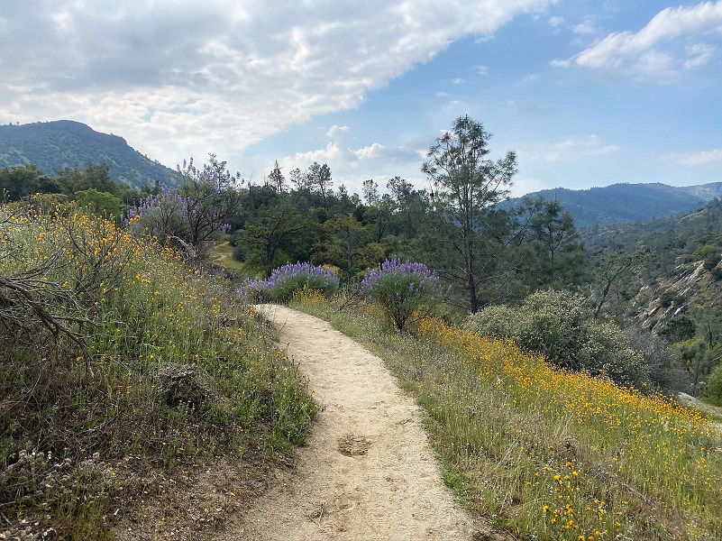
After crossing the bridge, we start climbing and came to a choice on which direction of this loop we would do. We turned right, doing the hike counter clockwise. The Wuh-ki’o Trail goes to the left and connects with our loop.
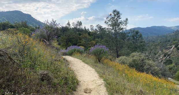
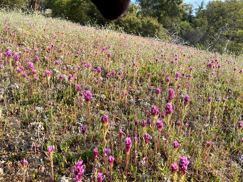
Flowers were really putting on a show, especially the owl’s clover as we started up the trail.
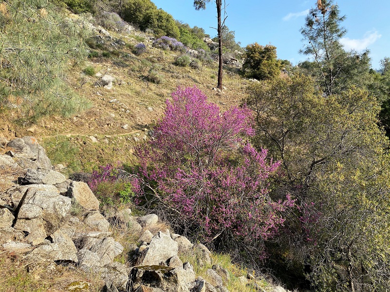
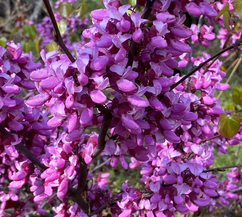
As I mentioned earlier, the redbud was spectacular!
And the lupine was another show off.

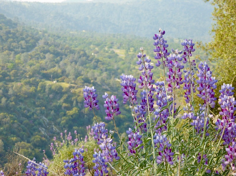
Photo by Gail Gilbert
We took a short 5 minute break with a snack and since we still had some more uphill to do, got at it.
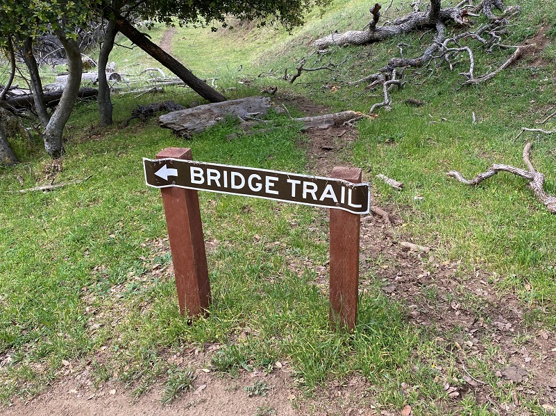
We followed the signs when the trail split.
Cows and their calves grazed along the trail, sometimes on the trail, leaving reminders for us on the trail.

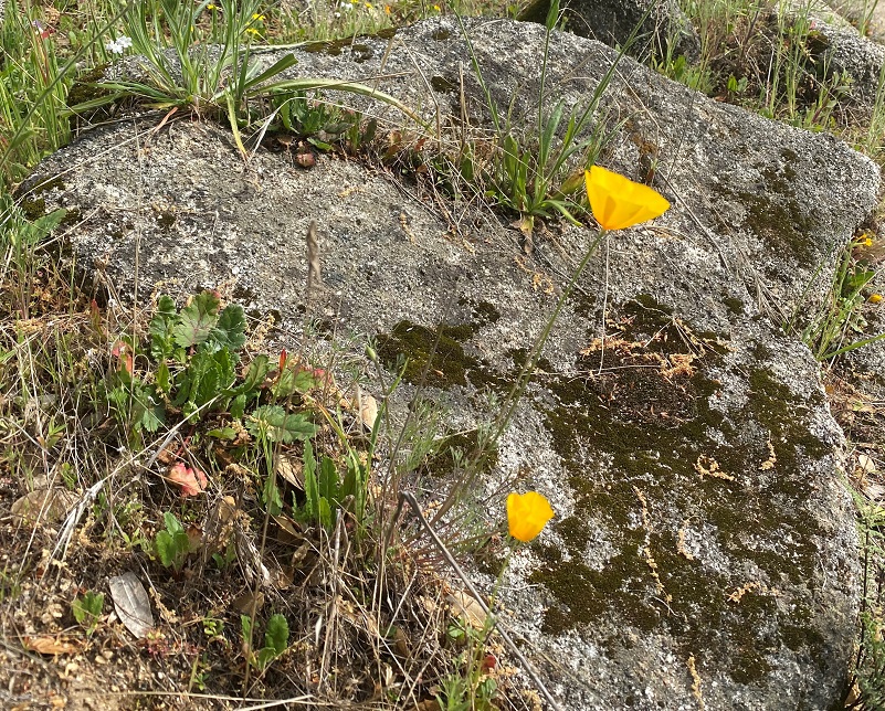
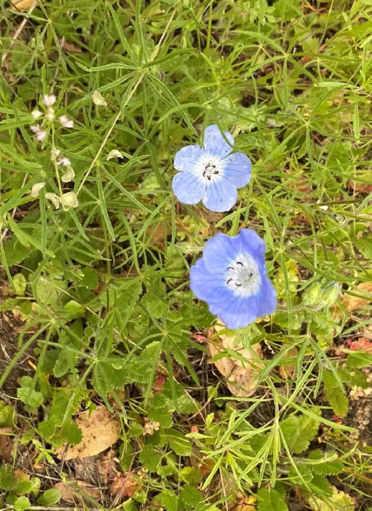 We didn’t see many poppies but plenty of other colorful wildflowers were blooming such as fiddleneck, shooting stars and baby blue eyes.
Heading back, that fiddleneck lining the trail was quite pretty.
If you wonder how I was able to capture my pictures, well, Gail took this picture of me in action. I snapped as I walked.
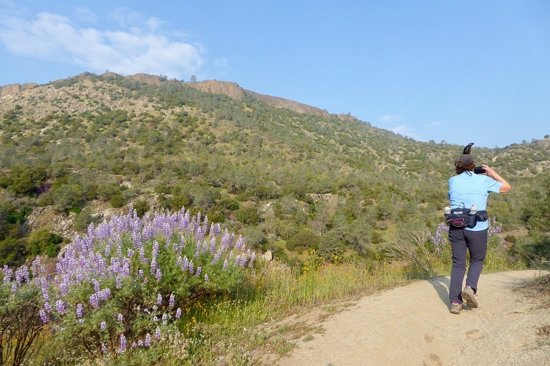
Photo by Gail Gilbert
We continued headed down the trail, taking the signs that led to the bridge. There weren’t hardly any poppies or wildflowers on this part of the loop but I think as you approach the bridge, the view from this side is very nice.
And our time? We made it under 3 hours with time to spare in 2 hours 37 minutes!
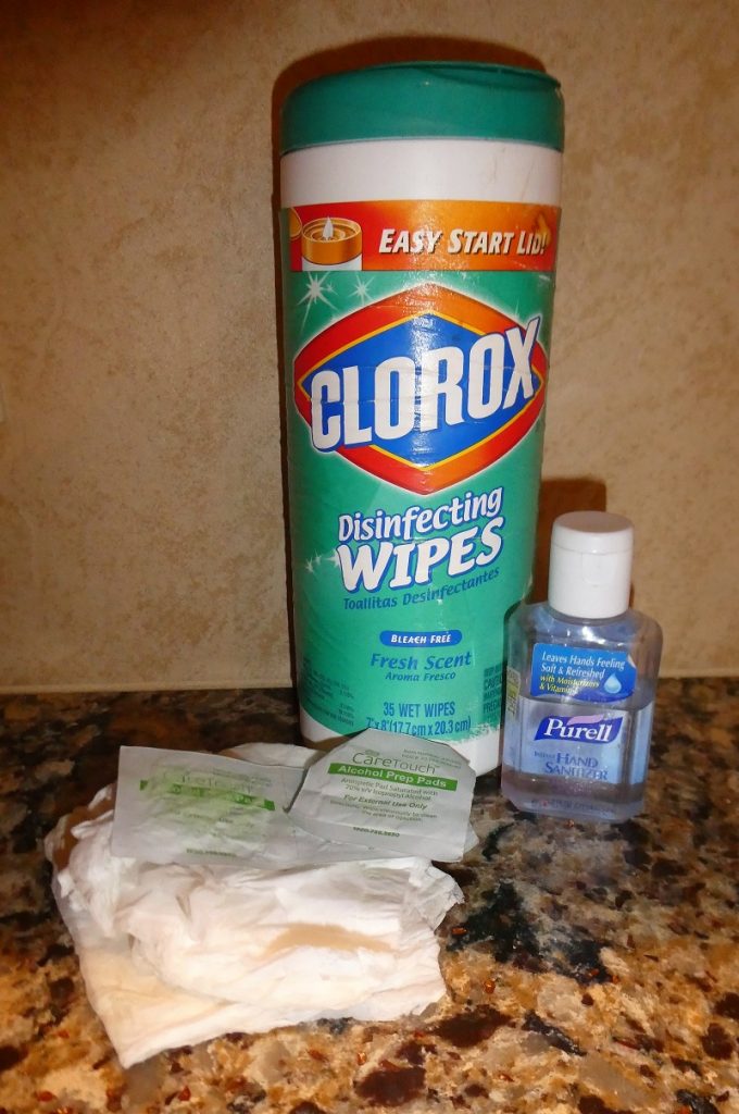 I wanted to share how I tried to minimize my exposure to germs on this hike because this hike wasn’t one where we were completely isolated by ourselves but we probably only saw less than 10 people all day spread out in different areas. We had distance between us, but also had to open and close a couple of gates. The picture shows my arsenal. I carried the Kleenex, alcohol wipes and a small bottle of hand sanitizer in my pocket. The Clorox wipes and a hand sanitizer stay in the car. I use the little bottle of hand sanitizer and fill it up. I also keep a small bottle in my pack. When I used the restroom, I used one of the wipes to open and close the door. I also offered to take a picture of a group of hikers and used a wipe to hold their phone. I then used the hand sanitizer after that. I knew there were a couple of gates to open on this hike and I “let” my hiking companions open them on the way in. On the way out I didn’t have that option since I was some distance ahead of them. I could have used the Kleenex that I had in my pocket but didn’t think of that, so I used a couple of fingers on one hand to open and close it, then tried to not touch anything with that hand. As soon as I cleared the last gate, I took out an alcohol wipe and wiped those fingers down. I also wiped down my cell phone, hiking poles and my car door entry, then hand sanitizer. I also drove my own car by myself.
Since I did this hike, the rules have changed regarding leaving our homes and will continue to change. Getting outdoors in these times can be beneficial and in my future blogs, I will try to share some ways I have found to get some sunshine and an adventure.
Doarama:
What is a Doarama? It is a video playback of the GPS track overlaid on a 3 dimensional interactive map. If you “grab” the map, you can tilt it or spin it and look at it from different viewing angles. With the rabbit and turtle buttons, you can also speed it up, slow it down or pause it.
Map and Profile:
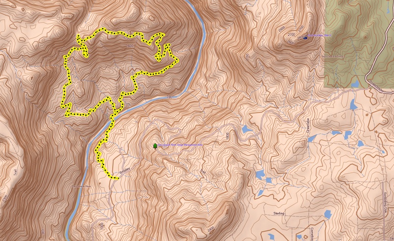
Pa’san Ridge Hike Topographic Map
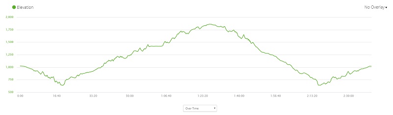
Pa’san Ridge Hike Profile
Sources:
San Joaquin River Gorge Special Recreation Management Area
Kerckhoff Lake, Powerhouse, and Dam
Reclamation: Managing Water in the West
Prior Blogs in the Area:
Hiking From Sky Harbor Along Millerton Lake January 28, 2020
Hiking From Sky Harbor Along Millerton Lake With The Cows February 25, 2019
Hiking from Sky Harbor along Millerton Lake March 31, 2017
Hiking with the Cows along the San Joaquin River Gorge March 23, 2017
Hiking the San Joaquin River Trail March 31, 2016
Hiking the Pa’san Ridge Trail February 21, 2016
San Joaquin River Gorge Hike April 17, 2014


