We headed down to Sequoia & Kings Canyon National Park to hike beneath many huge giant sequoias. The world’s largest giant sequoia lives here, along with most of the top 25 largest giant sequoias in the world. Our choice of trails led us through more huge trees than we could count. Oh, and the fall colors were pretty nice too!
Where: Sequoia & Kings Canyon National Park
Distance: 10.68 Miles
Difficulty: Moderate
Elevation Range: 5,497′ – 6,935′
Date: October 22, 2019
Map: General Grant Grove Topographic Map
Dog Hike? No
Horseback? Maybe
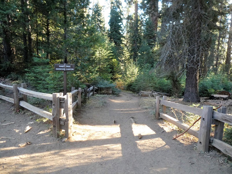
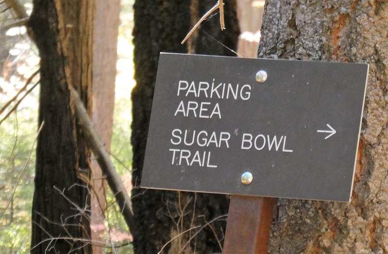
We met up at the Park & Ride at Hwy 41 and Road 200, then all hopped in one car to drive to Sequoia & Kings Canyon National Park. From Fresno, we drove east on Hwy 180 then followed the General’s Highway south for 3.6 miles to the Quail Flat / Hume Lake junction (7 miles south of Grant Grove). Opposite the Quail Lake sign there was a sign for Redwood Canyon and we turned right (west) on the dirt road. The road wasn’t bad but it was about one lane wide and had some bumps that were sneaky and hiding as we drove. Driving down this road for about 2 miles, we came to a signed junction, turned left at the junction into a parking area. The trailhead is located at the south end of the parking area.
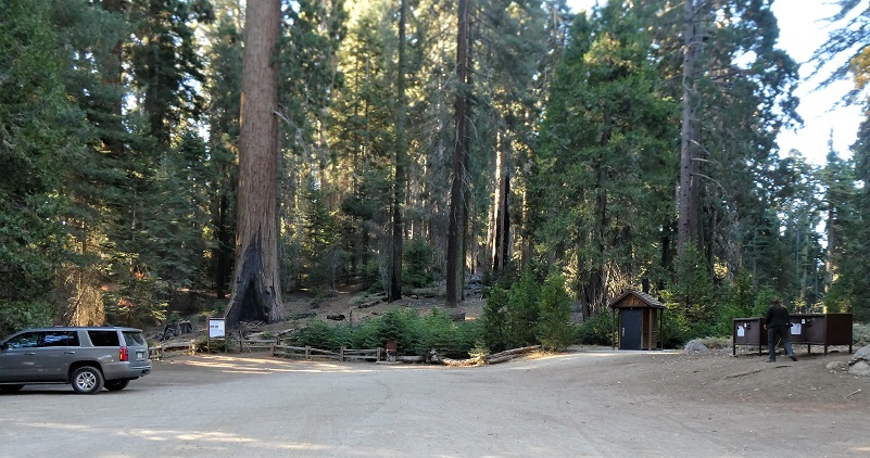
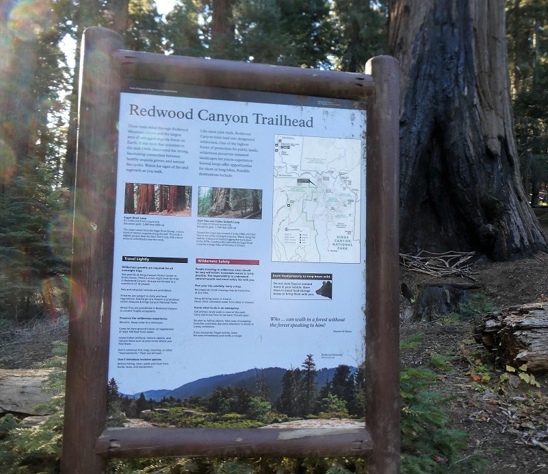
There are two trails that start from this trailhead, the Hart Trail and the Sugar Bowl Trail. We looped both of these together for our hike but you elect to just do one of them. Below is the information that Sequoia & Kings Canyon gave on each specific trail.
- Distance: 7.3 miles (loop) to Hart / Redwood Creek Loop
9.6 miles (loop) to Sugar Bowl Trail - Elevation: 6,220-ft. at Trailhead
6,414-ft. at Hart / Redwood Creek Loop
6,950-ft. at Sugar Bowl Trail - Elevation Gain: 919-ft. to Hart / Redwood Creek Loop
1,455-ft. to Sugar Bowl Trail
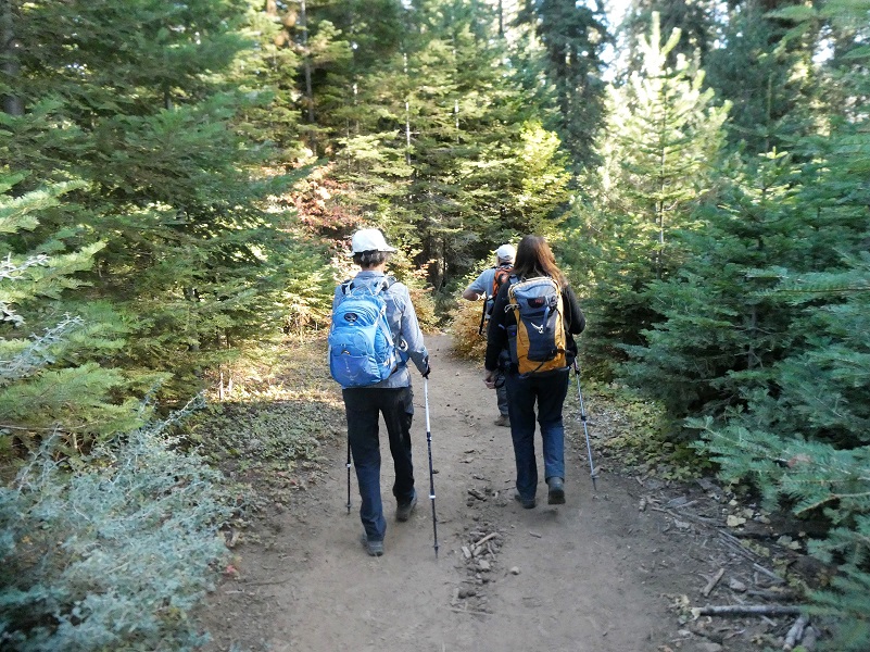
It was a warmer fall day for our adventure with the temperature around 60 when we left the car and started out on the Hart Trail.
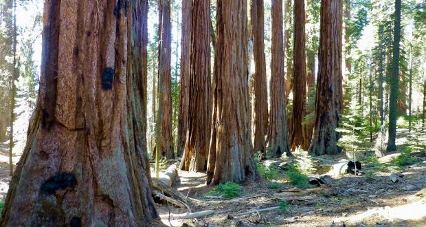
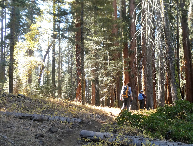
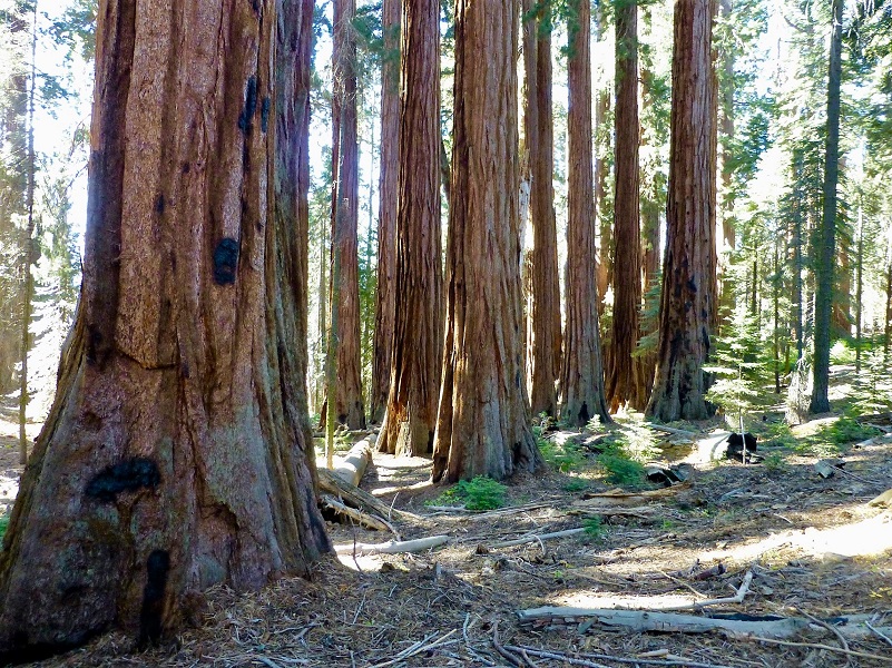
The biggest highlight of this trail is the Redwood Mountain Grove, the largest grove in total area, having the largest area of old growth giant sequoias, and contains more mature sequoias than any other grove. This grove was one of the first areas where Sequoia and Kings Canyon National Parks started prescribed burning to reduce fuels and stimulate giant sequoia reproduction. The large fire scars on some of the monarch giant sequoias are a testament to the presence of fire over many centuries in sequoia groves. Beautiful large sequoias were along the trail from the beginning.

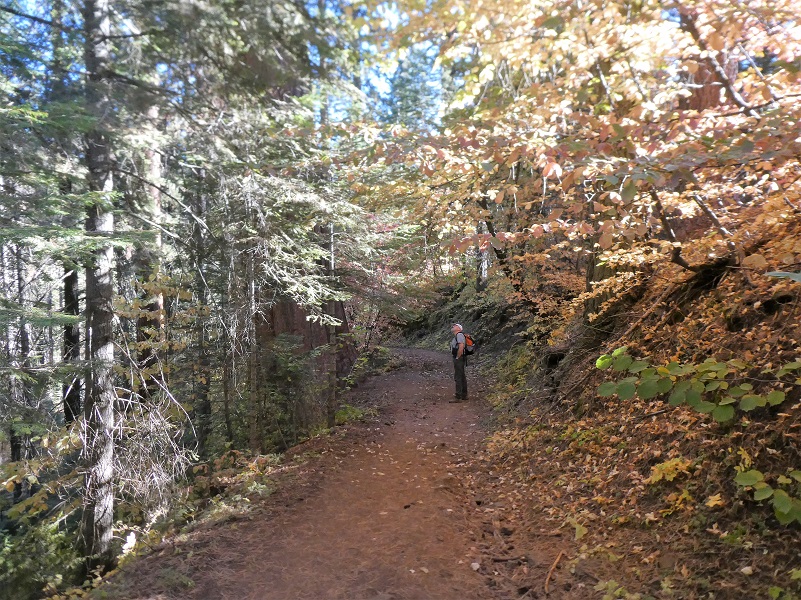
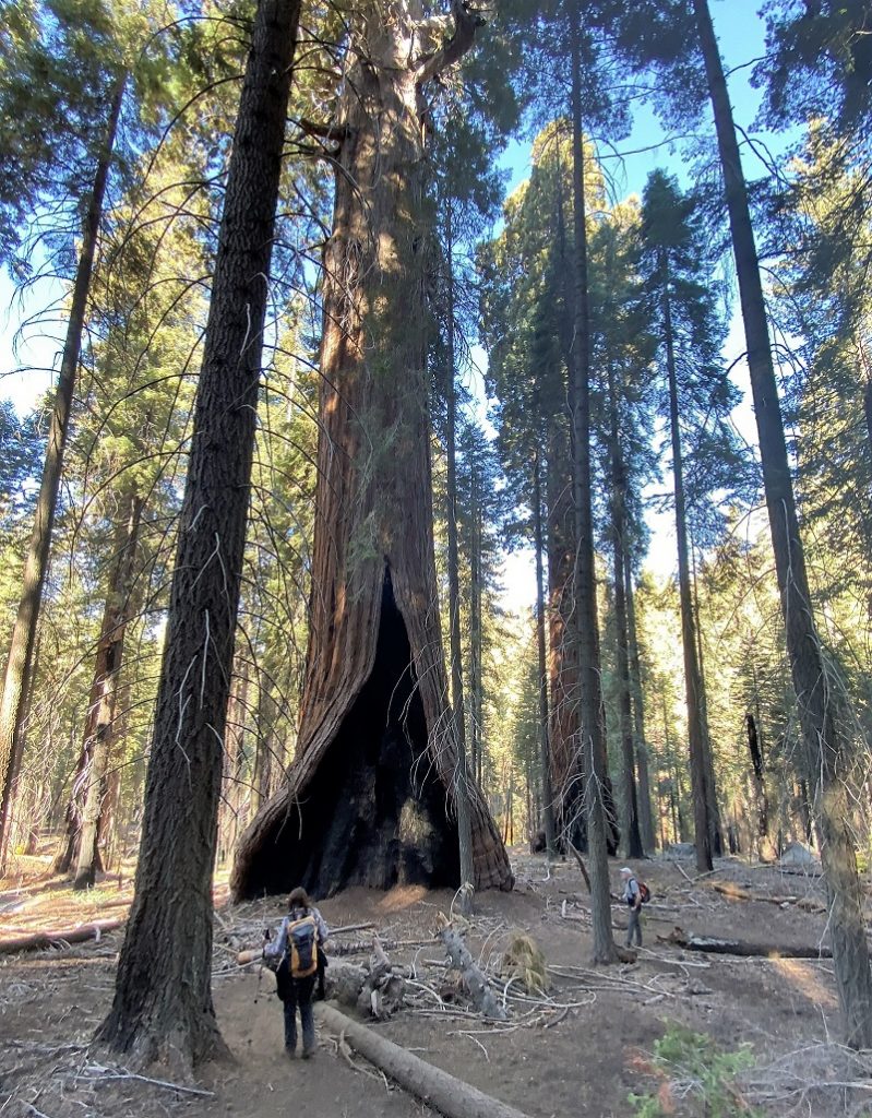
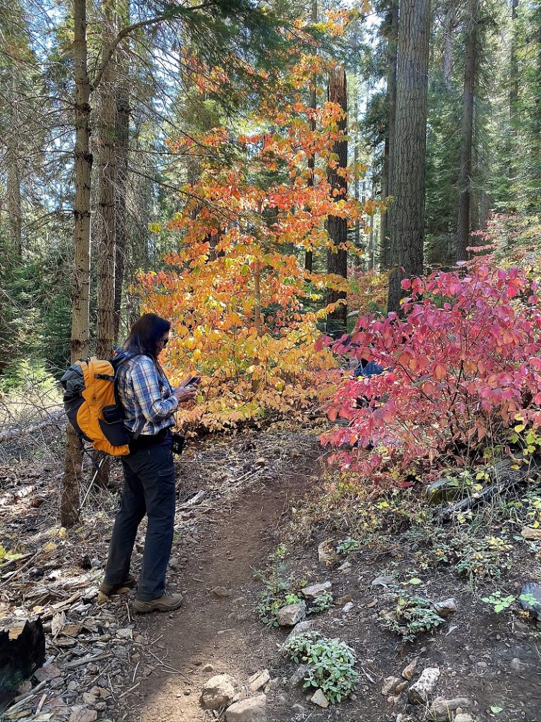
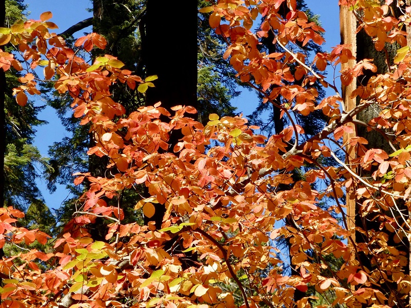
Then we saw plenty of dogwood with beautiful fall colors, some subtle red and some very deep red.
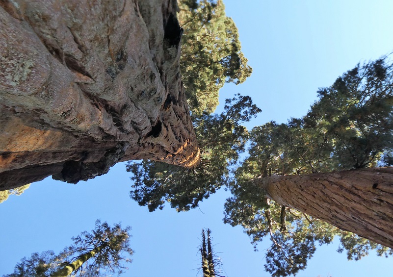
Boy those sequoia were tall and it is so hard to show how tall they are with a picture.
We crossed Barton Creek.

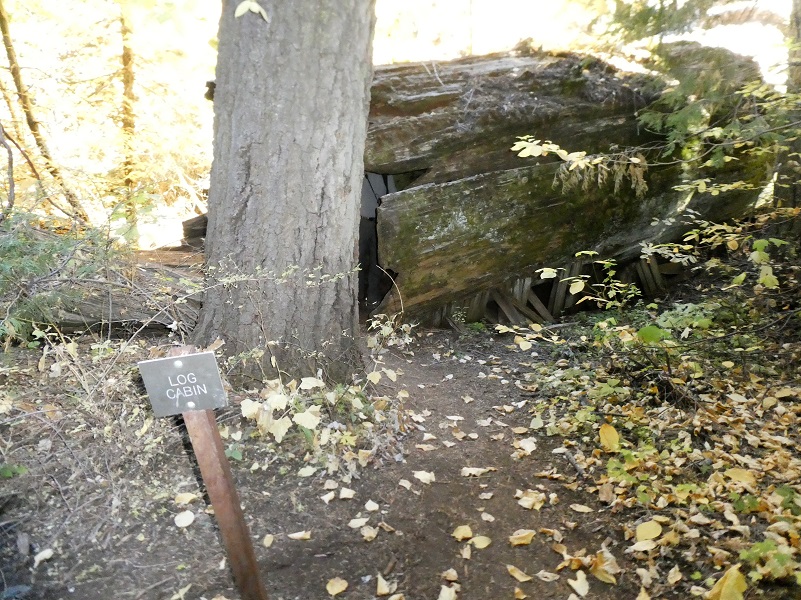
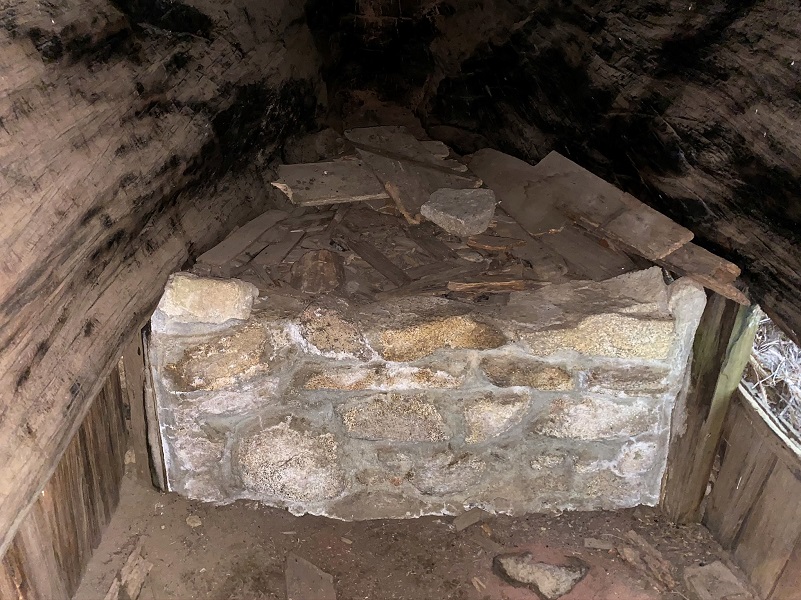
Then we reached the Log Cabin Tree, a hollowed out sequoia lying on its side. The cabin is near a few large stumps that mark the remains of Barton Post Camp, an old logging site from the 1800’s. It was a small scale logging operation that made fence posts.
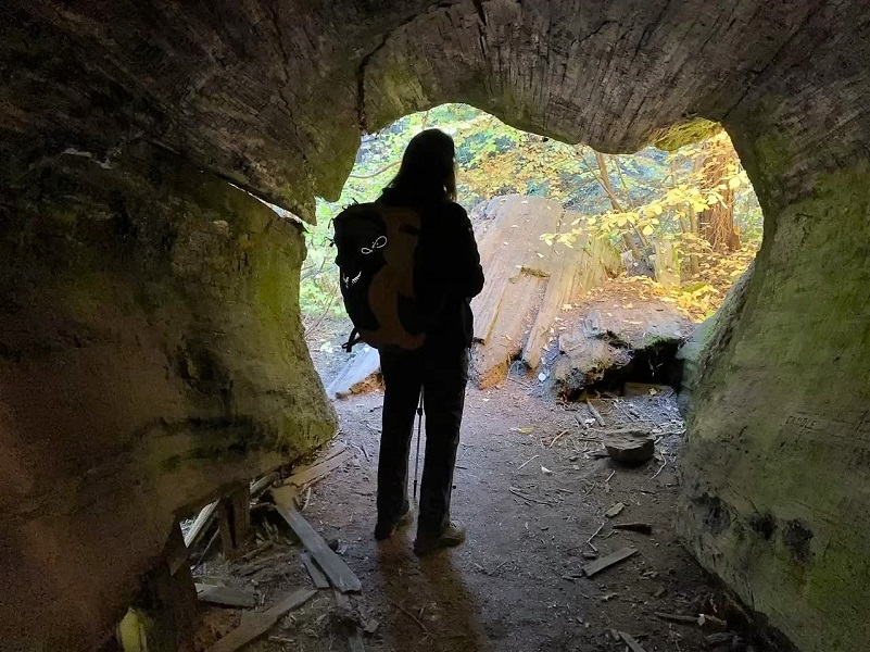
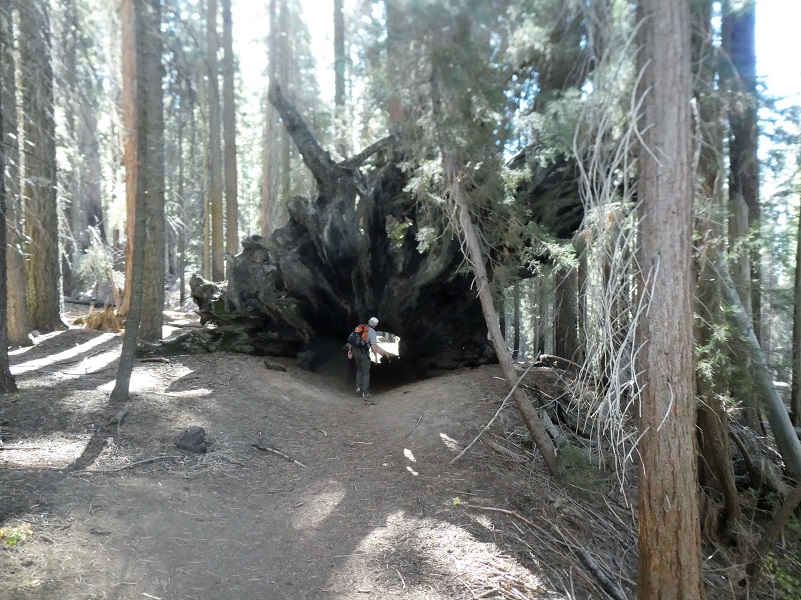
After about 2 1/2 miles, we reached the Fallen Tunnel Tree.
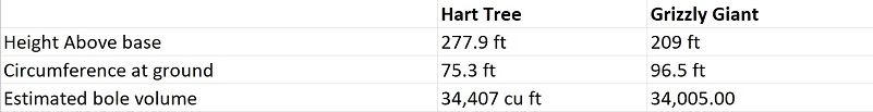
A short spur trail that was signed led us up to the Hart Tree, named after Michael Hart who discovered the tree around 1880. It is the 24th largest sequoia in the world. I thought it would be interesting to compare it with the Grizzly Giant tree in Mariposa Grove, currently ranked as the 25th largest sequoia in the world.
As we moved along the trail we came across a beautiful little waterfall!

As we got closer to Redwood Creek, quite a few redwoods lined the trail, shaded by much taller trees above them.
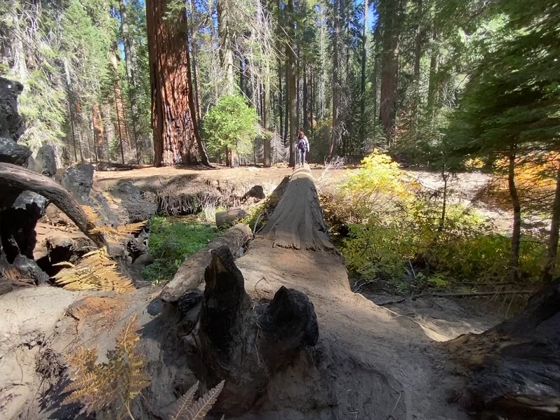
It was time for lunch and our timing was perfect to relax along Redwood Creek.

Just upstream from our lunch spot was a log crossing. I crossed it and lay in wait, ready with my camera.

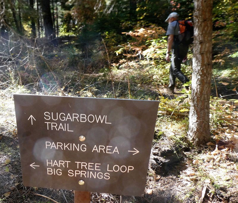
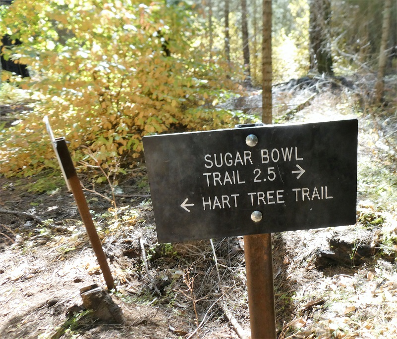
We followed the signs to the Sugar Bowl Trail and just over 5 miles out, we reached the junction.
The trail started its uphill climb, eventually gaining about 1,400′ when we reached the top.
The trail wound around the south and western facing slopes which can get a bit warm but we were treated to views of Big Baldy, Buena Vista Peak and other views along the way.
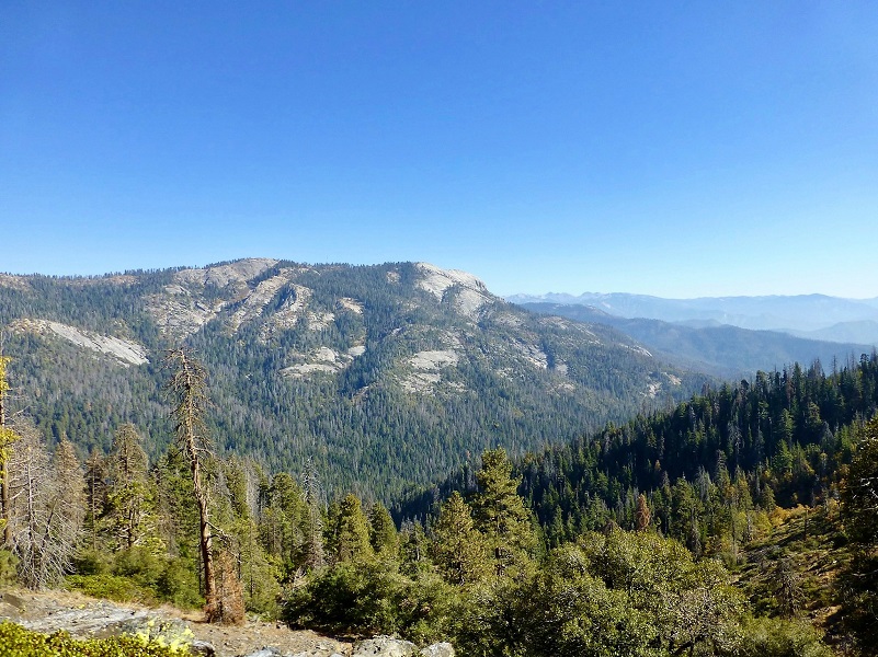
Photo by Gail Gilbert
At about 8 1/2 miles, we reached the ridge of Redwood Mountain and home of the Sugar Bowl Giant Sequoia Grove. The Sugar Bowl Grove is one of few examples of a nearly pure giant sequoia forest, rather than the typical mix of giant sequoias with other types of trees. From one spot along trail, they say that you can one see more than 50 giant sequoias. The trail wound through the grove, giving us all kinds of different perspectives of the huge trees.
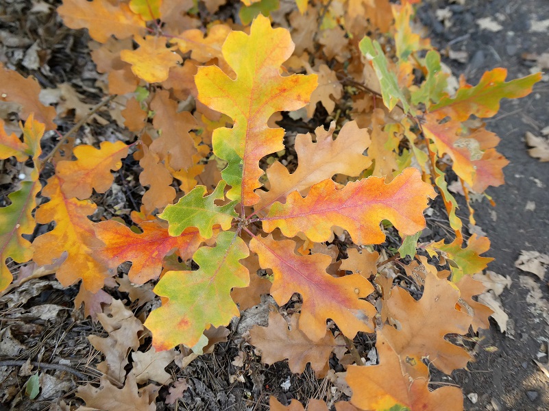
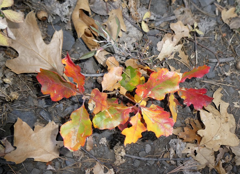
After we left the Sugar Bowl Grove, we starting seeing a really nice amount of fall color and of course, we needed to stop, admire and take pictures.

Giant sequoias grow only on the western slopes of the Sierra Nevada in California, between 4,000 and 8,000 feet (1219 and 2438 m) in elevation. Within Sequoia & Kings Canyon National Park boundaries, park staff distinguish approximately 40 different giant sequoia groves, ranging from one to tens of thousands of sequoia trees per grove. Numerous groves can be reached by road, while others are remote and involve an arduous hike to visit.
If you are interested in exploring other Sequoia groves in the area, here is a map.

Sequoia Groves of Sequoia & Kings Canyon National Park (Courtesy Wikipedia)
Dog Hike?
No, dogs are not allowed on this trail in Yosemite National Park.
Horseback Riding?
I was asked to include information on horseback riding when they are allowed on trails. I tried to locate official information related to horses on these trails but I couldn’t locate any. I have heard from some that have ridden these trails so it is possible. I noticed that there was some down material on the trails that might be an issue for some horses but I don’t feel that any of these were impassable. If you are interested in riding these trails, I recommend you contact the park or local horse groups for more information.
Doarama:
What is a Doarama? It is a video playback of the GPS track overlaid on a 3 dimensional interactive map. If you “grab” the map, you can tilt it or spin it and look at it from different viewing angles. With the rabbit and turtle buttons, you can also speed it up, slow it down or pause it.
Redwood Canyon Looped Hike Doarama
Maps and Profile:
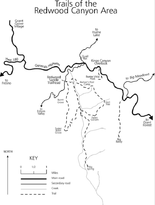
Trails of the Redwood Canyon Area (Courtesy Sequoia & Kings Canyon National Park)
Redwood Canyon Hiking Trails http://www.hikingwalking.com/destinations/ca/ca_sws/lodgepole/redwood_canyon/redwood_canyon_fullpagemap
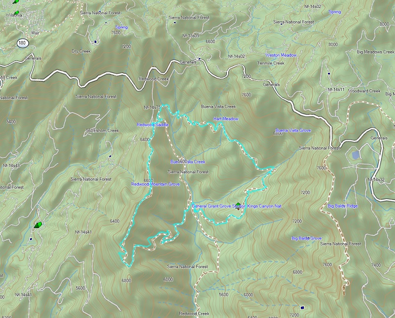
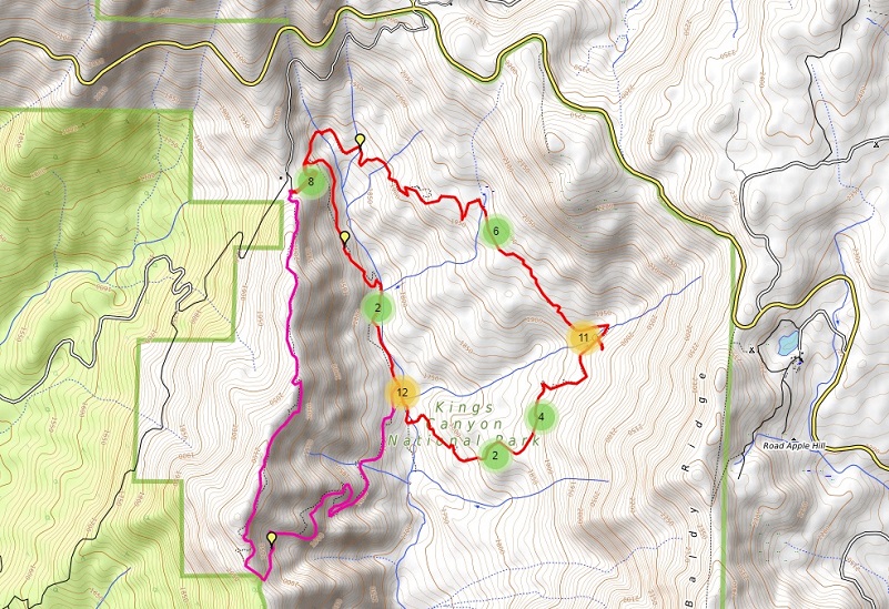
Redwood Canyon Looped Hike Topographic Map
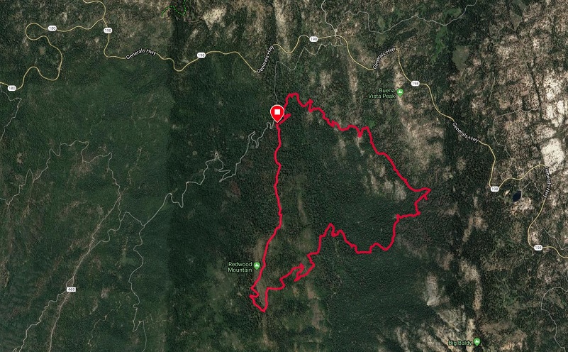
Redwood Canyon Looped Hike Google Earth
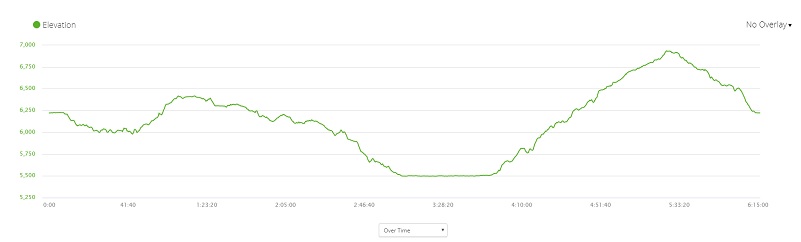
Redwood Canyon Looped Hike Profile
Sources:
Redwood Mountain Grove Wikipedia
Exploring Giant Sequoia Groves NPS
Scheidt, Laurel, Hiking Sequoia and Kings Canyon National Parks, 2nd: A Guide to Parks’ Greatest Hiking Adventures, Morris Book Publishing, Inc., 2002