It had been a couple of years since we hiked at Hetch Hetchy. This year didn’t give us super strong flowing waterfalls and it was a bit early for wildflowers but the hike gave us a good workout with beautiful views.
Where: Yosemite National Park
Distance: 11.50 Miles
Difficulty: Moderate
Elevation Range: 3,682′ to 4,470′
Date: March 5, 2020
Maps: Ackerson Mountain and Hetch Hetchy Reservoir Topographic Quads
We drove up Big Oak Flat Road to Hwy 120, then about a mile west of Yosemite National Park’s Big Oak Flat Entrance Station, we took the Hetch Hetchy turnoff, following Evergreen Road, then Hetch Hetchy Road 16 miles to its end at the parking lot above O’Shaughnessy Dam and Hetch Hetchy Reservoir. My directions sound complicated, but the signs lead you where you need to go. The Hetch Hetchy Visitor booth on Hetch Hetchy Road was open and they advised us that their hours were 8 to 5, then the gate would be closed, so we made sure we were out by then. We arrived at the gate past the Visitor booth at 830 and it was still closed. We were getting ready to hike from the overflow parking area when a Ranger showed up to open the gate. That made us very happy.
A while back, my mom asked me how Hetch Hetchy received its name so I did a bit of easy research. American Indians have lived in Hetch Hetchy Valley for more than 6,000 years, gathering seeds and plants, hunting and trading. It is thought that it probably derived from the Miwok word hatchhatchie, which means “edible grasses.”
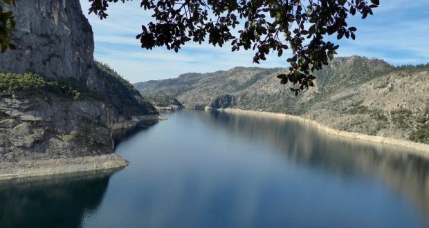
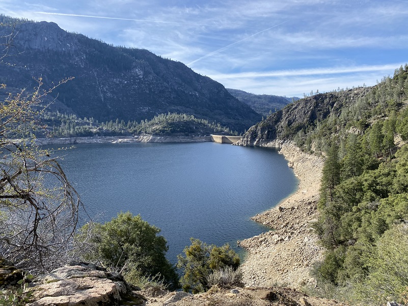
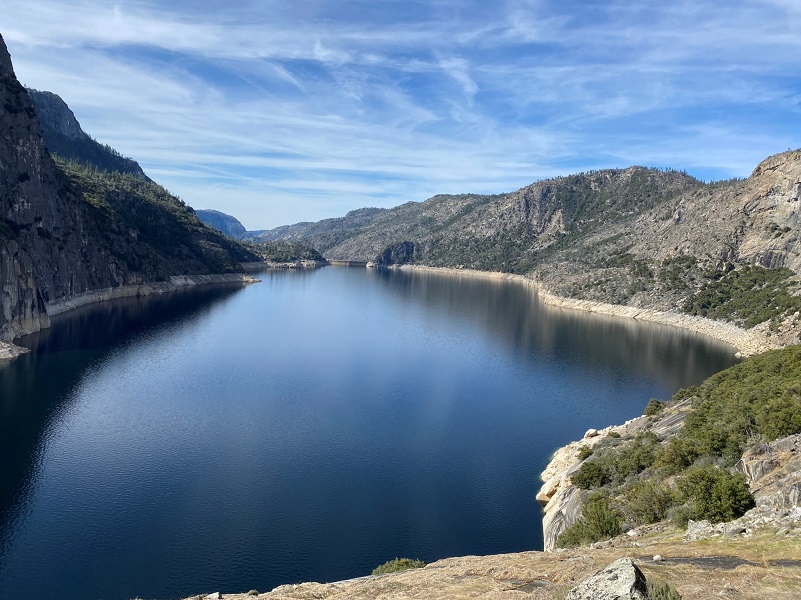
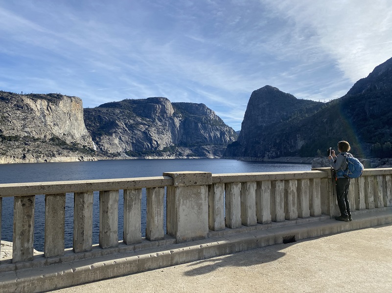 From the parking lot, we walked across the O’Shaughnessy Dam, which is a 430 foot high concrete arch-gravity dam on the Tuolumne River. Hetch Hetchy Reservoir is formed behind the dam which is the source for the Hetch Hetchy Aqueduct, which provides water for over 2 million people in San Francisco and other municipalities of the west Bay Area. The dam is named for engineer Michael O’Shaughnessy, who oversaw its construction.
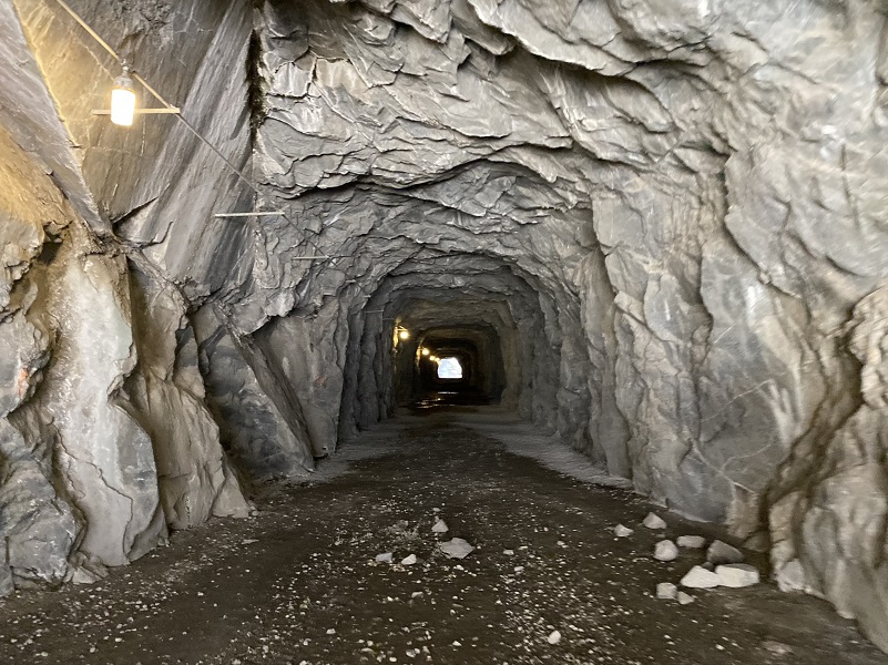
After crossing the dam, we headed through a 500 foot long tunnel.
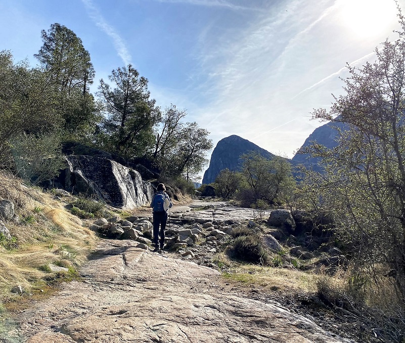
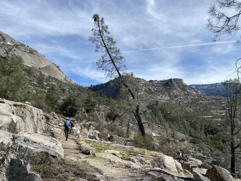
Then the trail followed an old road, fairly flat as we started out, and with views of where we were headed.
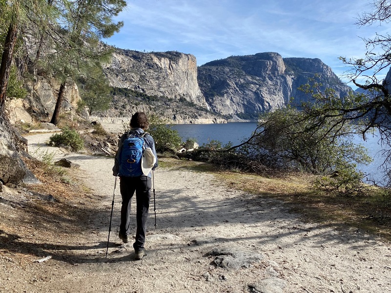
And as we looked back, we had views of where we had started.
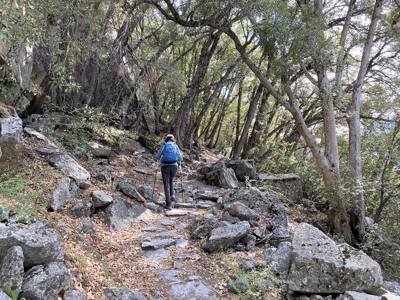
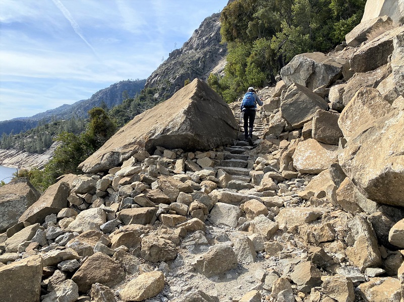
The trail quit that flat part and became slightly up and down for the remaining hike.
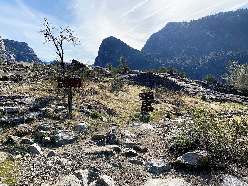
We followed the signs toward Wapama and Rancheria Falls.
We headed past Tueeulala Falls, which was barely falling. At about 880 feet it is the smaller of two large waterfalls that spill into Hetch Hetchy Reservoir, the other being Wapama Falls. It is the larger of the two in terms of greatest free-fall distance, as Wapama is split into two falls. Tueeulala Fall drops free for 600 feet, hits a ledge, then slides steeply down 280 feet further.

There was no breeze when we started out and those dang gnats started hovering around our face at times. I took out my bandana and looked like a church lady as I occasionally waved it in front of my face. It was effective though because I didn’t eat any gnats all day.

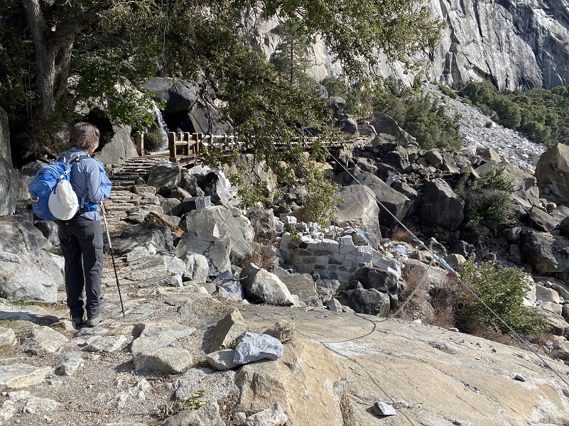
After about 2 1/2 miles, we reached Wapama Falls, which is the larger of the waterfalls that spills into Hetch Hetchy. On occasion the waterflow is so strong that it inundates the trail bridge crossing at its base and the trail is shut down and impassible at that point. On this date, the water was not flowing very much, especially for this time of the year. Wapama Falls water comes from Lake Vernon and has two main drops of water, along with a cascade of water as it empties into Hetch Hetchy. Its total drop is about 1,100′, with the top part dropping about 300′, then a 600′ drop through a steep gorge, the bottom dropping about 200′ down an escarpment. You can’t see the whole falls when you are right next to it but you can see it from the dam.
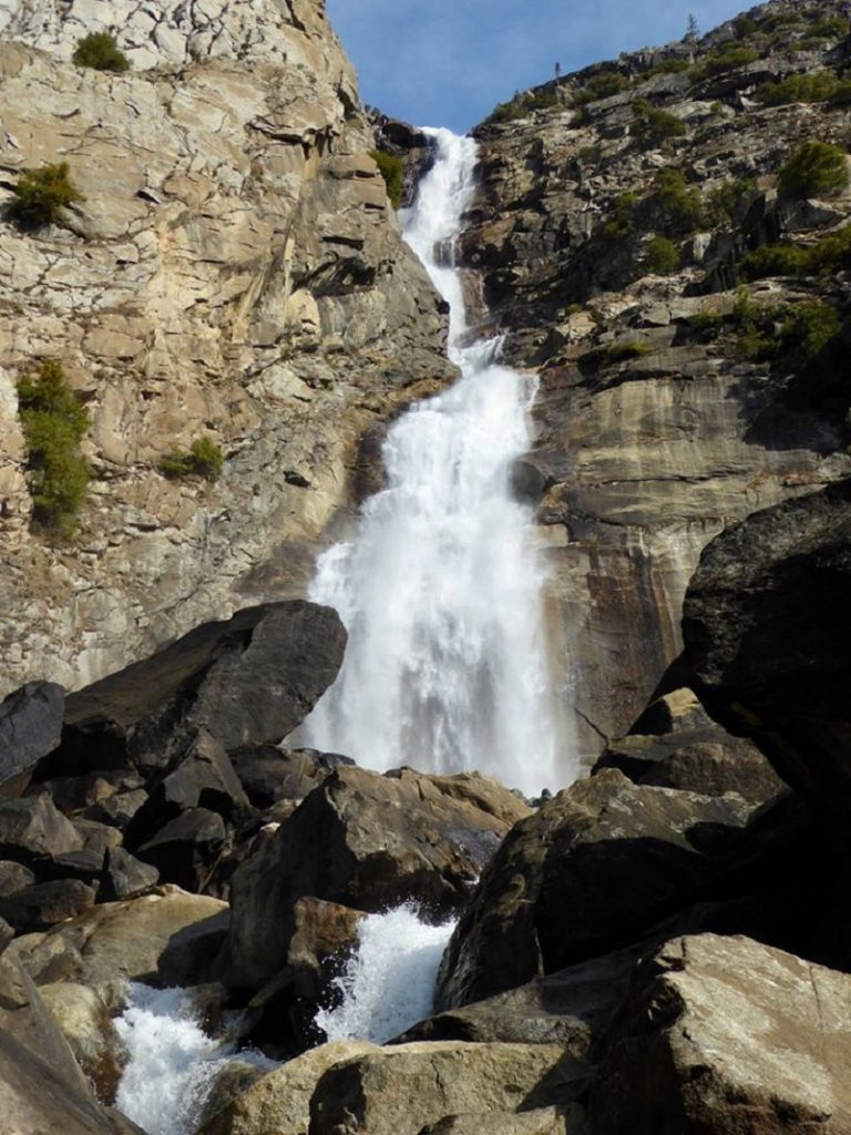
Wapama Falls (Photo by Gail Gilbert)
People die here. They get swept over the bridge when the spring water flows strongly in these falls. Even though the water isn’t as strong as prior years, this is still a dangerous area and the water is flowing plenty strong enough to tumble your body over the rocks and kill you. Don’t take the chance. Follow any warnings that the park service has posted and if there’s water flowing over the bridge or it doesn’t look safe, please don’t risk it. Some of the smaller streams you pass along the way can also be difficult or dangerous to cross.
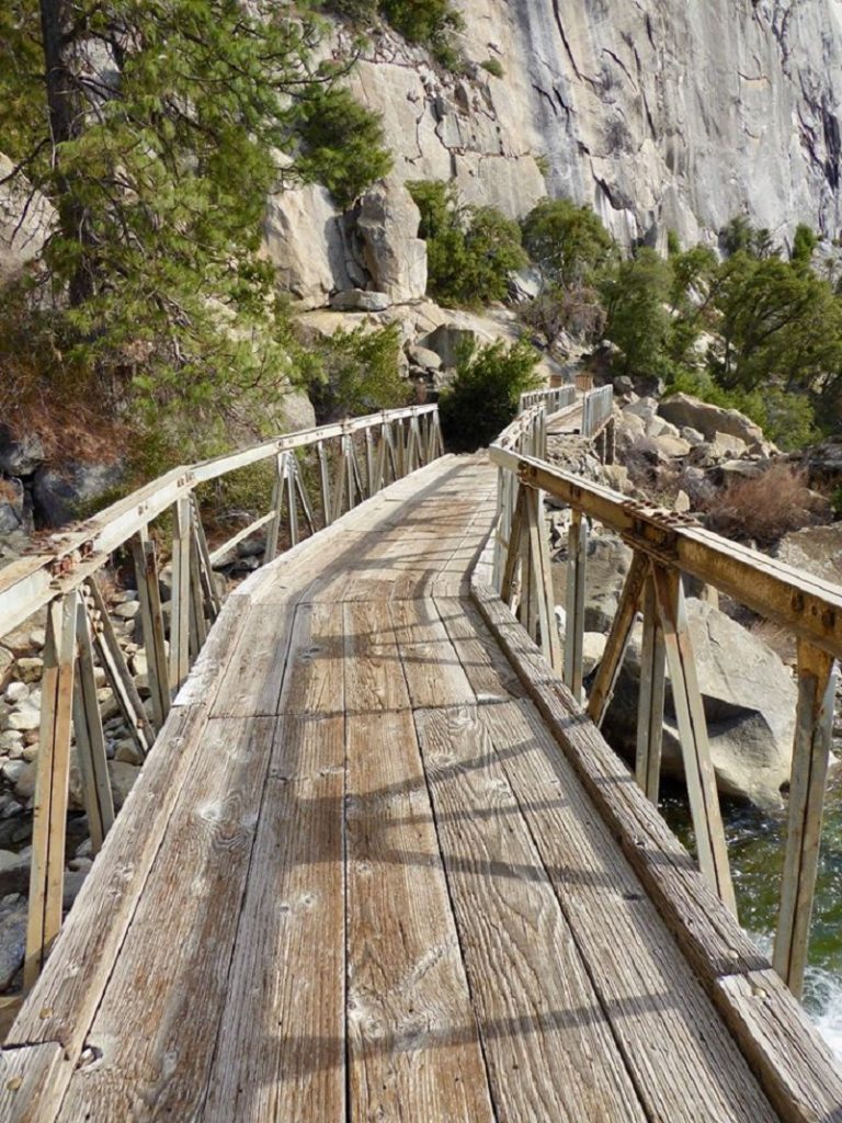
Photo by Gail Gilbert
After a few pictures, we continued on the trail.

Photo by Gail Gilbert
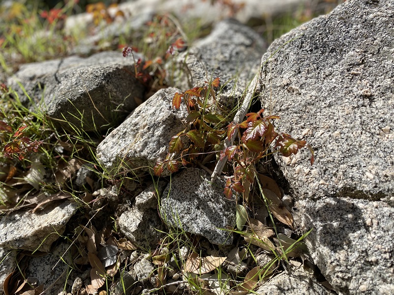
The poison oak was leafing out, some of it bright red and glistening. Some years, the poison oak can infringe on the trail and your legs can’t help but brush by it on occasion.
We continued on, through areas shaded by oak and bay trees. We could smell that nice bay fragrance.
Looking back, we could see the distance that we had traveled.
Then we had stretches that were exposed to the sun and knew that these areas would be warm in the afternoon when we returned. The National Weather Service had forecasted a high temperature of 70-72 degrees here, and I think that was about right but it felt pretty warm to me. I wished I had worn shorts.
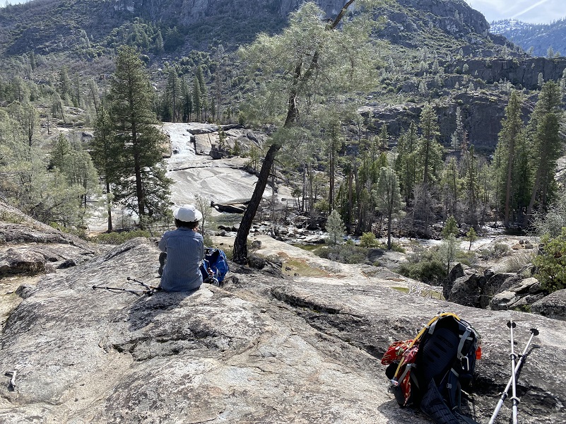
When we came within view of Rancheria Falls, we picked a good spot where we could view it all and ate our lunches. Rancheria Falls is actually a series of cascades, dropping more than more than 1,000 feet though a narrow canyon into Hetch Hetchy. Pretty nice lunch spot!
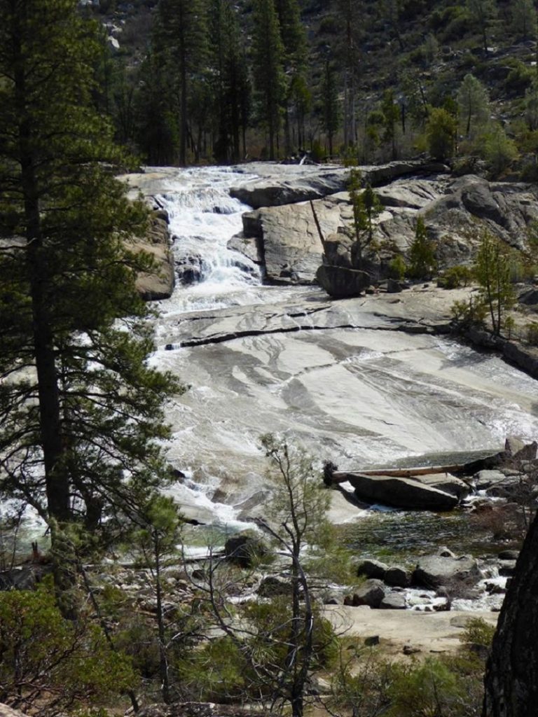
Photo by Gail Gilbert
As we headed back, we set a steady pace and it was warm. I wished I hadn’t worn long pants. We had some uphill in that sun to do but a welcome breeze made an appearance every once in a while. Those dang gnats also made an appearance when that breeze disappeared.
We always see a bear on this hike, but not today. Rattlesnakes are also in this area so watch for them. Don’t forget the mosquitoes and ticks either! We hadn’t done this hike in a couple of years and we had a good workout, along with a nice view of some beautiful falls. Personally I don’t like to do this hike when it is warm. That trail gets awful hot and dusty, plus the falls diminish their flow and aren’t as impressive. We picked a good time to do this one but I sure wished I had worn shorts.
Evergreen Road into Hetch Hetchy is open all year, but can be closed due to snow in the winter or a washout after storms. You can check road conditions here or by dialing 1-209-372-0200, dialing extensions 1/1. Chain restrictions may also go into effect at any time in the winter, so bring chains with you. This is the only park road not open 24 hours/day, the hours below may change without notice:
April 1 to April 30: 8 am to 7 pm
May 1 to Labor Day: 7 am to 9 pm
Day after Labor Day to October 31: 8 am to 7 pm
November 1 to March 31: 8 am to 5 pm
No swimming or boating is allowed in the reservoir.
Dog Hike? No
Dogs are not allowed on this Trail.
Where Pets Are Not Allowed
- On trails, including the trail to Vernal Fall (however, pets are allowed on the Wawona Meadow Loop)
- On unplowed roads covered in snow
- In undeveloped and wilderness areas
- In public buildings
- On shuttle buses
- In lodging areas
- In all walk-in and group campgrounds/campsites, including Camp 4
- In any other areas, as signed
These regulations protect both pets and wildlife from disease and each other. The National Park Service has prohibited pets on trails for many years. In particular, some pets chase wildlife, pollute water sources, and can become defensive and dangerous in unfamiliar surroundings. Pet owners have the burden to assure their pet does not damage the park values for others in those areas where pets are allowed.
Doarama:
What is a Doarama? It is a video playback of the GPS track overlaid on a 3 dimensional interactive map. If you “grab” the map, you can tilt it or spin it and look at it from different viewing angles. With the rabbit and turtle buttons, you can also speed it up, slow it down or pause it.
Hetch Hetchy to Rancheria Falls Doarama
Maps and Profile:
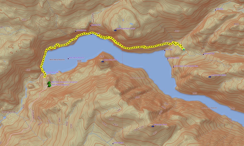
Hetch Hetchy to Rancheria Falls Topographic Map
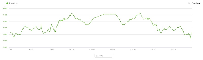
Hetch Hetchy to Rancheria Falls Profile
Prior Blogs in the Area:
Hiking Along Hetch Hetchy April 5, 2016
Sources:
Rancheria Falls Yosemite National Park
Michael O’Shaughnessy Wandering Lizard history
Michael O’Shaughnessy Wikipedia