I love checking out the Gaylor Lakes Basin as soon as Tioga Road reopens for the season. Will the lakes still be iced over? Will those lakes hold beautiful reflections? Will I see pika? Yes, yes and yes!
Where: Yosemite National Park and a smidge over into Inyo National Forest
Distance: 6.17 Miles
Difficulty: Moderate
Elevation Range: 9,943′ – 10,817′
Elevation Gain: 1,356′
Date: June 1, 2022
Map: CALTOPO: Hiking to Gaylor Basin
Dog Hike? No
My friend Gail and I took separate cars from different park entrances and we left early, trying to minimize our wait at road construction. The Arch Rock Gate was staffed at 0602 when I came through, ready with my Peak Hour Reservation Pass. After they scanned it and checked my Park Pass and ID, they then printed out the important yellow slip to tape to my windshield and off I went.
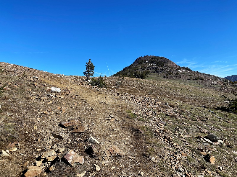
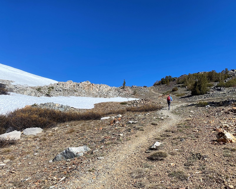
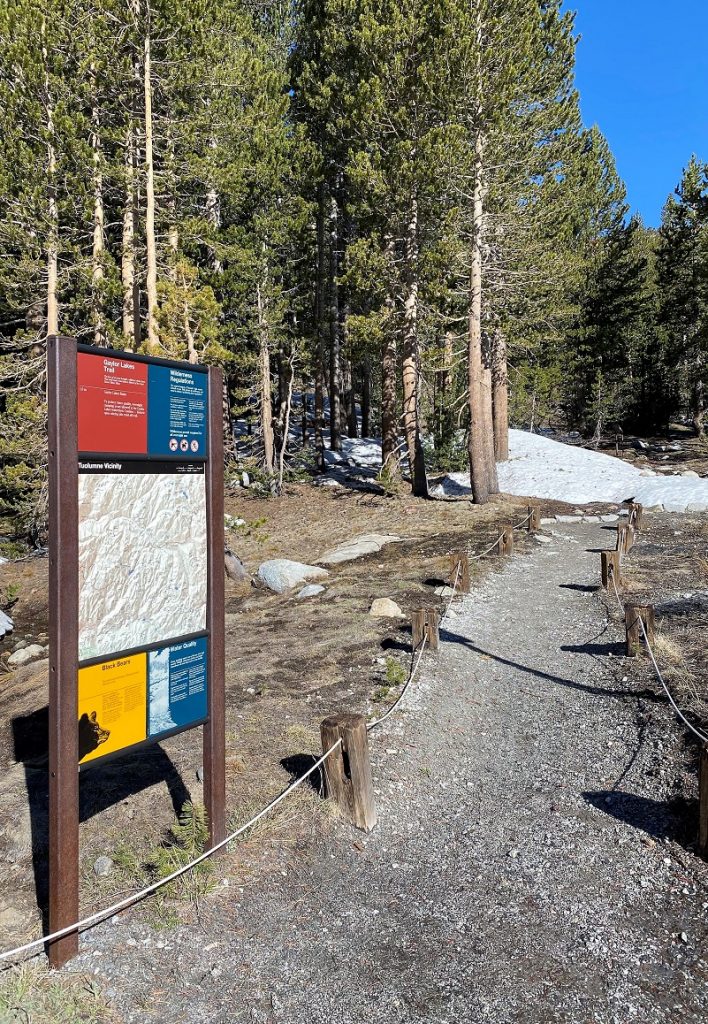 The Trailhead is located right on the parking lot near the restrooms at the Tioga Pass Entrance Station. I arrived a little early and walked over to talk with the personnel at the station to get intel about the amount of snow on the north side of Gaylor Saddle and the approach to Middle Gaylor Lake. I had brought my snowshoes and traction devices but didn’t want to pack them if I didn’t need to. The shared that one of them had made it to Upper Gaylor Lake without problem. Gail soon arrived and decided to put her snowshoes in her pack and I decided to just carry by traction devices because the weather said it would be icy on that snow. I forgot to take a picture of the Trailhead but here is one from last year’s hike.
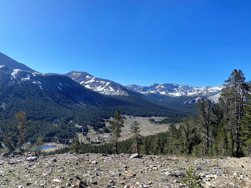
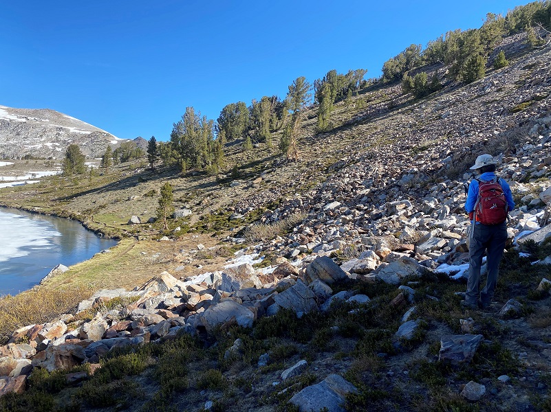
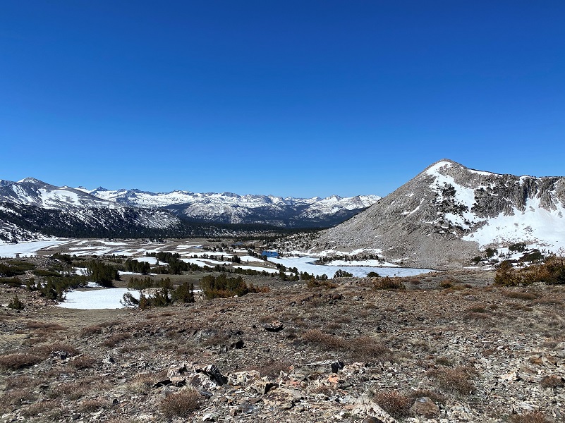
We headed up the trail, looking back to the view down to Dana Meadows and the high peaks beyond it.
And a look to where Tioga Road/Hwy 120 heads down Lee Vining Canyon.
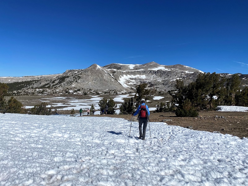
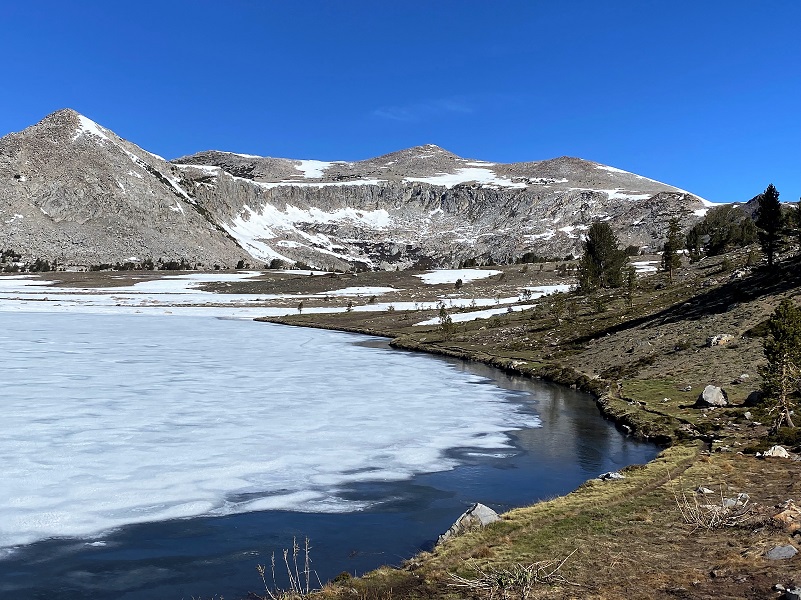
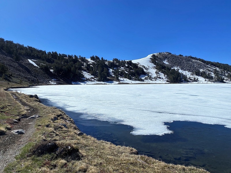
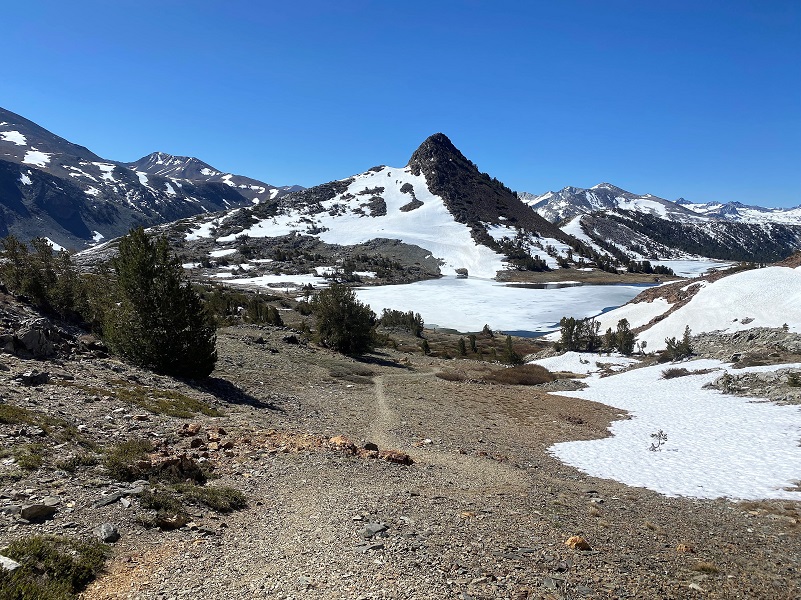
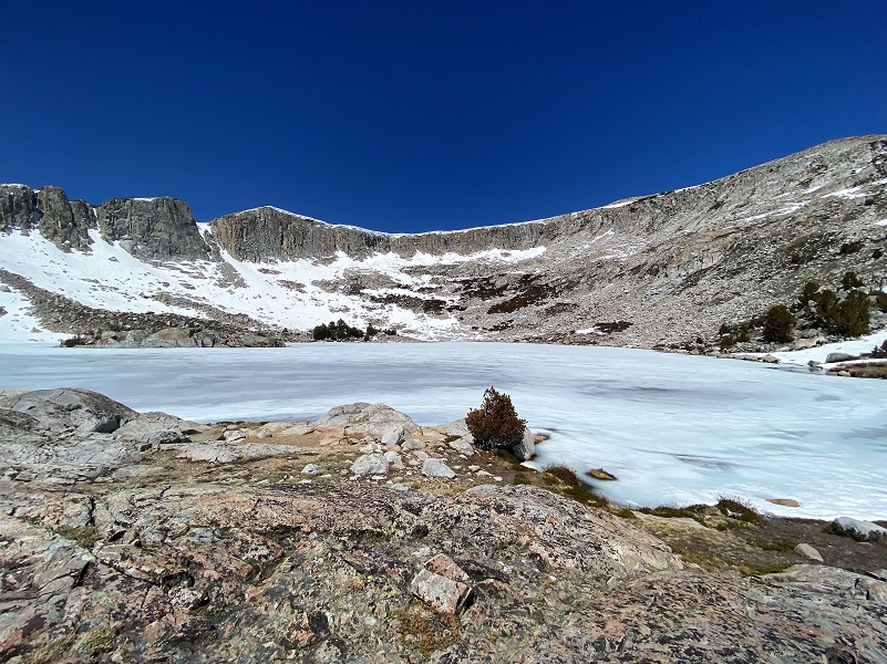
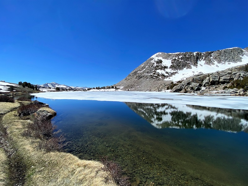
We were almost at the point where we would get our first glimpse of Middle Gaylor Lake. Would there still be ice on the lake or would it be melted?
As we headed down, we were thrilled that the lake was still iced over.

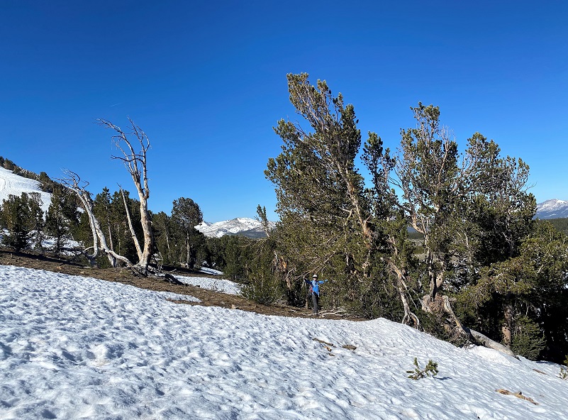
It was clear that the trail was mostly dirt and now snow, so Gail stashed her snowshoes by a tree and I took a picture so we could remember where we put them.
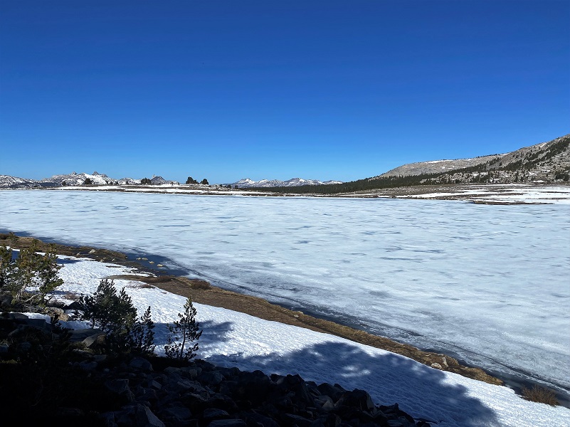
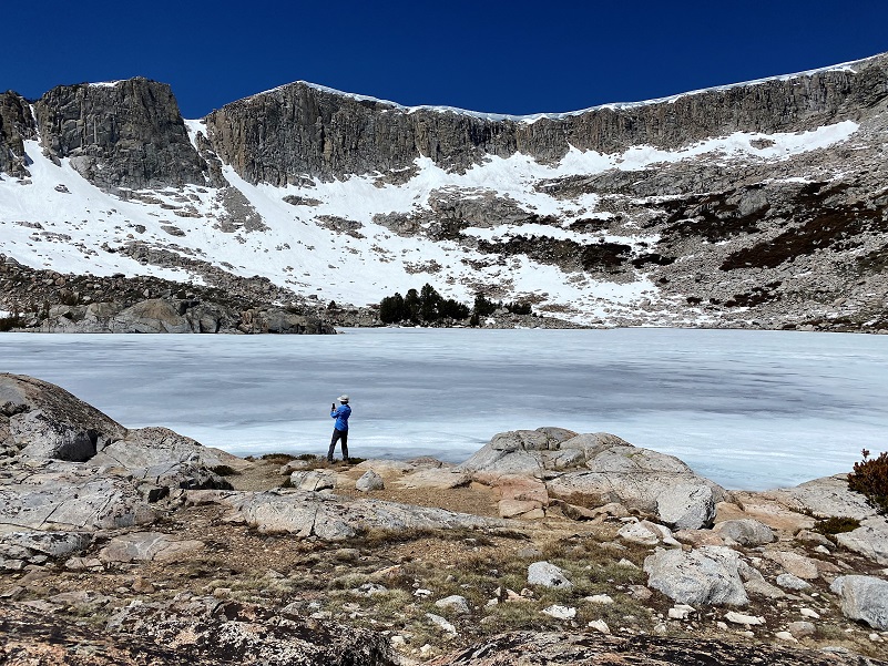
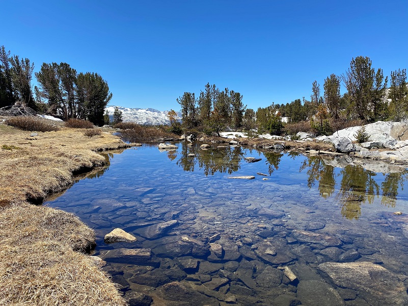
Middle Gaylor Lake (10,335′ elevation) was beautiful. Gaylor Lakes were named after Park Ranger Andrew Jack Gaylor who served in Yosemite from 1907 to 1921, dying of a heart attack while on patrol at Merced Lake. You can read more about him in my blog.
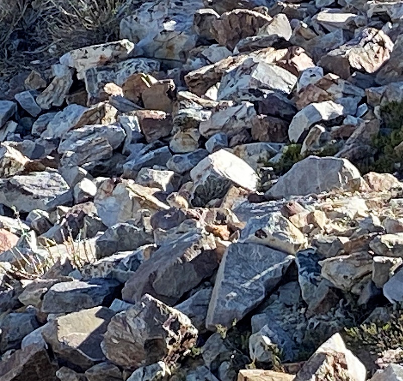
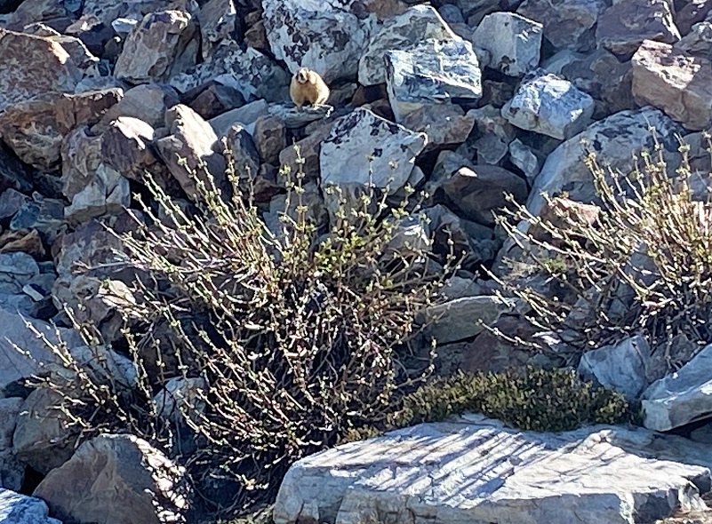
We stopped for a bit to look for pika.
The American pika (Ochontona princeps) is considered an indicator species for detecting the ecological effects of a changing climate in mountainous regions. Results from recent studies suggest that in some areas, pikas are being lost from lower elevations in response to increased warming and less suitable habitat.
They are distantly related to rabbits and prefer rocky slopes. They graze on a range of plants, mostly grasses, flowers and young stems. In the autumn, they pull hay, soft twigs and other stores of food into their burrows to eat during the long cold winter but they do not hibernate.
American Pikas are small mammals, with short limbs and rounded ears. They are about 6 to 8 inches long and weigh about 6 ounces. They have small litters of 2 to 5 with the young born after a gestation period of about 30 days. Sometimes the females will have a second litter.
And they were talking amongst themselves, alerting their buddies that we were there so it made it easier to locate them. Taking a good picture of them was a whole different story though. Can you spot the pika?
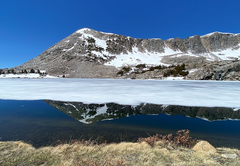
We wandered back down along the lake.
And we did some marmot watching.We spotted a Yellow-bellied marmot sitting on a rock watching us. They are Yosemite’s largest rodents, living above 6,500′ elevation and taking refuge from predators such as eagles and mountain lions in the safety of granite talus slopes by burrowing under piles of rock. Marmots often live in small colonies, so if you see one, you should stop hiking, remain quiet, and wait to see some more!
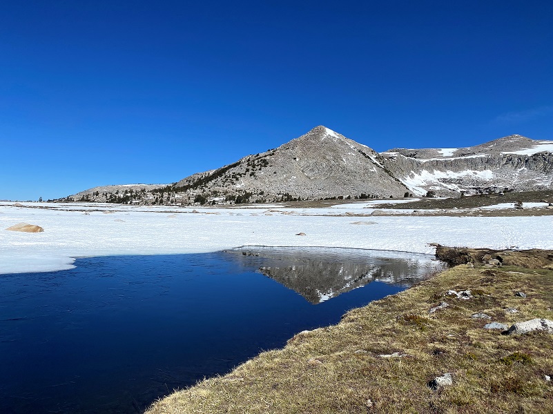
We continued along Middle Gaylor Lake and I took a look back where we had come down.
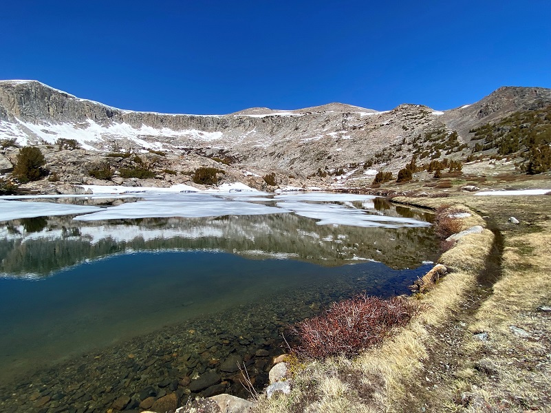
We spotted some beautiful reflections and had to try our best to capture them.
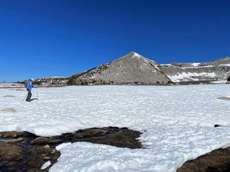
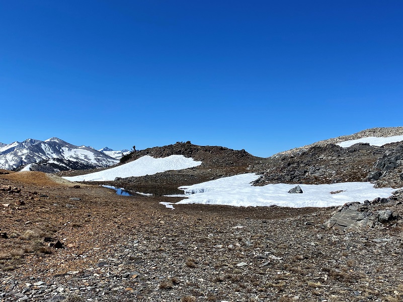
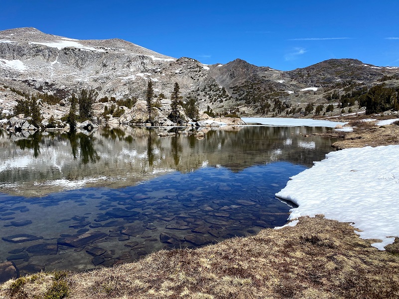
Then we worked our way through the snow and over the small creek toward Upper Gaylor Lake (10,517′ elevation).

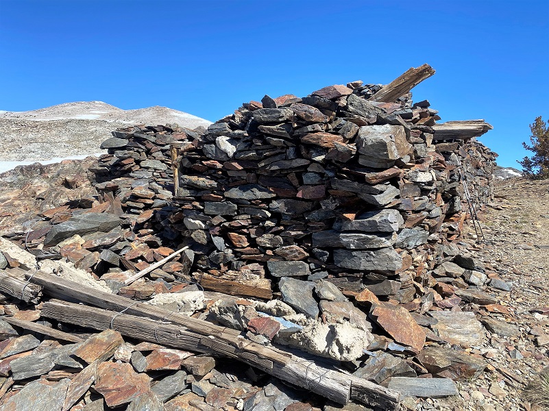
I can’t visit this area without stopping by the old mining town called Dana City (10,769′ elevation), following the same trail those miners of the past walked on.
And I looked back where I had traveled.
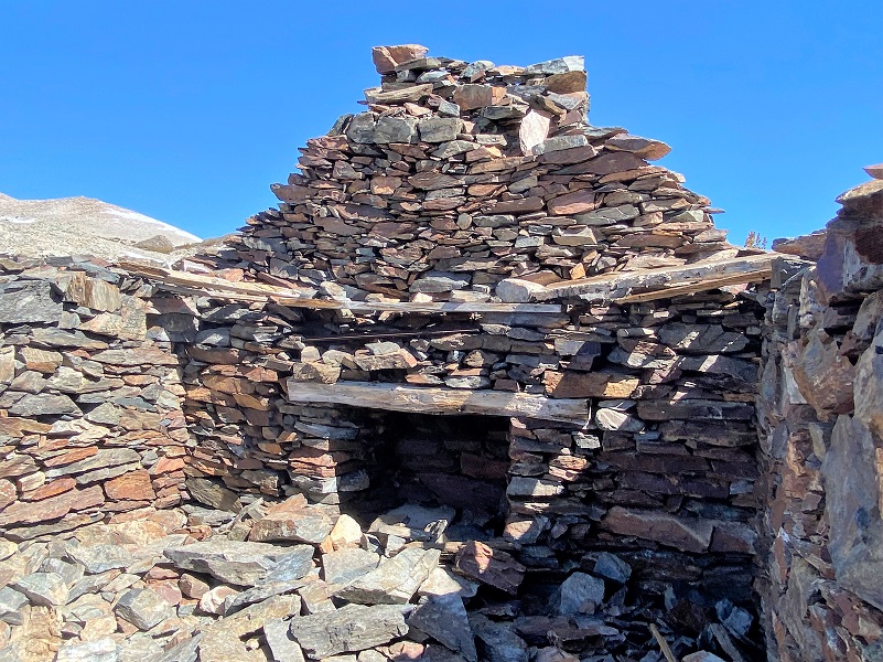
Dana City was a bustling place back in 1880 when it received a post office and is said to have had up to 1,000 people living in it at heyday. The post office was rescinded in 1882 and the focus on mining moved over to Bennettville and its growing town there. For about 4 short years the village of Dana rose up and then abruptly ended. Our first stop was at the old miner’s cabin, the most complete of all of the old structures.
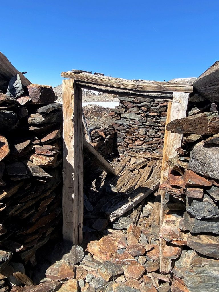
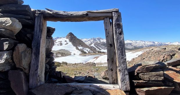
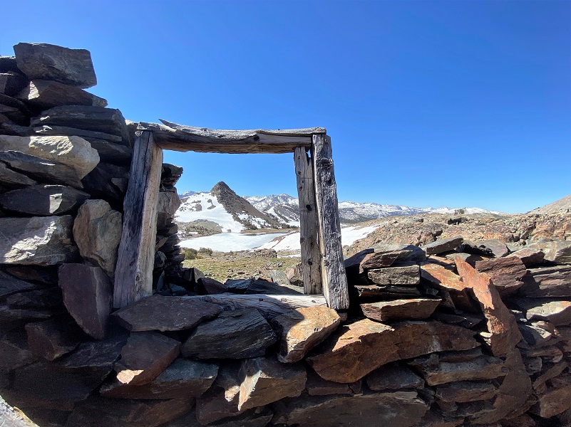
We can never resist the draw that the old window frame has. Everyone I know that looks out it or sees a picture ponders that view that the miners had out of it.
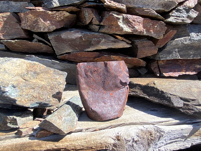
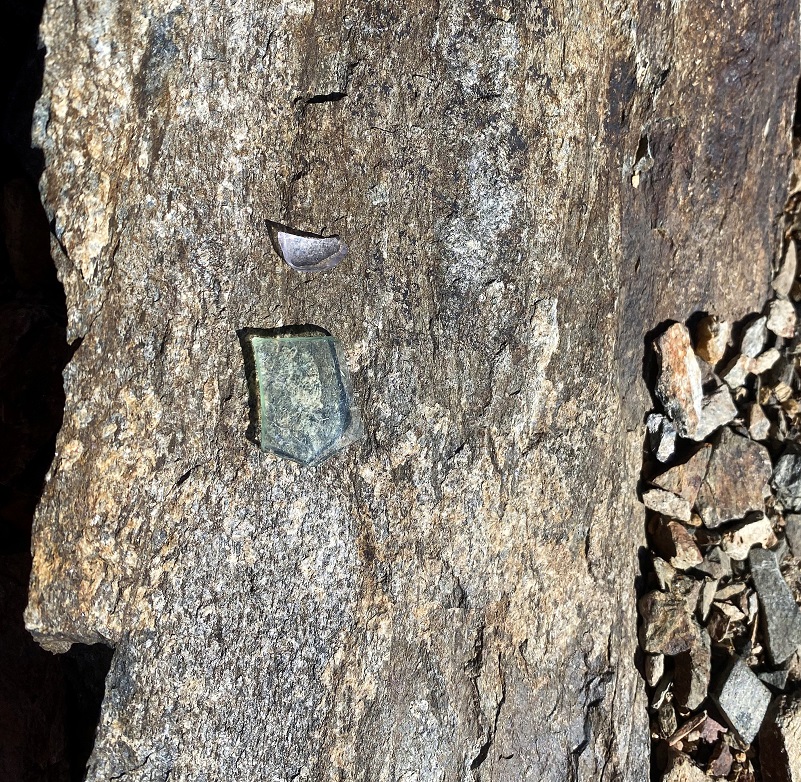
We stopped for a snack and I did some exploring, looking for remnants of those old miners. I did find a few treasures from the past, leaving them for others to discover and ponder.
We continued on through the old village, checking out the remains of the old buildings and vertical shaft of the Great Sierra Mine.
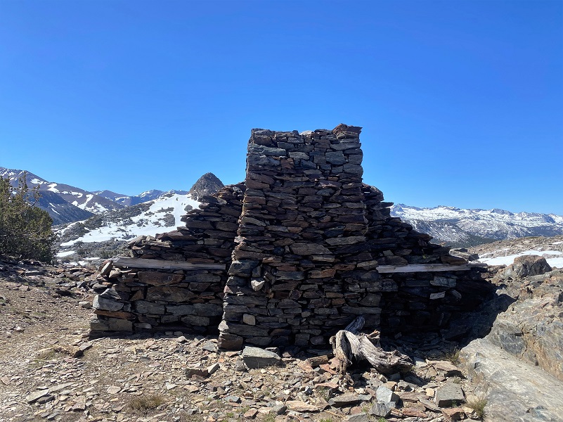

If you come up to check out these mines, please be extra careful. They go straight down and there would be no way to get yourself out of them. The ground near the edge is crumbly and could easily give way on you. Some even have old timbers lining the top parts of them
We headed cross country toward Upper Granite Lake, avoiding snow and brushy tree patches.
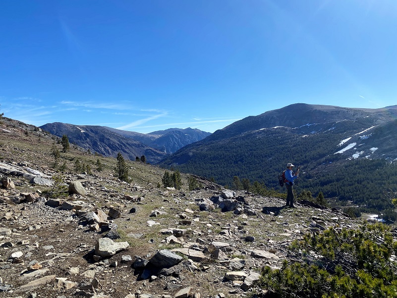
When we topped out and started working our way down to the lake, those views were pretty amazing.

Photo of Me by Gail Gilbert
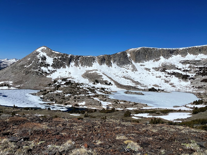
We headed down to large rocky slabs at Upper Granite Lake (10,427′ elevation), a perfect lunch spot and some pictue taking..
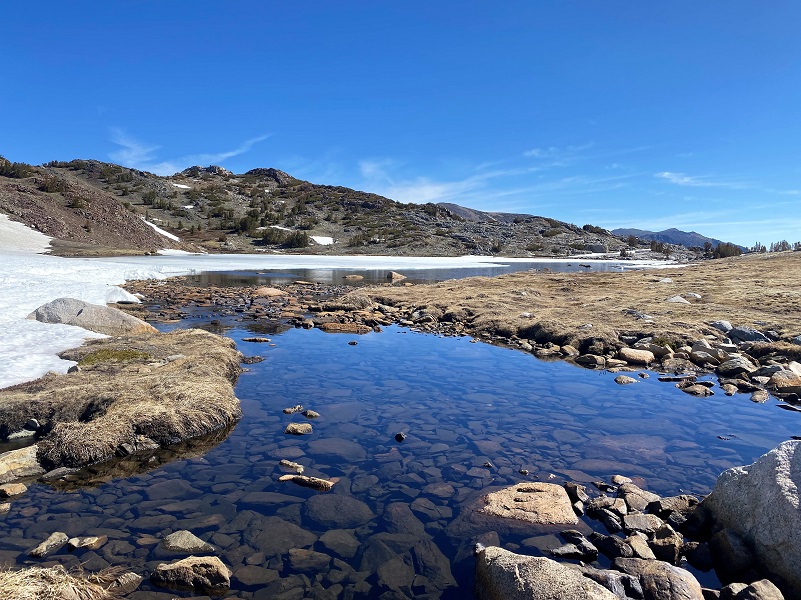
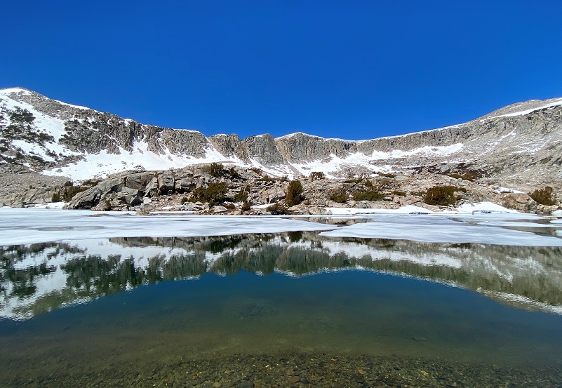
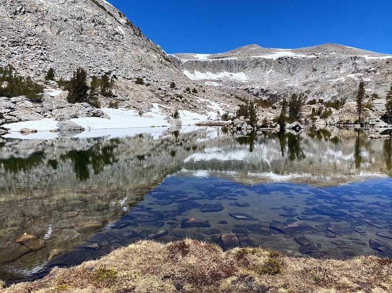
We wandered down along the Middle Granite Lake area, checking out melting ice and reflections.
We wandered our way way back to Middle Gaylor Lake then back over Gaylor Peak’s saddle to our cars.
I want to add a bit more on the road construction. When I went through the Tenaya Lake area, there were two sections of one lane controlled traffic but had waits of 1 minute or less on these coming and going. Tuolumne Meadows construction is a bigger issue though. I left early to beat the 30 minute waits that their schedule says start at 8 am and last through 3 pm. I made it and had a 4 minute wait coming in but going out was a different story but not too bad. I headed back through this construction area around 130 pm and had a 20 minute wait. But with the car stopped amongst the beautiful area above Tuolumne Meadows, windows rolled down, it was a nice way to go through the pictures that I had taken on the hike.
Here is a great site to check out for the latest Yosemite Road Work, with specifics on Tioga Road.
Dog Hike?
No, dogs are not allowed on this trail in Yosemite National Park.
Doarama:
What is a Doarama? It is a video playback of the GPS track overlaid on a 3 dimensional interactive map. If you “grab” the map, you can tilt it or spin it and look at it from different viewing angles. With the rabbit and turtle buttons, you can also speed it up, slow it down or pause it.
Hiking to Gaylor Basin Doarama
Map and Profile:
CALTOPO has some free options for mapping and here is a link to my hike this week: CALTOPO: Hiking to Gaylor Basin

Gaylor Basin Hike Topographic Map
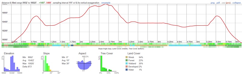
Gaylor Basin Hike Profile
Sources:
Inyo National Forest Policies and Rules
Inyo National Forest Hiking and Camping with Dogs
Prior Blogs in the Area:
Hiking to Snowy Gaylor Basin October 20, 2021
Hiking From Tioga Road to Lower, Middle Gaylor and Granite Lakes September 25, 2020
Sneak Peek of Tioga Pass Frozen Lakes June 9, 2019
Tioga Pass is Open and the High Country is Breathtaking!! May 24, 2018
Camping and Fishing with Sally at Saddlebag Lake and Beyond June 26, 2018
Camping and Fishing with Sally at Saddlebag Lake August 17, 2017
Hiking with Sally from Saddlebag Lake through Twenty Lakes Basin August 15, 2017
Hiking with Sally in the 20 Lakes Basin July 12, 2016
Hiking with Sally up to the Hess Mine in the Tioga Pass Area October 26 2016
Hiking with Sally on the 20 Lakes Basin Loop August 22, 2013

