One of the reasons that I love hiking in this country is because of the rich mining history that occurred in these parts and when I am up here, I cannot stop thinking of the characters that braved this tough country to pursue their dreams of finding gold and silver. “The Great Silver Belt,” which runs from Tioga Hill to Bloody Canyon, was where the illusive minerals were that they were searching for. Hundreds of thousands of dollars were spent. Some mines paid off, a few people made some money, but most never produced. When I am hiking in this country, I wonder who these men and women were and what their lives were like. There were some real characters who walked the same trail that I was hiking.
Where: Hoover Wilderness, Inyo National Forest
Distance: 7.41 Miles
Difficulty: Moderate to Strenuous
Elevation Range: 9,736′ – 10,375′
Date: August 10, 2017
Maps: Falls Ridge and June Lake Topographic Quads
Dog Hike? Yes
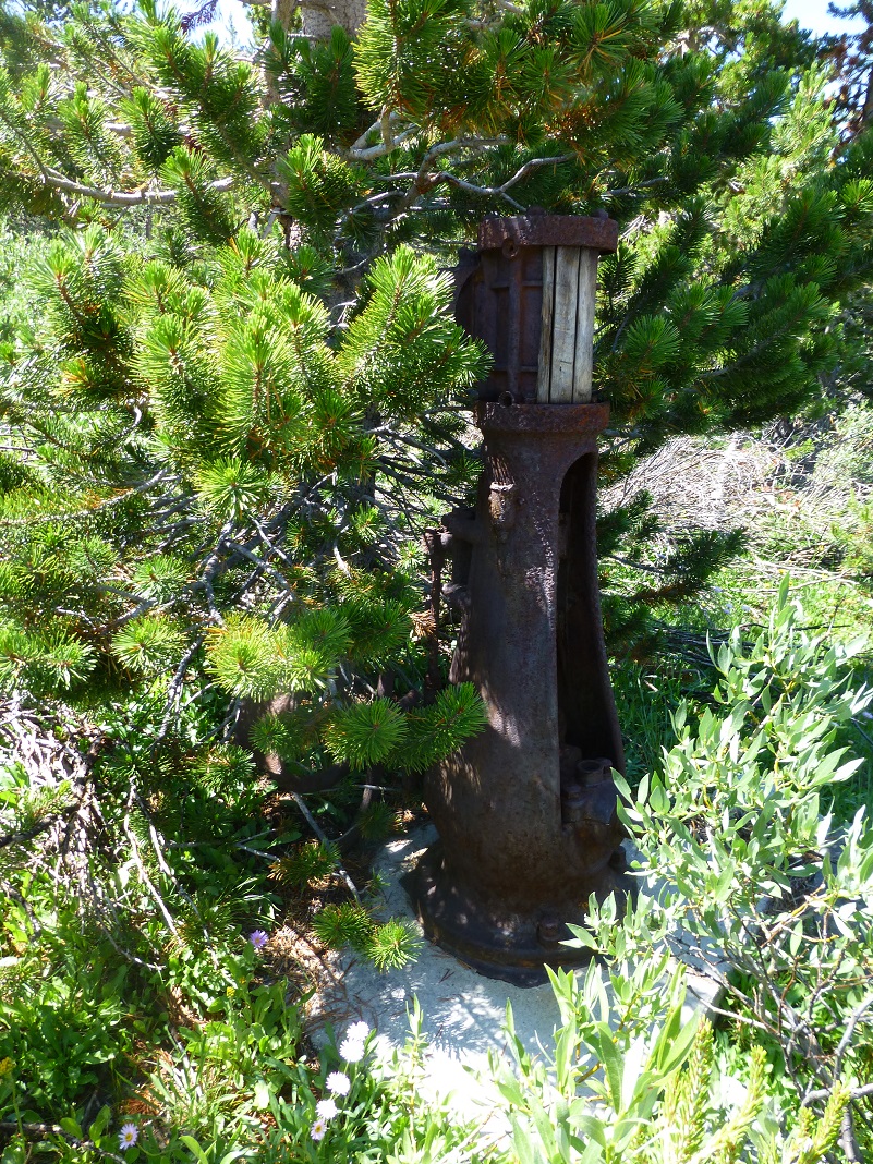 We started from Tioga Lake on our hike. East of the Yosemite National Park’s Tioga Pass entrance, there is a large parking lot with restrooms above Tioga Lake. We drove just a smidge east of this and there is a wide spot on the left where we parked. You will know you are in the right spot because there is an old piece of mining equipment on the east side of this parking area but it is nestled in the trees and easy to miss. Oh, and we put our mosquito repellent on before we left the car and sure were glad we did.
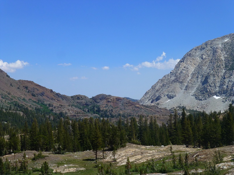
We headed up the trail, which used to part of the old road system created by the mining operations related to the Great Sierra Mine. What a fantastic view we had of Tioga Lake.
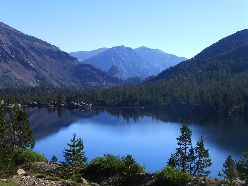
Tioga Lake
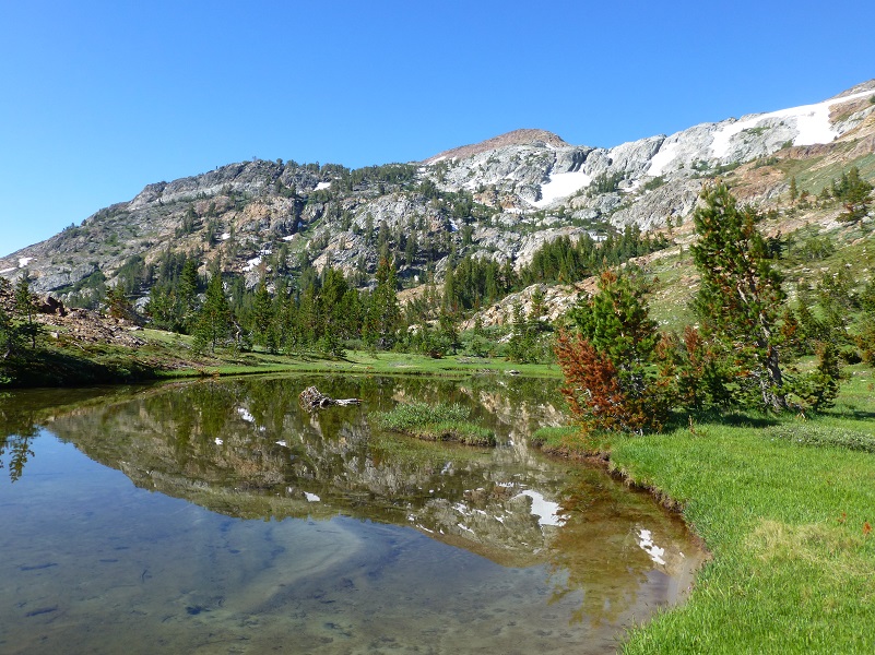
The road had bits of pavement in a few spots and when we reached the fork that headed down toward the Tioga Campground, we stayed to the left. The trail wound along some tarns and small lakes with beautiful reflections of Mt. Dana and the surrounding high spots.

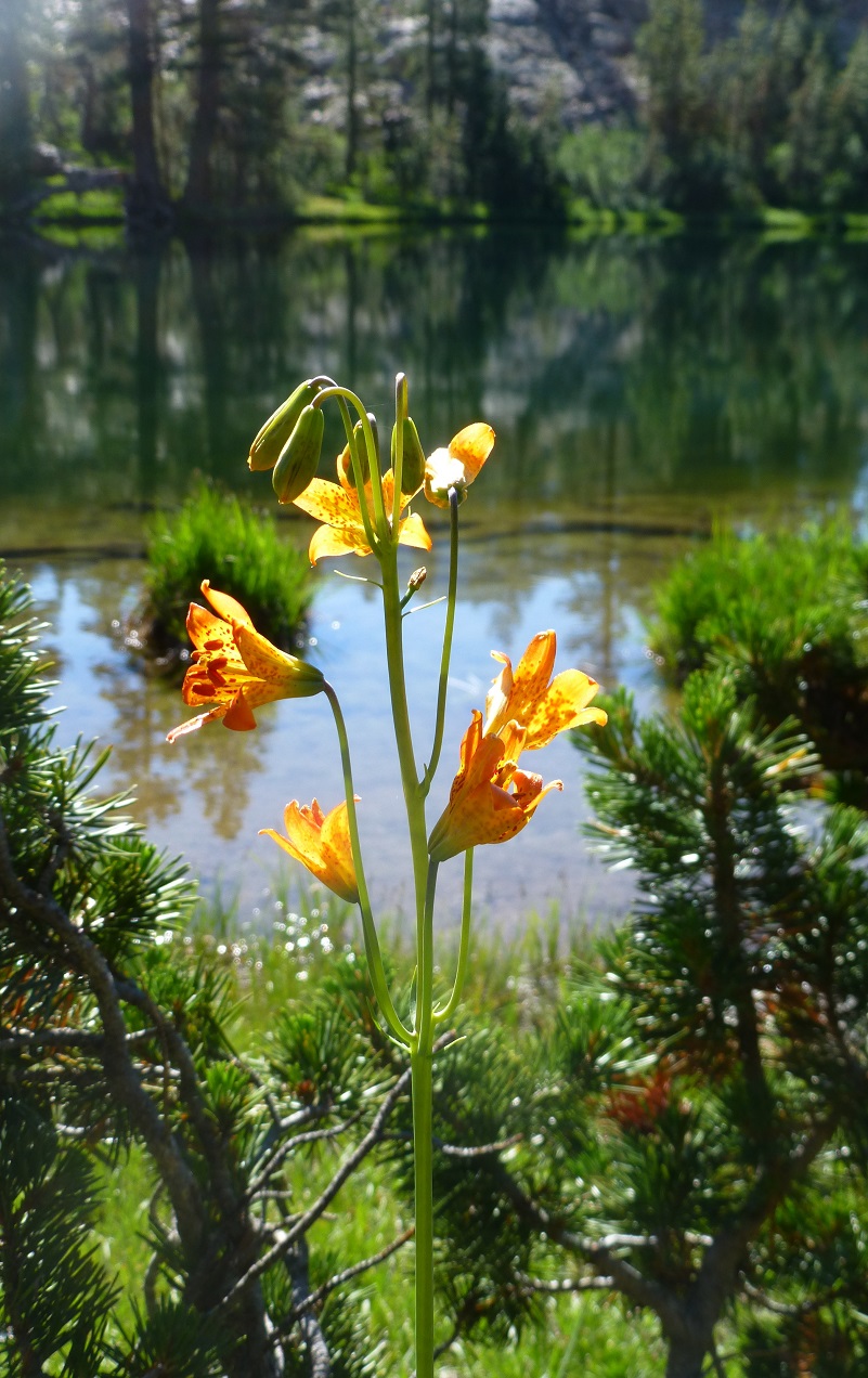
And the wildflowers were putting on a show for us. They were tall, really vibrant in color they just looked very happy to me.
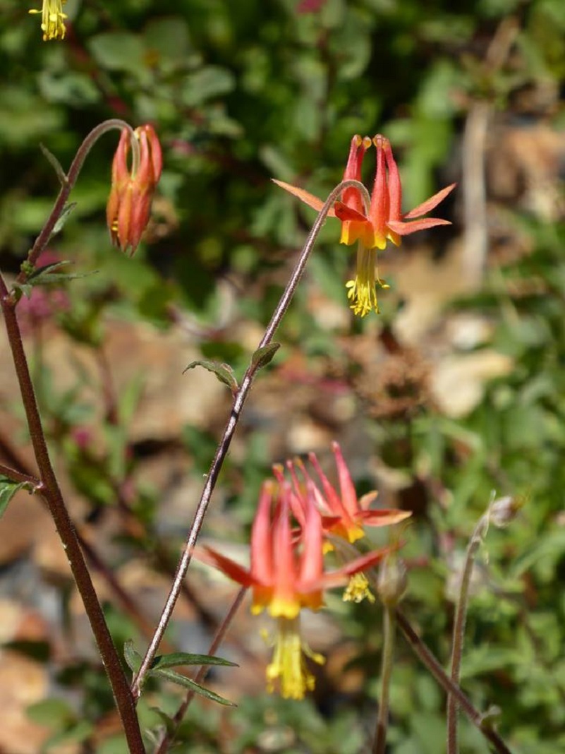
Photo by Gail Gilbert
In some spots along the trail, the mixture of colors just made us stop and take it all in.
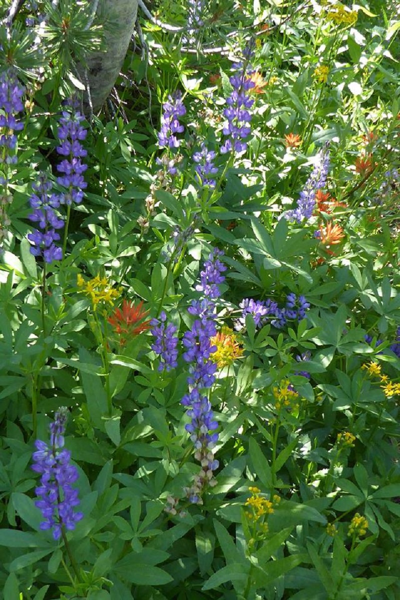
Photo by Gail Gilbert

Photo by Gail Gilbert
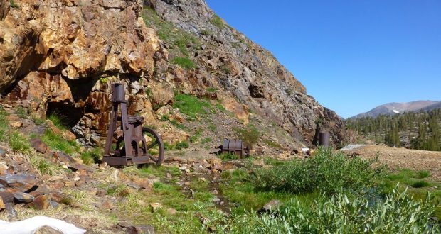
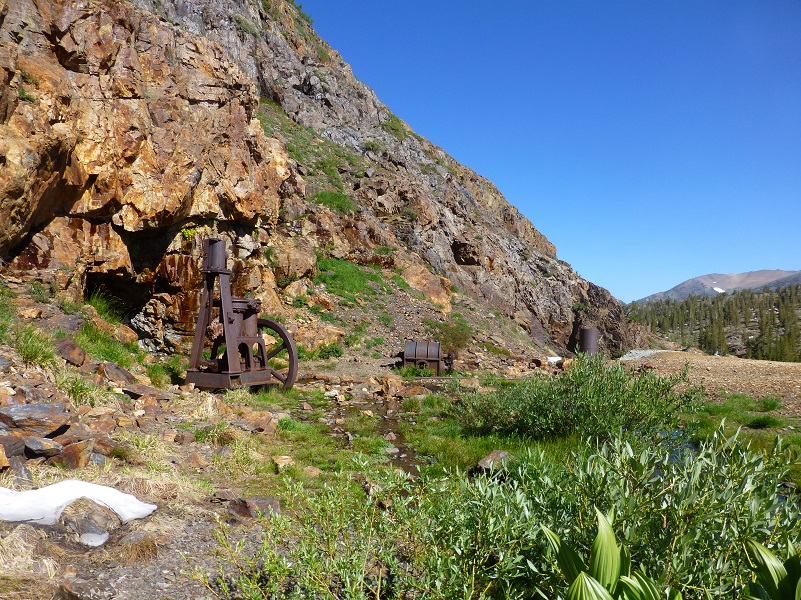
After about a mile, we broke out of the trees, came around a bend and there is was! The Great Sierra Mine.
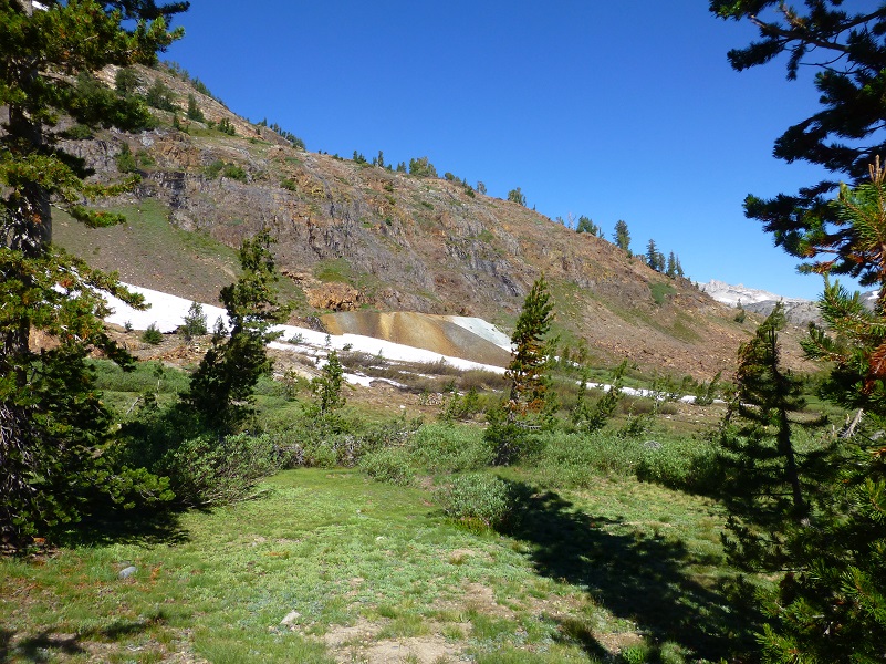
As we made our way towards the mine and a beautiful waterfall revealed itself to us.
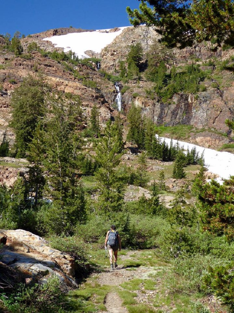
Photo by Gail Gilbert
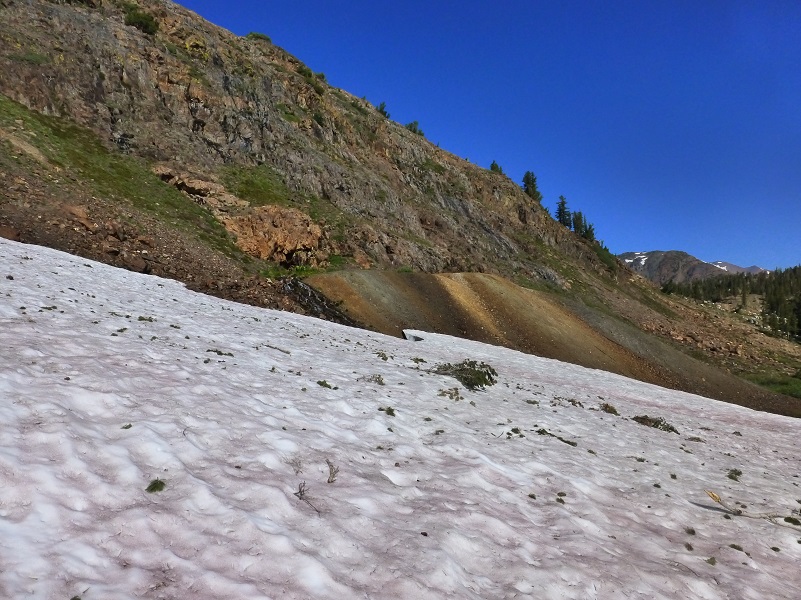
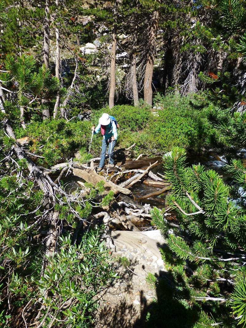
But we had a snowfield to cross and the creek that was fed by that waterfall ran under that snowfield so we needed to be careful.

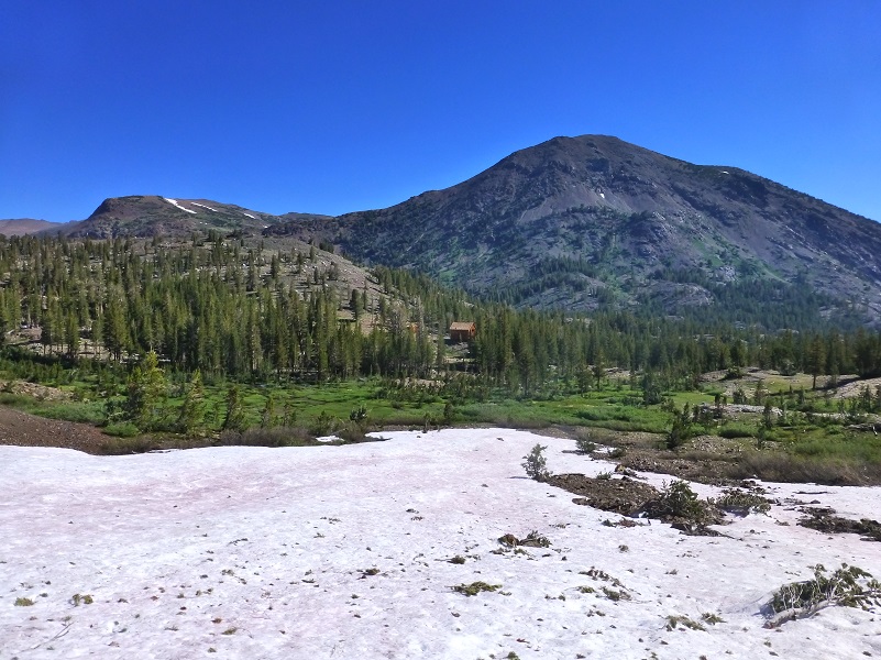
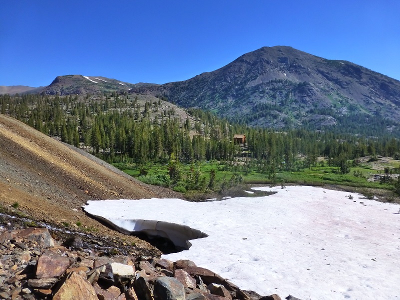
We looked across and saw the restored buildings that remain of the old town of Bennettville that supported the mining efforts in this area and I thought to myself, this is the view that those miners would have had.
And we arrived at the Great Sierra Mine.
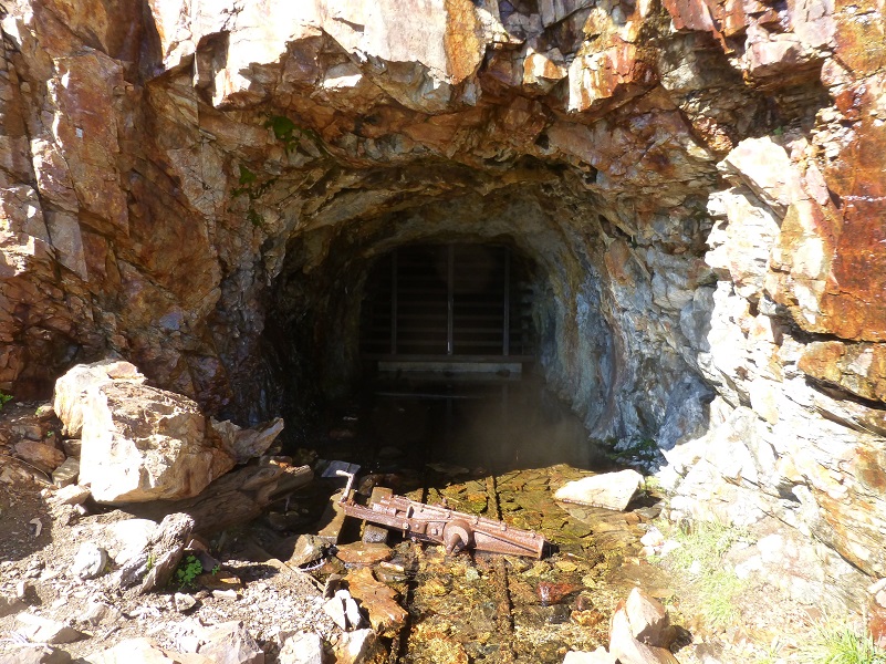
Things have changed a bit at the mine since the below picture was taken in 1882.

Photo from The Tioga Road; a History 1883-1961 (1961, 1980) by Keith A. Trexler
The mining history of this area includes many discoveries and rediscoveries of mines, along with the relationship of these mining operations being intertwined with the mining communities of Bodies, Aurora and Lundy. The search for gold and silver led to the discovery of the Sheepherder Lode, claimed to be “the biggest silver ledge ever discovered”. The Sheepherder Lode was discovered in 1860 and rediscovered in 1874 by a Sheepherder named Thomas Brusky Jr. The short version of this story is that many claims were made in this area and in 1881 The Great Sierra Consolidated Silver Mining Company bought up all of the claims around Tioga Hill and established a town with an approved post office in 1881 called Dana. The largest efforts related to Dana City were in sinking a shaft straight down to hit the Sheepherder Lode. That town didn’t last too long and by 1884 the operation was moved to the community of Bennettville, not too far away. The Consolidated Silver Mining Company had been reorganized into the Great Sierra Mining Company, and they made the decision to refocus their efforts away for Dana City and instead of trying to sink a shaft straight down, moved their efforts to the west from the base of Tioga Hill.
It is lucky for us that the Lundy newspaper The Homer Index recorded so much of the activity in this area and that this time period from the newspaper still exist. I would like for you to hear the story of this area from them.
On November 12, 1881 (The Homer Index):
“The Great Sierra Mining Company of Tioga District has advertised for sealed proposals for running a double track tunnel or adit 500 feet into Tioga Hill, the tunnel to be nine feet wide, six feet high in the clear at the walls and seven feet in the arch. The tunnel will be started in the cove at the head of the south fort of Lee Vining Creek, and driven for the Lake and Sonora locations on the Sheepherder Lode, and the survey for it is now being prosecuted.”
The second part of this project was building a road to the mine from the west that pretty much followed today’s Tioga Road from Crocker’s Station on the Big Oak Flat Road, through Tuolumne Meadows. Even though that road hadn’t been built yet, the work on the mine started, moving equipment and workers from Lundy. By January 16, 1882, the tunnel was 62 feet in length. Can you imagine hauling 16,000 pounds of equipment up from Lundy and down to the Great Sierra Mine? They did it by sledding it during winter but I just cannot imagine this feat.
Bennettville was first called Bennett City and shows up in the Homer Mining Index on February 18, 1882:
“The Coming City. The embryo town at the mouth of the Great Sierra (commonly called Tioga) tunnel is called Bennet City, in honor Thomas Bennett Jr., of New Bedford, Massachusetts, President of the Great Sierra Consolidated Silver Company. . . Bennett City, being centrally and beautifully situated, will be the principal town of the district, though when the mines are developed they will doubtless support one or two other towns of considerable size. But all the mines of Tioga Hill as far north as Mount Conness will be tributary to this place, as will also the Rhinedollar group of mines on the eastern line of contact and on both sides of Lee Vining creek, and all the mills and other reduction works required bu both tiers of mines in the central portion of the district. Bennett City will also be the terminus of the wagon road to be built early in the coming Spring, but the Great Sierra Company, to connect the mines with the railroads of the San Joaquin Valley. A portion of the flat near the mouth of the unnel has been located for placer mining and some good prospects obtained, but there is ample room on gently rolling ground for a city of 50,000 inhabitants, with an abundance of wood and water of the best quality on the ground.”
March 11, 1882 (Homer Mining Index) :
“High Up. The Lundy and Tioga telephone line, recently constructed by the Great Sierra Con. S. Co., of Tioga, is the highest telephone line in the world. The line is nine miles in length, ascends 4,245 feel from Lundy, crosses Mount Warren divide at an elevation of 12,250 feet above sea level, descends 3,750 feet to Lee Vining Creek, and again ascends 800 feet to Bennett City, which is 9,300 feet above sea level.”
May 6, 1882 (Homer Mining Index) :
“Mr. John M. Martin has six men at work putting up his Tioga saw mill, situated just below Lake Lee Vining, where the stream of that name enters the gorge that separates Mt. Dana. It is about one mile from Bennettville and the mouth of the Great Sierra tunnel, is almost within a stone’s throw of the Rhinedollar mine.”
It was a rough life, living in this area. Many stories are documented about life in the Bennettville area but this one is at the top of my list.
March 25, 1882 (Homer Mining Index):
“Twenty-one Men Buried at Tioga. At the usual hour, 11 o’clock on the night of the 15th, 21 men were buried in the Great Sierra tunnel lodging house at Bennett City, by a huge avalanche from Tioga Hill. Several smaller snow slides had coursed down the hill during the day, covering the portal of the tunnel with their wings, and hence work had been suspended and all the men were in the lodging house – a structure of huge logs two to three feet in diameter, with a partition wall of similar material, the whole building half buried on the side next to the mountain, with the deep ravine of Slate Creek between the base and the building; and yet the avalanche swept across the creek, up the ridge, demolished the building and plunged through heavy timber and along the side of the ridge for a distance of 1,000 feet or more. R.W. Woolard (Secretary) and Dr. F. Kemp were occupying the small frame office at the end of the building , and were just preparing to retire when the crash came. The frame building was crushed to the ground, Woolard was pinned across the hot stove and nails projecting through the roof nailed his head to the floor, Dr. Kemp was fastened against and behind the stove – and their lighted lamp was broken and their bed set on fire! A rafter from above and a plant shelf below closed tightly across Dr. Kemp’s hip. Dr. Kemp could have worked his way out, but the moment he removed his support from Woolard’s body the latter would be left hanging by the neck.”
“The Rescue. The log house had been struck between ‘wind and water’ as it were, the upper portion carried away, and the men left lying in their bunks, with eight or ten feet of soft snow above them. Jack Hammond was the first to dig his way out, and, realizing from the situation that the other men in the log building were not in danger, he went to the rescue of Woolard and Kemp. With bare feet and hands he dug down through the snow to the base of the building, and crawled in between the roof and the floor on his belly. A strong table had been overturned and ws supporting the roof, and the legs of this table obstructed Hammond’s passage. Tearing off one of the legs he continued crawling until he reached the men. He had carried a hatchet in with him, and with this he cut the rafter away and released Woolard’s neck, broke the stove and released his legs and dragged both men out. . . All the other men escaped without injury, except Frank Cavin, who had one foot severely cut by a window glass. Woolard sustained two long cuts on the head, made by nails, and a severe burn on the front portion of the left thigh. On the 24th, he was placed upon a sled and drawn across the mountains to Lundy.”
The Great Sierra Wagon Road took 100 days to build at a cost of $62,000 and went into service in 1883. A lot of money had been spent by the Great Sierra Consolidated Silver Company and they pretty much ran out of money by the end of 1883. Appeals were made to the stockholders for money with limited success. Work was stopped on July 3, 1884 despite an appeal to the stockholders that “the heading of the tunnel was at 1784 feet, and without debt, is within 200 feet of the great Sheep Herder’s ledge, doubtless one of the largest and richest ore at present in existence in this country.”
Creditors received judgement in 1887 and a Sheriff’s sale was made in 1888. The Great Sierra Mine showed up in property and tax records throughout the years, changing hands. Much of the equipment that was at the mine was donated by the landowner to Yosemite National Park where some of it is displayed today at Wawona. The Great Sierra Wagon Road was eventually sold for $15,500 with money collected through the effort of Stephen Mather who deeded the road to the Federal Government in 1915 to be included in Yosemite National Park.
So, how much money did the Great Sierra Mine make in profit over its life? No records survive of any ore shipments. More than $300,000 had been spent, but it appears that no ore ever left for milling.
Nestled in the front and side of the tunnel were many different types of blooming wildflowers. This country looks rocky and barren from afar and when you look closer, it is still rocky and barren, but tucked in some cracks and crevices, there were beautiful flowers.

Monkeyflower in the Mine Entrance
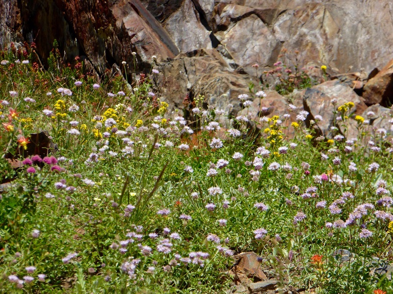
Photo by Gail Gilbert

Crimson columbine
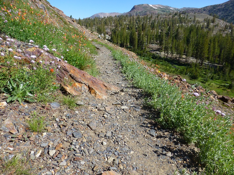
We headed up the trail that was lined with one of my favorite plants in this area, pennyroyal, its minty scent following us in the air as we hiked.
We crossed Mine Creek on a tangled jam of logs.
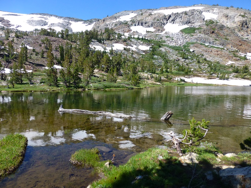
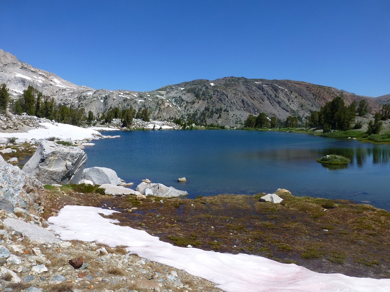
We caught up with the trail out of Bennettville and headed up to several beautiful lakes. The first one that we reached was Shell Lake (9879′ elevation).

Shell Lake
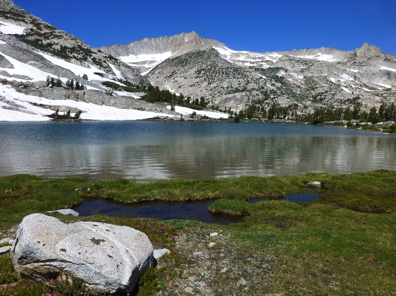
Then our next lake was Fantail Lake (9,905′ elevation).
 I had left my dog Sally at home but she loves this hike. And it is a great dog hike! We met this dog enjoying the grassy shore, looking like she was having a ball.
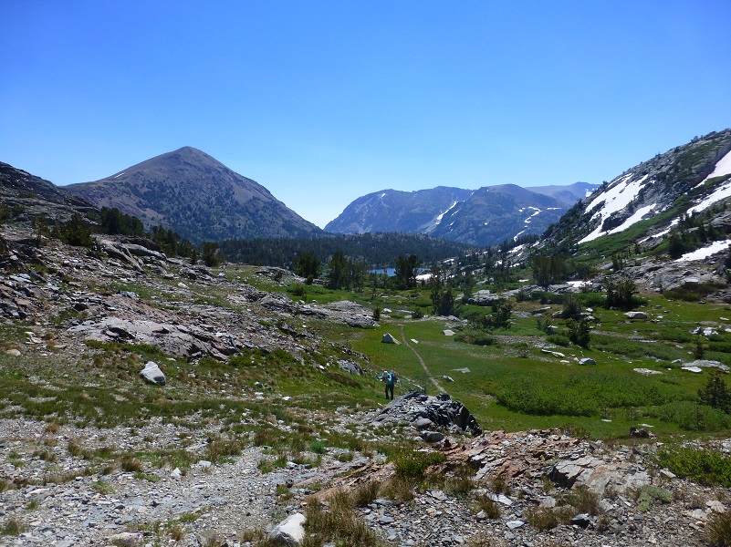
The trail climbs at this point and as I looked back at the Tioga Pass area and direction that we had hiked from, I just thought to myself how gorgeous this country is.

Our next lake was Spuller Lake (10,279′ elevation).
We did a little more climbing until we reached the top and headed down throw snow to Maul and Green Treble Lakes.
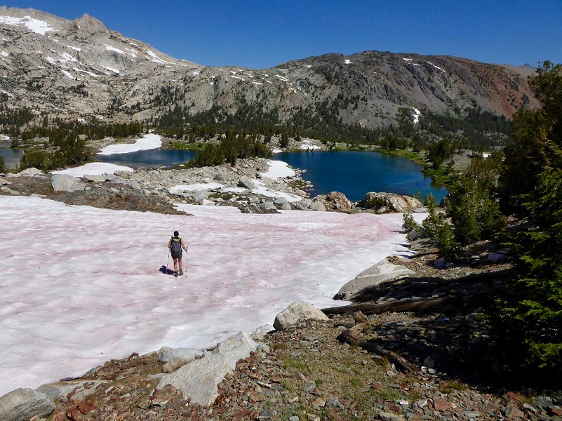
Photo by Gail Gilbert
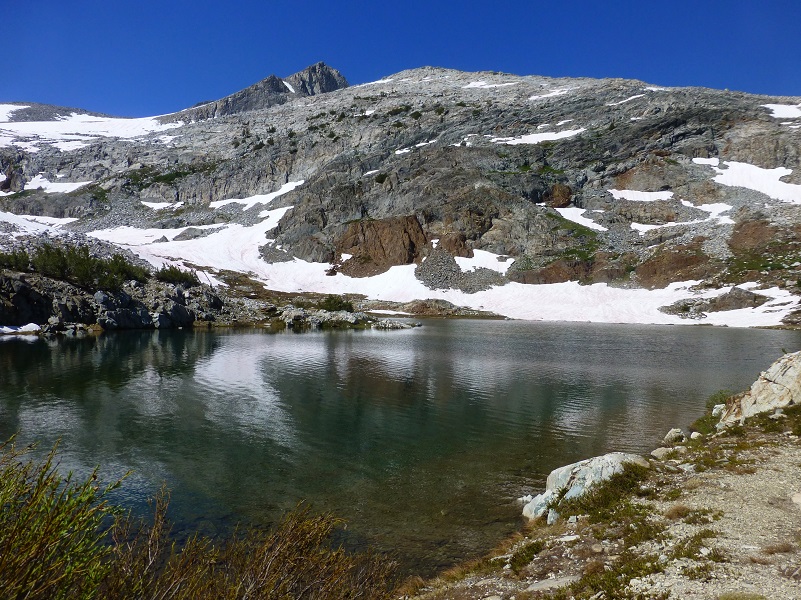
We skirted along the lake on the right named Maul Lake (10,249′ elevation).
We then headed over to Green Treble Lake (10,239′ elevation).
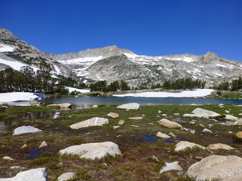
We found a flat rock that made a wonderful lunch spot with a killer view.
After lunch, we headed back same way. I just love this country!
I have written quite a bit over the years about this area from Lundy to Bodie to Dana City in my blogs and they all include different aspects related to that history. Some have stories about people, some about the mines. In my prior blogs section below, I only included my blogs on Bennettville but you can search Sierra News Online for Adventures with Candace and Dana City or Lundy and find many more stories.
There is a wonderful book at Bennettville that I cannot recommend enough if you want to learn more about Bennettville and the surrounding area. It is called Bennettville and the Tioga Mining District by Alan H. Patera. He includes many stories about the people who lived here, along with historical information. You will probably have a challenge finding it but you can usually pick up a copy on EBay if you set a search.
Dog Hike?
This is a good hike for Sally. It is above tree line so I can keep a good eye on her and let her run a little. There aren’t any rattlesnakes or poison oak and there is plenty of good, fresh drinking water for her all along the way. That means I don’t have to pack her water and that is a good thing! Sally has never had any problems drinking the water out of these higher elevations but some dogs may not be as easy as Sally on this issue. I think you need to know your dog and you may need to carry some water for them. There are a couple of negative issues for dogs in the area though. The rocks can be tough on their feet, especially if they aren’t toughened up yet. I carried Sally’s boots, just in case. Also, this area has bubonic plague and if you dog gets a hold of a critter such as a squirrel or mouse, this could be something to watch for after a trip in this area.
Here is some information from Inyo National Forest regarding their dog rules:
Traditionally, National Forests have welcomed dogs. However there are a few rules that apply to assure that you and other National Forest visitors have an enjoyable outdoor recreation experience. If you are camping with your pet, please practice the following:
- Leave vicious or unusually noisy dogs at home.
- During the day keep your dog on a leash no more than 6 feet long, or otherwise restrict its freedom to roam at will.
- At night keep your dogs and other pets inside an enclosed vehicle or in a tent.
- Developed campgrounds are for people, not animals. Please do not bring more than two dogs or other pet to any one campsite.
Map and Profile:
Tioga Lake to Great Sierra Mine to Green Treble Lake Hike Doarama
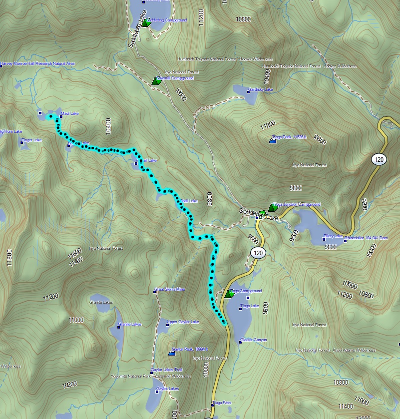
Tioga Lake to Green Treble Lake Hike Topographic Map
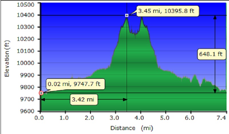
Tioga Lake to Green Treble Lake Hike Topographic Profile
Sources:
Homer Mining Index
http://www.lundycanyon.com/the-homer-mining-index/
Hubbard, D. H.,Ghost Mines of Yosemite, 1958, Awani Press, Fresno.
Trexler, Keith A., The Tioga Road; a History 1883-1961 http://www.yosemite.ca.us/library/tioga_road/mines.html
Patera, Alan, Bennettville and the Tioga Mining District, Western Places, Lake Grove, Oregon, 2003
Inyo National Forest Dog Rules
Prior Blogs in this Area:
Hiking with Sally From Bennettville to Green Treble Lake August 18, 2016
Hiking with Sally In the Hoover Wilderness August 6, 2015
Hiking to the Old Mining Town of Bennettville and the Lakes Beyond November 11, 2014
Hiking With Sally And Raven from Bennettville to Green Treble Lake June 2, 2014
Bennettville to Spuller Lake Snow & Ice Hike February 13, 2013

