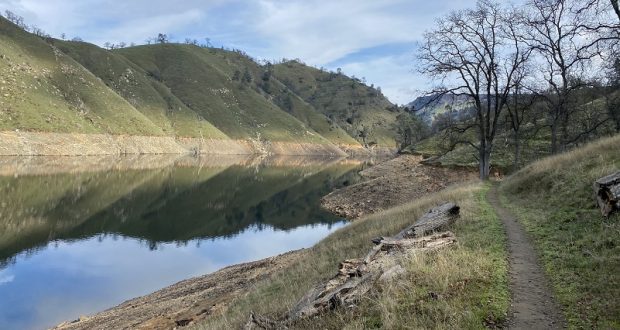
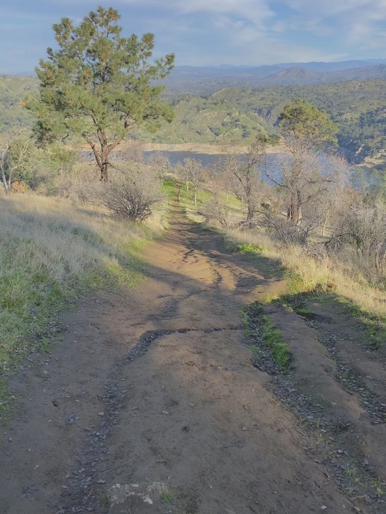
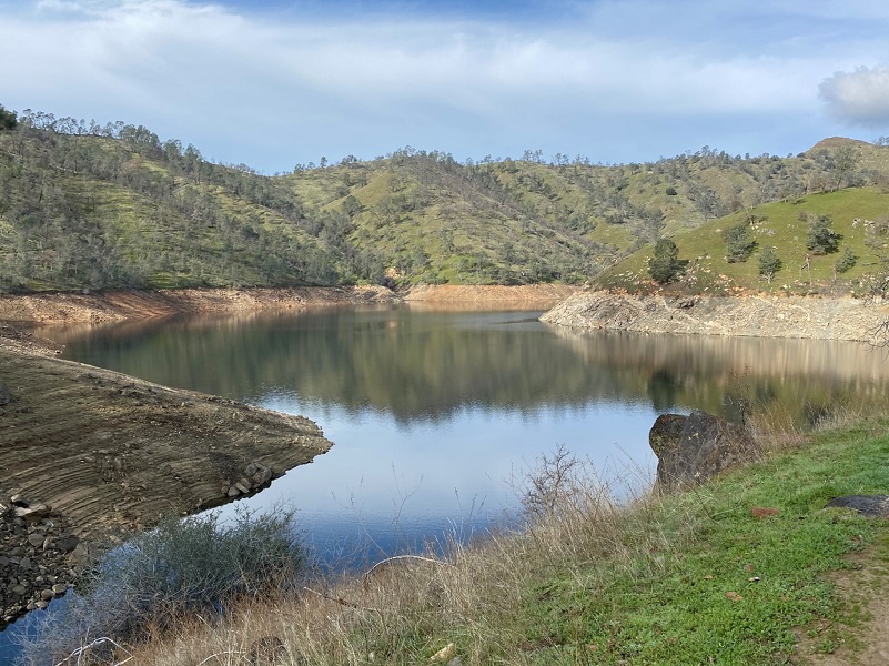
A good workout hike was what I needed and the trail out of Sky Harbor fit that bill. The valley’s patchy fog was lifting as I hiked, casting beautiful reflections in Millerton Lake as I dodged the cowpies on the trail.
Where: Millerton Lake State Recreation Area, San Joaquin River Gorge Special Management Area, Bureau of Land Management
Distance: 9.05 Miles, but you can go shorter or longer
Difficulty: Moderate
Elevation Range: 564′ – 1,535′
Date: January 28, 2020
Maps: Millerton Lake East Topog
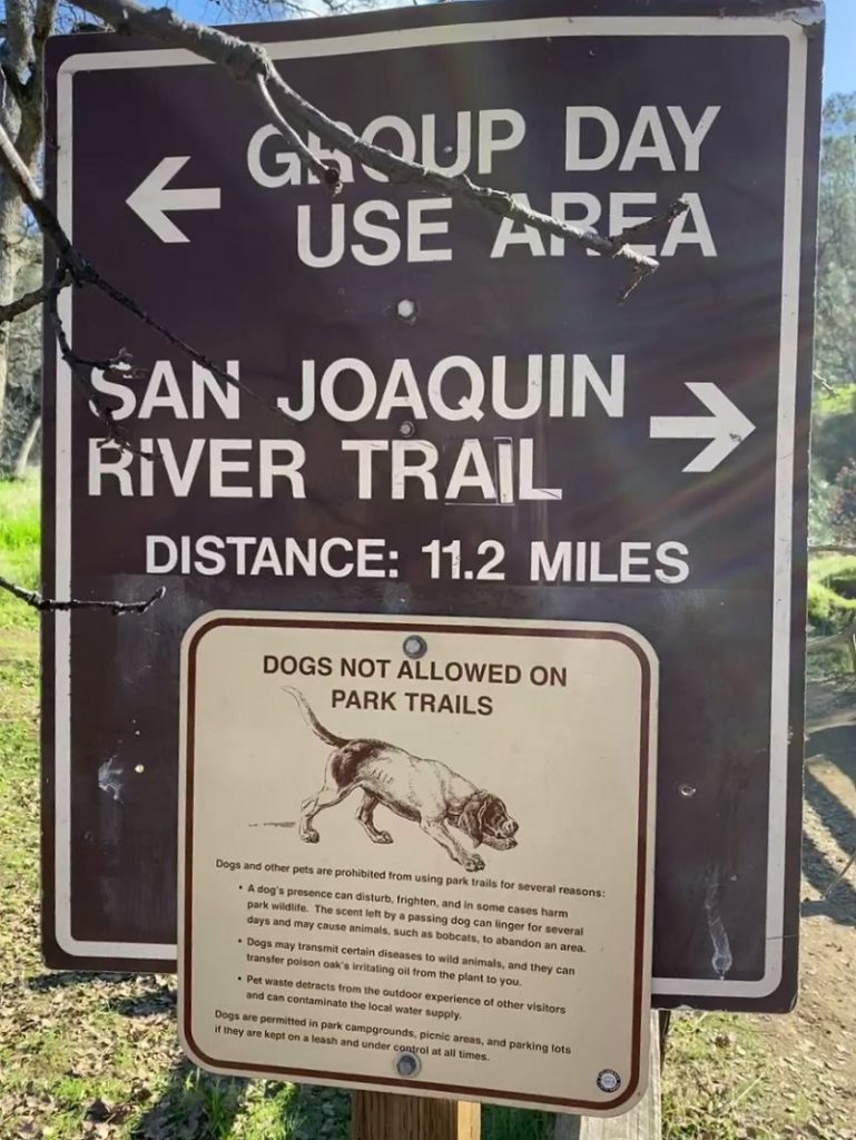
Dog Hike? Dogs are not allowed on Millerton Lake Recreation Area trails but are on the other jurisdictional areas outside the Recreation Area.
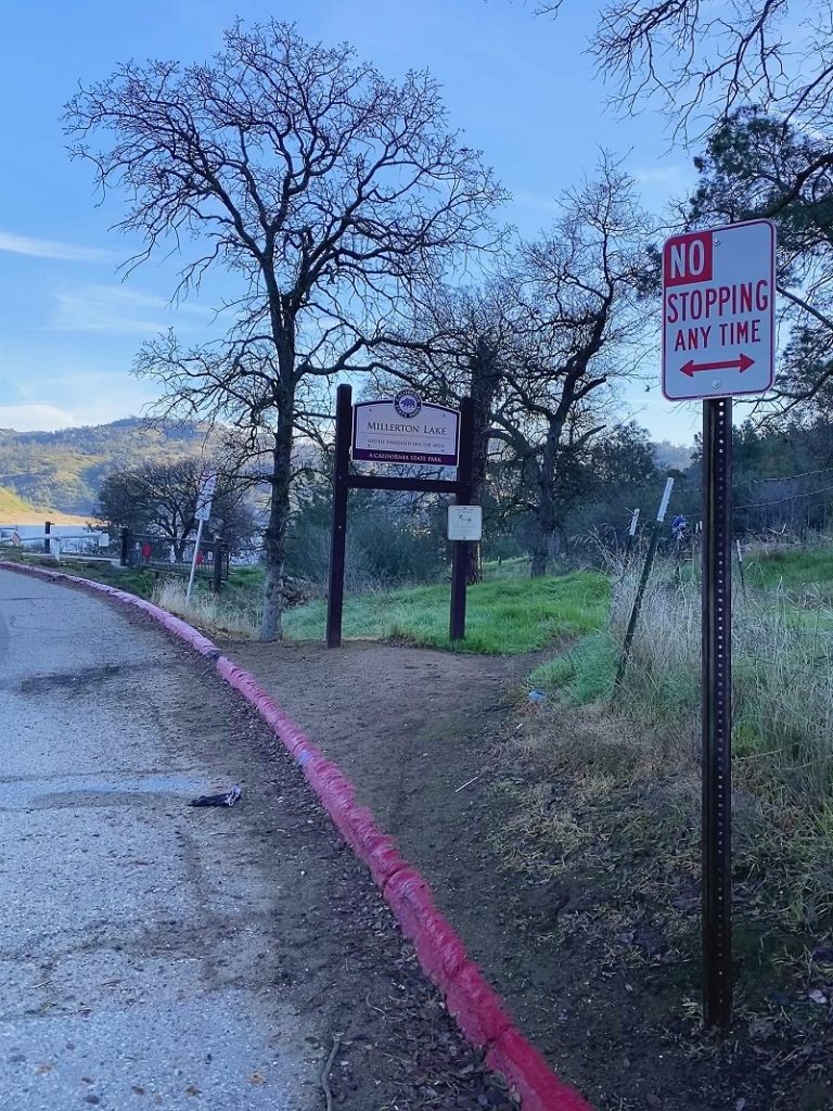 I drove out Friant Road past the entrance to Millerton Lake State Recreation Area and just before Table Mountain Casino, turned left on Sky Harbor Road. I drove all the way to the end of the road and parked alongside the road. The gate to the day use area was open and I saw a change from last year’s visit. No parking signs lined the east side of Sky Harbor Road before you reached the day use area. The west side was ok and I parked there.
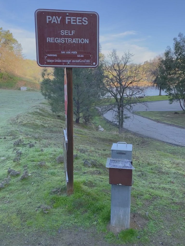
If you walk through the day use area there are bathrooms and a port-a-potty which I did not inspect. Also note that there was a fee sign that said $5 for parking in the Day Use Area with a self pay box.
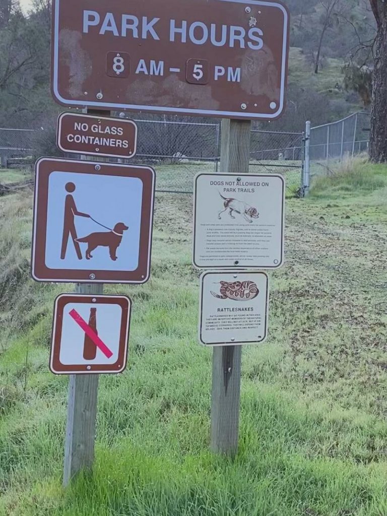
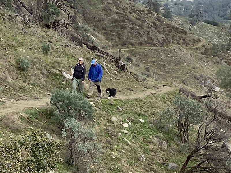
The signs at the trailhead that said that no dogs were allowed on this trail was still there but it didn’t appear that anyone was paying attention to them. I saw 5 dogs with their owners on the trail today, one of them off leash.
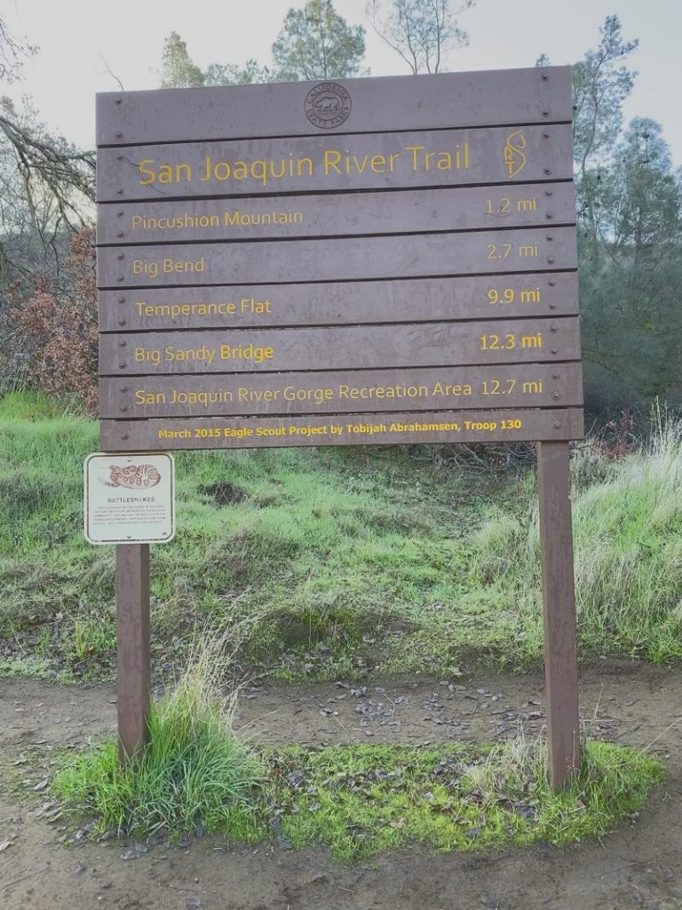
It was 48 degrees when I headed up the trail. You can hike all of the way up to the San Joaquin River Gorge if you want to but my plan for today was to hike a total of about 9 to 10 miles up to the area below Boling Gap, then turn back.
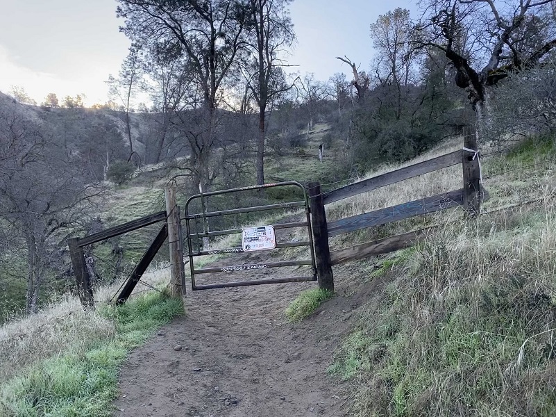
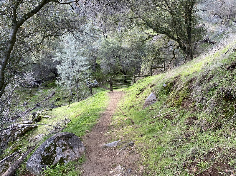
There were a couple of gates that I had to open and close along the way.
Then I just headed up the trail.
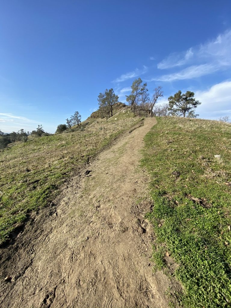
I decided to head up to Pin Cushion (1,560′ elevation) to start with, staying with the right fork of the trail but if you take the left fork, it bypasses this steeper section of the hike. From that fork, you climb about 600 feet in a half of a mile to get to the top of Pin Cushion. People refer to Pin Cushion as a Peak, Mountain and Hill. To me it is a hill but if you make the effort to hike to the top, I think you deserve to call it whatever you wish.

I didn’t expect to find a person jumping rope on top of Pin Cushion but you just never know what you will see on any adventure.
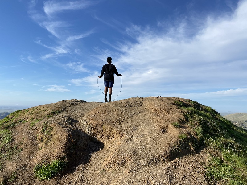
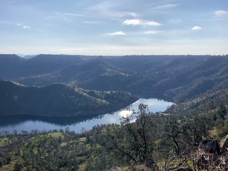
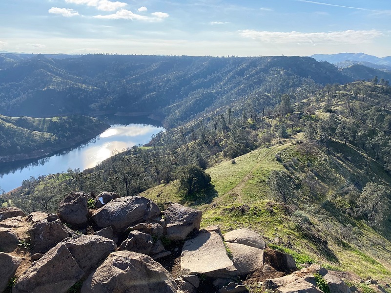
Of course there were great views from the top.
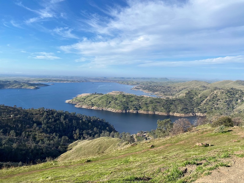
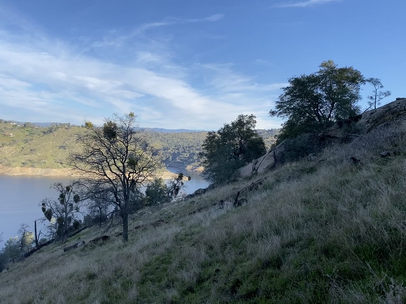
I headed back to the main trail, watching the cloud reflections in the lake.
I reached another gate, went through it and closed it as I had found it.
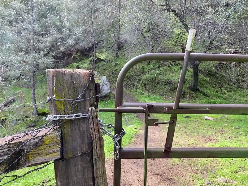
There is a reason for these gates. Cows and their calves were grazing and we sure don’t want them to get out on the wrong side of the fence.

Speaking of cows, there are some trail hazards to watch out for. Seriously, you can slip on these cow pies if you aren’t paying attention.

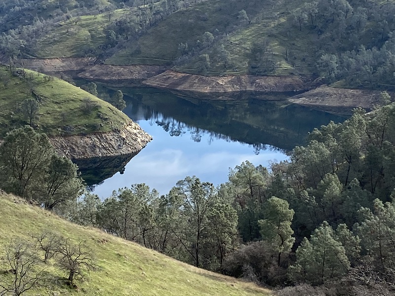
As I continued along the lake, those killer reflections were different around every bend.

I think this hike is perfect in early spring and if you can hit the wildflowers just right, you are in for a treat. It is not a hike that I would like to do on a warm day though. There are many exposed areas and those south facing slopes can get darn hot. Also, this area dries out sooner than the gorge part of the trail and the flower display doesn’t last as long into the season. No matter the weather, don’t forget to bring your water with you because you are a long ways away from good water sources. Be advised this area has rattlesnakes and once the weather warms up, they will be out. There is also poison oak. You share the trail with bikes and horses so be on the lookout for them, stepping aside to give them the right away.
Dog Hike? Not on Park Trails within Millerton Lake State Recreation Area
Dogs are allowed in certain areas within Millerton Lake State Recreation Area on leash and under control such as park campgrounds, picnic areas and parking lots. Dogs are not allowed on this trail though. The first couple of miles of this trail goes through the Millerton Lake State Recreation Area where dogs are not allowed on the trails and the trail is well signed that dogs are not allowed. Some people chose to disregard the signs.
There are other options to get on the San Joaquin River Trail outside of the Recreation Area. You can enter this area from many places off of Sky Harbor Road lower down the road. You will see many pullouts where vehicles have parked and this can also allow you to get your dog to the San Joaquin River Trail without going through the State Recreation Area. You can also enter it from other areas to the east such as Ya-Gub-Weh-Tuh Trailhead (link from my last hike there at the bottom) or Wellbarn Road.
Doarama:
What is a Doarama? It is a video playback of the GPS track overlaid on a 3 dimensional interactive map. If you “grab” the map, you can tilt it or spin it and look at it from different viewing angles. With the rabbit and turtle buttons, you can also speed it up, slow it down or pause it.
Map and Profile:
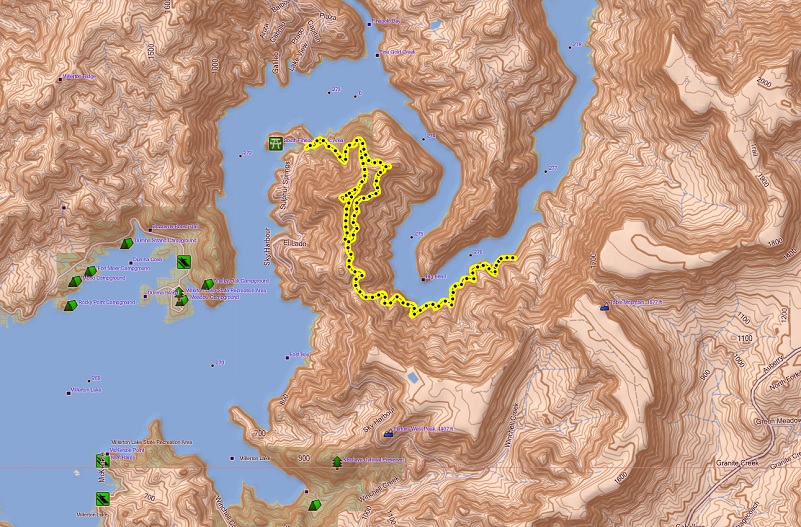
Sky Harbor Hike Topographic Map

Sky Harbor Hike Profile
Sources:
Millerton Lake State Recreation Area
Goals and Objectives of the Millerton Area Watershed Assessment
BLM San Joaquin River Gorge Special Recreation Management Area
Prior Blogs in the Area:
Hiking From Sky Harbor Along Millerton Lake With The Cows February 25, 2019
Hiking from Sky Harbor along Millerton Lake March 31, 2017
Hiking with the Cows along the San Joaquin River Gorge March 23, 2017
Hiking the San Joaquin River Trail March 31, 2016
Hiking the Pa’san Ridge Trail February 21, 2016
San Joaquin River Gorge Hike April 17, 2014


