As we hiked down to the old Kistler Cabin site, we could easily make out the animal tracks on the damp trail and there were quite a few bear tracks. We didn’t see any of those bear but we did come across an 8-toed bear track, which was extra scary.
Where: Yosemite National Park, Sierra National Forest
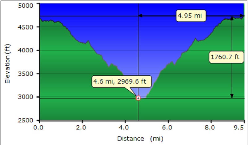
Distance: 9.54 miles
Difficulty: Moderate to Difficult
Elevation Range: 3,230′ – 4,954′
Date: February 14, 2018
Topographic Quad Map: El Capitan Topographic Quad
Dog Hike? No
 This is a tricky one to give directions to and the trailhead sign is not visible from the road. We drove north out of Wawona on Hwy 41 about 4 miles, and went past Alder Creek, which has a sign on it. We continued north to where the road crosses the next creek. This is Mosquito Creek but I did not see a sign on it. There is a double bear box on the west side of the road with a long pullout and that is where we parked. There was a blind curve just ahead of us though and we were very careful to watch for traffic zipping around that curve before we accelerated into the parking area. Perhaps the topographic map at the bottom of this blog can better help illustrate this. We stashed our post-hike goodies in the bear box and headed down the trail where we spotted the metal trail sign about 30 yards down the trail.
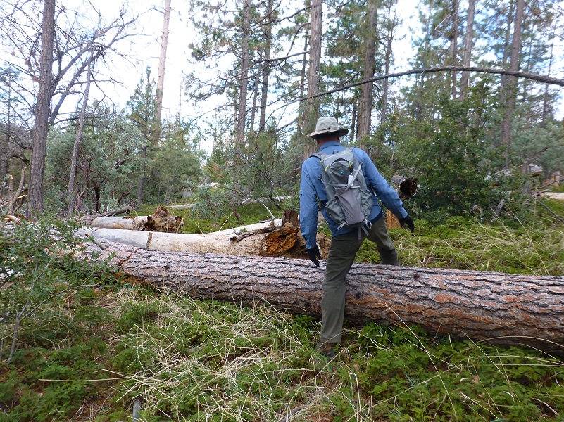
The trail’s grade led us downhill through mountain misery on the bed of the old road that went from Wawona to Yosemite Valley. There were a few down trees across the trail but they were nothing we couldn’t walk over or around.
There are many standing dead trees and we talked about the potential of one of those falling, not wanting to get squished by it. Stretches of the trail were under the shade of trees.

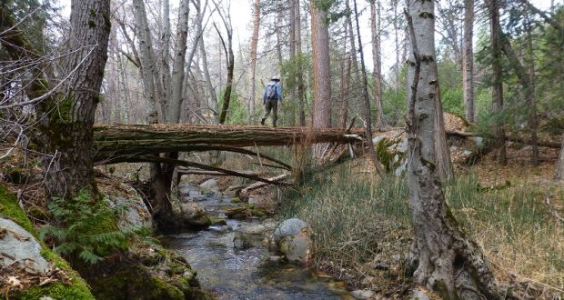
The trail then started dropping down with a few small creek crossings, the largest being Bishop Creek. We utilized two different techniques to get across that creek, both of them equally successful.
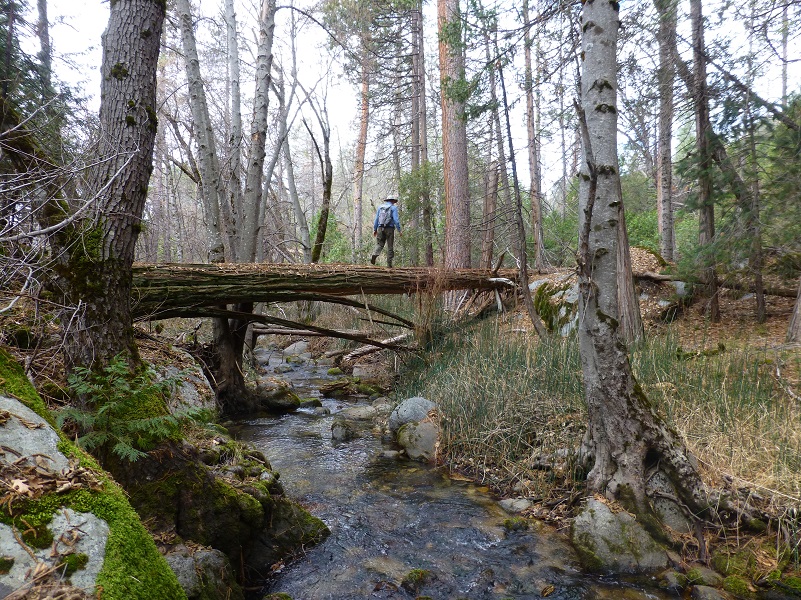

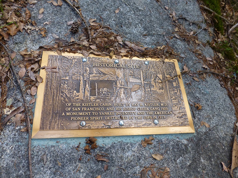
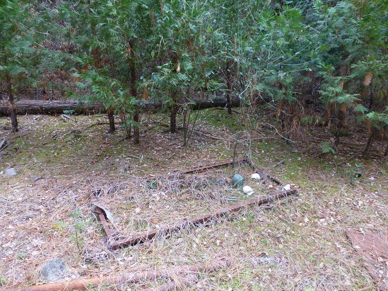
After we recrossed Bishop Creek at the bottom, we reached the site of where Kistler’s Cabin used to stand. Someone had placed a very nice plaque about the cabin, which also showed a picture.
Well, you know me. I had to figure out more about Dr. Ray H. Kistler and this cabin.
Raymond Henry Kistler was born May 15, 1893 in Moscow, Idaho and his parents were Charles Henry Kistler and Frances Manetta “Nettie” Blacker. They married in Kansas City, Missouri. Charles and Nettie’s first child, Jessie Rua, was born August 3, 1887 in Kansas City but it clear that this family was moving toward a new home because their next children was born in Moscow, Idaho. Leroy Emanuel and Raymond Henry arrived on the same date–twins!
On the 1900 census, they are living in Jewell, Kansas and Charles’ occupation is listed as Piano and Organ Dealer. On the 1910 census, they are living in Rowland, Los Angeles County, California and Charles is the proprietor of a paint store. On the 1920 census, Charles is living at Huntington Park, Los Angeles County, occupation listed as painter, but the twin boys are not at home.
Roy Emanuel joined up with the Army Corps of Engineers during WWI and served as a 1st Lieutenant. He married Minnie Washington and they lived in Washington. He passed away in 1959 and is buried at Seattle, Washington.
Raymond Henry is listed in the Stanford University “Quad” Yearbook 1915 as Pre-Medical. In 1917, he filled out his WWI Draft Registration and he was single, a medical student and living in San Francisco. On the 1920 census, he is listed as single, and occupation as a Physician in a hospital living in San Francisco. On the 1930 census, he is listed as single, occupation as Physician in an office, working on his own account, living in San Francisco. On the 1940 census, he is listed as married, occupation as Physician Surgeon and living in San Francisco. His wife is Violet Elizabeth Peterson, born 1903 California and they have 3 children in the household, along with Raymond’s father Charles. The children’s names are Ray H. and Peter J.
I went back to locate Violet on the 1930 census and she is living in San Francisco and working as a Registered Nurse, so I bet that is how they met.
In 1942, Raymond Henry filled out his WWII Draft Registration, listing his occupation as self-employed physician and his wife’s name as Violet. They were living in San Francisco.
Raymond died October 3, 1970 and is buried at Colma, San Mateo County, California. Violet died in 1984 and is buried beside him.
OK, what about this cabin? Why and how was this cabin or group of buildings built on United Forest Service Land? Was it a hunting and fishing get away place? Were they doing some gold panning?
First I had to sort through the various spellings of the cabin as is is spelled as Kissler, Kistler and probably some other ways that I didn’t find. I located a reference that detailed several structures listed as Kessler in the Historic Resource Study by Linda Widel Greene back in 1987, but these buildings are shown in in Section 35 and the cabin we were at was in the southwest corner of Section 1, at least a mile or so away.
I located a newspaper article in the Fresno Bee back in 1973 about a group of guys who took their horses down to Kestler’s Cabin on a fishing adventure but it didn’t have any details on the cabin’s history. There is a link to the article at the end of the blog in case you wish to read more about their adventure.
I searched old mining claims in the area to see if I could find one in his name but didn’t find anything.
I located a researcher of this family and contacted them to see if they could shed light on the cabin but didn’t hear back from them.
I struck out finding out any information about the cabin other than what was on the plaque. I think that the engraved picture that serves as the background on the plaque probably is from an actual picture and that is the best I can come up with by my deadline for the blog. Maybe a SNO reader can help with more information? I would love to learn more.
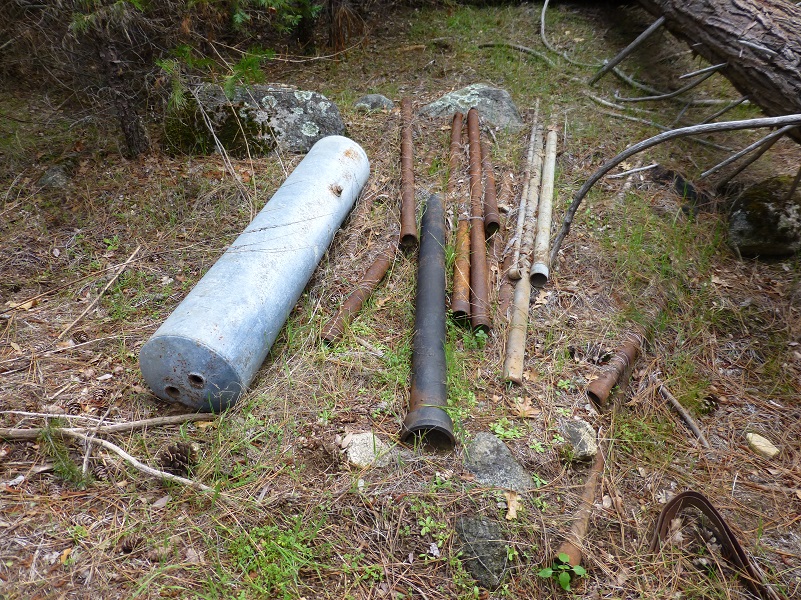
We explored around the old cabin site, checking out old items utilized and long discarded by people who occupied the site.
We then wandered down to the South Fork of the Merced River and found a comfortable spot to enjoy our lunch.
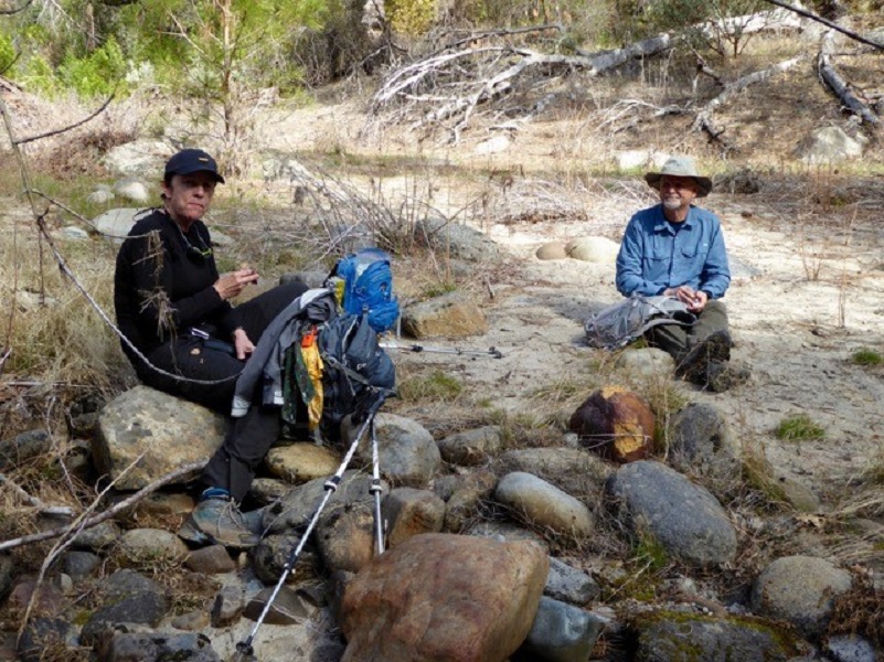
Photo by Gail Gilbert
We then checked out the river and I could see what looked like some good fishing holes.

Photo by Gail Gilbert
It was time to do the part of the trail that I had not been looking forward to. It was time for the uphill part, pretty much all of being an uphill part. As we headed up, I took a look back.

Uphill through the bear clover and down trees.
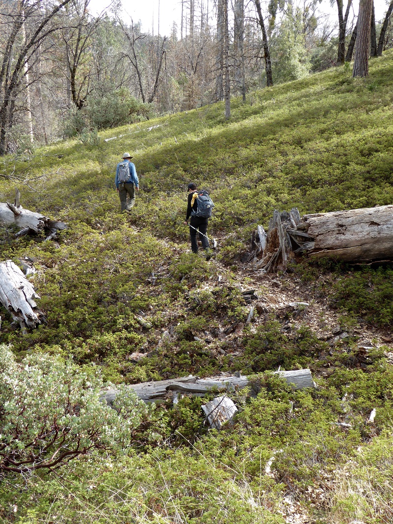
Photo by Gail Gilbert
I would not want to do this hike in warm weather. We could see many animal tracks on the trail, including that 8 toed bear track. Upon our closer investigation, we could see that the bear had stepped in its own track, creating the appearance of 8 toes. We had a pretty good laugh about that but it was a reminder that bears were using that trail like a highway. Hope you aren’t mad at me for making you read all the way down to the end of the blog for the rest of the story, as Paul Harvey might have said.
There are a few hazards on this trail that I should share with you besides the bear activity. There is a bit of poison oak along the trail, some of it encroaching into the trail. I found a tick crawling on me when I got home and I bet rattlesnakes love the area. That haul out of the canyon would be hot in the summer and if for some crazy reason you want to tackle this hike on a warm summer day, be sure and bring plenty of drinking water.
Dog Hike?
This hike starts and travels about 1 mile through Yosemite National Park on the top portion and dogs are not allowed on this trail in Yosemite National Park. Dogs are allowed in the Sierra National Forest but it not possible to get to the National Forest without crossing Yosemite National Park on this trail.
Maps and Profile:
Alder Creek to South Fork Merced River Doarama

Alder Creek to South Fork Merced River Topographic Map
Alder Creek to South Fork Merced River Profile
Prior Blogs in the Area:
Hiking to Alder Creek May 19, 2017
Hiking up to Alder Creek Falls May 17, 2016
Alder Creek Falls Hike 2015 May 22, 2015
Alder Creek Falls Hike May 25, 2014
Alder Creek Falls (And Beyond) Hike May 9, 2013
Sources:
Yosemite: the Park and its Resources (1987) by Linda W. Greene