The clock is ticking this year to drive on Glacier Point Road and out to those wonderful trailheads along it’s way. When Glacier Point Road closes this year, it will be closed for at least a year due to construction. This week, I headed to two destinations full of amazing views from the Taft Point Trailhead, Sentinel Dome and Taft Point.
Where: Yosemite National Park
Distance: 4.54 Miles
Difficulty: Easy to Moderate
Elevational Range: 7,222′ to 8,107′
Elevation Gain: 1,223′
Date: November 22, 2021
CALTOPO: Glacier Point Road to Sentinel Dome & Taft Point
Dog Hike: No
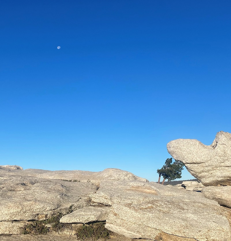
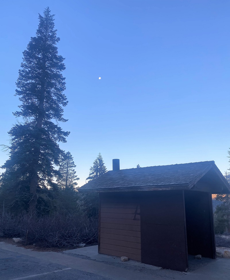 Glacier Point Road had closed when we had some early storms but had reopened, but who knows for how long? I wanted to get Glacier Point Road hikes in before I was shut out, so I headed out bright and early to Glacier Point Road, parking at the Sentinel Dome Trailhead. My vehicle was the only vehicle in the parking lot and the waning moon looked beautiful as it set over the toilets at the trailhead . . . seriously!
Once Glacier Point Road closes this year, it will be closed for a while and that is why I am trying to get my Glacier Point Road Trailhead hikes in while I can. From Yosemite National Park:
Glacier Point Road will be closed for the entire 2022 visitor season. The project will address multiple severe safety issues on the ten miles of road located between the intersection to the Badger Pass Ski Area and the Glacier Point Parking Area. Some of the road safety issues that will be addressed in this project include:
-
- To pulverize and repave ten miles of road between Badger Pass and Glacier Point.
- To repair the narrow hairpin turns between Washburn Point and Glacier Point to address vehicular safety issues
- To construct additional parking and new vault toilets near the Sentinel Dome Trailhead

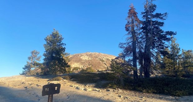
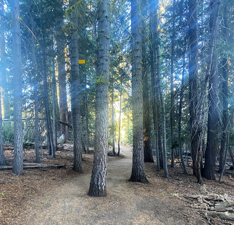
It was 37 degrees when I headed down the well-signed trail. Turning left heads 1.1 miles to Taft Point and going right took me 1.1 miles to Sentinel Dome. My plan was get on top and have it to myself early in the morning, then going to Taft Point to try and minimize the crowd factor. This hike is NOT one that you will have the trail to yourself and can be very busy during peak times.
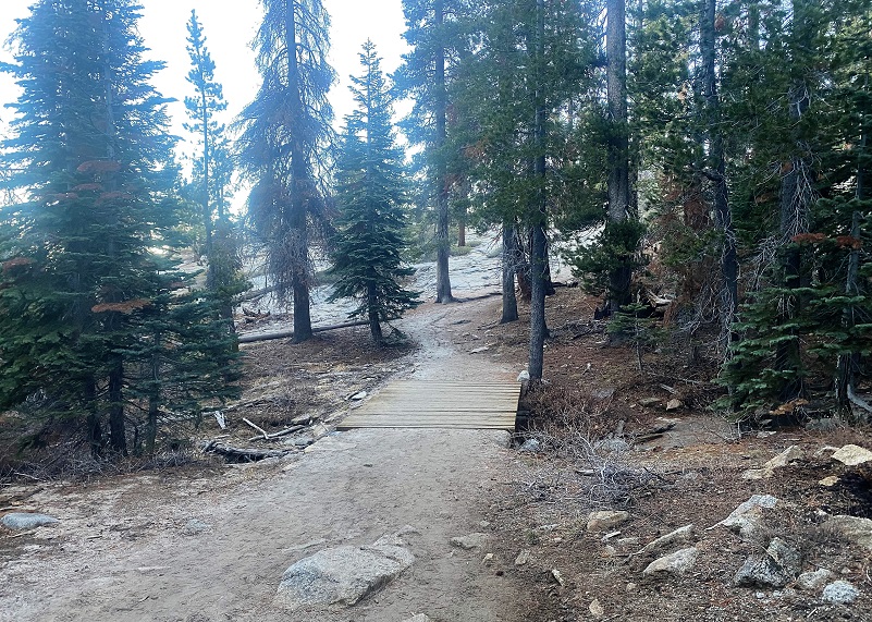
The trail was well marked, even as it passed over granite areas.
 Well, there was a little down log.
The trail led on with Sentinel dome ahead.
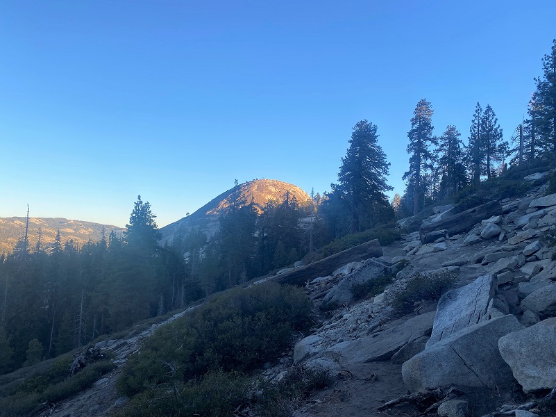
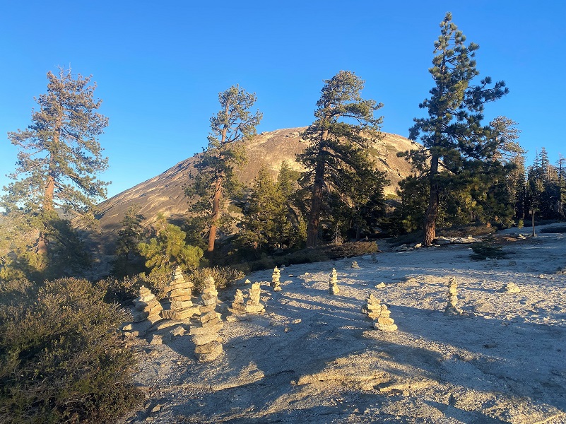
I mentioned that granite slab being well marked because in addition to the boulders lining the trail, people had built a small city of cairns.
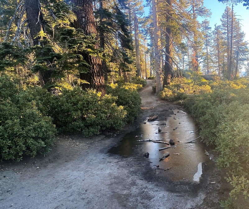 The next small obstacle was a frozen mud puddle.
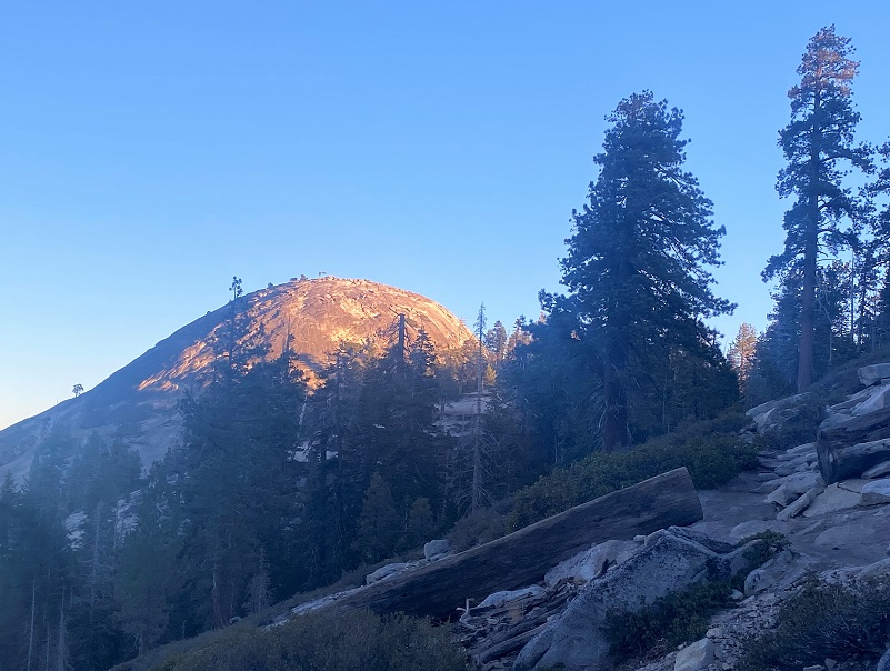
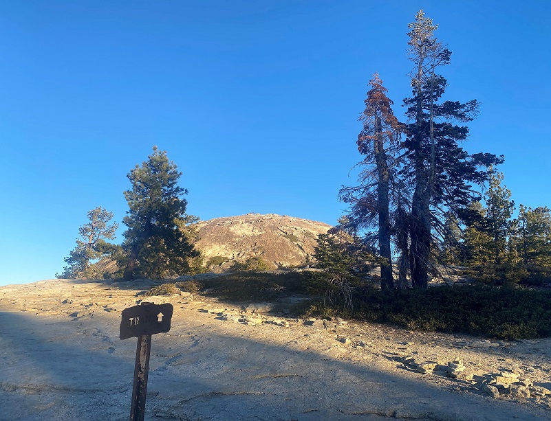
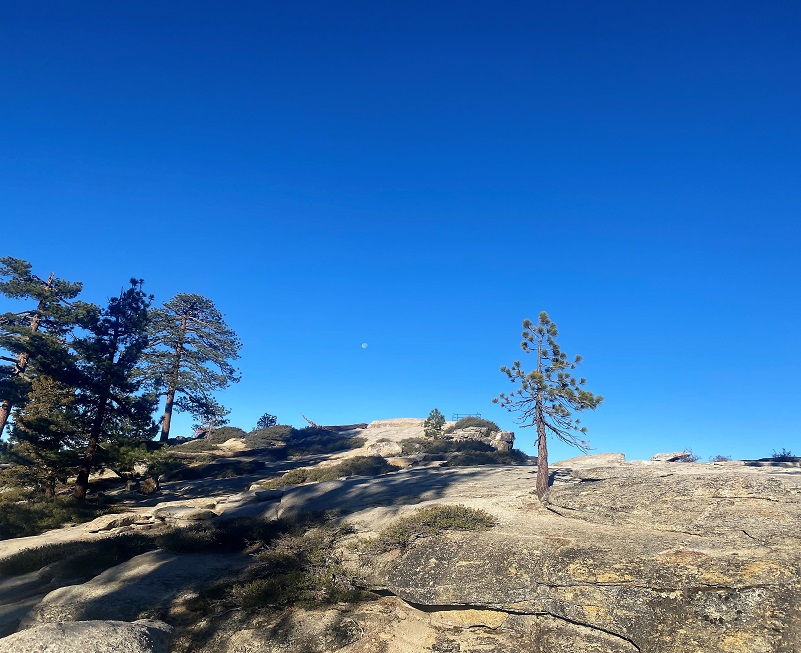
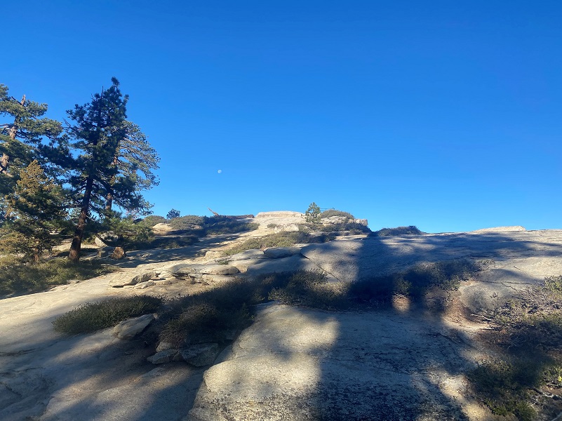
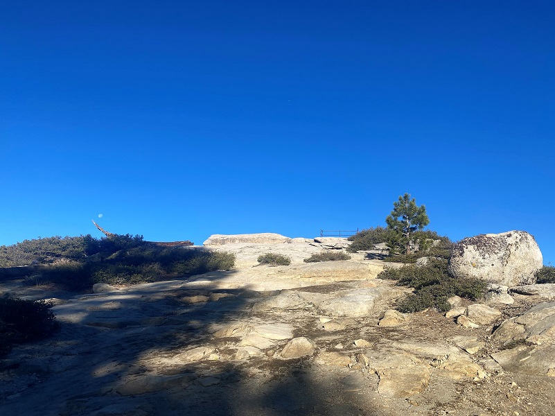
The trail/old road split and I followed the signs to Sentinel Dome. There is kind of a trail up it that you can see from the wear pattern and footprints. Sometimes it can be icy or snowy but not on this day.
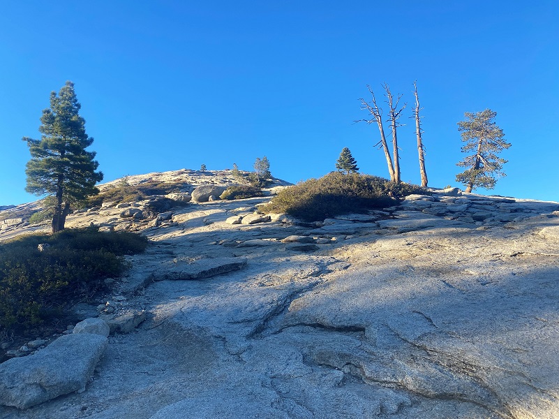
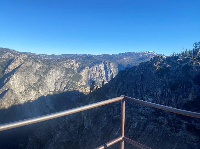
Sentinel Dome (8,107′ elevation) was full of beautiful views every way I looked but a picture just doesn’t do justice to this view so how about a 360 degree spin?
One last look back up at Sentinel Dome.
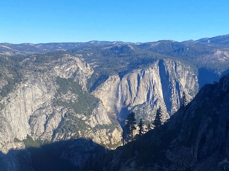
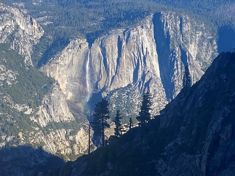
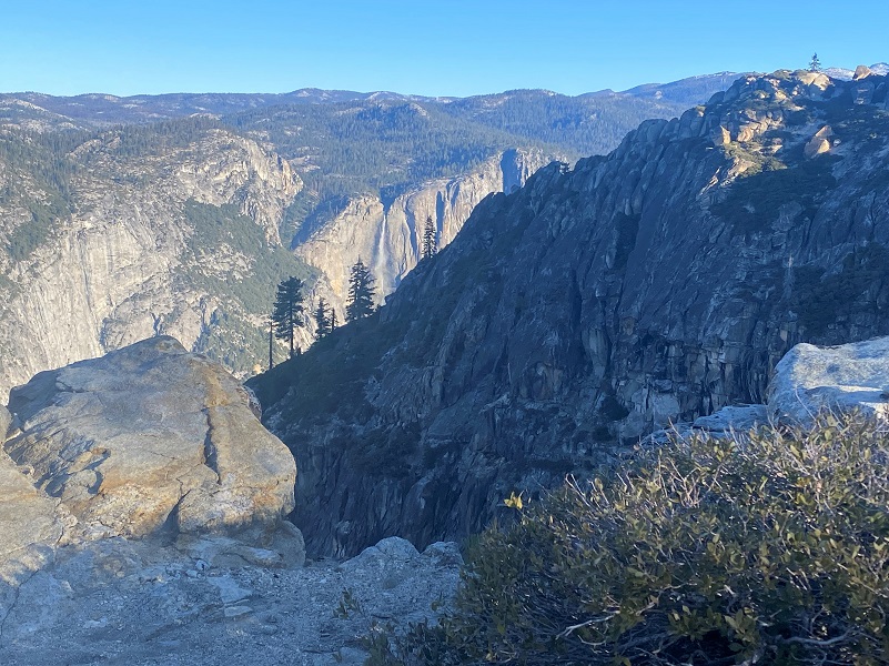
And I had some wonderful views of Yosemite Falls as I headed down.

A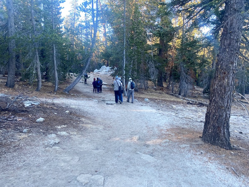 s I headed back to the junction to the trail that heads to Taft Point, a couple of people passed me on their way up to Sentinel Dome. Once I reached the junction, there were people. Not a surprise but it is what it is. They were moseying and I had a good pace, so I passed them. I now had the trail to myself for a while.
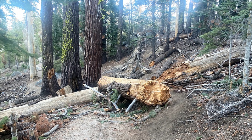
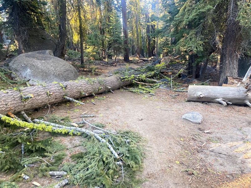 There were a couple of trees across the trail but nothing that couldn’t be walked over.
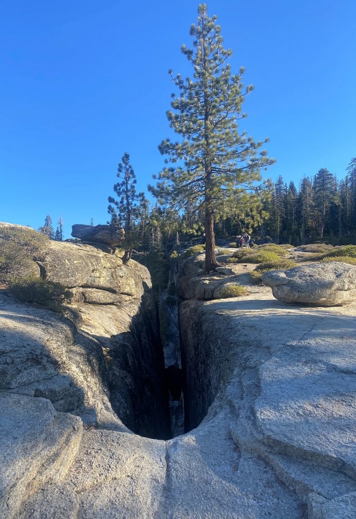
Pretty soon Taft Point was in my sights. A small group were inspecting the Fissures so I bypassed them to visit on my way back.
I could see Taft Point ahead of me, named for William Howard Taft, who was serving as the President (1909-1913) at the time that Robert Marshall, Chief Geographer for the United States Geological Survey, named it. John Muir guided President Taft through Yosemite for 3 days back in 1909. Did you know that President Taft walked down the four-mile trail from Glacier Point to the Yosemite floor?
It seems the big topic of discussion on that visit was water and Hetch Hetchy. San Francisco wanted that water and had a proposal to dam up the Tuolumne River to create a reservoir out of Hetch Hetchy Valley. John Muir found an ally in President Taft but Congress passed the Raker Act in 1913 which gave San Francisco the right to build the dam and develop hydroelectric power in the valley. Taft lost his re-election to President Woodrow Wilson who signed the bill. Many issues arose regarding Hetch Hetchy but it was eventually completed in 1934.
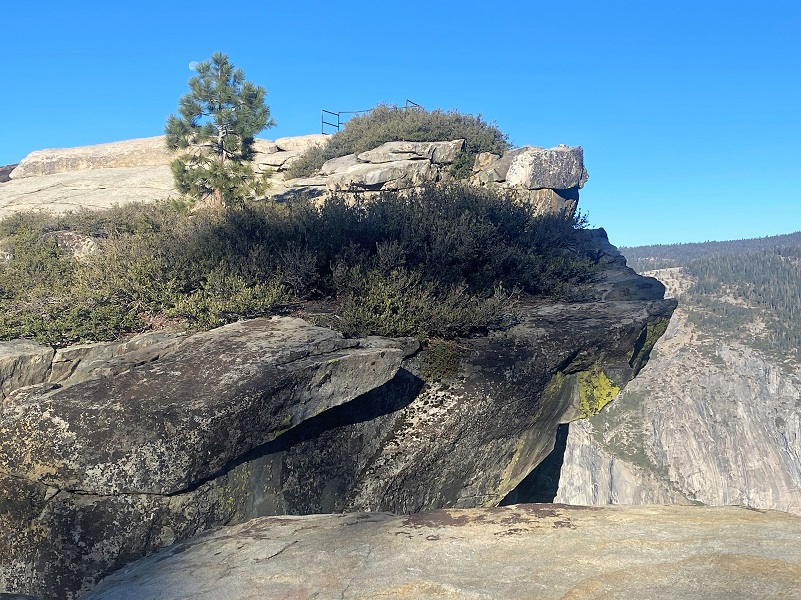
The views from Taft Point (7,500′ elevation) are incredible. There is a rail but it was still a bit scary to me to be very close to that edge. It isn’t much of a rail. El Capitan looks a little different from this point of view and I also could see the Three Brothers, Yosemite Falls, Mt. Hoffman, Mount Conness and many of our other mountainous friends. I could also see the Merced River way down there in the valley.
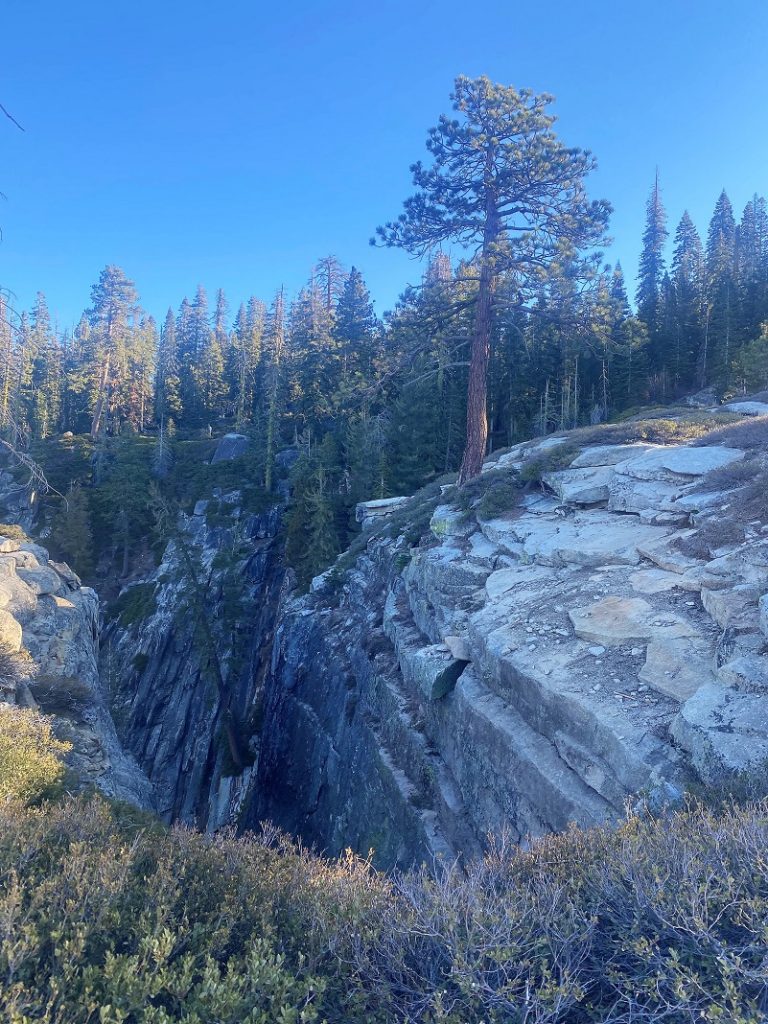
I checked out “The Fissures.” There is no guard rail around these dangerous fissures that drop off about 3,000′ straight to the valley floor. As you begin to catch sight of these fissures, you realize how monstrous they are.


When I got back to my car around 10, the parking lot was almost full, sure a big difference from when I arrived. And the line of cars entering the Wawona Entrance Station was backed up almost to the Snow Play Area. That is the busiest I had seen it in a while. Glacier Point Road will eventually close and there are a still a few ways that you can access this area.
- You can take the Tunnel View Trail up and follow the Pohono Trail as far as you wish. Depending on the amount of snow and ice, we pack our snowshoes and ice traction devices for this.
- If they haven’t closed the Four Mile Trail, you can head up it to Glacier Point and Sentinel Dome. They do close it during the winter though and there can be some very icy stretches of this trail.
- Of course, when they open up Badger Pass, you can snowshoe or cross country ski up Glacier Point Road, taking the trails over to the Pohono Trail.
- And here is an easy option that you can do online. Yosemite Conservancy’s Yosemite High Sierra Webcam is located on Sentinel Dome and you can check out the beautiful views from there.
Dog Hike? No
Dogs are not allowed on this Trail.
Where Pets Are Not Allowed
- On trails, including the trail to Vernal Fall (however, pets are allowed on the Wawona Meadow Loop)
- On unplowed roads covered in snow
- In undeveloped and wilderness areas
- In public buildings
- On shuttle buses
- In lodging areas
- In all walk-in and group campgrounds/campsites, including Camp 4
- In any other areas, as signed
These regulations protect both pets and wildlife from disease and each other. The National Park Service has prohibited pets on trails for many years. In particular, some pets chase wildlife, pollute water sources, and can become defensive and dangerous in unfamiliar surroundings. Pet owners have the burden to assure their pet does not damage the park values for others in those areas where pets are allowed.
Doarama:
What is a Doarama? It is a video playback of the GPS track overlaid on a 3 dimensional interactive map. If you “grab” the map, you can tilt it or spin it and look at it from different viewing angles. With the rabbit and turtle buttons, you can also speed it up, slow it down or pause it.
Sentinel Dome Taft Point Doarama
Map and Profile:
CALTOPO has some free options for mapping and here is a link to my hike this week: CALTOPO: Glacier Point Road to Sentinel Dome & Taft Point
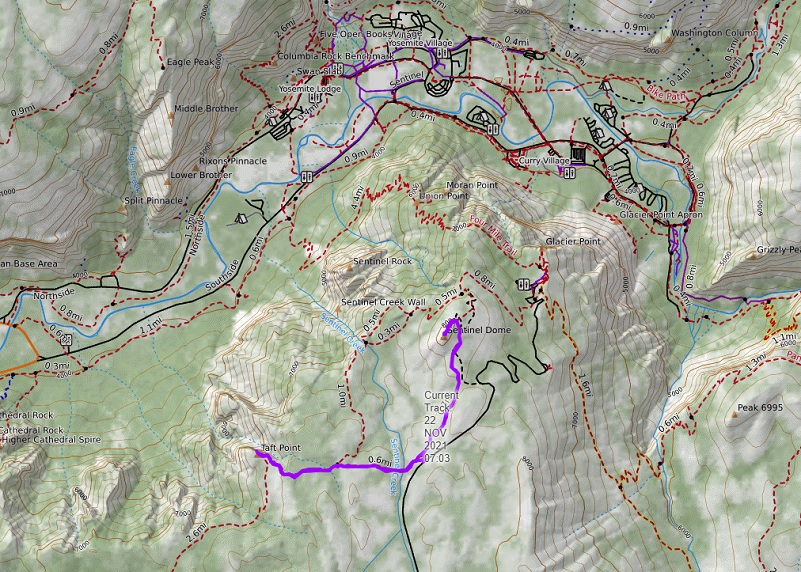
Glacier Point Road to Sentinel Dome & Taft Point Topographic Map
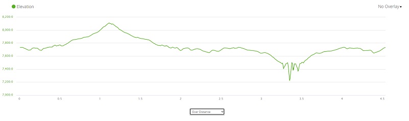
Glacier Point Road to Sentinel Dome & Taft Point Profile
Prior Blogs in the Area:
Hiking to Sentinel Dome and Taft Point Before the Storm Rolled In November 19, 2019
Hiking from Tunnel View to Dewey Point January 12, 2018
Hiking to the Fissures, Taft Point and Sentinel Dome October 29, 2014
Tunnel View To Dewey Point Hike January 8, 2014
Sources:
Glacier Point Road Rehabilitation Project (2022)
Taft Point, Yosemite Valley Place Names (1955) by Richard J. Hartesveldt
Days Gone By: 1909: John Muir accompanies President Taft to Yosemite Mercury News

