Cooler temperatures, white puffy clouds, a breeze, incredible views, marmots, blooming wildflowers and a great workout. We had a perfect day to escape the heat at home as we hiked up and around Dana Plateau in the Tioga Pass.
Where: Ansel Adams Wilderness Area, Inyo National Forest
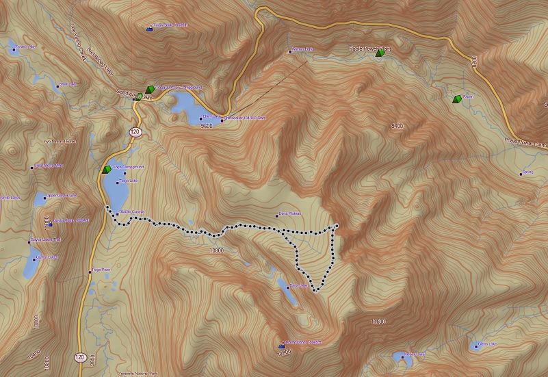
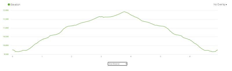
Distance: 6.94 Miles (5.69 miles to the Mono Lake overlook)
Difficulty: Strenuous
Elevation Range: 9,653′ – 11,926′
Date: July 8, 2021
CALTOPO: Hiking to Dana Plateau
Dog Hike? Probably not
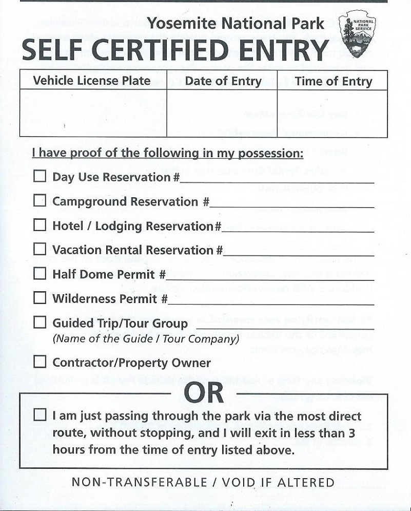
We left the house early and headed into Yosemite National Park via the El Portal Entrance Gate around 0720. The Gate was not staffed but I had already printed out my Day Use Reservation Pass, picking up one of the Self Certified Entry white slips at the Entrance Station to fill out and placed on my dashboard. I wasn’t sure if we would be making any stops within Yosemite National Park and since I already had a Day Pass, I used that but I could have utilized the Self Certified Entry slip’s bottom box that allowed me to pass through the park without stopping.
I started this short but steep adventure at the trailhead at the west end of Tioga Lake on Tioga Road, just east of the Tioga Pass entrance to Yosemite National Park.The trailhead starts where the informational signs and restrooms are located.
After I crossed the inlet to Tioga Lake, there used to be a sign related to Glacier Canyon but only a wooden post is left this year.
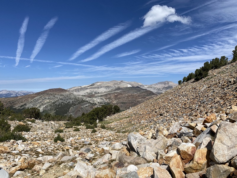
This hike is a fantastic one to really see how the glaciers shaped the land. In Glazner and Stock’s book, Geology Underfoot In Yosemite National Park, they discuss the most recent glaciation that occurred between 26,000 and 18,000 years ago known as the Tioga glaciation. These glaciers deposited a whole bunch of rocks and debris, also carving out the majority of glacial features that we see today.
A huge ice field formed over and around the Tuolumne Meadows, up to 2,000 feet thick in places. These glaciers smoothed the landscape under the ice, forming the domes and slabs in the Tuolumne Meadows area. A few peaks and ridges poked up above this sea of ice and they were called “nunataks.” They were a kind of bedrock island and some examples include Cathedral Peak and Unicorn Peak. Dana Plateau became a nunatak for short periods as the Tioga glaciers formed around them. These nunataks were sanctuaries for many plants and animals. It was an area that was free of ice where they could live and as the glaciers retreated, these species expanded outward from their nunataks to colonize the freshly deglaciated landscape.

We easily crossed a small creek that had logs across it. This crossing always has logs to get across it but it looks like this year’s model had a log added.
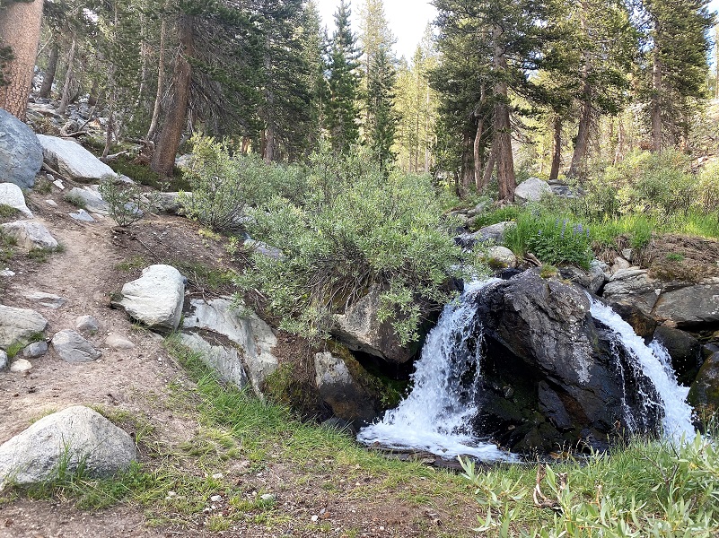
The trail followed the creek up through some stretches with bouldery steps. And there were flowers, many different varieties, along the creek.
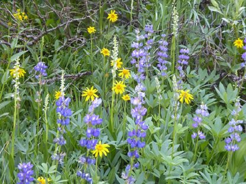
Photo by Gail Gilbert
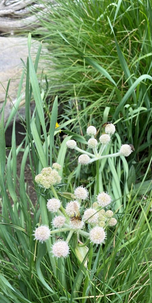
Ranger Buttons
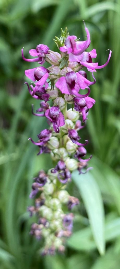
Elephant Head

Rein Orchid
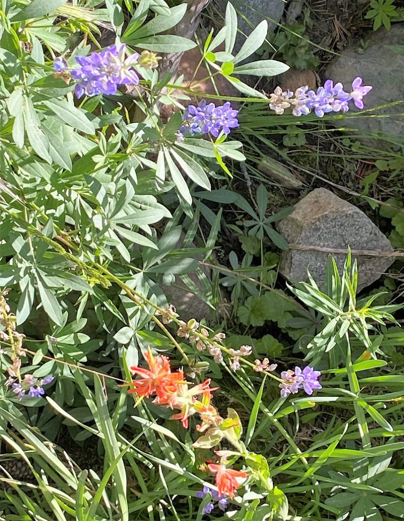
Lupine and Paintbrush
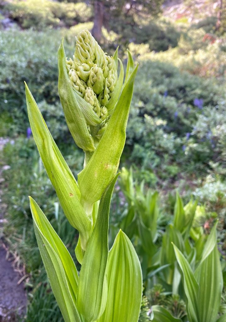
Corn Lily

Paintbrush
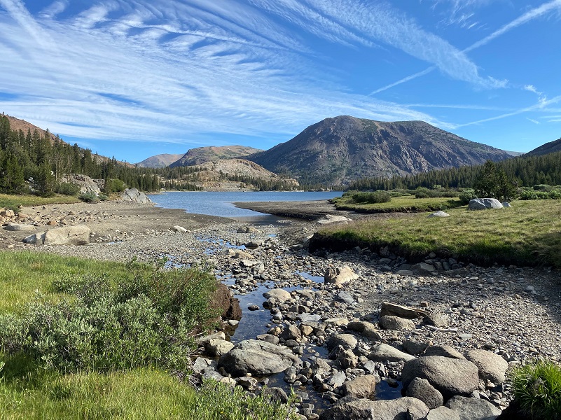
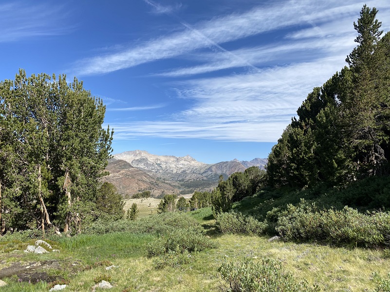
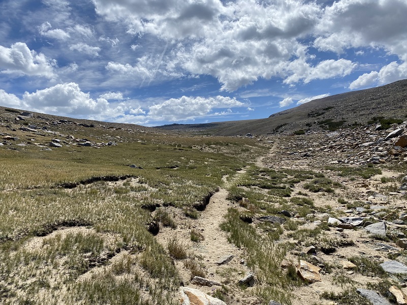
The trail completed its gain for a while and left the creek. That area was a great spot to check out the view to the north, up Mine Creek and toward Saddlebag Lake.
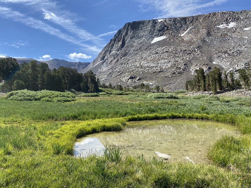
Small tarns shared reflections that changed as we moved around them.
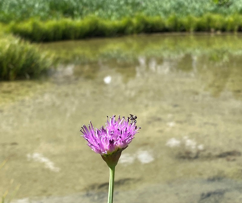
Wild onions were in full bloom and bugs were busy working on them.
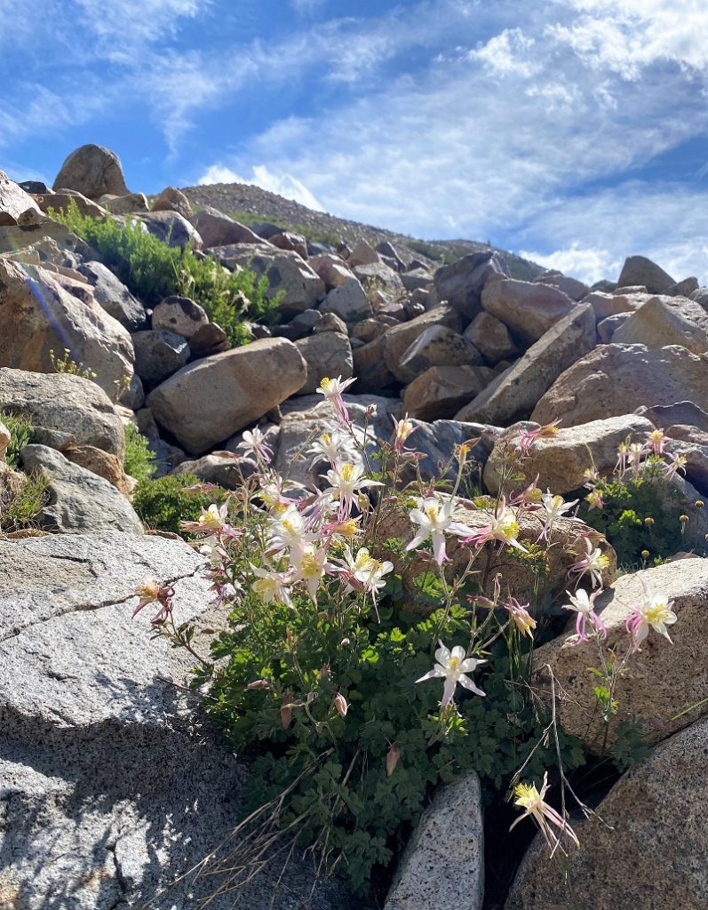
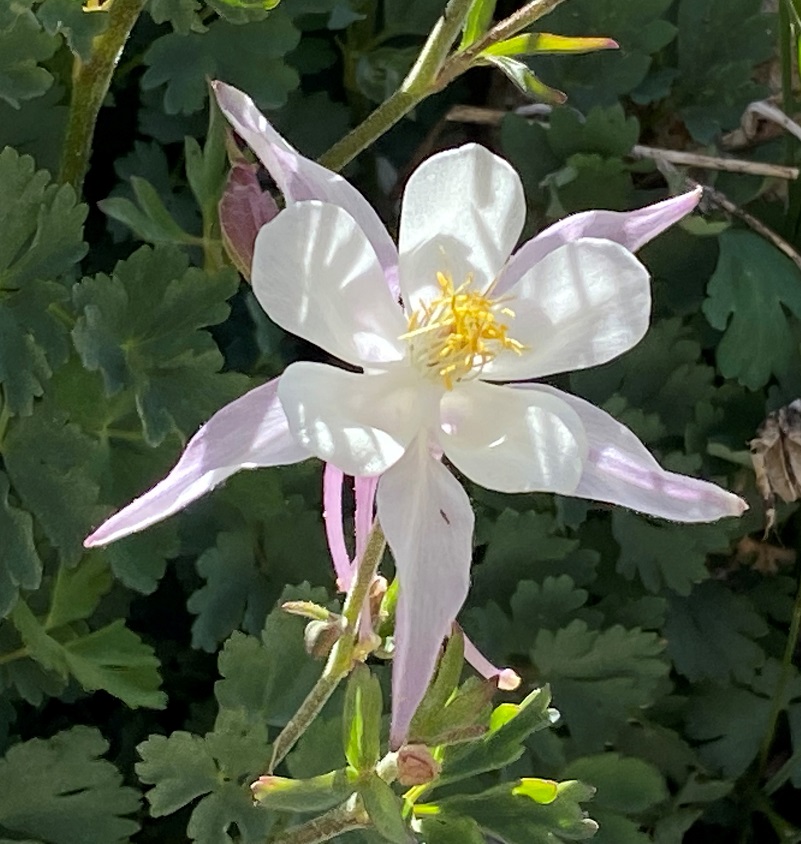
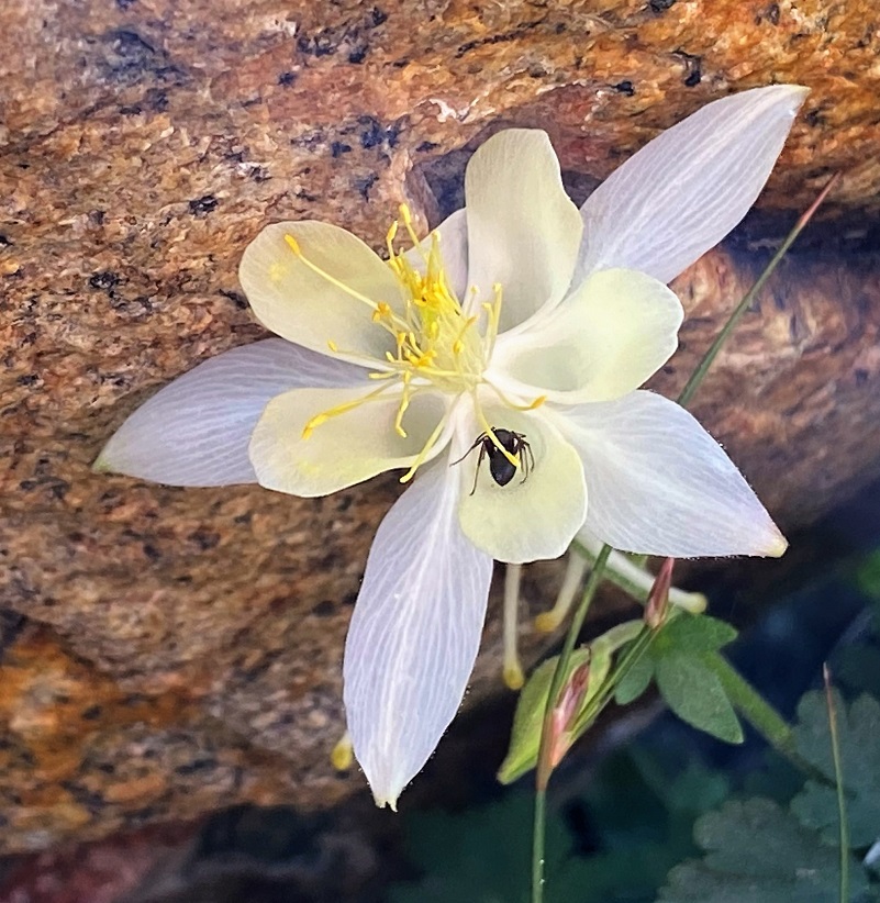
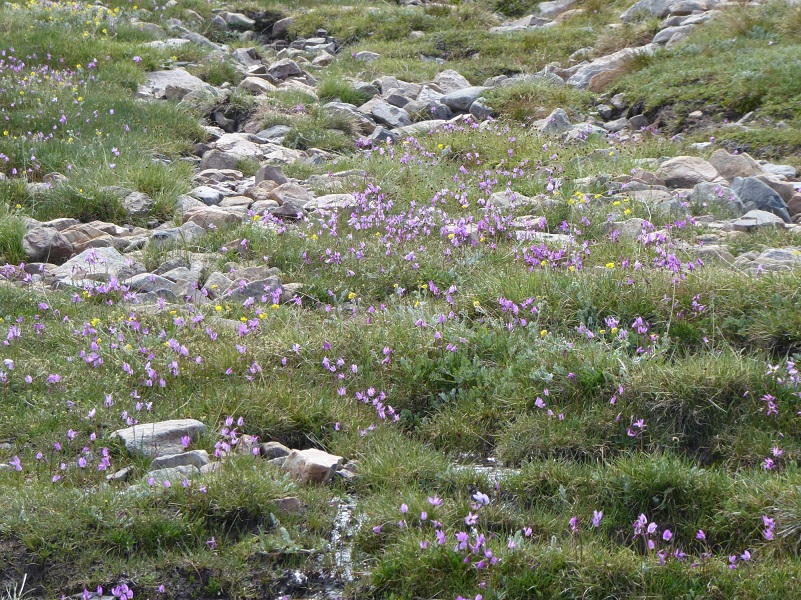
We started heading up a wash where I periodically stopped to listen and watch for pika but didn’t see any on this hike. I have before though. The columbine were really putting on a show with their beautiful multi colors. My hiking buddy Gail researched the columbines in this area a few years ago and located some very interesting information about the columbine in this specific area from Wildflowers of the Sierra Nevada & Central Valley Field Guide. Alpine columbine and crimson columbine grow in different habitats at different elevations and are visited by different pollinators, but there are a few places in Yosemite at 9500-10,000′ where these two columbines hybridize. The result of this hybridization is a large, glorious white columbine with tinges of pinks, purples and yellow.

The marmots were out in force and we saw 5 on our hike. Some were basking in the sun and others were feeding. It was a record day.

Yellow-Bellied Marmot (Photo by Gail Gilbert)
We continued climbing up the wash, peeking up Glacial Canyon toward Dana Lakes and Mt. Dana.
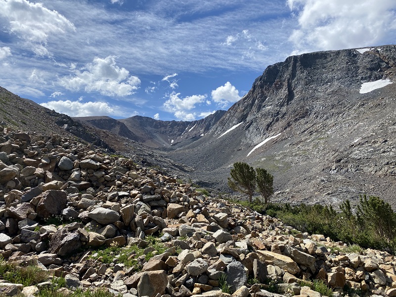
That trail was a bit like a snake track in some places but we knew where we was going–up. So we picked our way through the rocks the easiest way we could see when we temporarily got off the trail.
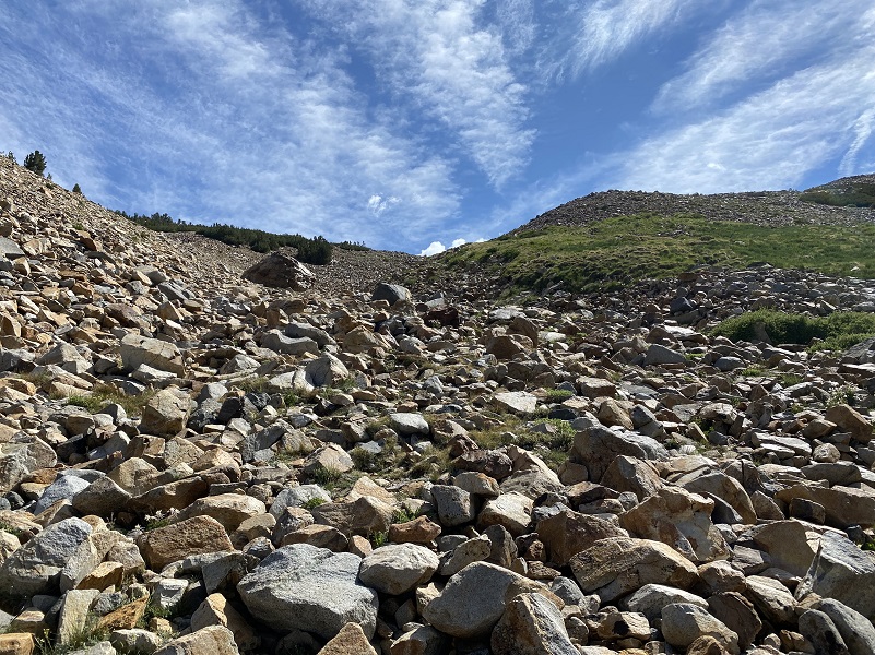
The trail soon left the bottom of the wash and those beautiful columbines, then worked it’s way along the ridge. I took some looks back at where I had traveled.
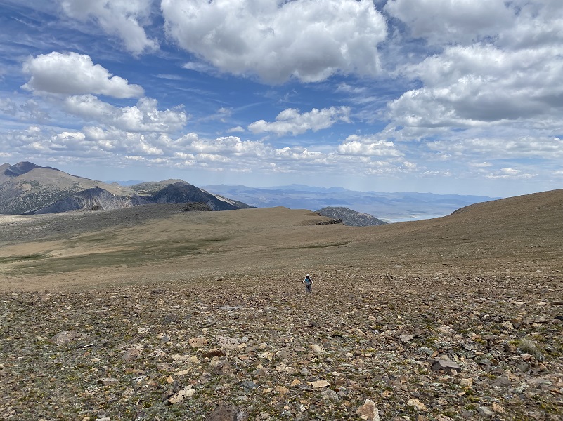
When we made it out of the wash, we followed the trail until it petered out.

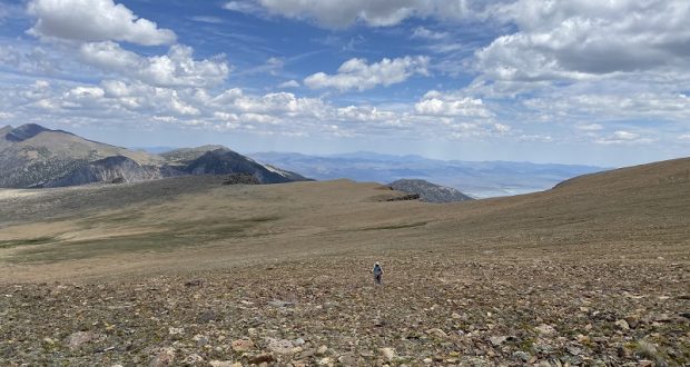
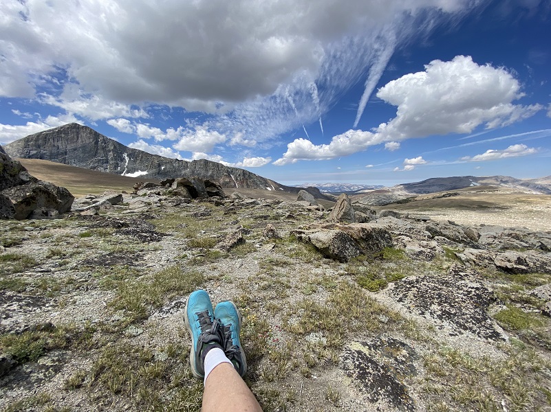
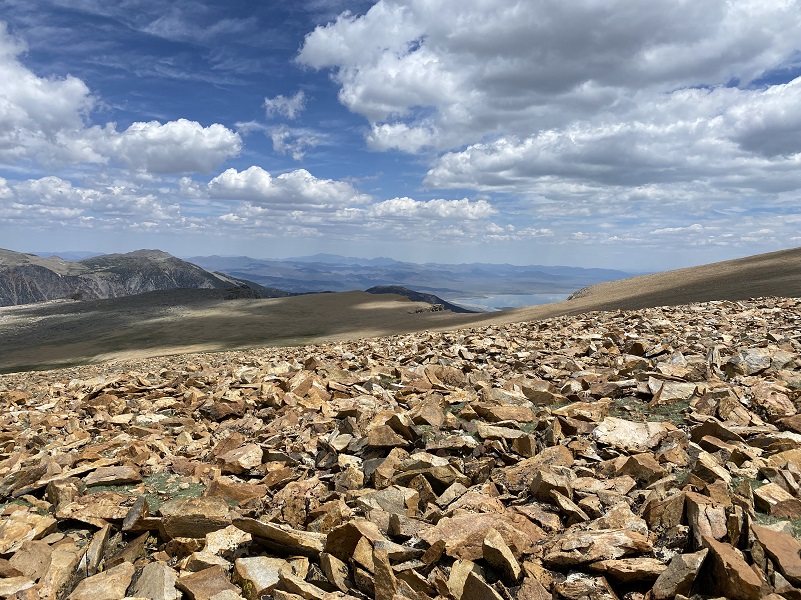
We had reached the plateau portion.
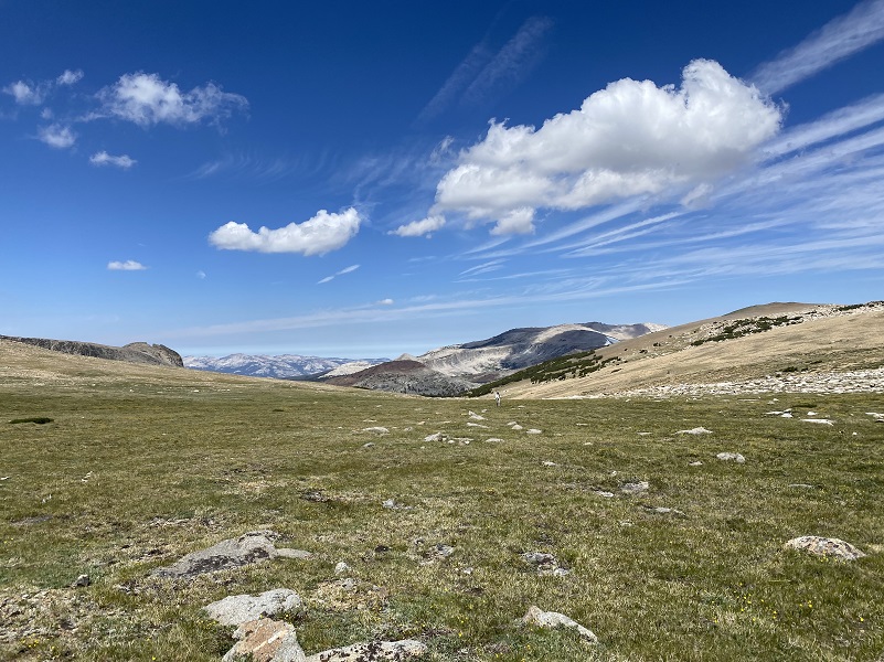
Without a trail to follow, it was easy to spot our destination, a high spot with a view. If you look in the middle of the picture at the tip top, there is a bit of a scraggly higher rocky area and that is it.

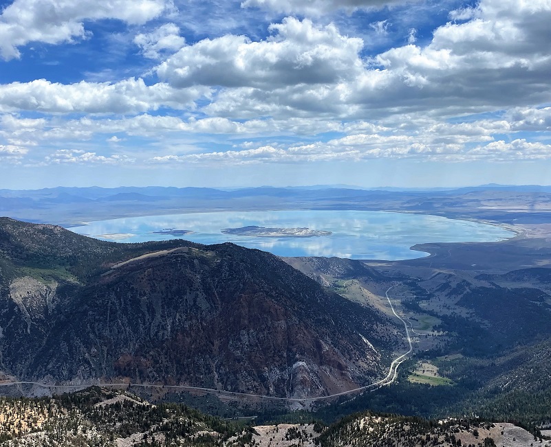
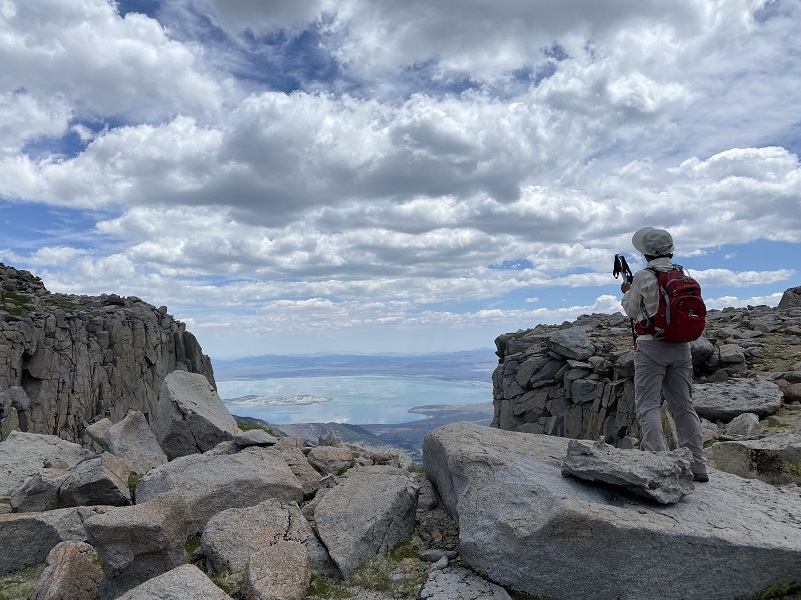
And what a view it is from this spot looking down at Mono Lake!
We had some mighty pretty views all around me though. We looked toward Mt. Dana, which towers over Glacier Canyon at 13,045′ elevation. It is the second highest mountain in Yosemite (after Mount Lyell) and is named after James Dwight Dana, who was a professor of geology at Yale College.
It was hard to beat this lunch spot.
We wandered along the rim for a while, looking at different views of Mono Lake and the area along Hwy 395.
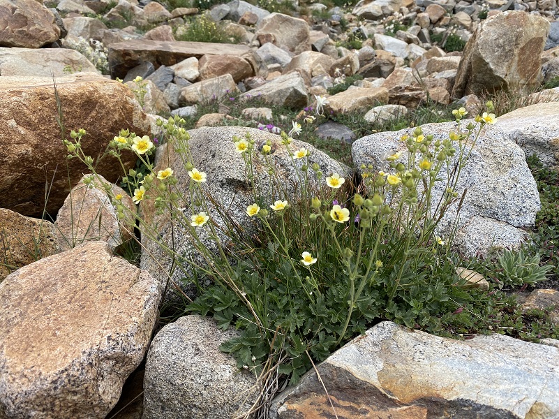
When you look across the Dana Plateau, it looks baron but when I looked closer, there were many tiny plants, many with flowers. They were tucked into small cracks and rocky areas.
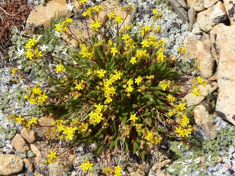
Photo by Gail Gilbert
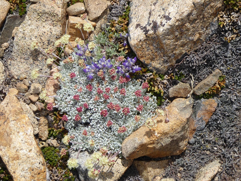
Photo by Gail Gilbert
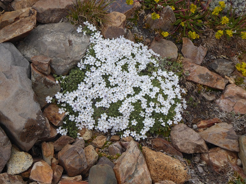
Photo by Gail Gilbert
Then we tried to gain a little elevation circling the plateau. It is farther than it looks, almost a mile across.
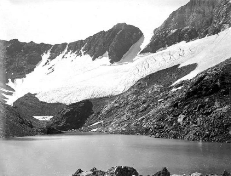
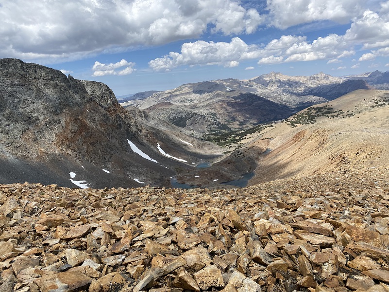
We reached a high point that overlooked the upper Dana Lake, straight across at Mt. Dana and what remains of the Dana Glacier. 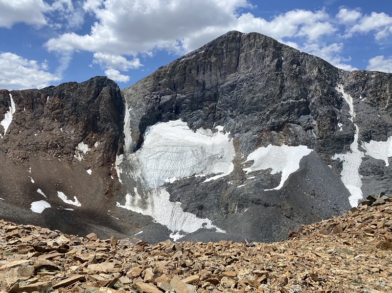
The Dana Glacier has continued to shrink over the years and there is a famous picture taken in 1883 by I. C. Russell that shows how much it has shrunk.
We walked down the ridge and every once in a while a 35 mph gust of wind would hit us. How do I know it was 35 mph you ask? Well, the National Weather Service had forecast the below:
Winds...
Breezy winds today will lead to some recreational impacts later
today with peak gusts to 30-35 mph
It was hold onto your hat, even if it was tied on, time. But those views were mighty pretty.
We could look down to the Dana Lakes, formed when that glacier retreated.
 We continued down until that wind got to be too much, quit the ridge and met up with the trail that led us back down the wash, noticing other flowers that we missed seeing in the morning.
Heading back down the creek, we took some time to take a few more flower pictures. They were so beautiful and how could we not do this?
Shooting Stars (Photo by Gail Gilbert)
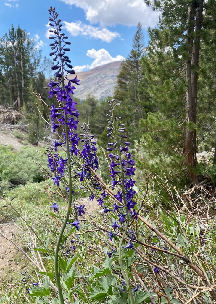
Larkspur
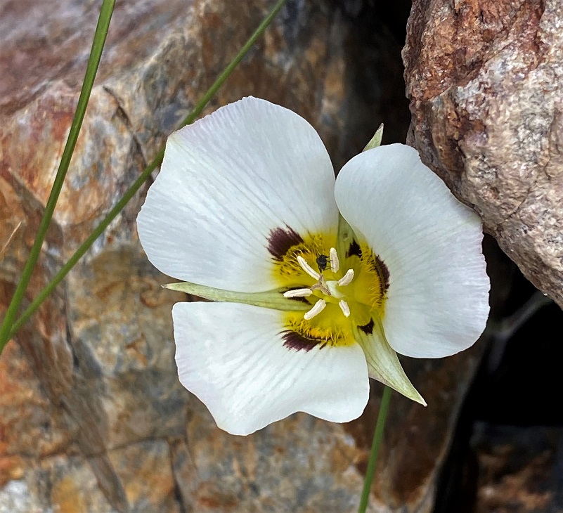
Mariposa Lily
We made it down to Tioga Lake, back to the car and the temperature was about 80 degrees when we reached the Tioga Pass Entrance Gate. I was surprised that there were almost no wait to get back into Yosemite around 2:45 pm and the personnel there inspected my printed pass, Park Pass and ID, filling out a pink slip to replace the white Self Certified Entry slip that I had filled out in the morning. If you aren’t aware, Yosemite National Park has implemented a Temporary Day Use Reservation system. Day Use Entry Passes are validated at the park entrance gate on the reservation date and can be used for 3 days of entry. There are some exceptions but reservations are required to enter Yosemite for day and overnight trips and you get them through Recreation.gov. If you have questions about those exceptions or changes, you can also check out Yosemite’s How will COVID-19 affect my visit?
There was some road construction along the way. We had to wait for about 15 minutes coming and going in Tuolumne Meadows where they were doing some culvert replacing, then Hwy 49 for about 10 minutes.
I don’t want to make this hike seem too easy. Although it is short in length, there is a lot of elevation gain here and it is above 10,000′ elevation. It is important to be acclimated to hiking at this elevation and recognize the symptoms of altitude sickness when doing so. People do die of altitude sickness every year and this is a very real issue that people should be more aware of.
Altitude sickness occurs when you cannot get enough oxygen from the air at high altitudes. This causes symptoms such as a headache, loss of appetite, and trouble sleeping. It happens most often when people who are not used to high altitudes go quickly from lower altitudes to 8000 feet or higher, but it can occur to even a seasoned and conditioned hiker at times.
You can be adversely affected by the higher altitudes because the air is “thinner” at these high altitudes. When you go too high too fast, your body cannot get as much oxygen as it needs. This causes the headache and other symptoms of altitude sickness. As your body gets used to the altitude, the symptoms can go away.
These symptoms can include:
• A headache, usually throbbing, that gets worse during the night and when you wake up.
• Not feeling like eating.
• Feeling sick to your stomach. You may vomit.
• Feeling weak and lazy. In severe cases, you do not have the energy to eat, dress yourself, or do anything.
• Waking up in the night and not sleeping well.
• Feeling dizzy.
Your symptoms may be mild to severe. They may not start until a day after you have been at a high altitude. Some people say that having altitude sickness feels like having a hangover.
Altitude sickness can affect your lungs and your brain. When this happens, symptoms include being confused, not being able to walk straight, feeling faint, and having blue or gray lips or fingernails. When you breathe, you may hear a sound like a paper bag being crumpled. These symptoms mean the conditions are severe enough that they can be deadly.
Usually the best immediate treatment for altitude sickness is to go to a lower altitude. If your symptoms are mild, you may be able to stay at the elevation, take it easy, rest and make sure you keep yourself well hydrated.
If you are going to go on a hike at high altitude, learn about altitude sickness, the symptoms and how to treat it. It is very important that you look out for the other people in your group also. I have only briefly touched the subject of altitude sickness but felt it was important that it was on your radar should you decide to attempt a hike at elevations that are higher than you are used to. Altitude.org is a site where physicians who are knowledgeable about altitude sickness and associated illnesses have collected some information to share with the public. It has cautionary tales, a calculator where you can enter you’re your elevation to determine your percent oxygen that you will be breathing, along with detailed recommendations on the site. I used their calculator for our Dana Plateau hike and it showed that at our summit of 11,640′ elevation, we had 66% of normal oxygen at sea level. It even has a link that you can email them with questions if you have them. You can find them at Altitude Sickness .
Dog Hike?
Probably not. This hike is very steep through boulders and loose soil. For myself, it is difficult enough to climb up this trail without having to hold on to a dog. There are also sheer dropoffs at the top. This would not be a good hike for my dogs and I have never taken them up here for that reason. But you might be able to do the lower portion with your dog along the creek.
Here is some information from Inyo National Forest regarding their dog rules:
Traditionally, National Forests have welcomed dogs. However there are a few rules that apply to assure that you and other National Forest visitors have an enjoyable outdoor recreation experience. If you are camping with your pet, please practice the following:
General rules for dogs within the Inyo National Forest:
Doarama:
What is a Doarama? It is a video playback of the GPS track overlaid on a 3 dimensional interactive map. If you “grab” the map, you can tilt it or spin it and look at it from different viewing angles. With the rabbit and turtle buttons, you can also speed it up, slow it down or pause it.
Map and Profile:
CALTOPO has some free options for mapping and here is a link to my hike this week, which you can view or download: CALTOPO: Hiking to Dana Plateau
Dana Plateau Topographic Map Dana Plateau Profile Sources:
Ansel Adams Wilderness Wikipedia
Blackwell, Laird, Wildflowers of the Sierra Nevada & Central Valley Field Guide, Lone Pine Publisher, 1999
Monkshood Yosemite National Park
Glazner, Allen F. and Stock, Greg M., Geology Underfoot in Yosemite National Park, 2010.
Prior Blogs in the Area:
Hiking From Tioga Lake Up To Dana Plateau June 13, 2020
Hiking Up, Down and Around Dana Plateau July 31, 2019
Hiking up to and around Dana Plateau July 9, 2018
Hiking up the Glacier Canyon Trail to Dana Plateau August 28, 2017
Hiking up to Dana Plateau August 3, 2016