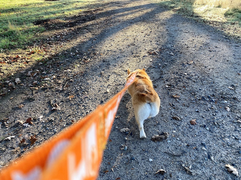
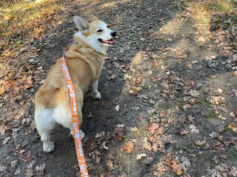
Fannie the Corgi led the way as we took a short fall hike looping our way around the trails and hills at Ahwahnee Hills Regional Park, watching the fog lift and roll onward.
Where: Ahwahnee Hills Regional Park
Distance: 3.40 Miles (more or less, depending on how far you wish to go)
Difficulty: Easy to Moderate
Elevation Range: 2,286’– 2,625′
Elevation Gain: 359′
Date: November 17, 2021
CALTOPO: Ahwahnee Hills Regional Park With Fannie
Dog Hike? Yes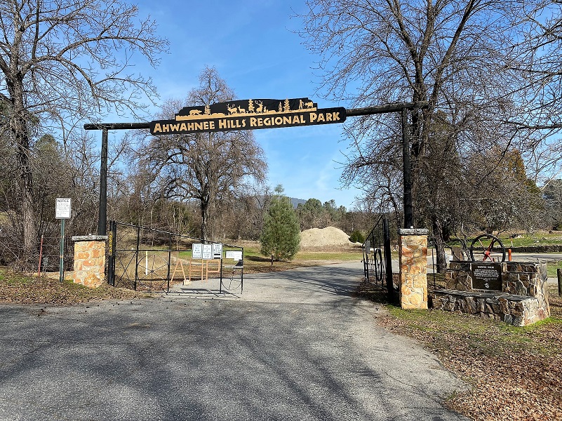
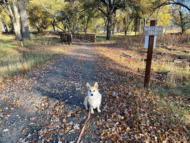
I didn’t have a full day for a hike so Fannie the Corgi and I headed to nearby Ahwahnee Hills Regional Park, off of Hwy 49 adjacent to Wasuma Elementary School in Ahwahnee. It has up to 5 miles of walking or hiking trails, 6 miles of equestrian trails, picnic areas, restrooms, interpretive and study centers on 241 acres. The back section of the park is temporarily closed due to a fire mediation project. The hiking and horse trails will be reopened when that project is completed. The lower portion is currently open to walkers and horses. Dogs are welcome, on leash.
Entrance to the park is free for individuals, but a fee is required to reserve space or conduct events. Their website says that when staffing levels permit, the park will be open daily from 8:00 a.m. until dusk Wednesday through Sunday. In the past, pedestrians could access the park via the Wasuma gate on Mondays and Tuesdays nut there was a sign on that gate this week saying it was closed. I don’t know how long that sign has been there but maybe it had something to do with the parking lot being used for the nearby construction. A park host will be in residence or volunteer docents will be on duty at most times when the park is open to the public. I suggest that you check their website Ahwahnee Hills Regional Park for more specific and up to date information. Directions to the park, along with maps of the trails and rules are located on the website.
The park land is owned by Madera County, but the day-to-day operation, maintenance, and improvements are the responsibility of the Friends of Ahwahnee Hills Regional Park, a non-profit organization formed for this purpose. They have done an amazing job on the trails and park. The Friends is an all-volunteer group and they count on your donation of time or money to help this park going.
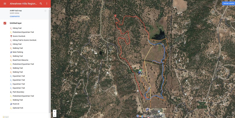
Their website also is full of information on the history of the land that the park is on, along with some wonderful historical pictures. They shared that the name Ahwahnee is an Indian word meaning “deep grassy valley.” They also have a fantastic map of their trails on their website with much more detail than my maps at the end of this blog, plus you can zoom in or out to print as you wish. There are approximately three miles of walking trails, another four miles of hiking trail, and six miles of equestrian trail. About one mile of the walking trails can accommodate wheelchairs. There are two handicapped parking areas designed to provide access to the walking trail. Some of the trails are used by all and some are focused on on a specific type of user. The park has three restrooms: a pit toilet at the ball fields, a pit toilet at the lake, and a flush toilet at the main parking lot with water fountains. All three are handicapped accessible. You can check out their website for rules and more information.
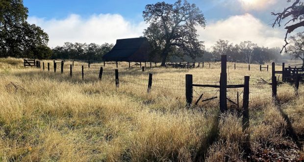
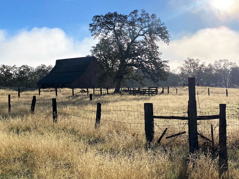
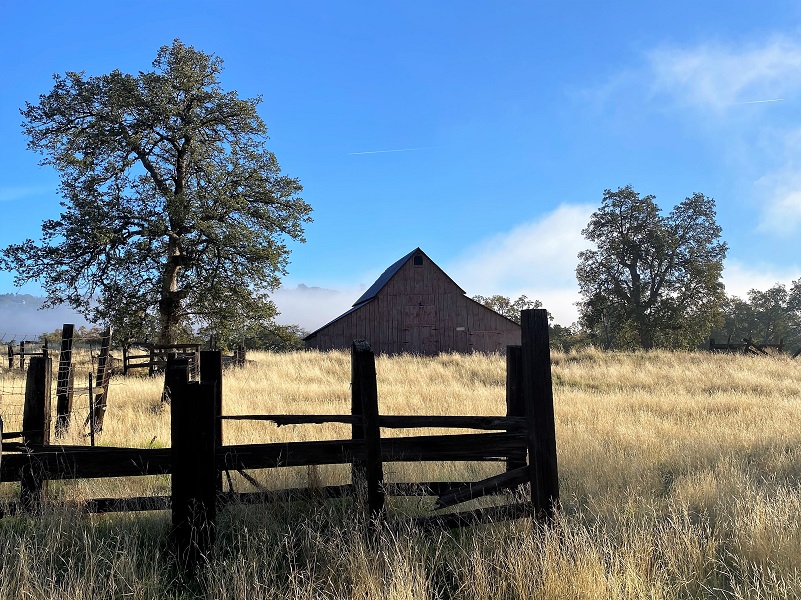
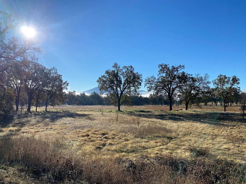
As we started out, the fog was trying to come into the Oakhurst Bowl and I loved the way it played its way around in the morning light.
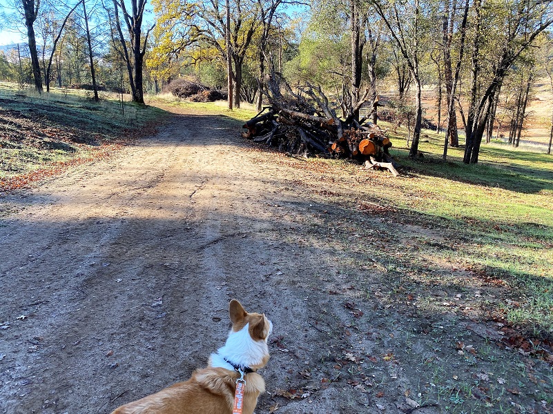
Fannie was happy to lead the way as she moved out, leaving no scent unsmelled. Oh, what wonderful stories dogs must have to tell about what they smell along the way.
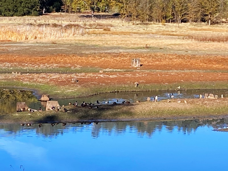
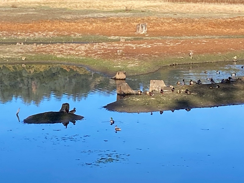
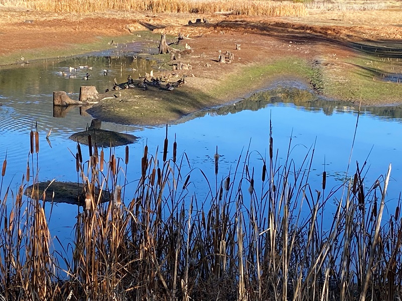
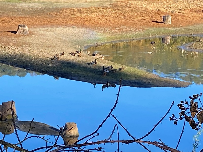
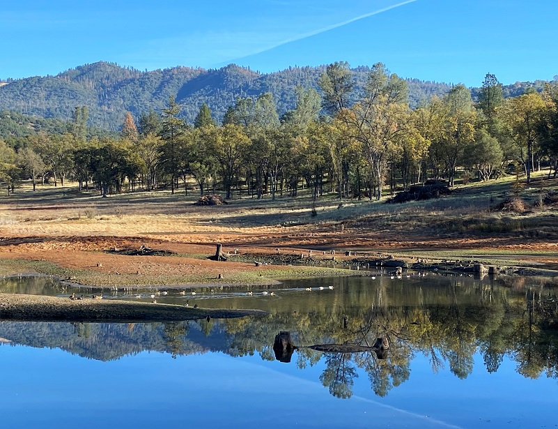
One of my favorite areas in the park is the pond and I was very curious what the level of it would be. It was lower than I would have liked but I was sure happy to see that it had water in it and waterfowl.
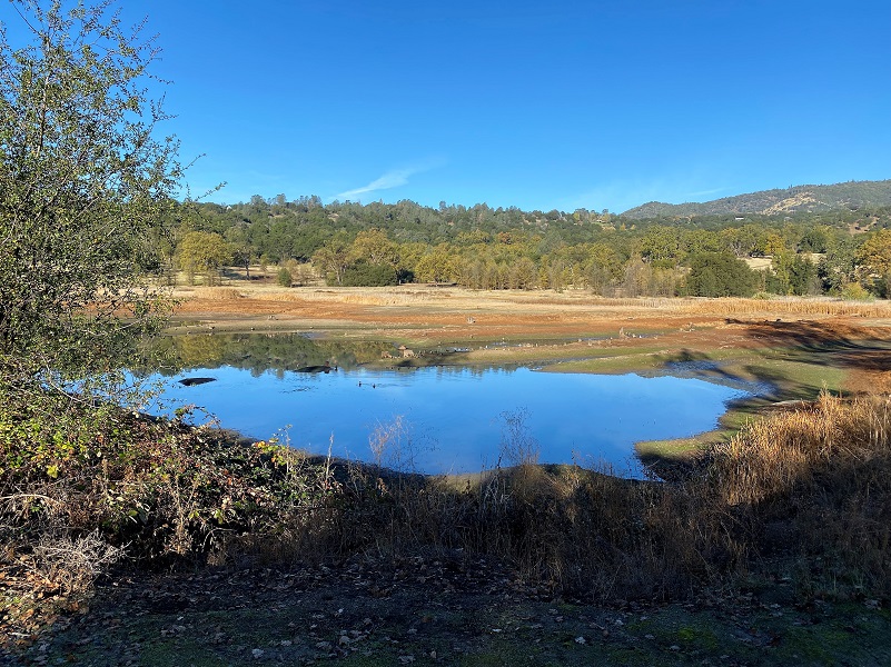
Those waterfowl were basking in the early morning sun on small peninsulas, giving them easy access if they needed to escape.


We continued across the dam, checked out the restrooms then moved up the trails, meandering up and down different ones.
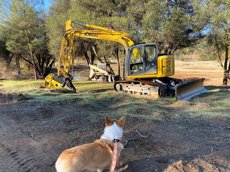
Quite a bit of vegetation treatment had been taking place with slash piled up.
Wildlife loves the park and has been here longer than we have been. We found plenty of fresh bear sign and real signs pointing out that mountain lions had been sighted in the area.
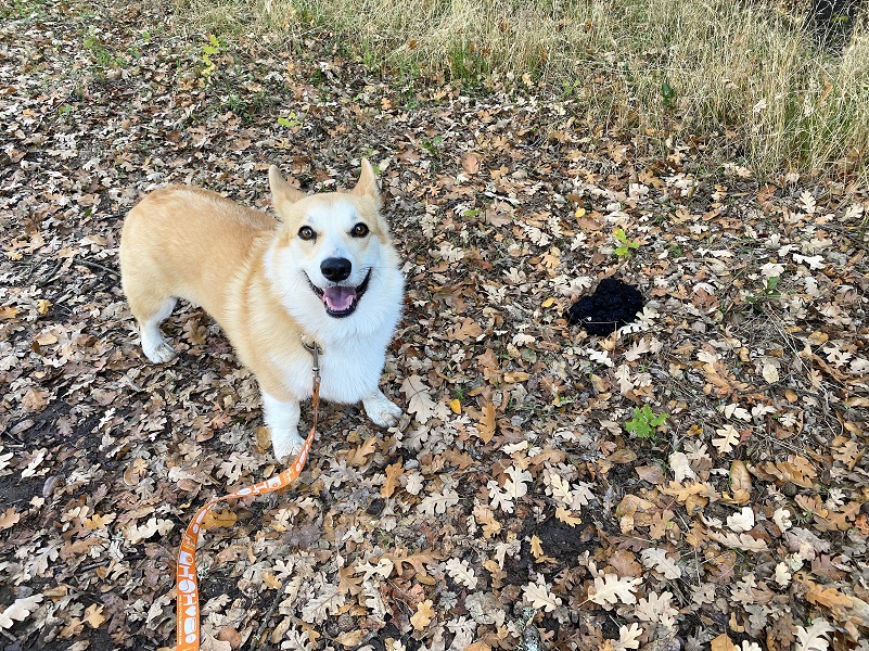
Fannie was happy to move on and past that bear scat.


We headed up to the Viewpoint.
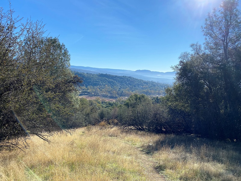
And since Fannie wanted to get her picture of that wonderful view looking across the park and into Oakhurst, how could I say no.

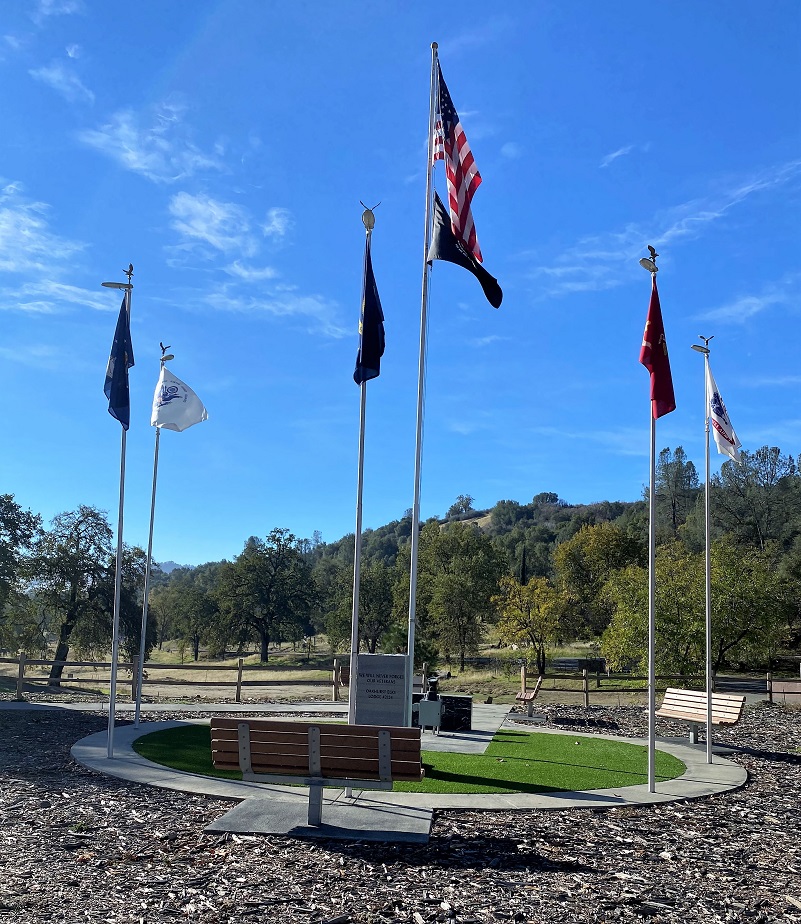
As we came down the homestretch toward the parking lot, we walked by the Veteran’s Memorial. Those flags looked beautiful against the blue sky, slightly waving in the breeze. This Veteran’s Memorial was developed by local groups including the Marine Corps League Griswald Mt. Detachment #1121 and the VFW, with help from Friends of Ahwahnee Regional Park, local Boy Scouts, and members of the Ancient and Honorable Order of E Clampus Vitus, Grub Gulch 41-49. It as completed in 2017. Inside the concrete circle are five flag poles, one for each branch of the Armed Forces: Army, Marine Corps, Navy, Air Force and Coast Guard.

Dog Hike? Yes
All dogs in Madera County are expected to be under control at all times. They must be confined to your property. If you take them off your property, to go for a walk for example, they must be on a leash. Any dog found running at large can be impounded at the County Shelter or returned to its owner with a citation.
Dogs picked up in violation of the leash law may be redeemed at the shelter at 14269 Road 28 in Madera. Dogs brought in without identification are held for three (3) working days. Dogs with ID or known owners are held for ten (10) working days. Dogs unclaimed at the end of the holding period are available for adoption to responsible homes or can be euthanized after this time.
Link to Madera County Dog Ordinance Section 6.04.520 and Forward
Doarama:
What is a Doarama? It is a video playback of the GPS track overlaid on a 3 dimensional interactive map. If you “grab” the map, you can tilt it or spin it and look at it from different viewing angles. With the rabbit and turtle buttons, you can also speed it up, slow it down or pause it.
Ahwahnee Hills Regional Park Hike Doarama
Map and Profile:
CALTOPO has some free options for mapping and here is a link to my hike this week: CALTOPO: Ahwahnee Hills Regional Park With Fannie
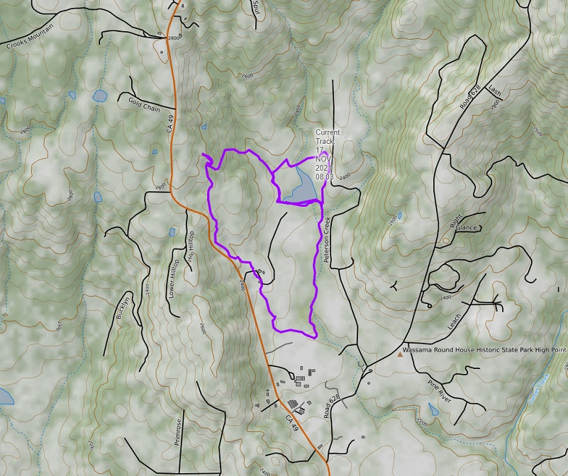
Ahwahnee Hills Regional Park Hike With Fannie Topographic Map
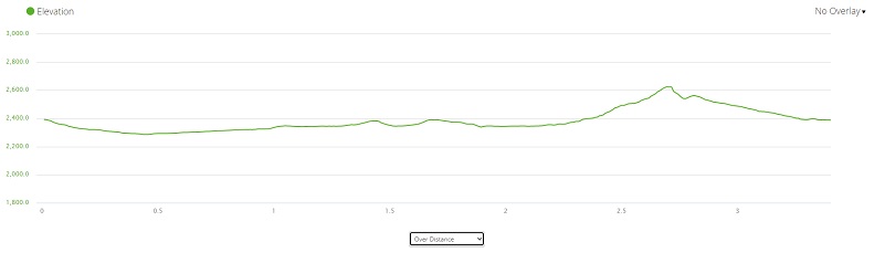
Ahwahnee Hills Regional Park Hike With Fannie Profile
Ahwahnee Hills Regional Park (Courtesy their Home Page)
Sources:
Ahwahnee Hills Regional Park Home Page
Ahwahnee Tavern E. Clampus Vitus
The Last of the California Rangers (1928) by Jill L. Cossley-Batt
Madera Tribune, Number 136, September 21, 1954
Madera County Dog Zone Sections 6.04.520 and Forward
Prior Blogs in the Area:
Hiking in Ahwahnee Hills Regional Park Jamuary 31, 2021


