Can you picture a wildflower-lined trail leading you by small reflective tarns, beautiful lakes and wildly colorful mountains? That was my adventure with Fannie the Corgi, along with some snow-playing, fishing, rain and rumblings of thunder.
Where: Inyo National Forest, Hoover Wilderness
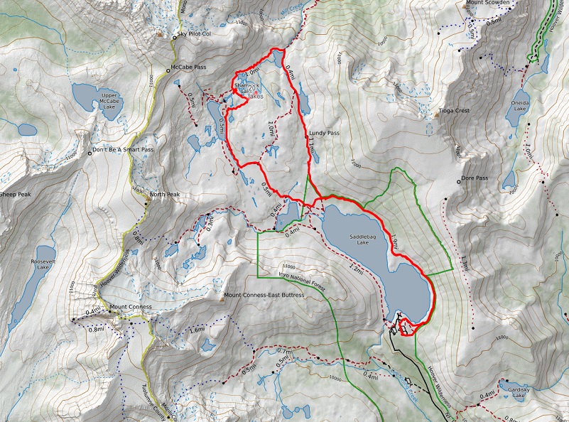
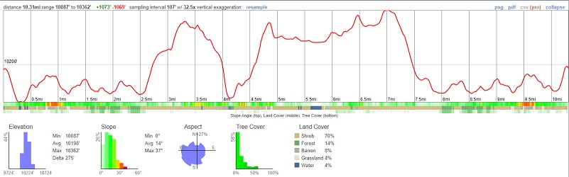
Distance: 10.3 Miles
Difficulty: Moderate
Elevation Range: 10,090′ – 10,359′
Elevation Gain: 1,100′
Date: July 18, 2022
CALTOPO: Hiking 20 Lakes Loop with Fannie
Dog Hike? Yes
Fannie the Corgi and I just returned from a few days of camping at the Saddlebag Lake area, giving me the opportunity to have several adventures without driving through Tuolumne Valley’s road construction each day. I am sure that you all know by now that it is one of my favorite summer hangouts.
Sally the Weimaraner didn’t go on this trip because she has some arthritis in her back that limits her hiking and I wanted to do a little more mileage on this trip than she could handle. If you were to ask her, she would say she would have been good to go though. She had her own fun adventures, staying at Mysham Training and Boarding, my go-to place for boarding my dogs when that is needed.
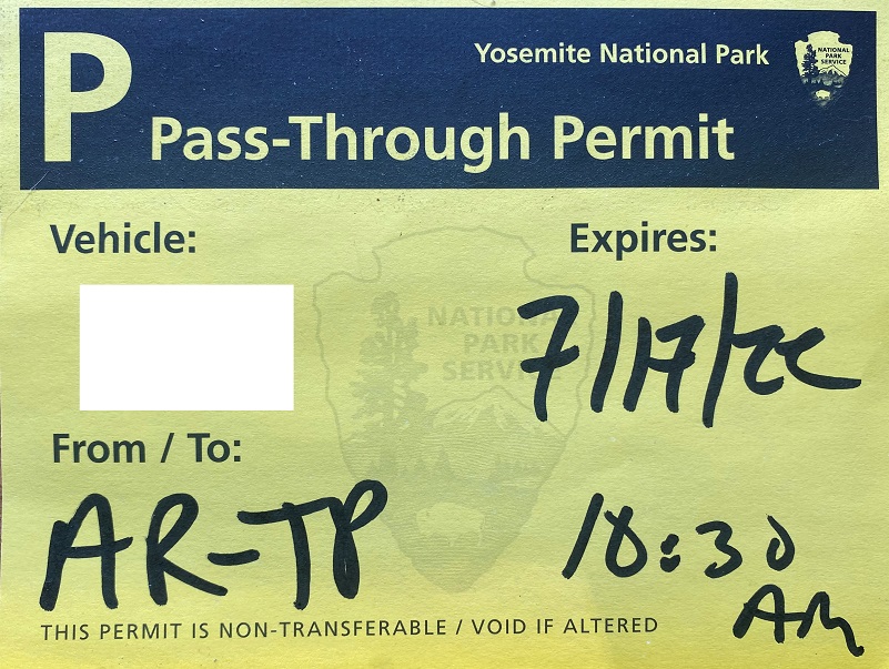 I didn’t have a Peak Hour Reservation Pass, but utilized the Local Pass-Through Permit. When I drove through Yosemite National Park’s Arch Rock Entrance Station, I showed them my California Driver’s License that showed my local address and they asked me which Entrance Station I planned on exiting. Instead of the printed Local Pass-Through Permit they gave me the last time I had gone through utilizing this process, they wrote out the information on a yellow slip that I stuck to my left lower windshield.
To get to Saddlebag Lake, I exited the east entrance to Yosemite National Park at Tioga Pass, then drove east on Hwy 120 about 2 miles to Saddlebag Road. Heading up the mostly dirt road to Saddlebag Lake, I stayed at the Saddlebag Lake Campground in the Inyo National Forest above the resort. If you are daytripping it, there is parking at the resort or the adjacent backpacker parking lot. This area where we stayed and hiked actually used to be within Yosemite National Park boundaries from 1890 to 1905 but is now under the jurisdiction of the Inyo National Forest.
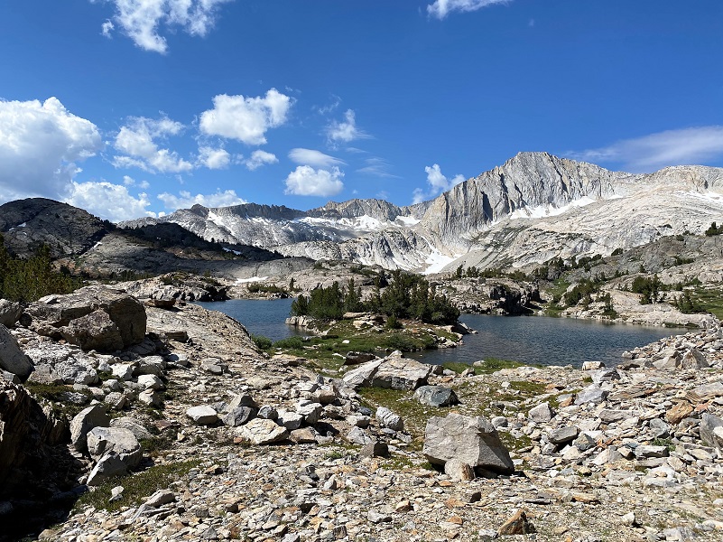
The first adventure was hiking a looped trail around several high lakes. I don’t always stick to the trail in this area but I mostly did this time. If you feel comfortable going off trail, those are also several pretty lakes in the center of the loop that you can head cross country to see such as Z and Twin Lakes, along with many small tarns. Or you can head up to Cascade Lake to the west of Steelhead Lake to see small lakes nestled in the granite.
There is a trail that goes around the lake called the Saddlebag Lake Trail and you can start from either side of the lake to head to the trail that leads you to the 20 Lakes Basin. You can also take the water taxi that is operated by Saddlebag Lake Resort when it is running. But it is not running this year. More about that at the end of the blog.
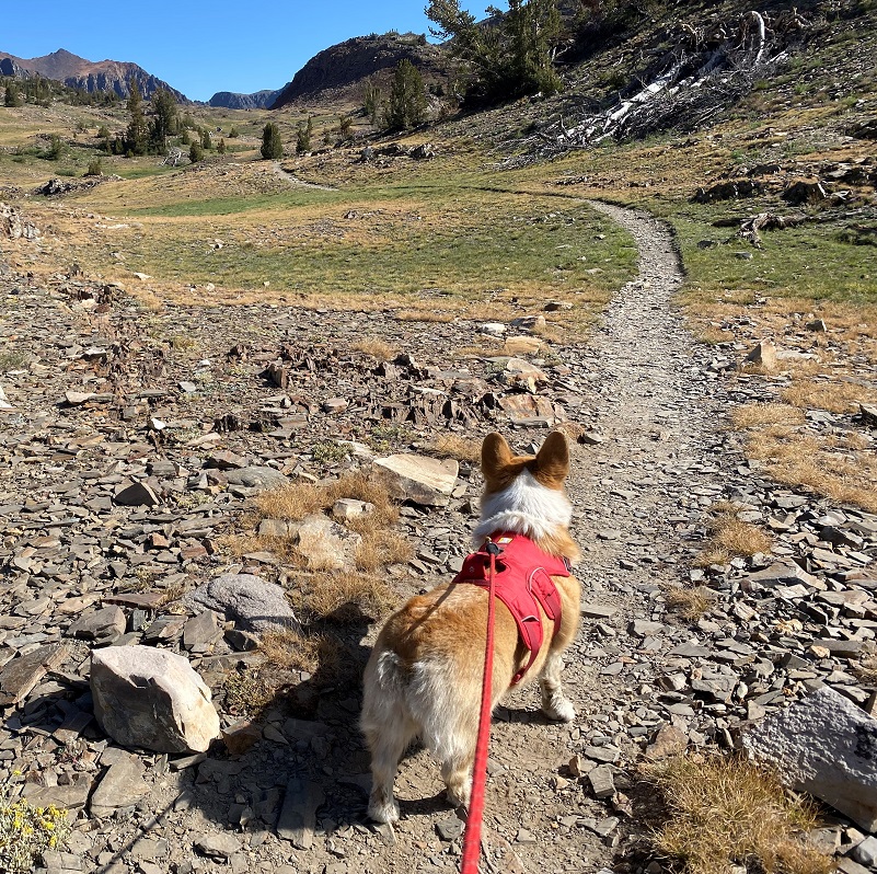
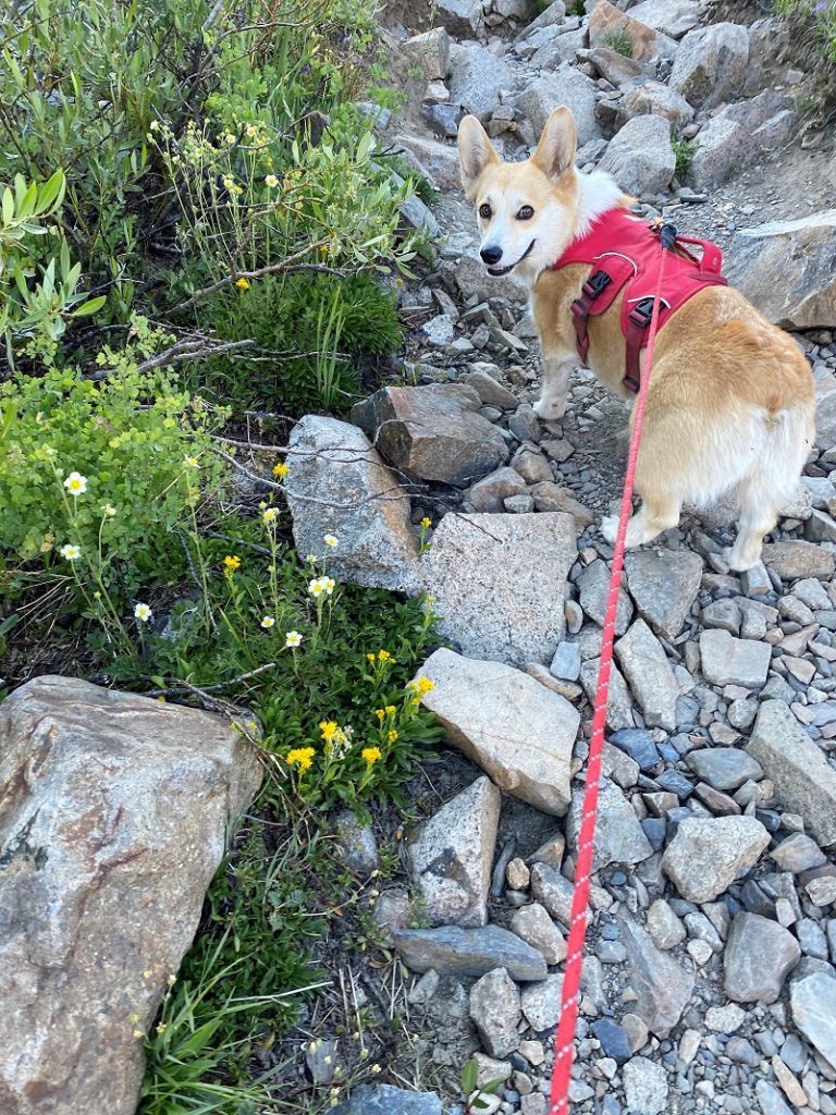 Fannie’s fashionable hiking outfit includes wearing a harness with a handle on it, making it easy for me to lift her over big things along the trail. Another thing that I pay attention to are the rocks in this area, which are brutal on paw pads, rubbing them down like sandpaper and sometimes slicing them like a razor blade. This is just one of the reason that I kept Fannie on leash at the beginning, didn’t want her to waste energy running around or to risk an injury on her paw pads early in the hike. And speaking of fashion, I carry her boots just in case a paw injury occurs.
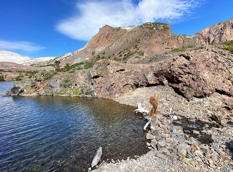
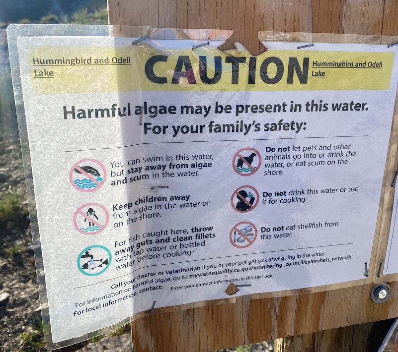 We started our hike on the east side of the lake and noticed a sign warning about possible harmful algae in a couple of lakes along our route. To be on the safe side, I kept Fannie out of these lakes and the tarns that weren’t flowing.
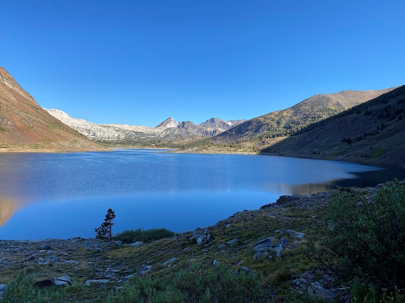
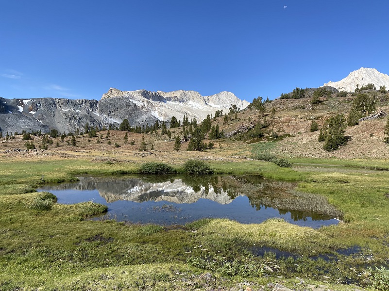
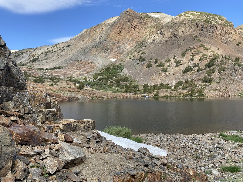
A light breeze didn’t provide reflections in Saddlebag Lake and notice that there is not a cloud in the sky. That would soon change. Here is a little information about Saddlebag Lake: Saddlebag Dam (10,090′ elevation) was built in 1921 to enlarge an existing alpine lake for hydropower generation purposes. The dam was raised and a spillway was added in 1925. The reservoir is oversized compared to the volume of water produced in its watershed and the agreement between Southern California Edison (SCE) and the Los Angeles Department of Water & Power (DWP) requires it to be very low every spring. The water from Saddlebag Lake is used to generate power in Lee Vining and the water then flows to Mono Lake or it is diverted to the L.A. Aqueduct System
Here is what Yosemite Place Names says about how the name originated:
Undoubtedly named for its shape–two partly rounded ends with a narrowing in the middle–at the time of the mining activity in the early 1880s. The name “Saddlebags Lake” was used in the Homer Mining Index as early as January 28, 1882. On the 1895 GLO plat (surveyed in 1883), the lake was called “Lee Vining Lake,” since it is at the head of Lee Vining Creek. The first two editions of Mt. Lyell 30′ map, 1901 and 1905, called it “Saddleback Lake.” It was changed to “Saddlebag Lake” beginning with the edition of 1910.
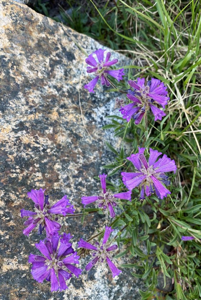
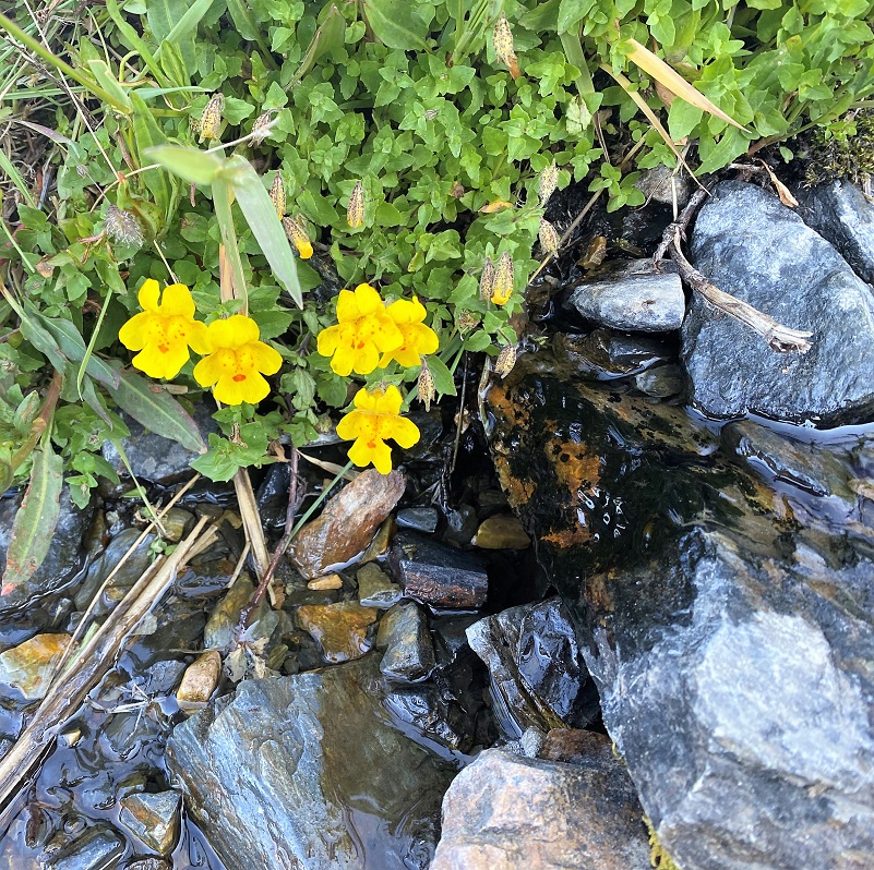
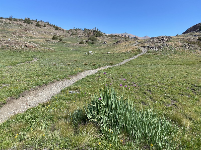
Beautiful wildflowers lined the trail.

Pennyroyal

Wild Onion
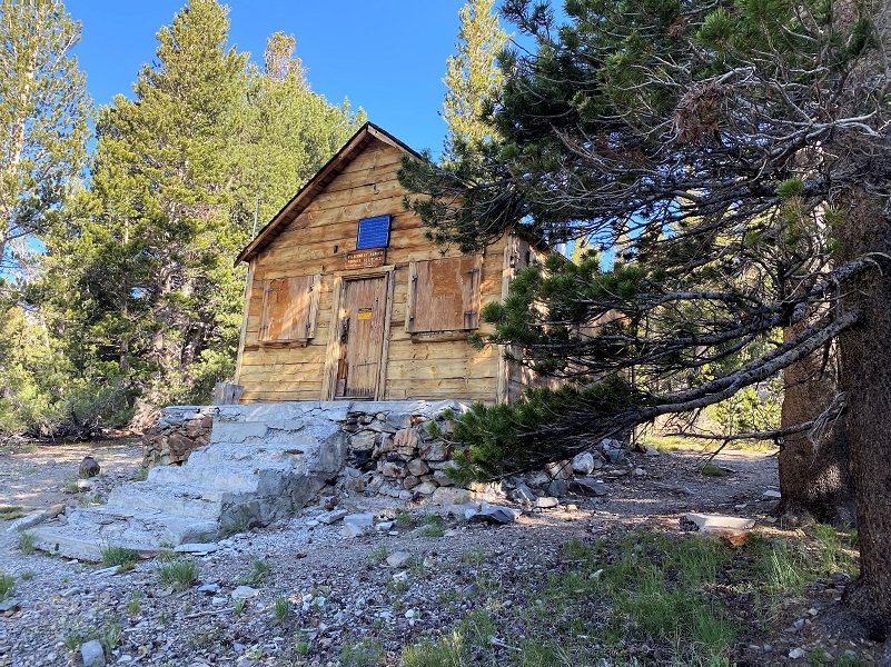
After we made it to the north side of the lake past the Ranger’s Cabin, we entered Hoover Wilderness.
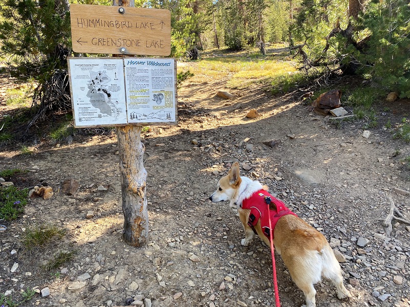
The trail then forked and we headed toward Hummingbird Lake. It wasn’t long before we could spot the high point of Lundy Pass (10,393′ elevation).
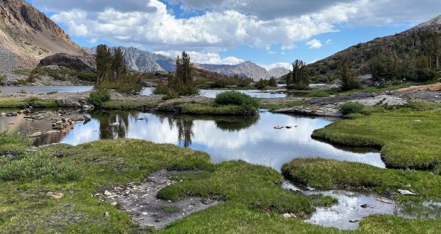
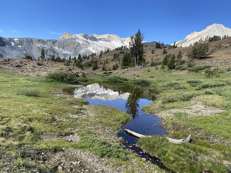
Those small tarns were sure pretty with their reflections.
Then a small squirrel ran right in front of us and hunkered down in some rocks, not 2 feet away from us. I am sure that it thought that we couldn’t see if and it did blend in very well with the rocks.
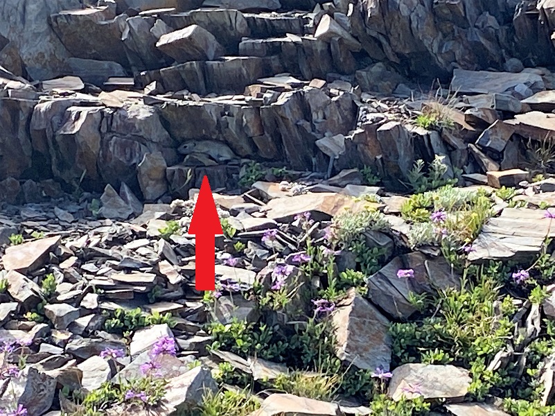
After taking pictures, we moved on to not disturb it further, past another pretty tarn with reflections.
A short spur trail leads to Hummingbird Lake (10,255′ elevation) which we could see from the main trail but we didn’t wander over there. From Yosemite Place Names: Named in 1932 by Al Gardisky because at one time he saw many hummingbirds there.
In case you were wondering who Albert James Gardisky was, he built a cabin east of Tioga Pass in 1919, adding a store in 1920, calling it Camp Tioga. Today those facilities now are part of the Tioga Pass Resort. What else could I discover about him? Well, he was living in Mono County when he filled out his WWI Draft Registration, he was born November 1, 1880. He had a medium build, tall, black hair and had brown eyes. He listed a relative by the name of Joseph Reis. From Census and California Voter Registration, he was born in New York and his parents were born in Germany. Through his years, it appears that he worked at several different occupations that included logger, miner, trapper and resort owner. The California Death Index shows that he died April 3, 1941 Alameda County but I wasn’t able to locate his grave. Rumors after his death circled that he had money or gold buried somewhere nearby but as far as I know, none was ever found.
Notice those small white clouds?
And the trail led us onward.
Odell Lake (10,263′ elevation) was the next lake along the trail. Yosemite Place Names shares that Al Gardisky named the lake in 1932 for a friend.
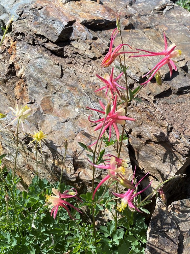
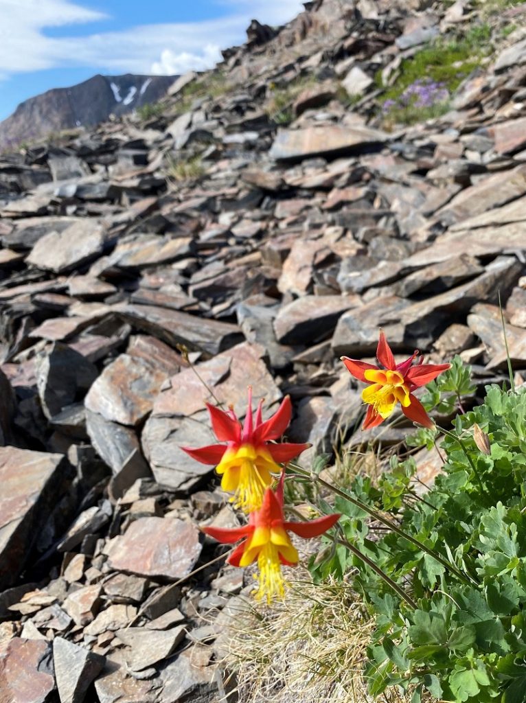
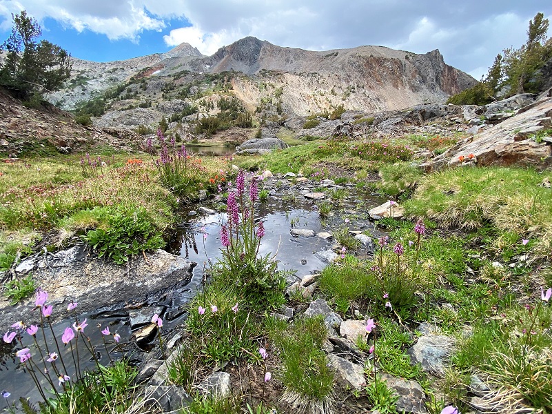
But before we reached that lake, I checked out the colorful columbines nestled in the rocks along the trail.

ODell Lake was very pretty with a bit of snow still handing on the north shore.

And more beautiful wildflowers!
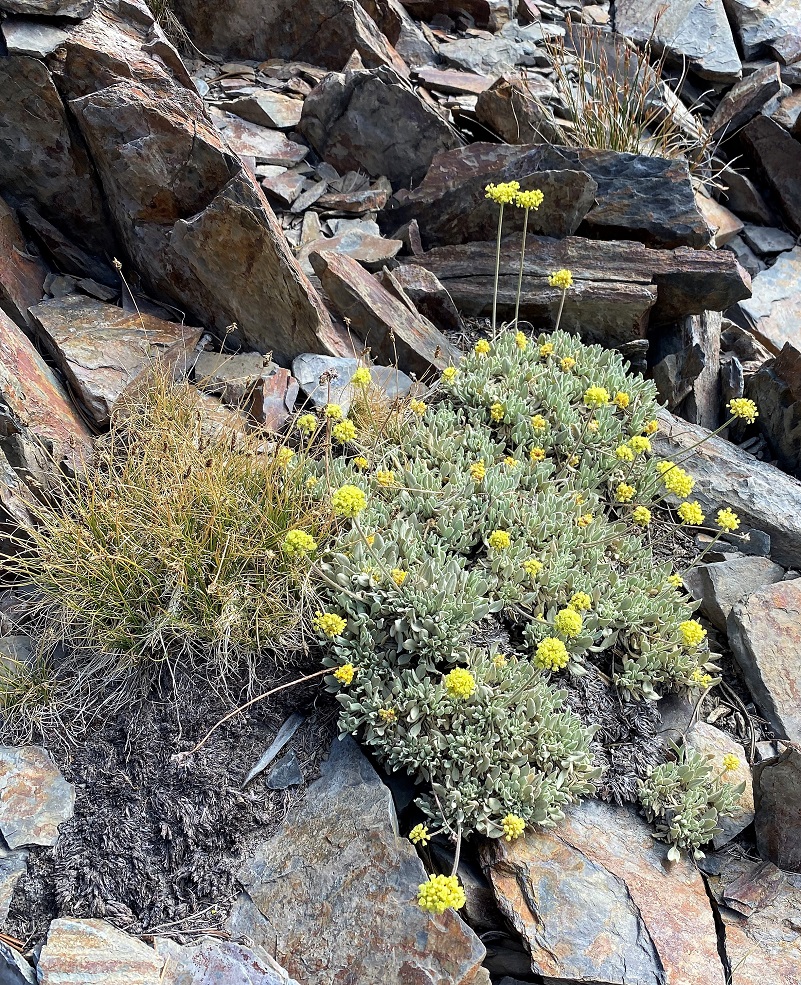
Buckwheat
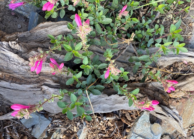
Mountain Pride
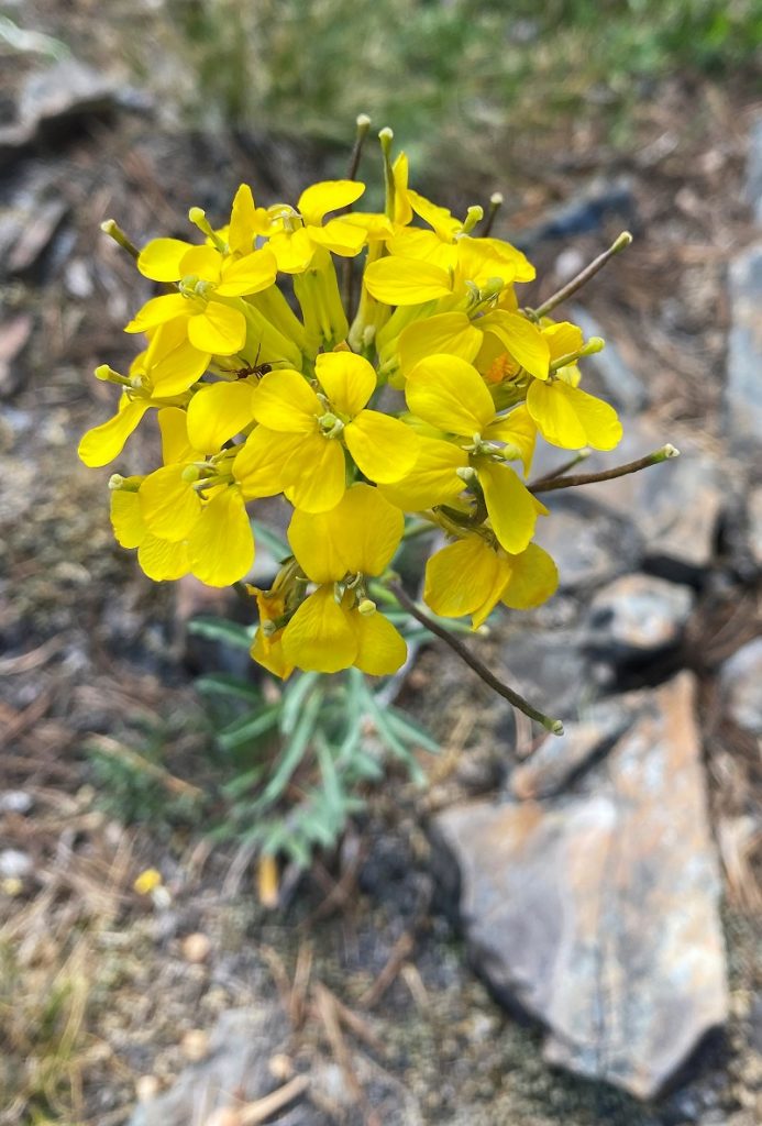
Wallflower

Little Elephant Heads
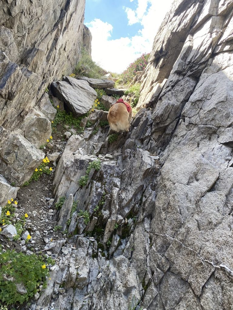
The trail headed down a rocky chute to Lake Helen (10,263′ elevation). From Yosemite Place Names, named in 1932 by Al Gardisky for a “lady friend.”
It was too much to walk down the wobbly rocky trail with Fannie, so she was off leash to find her own way down the trail.


Just before we reached Lake Helen, there were more of those crazy colored columbines were tucked in the rocks.


Crossing the outlet from Lake Helen, we were able to walk across with the help of some rocks that worked like stepping stones. After getting over that creek, there is a wall of rock to get up or around. This wall was way too high for Fannie’s short little legs to get her to the top so I picked her up, lifting her up as high as I could on that rock wall, then I climbed up to meet her. It worked!
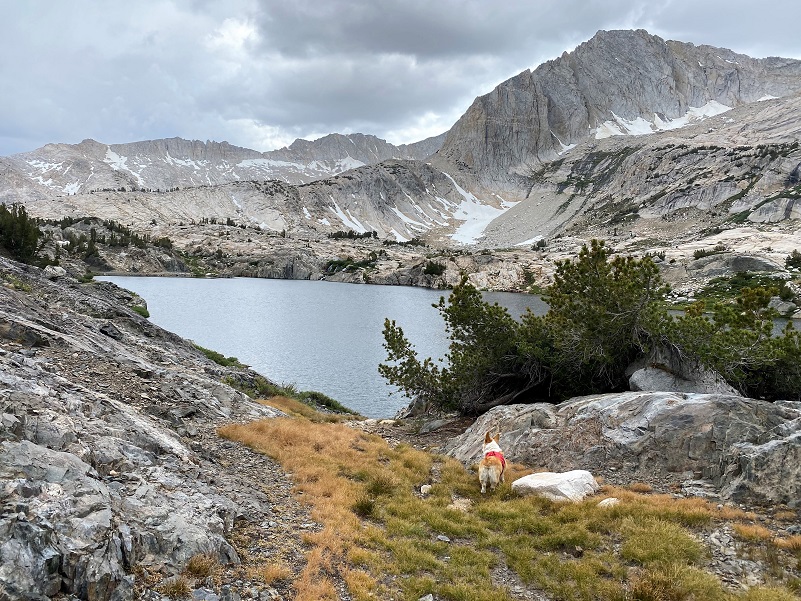
A few more clouds were building as I glanced back at where we had come down.
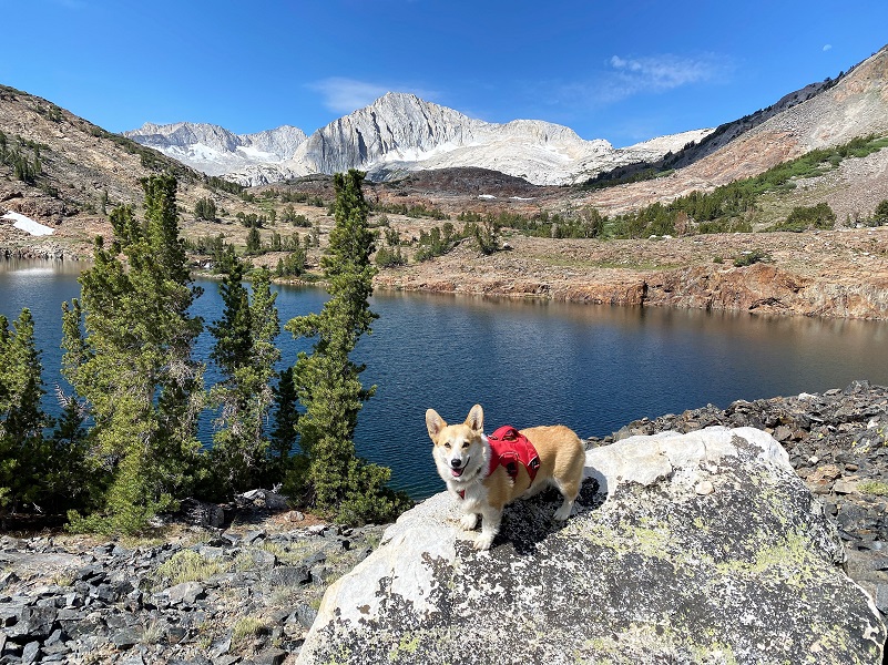
I could tell that Fannie would like to have her picture taken with the amazing background of North Peak and Mount Conness. I said “cheese” and she was happy to smile for the camera.
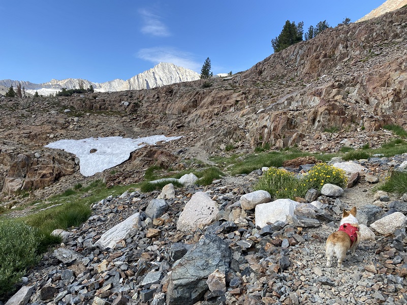
The trail led us around the north side of the lake and Fannie had a chance to play in some snow.

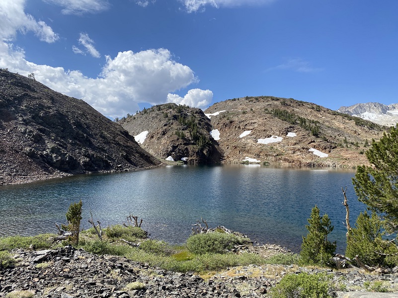
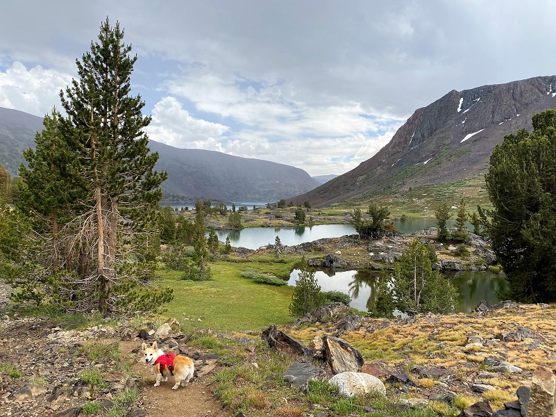
As the trail led us over the top of the hill, we soon had a view of Shamrock Lake (10,266′ elevation). From Yosemite Place Names: On the map the lake appears o have three lobes-like a shamrock. It was probably named by the USGS during the 1905-9 survey for the Bridgeport 30′ map; it is on the first edition, 1911.
We worked our way around tarns, across small streams and snowbanks to my secret fishing spot.

But it was all good because Fannie found more snow to play in.
A few more clouds were filling the sky but they still looked “friendly” as we reached my secret fishing spot.
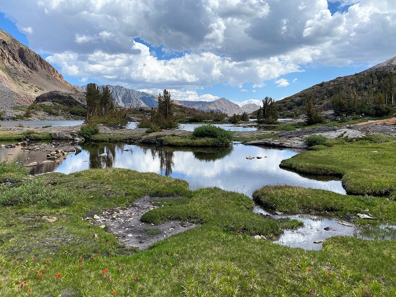
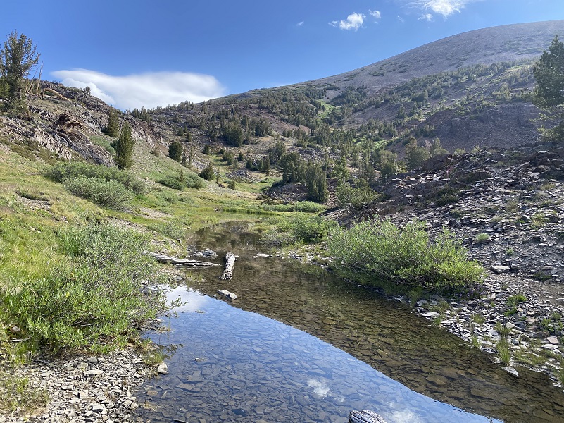
We took a lunch break and I fished. And then it startled sprinkling. I had been keeping an eye toward the south where those pretty white puffy clouds had been coming from and I could see darker clouds heading my way. So, I packed up my fish and fishing gear, deciding it was time to head back to the campground. I took a shortcut back to the main trail, winding our way through pretty little tarns lined with flowers.
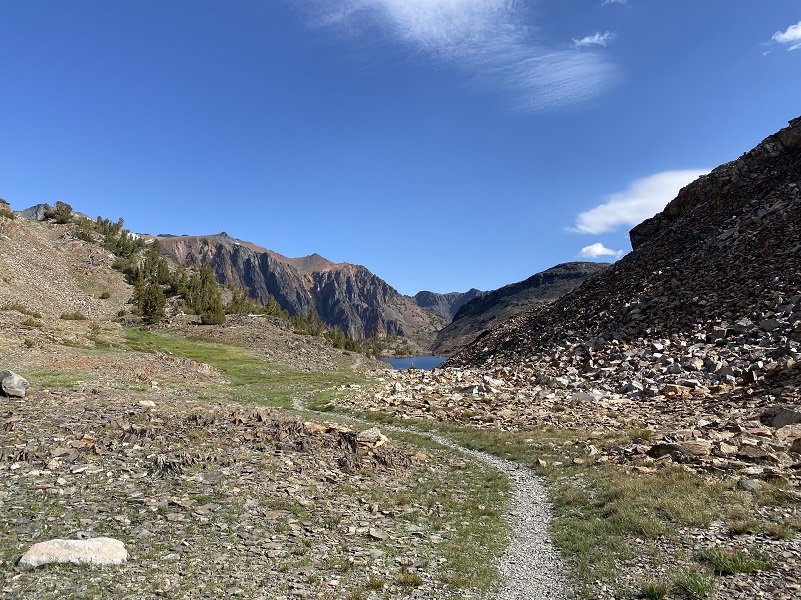
When we reached Steelhead Lake (10,279′ elevation), we then followed the old mining road from the Hess Mine which is the trail back to the intersection of the trail that I had headed up in the morning.

After we reached Wasco Lakes (10,322′ elevation), I noticed a small tarn by the trail that was full of reflectiosn and light raindrops.
I pushed the pace on the way back, hoping to beat the rain before it got heavier. I was also hearing some distant rumblings of thunder.

It sprinkled most of the way back but once I got back to our campsite, it started pouring. Not to worry because we were nice and dry and could just relax and listen to the far away thunder and rain on the roof.
We took several breaks during the hike, many near running streams. I checked Fannie’s feet a few times through the day and they were fine. No bad wear and no cuts, so that is great. Fannie was pretty pooped when we got back to our campsite and we took it easy the next day. I don’t like to hike the dogs up in this rocky country for 2 days in a row. Fannie had already hiked up here this year and just like people, they need to condition to get in shape at this altitude.
The Saddlebag Lake Resort (SLR) has operated a water taxi in prior years but it is not up and running this year. They also own the Tioga Pass Resort (TPR). Here is what SLR posted June 19th on their Facebook Page related to operations this year:
Dog Hike?
That rocky country can be tough on a dogs feet and I brought Fannie’s boots with me but she didn’t need them. Her hiking boots are made by Ruffwear and I have forgotten what model she has, but they have several types. If I am hiking with my dogs and don’t have their boots on, I still carry them in case they have a paw injury. Even if you think your dog’s feet are toughened up enough for this hike, you can have surprises so please be prepared. Fannie hiked for 3 days on this trip.
I also carry a small first aid kit for my dogs in my pack and a dog trauma kit in my car. I bring energy bars for the dogs. They are expending a tremendous amount of her reserve energy in her travels. I am not talking about dog treats but something that will replenish the important nutrients that your dog needs to maintain the high level of energy output on a hike.
This is a good hike for my dogs. There aren’t any rattlesnakes or poison oak and there is plenty of good, fresh drinking water for her all along the way but the creeks that she drank out of looked like they would soon dry up. My dogs have never had any problems drinking the water out of these higher elevations but some dogs may not be as easy as them on this issue. There have been recent algae blooms in lower elevation waters and the notice was up for some in this area. I would use extra caution and not take chances with your dog drinking water out of any sources that you are not sure of. You can check status of California Lakes at this Harmful Algal Blooms site where voluntary reporting is captured but there have been little reporting in the area of this blog. You can read more in this Sierra News Online article. Even if harmful algal blooms are not an issue, I think you need to know your dog and you may need to carry some water for them. This area also has bubonic plague and if you dog gets a hold of a critter such as a squirrel or mouse, this could be something to watch for after a trip in this area.
Here is some information from Inyo National Forest regarding their dog rules:
Traditionally, National Forests have welcomed dogs. However there are a few rules that apply to assure that you and other National Forest visitors have an enjoyable outdoor recreation experience. If you are camping with your pet, please practice the following:
- Leave vicious or unusually noisy dogs at home.
- During the day keep your dog on a leash no more than 6 feet long, or otherwise restrict its freedom to roam at will.
- At night keep your dogs and other pets inside an enclosed vehicle or in a tent.
- Developed campgrounds are for people, not animals. Please do not bring more than two dogs or other pet to any one campsite.
General rules for dogs within the Inyo National Forest:
- Dogs are allowed for trips staying in the National Forest. Pet food must be stored the same as required for your food.
- Dogs are prohibited, as are any other pets, on trips visiting the wilderness of Yosemite, Sequoia and Kings Canyon National Parks.
- Pets need to be on leash or under verbal command. Do not allow pets to chase or harass wildlife.
Doarama:
What is a Doarama? It is a video playback of the GPS track overlaid on a 3 dimensional interactive map. If you “grab” the map, you can tilt it or spin it and look at it from different viewing angles. With the rabbit and turtle buttons, you can also speed it up, slow it down or pause it.
20 Lakes Loop Hike With Fannie Doarama
Map and Profile:
CALTOPO has some free options for mapping and here is a link to my hike this week, which you can view or download: CALTOPO: Hiking 20 Lakes Loop with Fannie
Hiking 20 Lakes Loop With Fannie Topographic Map Hiking 20 Lakes Loop With Fannie Profile Sources:
Saddlebag Campground Inyo National Forest
Browning, Peter, Yosemite Place Names, Great West Books, Lafayette, CA, 1988
Saddlebag Lake Trail Inyo National Forest
Inyo National Forest Policies and Rules
Inyo National Forest Hiking and Camping with Dogs
Prior Blogs in the Area:
Hiking 20 Lakes Loop with Sally & Fannie July 23, 2021
Hiking 20 Lakes Loop with Sally August 6, 2019
Camping & Fishing With Sally in Tioga Pass July 15, 2019
Camping and Fishing with Sally at Saddlebag Lake and Beyond June 26, 2018
Camping and Fishing with Sally at Saddlebag Lake August 7, 2017
Hiking with Sally from Saddlebag Lake through Twenty Lakes Basin August 15, 2017
Hiking with Sally in the 20 Lakes Basin July 12, 2016
Hiking with Sally up to the Hess Mine in the Tioga Pass Area October 26 2016
Hiking with Sally on the 20 Lakes Basin Loop August 22, 2013