FISH CAMP – The Railroad Fire continues its push to the north and east, but firefighters are expected to get a bit of relief from the triple digit temperatures today.
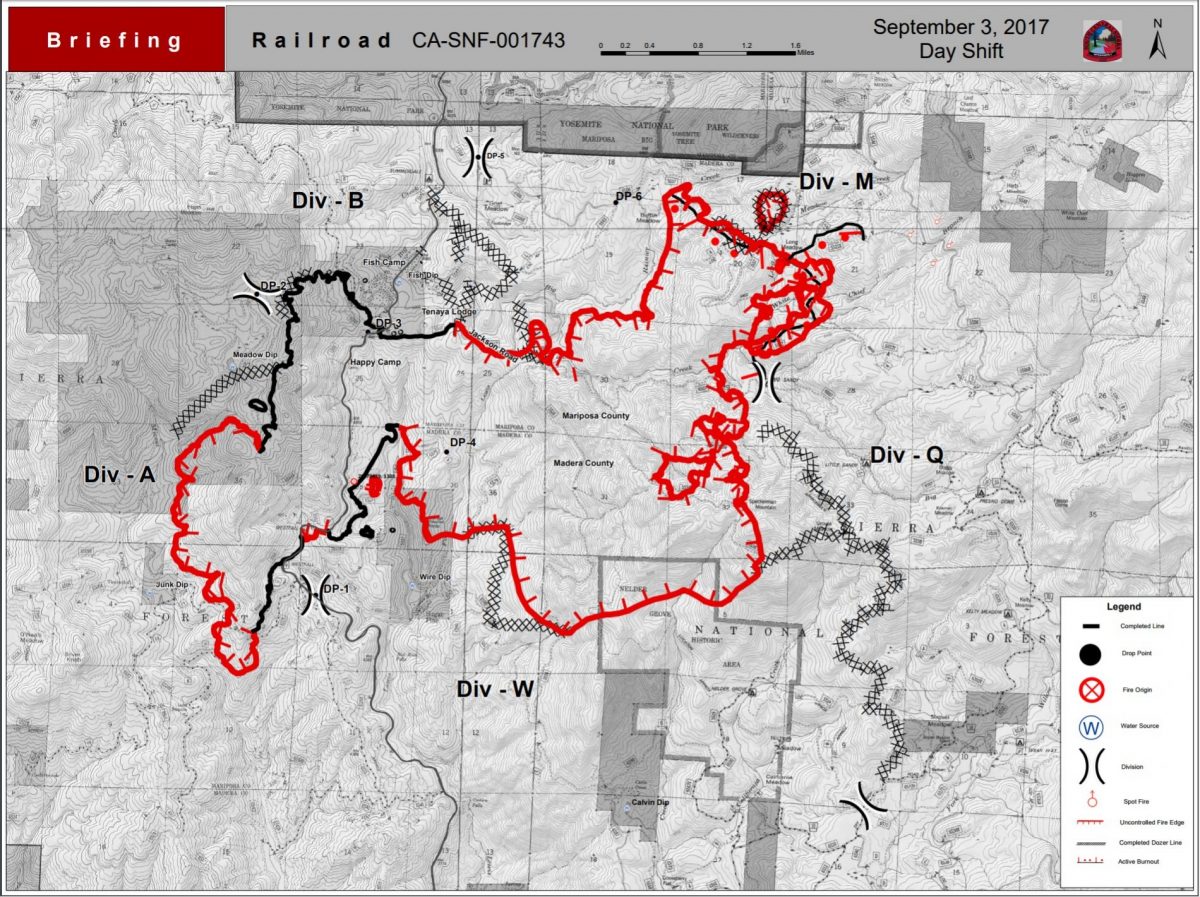
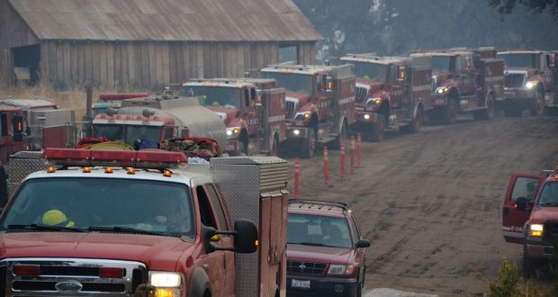
The fire grew by less than 400 acres in the past 24 hours, and is now estimated at 5,800 acres with 15 percent containment. There are currently 823 personnel assigned to the incident.
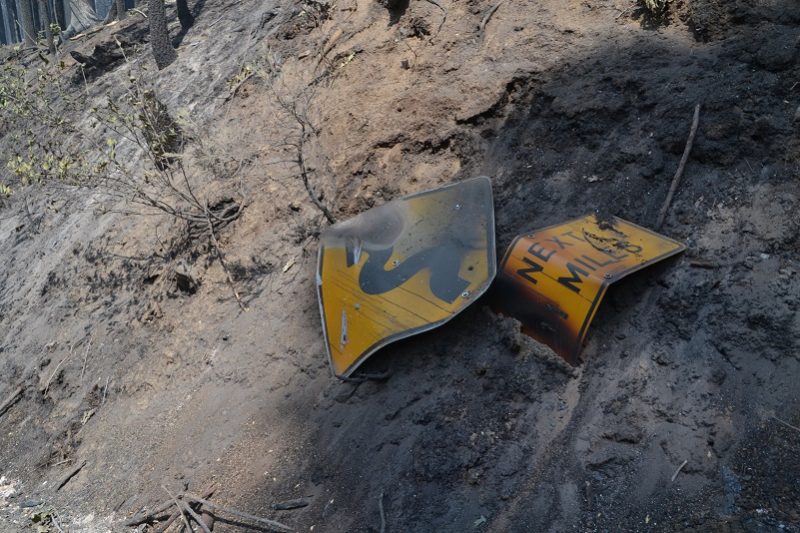 Caltrans continues their work along the Highway 41 corridor. Crews are removing hundreds of hazard trees. Once all the work of falling and removing the hazards is done, they will sweep all the debris from the roadway. They must also replace the highway signs destroyed by the fire.
PG&E has assessed the lines in the fire zone, and their crews continue to replace or reset poles that have been damaged. They also have to remove hazard trees that threaten to fall over the lines.
While everyone is anxious to return to their homes and have Highway 41 reopened, the dangers to the public are still very real. Cooperators are working closely together and focusing on the end goal – to repopulate and reopen when everything is safe. No one is taking lightly the inconvenience and financial impact of these closures. We anticipate it will be at least another 48 hours until any news of reopening the area, but there is no estimate given from fire officials.
Though lines around the community of Fish Camp have been holding strong for the past 48 hours, the fire continues to push north, just east of Highway 41. With the forecasted thunderstorms a concern for outflow winds, there is always the chance that the fire could hook back around to the west, as happened just a few weeks ago with the South Fork Fire in Yosemite. The west flank of that fire looked pretty secure, until an erratic wind event pushed it west, back across the line near Wawona Dome, threatening the community of Wawona once again. Fire officials don’t want to repopulate only to have to evacuate all over again.
The fire continues to spot over Road 6S90 near the community of Sugar Pine, and dozers have been doing a lot of work in that area to secure the line there.
Moderate to long range spotting continues to challenge firefighters and planners in the northeast corner. The fire spotted over the primary indirect line last night as down-canyon winds kicked up about 3 a.m. It also spotted north across Jackson Road, but is still south of the creek.
The fire continues to spread east toward Big Sandy and downslope from Speckerman Mountain Peak.
A new division was added yesterday — Division Q (see map below) — and there were numerous spot fires there as well, ranging from one-half to four acres. They were able to get dozers and an engine strike team in there and got line around each one. This part of the fire is rather a thermal belt, and temperatures haven’t been dropping below the 70s overnight.
On the southwest perimeter near Miami Mountain, crews got a lot of good work done over the past 24 hours, and are strengthening the line, manning the hose lays that were completed yesterday, and doing mop-up work. The goal for today is to get that section buttoned up so that resources can be reassigned to other priorities on the fireline.
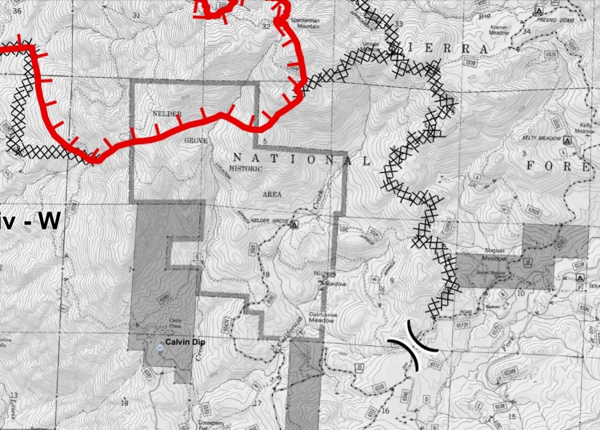 The fire continues to work its way south into Nelder Grove. It is burning and creeping along the ground, staying out of the crowns up to now. It has burned past the Hawksworth and Granddad trees according to this map of the fireline (click to enlarge), and is approaching The Leaner, where Nelder Creek crosses The Graveyard of the Giants Trail. We will do our best to get details of the burn inside the Grove, but none are available at this point.
Moisture is moving up from former tropical storm Lidia, spinning near Baja California, bringing a chance of afternoon thunderstorms over the fire. The general storm motion will be from southeast to the northwest. The biggest concern is for lightning and gusty, erratic winds. The system could produce some wetting rains. Temperatures will be slightly lower and humidity slightly higher as the high pressure ridge begins to weaken. The forecast is for temps into the lower 90s on the firelines, and close to 100 in Base Camp.
Though the community of Wawona is not under direct threat at this time, Yosemite National Park officials will host an informational briefing on Sunday, Sept. 3, at 5 p.m. at the Wawona Community Center, for employees and members of the community.
There have been no reports of more structures lost. Seven were destroyed in the first day of the fire.
Closures and evacuations on the Railroad Fire:
**UPDATE 10 A.M. — A mandatory evacuation order is being issued for the Cedar Valley Subdivision as of 10 a.m. today., due to an unexpected spot fire over the line from the #RailroadFire. This includes the following roads: Cedar Valley Drive, Deer Run Trail, Lazy Oak Drive, Cedar Brook Road, Cedar Springs Road, Mountain Meadow Road, Chu Ranch Road, Tolladay Road, Jackson Road, Cedar Ridge Circle North and South, ManzanitA Drive, Three Springs Road, Lakeside Drive, and Cedar Place. The Sheriff’s Office strongly encourages you to take important documents, plus pets and medications. You will not be allowed to return until the danger has passed. A shelter will be established at the Oakhurst Community Center, 39880 Road 425B.**
Highway 41 remains closed in both directions from Cedar Valley on the south (about three miles north of Oakhurst), to Wawona inside Yosemite National Park. Yosemite visitors should use Highway 49 to Highway 140 or 120 for entrance to the National Park.
Road closures include all Highway 41 offshoots between Cedar Valley Road and Summerdale Campground north of Fish Camp, in both Madera County and Mariposa County, and Road 630 (Sugar Pine Road) and all cross streets, including Sugar Pine Christian Camps.
Jackson Road (6S07) is closed from Fish Camp to Beasore Road.
A mandatory evacuation is in place for the the community of Fish Camp, the Tenaya Lodge, the Narrow Gauge Inn, the Yosemite Mountain Sugar Pine Railroad, the community of Sugar Pine including the Christian Camp, Big Sandy Campground and Summerdale Campground.
Sky Ranch (Road 632) is under an evacuation advisory from Highway 41 to Buckskin Lane. The road is closed beyond that point, and evacuations ordered for Nelder Grove, Camp Redwood, Paradise Springs, Calvin Crest, and Soquel and Texas Flat campgrounds.
There have been some changes to this list of Forest road closures:
- Road 632 at Buckskin Lane
- Forest Road 5S10 at 5S39
- Forest Road 6S13 at Road 274
- Forest Road 6S08 at 6S36
- Forest Road 6S10 at 6S39
- Forest Road 6S99 at Beasore Road
- Forest Road 6S40 at Beasore Road
- Forest Road 6S40X at Beasore Road
- Forest Road 5S40Y at Beasore Road
- Worman Road one mile in from Highway 49 (at Road 601).
The community of Wawona is being warned of the possible threat potential from this fire. Residents and visitors are encouraged to make appropriate pre-evacuation preparations.
The Red Cross Evacuation Center at the Oakhurst Community Center has been closed down due to lack of need, as has the one in Yosemite Valley. However, they are on standby and prepared to get back up and running again within two hours.
“Just because we’re closed doesn’t mean we’ve left,” says Red Cross Disaster Program Manager Katrina Poitras. “You can still call, and we will provide assistance, or connect you with other resources who can help you.”
The hot line number for the Red Cross is 559-343-2549.
The Central California Animal Disaster Team has activated a small animal shelter at the Oakhurst Community Center Pavillion Building. Small animals can also be sheltered at the Mariposa SPCA, 5599 Highway 49 in Mariposa. The phone number is 209-966-5275. Large animals can be sheltered at the Coarsegold Rodeo Grounds, at 44777 Rodeo Grounds Lane in Coarsegold. The phone number is 559-676-7864.
All roads past Wawona inside Yosemite are open, except Glacier Point Road, which was closed last Sunday due to increased fire activity on the Empire Fire.
For fire updates, residents and visitors can message RAILROADFIRE (one word) to 888777.
A fire information line has been established for the Railroad Fire at 559-373-0040.
The Railroad Fire was reported at 12:20 p.m. on Tuesday, Aug. 29, just south of the Yosemite Mountain Sugar Pine Railroad on the west side of Highway 41. It is burning on the Bass Lake Ranger District of the Sierra National Forest.
The estimated date for containment is Friday, Sept. 8.
The cause of the fire is under investigation.