MOUNTAIN AREA — A Flash Flood Watch has been issued for some of our local area, according to the National Weather Service (NWS), as isolated afternoon and evening thunderstorms remain possible in the Sierra through Friday, July 26.
A large area of high pressure maintains widespread triple digit heat across the San Joaquin Valley, West Side Hills and Kern County Deserts through at least Monday, with the peak of this heat expected to occur this weekend.
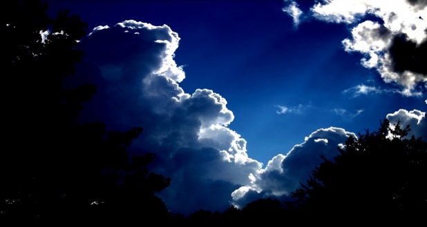
Afternoon thunderstorms are flaring up as monsoonal moisture continues to surge north into the region, says the NWS. While the Sierra Nevada and Tehachapi Range will keep thunderstorm activity confined to the mountains and deserts, a few stray showers could reach the lower foothills before sunset this evening.
Yet, with abundant moisture and smaller-scale disturbances moving into the area, thunderstorms are very likely outside of the San Joaquin Valley. Enough moisture, instability and lift could support brief heavy precipitation over the favored areas, leading to the issuance of a flash flood watch over the deserts and mountains through 11 p.m. this evening.
In the next few days, the trend will be for in increase in the heat as per advisories and watches that are currently in effect, and a decrease in the moisture. Therefore, while thunderstorms may still develop on Friday, the threat will slowly diminish during the weekend.
By Monday, July 29, longer range models indicate the possible introduction of a stronger pattern entering the West Coast and the NWS says confidence remains high that a trough could enter the area at the start of the week. By Tuesday, a change in the pattern will lead toward a cooling trend that may finally break the 100 degree streak. Afterward, the pattern shows little change as triple digit heat may not return to the area until after the start of the new month.
Flash Flood Watch for parts of Yosemite, Fish Camp and Bass Lake
The National Weather Service has issued a flash flood watch for monsoonal thunderstorms with heavy rainfall for a portion of central California including the Central Sierra areas of Tuolumne Meadows, Bass Lake, Fish Camp and Wawona. The flash flood watch was issued early this afternoon and is in effect until 11 p.m. tonight — Thursday, July 25.
Also included are Lake Wishon, Huntington Lake, Shaver Lake, Camp Nelson, Giant Forest, Lodgepole, Cedar Grove, Grant Grove, Hume Lake, Johnsondale, Lake Isabella, Kernville, Tehachapi, Frazier Park, Grapevine, Lebec, Inyokern, Ridgecrest, Rosamond, California City, Randsburg, Edwards AFB, Mojave, Devils Postpile, Florence Lake and Lake Thomas Edison.
The National Weather Service explains that a Flash Flood Watch means that conditions may develop that lead to flash flooding — a very dangerous situation.
Avoid low lying areas and drainages as heavy rainfall in higher elevations can quickly send a surge of runoff into these areas creating dangerous conditions.
Turn around — do not drown!
You should monitor later forecasts and be prepared to take action should Flash Flood Warnings be issued.