Beautiful snow was waiting for our adventure, snowshoeing along Tamarack Ridge above Shaver Lake.
Where: Tamarack SNO-PARK, Sierra National Forest
Distance: 5.11 miles
Difficulty: Moderate
Elevational Range: 7,460′ to 7,911′
Date: December 11, 2019
Maps: High Sierra Ranger District Winter Recreation Guide, Dinky Creek Topographic Quad
Dog Hike? Maybe
We were heading out on our first snowshoe adventure of the season and Badger Pass Ski Area hadn’t opened up yet but they are now open! So, we headed over to the SNO-PARK area above Shaver Lake. China Peak Mountain Resort was reporting that they had received 12-14 inches of new snow over the past week. They have a base elevation of 7,030 with a peak of just over 8,700 feet and that elevation matched the proximity and location where we were headed to snowshoe.
 We drove up Hwy 168 to Shaver Lake and stopped by Shaver Lake Sports to pick up a Permit which is required November 1 through May 30 for each vehicle parked at a SNO Park site. We picked up a season permit for $25 since we planned on more adventures in this area on the snow this season but you can also pick up a day permit for $5.
There are several areas where you can purchase your permit and the SNO-Park link at the bottom gives you that list. In the past, you could also pick up a free map that is perfect for this area, but I hear that they don’t have this map anymore. It is called the High Sierra Ranger District Winter Recreation Guide and has the trails, along with additional information such as trail etiquette, winter travel safety and the type of equipment that you should bring to be prepared for winter recreation in this area. Some of the trails are only for cross country skiing and some are snowmobile trails. There are also areas just for snow play. Also note that there is a fine of $94.50 for parking in the SNO Park areas without a permit displayed. The money collected for the SNO-PLAY areas pays for plowing of the SNO-PLAY parking areas and sanitation facilities. There is limited information on the SNO-PARKS online but it doesn’t contain the good maps from the High Sierra Ranger District Winter Recreation Guide.
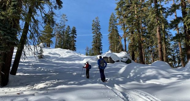
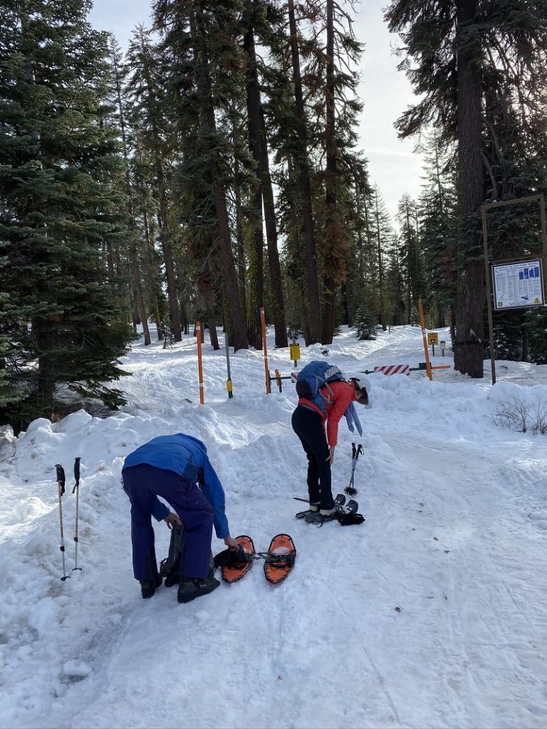
We also made a quick stop at Blue Sky Cafe to pick up some coffee and used their restroom, then continued up the road to the Tamarack Ridge SNO-PARK on the right side of the road. We were the only vehicle in the parking lot but I’m not counting the Caltrans rig that was there with a crew repairing a sign that someone hit. The temperature was about 31 degrees when we got out of the car and 41 degrees when we returned. We quickly put our snowshoes on and headed up the trail which is really a dirt road covered in snow. At about .8 miles, the trail out to Tamarack Ridge took off the road on the right side. It isn’t marked and sometimes we are talking and miss it, especially if no one has traveled up it since the last snow. This time there were snowmobile and ski tracks that caught our attention.
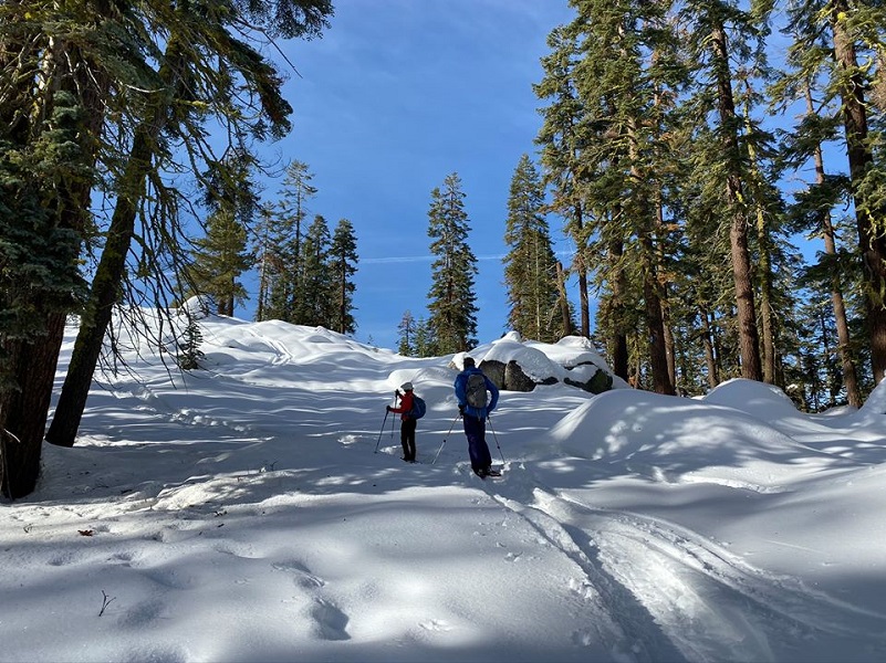
The snow was well packed and we followed in the snowmobile tracks to make our traveling a bit easier. The trail had some up and down to it along the way.

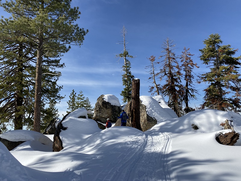
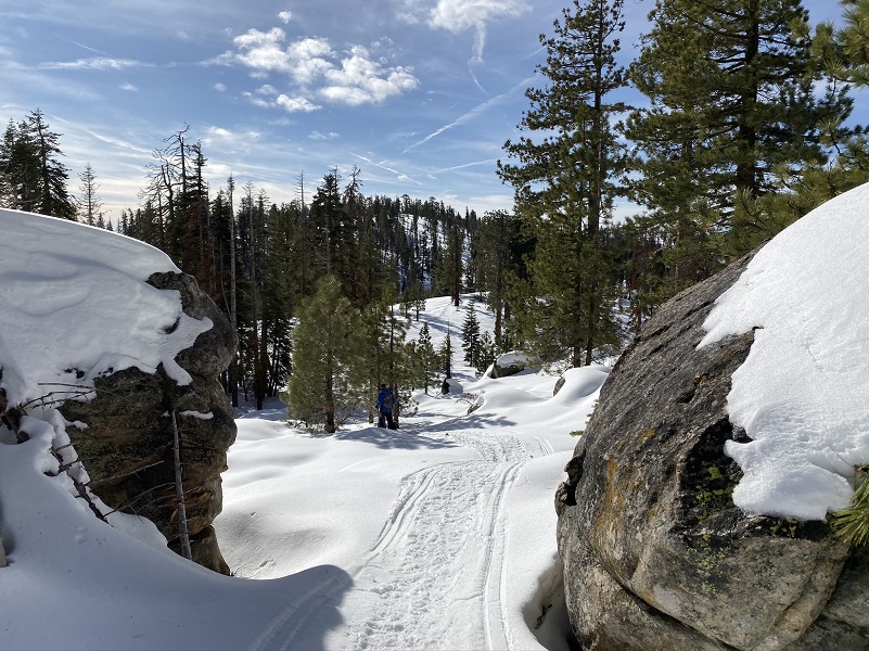
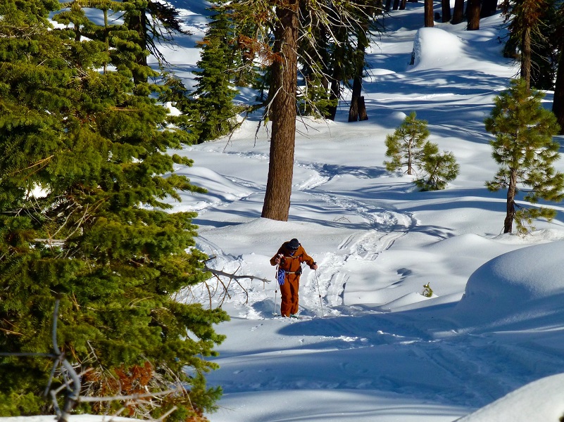
Photo by Gail Gilbert
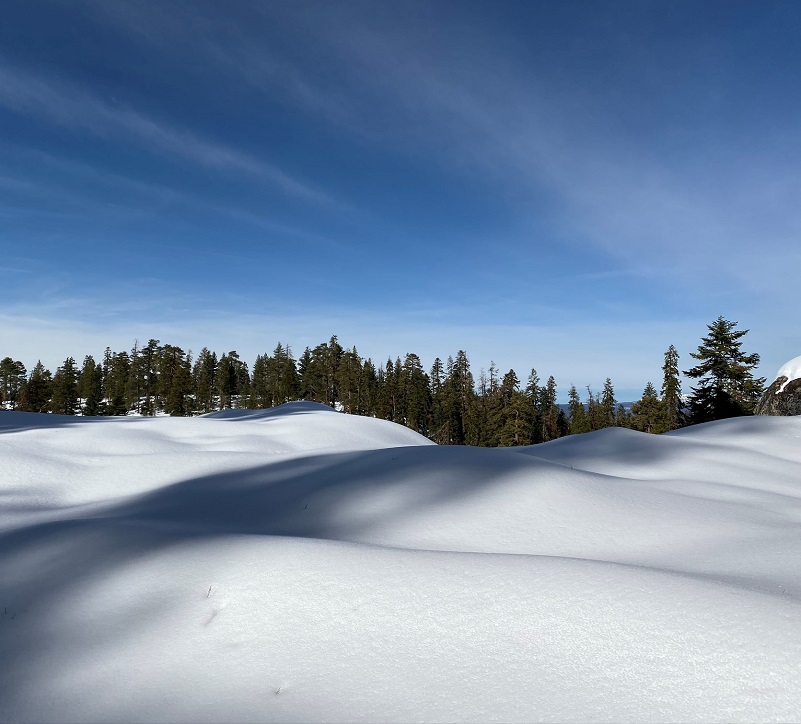
Along side the trail, the snow was pristine, sparkling with the morning sun.
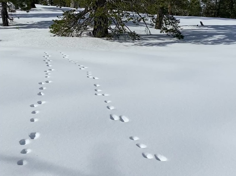
Animal tracks were going every which direction.
The trail led us along the ridge with views of the foggy valley and the leading edge of a storm coming in.
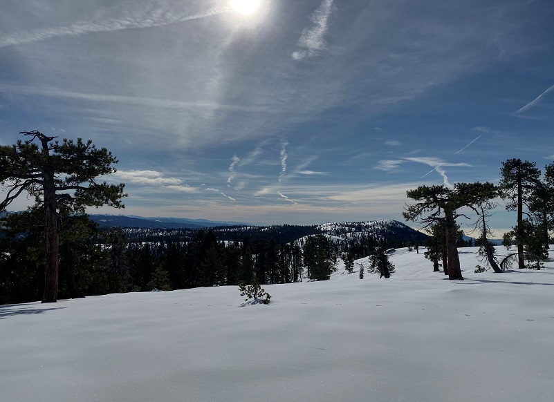
Oh, and we could look down at Shaver Lake.

The end of the ridge is where we stopped and ate our lunch. What a view!
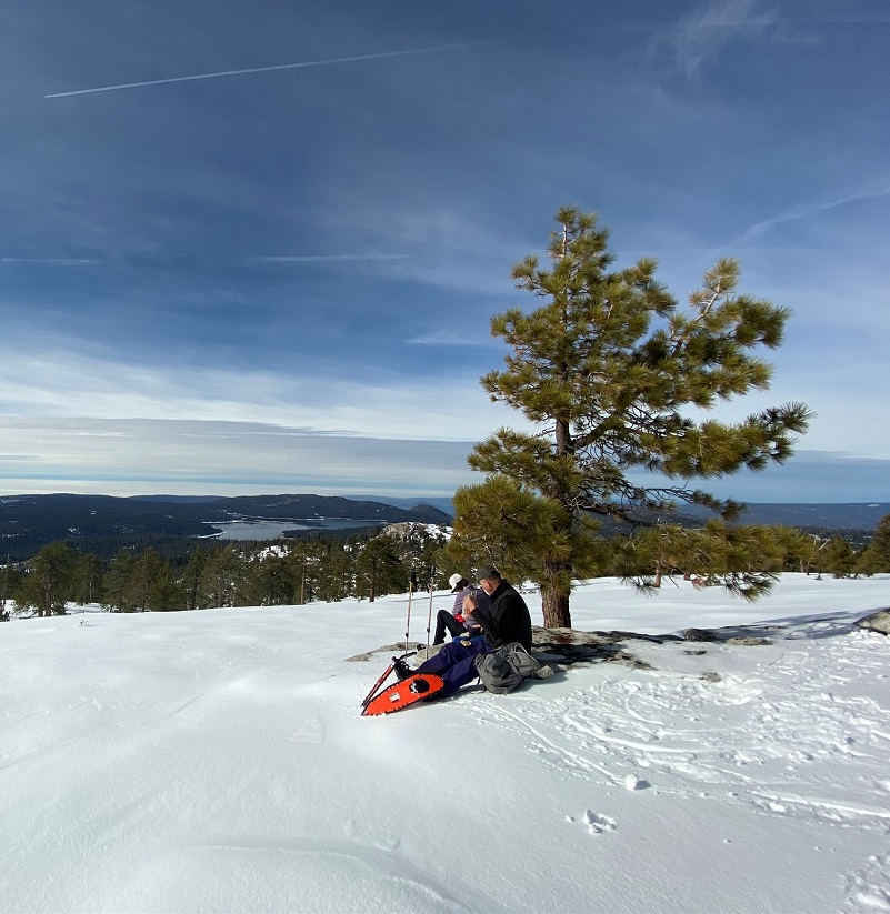
A snowmobiler headed out our way while we were eating lunch and that was the only person we saw on our hike. The clouds started coming in quickly and although they weren’t a weather threat for our adventure, they really changed the mood of the day, taking away our blue sky and giving us grey all around us. It was still all beautiful.

When we got back to the parking lot, there was one more car in the parking lot and a small group were carrying their snow toys out to enjoy an afternoon playing in the snow.
This is a fantastic area to enjoy the snow. We have seen families with small children tailgating in the parking lot, with the kids playing on toboggans and building snowmen. It always puts a smile on our faces to see families enjoying this area. The great thing about this area is that it is big and you don’t need to get too far from the parking lot where you can feel like you have the place to yourself. Some of these trails are groomed for snowmobile trail, some are designated for cross country skiing and some of the trails are used by all. With that said, snowmobile operators may not be able to hear approaching skiers and snowshoers so you want to be aware and use caution when you hear them coming.
Dog Hike: Maybe
I didn’t bring Sally on this hike but she has hiked in the Tamarack SNO-PLAY area across the road. This is one of those instances where you will need to know your dog’s limitations and how well it can tolerate the cold, dressing them accordingly.
Here are the Sierra National Forest rules for pets from their website:
Domestic pets are allowed in wilderness areas. You are responsible for their actions as well as their welfare. Pets should either be leashed or under direct voice control. When camping in areas with other visitors, pets should be kept on a leash. Wilderness visitor’s who plan to travel into an adjacent National Park should be aware that National Parks do not permit pets.
When in campgrounds, public beaches or on trails local ordinances require pets to be leashed. As a consideration to others, please refrain from taking pets to beach areas to prevent contamination. Domestic pets are allowed in wilderness areas. You are responsible for their actions as well as their welfare. Pets should either be leashed or under direct voice control. When camping in areas with other visitors, pets should be kept on a leash. Wilderness visitor’s who plan to travel into an adjacent National Park should be aware that National Parks do not permit pets.
Doarama:
What is a Doarama? It is a video playback of the GPS track overlaid on a 3 dimensional interactive map. If you “grab” the map, you can tilt it or spin it and look at it from different viewing angles. With the rabbit and turtle buttons, you can also speed it up, slow it down or pause it.
Tamarack Ridge Snowshoe Doarama
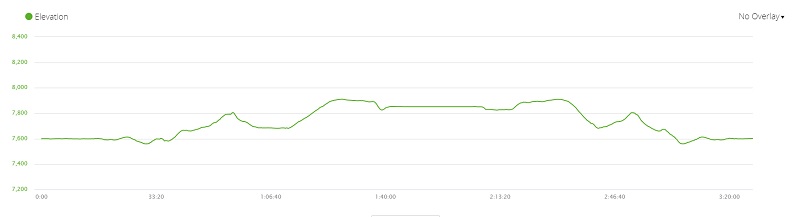
Map and Profile:
Tamarack Ridge Snowshoe Topographic Map Tamarack Ridge Snowshoe Profile Prior Blogs in this Area:
Snowshoeing Tamarack Ridge January 22, 2019
Snowshoeing at the Coyote SNO-PARK Area March 19, 2018