MARIPOSA COUNTY – Firing operations continued today on the three sides of the Ferguson Fire, now estimated at 57,041 acres. The fire grew by just 382 acres today, and is still reported as 30 percent contained.
There was good news today for residents along East Westfall Road, the Ponderosa Basin and for some who live along Highway 140 as mandatory evacuations have been lifted (see details below). All these areas are open to residents only. Highway 140 is not open to the public as of yet.
Over the fire today, Air Attack reported that the inversion was as bad as it has ever been; a situation that was not unexpected due to all the firing operations being conducted.
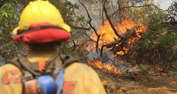
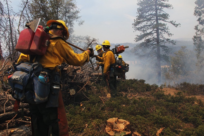
Firing operations on the Ferguson Fire – photo USFS
On the northwest corner of the fire burning on the Santislaus National Forest, crews fired on the western perimeter today from Soapstone Ridge to Bull Creek Road, but had to suspend operations when wind and humidity levels failed to cooperate. They continued prep to finish off the western flank.
Prep work is complete on Pilot Ridge and crews hope to be firing that portion of the line tonight. The day shift was not able to put fire on the ground on the eastern perimeter, as weather conditions were not favorable, but expect the night shift will be able to do firing in that area.
South of El Portal, everything remained in its current footprint, say fire officials, except for the slopover on the line to the east, which is in very dangerous terrain. After yesterday’s tragic accident where a firefighter was struck and killed by a falling tree, the Arrowhead Hotshots were pulled off the line and sent back to their duty station. Aircraft monitored the spot today, and this afternoon, when it started showing some heat, a heavy helicopter started working. Crews will be on it tomorrow.
Crews continued firing down from Henness Ridge on the west side of Highway 41 last night. They had good success with the burning operations, and mop-up is in progress on that piece of the line. The plan for today was to burn down to the area of Mosquito Creek, west of Turner Ridge, about halfway to Wawona. Crews will continue burning tonight, if conditions are favorable, and expect to reach Wawona Campground by end of shift.
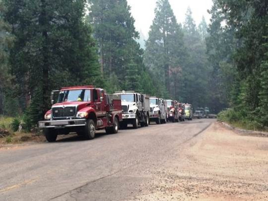
Engines staged along Summit road in Fish Camp – photo Donn Harter
Prep work continues and fallers are still working to remove numerous hazard trees from the line west of Wawona Campground, and also across the southern line that runs west, over toward Roundtree Saddle. Engines and dozers were staged in the Fish Camp area this morning along Summit Road, preparing to head out to assignments along the Chowchilla Mountain Road.
On the southern perimeter, crews were able to complete their work and get around the tough topography in the Roundtree Saddle area that has proved so challenging over the past week. There were a couple spot fires south of the line, as has happened most every day, but crews were able to hold them in check.
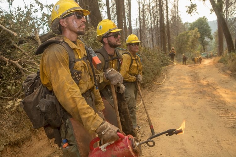
Springville Hot Shots – photo USFS
Work continues on the removal of hazard trees in the Crow Peak area so that firing can continue along the southern fireline. Once they get east of Crow Peak, there is a transition in the type of fuels on the ground. Fuels are not as dense, the hazard trees don’t present as much of a danger, and crews will be able to cover more ground. The night shift will be working to complete firing over to Battalion Pass.
If the fire stays within its current box on the southeast corner, officials expect to have the burning done in the next 48 to 72 hours.
During all tactical firing operations on the Ferguson Fire, firefighters and law enforcement maintain a presence in evacuated communities to ensure home and structure safety.
From Lushmeadows on up through Jerseydale, Mariposa Pines and Sweetwater Ridge, the line is contained. Crews will remain in the area to patrol and do mop-up.
Air quality across the region was very poor today, and is likely to decrease as a result of increased smoke from the firing operations. Residents can monitor the latest air quality and health advisories at:
- https://wildlandfiresmoke.net/outlooks/YosemiteArea
- https://wildlandfiresmoke.net/outlooks/SouthernSierra
Officials estimate 5,846 structures are threatened by the fire, and one non-residential structure has been destroyed.
There is now an estimated date for full containment of Aug. 15.
There are currently 3,638 personnel assigned to the incident including 219 engines, 93 crews, 46 water tenders, 72 dozers, 14 helicopters, and fixed-wing tankers as conditions allow.
There have been seven firefighter injuries reported, and numerous instances of heat exhaustion-type symptoms. There have been two fatalities on the fire; HFEO Braden Varney was killed in a dozer rollover accident on July 14, and Brian Hughes, Arrowhead Hotshot Captain, lost his life yesterday when he was struck by a tree during a firing operation.
Yosemite National Park
Officials have announced that Yosemite Valley will reopen to all visitors at 4 p.m. on Friday, Aug. 3. Limited visitor services will be available inside Yosemite Valley, including campgrounds, lodging, and food service operations.
Yosemite Valley has been temporarily closed since July 25 due to smoke impacts and for firefighting operations along El Portal Road and the Wawona Road due to the Ferguson Fire.
The Mariposa Grove of Giant Sequoias and the Wawona Road (Highway 41) from the south entrance of Yosemite National Park to Tunnel View will remain closed until further notice.
The Hetch Hetchy area remains open. The Big Oak Flat Road (Highway 120 West) to Crane Flat and Tioga Road (Highway 120 East) from Crane Flat to Tioga Pass, remain open to all visitors and vehicles. All trails and campgrounds along Tioga Road, including the Tuolumne Meadows Campground remain open. All visitor services along Tioga Road, including the High Sierra Camps and visitor services near Tuolumne Meadows, remain open.
Since the Ferguson Fire began on Friday, July 13, several other park facilities and roads have been closed due to fire impacts and the need to support firefighting operations. These closures include Glacier Point Road, Bridalveil Creek Campground, the Wawona Campground, and the Merced Grove of Giant Sequoias.
Yosemite National Park continues to work closely with the Incident Management Team and continues to assess park conditions daily.
For updated 24-hour road and weather conditions for Yosemite National Park, please call 209-372-0200, press 1 and press 1 again. Updated information is also available on the park’s website at www.nps.gov/yose and on the Yosemite National Park Facebook page.
As of July 21, there are fire restrictions in place on the Sierra National Forest. Please read and be informed before you use any type of fire in the forest.
The Incident Command Post for the Ferguson Fire is located at the Ahwahnee Hills Regional Park. Please be aware of heavy fire equipment moving through the area. There is also a base camp set up at the ski area at Badger Pass.
The fire is under Unified Command with Cal Fire, U.S. Forest Service, Yosemite National Park and the Mariposa County Sheriff’s Office. Management of the fire transitioned to a Type 1 Management Team – California Team 4 – on Thursday, July 19. For information about the fire please call 530-377-6221.
The Ferguson Fire started on Friday, July 13, at 8:30 p.m. The cause remains under investigation.
Make sure you are signed up to receive alerts when wildfire or other emergencies threaten.
- To sign up for the Mariposa Sheriff’s Office Emergency Alert System visit https://local.nixle.com/register.
- To register for the Madera County Sheriff’s Office Emergency Alert System visit mcalert.org.
Smoke from the Ferguson Fire is impacting the Mariposa County Air Pollution Control District and across the region. For information specific to Mariposa County visit http://www.mariposacounty.org/index.aspx?NID=1434. For additional information on air quality you can visit the AirNow website or the air fire smoke page.
Residents can check the San Joaquin Valley Air Pollution Control District’s wildfire page at www.valleyair.org/wildfires for information about any current wildfires and whether they are impacting the Valley. The District’s Real-time Air Advisory Network (RAAN) provides localized air quality data from an extensive air-monitoring network which allows Valley residents to track PM at any Valley address by visiting myraan.com.
Evacuations
New today: Evacuation orders were lifted at 9 a.m. for the East Westfall Road area. These areas will remain under a Fire Advisement – an advisement only of a potential Evacuation Order should conditions change.
The East Westfall area will include all homes on East Westfall from Triangle Road to Chowchilla Mt. Road including all side roads, and Chowchilla Mt. Road from Hwy 49S to East Westfall.
The Fire Advisement has been lifted for the Vista Lago, Monte Vista and Triangle Road from East Westfall to Hwy 49S including all side roads.
At 7 p.m., evacuations were lifted for Ponderosa Basin and some residents of Highway 140.
These areas will be open to residents only and will remain under a Fire Advisement. Fire Advisement- an advisement only of a potential Evacuation Order should conditions change.
Evacuation Areas Lifted:
Ponderosa Basin– This will include the entire Ponderosa Basin area for RESIDENTS ONLY.
Entry Point location – All residents will need to enter using Highway 49S to Chowchilla Mt. Rd. Harris Rd at Highway 49S will remain closed.
Highway 140 Corridor – This area will include the following for RESIDENTS ONLY:
- Savages Trading Post
- Cedar Lodge
- Indian Flat
- Incline Road
- Rancheria Flat- Government Housing & National Park Service
- El Portal Complex
All residents will need to enter using Highway 140 in the Midpines area.
Due to the large amount of emergency equipment in the area, speed control will also be enforced.
Evacuation Order remains in effect for:
- Old El Portal
- Trailer Court Park Line / Yosemite View Lodge area
- Foresta
Mandatory evacuations are in place for:
- The BLM campgrounds in Briceburg are closed until further notice
- El Portal Trailer Park
- Old El Portal
- Rancheria Flat- Government Housing
- Foresta
- Yosemite View Lodge
- Yosemite West
- Anderson Valley
- Old Yosemite Road
A Red Cross Evacuation Center has been established at Mariposa Elementary School at 5044 Jones Street in Mariposa. This shelter is accepting small pets with their owners.
The shelter at Mountain Christian Center at 40299 Highway 49 in Oakhurst has been closed due to lack of need by evacuees. They remain on standby and will reopen if conditions warrant.
The shelter at New Life Christian Church located at 5089 Cole Road in Bootjack has been closed.
If you have been evacuated due to the Ferguson Fire, the Sheriff’s Office asks that you please check in with the Red Cross Shelter even if you do not plan to stay there.
If you are in a Mandatory Evacuation or Advisory Area and may require assistance with evacuation transportation due to special needs or medical issues, please contact Human Services toll free at 1-833-423-0816 as soon as possible.
Planning ahead will help with a safe and timely evacuation.
Animal Evacuation Centers
Small Animal Shelter is at SPCA of Mariposa County, 5599 Highway 49 in Mariposa is at full capacity.
Residents with small pets can be accommodated at the Mariposa Elementary School Shelter at 5044 Jones Street for those under mandatory evacuation, where Central California Animal Disaster Team (CCADT) is operating an emergency animal shelter. You must check in with Red Cross first. Please try to accommodate your pets with family and friends first, however your pet is welcome to be sheltered if necessary at the Mariposa Elementary School. For questions about pets, please call CCADT at 888-402-2238 ext. 0, and leave a message. Someone will return your call as soon as possible.
Large Animal Shelter is at the Mariposa County Fairgrounds, 5007 Fairgrounds Road in Mariposa.
Road Closures
- Highway 140 from 1.5 miles West of Midpines to the Foresta Bridge- Open to Residents Only
- Highway 140 from Foresta Bridge to Yosemite National Park Entrance
- El Portal Rd
- Foresta Road from El Portal Road to Foresta and all side roads
General information on returning to previously evacuated areas:
Mariposa County Sheriff’s Office will have a heavy presence in the area to ensure the security and safety of residents and businesses.
There will still be smoke in the respective areas as firefighters continue firefighting operations. If at any time you feel unsafe, please call 911.
For questions or concerns regarding power, please contact PG&E at 800-743-5000 or visit their website at www.pge.com.
The Mariposa County Health Department has health and safety information for residents returning to their homes on their website at http://www.mariposacounty.org/health or call 209-966-3689.
Mariposa County Health and Human Services will be available to assist residents with gaining additional services. Additional information regarding these and other services is available at www.mariposacountyrecovers.org.
SAFETY MESSAGE – The public is reminded to stay vigilant on current fire conditions. Please continue to adhere to road closures and any evacuation warnings. If you see electrical wires on the ground, stay clear and contact PG&E immediately. Trees and poles with deep charring, particularly if still smoking, should be considered hazardous. Please drive slowly and yield to emergency personnel in the area. As you re-enter your property and evaluate damage, be aware that hazardous conditions may exist, particularly if a residence or out-building has burned. Hazards may include asbestos, heavy metals, by-products of plastic combustion and various other chemicals. We encourage the public to remain prepared year-round for wildfires by visiting the www.readyforwildfire.org website. The best show of support is having your home and property “fire-ready.”
Cooperating Agencies on the Ferguson Fire include:
- Bureau of Land Management
- California Conservation Corps
- California Department of Corrections
- California Highway Patrol
- California Office of Emergency Services
- Caltrans
- Central Califonia Animal Area Disaster Team
- Madera County Sheriff
- Mariposa County Public Works
- Mariposa Public Works
- National Weather Service
- North Fork Rancheria of Mono Indian of California
- Pacific Gas and Electric
- Red Cross
- Sierra Tel
- Tuolumne County Sheriff
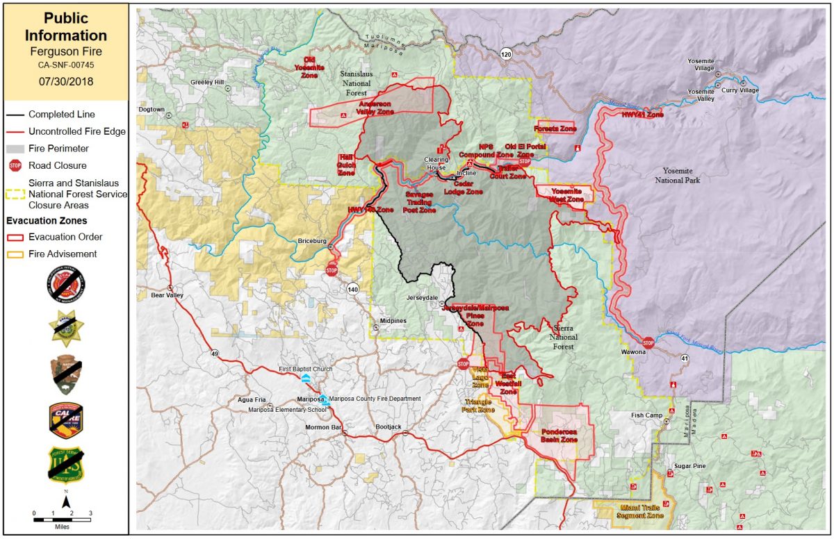
Please note that the PIO map below shows incorrect information about the evacuations on the southern part of the fire. Jerseydale, Mariposa Pines and East Westfall are no longer under a mandatory evacuation order. We will update when a corrected map becomes available.