MARIPOSA COUNTY — The Ferguson Fire, burning in the Merced River Canyon between Mariposa and Yosemite National Park, is now estimated at 4,000 acres and is just 2 percent contained.
There are currently 500 personnel assigned to the incident. Smoky conditions are challenging for air operations this morning.
Crews are focused on securing fireline along Highway 140 and protecting structures threatened along the corridor. Structure protection engines have arrived and setting up to protect homes and businesses between Cedar Lodge area and Hite Cove.
Additionally crews are working to extend containment lines east on both the north and south flanks. Firefighters are scouting ridgelines to the east to cut the spread up the South Fork of the Merced River toward Yosemite National Park.
Firefighters are aggressively fighting the fire at locations where they have the highest probability of success. However, they are challenged by extremely steep and hazardous terrain with limited road access.
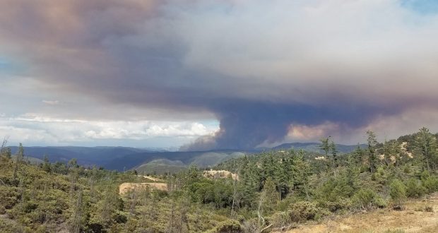
Ferguson Fire behind Cedar Lodge July 14 – photo by Kevin Shelton
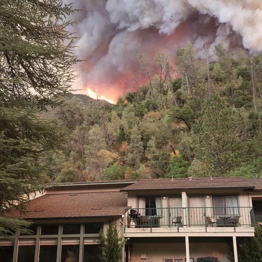
Crews completed hand line and hose lays around Cedar Lodge and Indian Flat Campground last evening as the fire came within 1/4 mile of the lodge.
Last night at 10:45 p.m., a mandatory evacuation was issued for the Jerseydale area.
This includes all residences on Jerseydale Road, Hites Cove Road and all side roads from Triangle Road to the end of Hite Cove Road.
Savage Trading Post, Redbud Lodge, Cedar Lodge, Indian Flat Campground and Ferguson Ridge are also under mandatory evacuation, and the BLM campgrounds in Briceburg are closed until further notice.
At 10:40 this morning the Mariposa County Sheriff’s Office issued a fire advisement for the Yosemite West area of Mariposa County. This is NOT an Evacuation Order. This is an advisement only of a potential Evacuation Order should conditions change.
“Should this area become under a Mandatory Evacuation Order you will be notified via the Sheriff’s Office Emergency Alert System by Text, Email and a Voice Call, the Mariposa County Sheriff’s Office Facebook page and door to door communication by Sheriff’s Office staff. Also at that time you will be notified of a Red Cross Shelter and the best routes of travel to safely evacuate your residence.”
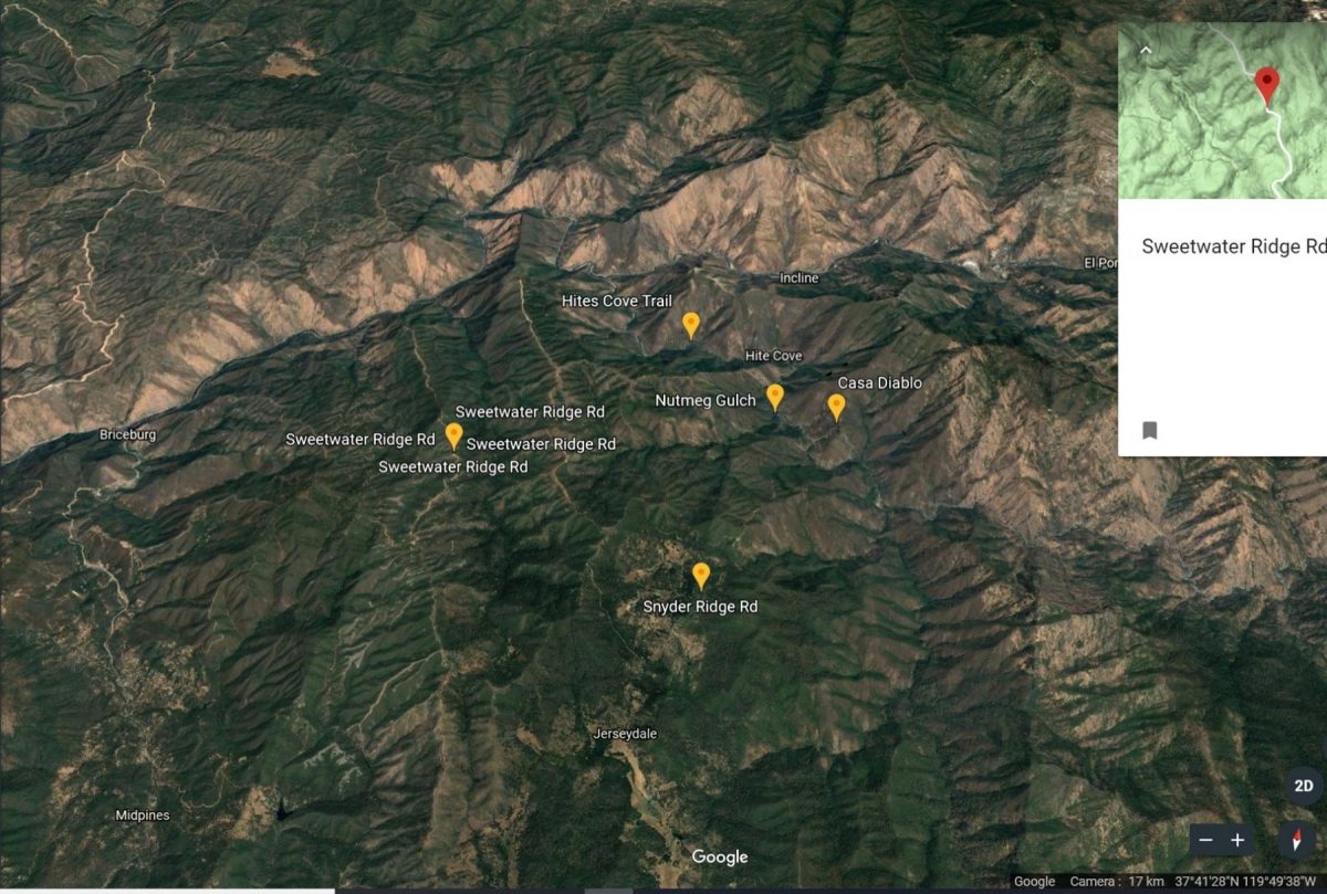
For those unfamiliar with the area, please see the map below with locations marked.
A Red Cross Evacuation Center has been established at the New Life Christian Church located at 5089 Cole Road in Mariposa.
Hwy 140 remains closed from 1.9 miles east of Midpines to the Cedar Lodge/ Incline area.
At about 11 p.m. last night, the fire made a good run up the southwest facing slope in the South Fork of the Merced River canyon on its way to Hite Cove.
Fire managers ordered three more strike teams, three more dozers and three more water tenders, noting that the dozers could wait until morning but need strike teams and water tenders were needed for the night shift.
At 12:35 a.m., Operations reported that the fire had slopped over Ferguson Ridge and it was strongly recommended that Sweetwater Ridge be evacuated first thing in the morning.
This morning there have been reports of fairly active fire behavior over Marble Point and the area headed towards Mariposa Pines.
Recent reports are that the fire is 1.5 miles from Mariposa Pines and 3.0 miles from Jerseydale.
Firefighters will be dealing with predicted triple digit heat today with slight chance of isolated thundershowers on the Sierra ridges.
The Central California Animal Disaster Team is working in coordination with Mariposa Animal Control in dealing with small animals. Right now, they are referring pet owners with small animals to the Mariposa SPCA. If you need assistance with large animal evacuation please call the Mariposa County Sheriff’s Office at 209-966-3615.
PG&E has deenergized the power lines running through the fire area, affecting Yosemite, El Portal and Foresta.
At 6 a.m. today, the South Central Sierra Interagency Incident Management Team took over the incident.
Smoke is expected to continue to impact adjoining communities, especially during night and early morning hours. You can learn more about air quality, and daily smoke forecasts by visiting either www.airnow.gov or www.valleyair.org.
So far no structures have been lost and no injuries reported. There has been one fatality on the fire.
The Ferguson Fire started on Friday, July 13, at 8:30 p.m. The cause remains under investigation.
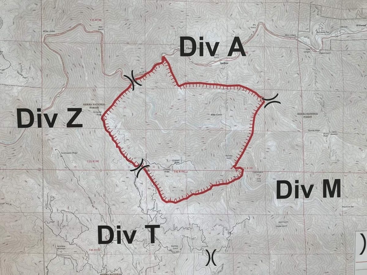
The map below is a photo taken by Derek Sprague. We will provide detailed maps as soon as they become available.
The second map shows local landmarks referred to in our coverage (thank you Shelly Sprague Jouett).