Colorful uplifted ancient canyons and mountains that used to be rivers, swamps, deserts and oceans make up Capitol Reef National Park. As I rounded every bend of the trail, it revealed a slice of geologic history through millions of years. It also revealed beauty unlike anything I had seen.
Where: Capitol Reef National Park
Distance: 10.49 Miles
Difficulty: Moderate
Elevation Range: 5,414′ – 6,447′
Date: September 2, 2018
Dog Hike: No
I headed over to Torrey, Utah a couple of days early for a 5 day horse camping trip, planning to get a couple of adventures in. I researched hikes along my flight path and came up with a dandy in Capitol Reef National Park. I printed out maps, loaded my GPS and water bottles to hike to Cassidy Arch, named for Butch Cassidy, who lived and rode around this area. On my drive over, I drove through Circleville, where Robert Leroy Parker, better known as Butch Cassidy, was raised. That kind of helped set the stage for the hike.
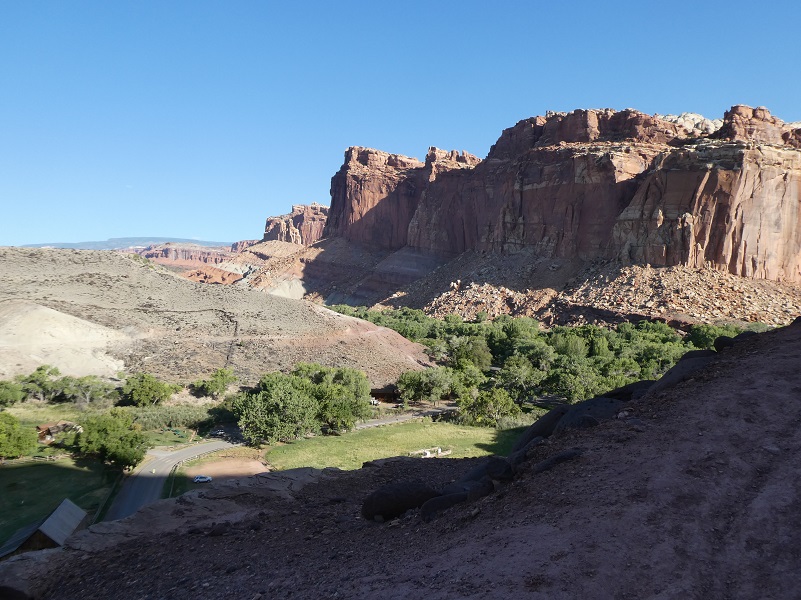
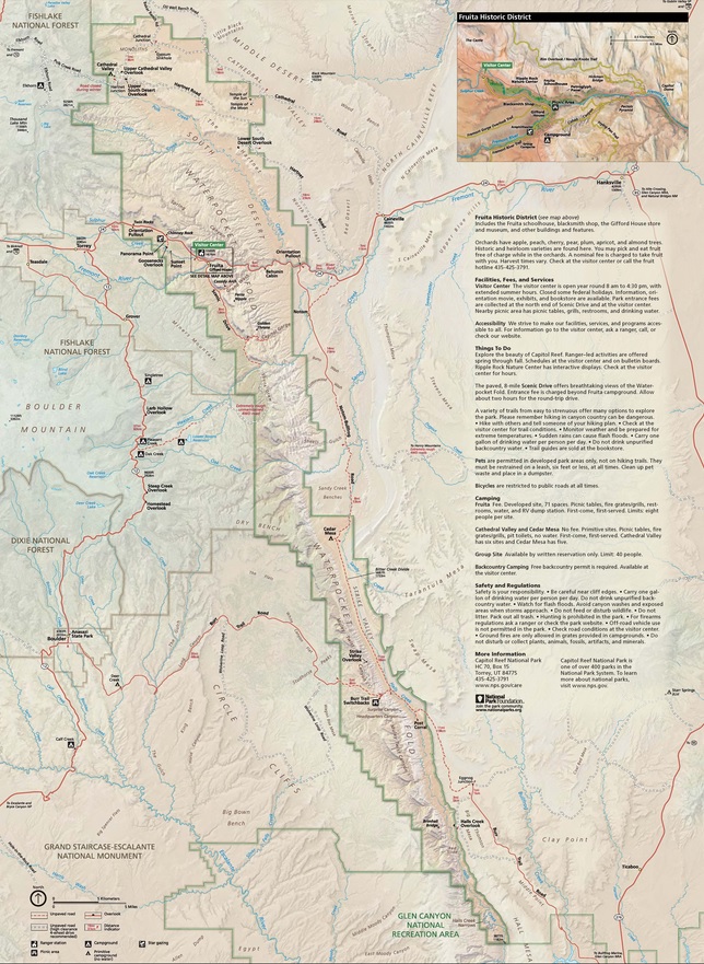
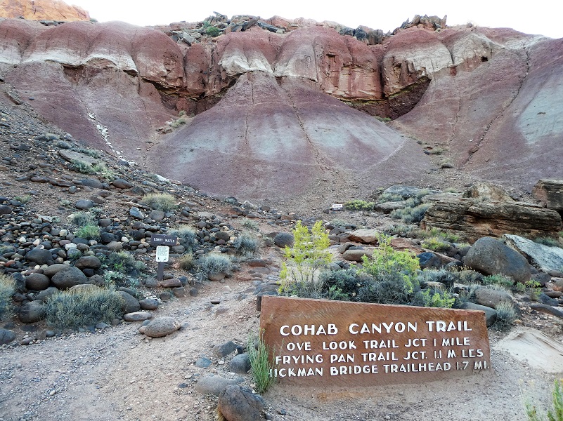 I wanted to get an early start on the hike because it would be getting warm out on this trail. I had a very short drive to get there. There are a couple of ways to hike to Cassidy Arch and I chose the longer one. I drove 1.2 miles up the Scenic Drive that goes by the Capitol Reef National Park Visitor Center to the parking area across from the campground and adjacent to the Cohab Canyon Trailhead, which was well marked. You could also reach Cassidy Arch via the Grand Wash Trailhead, about 2 miles south of Fruita, which is only about a 3/4 mile hike one way. I had been pretty much driving for 2 days, needed to stretch my legs and wanted to see as much as I could see, so hiking through Cohab Canyon, then up the Frying Pan Trail to see that arch appealed more to me.
Let me start by sharing some information about Capitol Reef National Park. It is next door to Escalante Grand Staircase, Capitol Reef and nearby Bryce and Zion National Parks. It is long and skinny, approximately 60 miles long from north to south axis and an average of only 6 miles wide. The park was established in 1971 to preserve 241,904 acres of desert landscape and is open all year with May through September being the highest visitation months.
Capitol Reef National Park was initially designated a National Monument on August 2, 1937, by President Franklin D. Roosevelt in order to protect the area’s colorful canyons, ridges, buttes, and monoliths, but it was not until 1950 that the area officially opened to the public. Easy road access only came in 1962 with the construction of State Route 24 through the Fremont River Canyon.
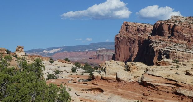
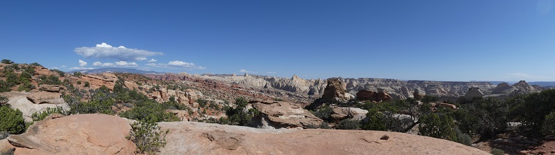
The majority of the nearly 100 mile long up-thrust formation called the Waterpocket Fold—a rocky spine extending from Thousand Lake Mountain to Lake Powell—is preserved within the park. Capitol Reef is the name of an especially rugged and spectacular segment of the Waterpocket Fold by the Fremont River. The park was named for a line of cliffs of white Navajo Sandstone with dome formations, similar to the white domes often placed on capitol buildings, that run from the Fremont River to Pleasant Creek on the Waterpocket Fold. The local word reef refers to any rocky barrier to land travel, just as ocean reefs are barriers to sea travel.
The trail headed up from the very beginning, revealing beautiful views all along that climb.
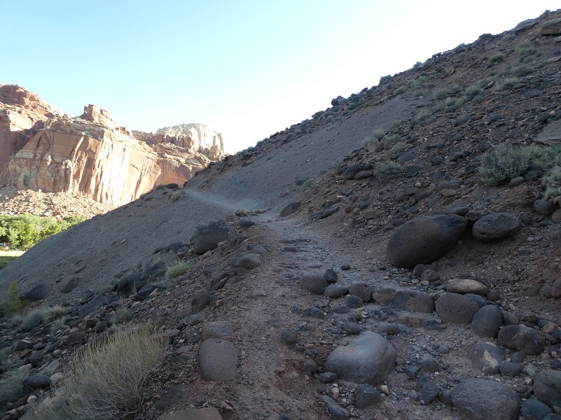
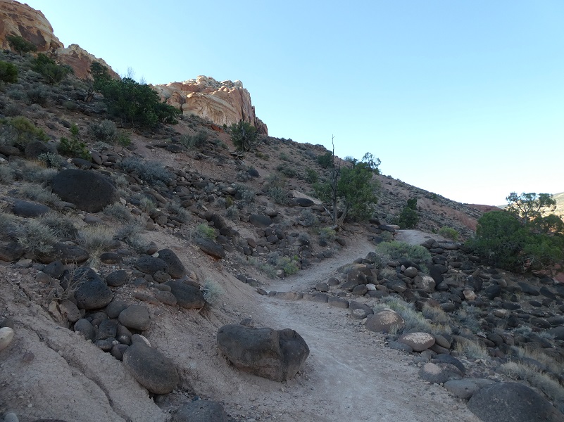

Once I finished that elevational gain, I entered the upper end of Cohab Canyon with colors that included brown, red, white and yellow. The trail followed through the wash for about a mile full of interesting landscape.

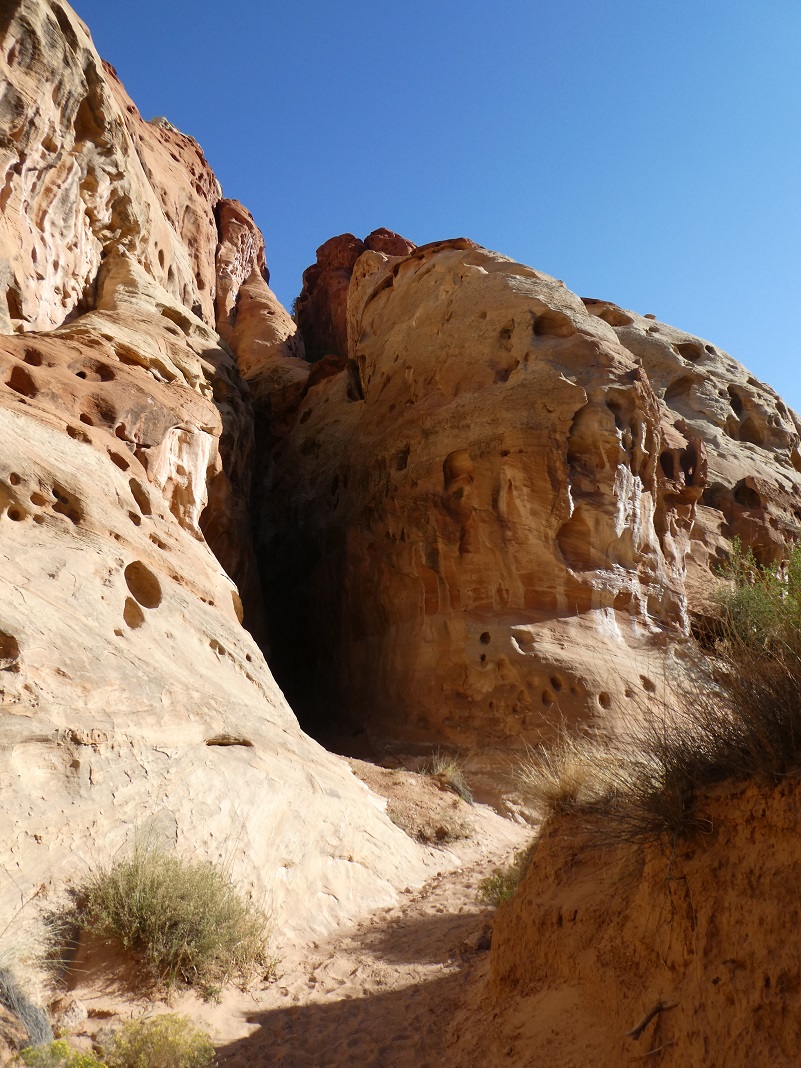
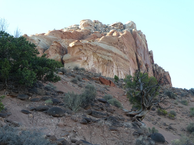
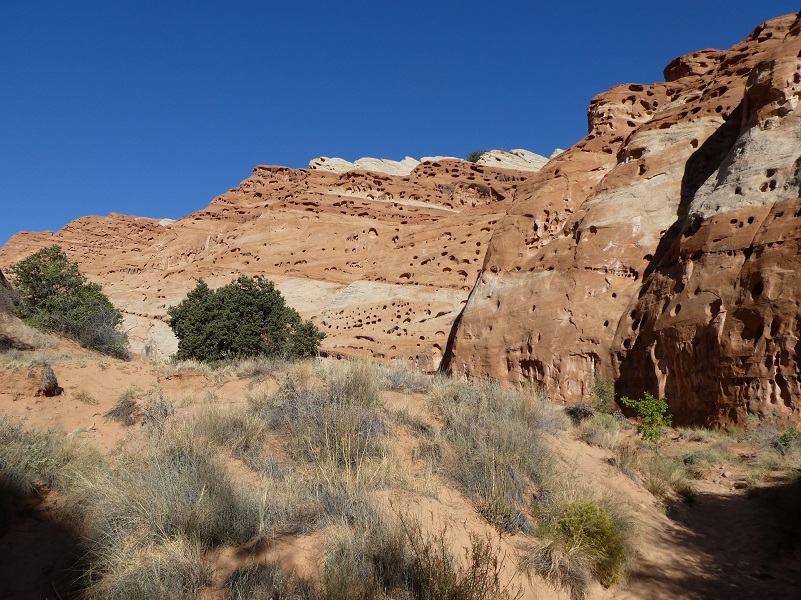
The wash widened and had an entirely different feel to it. Pockmarked areas looked like tiny caves high up but they were made when the fine grain of sand eroded over time, leaving what is called honeycombs or tafoni.
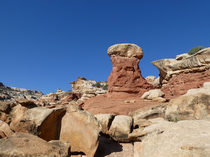
I soon spotted a hondoo in the distance, a 20-foot mushroom-shaped hoodoo standing by itself.

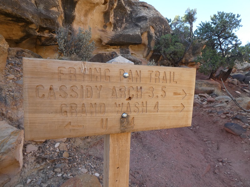
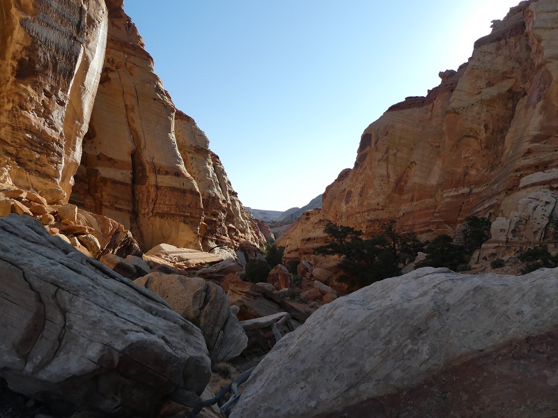
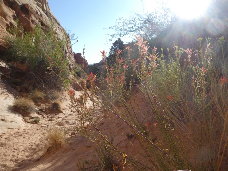
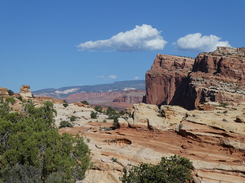
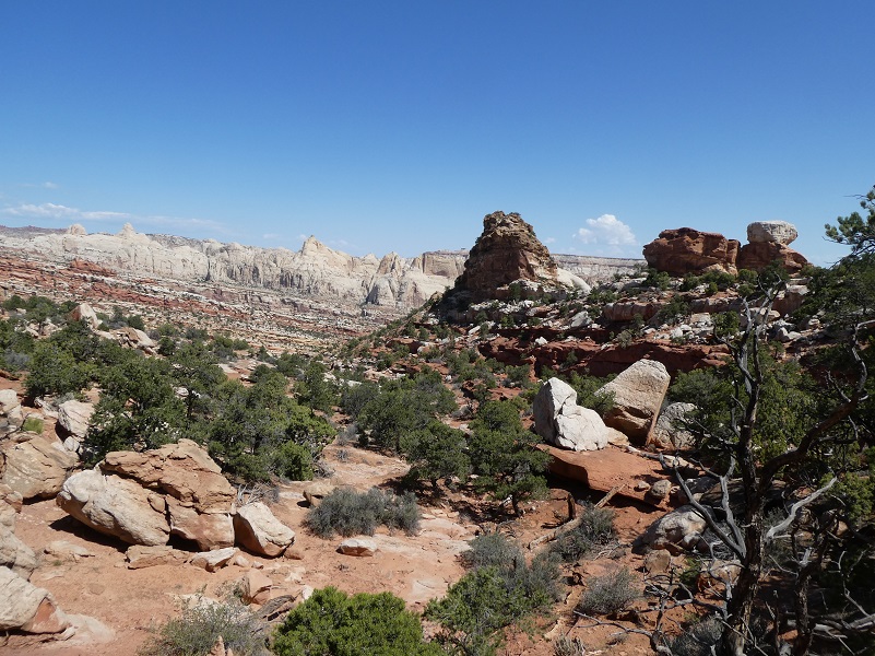
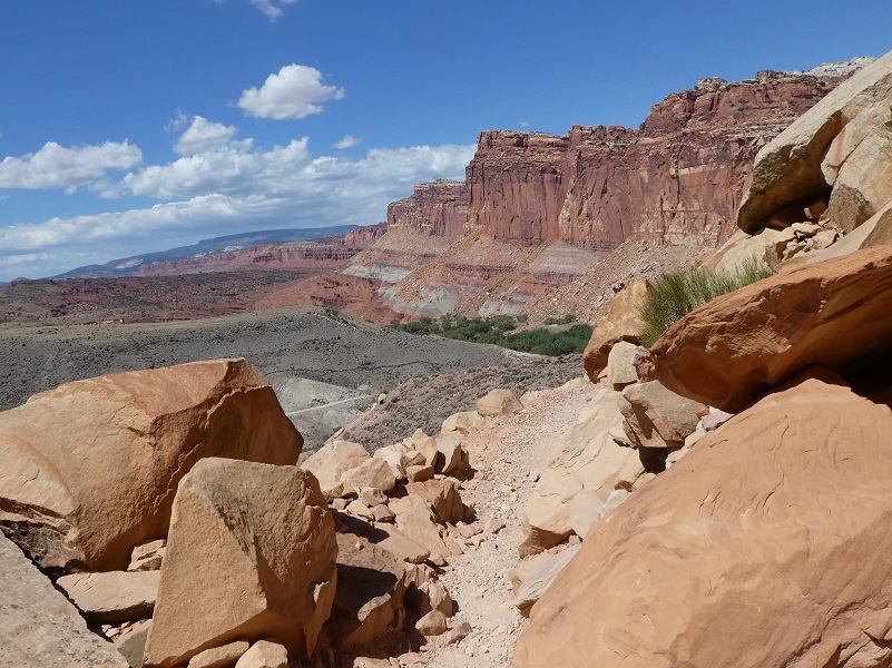
After 1.1 miles, I reached the junction of the Frying Pan Trail and took it to Cassidy Arch. The trail started climbing from the start, revealing huge views all around me. Stripey, jutting walls of rock kept changing colors as I hiked upward.


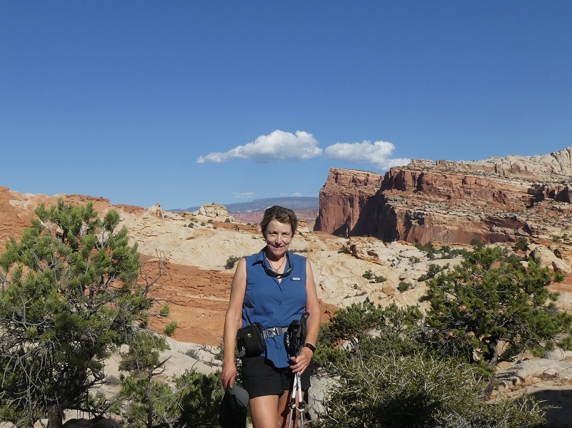
Some nice hikers took this picture of me on the trail, looking back toward Cohab Canyon and where I had started.
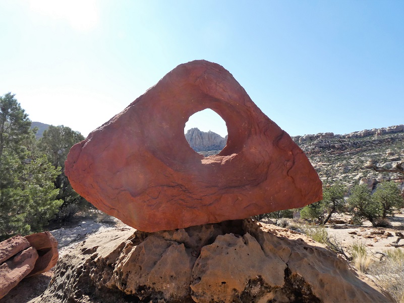
I saw an interesting formation ahead of me but what was it? Is it called an arch?

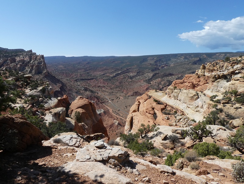
I stopped at a high point where I could look toward the south, where Cassidy Arch was. I still had a ways to go. I could spot a couple of landmarks that I had read about in my preparation for this trip, Pectols Pyramid and Ferns Nipple. Yes, you read that right on the second landmark. I don’t know who Fern was she must have been memorable.
After a breather, I continued onward. I could see the highway below me, straight below me, so I must be getting close. Where in the heck was this Cassidy Arch?
Was this it? I expected a little more after this warm hike.

I hadn’t seen anyone in a couple of hours and in places the trail was faint but I could always pick it up by paying attention but maybe I got off of it somehow. I stopped to try and pick out any sign of the trail such as footprints or trail markers, nothing. The slickrock did not reveal any signs. Finally I saw people, so I must be getting closer to Cassidy Arch and followed after them.

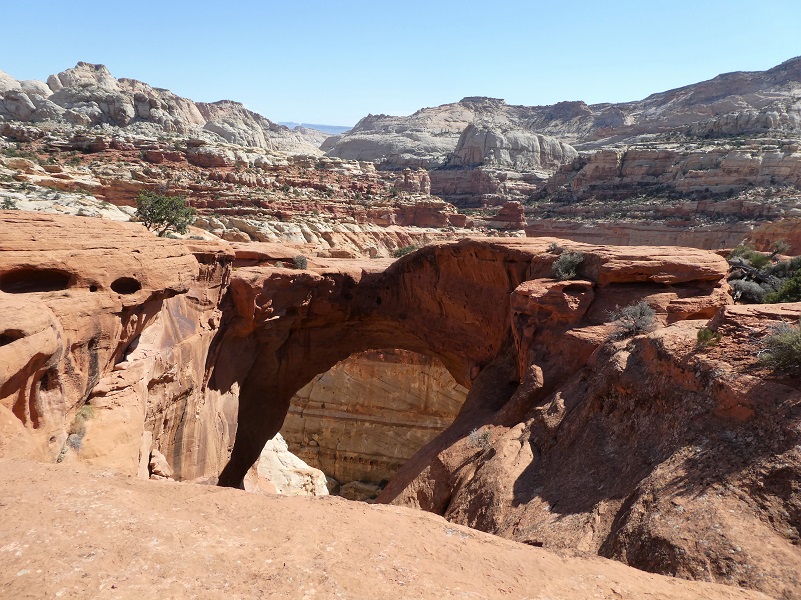
And there it was! Cassidy Arch. They say the width at the top is about 40 feet across.
After checking out the arch from some different angles, I headed back the same way I had come in. I could have continued on down the Grand Wash to the highway and walked 3.5 miles up the highway back to the car, but I came here for the experience of being up close to those beautiful red rocks. The afternoon was getting warm and regretted only bringing 2 liters of water with me and saving my lunch in the ice chest at the car for my return. I rationed the water out for the rest of the hike and took a few breaks in shady spots.

And there was that beautiful view and the final stretch back down the car.
What a great hike through some very different country for me. They recommend that you bring plenty of water for this hike and that is the biggest thing that I learned. Next time I will bring more. I got back at the car about 1230, rehydrated and ate my sandwich. Boy, did it hit the spot!
Dog Hike: No, Dogs are not permitted on hiking trails, in public buildings, or in the backcountry.
Maps:

Cassidy Arch Hike Google Earth Image
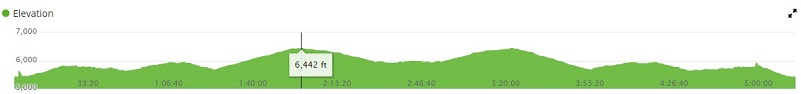
Cassidy Arch Hike Profile
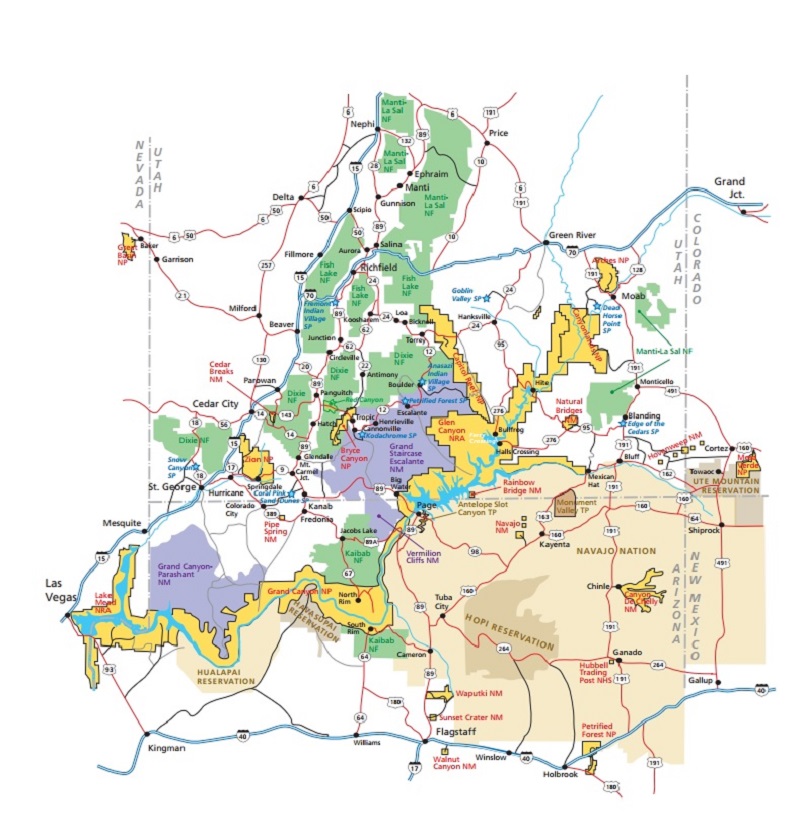
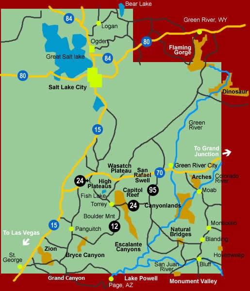
Capitol Reef Map from Capitol Reef National Park’s Website
Sources:
Capitol Reef National Park Wikipedia
Capitol Reef National Park Pet Rules
Prior Blogs in the Area:
Horseback at Capitol Reef in Utah: The Secret Life of Horse Camping May 27, 2018