MADERA COUNTY – Oct. 8, 2020 – Damage assessments are 98% complete leaving roughly 119 structures still threatened, 856 destroyed and 71 damaged. An interactive damage assessment map for Fresno County and Madera County is available: Fresno County Damage Assessment Map or https://bit.ly/3kxDyvI
The Sierra National Forest will host an Incident Briefing Friday at 7pm via Facebook Live: https://www.facebook.com/SierraNF/
We are still in the height of fire season so remember to sign up for emergency alerts if you have not done so: Fresno County, Madera County, Mariposa County
The Temporary Flight Restriction is still in place. The flight restriction zone perimeter runs from South Merced River Fork on the south end of Yosemite National Park, south to Millerton Lake roughly following Route 41, east to Kings Canyon National Park, and north to Inyo National Forest. See: tfr.faa.gov
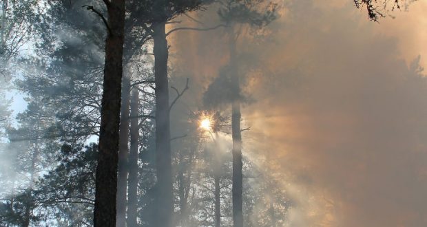
Seasonally mild temperatures will remain present through the end of the week. A change in the weather system is expected this weekend and will bring higher humidity which will aid in the fire fighters efforts. While measurable rainfall is not expected, the higher relative humidity will begin to slow the fire’s progress. Smoke will remain present overnight and in the morning with general air quality improving in the afternoons as winds develop.
MADERA COUNTY – North Zone – Crews were able to complete fire line in the Little Shuteye Peak area Tuesday and have been continuing the mop up as well as widening the line with helicopter assistance as smoke allows. Additionally, snagging and cold trailing will continue to find any remaining heat in the vicinity.
In the Whisky Falls area, crews completed five miles of chipping and additional crews are finishing up with securing structures in Johnson Meadows.
The Roads Group has completed the removal of hazard trees along the 81 corridor, which is now completely open. Now, crews are focusing on peripheral roads within the fire area.
The fire is still 10 miles west of Mammoth Lakes; little forward progression is occurring due to the natural barriers of rock and the Lions Fire (2018) burn scar. Conditions continue to be monitored very closely.
FRESNO COUNTY – South Zone – The Sierra National Forest will allow individuals who were evacuated from campgrounds, camping areas and cabins in the South Zone of the fire an opportunity to return and collect their belongings again this weekend, October 10 and 11.
Please follow this link for more information on how to obtain an access permit. Permit Holder Access/Recreation Residence
Crews conducted defensive firing operations around Florence Lake with heavy resources currently protecting property. Small clusters of homes and seasonal residences in the areas of Mono Hot Springs, Vermillion Resort, Muir Trail Ranch, Blayney Meadow and Florence Lake remain evacuated.
2020-10-08-SanJoaquin-Yosemite-Outlook.20201008145315