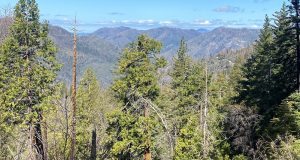
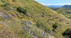
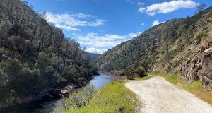
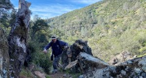
A little early for wildflowers and plenty of down trees were across this historic trail but my hike was rewarded with a lovely waterfall, pretty views along the way and a good workout. Where: Yosemite National ParkDistance: 12.12 MilesDifficulty: ModerateElevation Range: 4,037′ – 5,841′Elevation Gain: 2,252′Date: April 20, 2022CALTOPO: Alder Creek Falls HikeDog Hike? No I headed to Wawona through ...
Read More »History
History Mystery #110: Missing Plaques on Stone Monuments
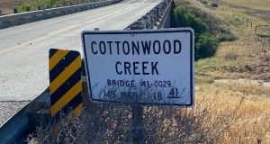
Submitted by Jack Butler, Historian, E Clampus Vitas Grub Gulch Chapter 41/49 On State Route 145, between Road 33 and Road 36, is the Cottonwood Creek Bridge. There are two rock monuments, one is west-facing on the south, and one is east-facing on the north side. They are both missing their plaques explaining the history of their placement. A blue ...
Read More »Hiking Down the Skelton Creek Trail to the Blue Glory Mine
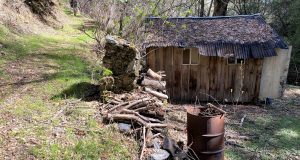
The historic Skelton Creek Trail shows up on maps in the 1850’s and walking down it was right up my alley. Tons of history in this area and I always learn something new when hiking with the Sierra Hiking Seniors, a friendly group of fellow hikers. Where: Sierra National Forest, Bureau of Land Management, Private PropertyDistance: 4.62 MilesDifficulty: Easy to ...
Read More »History Mystery #109: Mystery Mail Bags
Submitted by Lynn Northrup, Raymond Museum. These are mail bags from the River Route found by a museum supporter and donated. We have so many questions about these bags. What years were they used and when and why did they cease? Who were the local mail carriers and does anyone have any other bags from the different routes? Are there ...
Read More »Hiking Hite’s Cove Trail With Wildflowers and Newts
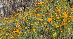
Wildflower season has definitely arrived in the Merced River Canyon. And, it was a 15 newt day on the Hite’s Cove Trail! If you don’t feel like going the distance that I did on the Hite’s Cove Trail, the most concentrated area of poppies is within the first 1/2 mile or so. But that is also the most concentrated area ...
Read More »Hiking Through Hersheimer Gap To Vernal Pools With the Sierra Foothill Conservancy
Kaleidoscopic splashes of yellow here, mounds of orange there and then a little later, oceans of purple, sometimes with some red to liven up the wildflower colors as I hiked up new trails with the Sierra Foothill Conservancy. At the top of the Ruth McKenzie Table Mountain Preserve vernal pools were especially beautiful, ringed with white meadowfoam. Where: Sierra Foothill ...
Read More »Hiking From Briceburg Down The Historic Merced River Trail
Wildflowers, miners, gold mines, an old railroad bed and a beautiful but deadly river all have roles in this week’s blog. Oh, and can’t forget about the geese!Where: Bureau of Land Management (BLM), Merced River Recreation Management AreaDistance: 13.36 miles round trip but you can go shorter or longerDifficulty: EasyElevation Range: 1,001′ – 1,215′Elevation Total Ascent: 1,125′Date: March 7, 2022CALTOPO: ...
Read More »Hiking The Stockton Creek Preserve With The Sierra Foothill Conservancy
Frogs and birds were singing their tunes and turtles were basking in the sun on a beautiful day as I hiked with the Sierra Foothill Conservancy (SFC), exploring trails in the Stockton Creek Preserve. Recent land acquisitions have expanded this preserve, a partnership with SFC and Mariposa Public Utilities District (MPUD), to 700 acres and grants have improved and added ...
Read More »History Mystery #108: The North Fork Recreation Center
NORTH FORK — The North Fork Boosters owns and operates the North Fork Recreation Center, hosting community events and renting out to community organizations and private parties. Among the many events held at this venue is the Summer Youth Program that has been running for over 60 years. The Summer Youth Program is Monday-Friday from noon to 5 p.m. during ...
Read More »Hiking to Stevenson Creek Falls and Beyond
The Million Dollar Road led us to Stevenson Creek Falls, its water dropping 1,200′ as it leaped over the rocks down to the San Joaquin River. A few wildflowers along the way put smiles on our faces. Where: Sierra National Forest, Southern California EdisonDistance: 12.44 Miles (About 7 miles roundtrip to Stevenson Creek Falls)Difficulty: ModerateElevation Range: 1,186′ to 2,387′Elevation Gain: ...
Read More »
