CALIFORNIA – Sept. 15, 2020 – Over 16,600 firefighters remain on the front lines of 25 major wildfires and two extended attack wildfires in California. Yesterday, activity increased on several of the wildfires, while on other fires, crews continued their progress towards containment. Firefighters were able to contain two large wildfires yesterday, all while still responding to 33 initial attack wildfires across the State.
See links below for more detail about specific fires burning throughout the State.
Since the beginning of the year, wildfires have burned over 3.2 million acres in California. Since August 15, when California’s fire activity elevated, there have been 25 fatalities and over 4,200 structures destroyed.
A Red Flag Warning continues in portions of Northeastern California around Modoc National Forest and Tulelake Basin due to gusty winds and low humidity. This Red Flag Warning is in effect today, but these conditions will likely continue through Thursday. Temperatures are expected to be warm today and Wednesday although tempered a bit by smoke. It will be cooler Friday and through the weekend as the trough moves through with some increase in humidity.
With no significant precipitation in sight, California remains dry and ripe for wildfires. Have you signed up for emergency alerts in case a fire near your home requires you to evacuate? If not, be sure to sign up for the alerts in your county here to make sure you are prepared, and to learn more about other ways to be ready for any emergency, visit www.ReadyForWildfire.org.
Fires of Interest:**CAL FIRE Incidents**
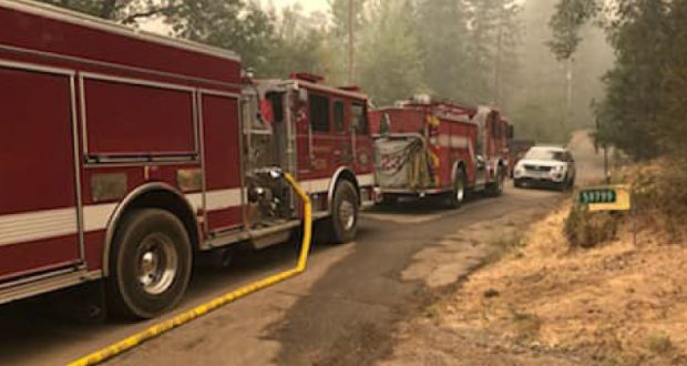
Shackleford Fire, Siskiyou County (more…)
Southwest of Quartz Valley Reservation
*50 acres, 50% contained
Willow Fire, Yuba County (more info…) FINAL
Willow Glen Road, Dobbins
*1,311 acres, 100% contained
*Evacuations in place
Oak Fire, Mendocino County (more info…) FINAL
North of Willits
*1,100 acres, 100% contained
LNU Lightning Complex, multiple North Bay counties (more info…)
Napa, Lake, Sonoma, Colusa, Solano, and Yolo Counties
*363,220 acres, 97% contained
*Hennessey (merged fires) 305,651 acres, 96% contained
*Wallbridge 55,209 acres, 95% contained
*1,491 structures destroyed
*5 fatalities
*CAL FIRE Incident Management Team 2 in command
SCU Lightning Complex, multiple Easy Bay counties (more info…)
Contra Costa, Alameda, Santa Clara San Joaquin, Merced, and Stanislaus Counties
*396,624 acres, 98% contained
*20 fires in the complex, several have merged together
*222 structures destroyed
*CAL FIRE Incident Management Team 6 command
CZU Lightning Complex, San Mateo and Santa Cruz Counties (more info…)
*86,509 acres, 91% contained
*Multiple fires
*1,490 structures destroyed
*1 fatality
*CAL FIRE Incident Management Team 3 command
Schoolhouse, Siskiyou County (more info…)
Schoolhouse Gap Road, north of Fort Jones
*45 acres, 90% contained
**Unified Command Incidents**
North Complex, Plumas County (more info…)
Southwest of Susanville (Plumas National Forest)
*269,358 acres, 32% contained
*15 fatalities
*Evacuations in place
*Includes the Bear and Claremont Fire
*CAL FIRE Team 4 is now in unified command with US Forest Service IMT Team 4
Creek Fire, Fresno County (more info…)
Northeast of Shaver Lake (Sierra National Forest)
*220,025 acres, 16% contained
*Evacuations in effect
*Heavy tree mortality in the area
*CAL FIRE and US Forest Service in unified command
*CAL FIRE Incident Management Team 1
*Great Basin Team 1
El Dorado Fire, San Bernardino County (more info…)
West of Oak Glen (San Bernardino National Forest)
*17,598 acres, 54% contained
*Evacuations in place
*California Interagency Incident Management Team 11 in unified command with CAL FIRE, Yucaipa Fire Department and San Bernardino County Fire Department
Butte/Tehama/Glenn (BTU/TGU) Lightning Complex, multiple Counties (more info…)
Butte, Tehama, and Glenn Counties
*19,609 acres, 97% contained
*Includes multiple other smaller fires
*Decrease in acres as Elkhorn was moved to the August Complex.
*16 structures destroyed
**Coordinated Command Incidents**
August Complex, Tehama County (more info…)
Elk Creek and Stonyford area (Mendocino National Forest)
*803,489 acres 30% contained
*North/South Zone 754,480 acres, 30% contained
*West Zone 49,009 acres, 0% contained
*Decreased acreage due to mapping by USFS
*1 fatality
*Includes multiple fires including the Elkhorn, Hopkins, Willow, Vinegar, and Doe fires
*A California Interagency Incident Management Team and Great Basin Team in command
*A CAL FIRE Incident Management Team is deployed on the west zone of the fire.
**Federal Incidents**
SQF Complex, Tulare County (more info…)
25 miles north of Kernville (Sequoia National Forest)
*107,101 acres, 12% contained
*Castle and Shotgun Fires merged into this complex
Slater Fire, Siskiyou County (more info…)
5 miles North of Happy Camp (Klamath National Forest)
*131,601 acres, 10% contained
*2 fatalities
*Evacuation orders in place
Devil Fire, Siskiyou County (more info…)
5 miles north of Upper Devil’s Peak (Klamath National Forest)
*4,429 acres, 0% contained
Bobcat Fire, Los Angeles County (more info…)
North of Duarte
Angeles National Forest
*41,231 acres, 3% containment
*Evacuations in progress
*EA Silver Team in command
Bullfrog Fire, Fresno County (more…)
SE of Bullfrog Lake, Sierra National Forest
*900 acres, 0% contained
Fork Fire, El Dorado County, (more info…)
15 miles northeast of Pollock Pines (El Dorado National Forest)
*1,752 acres, 7% contained
*Evacuation orders remain in place
Valley Fire, San Diego County (more info…)
Near Alpine (Cleveland National Forest)
*17,665 acres, 87% contained
*CAIIMT 15 in command
Lake Fire, Los Angeles County (more info…)
Southwest of Lake Hughes
Angeles National Forest / Los Angeles County Fire Department
* 31,089 acres, 96% contained
Dolan Fire, Monterey County (more info…)
Hwy 1, 10 miles south of Big Sur (Los Padres National Forest)
*118,465 acres, 40% contained
*Structures threatened
*Type 1 NW Team 2 (Allen) in command
Apple Fire, Riverside County (more info…)
Oak Glen/Cherry Valley (San Bernardino National Forest)
*33,424 acres, 95% contained
Red Salmon Complex – Humboldt County (more info…)
14 miles northeast of Willow Creek (Shasta-Trinity National Forest)
*91,743 acres, 16% contained
Blue Jay Fire, Mariposa County (more info…)
Yosemite National Park Wilderness
*3,500 acres, 20% contained
Wolf Fire, Tuolumne County (more info…)
Yosemite National Park Wilderness
*828 acres, 10% contained
Woodward Fire, Marin County (more info…)
3 miles southwest of Olema (Point Reyes National Seashore)
*4,920 acres, 96% contained
Slink Fire, Mono County (more info…)
2 miles west of Coleville (Humboldt-Toiyabe National Forest)
*26,709 acres, 60% contained
Moraine, Tulare County (more info…)
Sequoia and Kings Canyon National Parks Wilderness
*575 acres, 70% contained
Rattlesnake, Tulare County (more info…)
Sequoia and Kings Canyon National Parks Wilderness
*1,441 acres, 0% contained
Top 20 Wildfire Records
- 5 of the Top 20 largest wildfires in California History have occurred in 2020.
- Largest Wildfires – #1 August Complex, #3 SCU Lightning Complex, #4 LNU Lightning Complex, #9 North Complex, and #16 Creek Fire.
- Most Destructive – #9 LNU Lightning Complex and #10 CZU Lightning Complex
- Deadliest Wildfires – #5 North Complex and #20 LNU Lightning Complex
