CALIFORNIA – Oct. 14, 2020 – Today over 11,000 firefighters remain on the frontlines of 20 wildfires across the state, 13 of which remain major incidents. Yesterday, firefighters across the State responded to 24 new wildfires, all of which were quickly contained.
The National Weather Service has issued a Red Flag Warning for many parts of Northern California due to critical fire weather. A weak cold front moving into Northern California will bring gusty winds and low humidity beginning Wednesday, continuing through Friday. Breezy conditions with wind gusts from 25-45 mph with wind prone areas potentially experiencing gusts to 70 mph. With dry conditions and above normal temperatures continuing across the State CAL FIRE has increased staffing.
Since the beginning of the year, there have been over 8,500 wildfires that have burned well over 4.1 million acres in California. To date, the total number of fatalities statewide is 31 and more than 9,200 structures have been destroyed.
CAL FIRE is asking residents to ensure they are prepared if a wildfire strikes near them. With Red Flag conditions in many parts of the state over the next couple of days, fires in these areas can spread rapidly. Making quick and safe evacuation is critical to protecting your life and your family. To learn ways to be prepared, visit www.ReadyForWildfire.org.
Fires of Interest:
**CAL FIRE Incidents**
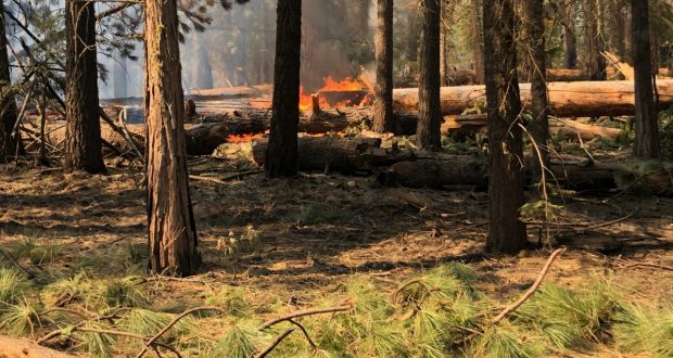
Zogg Fire, Shasta and Tehama Counties (more info…) **FINAL**
Southwest of Redding
*56,338 acres, 100% contained
*4 Fatalities
*204 structures destroyed.
Butte/Tehama/Glenn (BTU/TGU) Lightning Complex, multiple Counties (more info…)
Butte, Tehama and Glenn Counties
*19,609 acres, 97% contained
*14 structures destroyed
*While no growth is expected, fire suppression repair work is ongoing.
**Unified Command Incidents**
Glass Fire, Napa and Sonoma Counties (more info…)
4 miles east of Calistoga
*67,484 acres, 97% contained
*Evacuation orders and warnings in place
*1,555 structures destroyed
*CAL FIRE Team 3 in command.
Creek Fire, Fresno and Madera Counties (more info…)
Northeast of Shaver Lake (Sierra National Forest)
*337,655 acres, 55% contained
*Evacuations in place
*Heavy tree mortality in the area
*856 structures destroyed
*Northern Rockies Team 4 is in command of the North Zone and California Interagency Incident Command Team 14 is in command of the South Zone.
SQF Complex, Tulare County (more info…)
3 miles east of Giant Sequoia National Monument
*167,625 acres, 70% contained
*Evacuation order and warnings remain in place
*232 structures destroyed
*California Interagency Incident Management Team 13 in unified command with CAL FIRE.
**Coordinated Command Incidents**
August Complex, multiple Counties (more info…)
Colusa, Glenn, Lake, Mendocino, Tehama and Trinity Counties
Elk Creek and Stonyford area (Mendocino National Forest)
*1,029,110 acres, 77% contained
*South Zone 548,295 acres
*North East Zone 270,336 acres
*North West Zone 69,957 acres
*West Zone 140,552 acres
*1 fatality
*210 structures destroyed
*Includes multiple fires including the Elkhorn, Hopkins, Willow, Vinegar, and Doe fires
*The fire is being managed in four zones by 4 national Incident Management Team and CAL FIRE Incident Management Team 5.
**Federal Incidents**
North Complex, Plumas County (more info…)
Northeast of Oroville to southwest of Quincy (Plumas National Forest)
*318,930 acres, 94% contained
*15 fatalities
*2,342 structures destroyed.
Slater Fire, Siskiyou County (more info…)
5 miles North of Happy Camp (Klamath National Forest)
*156,417 acres, 78% contained
*2 fatalities.
Devil Fire, Siskiyou County (more info…)
5 miles north of Upper Devil’s Peak (Klamath National Forest)
*8,849 acres, 58% contained.
Fork Fire, El Dorado County, (more info…)
15 miles northeast of Pollock Pines (El Dorado National Forest)
*1,670 acres, 85% contained.
Red Salmon Complex – Humboldt County (more info…)
14 miles northeast of Willow Creek (Shasta-Trinity National Forest)
*141,820 acres, 62% contained.
Blue Jay Fire, Mariposa County (more info…)
Yosemite National Park Wilderness
*6,334 acres, 50% contained.
Wolf Fire, Tuolumne County (more info…)
Yosemite National Park Wilderness
*1,818 acres, 60% contained.
Moraine, Tulare County (more info…)
Sequoia and Kings Canyon National Parks Wilderness
*694 acres, 69% contained.
Rattlesnake, Tulare County (more info…)
Sequoia and Kings Canyon National Parks Wilderness
*5,765 acres, 30% contained.
Dolan Fire, Monterey County (more info…)
Hwy 1, 10 miles south of Big Sur (Los Padres National Forest)
*124,924 acres, 99% contained.
Slink Fire, Mono County (more info…)
2 miles west of Coleville (Humboldt-Toiyabe National Forest)
*26,759 acres, 90% contained.
Apple Fire, Riverside County (more info…)
Oak Glen/Cherry Valley (San Bernardino National Forest)
*33,424 acres, 95% contained.
Bobcat Fire, Los Angeles County (more info…)
North of Duarte (Angeles National Forest)
*115,796 acres, 92% containment.
Bullfrog Fire, Fresno County (more info…)
SE of Bullfrog Lake (Sierra National Forest)
*1,185 acres, 60% contained.
El Dorado Fire, San Bernardino County (more info…)
West of Oak Glen (San Bernardino National Forest)
*22,744 acres, 95% contained
*1 fatality.
Top 20 Wildfire Records
- 5 of the Top 20 largest wildfires in California History have occurred in 2020.
- Largest Wildfires – #1 August Complex, #3 SCU Lightning Complex, #4 LNU Lightning Complex, #5 Creek Fire, #6 North Complex and #18 SQF Complex
- Most Destructive – #5 North Complex, #10 Glass Fire, #11 LNU Lightning Complex, #12 CZU Lightning Complex, #17 August Fire, #19 Creek Fire.
Deadliest Wildfires – #5 North Complex and #16 LNU Lightning Complex.
