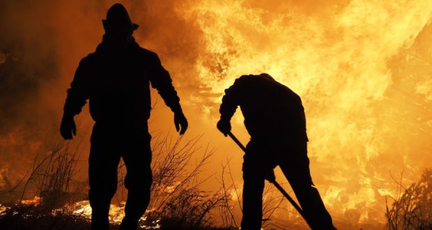
CALIFORNIA – Sept. 29, 2020 – Yesterday, critical fire weather continued to fan multiple fast-moving wildfires, as over 18,700 firefighters continue to battle 27 major wildfires. Fortunately, the gusty winds decreased overnight allowing firefighters to continue to build containment line and perform structure defense. Yesterday the US Forest Service reported that the 31,000 Lake Fire in Los Angeles County, which started on August 12, was fully contained. Firefighters across the State responded to 19 new wildfires, one of which, in Los Angeles County, is still burning. Sadly, the Shasta County Sheriff’s Department announced yesterday that three civilian fatalities occurred on Zogg Fire, which raises the overall fatality count since mid-August to 29.
Since the beginning of the year, there have been over 8,100 wildfires that have burned well over 3.8 million acres in California.
A Red Flag Warning remains in effect for the mountains and inland valleys in Riverside and San Diego Counties through Tuesday night. Although gusty winds have dissipated, strong high pressure continues to keep temperatures above normal across much of the inland areas of California, while coastal regions should expect cooler conditions accompanied by marine layer. This weather pattern is expected to remain in place for much of the week.
With no significant precipitation in sight, California remains dry and ripe for wildfires. Have you signed up for emergency alerts in case a fire near your home requires you to evacuate? If not, be sure to sign up for the alerts in your county here to make sure you are prepared, and to learn more about other ways to be ready for any emergency, visit www.ReadyForWildfire.org.
Fires of Interest:
**CAL FIRE Incidents**
Zogg Fire, Shasta County (more info…)
Southwest of Redding
*40,317 acres, 0% contained
*3 Fatalities
*Evacuation orders in place
*146 structures destroyed
*CAL FIRE Team 2 in command
Glass Fire, Napa County (more info…)
4 miles east of Calistoga
*42,560 acres, 0% contained
*Evacuation orders in effect and additional evacuations in progress
*CAL FIRE Team 3 in command today
LNU Lightning Complex, multiple North Bay counties (more info…)
Napa, Lake, Sonoma, Colusa, Solano, and Yolo Counties
*363,220 acres, 98% contained
*While no growth is expected, fire suppression repair work is ongoing.
SCU Lightning Complex, multiple Easy Bay counties (more info…)
Contra Costa, Alameda, Santa Clara San Joaquin, Merced, and Stanislaus Counties
*396,624 acres, 98% contained
*While no growth is expected, fire suppression repair work is ongoing.
Butte/Tehama/Glenn (BTU/TGU) Lightning Complex, multiple Counties (more info…)
Butte, Tehama, Glenn Counties
*19,609 acres, 97% contained
*14 structures destroyed
*While no growth is expected, fire suppression repair work is ongoing.
**Unified Command Incidents**
North Complex, Plumas County (more info…)
Northeast of Oroville to southwest of Quincy (Plumas National Forest)
*308,995 acres, 76% contained
*15 fatalities
*2,342 structures destroyed
*Evacuations in place
*Includes the Bear and Claremont Fire
*CAL FIRE Team 4 is in unified command with US Forest Service IMT Team 4, Butte County Sheriff’s Office and California State Parks
Martindale Fire, Los Angeles County (more info…) **NEW**
Bouquet Canyon, Northeast of Santa Clarita
*230 acres, 20% contained
*Structures threatened
*Evacuation orders remain in place
*Unified Command USFS and Los Angeles County FD
Creek Fire, Fresno County (more info…)
Northeast of Shaver Lake (Sierra National Forest)
*305,240 acres, 44% contained
*Evacuations in place
*Heavy tree mortality in the area
*855 structures destroyed
*CAL FIRE Incident Management Team 1 in unified command with USFS Great Basin Team 1
SQF Complex, Tulare County (more info…)
3 miles east of Giant Sequoia National Monument
*150,800 acres, 58% contained
*Evacuations in place
*232 structures destroyed
*CAL FIRE Incident Management Team 6 in unified command with USFS Team 2
**Coordinated Command Incidents**
August Complex, multiple Counties (more info…)
Colusa, Glenn, Lake, Mendocino, Tehama and Trinity Counties
Elk Creek and Stonyford area (Mendocino National Forest)
*938,044 acres, 43% contained
*South Zone 488,897 acres, 70% contained
*North Zone 332,388 acres, 49% contained
*West Zone 116,759 acres, 65% contained
*1 fatality
*86 structures destroyed
*Includes multiple fires including the Elkhorn, Hopkins, Willow, Vinegar, and Doe fires
*A California Interagency Incident Management Team and Great Basin Team in command
*CAL FIRE Incident Management Team 3 & 5 are deployed on the West Zone of the complex
**Federal Incidents**
Snow Fire, Riverside County (more info…)
Snow Creek Rd, west of Palm Springs
*6,254 acres, 95% contained
El Dorado Fire, San Bernardino County (more info…)
West of Oak Glen (San Bernardino National Forest)
*22,744 acres, 93% contained
*1 fatality
*10 structures destroyed
*California Interagency Incident Management Team 13 in command
Fox Fire, Siskiyou County (more info…)
7 miles southwest of Callahan
*2,188 acres, 93% contained
*Evacuations in place
Slater Fire, Siskiyou County (more info…)
5 miles North of Happy Camp (Klamath National Forest)
*154,102 acres, 40% contained
*2 fatalities
*Evacuation orders in place
Devil Fire, Siskiyou County (more info…)
5 miles north of Upper Devil’s Peak (Klamath National Forest)
*8,410 acres, 18% contained
Bobcat Fire, Los Angeles County (more info…)
North of Duarte (Angeles National Forest)
*114,202 acres, 62% containment
*Evacuations in place
*Unified command with the US Forest Service, Los Angeles County Fire Department and Monrovia Fire Department
Dolan Fire, Monterey County (more info…)
Hwy 1, 10 miles south of Big Sur (Los Padres National Forest)
*128,417 acres, 77% contained
*Structures threatened
*California Interagency Incident Command Team 15 in command
Bullfrog Fire, Fresno County (more info…)
SE of Bullfrog Lake (Sierra National Forest)
*1,185 acres, 50% contained
Fork Fire, El Dorado County, (more info…)
15 miles northeast of Pollock Pines (El Dorado National Forest)
*1,667 acres, 70% contained
Lake Fire, Los Angeles County (more info…) **FINAL**
Southwest of Lake Hughes
Angeles National Forest / Los Angeles County Fire Department
* 31,089 acres, 100% contained
Apple Fire, Riverside County (more info…)
Oak Glen/Cherry Valley (San Bernardino National Forest)
*33,424 acres, 95% contained
Red Salmon Complex – Humboldt County (more info…)
14 miles northeast of Willow Creek (Shasta-Trinity National Forest)
*116,819 acres, 31% contained
Blue Jay Fire, Mariposa County (more info…)
Yosemite National Park Wilderness
*4,488 acres, 50% contained
Wolf Fire, Tuolumne County (more info…)
Yosemite National Park Wilderness
*1,087 acres, 35% contained
Woodward Fire, Marin County (more info…)
3 miles southwest of Olema (Point Reyes National Seashore)
*4,929 acres, 97% contained
Slink Fire, Mono County (more info…)
2 miles west of Coleville (Humboldt-Toiyabe National Forest)
*26,759 acres, 86% contained
Moraine, Tulare County (more info…)
Sequoia and Kings Canyon National Parks Wilderness
*668 acres, 70% contained
Rattlesnake, Tulare County (more info…)
Sequoia and Kings Canyon National Parks Wilderness
*4,070 acres, 0% contained
Top 20 Wildfire Records
- 5 of the Top 20 largest wildfires in California History have occurred in 2020.
- Largest Wildfires – #1 August Complex, #3 SCU Lightning Complex, #4 LNU Lightning Complex, #5 North Complex, and #6 Creek Fire.
- Most Destructive – #5 North Complex, #10 LNU Lightning Complex, #11 CZU Lightning Complex, and #17 Creek Fire.
- Deadliest Wildfires – #5 North Complex and #20 LNU Lightning Complex.