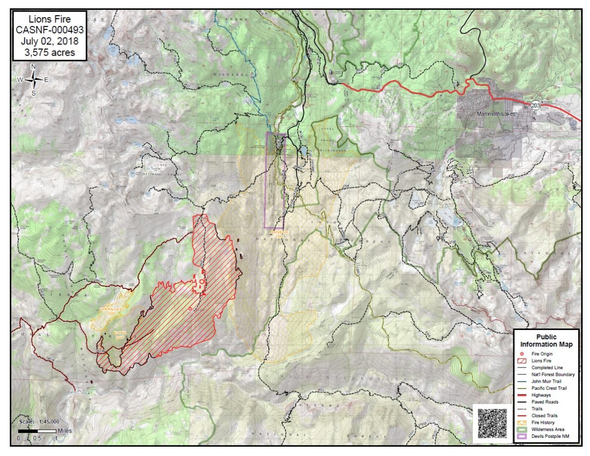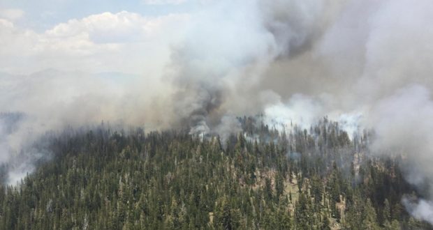
CLOVIS – Burn-out operations continue on the Lions Fire, burning in the Ansel Adams Wilderness, causing smoky conditions in the surrounding areas.
Yesterday’s burn-out operations brought the Lions Fire to 3,575 acres and 35 percent containment. In a burn-out operation, firefighters introduce fire inside of containment lines and natural barriers, and allow it to move towards the approaching wildfire, thus depriving the approaching wildfire of fuel.
Using this technique consumes fuels that otherwise might take much longer to burn, and reduces the overall duration of the incident. Burn-out operations continue today on a smaller scale than on previous days.
Smoke impacts in Mammoth Lakes and the surrounding areas are expected to continue throughout the week, but lessen each day as the vegetation and dead and down wood within the fire area continues to burn down.
Fire managers are using aerial resources to support a broad range of operations. Helicopters are transporting firefighters to and from their wilderness spike camps, supplying ground operations, and making water drops to cool the fire perimeter. Helicopters are also being used to perform aerial ignitions during burn-out operations in areas where ground access would be unsafe or inefficient.
This lightning-caused fire was detected in early June, and is located in the Ansel Adams Wilderness. It is located primarily in the Stairway Creek drainage, north and west of the Middle Fork of the San Joaquin River.
To provide for public and firefighter safety, the following National Forest System Trails near the burned area have been temporarily closed:
Sierra National Forest Trails No. 26E01 (Mammoth Trail) to the Inyo National Forest Boundary; 26E14, 26E56 and 26E46 from the Inyo NF boundary.
Inyo NF trail closures include 26E01 from the Sierra NF to 2601 junction, and 2601 from the boundary of the Inyo NF and Devils Postpile National Monument (King Creek Trail).
Shuttles to Devils Postpile National Monument and Reds Meadow Valley are running, and trails there are open. The Pacific Crest Trail and the John Muir Trail are open. Visitors should expect smoke impacts of variable intensity.
Air quality forecasts are available at https://airnow.gov/index.cfm?action=topics.smoke_wildfires.
For more information about smoke conditions in the area, visit webcams at www.mammothmountain.com and the alert tab at nps.gov/DEPO.
For more information, see https://inciweb.nwcg.gov/incident/5850 or call 760-582-5203.