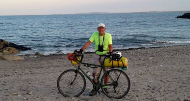
Editor’s Note: Oakhurst resident Bob Kaspar completes his epic ride across the United States from California to his hometown of Brockton, Massachusetts.
After leaving Gettysburg I head north through the Pennsylvania rust belt. At Scranton I turn east once again and travel through the Poconos and into New York, Connecticut, Rhode Island and then finally touchdown in Massachusetts.
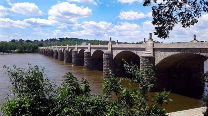
A stonework bridge over the Susquehanna River at Harrisburg, Pennsylvania.
 Congestion in Harrisburg, capital of Pennsylvania. Bike couriers boldly dart through traffic.
This provided the opportunity to practice my rude and aggressive cycling skills including head fakes, counter traffic movement and communicating with hand gestures.
A great camp on a 400 foot bluff overlooking the confluence of the Main and West branches of the Susquehanna Rivers above Northumberland, PA.
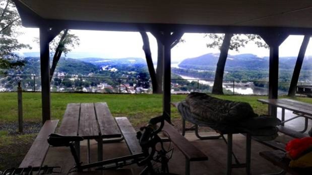 The park was gated so no vehicles. It began raining in the middle of the night so I moved under a picnic pavilion. Great views at sunrise.
One of the problem navigating with Google Maps is it generally doesn’t indicate dirt roads.
Road bikes, like mine, don’t do well on dirt. Worse yet, some paved roads become dirt only after you’ve traveled many miles down them.

This leaves you with the choice of turning around even though the dirt may only be a short section or continuing on and finding the dirt continues for many miles. The rain makes the decision more difficult.
This happened east of Scranton, PA., and I opted to continue in the mud. It lasted for about 15 miles but wasn’t too bad. The surface was hard and the rain pleasant. I enjoyed it despite ending up mud-caked.
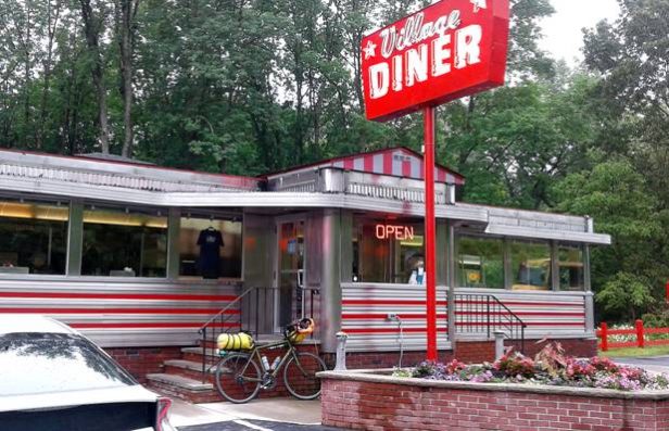
Breakfast stop at a roadside dinner in Milford, eastern Pennsylvannia.
Bridge over the Delaware River between Matamoros, PA, to Port Jervis, NY. The Husky puppy approaching on the left was criminally cute. I regret not getting a picture.
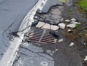 Bike-destroying potholes on secondary roads like this are not uncommon and you have to pay attention to avoid them.
I saw several like this that were missing the 18-inch square grate!
Despite conventional but ill-informed wisdom, biking on major highways with well-maintained shoulders is much safer than secondary roads. Major highways, including interstates, have wide shoulders separated from the traffic lanes by a “rumble strip” (those little dips carved into the surface) which audibly alert you to anyone crossing onto the shoulder from behind.
You have several hundred yards of unobstructed vision front and rear and so drivers can also see you from a distance. Also, no dogs. You will also hear “But what about the semi’s” on the major highways. It’s unclear what the difference is between being hit from behind by a 5,000 lb. pickup or a 50,000 lb/ semi. On the highways almost all professional drivers will move over and give you extra room. Not true on back roads with drunks driving pickups while talking on a cell phone. I’ll take my chances with a 50,000 lb. vehicle 15 feet away over a 5,000 lb. vehicle 12 inches away.
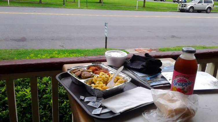
One of the best meals yet. Shrimp tortellini, Kielbasa sausage, meatballs, Kaiser Roll and Mediterranean salad at Rick’s Deli in Goshen, New York.
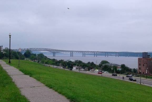
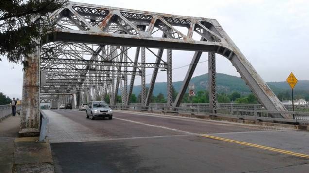
Very long bridge over the Hudson River at Newburg, NY just north of West Point. It drizzled all day.
Crossing the Hudson on the long bridge from Newburg to Beacon, NY. West Point is below the sunlight in the distance.
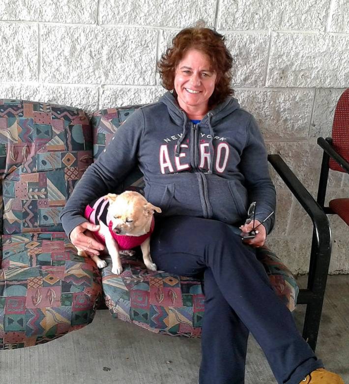
I spent a layover day in Fishkill, NY, due to weather. There I met Lilly who seemed interested in what I was doing. We spent about an hour together and I gave her the crust off my sandwich and part of cookie. I have no idea who the woman is.
![]() Agriculture in the East required clearing the land of trees and rocks. The trees were used as lumber and fuel while the rocks were laid in dry stone wall around the periphery.
Agriculture in the East required clearing the land of trees and rocks. The trees were used as lumber and fuel while the rocks were laid in dry stone wall around the periphery.
As the generations passed, the walls grew to miles in length as each hard-fought acre was cleared. Perhaps knowing that they would persist over the ages, the walls show an attention to detail far beyond their functional requirements and stand in mute testament to skill, pride of workmanship and stewardship of the land.
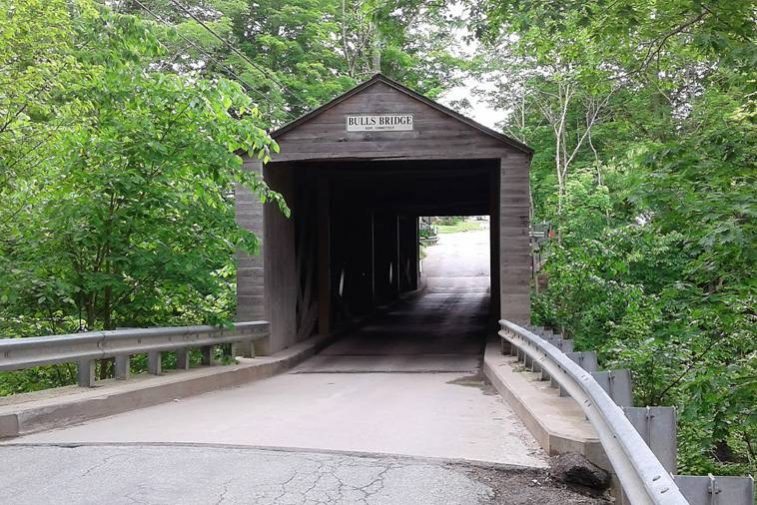
Bull’s Bridge across the Housatonic River and into western Connecticut.
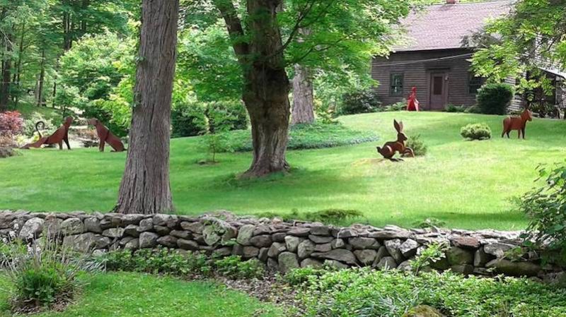
Interesting lawn sculptures in the Housatonic Valley, western Connecticut.
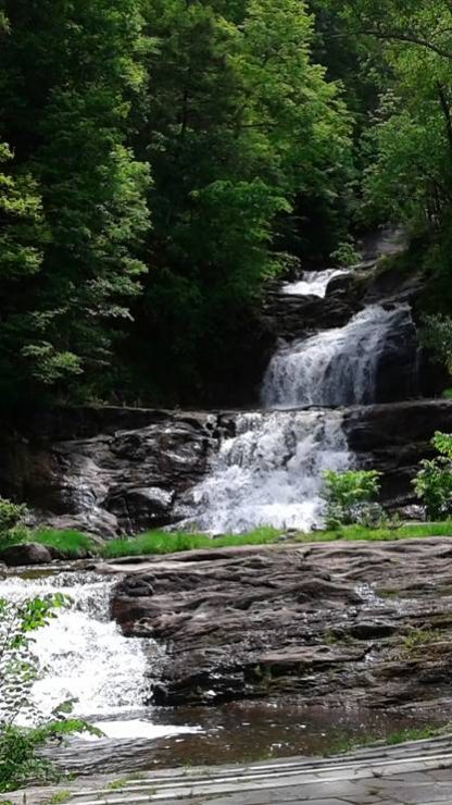
Kent Falls, in western Connecticut.
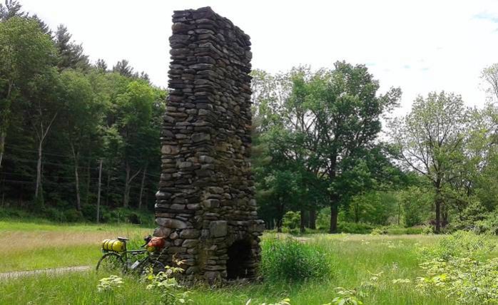
Ruins near Kent, Connecticut.
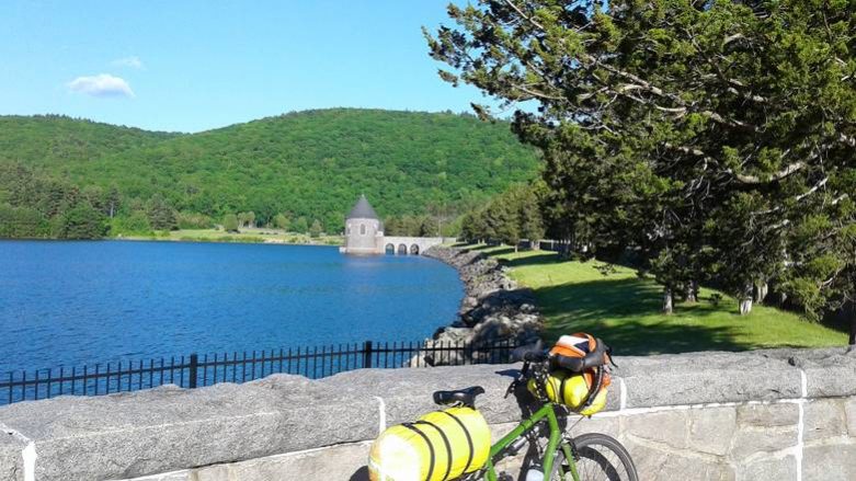
Saville Dam which contains the beautiful Barkhamstead Reservoir in northern Connecticut. The primary source of water for Hartford, Connecticut, the reservoir was opened in 1948 and features impressive stonework and a well-manicured landscape.
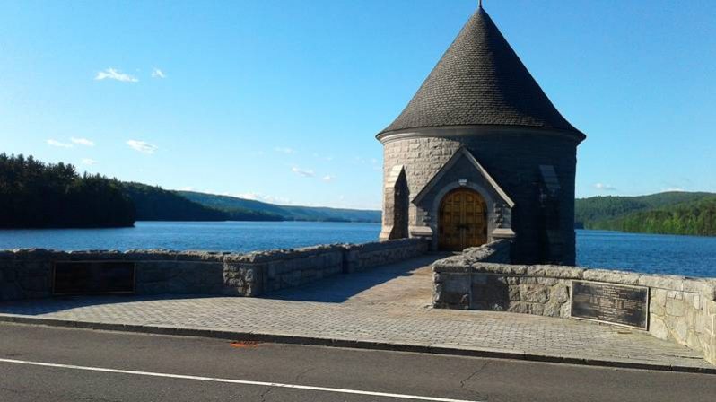
Barkhampstead Reservoir.
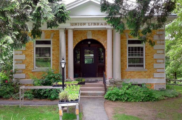
I’m now officially in Rockwellia. The lovely Union Library in Chepachet, Rhode Island. They don’t make ’em like this any more (possibly because nobody reads books anymore).
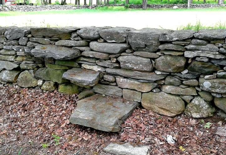
Interesting cantilevered steps, held in place only by weight, over a dry stone (without mortar) wall near Woodstock, Connecticut.
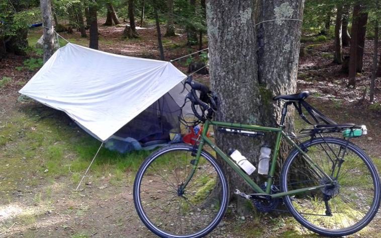
It started to get a little buggy in Rhode Island and so, for the first time on the trip, set up the net tent under the tarp cover. It rained a little during the night.
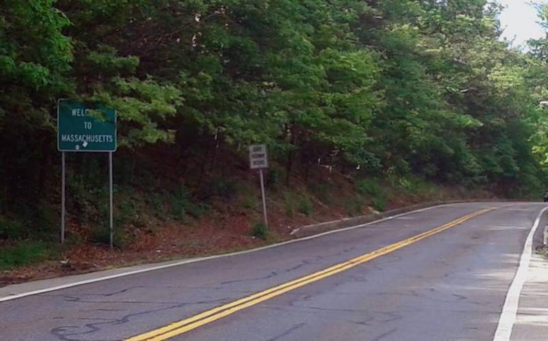 Entering Massachusetts from Rhode Island. This came up a little faster than I had expected. I navigate with both digital and paper maps. Each has it’s advantages and disadvantages. Digital maps are detailed but cannot convey larger context.
Paper maps are all about the same physical size. So a paper map of Rhode Island is the same size, about 24″ x 36″ as a map of Kansas. The problem is that Kansas is about 70 times larger than Rhode Island.
So, the maps physical size being the same as Kansas makes Rhode Island seem artificially larger than it is. As a result you arrive every place much sooner than expected. In fact, Rhode Island is only about half the size of Madera County! About 25 miles across!
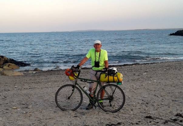 I crest a small hill in Marshfield, Massachusetts and, with Martha on the phone, catch a first glimpse of the Atlantic! Then… Splashdown! On the beach at Bluefish Cove, Brant Rock, Massachusetts.
My family had a summer house here built by my great-grandfather in the 1920s.
It was getting dark so I looked around, took some pictures and then headed off to find what was, as the story goes, a primary reason for the trip… Ipswich Whole Fried Clams! (Yah can only get ’em heah).
 Haddad’s in Brant Rock. Fried whole Ipswich Clams (that’s them waving at you from under the pile of onion rings) satisfy all the nutritional requirements of the three basic food groups – salt, fat and tide pool.
They’re a staple of New England beach life; in past times they were sold by the pint, quart or half gallon. They’re a little more pricey these days but no matter. But, tasty and iconic as they are, it’s easy to see why nobody ever got a fried clam tattoo. I don’t generally drink, but I indulged and washed them down with a beer and then headed off to sleep on the beach.
I spend several days in my original hometown of Brockton and on the New England coast eating fried clams, visiting sites and receiving a live sermon in the men’s room of Dunkin’ Donuts before catching a train in Boston for a four-day trip back to California.