TUOLUMNE COUNTY – With the Rim Fire now 80% contained, and the demobilization of over 2,000 personnel, I decided it was time to take a trip up to the area to see what the nearly 256,000 acre blaze had done to the landscape.
Enlisting my husband as my driver so I could take photos out the window along the way, I stocked up on bottles of cold water and we headed out early Sunday morning for the Incident Command Post just off Highway 120 east of Groveland. (please click photos to enlarge)
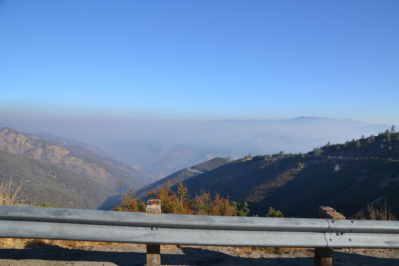 We first saw the heavy smoke as we started down the winding grade to Lake McClure. It was still early, so the smoke was laying in a heavy blanket over the fire area.
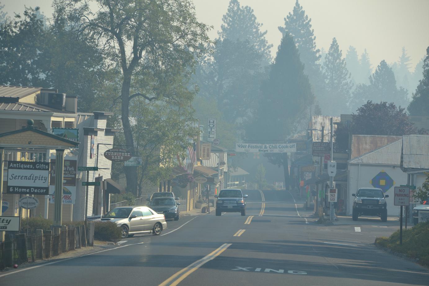
Arriving in Groveland, one really got the sense of what those nearest to this massive fire have been dealing with since the Rim Fire took off on Aug. 17. The omnipresent haze was going to be with us for the rest of this trip.
 The point of ignition was Jawbone Ridge near the Rim of the World Vista point about 15 miles east of Groveland.
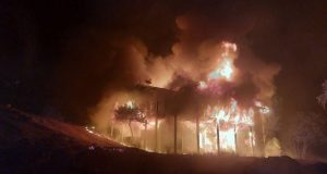
The fire quickly took off in the bone-dry fuels, doubling in size overnight for several days in a row.
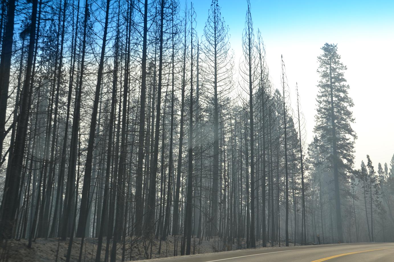
Now the highway is lined with the charred remains of standing trees in some spots, and untouched swaths of green forests in others.
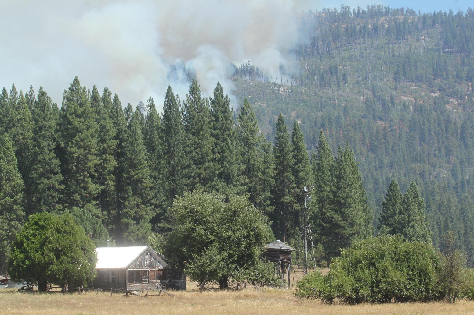
 The fire crossed the highway and burned on the south side in several places, most notably the Berkeley Tuolumne Camp just off Hardin Flat Road, where 100 of the 111 structures lost were incinerated.
Most all of the roads that branched off Highway 120 were blocked by signs advising that no admittance was allowed due to fire hazard conditions. Turnouts along the route were also blocked with cones, and signs advising motorists that they were not to stop anywhere along the roadway.
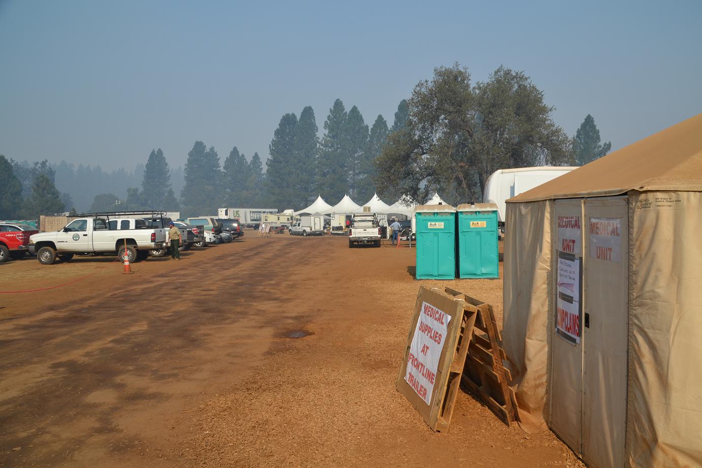 At Cherry Lake Road, we saw the signs showing the way to the Incident Command Center, and turned off to the north to head for fire camp.
The media tour was scheduled for 10 a.m., and we arrived in camp and signed in with the other three people who were to be part of our day’s adventure.
Before you can go into the active fire area, you must don the gear. That means Nomex – the yellow shirts and green pants that you see the firefighters wearing, along with hard hats, gloves, leather boots with 8″ tops and a fire shelter.
 A word of advice – if you’re fatter than the average firefighter, buy your own Nomex. It’s very expensive but beats being smashed into pants with no give that are 2 sizes too small for you for about six hours.
After we were suited up and had a safety briefing from our tour guide, we headed for Evergreen Road and into the burn area, hoping for a chance to visit Hetch Hetchy and see how the fire may have an impact on the water supply for San Francisco once the rains begin.
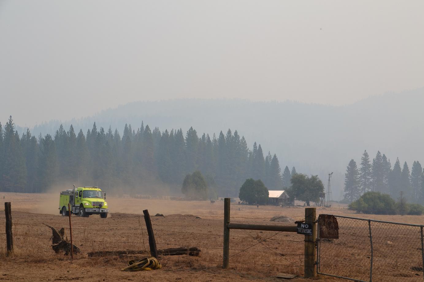
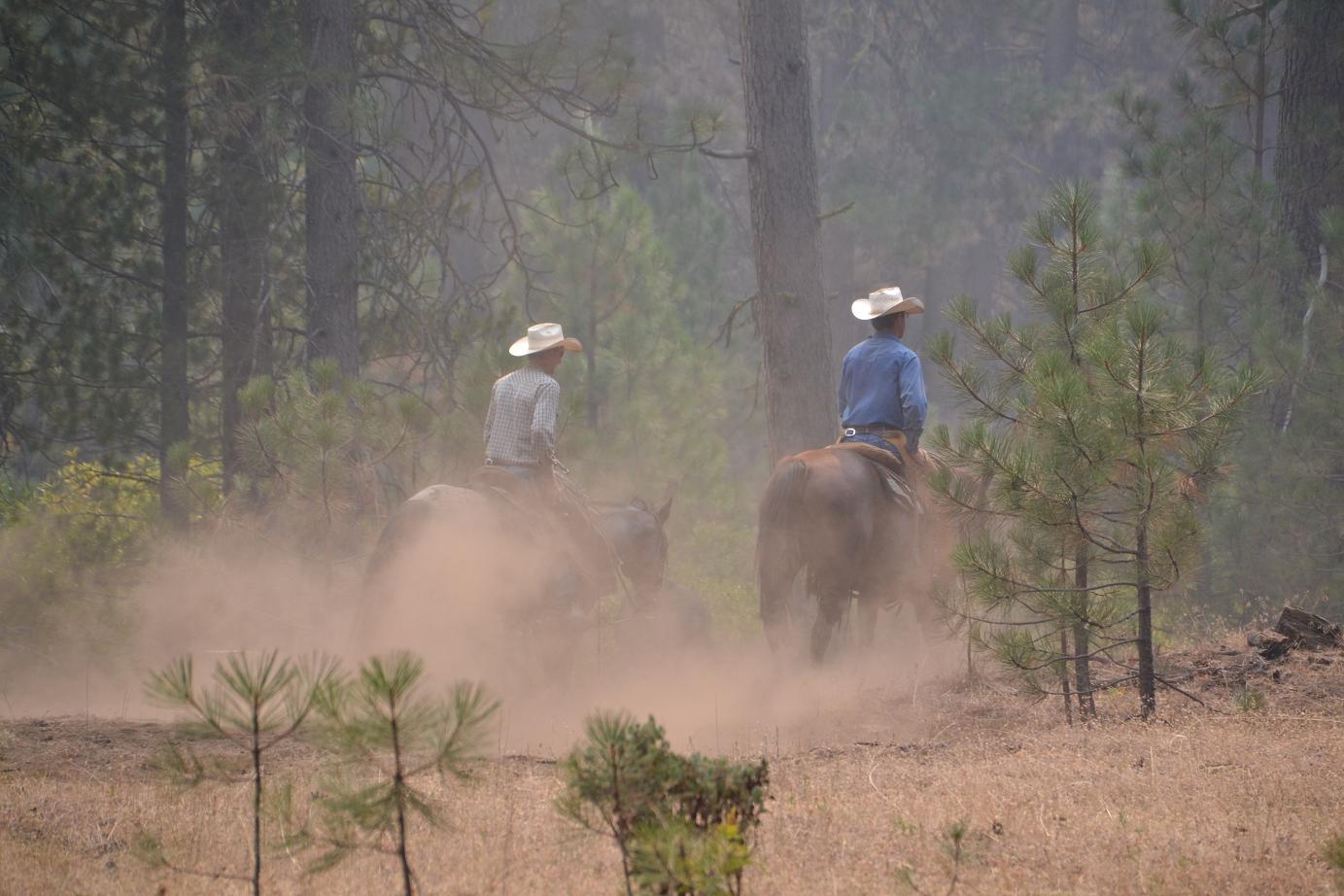 We stopped for a while at Ackerson Meadow, watching the strange juxtaposition of fire engines running on the dirt roads and cowboys gathering up their cows from summer pasture.
As the cattle bellowed and the sound of their bells clanged across the meadow, firefighters sharpened saws and straightened gear, preparing for their next assignment on the complex fire.
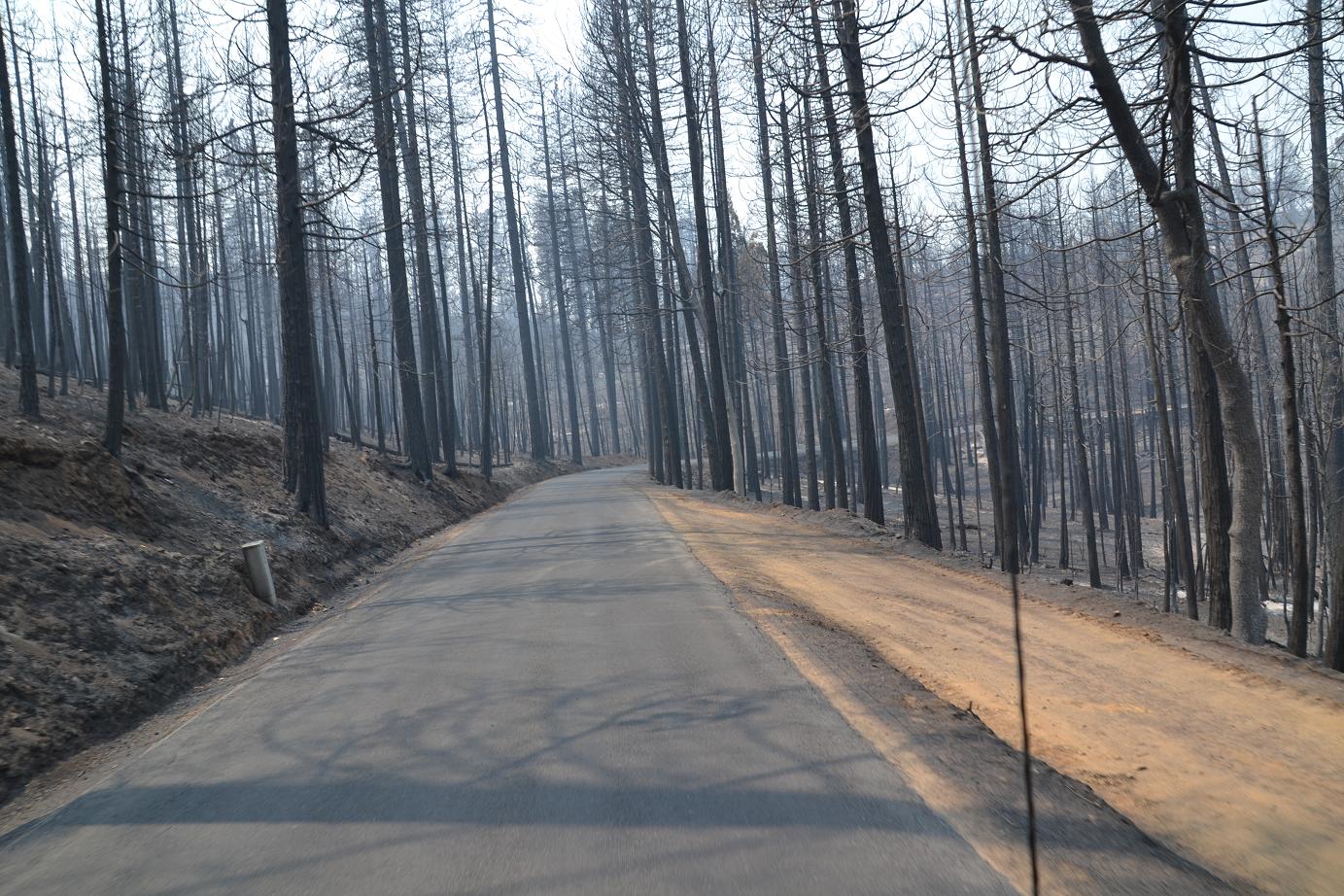 Though the Rim Fire now encompasses some 400 square miles, there are large areas inside the perimeter that the fire has not touched. Along some parts of the road the forest was burned to ashes on one side, and green and pristine on the other.
On this day, crews were doing burnouts in some areas to burn the fuels that were not consumed when the main fire swept through, and the smoke was heavy near that activity. But in the early part of our trip, the occasional smoking stump was the only remnant of active fire activity, and we wound along the mostly deserted road through the ghostly remains of blackened trees.
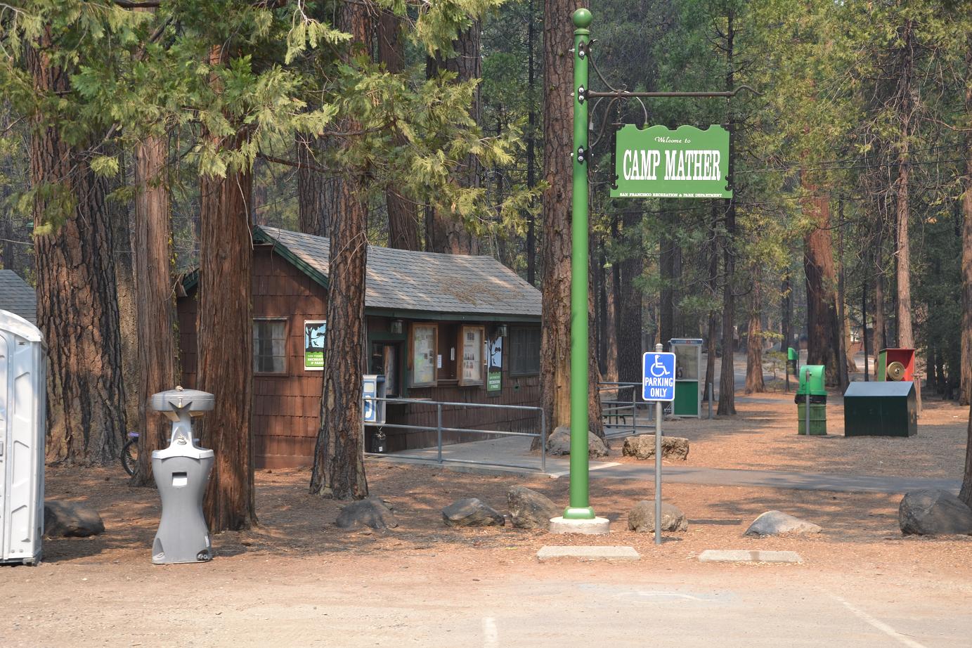 As we approached Camp Mather, it was evident that it had been a priority to save these structures, and that firefighters had staged around cabins and buildings, in the midst of the firestorm to protect homes, cabins and businesses.
Many were surrounded by charred earth, yet stood untouched in the midst of the forest. Evergreen Lodge and Camp Mather were intact, though eerily quiet. What should have been a Labor Day weekend packed with revelers and music makers, was just another three days on the fireline after the Strawberry Music Festival was cancelled. The only sounds were those of engines and trucks rumbling through the deserted camp. We turned west and headed up Mather Road.
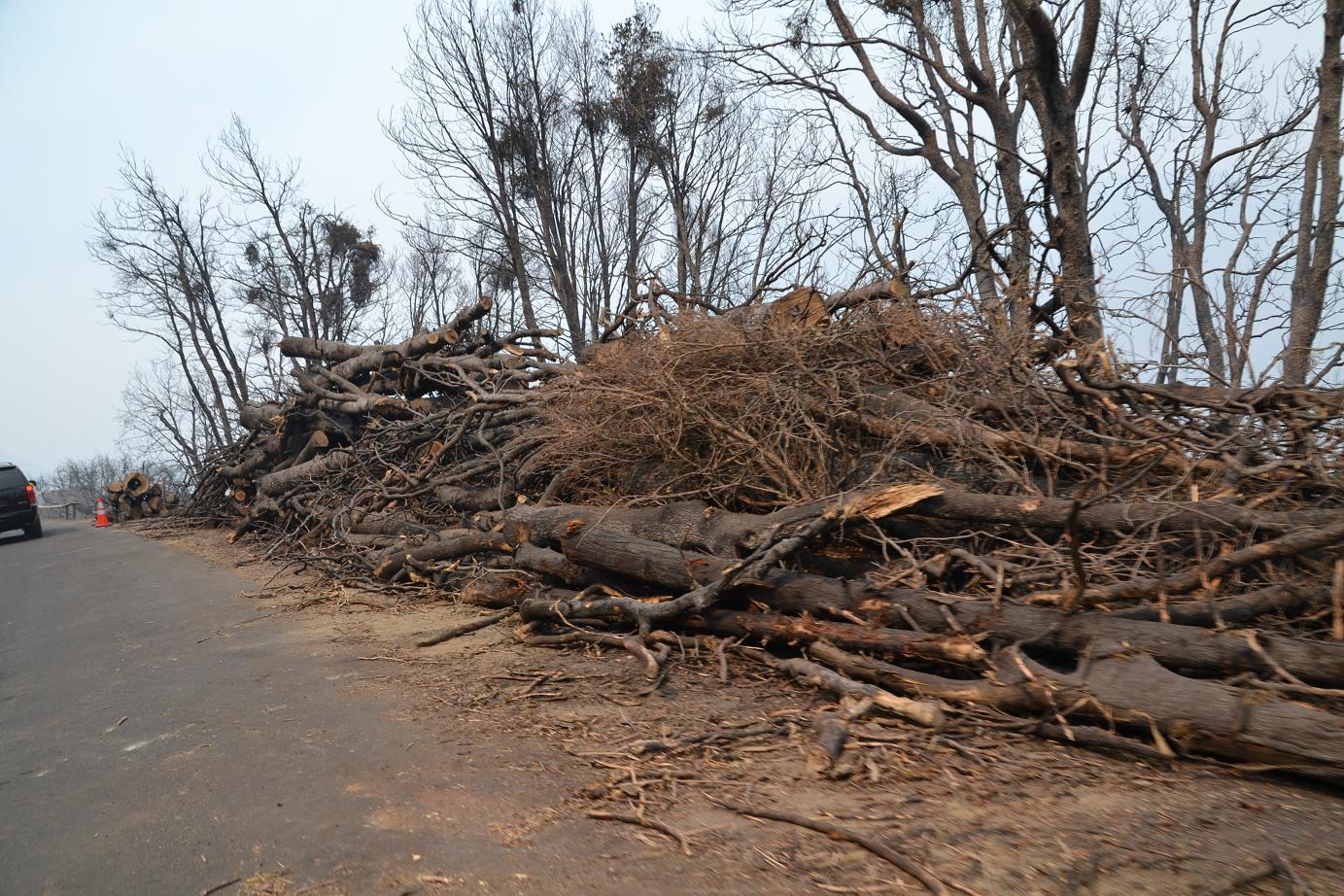
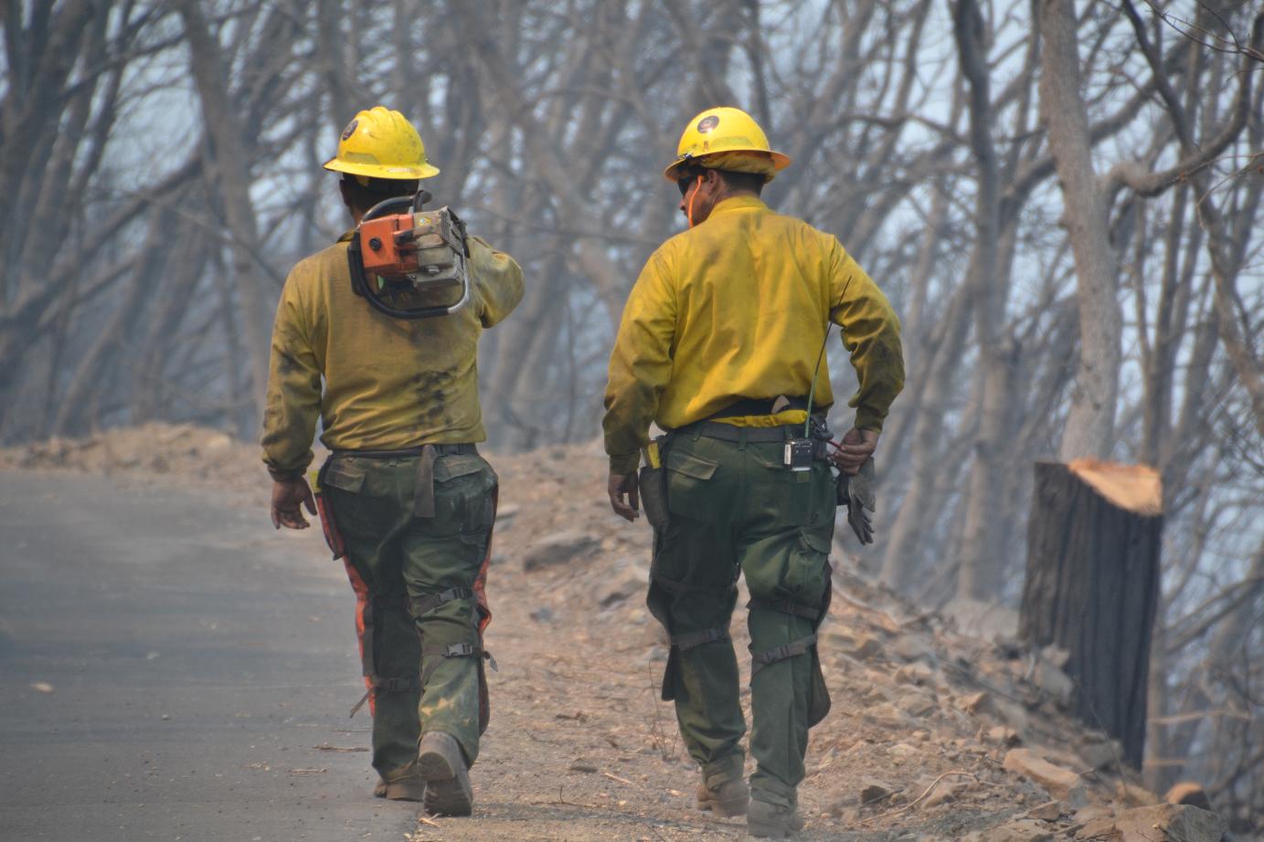 A short distance out from Mather, the beautiful green forests began to give way to charred remains. For the first time on our journey we encountered crews working along the road.
They were packing chain saws and clearing hazard trees along the road. There were huge piles of trees and branches, along with decks of logs already cleared from the forest. The intensity of the fire in this area was evident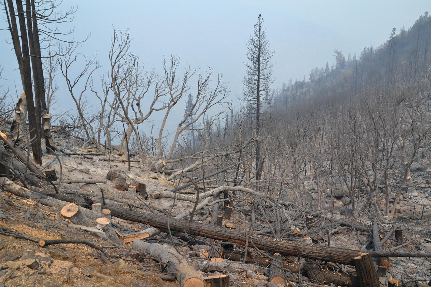
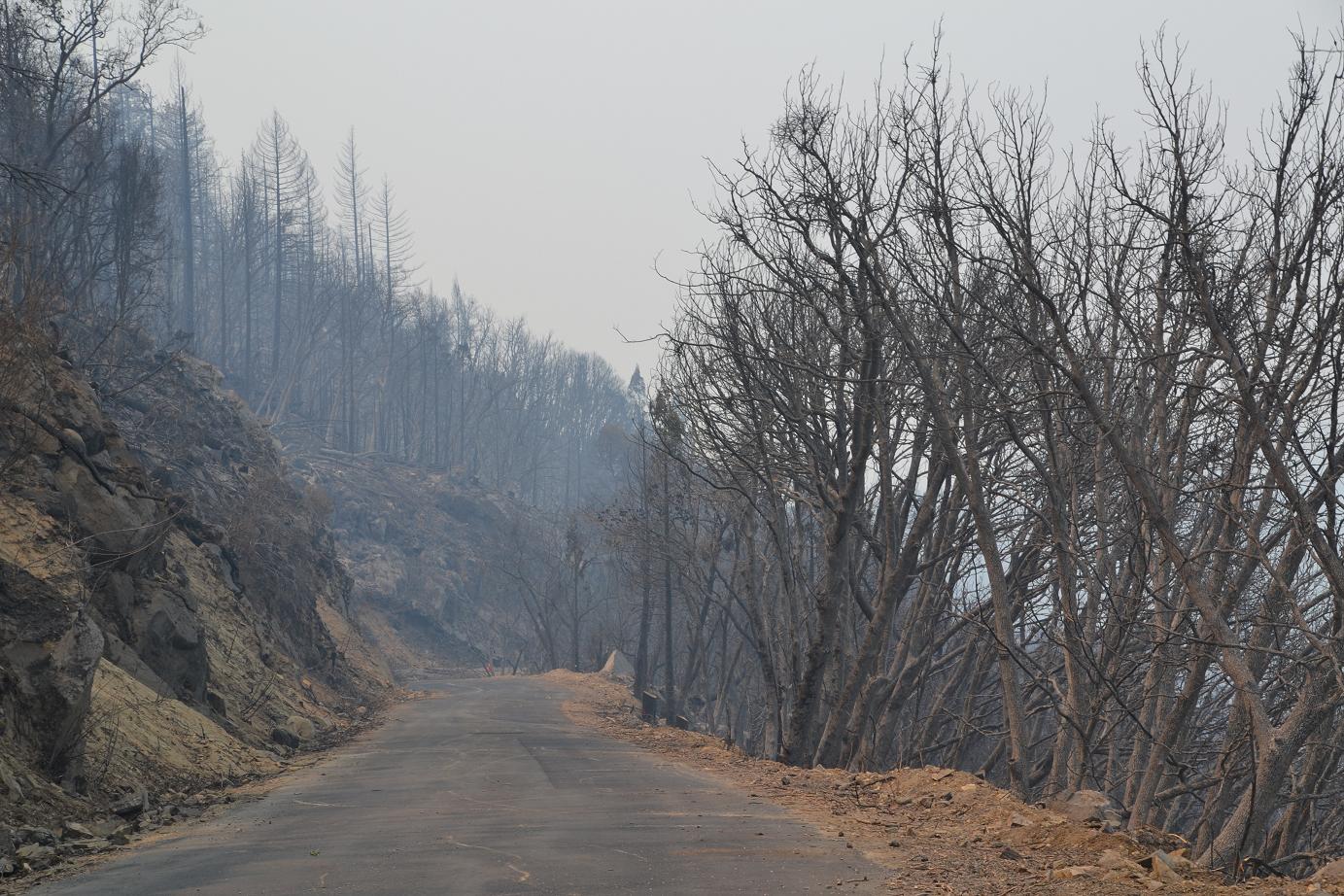
In some areas, everything on both sides of the road was completely incinerated, with the bark on some of the trees completely white – turned to ash by the intense heat. Then the landscape would change as we moved back into untouched pine, cedar and oak.
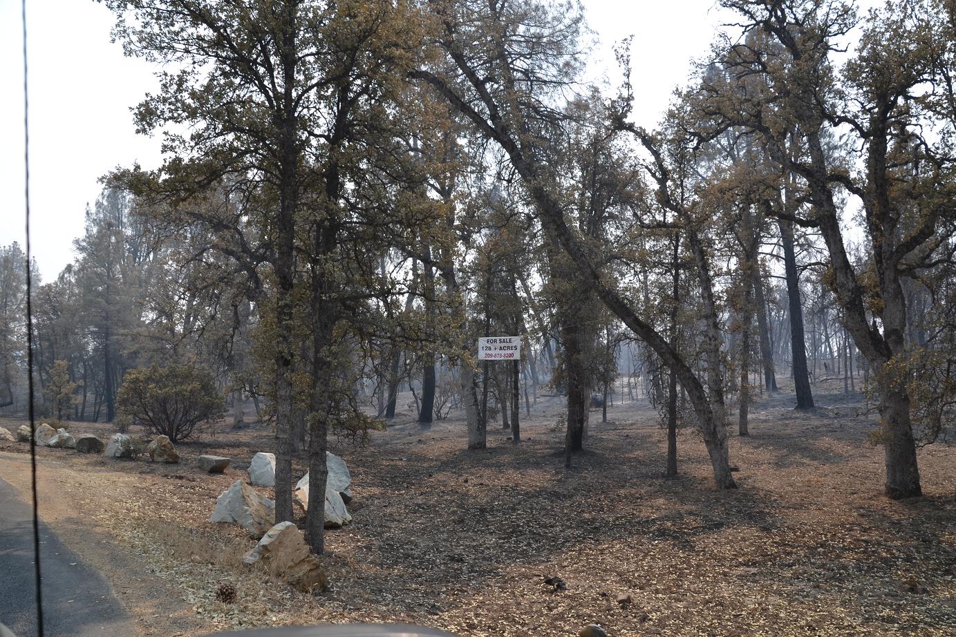
One land owner apparently decided this was a good time to unload his property, and was already advertising to fire crews, contractors and the occasional press who may be passing by. An interesting twist on “fire sale.”
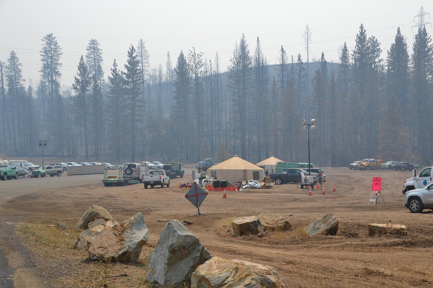 After winding our way up the mountain for about a half hour, we came to a spike camp where our tour guide stopped to refuel from a big tanker truck parked beside at the outpost.
 We had now received word that we could go in to the Hetch Hetchy area, and we headed back the way we had come. After passing through Camp Mather once again, we started down toward the Yosemite National Park entrance.
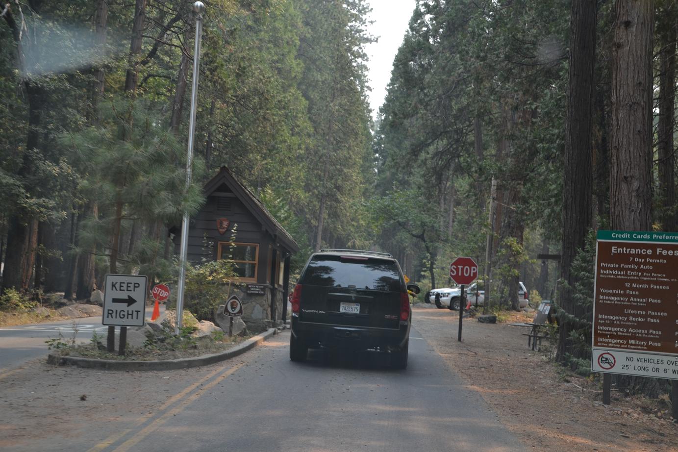
At the gate, we saw once again that the fire had burned right up to the edge of the buildings. I planned to ask the rangers when we got back if those areas had been fired intentionally to protect the structures, but the situation that unfolded over the next couple hours blew that totally out of my mind.
But that’s another story. Click here for Part 2 of our Rim Fire adventure.