
A New Way for Mountain Residents to Follow Emergency Updates
Free app brings incident maps, evacuation information and agency updates together on a mobile device.
When smoke appears over a nearby ridge, mountain residents want to know what is happening, where it is happening and whether their families could be affected. A new emergency information app aims to make those answers easier to find.
CAL FIRE and local emergency response agencies have announced AwareCA, a free mobile app designed to deliver information directly from the agencies managing emergencies.
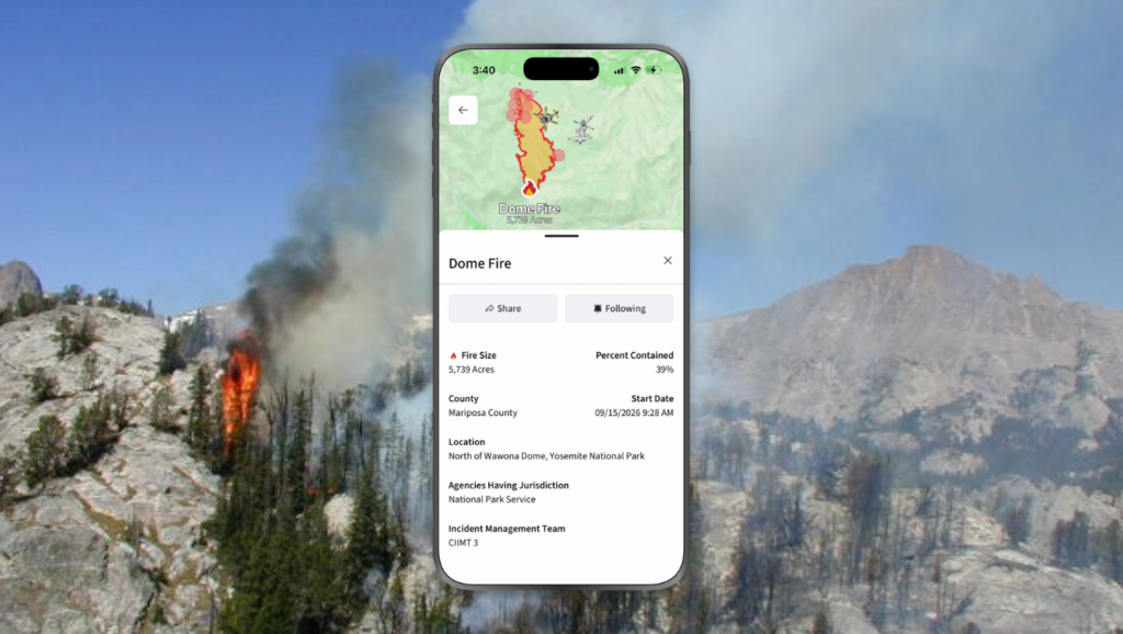
Developed through a collaboration between CAL FIRE, Intterra and local emergency response agencies, the app combines incident updates, interactive maps and notifications. Its features include evacuation warning and order zones, road closures, shelter and assistance locations, and other hazard information.
For residents of the mountain communities around Oakhurst, Coarsegold, North Fork and Mariposa, those are familiar concerns. A nearby emergency can affect travel routes, schools, workplaces and loved ones living elsewhere in the foothills.
“We know the public wants fast, accurate, mobile-first information directly from the agencies managing incidents on the ground,” said CAL FIRE Director and Fire Chief Joe Tyler in the announcement.
Following the Places That Matter
AwareCA allows users to add locations of interest and set notification distances around them. That gives residents a way to follow areas where they live, work or travel, along with places where family members live.
Users can choose map layers to control which hazards appear, follow individual incidents and share information with their contacts. The app also offers access to Caltrans traffic cameras and ALERTCalifornia wildfire cameras, along with the ability to view response assets such as aircraft.
All features are free, according to CAL FIRE.
Although wildfire information will likely draw particular interest in the Sierra foothills, the app is designed to support a wider range of emergencies, including floods, earthquakes, severe weather and hazardous materials incidents.
Another Connection to Official Information
During a fast-moving incident, residents may encounter social media posts, photographs and reports that offer only part of the picture. AwareCA is intended to make information from responding agencies easier to locate in one place.
The app is an additional information resource. Residents should continue following instructions from local emergency officials and remain enrolled in their county’s emergency notification system.
CAL FIRE encourages users to download AwareCA and enable notifications for the areas they want to follow. Setting those preferences before an emergency gives residents an opportunity to become familiar with the maps and features.
AwareCA is available for Apple and Android mobile devices through the App Store and Google Play. Download links and additional information are available at Aware.ca.gov.