CENTRAL SIERRA — A Winter Storm Warning has been issued by the National Weather Service for the Sierra Nevada above 7,000 feet, from Yosemite National Park to the Tulare and Kings county line.
The watch is in effect from late Friday morning, Apr. 7 through 11 a.m. Saturday morning, Apr. 8. Hazards may include snow and blowing snow, with accumulations of between two and three feet over the highest elevations.
From Friday night through Saturday morning, the impact of this storm could include difficult travel conditions with reduced visibility and blowing snow. Power outages could occur. Winds are predicted to be southwest 25 to 35 miles per hour, with gusts up to 75 miles per hour.
Periods of heavy rain are anticipated in the foothills Thursday night through Friday night.
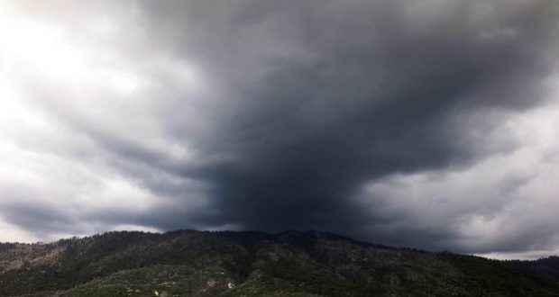
Isolated thunderstorms are expected over much of the Central California Interior this Saturday, especially during the afternoon and early evening. In addition to dangerous cloud to ground lightning, thunderstorms can also be accompanied by briefly heavy rain, gusty winds and small hail.
Thunderstorms over the foothills could produce locally lower snow levels resulting in brief snow showers, possibly as low as 3,500 feet. When skies turn dark and threatening, it’s a clue that thunderstorms are approaching. Play it safe and move indoors.

