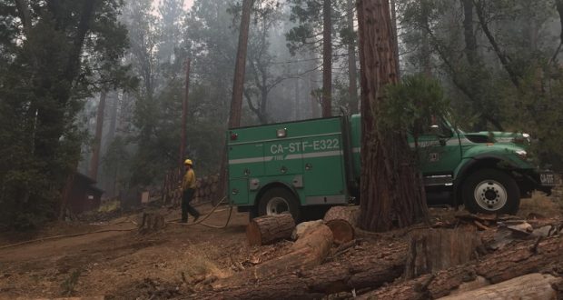
YOSEMITE — Crews continue to make good progress on the South Fork Fire near Wawona.
The fire is now estimated at 4,330 acres with 44 percent containment.
There are currently 304 personnel assigned to the incident, as more crews are demobilized to return to their home units.
The mandatory evacuation order for Wawona has been completely lifted for residents and visitors as of 7 a.m. yesterday. Trails within the fire area will remain closed until further notice.
Crews continue to strengthen firelines and do mop-up inside the perimeter.
Repair and rehabilitation have begun within the Yosemite Wilderness.
Smoke and poor air quality continue to be an issue in the park. Temperatures are predicted to be near normal and the threat of storms is greatly decreased for the rest of the week.
The incident was transition from the South Central Sierra Interagency Incident Management Team to a Type 3 organization this morning at 6 a.m. The new team will continue to update the fire. For information about the South Fork Fire, call 209-379-1493 or email yose_fire_info@nps.gov.
All roads within the park remain open to travel.
The cause of the fire is under investigation.
The estimated date of containment is Sunday, Sept. 3.
As of 7 a.m. today, the following areas remain closed until further notice. We will update here if any of these are lifted today:
- The Swinging Bridge Trail on both the north and south sides of the South Fork of the Merced River.
- The Chilnualna Falls Trail from Wawona Trailhead to the top of Chilnualna Falls.
- The two mile connecting trail heading north from the top of Chilnualna Falls to the intersection of the Buena Vista Trail.
- The Chilnualna Creek Trail from the top of Chilnualna Falls east to the intersection of the Buena Vista and Buck Camp trails (Just east of Johnson Lake).
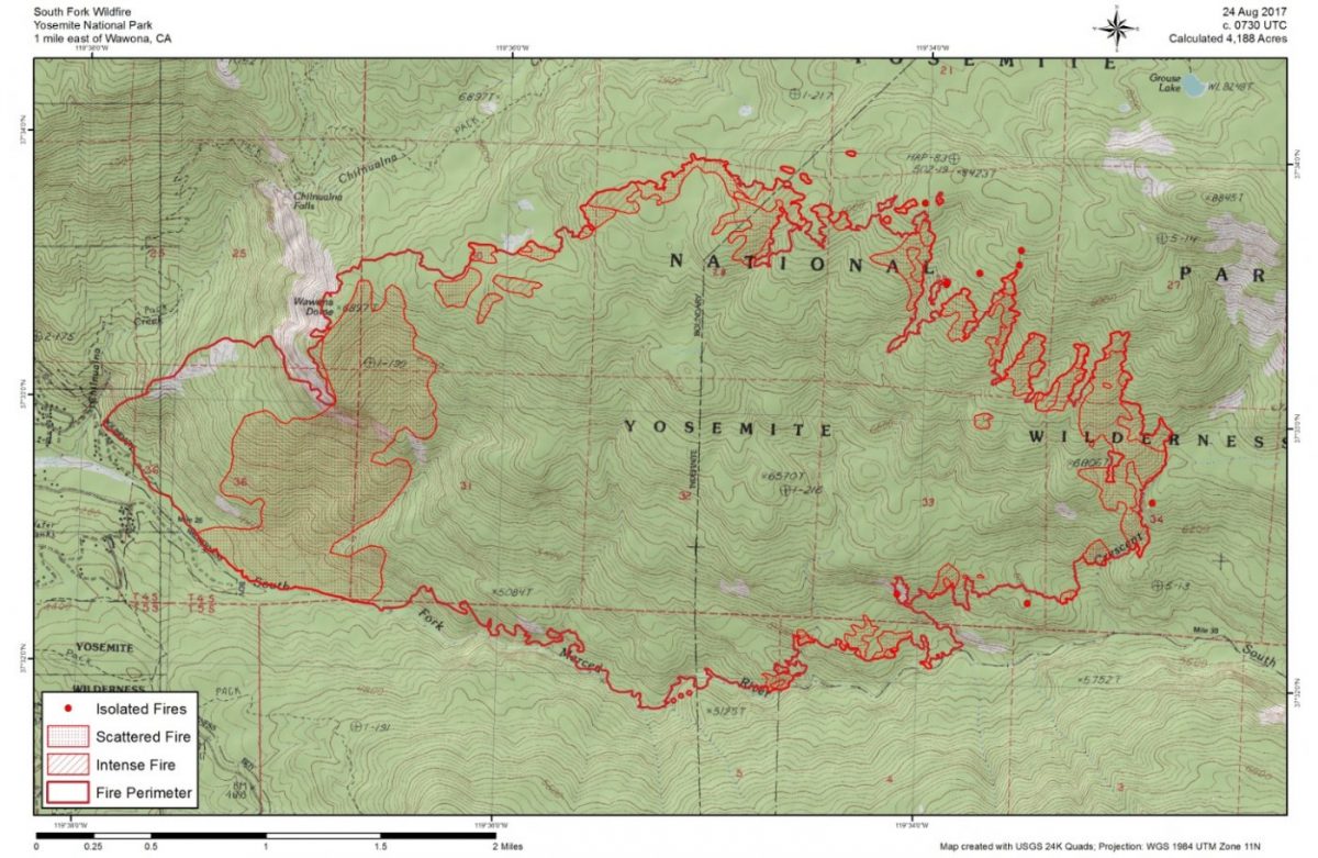
- Off-trail areas in the vicinity are closed (i.e. all areas within the shaded circle on the map below).
- All climbing routes on and around Wawona Dome are closed.
- Bridalveil Creek Campground closed to accommodate firefighters.
- Wawona trail (mule) rides are not operating.
- Big Trees Golf Course is closed.
- The Badger Pass-Glacier Point shuttle will not operate until further notice as the incident command post is occupying the Yosemite Ski and Snowboard Area facility and parking lot.
- The Glacier Point Road will will remain open to the public however it will close periodically between 10 a.m. and 5 p.m. each day when parking at Glacier Point fills to capacity (and will reopen when sufficient space is available). Traffic delays should be expected.
- A voluntary ban on wood fires is in place in Yosemite Valley to reduce smoke. A mandatory ban may be instituted in the days to come.
For additional information:
- Rapid Notify is a community alert system for rapid event notifications. Register by visiting www.alert.rapid notify.com
- Nixle is a public-safety notification system. Sign up for emergency alerts by texting 95389 to 888-777 or visit their website at www.nixle.com
- Fire Information: Yose_Fire_Info@nps.gov
- Yosemite National Park Fire Information website: http://www.nps.gov/yose/blogs/fireinfo.htm
- Facebook, search: Yosemite Fire and Aviation
- Twitter, search @YosemiteFire : http://www.twitter.com/YosemiteFire
Air quality links for Yosemite National Park:
https://app.airsis.com/USFS/UnitMap
https://www.nps.gov/yose/learn/nature/aqmonitoring.htm
Click here for a detailed IAP map.
Click here for a heat map.
Click here for interactive map.