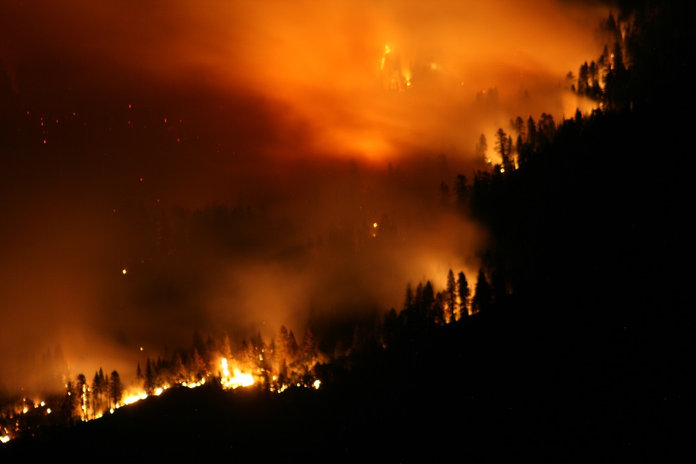
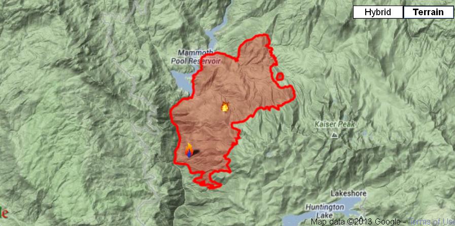
EASTERN MADERA COUNTY – The Aspen Fire, burning on the Sierra National Forest – High Sierra Ranger District, has now grown to 16,204 acres and is 40% contained.
Additional resources continue to arrive to assist in the fire suppression efforts, and there are now a total of 1,947 personnel assigned to the incident. The Forest Service says firefighter and public safety remains the highest priority.
Due to the extremely steep, rugged and inaccessible terrain, fire crews are using a tactic called indirect attack which creates control lines away from the fires active edge. Air resources, including several helicopters and air tankers are being utilized along the fireline to slow the forward progress of the fire and to cool down hot spots.
As the situation changes and firefighters can safely gain access to the fire, a more direct attack will be implemented.
 Crews will be performing firing operations over the next three days to help enforce containment lines. Firing operations are actions taken to remove unburned fuels between the active fireline and the contingency lines which crews have been creating over the past several days. These operations will put additional smoke into the atmosphere.
An air quality monitoring device has been installed at the Huntington Lake Volunteer Fire Station. The device will provide smoke data from the Aspen Fire to the air resources advisor and the area air pollution control districts.
The inversion layer continues to cause smoke to accumulate in the low lying areas of the fire which hampers visibility of firefighters on the ground and in the air. As the smoke clears in the early afternoon, a more defined smoke column(s) may be seen from several miles away. As the evening progresses, the inversion returns causing the smoke to return into the lower levels.
Last night’s infrared images showed the fire growth continued in the northeast and southeast areas of the fire perimeter. Fire crews continued to make good progress with indirect attack operations, but access and fire behavior are still a major safety concern for fire crews.
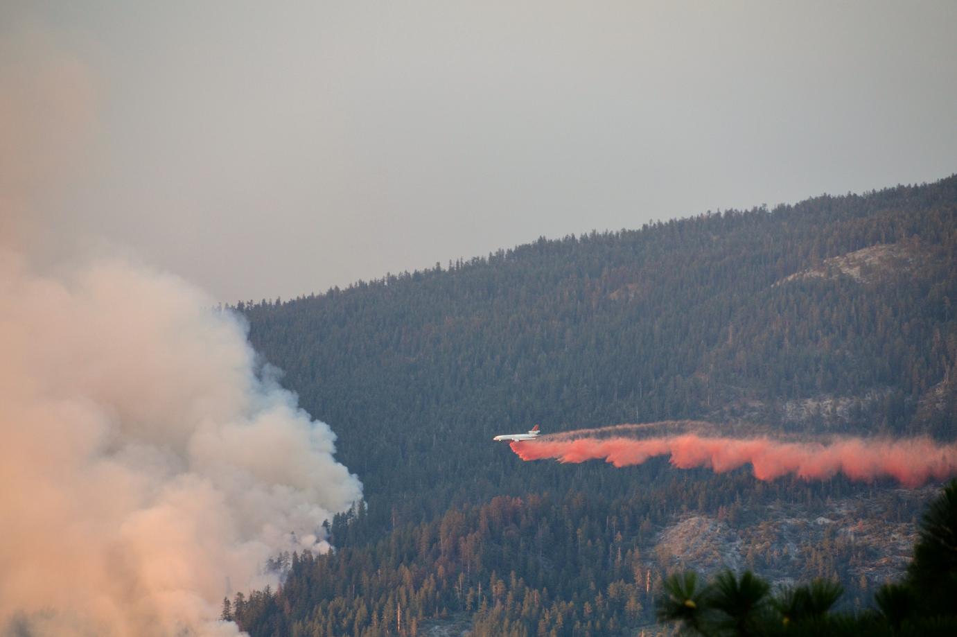 Air and ground resources continue to construct and reinforce indirect line around the fires perimeter, using direct attack when possible. The Very Large Air Tanker (VLAT) DC-10 is still being utilized in the effort. Temperatures are increasing and humidity decreasing.
Crews continue to monitor the west side of the San Joaquin River, watching for any sign that the fire has crossed the canyon.
Recreational areas and businesses remain open in the Shaver Lake, Huntington Lake, Lake Thomas Edison, Florence Lake and the Mono Hot Springs areas.
The Forest Service reports that fire crews are being sensitive to environmental and cultural resources in and around the fire area.
Helicopters dipping water out of lakes in the area are being directed not to use the High Sierra and wilderness lakes without disinfecting the buckets. There is concern that cross-contamination may occur due to a fungus that may be present in Huntington Lake and the San Joaquin River, both of which have already been used for dipping water.
So far there have been two reported minor injuries, and the cost to fight the fire to this point is reported at $12.8 million. No structures have been lost.
Road and Trail Closures
Roads:
Stump Springs Road is closed to all traffic due to fire suppression activity.
Minarets Road (4S81) from Fish Creek to Jackass Rock Organization Campground, Grizzly at Beasore Road to Minarets Road are closed to the public. Residents within the road closure are allowed into the area with valid identification.
Trails:
Per the U.S. Forest Service Closure Order number 15-13-09, the Kaiser Wilderness is closed.
Evacuations
Additional campground closures went in to affect as a precautionary measure. Campground closures within the Sierra National Forest are as follows:
-Sample Meadow
-West Kaiser
-Jackass Rock Organization
-Lower Chiquito
-Little Jackass
-Soda Springs
-Placer
-Sweet Water
-China Bar
-Rock Creek
-Wagner’s Mammoth Pool Resort
Campgrounds closed to support firefighting efforts:
-Rancheria
-Badger Flat
-Midge Creek
Current Weather
Wind Conditions 3-7 mph N
Temperature 42-52 degrees
Humidity 46-56%
Individuals sensitive to smoke are advised to remain indoors and keep windows closed to minimize exposure to smoke. For more information regarding smoke visit: www.valleyair.org
Cooperating agencies include
The U.S. Forest Service, National Parks Service, U.S. Department of Defense, National Weather Service, California Governor’s Office of Emergency Services, Fresno County Sheriff, Madera County Sheriff, California Highway Patrol, California Department of Corrections and Rehabilitation, Southern California Edison, PG&E, California Conservation Corp.