We had crunchy snow under our feet in the morning, blue skies all day, views of snow covered mountains and the trail all to ourselves. What more can I say?
Where: Tamarack Ridge SNO PARK, Sierra National Forest
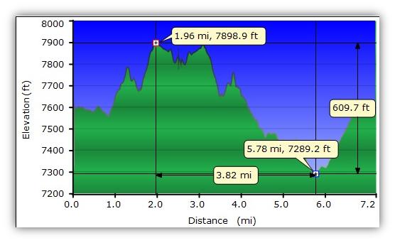
Distance: 7.20 Miles
Difficulty: Moderate
Elevation Range: 7,286′ – 7,899′
Date: March 8, 2014
Maps: High Sierra Ranger District Winter Recreation Guide, Dinky Creek Topog
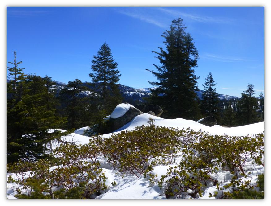
Highlights: A blue, blue sky and crisp white snow helped highlight great views of the mountains to the east and south. Snow covered hills gave us a nice adventure with changing views when we topped out over each one of them. We even got a view into the Minarets. These SNO PARKS provide an area for diverse winter fun, whether it is snowmobiling, cross country skiing, snowshoeing, sledding, or just playing in the snow and creating a great snowman!
We headed up Hwy 168 to Shaver Lake where we picked up our parking pass on our way in. We also looked for a copy of the High Sierra Ranger District Winter Recreation Guide, which has great maps of the area but they were out.
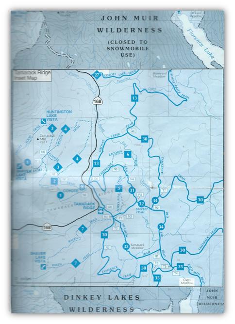
One of our group already had this guide and I copied a section of that map above to show the many areas where you can enjoy the SNO PARKs in the proximity to our adventure.
There are several stores where you can get this free map and the required parking pass and I have a link at the bottom of this blog. Day permits are sold for $5 and are valid for one single day. Season permits are sold for $25 and are valid for the entire SNOPARK season (November 1 through May 30).
Any vehicle parked at a SNO-PARK site without a permit properly displayed is subject to a $75 fine. The funding from the permit sales provides plowed parking as well as sanitation facilities.
These SNO PARKS welcome all users and all forms of winter play: skis, boards, snowshoes, sleds or tubes, and snowmobiles. Many areas are managed for certain uses and exclude others in order to maximize the enjoyment of any one group of users. Specific areas facilitate snowmobile use through the Green Sticker fees raised by the licensing of those vehicles. Other areas are dedicated to cross-country skiers and also welcome snowshoers or snow players; while some prohibit the use of snowmobiles in the same area. Winter enthusiasts are responsible for knowing the rules for any one area.
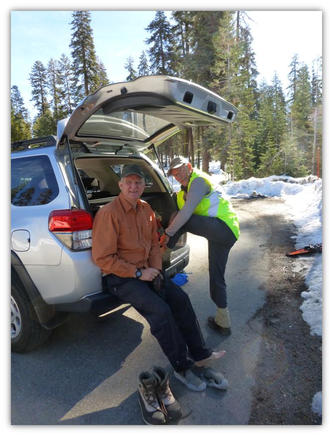
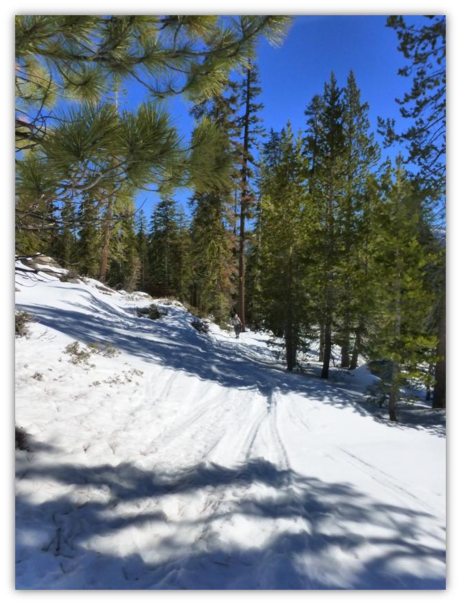
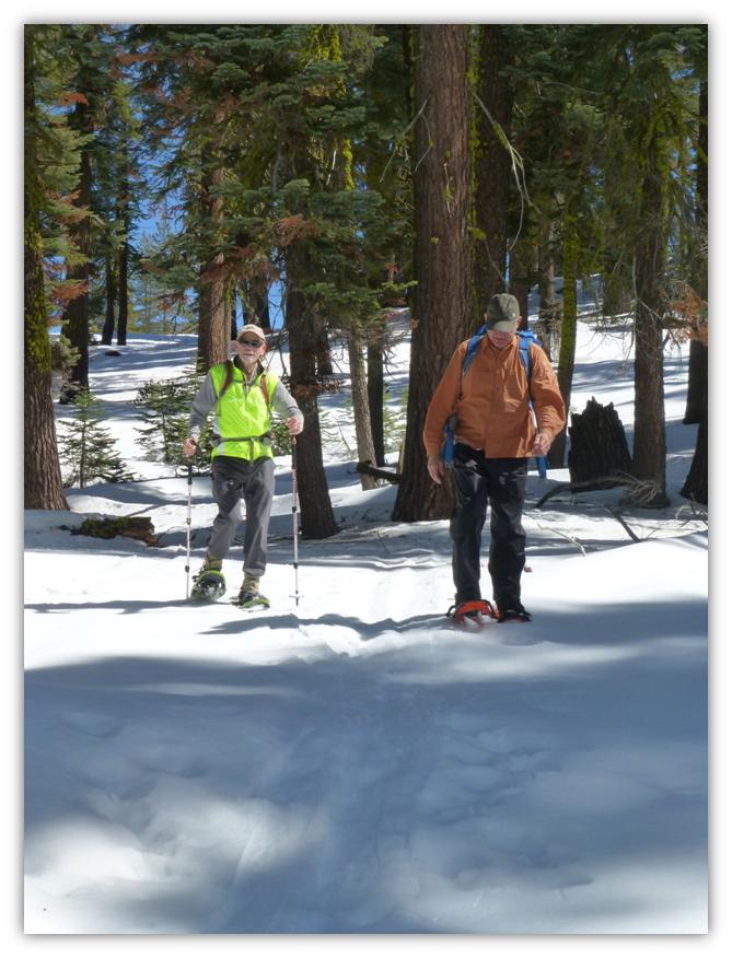
We arrived at the parking area for the Tamarack Ridge Trailhead and checked out the snow conditions. We decided to bring our snowshoes instead of wearing them because the snow was pretty solid and crunchy. We could always put them on later on if we needed them.
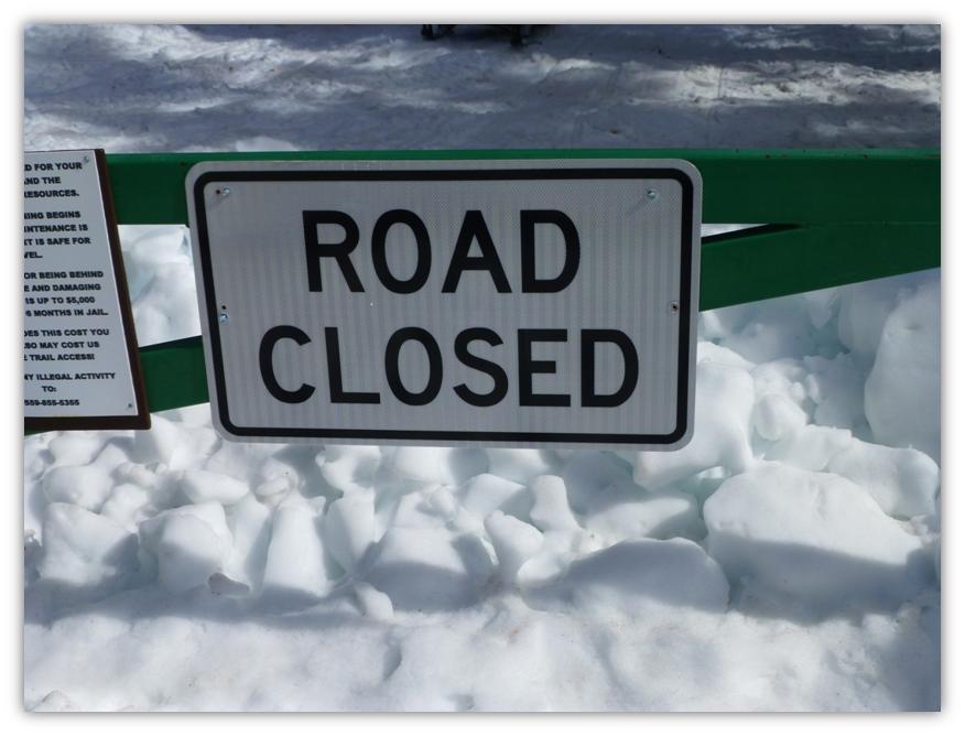
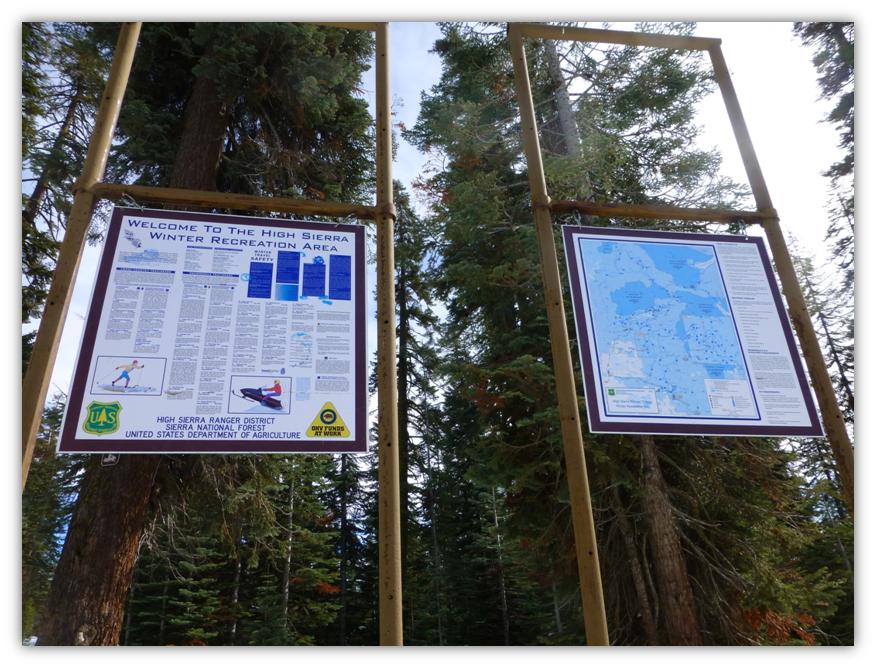
At the end of the parking lot, there was a road barrier and a sign with a map of the area. That is where the Tamarack Trail started and where we began our adventure.
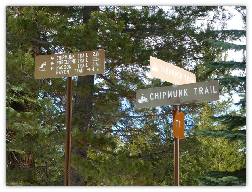
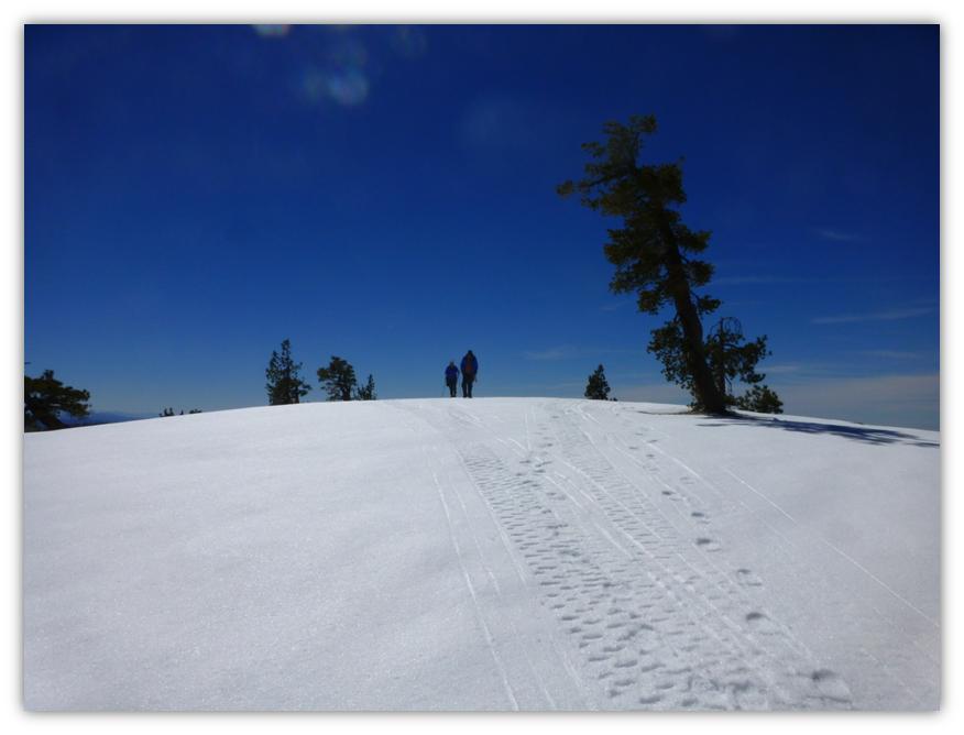
We followed the road for a little bit, past the trail signs, to a point where we saw some snow mobile and ski tracks take off to the right. We didn’t see a trail marker at this junction but decided to head in the direction of those tracks.
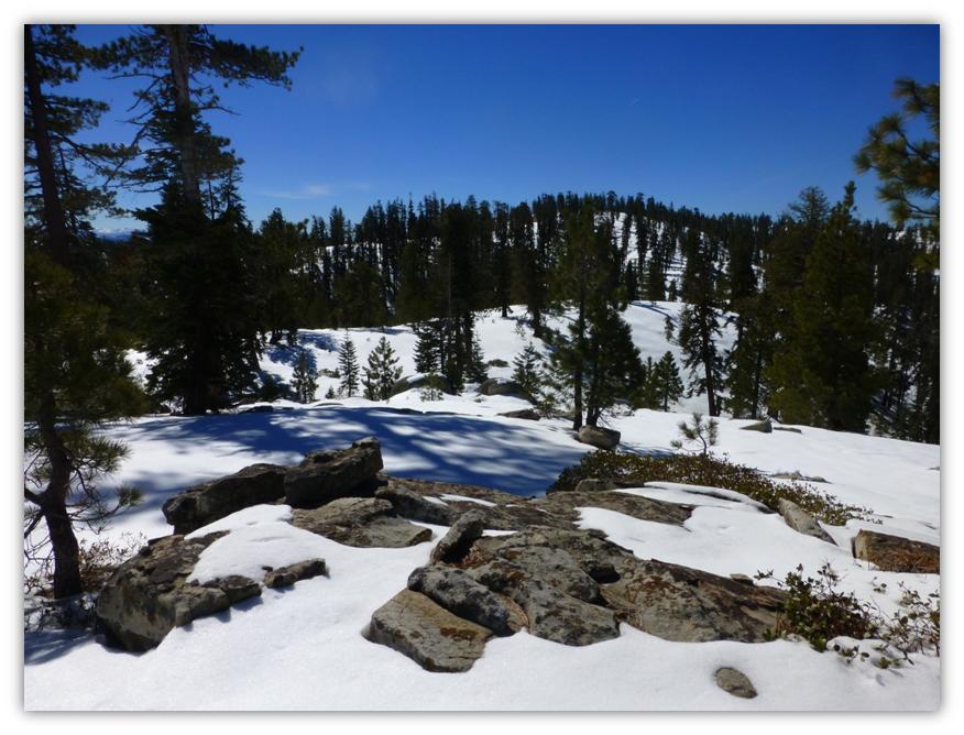
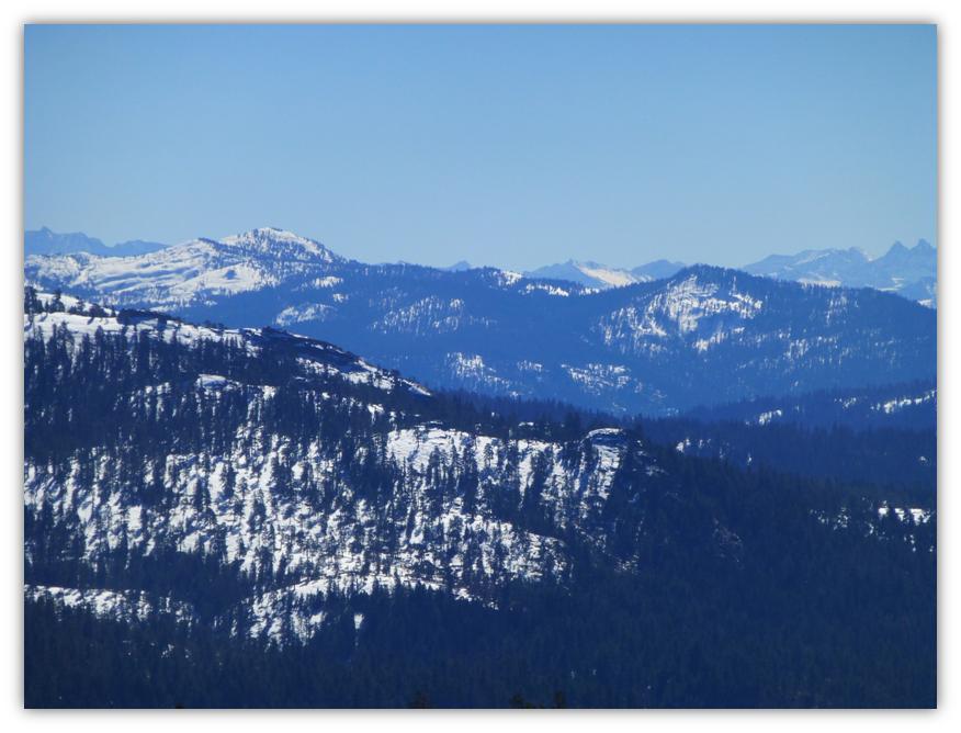
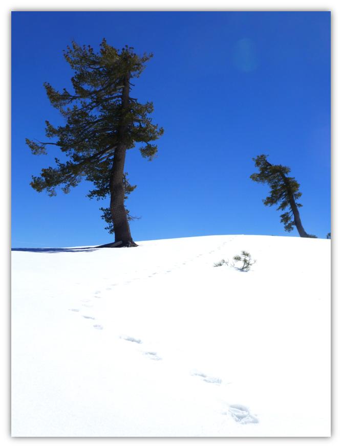
We were treated to beautiful views of the mountains to the east as we traveled along the ridges of some rolling knobs.
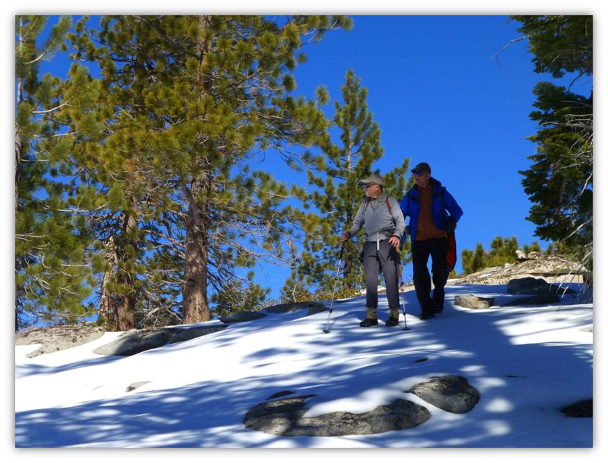
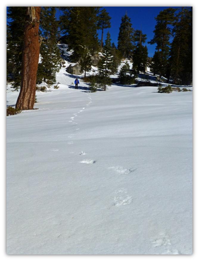
Our footsteps show how crusty the snow was and why we hadn’t put our snowshoes on but that was going to change in the afternoon.
We could even get a glimpse of the Minarets to the southeast.
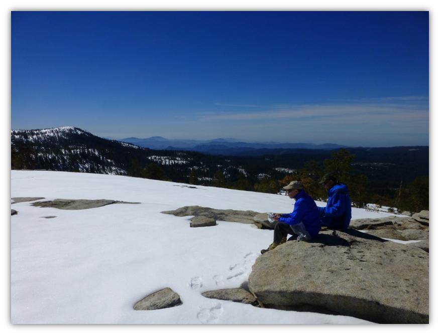
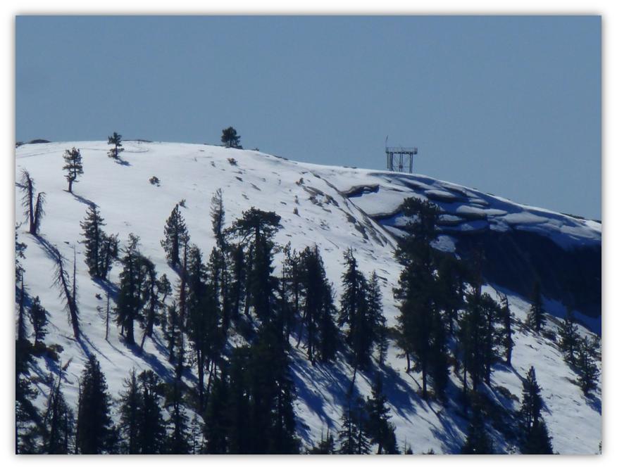
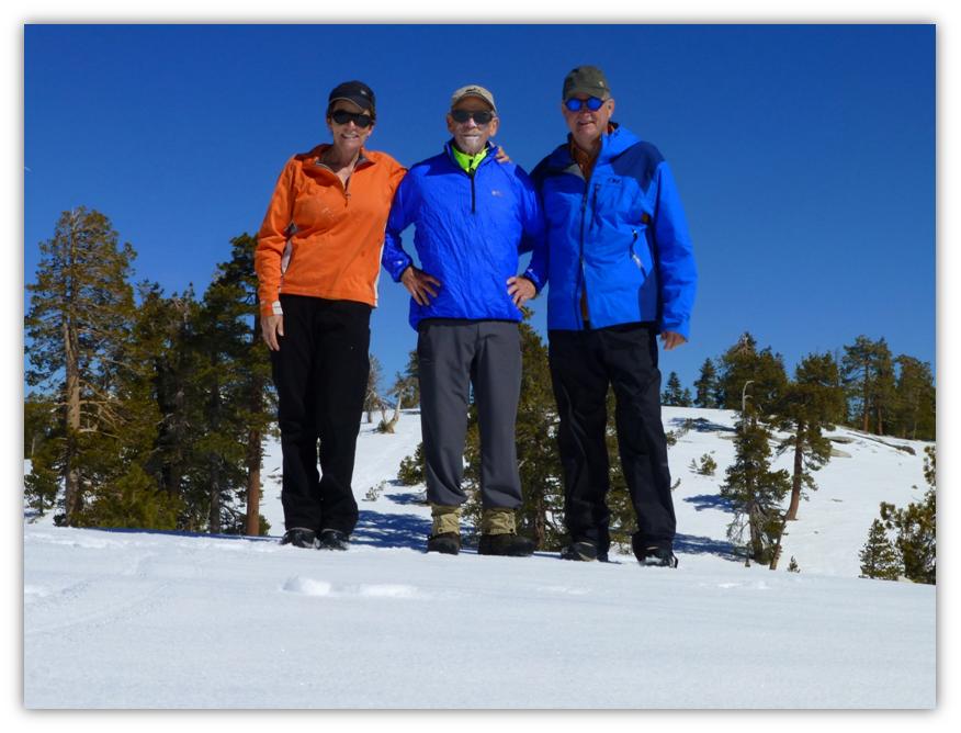
We arrived at a great lunch spot, with Shaver Lake on one side and Bald Mountain in front of us. We could even see the remaining structure of the old Lookout.
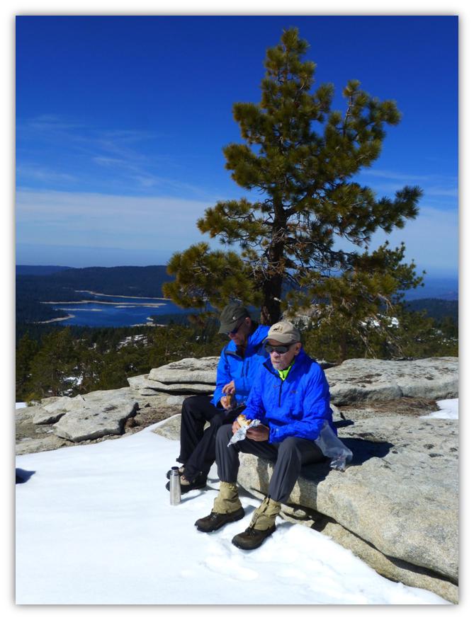
I couldn’t resist taking a group photo using my Gorillapod: Me, Keith and Steve.
We started to head back the way we came in.
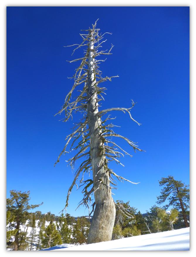
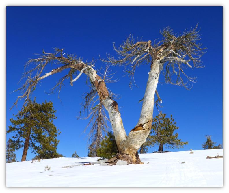
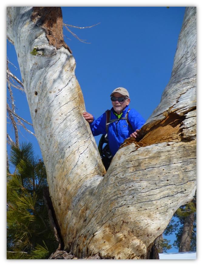
Some of the old snags sure had a lot of character.
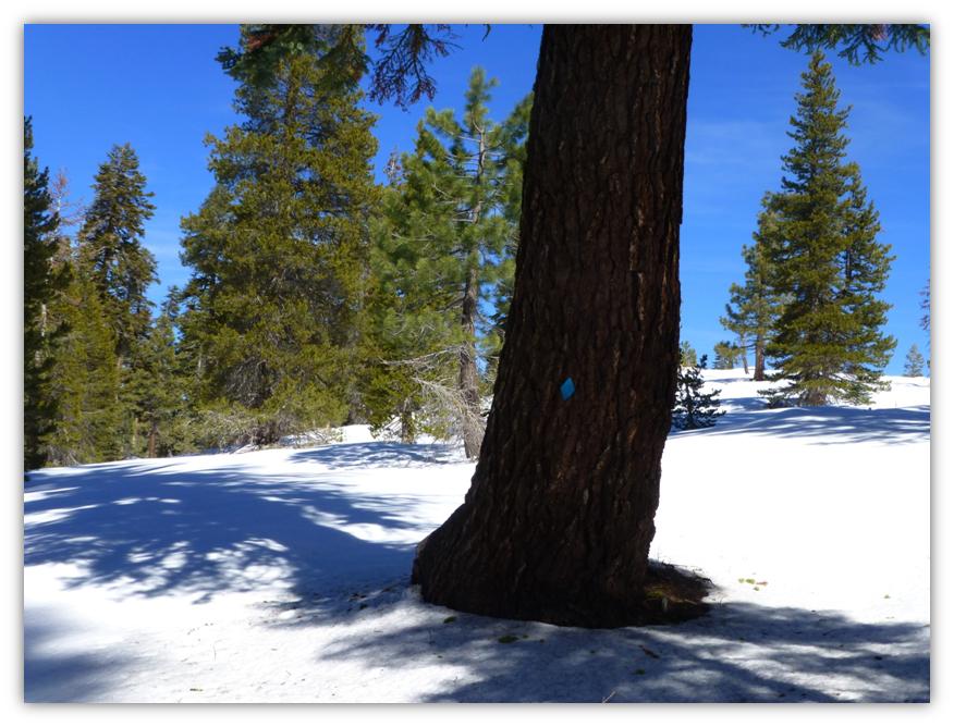
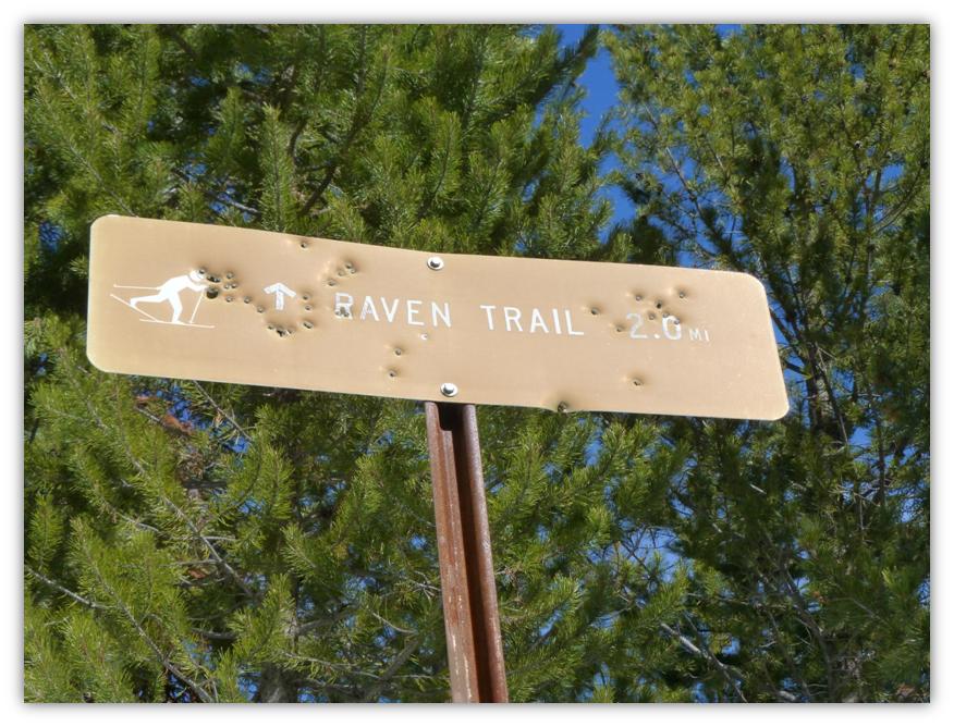
We were looking for the spot where our trail would intercept with the Raven Loop to take that back to the Trailhead, remembering a spot where we saw some ski trails that could have been that area. There was no trail sign but we kept our eyes open for possible flags on trees and found a blue one on a tree, figuring we were on the Raven Loop. Plus, it was heading in the correct direction.
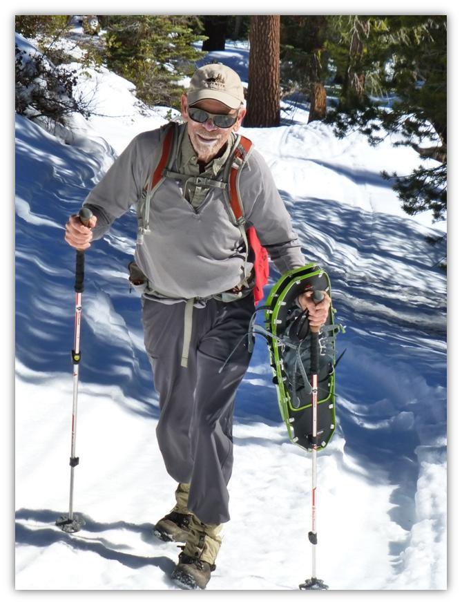
The afternoon had started to melt the snow and it was starting to get harder to walk on, so we decided it was time to put our snowshoes on.
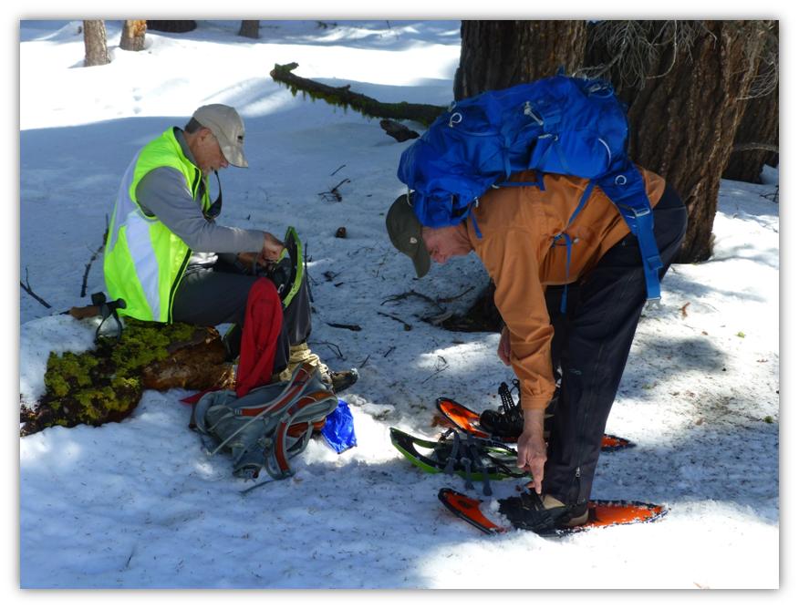
And off we went!
After a while, we came to a sign that reassured us that we were on the correct trail.
It was hard to believe that this was a Saturday and we had not seen anyone all day but as we started getting closer to the parking lot, we could hear voices. It wasn’t until we almost got to the parking lot that we shared the trail with some snowmobilers and some people playing in the snow.
This is a huge area and it is very easy to get away from the crowd and enjoy it. This was my first time to snowshoe out of one of these SNO PARKS. I have to admit that I thought they would be crowded, full of people and really wasn’t very appealing to me. But I was wrong. These are a real treasure!
If you are thinking about having a winter adventure in the SNO PARKS, it is very important that you be prepared. Please read up on what you will need to be prepared for. I feel like I would be remiss if I didn’t steer you in the direction of information to help you be prepared and The High Sierra Ranger District Winter Recreation Guide has some items to consider.
Avoid becoming lost in wintertime by:
- Take a good map. Learn to read it and know how to locate your position.
- Learn to read a compass and believe it.
- Check weather forecasts and avoid storms. It is easy to become disorientated in the whiteouts of winter and when physically exhausted.
If you are lost, injured or your equipment has failed:
- Keep calm, decide on a plan, trust your compass, stay together if possible and if not, send at least two people for help.
- Don’t abandon your snowshoes or skis. Build a fire and shelter, stay warm.
- Mark your base camp so it is visible from the air.
Distress Signals:
- Three smokes, three blasts of a whistle, three shouts, three flashes of light, three of anything that will attract attention.
Taking a safe route:
- Avoid avalanche terrain. Check with the National Weather Service for avalanche conditions in the area. Avoid thin ice or unsafe river crossings. Travel in areas open to snowmobiles and on designated trails. Watch for trail signs. Watch out for fences, steep slopes and cliffs, sudden dips at stream crossings, cornices, ice and snow bridges. Don’t trust ice on lakes or streams.
Leave word before you leave: When someone is overdue, notify the County Sheriff in the trip area. If the missing person returns after, be sure you advise the Sheriff. Notify a responsible person of:
- Your planned route of travel.
- Your planned departure time.
- Your planned time of return.
Hypothermia: As many as 85% of outdoor recreation fatalities are caused by hypothermia. Lowering of body temperature leads to mental and physical collapse. Cooling is accelerated by exposure to wetness and wind, particularly if a person is extremely tired and body fuels depleted.
- Symptoms: Uncontrollable fits of shivering, memory lapse, incoherence, stumbling, lurching gait, immobile and fumbling hands.
- Treatment: Insist upon immediate treatment. Victims can often deny they’re in trouble. Get victim out of the wind and rain. Remove all wet clothes. If conscious, give warm drinks (no alcohol). Prevent further heat loss by placing victim in sleeping bag. Put what heat you have next to victim’s neck and chest. Breathe into victim’s nostrils. Handle victim gently.
- Prevention: Regulate body temperature, avoid sweating, dress properly utilizing principles of layered clothing. Avoid exposure to rain and wind. Carry extra food and clothing for emergencies. Avoid fatigue by periodic rest. Consume enough fluids to prevent dehydration. Be aware of symptoms and watch for them in yourself and others.
Frostbite:
- Frostbite is caused by exposure of inadequately protected skin to subfreezing temperatures. Symptoms are loss of feeling and a dead white appearance. Party members would periodically observe their companions, especially nose and cheeks, for signs of frostbite. If frostbite is detected, restore body temperature as soon as possible by gradually rewarming affected parts. This can be done with blanket, ski cap, jacket or over covering material. DO NOT rub the affected parts to restore body temperature. IF it is necessary to continue moving, the affected part should be kept covered and the patient moved to a location where effective treatment and vehicle evacuation can be obtained.
Clothing and Equipment:
- Layers of clothing are best. A good quality windbreaker and wind pants are excellent. Avoid tight-fitting clothes and boots which restrict circulation. Take extra socks and gloves or mittens, warm cap, matches in a waterproof container, candle, firestarter (000 steel wool works well), nylon cord, general purpose knife, high energy food, plastic tarp, space blanket, signal mirror, first aid kit, wide tape for repairs and metal container for melting snow. Snowmobilers should carry tools and snowshoes as well as normal emergency and survival gear.
Avalanches:
- Avalanches may occur at any time during the winter. Avoid mountainous terrain after heavy snowfalls or prolonged periods of high wind. Get avalanche information from National Weather Service. Avoid crossing steep side hills and entering narrow, steep-side canyons. Stay on the windward side of ridges.
 Sources:
http://ohv.parks.ca.gov/pages/1233/files/SNO-PARK_Brochure-web.pdf
http://ohv.parks.ca.gov/?page_id=23057
http://www.fs.usda.gov/detail/sierra/recreation/?cid=stelprdb5245033
http://joby.com/gorillapod/hybrid