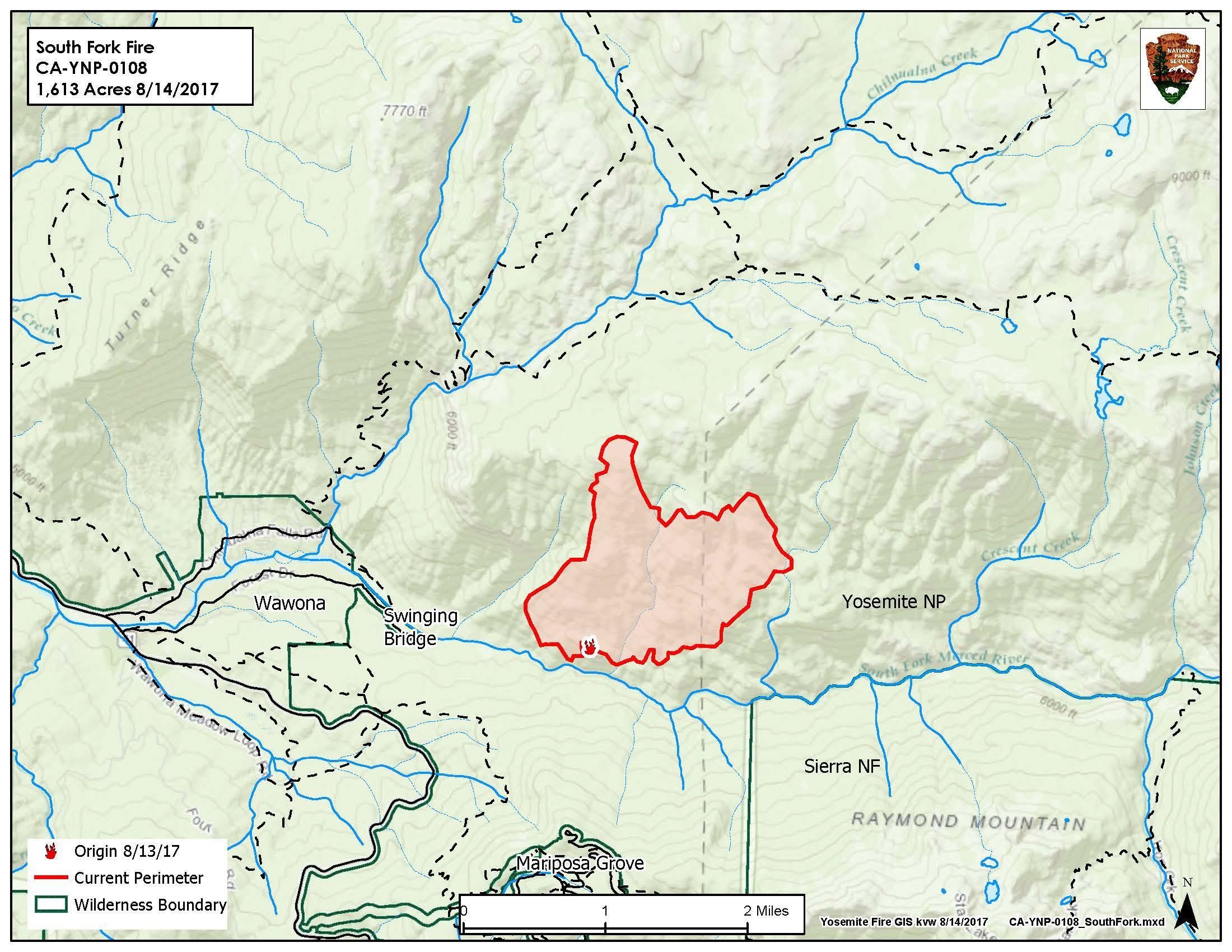
YOSEMITE — The South Fork Fire, burning inside Yosemite National Park just east of Wawona, is now estimated at 1,700 acres, still with 0 percent containment.
While residents and visitors in Wawona are still in a preparation mode for any possible evacuation, none has been ordered as of this hour.
The South Central Sierra Interagency Incident Management Team took over management of the fire today. They will host a community meeting at the Wawona Community Center tomorrow night, Wednesday, Aug. 16, at 6 p.m.
There are 253 personnel assigned to the incident including Hot Shots, ground and engine crews, with many more resources on order. There are also about 10 aircraft fighting the fire, including helicopters doing bucket work and fixed-wings laying down retardant, mainly on the left flank of the fire closest to Wawona.
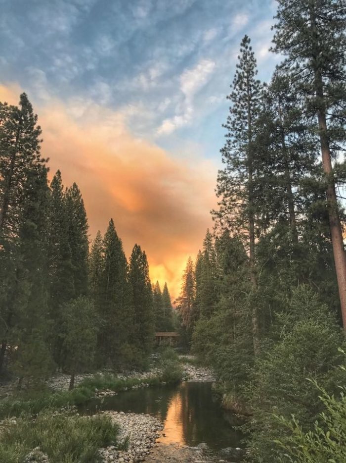
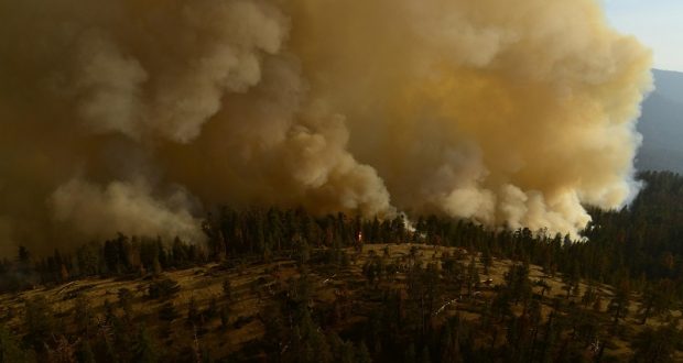
South Fork Fire from Wawona bridge – photo Ursa Major Stearns
Crews are working on direct line construction on the west edge of fire with the priority the protection of life and property in Wawona. They are also focused on keeping the fire from crossing to the south side of the Merced River, and protecting the Mariposa Grove of Giant Sequoias.
Fire behavior yesterday consisted of group tree torching, uphill runs and short range spotting in dense mixed conifer forest with heavy tree mortality.
Most of the projected fire growth is expected on the north and northeast flanks of the fire which is burning into the wilderness and away from the community. However, the fire also continues to back down the South Fork drainage.
The Wawona Campground was closed today in order to accommodate firefighters.
The Wawona area continues to be on alert to make appropriate pre-evacuation preparations. If there is an actual need for evacuation, there will be door-to-door notifications by park staff.
The South Fork Fire was reported just after 2 p.m. on Sunday, Aug. 13, and is burning on the South Fork of the Merced River drainage, south of Wawona Dome approximately one mile east of the Swinging Bridge.
Heavy smoke continues to impact Wawona and the areas surrounding Yosemite, especially overnight and through the morning hours, adding more smoke to what is being produced by the Empire Fire near Bridalveil Campground, which is now estimated at 1,320 acres.
Air quality in Wawona is expected to be extremely smoky and to reach unhealthy/ hazardous conditions. Smoke is expected to fill the canyons west of Wawona to Mariposa, and affect visibility along Highway 140 from El Portal to Mariposa, Wawona Road south to Fish Camp, and roads along Tioga Pass to the Mono Lake area.
The cause of the fire is under investigation.
Air quality links for Yosemite National Park:
https://app.airsis.com/USFS/UnitMap
https://www.nps.gov/yose/learn/nature/aqmonitoring.htm
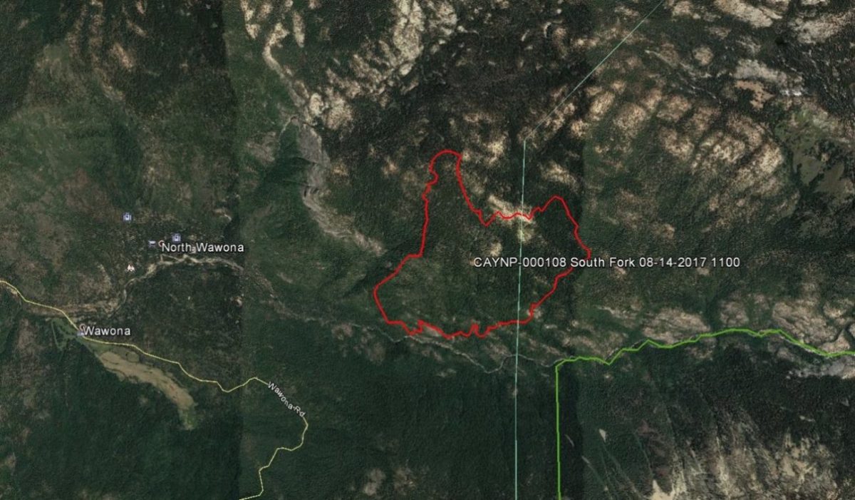
Click here for a perimeter map.
Click here for interactive map.
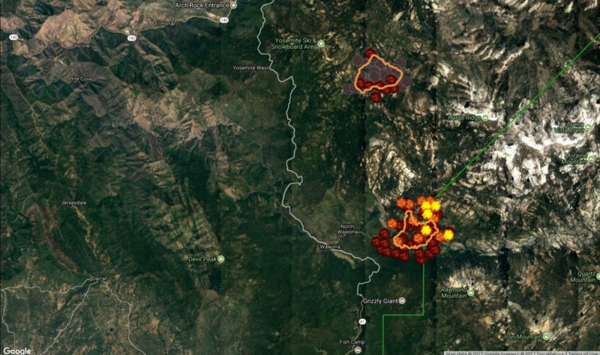
Map below shows South Fork Fire on the south and Empire Fire on the north.