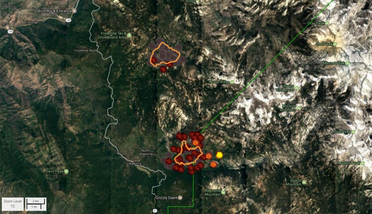
YOSEMITE — The South Fork Fire, burning inside Yosemite National Park just east of Wawona, has grown by several hundred acres overnight. It is now estimated at 2,296 acres, still with 5 percent containment.
The South Central Sierra Interagency Incident Management Team took over management of the fire yesterday. They will host a community meeting at the Wawona Community Center tonight, Wednesday, Aug. 16, at 6 p.m.
There are currently 253 personnel assigned to the incident including Hot Shots, ground and engine crews, with more resources on order.
There are about 10 aircraft fighting the fire, including helicopters doing bucket work and fixed-wings laying down retardant, mainly on the left flank of the fire closest to Wawona, which is holding at this time.
The Wawona area continues to be on alert to make appropriate pre-evacuation preparations. If there is an actual need for evacuation, there will be door-to-door notifications by park staff.
The Office of the Superintendent in Yosemite this morning announced these operational changes:
- Wawona Campground is closed.
- Bridalveil Creek Campground closes on Wednesday morning.
- Wawona trail (mule) rides are not operating.
- Big Trees Golf Course is closed.
- The Badger Pass-Glacier Point shuttle will not operate until further notice as the incident command post is occupying the Yosemite Ski and Snowboard Area facility and parking lot.
- The Glacier Point Road will will remain open to the public however it will close periodically between 10am and 5pm each day when parking at Glacier Point fills to capacity (and will reopen when sufficient space is available). Traffic delays should be expected.
- A voluntary ban on wood fires is in place in Yosemite Valley to reduce smoke. A mandatory ban may be instituted in the days to come.
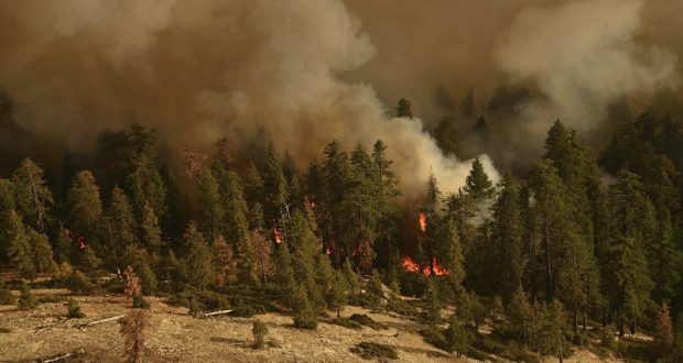
The South Fork Fire was reported just after 2 p.m. on Sunday, Aug. 13, and is burning on the South Fork of the Merced River drainage, south of Wawona Dome approximately one mile east of the Swinging Bridge.
South Fork Fire from Fresno Dome Trail – photo by Artisa Danielle O’Dell-Flanagan
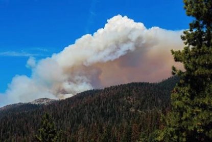
Heavy smoke continues to impact Wawona and the areas surrounding Yosemite, especially overnight and through the morning hours, adding more smoke to what is being produced by the Empire Fire near Bridalveil Campground, which is now estimated at 1,320 acres.
Air quality in Wawona is expected to be extremely smoky and to reach unhealthy/ hazardous conditions. Smoke is expected to fill the canyons west of Wawona to Mariposa, and affect visibility along Highway 140 from El Portal to Mariposa, Wawona Road south to Fish Camp, and roads along Tioga Pass to the Mono Lake area.
The cause of the fire is under investigation.
The estimated date of containment is Sunday, Sept. 3.
Air quality links for Yosemite National Park:
https://app.airsis.com/USFS/UnitMap
https://www.nps.gov/yose/learn/nature/aqmonitoring.htm
Click here for a perimeter map.
Click here for interactive map.
Map below shows South Fork Fire on the south and Empire Fire on the north.