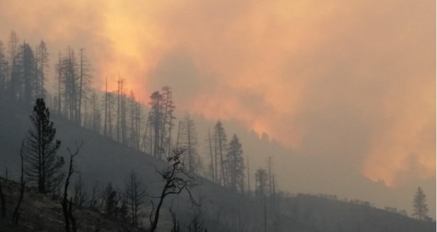
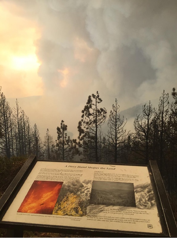
SIERRA NATIONAL FOREST – Central California residents woke once again to heavy smoke from the Rough Fire, which is now estimated at 128,796 acres with 29 percent containment.
There are currently 2,570 personnel assigned to the incident, including 60 crews, 164 engines, 14 helicopters and 23 dozers.
With the fire now into its seventh week, management teams continue to time out, with new teams coming in to take over command. The Rocky Mountain Incident Management Team (RMIMT), led by Todd Pechota, will be timing out and will be replaced by California IMT 4 with Rocky Opliger as Incident Commander, and Cal Fire IMT2. Today they will be shadowing the RMIMT to provide for a smooth transition when they assume command at 6 a.m. on Sunday.
Weather is expected to be hot and dry again today with low humidity. The inversion layer is expected to lift in the late morning leading to a possible increase in fire activity. Firefighters will need to watch for spot fires again today as spotting could be up to ½ mile.
 The fire moved very little in the southeastern portion last night and fire activity lessened in the Cedar Grove area. Both yesterday and overnight, firefighters performed burnout operations in the Grant Grove area and south towards Sequoia Lake and along portions of McKenzie Ridge.
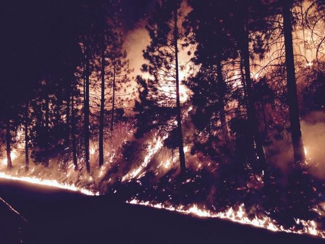
The fire moved quickly towards McKenzie Ridge yesterday and crews performed firing operations along the ridge in an effort to strengthen containment lines. Six air tankers made numerous retardant drops along the ridge and around structures yesterday.
Firefighters will continue firing operations along McKenzie Ridge today as conditions allow. Structure protection and preparation will still take place near the Highway 180 corridor.
 On the portion of the fire, a dozer crew and hand crew have almost completed contingency line on a ridge just south of Fence Meadow lookout that connects with 11S002A Road below Balch Camp.
Another contingency line is being scouted west of Fence Meadow Lookout towards Bob’s Flat down to Trimmer.
Crews will continue to work on completing contingency lines on the fire’s western edge in anticipation of receiving fire from the south. A camp has been established for the crews working on the west contingency lines.
Evacuation Areas Impacted by Rough Fire
The Fresno County Sheriff’s Office and fire officials would like to clarify the guidelines of the current evacuation situation.
Residents who have a Dunlap, Miramonte, or Pinehurst zip code must understand they are considered to be in either a mandatory evacuation area or an evacuation warning area.
Mandatory Evacuation Area
– All properties on the north and south sides of Highway 180 east of the Highway 180/Dunlap Road junction.
– All properties adjacent to the north side of Dunlap Road from the Highway 180/Dunlap Road junction to the Dunlap Road/Millwood Road Junction.
– All properties on both sides of Millwood Road.
– All properties on both sides of Todd Eymann Road from Millwood Road to Highway 245.
– All properties on both sides of Highway 245 from Todd Eymann Road to Highway 180.
Evacuation Warning Areas
– All properties on the south side of Dunlap Road from the Highway 180/Dunlap Road junction east to the Dunlap Road/Millwood Road junction
– All properties on both sides of Dunlap Road from the Dunlap Road/Millwood Road junction east to the Dunlap Road/Highway 245 junction.
– All properties on both sides of Brookside Road.
Definitions of Fire Terms
An evacuation warning is defined as an alert to community members in an area of a potential threat to life and property from an emergency incident. An evacuation warning may be issued when the potential or actual threat to civilian life is more than 2 hours away. When a warning is issued, residents are being warned to prepare to leave their home. The Sheriff’s Office tries to issue the advisory as early as possible based upon the fire’s activity so residents will have time to remove their pets, livestock, large boats, RV’s and any other personal effects in an orderly, unrushed manner. However, because a wildfire can be unpredictable, the time frame between an advisory and a mandatory evacuation can change quickly. You must be prepared to go at any time.
A mandatory evacuation is declared when a wildfire directly threatens a community and residents are placed in danger. You must leave the area for you and your family’s safety. Once you leave, you will not be allowed to return to your property until the mandatory evacuation is lifted.
For more answers to commonly asked questions regarding an evacuation situation, visit https://www.fresnosheriff.org/community/fire-season-information.html
View the latest information on the Rough Fire at http://inciweb.nwcg.gov/incident/4456/ and www.fresnosheriff.org, where a map of the evacuation areas can be accessed.
The Rough Fire was started by lightning on July 31.
For maps of the incident, click here.