 FISH CAMP — The Railroad Fire continues its push to the east, but the fire activity most are likely concerned about today is the move to the southeast and into the 1,540 acres of the Sierra National Forest that is the Nelder Grove.
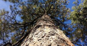
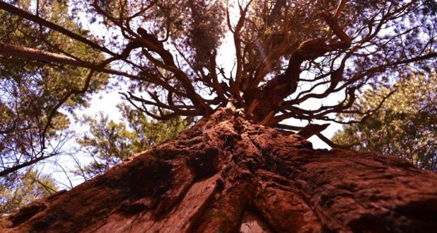
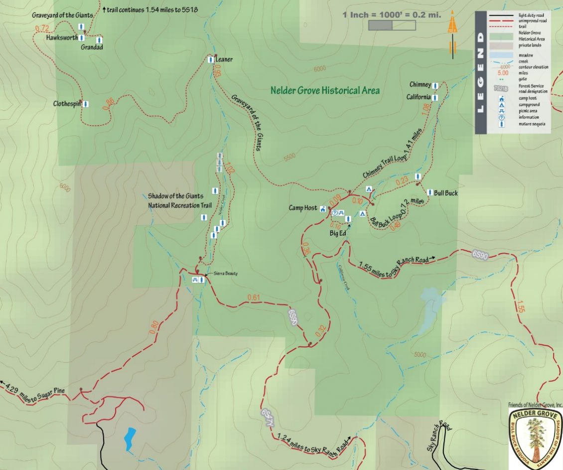
There are about 100 mature sequoias, mixed with pine, fir and cedar in the Grove. The fire has moved into the northwest corner, where the Hawksworth and Grandad trees have stood for millenia.
Giant sequoias require fire as part of their life cycle and are protected by the tannin they produce. We can only wait and watch to see how intensely it burns, how dense the fuels are, and whether the fire stays on the forest floor.
There are also two historic cabins that were moved to their current locations from Biledo Meadow. Fire managers have plans to ensure that they are not lost, no matter what the fire does.
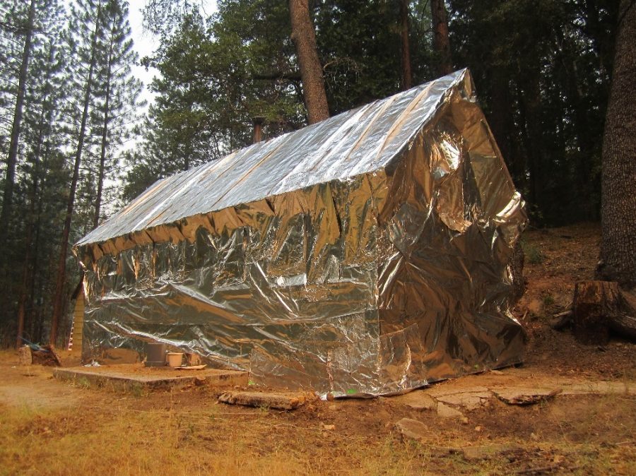
Wrapped building at Placer Guard Station – photo courtesy USFS
According to Deputy Planning Chief Dave Martin, a TSI (timber stand improvement) team will be in the Grove tomorrow to wrap the buildings in fire retardant material to protect them from damage. (Photo shows the same process during the French Fire in 2014)
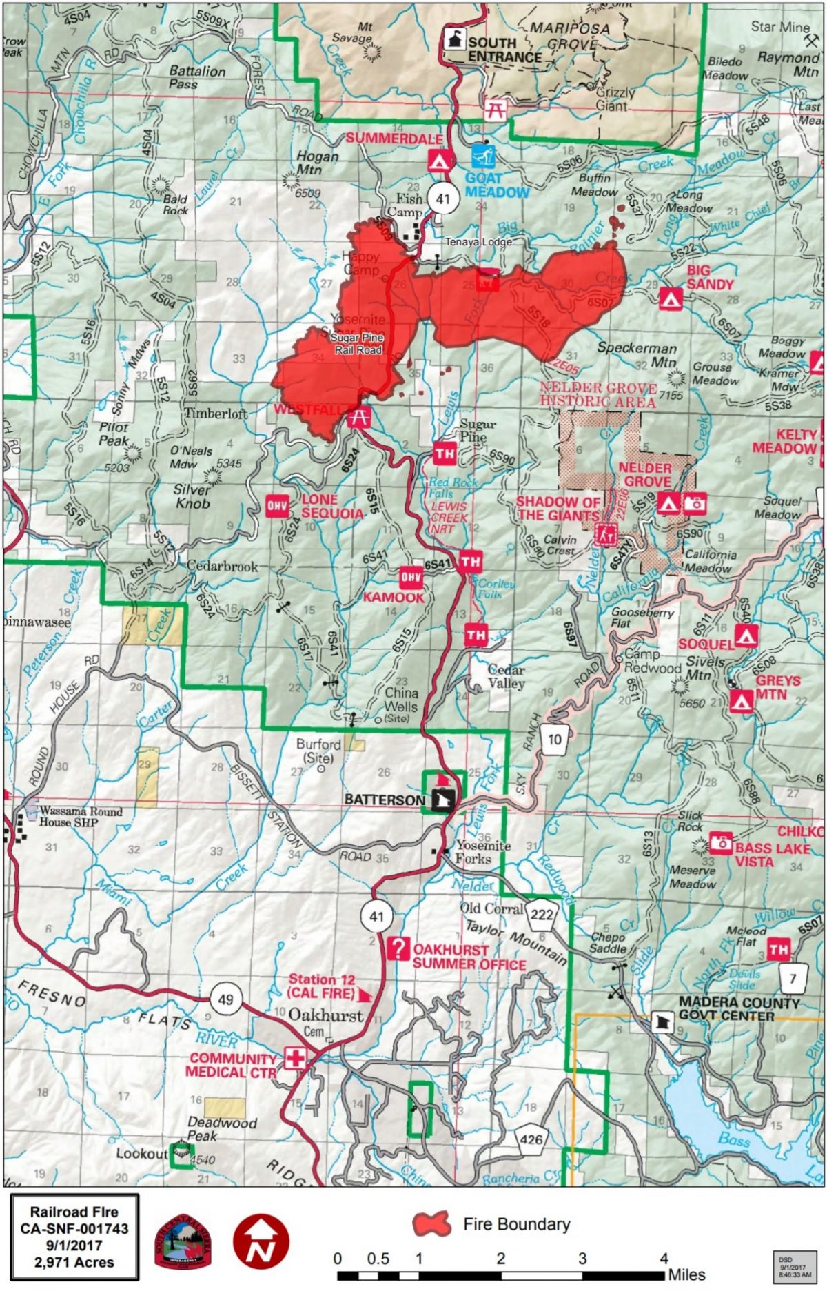
The Railroad Fire is now estimated at 4,360 acres with 10 percent containment.
The fire continues to push east away from Fish Camp and the Tenaya Lodge. Crews conducted burning operations today (clearing out fuel within the containment lines) from Big Sandy up to the 5S22 Road and further north toward Long Meadow and up to Buffin Meadow.
The operations were successful, but firefighters working the area also had to deal with some spotfires out to the northeast. Dozers, engines and hand crews got to work and by the end of the day shift, had those just about handled.
Contingency line on the northeast corner is being cut a little farther out now — they’re expanding the “big box” that is part of any fire operations planning, and moving it out to the 5S06 road.
Operations says everything on the 6S07 (Jackson) road that runs to the east below the Tenaya Lodge, is holding in place. Everything from the Tenaya over to Fish Camp and back down the west flank of the fire looks good, say managers. The forward progress along those lines has been stopped, and they are in the mop-up and patrol phase.
Dozer line construction continues on the southwest perimeter near Miami Mountain Road, and air tankers – including the VLAT and two C130 MAFFs — hit hard on that section, and the “finger” of the perimeter that runs behind Westfall, the farthest south portion of the fire. That part of the fire didn’t move today.
A spot fire that ran up the ridge near the sewage tanks northeast of the Railroad yesterday, ran back into the main fire today, and firefighters had good success tying that section down.
Much of the line running east from the Railroad is uncontrolled fireline, including the burn now headed into Nelder Grove.
There are currently 590 personnel assigned to the incident including 30 engines, 9 crews, 7 dozers, 12 water tenders and 4 helicopters, with air tankers as available.
Seven structures have been destroyed and over one hundred more are threatened.
At about 10:30 this morning, the Madera County Sheriff’s Office sent deputies to Soquel, Texas Flat, Nelder Grove and Calvin Crest to evacuate. They also announced closures on the east side of the fire area.
- Road 632 (Sky Ranch Road) at Buckskin Lane
- Forest Road 6S13 at Road 274
- Forest Road 6S40 at Beasore Road
- Forest Road 6S08 at 6S36
- Forest Road 5S39 at 5S90
- Forest Road 5S40Y at Beasore Road.
We were unable to match all these roads to an intersection and thereby create a map. Suffice it to say that everyone should avoid any area west of Beasore Road, which runs north from Road 274 near The Pines Resort on the north shore of Bass Lake. This interactive map shows the location of Beasore Road.
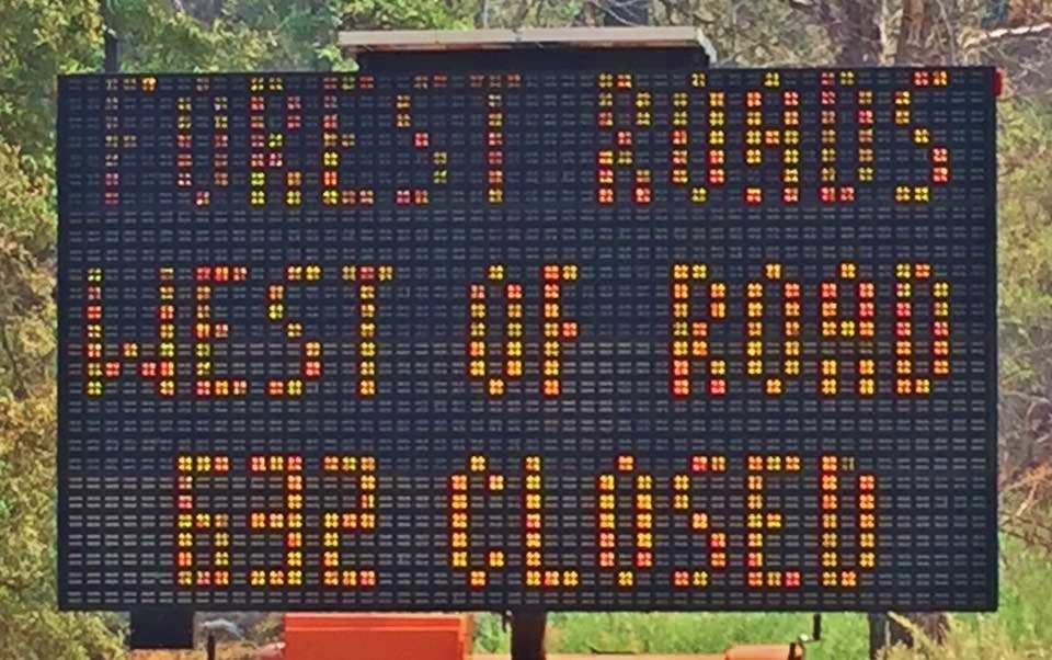
Forest closure sign on Sky Ranch Road – photo by Sheila Kleiwer
An illuminated sign was put up on Sky Ranch road near the bridge at Lewis Creek informing people of the closure, and law enforcement began turning people around. Deputies patrolled the roads instructing people to either move farther up into the high country to the east and north, or leave the area. Cold Springs Summit was closed down to prevent access to Sky Ranch Road from the east.
With the busy holiday weekend coming up and campers headed for the mountains, having a lot of inbound traffic to the areas out in front of the leading edge of the fire would certainly present problems.
Forest Service Law Enforcement and the Madera County Sheriff’s office are partnering to ensure that road closures and evacuated areas remain staffed with officers day and night.
The Red Cross Evacuation Center at the Oakhurst Community Center has been closed down due to lack of need. However, they are on standby and prepared to get back up and running again within two hours.
“Just because we’re closed doesn’t mean we’ve left,” says Disaster Program Manager Katrina Poitras. “You can still call, and we will provide assistance, or connect you with other resources who can help you.”
The hot line number for the Red Cross is 559-343-2549.
Closures and evacuations on the Railroad Fire:
There is a mandatory evacuation order for Big Sandy Campground and Summerdale Campground.
Sky Ranch is under an evacuation advisory from Highway 41 to Buckskin Lane. The road is closed beyond that point, including Soquel and Texas Flat campgrounds, Nelder Grove and Calvin Crest.
The road closure on Highway 41 northbound is at Cedar Valley about three miles north of Oakhurst, and southbound inside Yosemite National Park at Wawona. Yosemite visitors should use Highway 49 to Highway 140 or 120 for entrance to the National Park.
Road closures include all Highway 41 offshoots between Cedar Valley Road and Summerdale Campground in both Madera County and Mariposa County, and Road 630 (Sugar Pine Road) and all cross streets, including Sugar Pine Christian Camps.
Jackson Road (6S07) is closed from Fish Camp to Beasore Road.
A mandatory evacuation is in place for the the community of Fish Camp, the Tenaya Lodge, the Narrow Gauge Inn, the Yosemite Mountain Sugar Pine Railroad, the community of Sugar Pine including the Christian Camp, and all homes and businesses in the immediate vicinity. Evacuations also run north from Fish Camp to the Summerdale Campground.
Also closed are these Forest roads:
- Road 630 at Buckskin Lane
- Forest Road 6S13 at Road 274
- Forest Road 6S40 at Beasore Road
- Forest Road 6S08 at 6S36
- Forest Road 5S39 at 5S90
- Forest Road 5S40Y at Beasore Road.
The community of Wawona is being warned of the possible threat potential from this fire. Residents and visitors are encouraged to make appropriate pre-evacuation preparations.
The Red Cross Evacuation Center at the Oakhurst Community Center has been closed down due to lack of need, as has the one in Yosemite Valley. However, they are on standby and prepared to get back up and running again within two hours.
“Just because we’re closed doesn’t mean we’ve left,” says Red Cross Disaster Program Manager Katrina Poitras. “You can still call, and we will provide assistance, or connect you with other resources who can help you.”
The hot line number for the Red Cross is 559-343-2549.
The Central California Animal Disaster Team has activated a small animal shelter at the Oakhurst Community Center Pavillion Building. Small animals can also be sheltered at the Mariposa SPCA, 5599 Highway 49 in Mariposa. The phone number is 209-966-5275. Large animals can be sheltered at the Coarsegold Rodeo Grounds, at 44777 Rodeo Grounds Lane in Coarsegold. The phone number is 559-676-7864.
All roads past Wawona inside Yosemite are open, except Glacier Point Road, which was closed on Sunday due to increased fire activity on the Empire Fire.
For fire updates, residents and visitors can message RAILROADFIRE (one word) to 888777.
A fire information line has been established for the Railroad Fire at 559-373-0040.
The Railroad Fire was reported at 12:20 p.m. on Tuesday, Aug. 29, just south of the Yosemite Mountain Sugar Pine Railroad on the west side of Highway 41. It is burning on the Bass Lake Ranger District of the Sierra National Forest.
The cause of the fire is under investigation.
To view the map below on a website where you can zoom in and out, click here.