My dog Sally took me on a hike up to beautiful Lady Lake in the Ansel Adams Wilderness where we saw some gorgeous high lakes with backdrops of snow covered mountains.
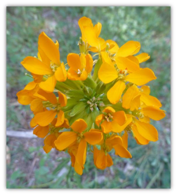
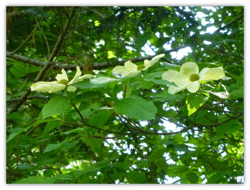
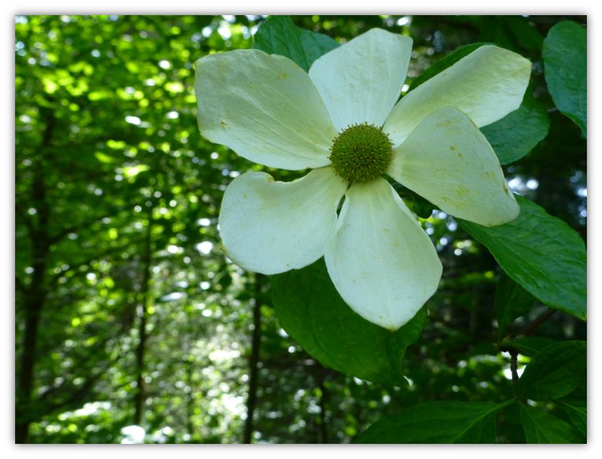
Where: Ansel Adams Wilderness, Sierra National Forest We started up Beasore Road and it wasn’t too far up before we started seeing quite the display of wildflowers. Big yellowish-orange wallflowers looked quite happy and although most of the dogwoods were fully leafed out, we discovered a small pocket, about 5 miles up the road, which had pristine dogwood flowers. What a gorgeous surprise.
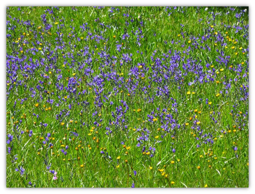
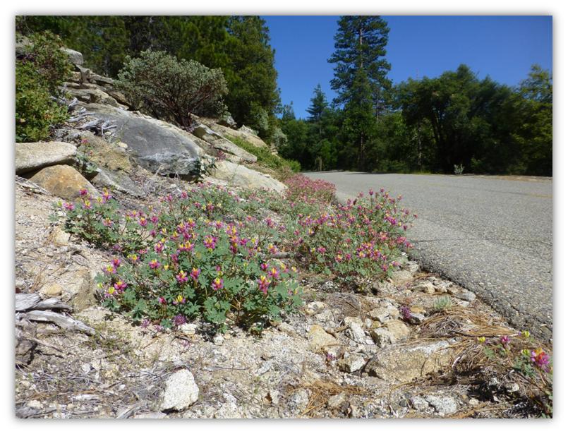
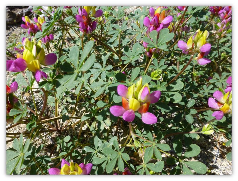
There are several beautiful green meadows along the road and if you look a little closer, you will see that they are loaded with wildflowers of every color. If you have never seen harlequin lupine, there is a patch just alongside the left hand shoulder of the road as you drive up. You can do all of this first part on a paved road without leaving your car!
We drove by Jones Store, which looked like it wasn’t open for the season yet. It usually opens around July 4 each year. If you haven’t been there, you might want to stop in and see this historic place that has been in existence for 100 years or so. Once they are open, you can also get something to eat or pick up some basic supplies here.
The Grub Gulch Chapter of E. Clampus Vitus has placed a marker at the Jones Store that has the writing below. Jones Store
As the cattle were driven from the valley to the rich mountain grasses in the spring at a site nearby, Tom Jones saw a need to supply the drovers with staples and supplies that were consumed or forgotten. As is today, the cattle drives still continue and the descendants carry on the tradition. When Beasore road was built in 1936, a new western front store was constructed at the present site. That store was replaced in 1954 by the present 2-story country store. Like a link to the past, the old manual globe gas pump is still out front and the store hasn’t changed. Third generation families as well as newly acquainted friends, still patronize the store and campgrounds.
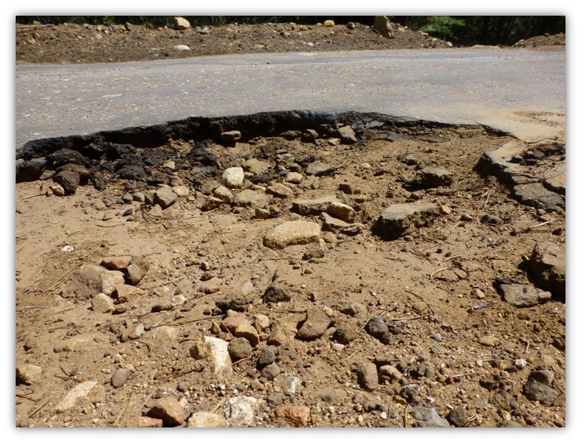
Dedicated July 2, 1994 That nice paved road rapidly changes its personality when it crosses Chilkoot Creek. Some parts of the road have a little bit of pavement on it in spots but it is more potholes than road. A car could negotiate these potholes by slowly and carefully weaving its way and crisscrossing the road. Even then, your car will likely find some of them.
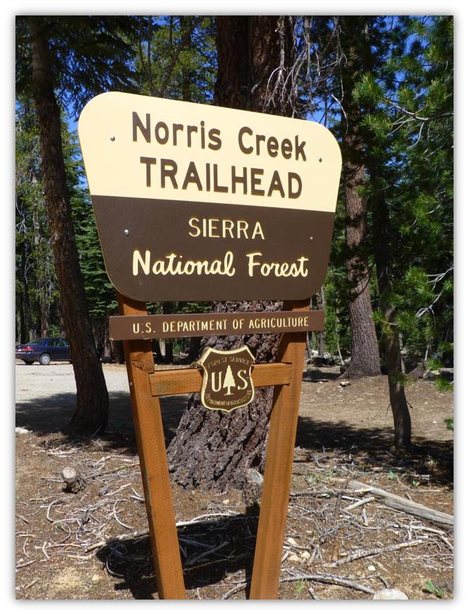
I didn’t clock the exact mileage but it was about 40 miles up Beasore Rd. where we saw the marked junction to the dirt road that took us to the Norris Trailhead and another 2 miles or so up that road, which was in good shape.
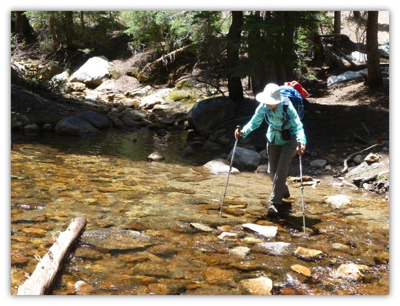
When we arrived at the Norris Creek Trailhead Parking Area, we put our snacks and things that a bear might find tempting in the bear boxes and headed up the trail. This can be a good dog hike and on this trip, there was plenty of water for Sally in the creeks and lakes along the trail. Later in the summer and fall, it is a different story and you will probably need to pack water if you hike with your dog. Speaking of bears, I have heard reports of a bear hanging out on the lower portion of the trail but we didn’t encounter it on this trip.
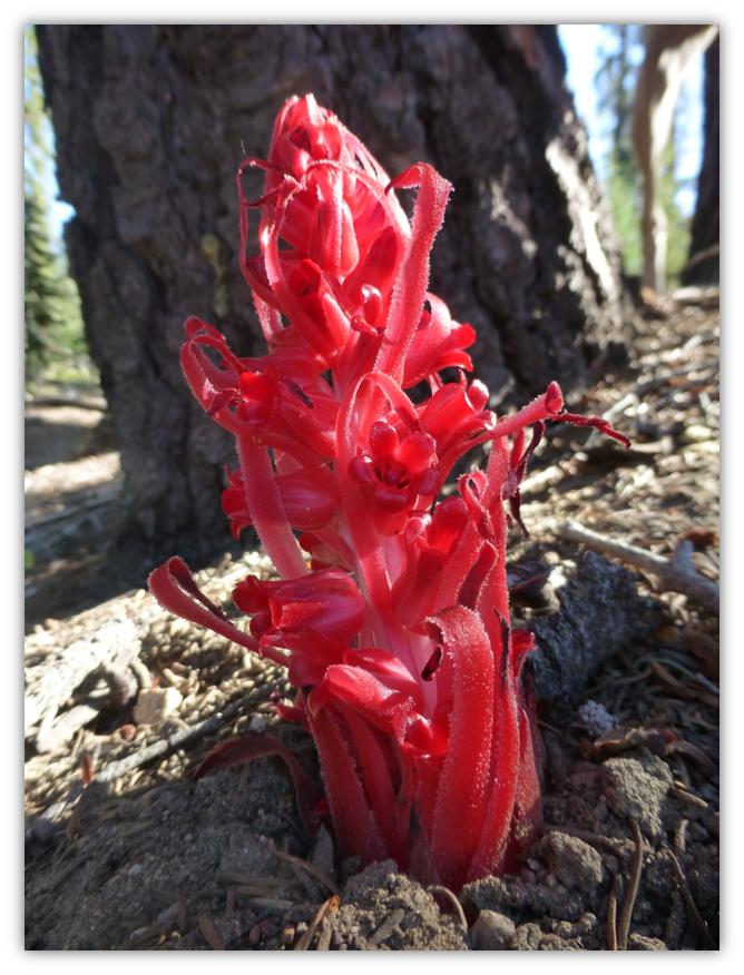
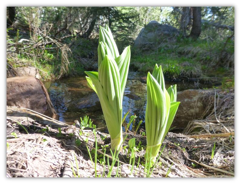
As we climbed the trail, we spotted a few snow plants, just starting to pop their way through the soil.
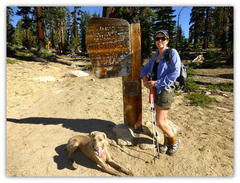
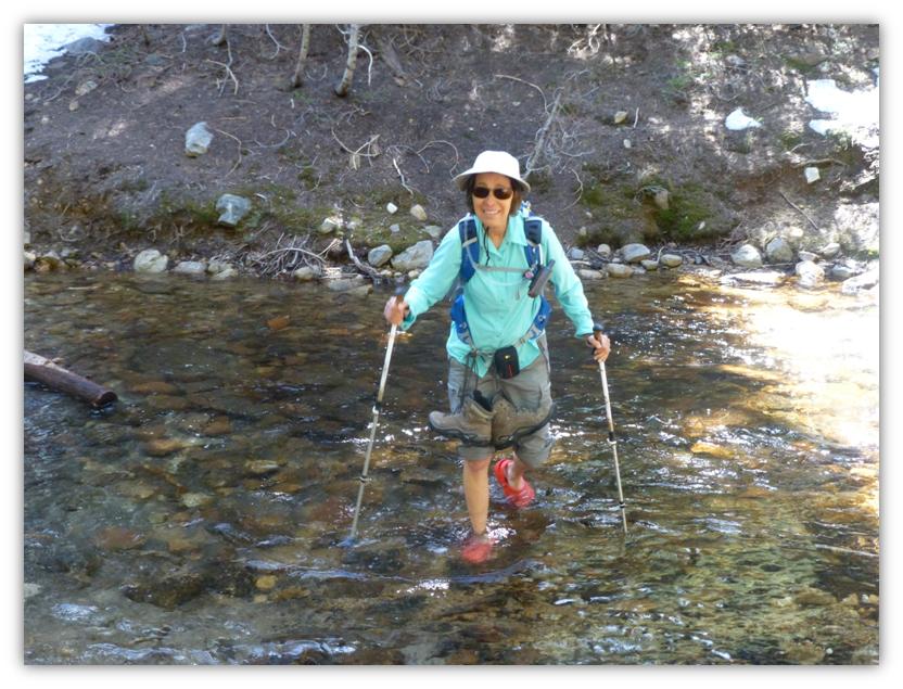
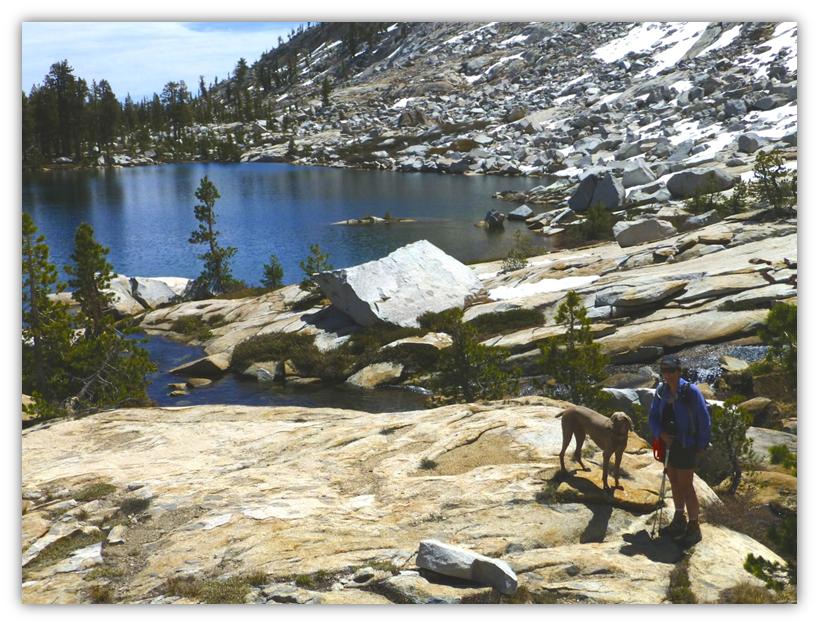
We crossed into the Ansel Adams Wilderness where Gail Gilbert took this picture of Sally and me. Sally loves to pose for pictures. . .when I have treats for her.
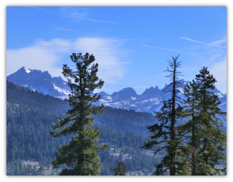
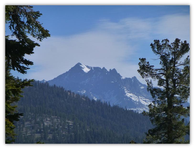
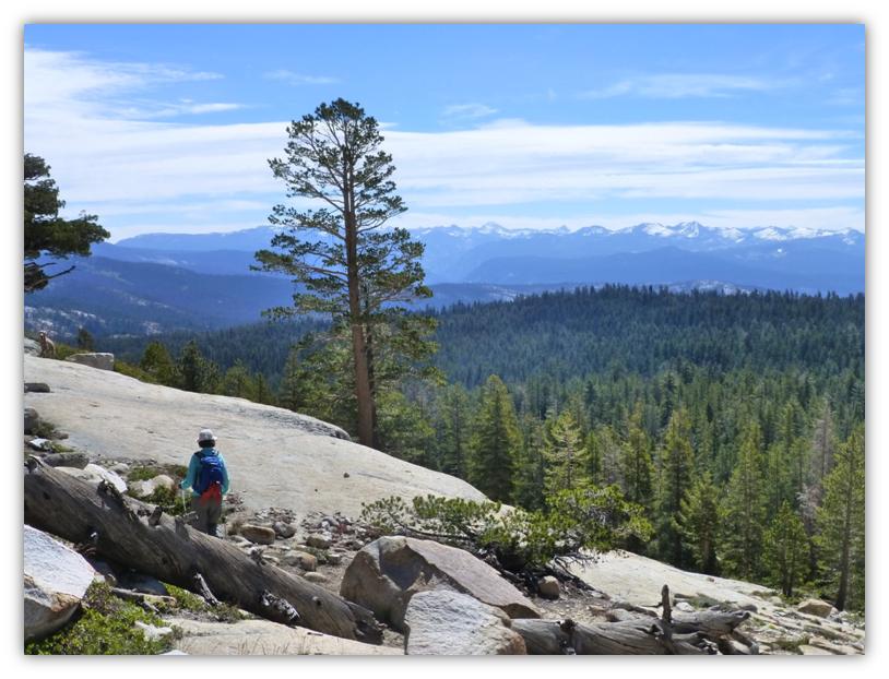
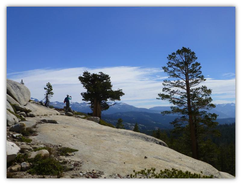
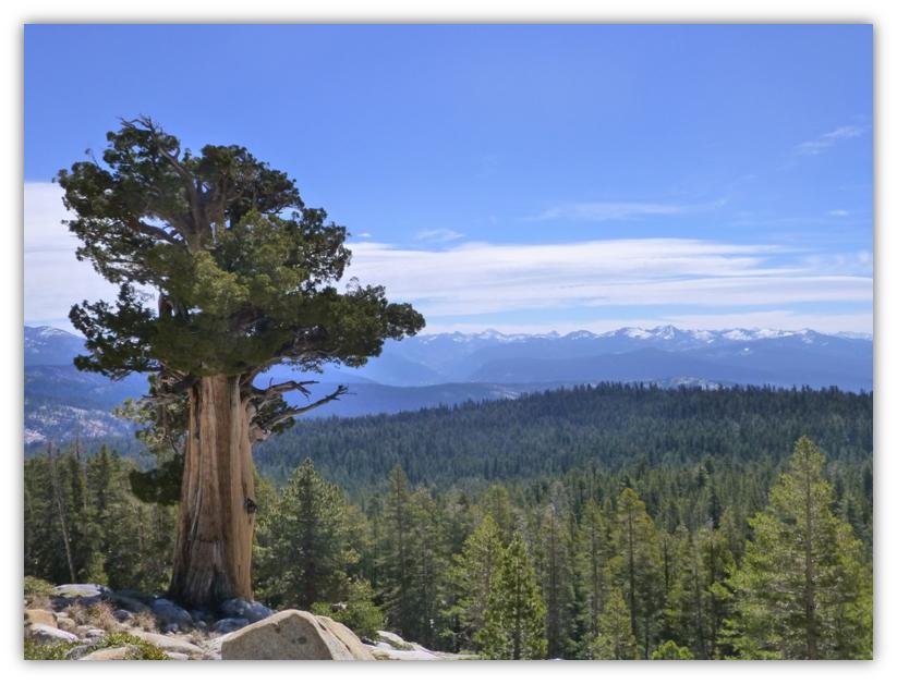
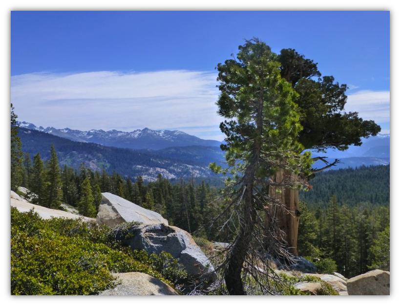
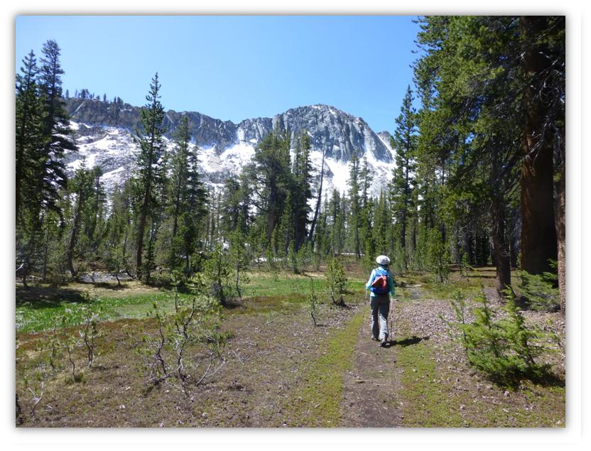
Above this point, we caught glimpses of snow covered mountains and could pick out the Ritter Range, the Yosemite divide, and the Clark Range.
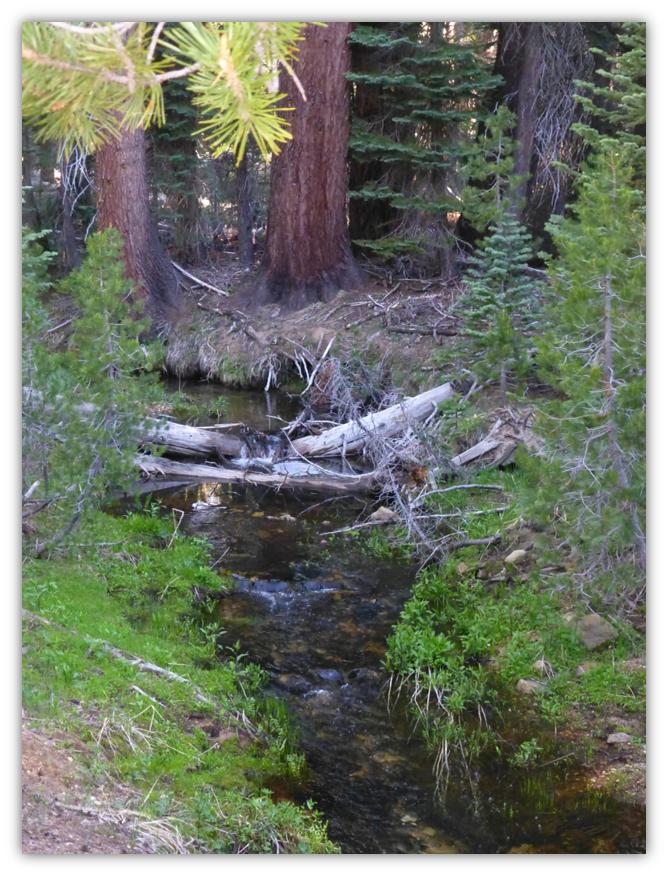
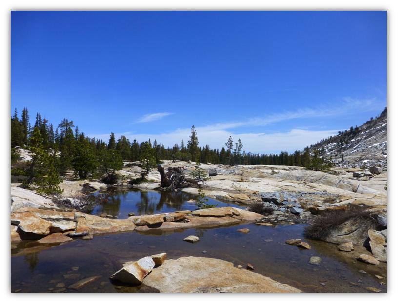
The trail goes right by several meadows and water filled tarns that will be meadows before too long. Many small creeks were flowing.
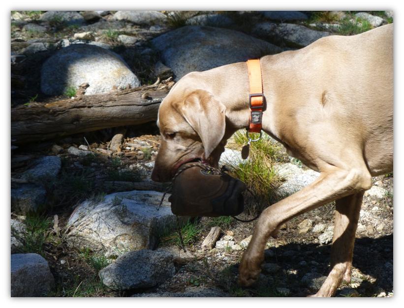
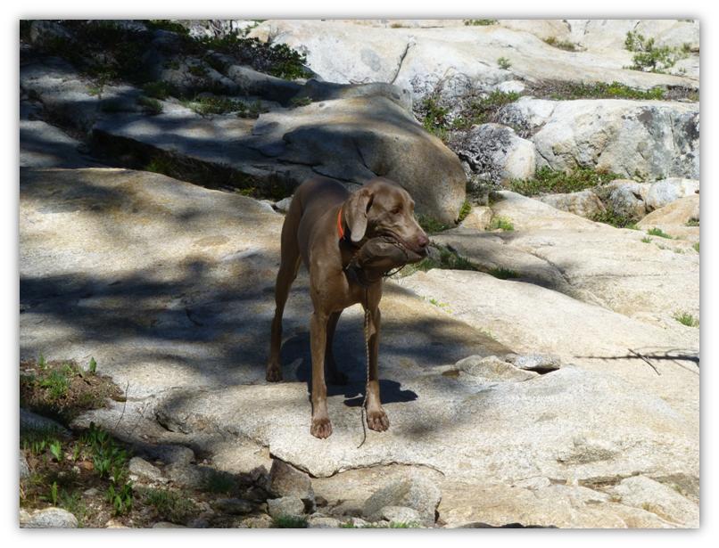
Sally found a boot and brought it back to show us her amazing find. Upon closer inspection, we discovered that the boot was missing it’s bottom sole so I guess that is why it was left behind. It sure makes you wonder how this person made it down the hill. Did they have other shoes with them or did they walk down in their socks? I guess we will never know. We do know that Sally is a very good shoe retriever, as she has found and retrieved several on her hikes over the years.
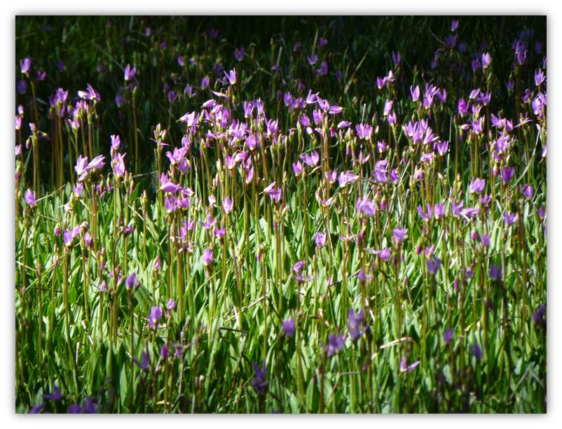
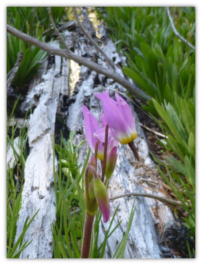
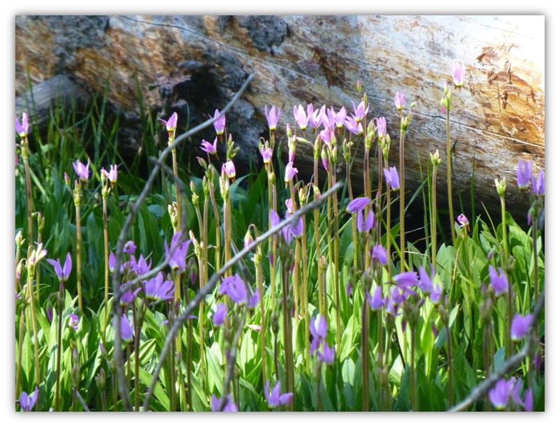
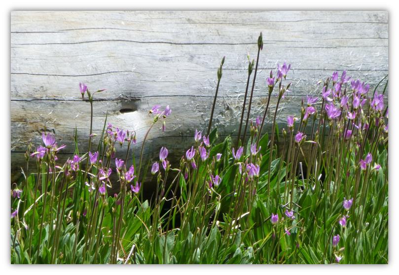
Some of the meadows had purple shooting stars starting to bloom and blanket the meadow. They were so pretty.
One of those great viewing spots along the trail.
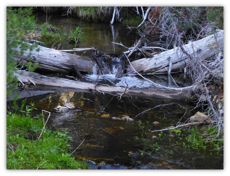
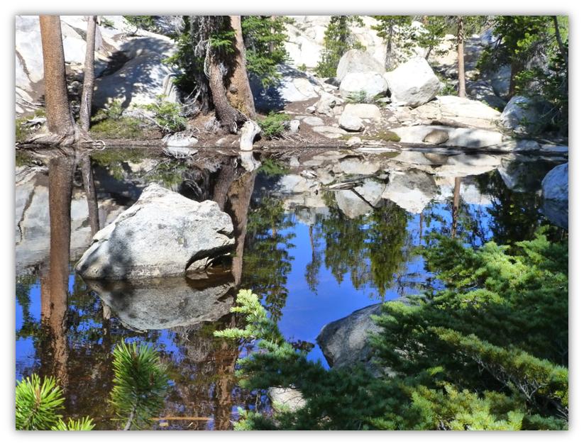
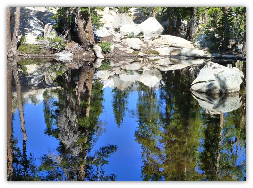
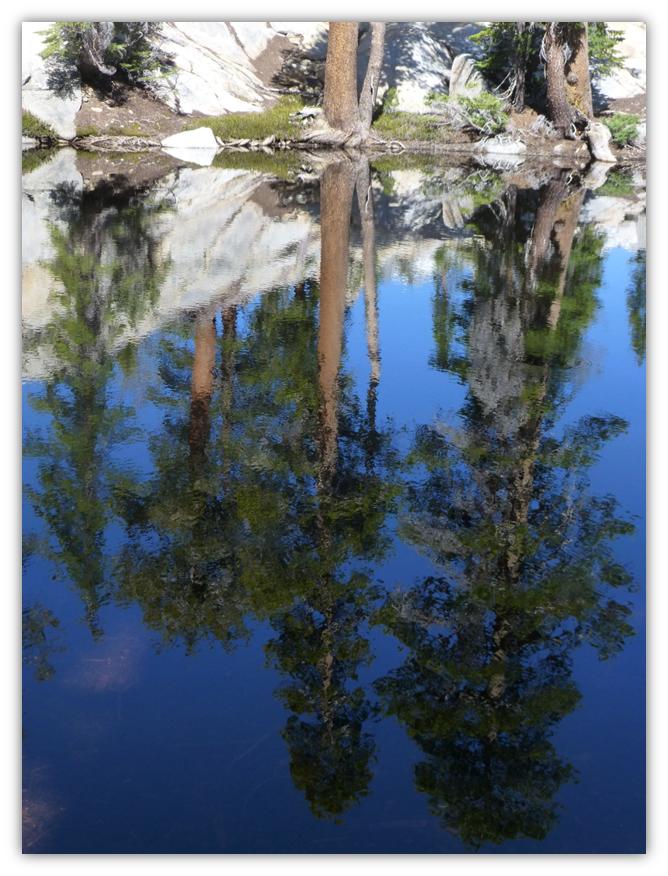
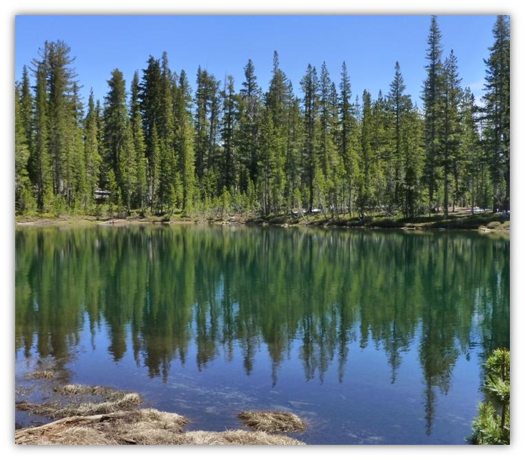
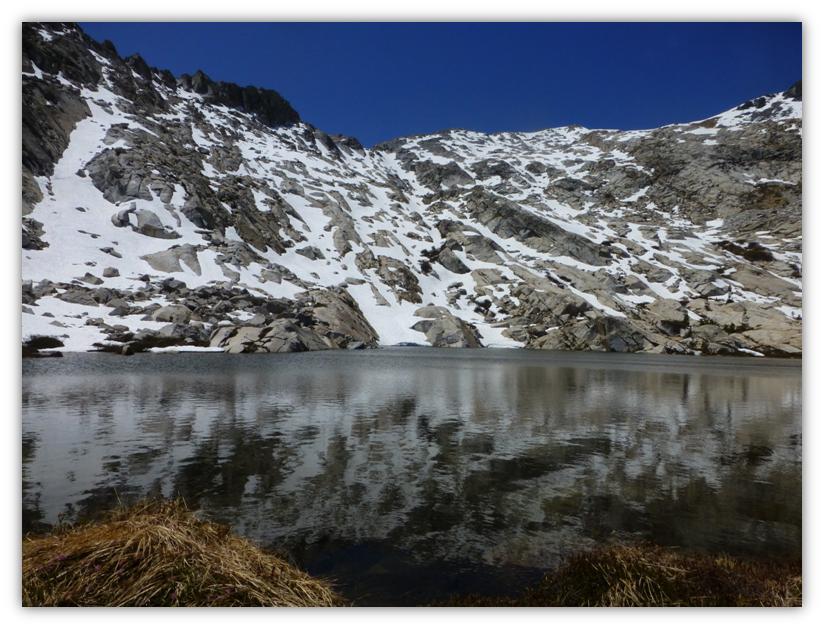
Not too far after that great view, we came across a couple of small tarns with great reflections.
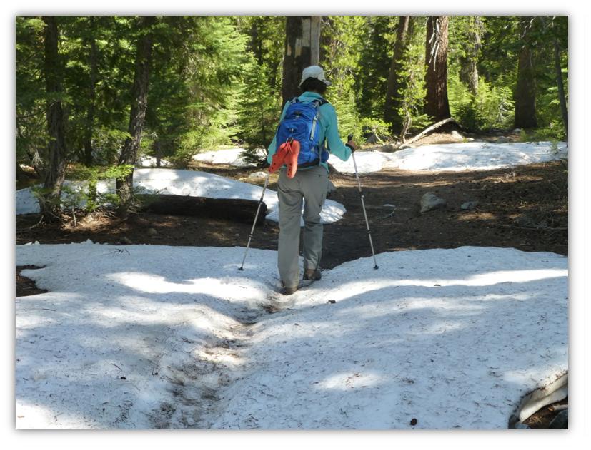
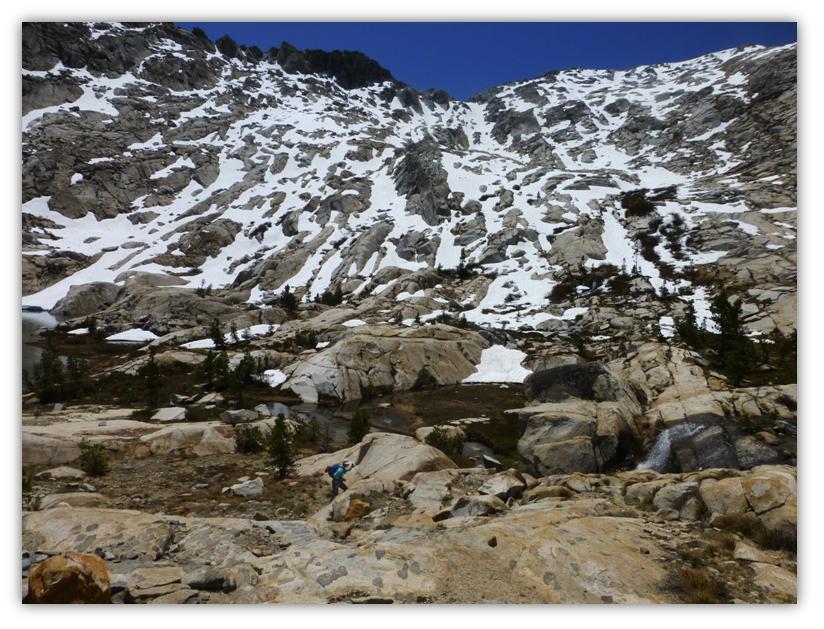
Well, it was just about after these small tarns that we started to hit a little snow but nothing that we couldn’t walk through. The patches got larger as we headed toward Lady Lake. We had carried our water shoes with us because we weren’t sure if we would need them when we crossed Madera Creek. We used them!
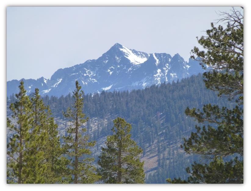
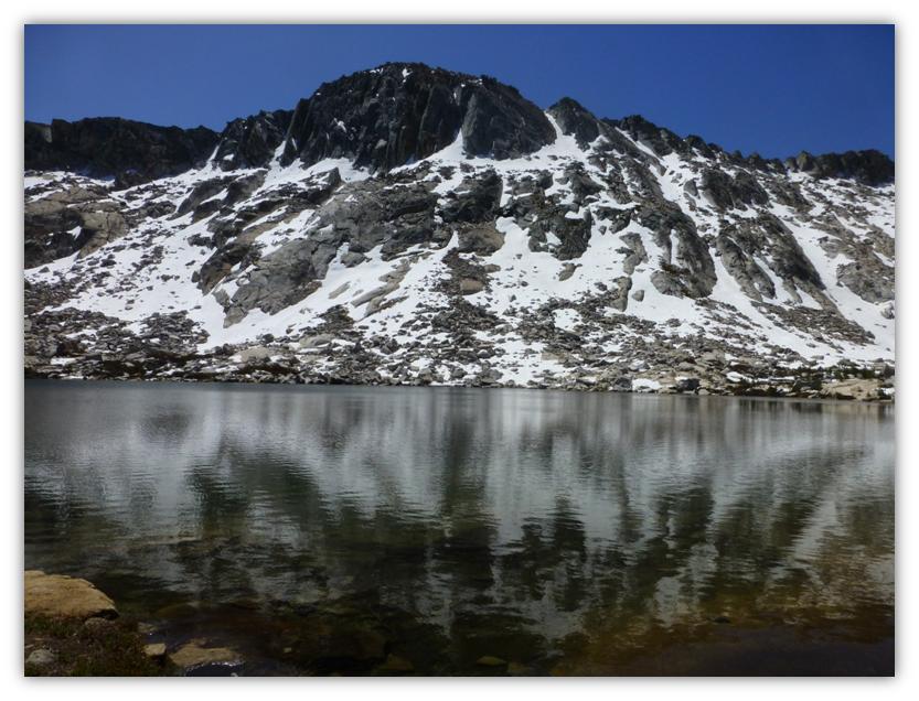
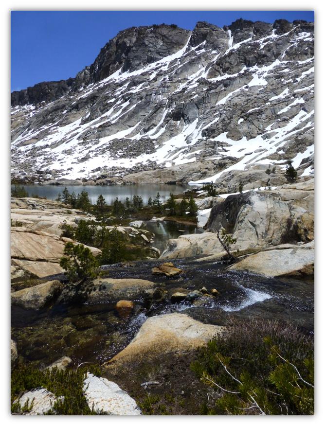
After we took the fork in the trail that headed to Lady Lake, the snow covered mountains surrounding Madera Peak started to reveal themselves to us.
There was a bit of a wind when we reached Lady Lake so reflections were a kind of a challenge to get pictures of. The lake was gorgeous, of course, with or without those mountains and trees reflecting in them.
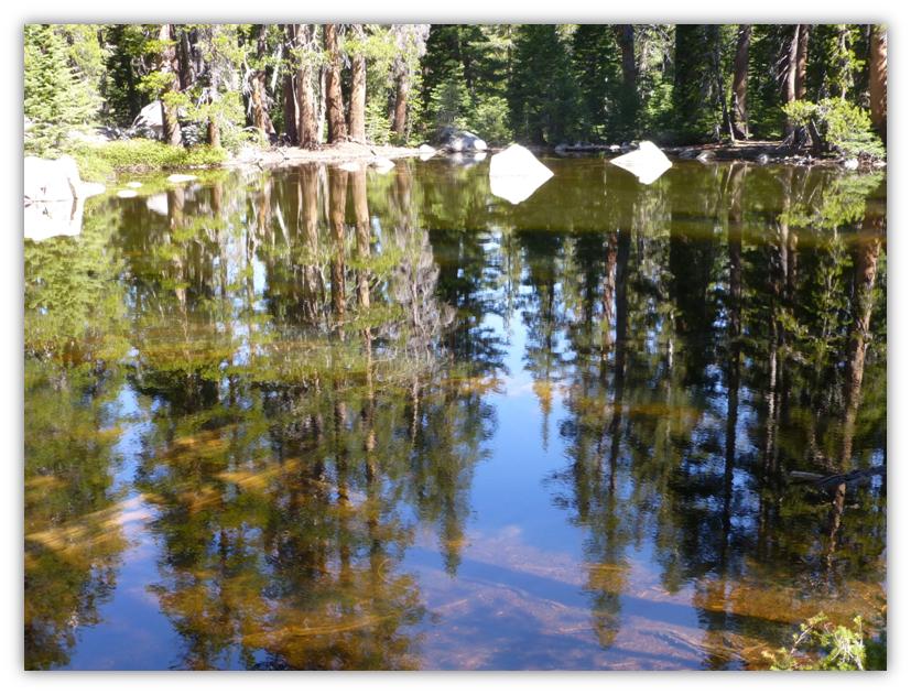
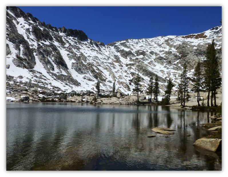
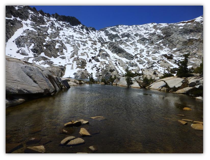
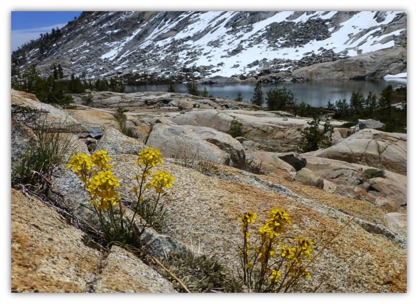
We meandered around, then walked above Lady Lake where there is a small lake and tarns. What a great lunch spot!
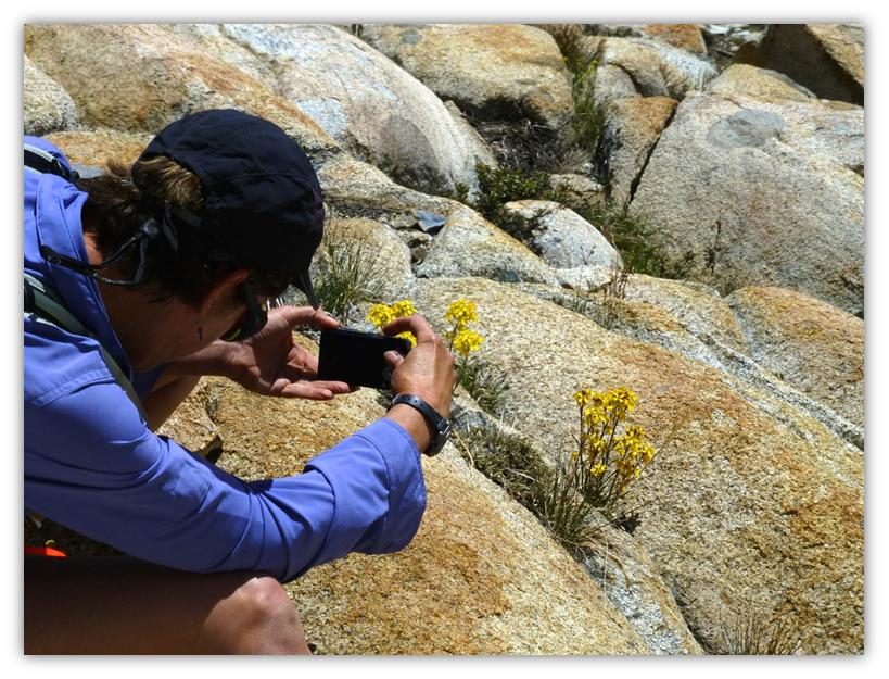
After lunch, we explored the small tarns higher up, following the streams that feed Lady Lake. The pictures that have me in them were taken by Gail Gilbert.
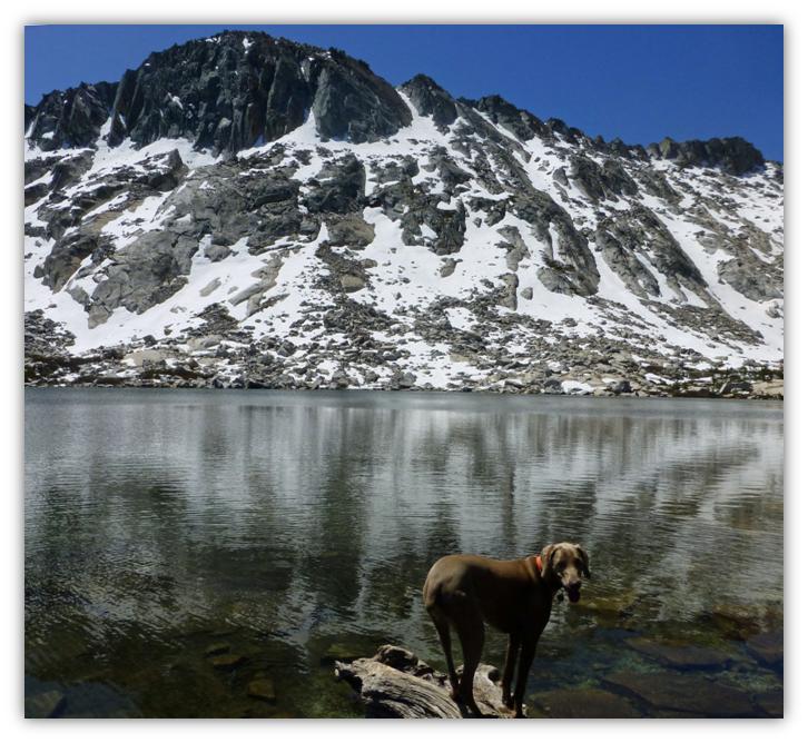
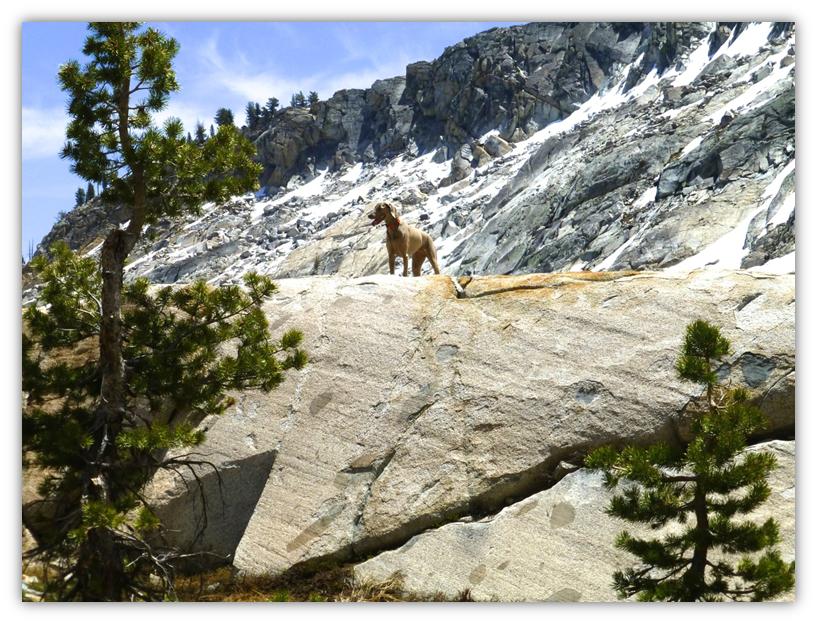
Sally is working on her Lassie pose (photo by Gail Gilbert). Sally really had a pretty good idea there, so we all took turned copying her pose with that amazing backdrop of snow covered rocky mountains.
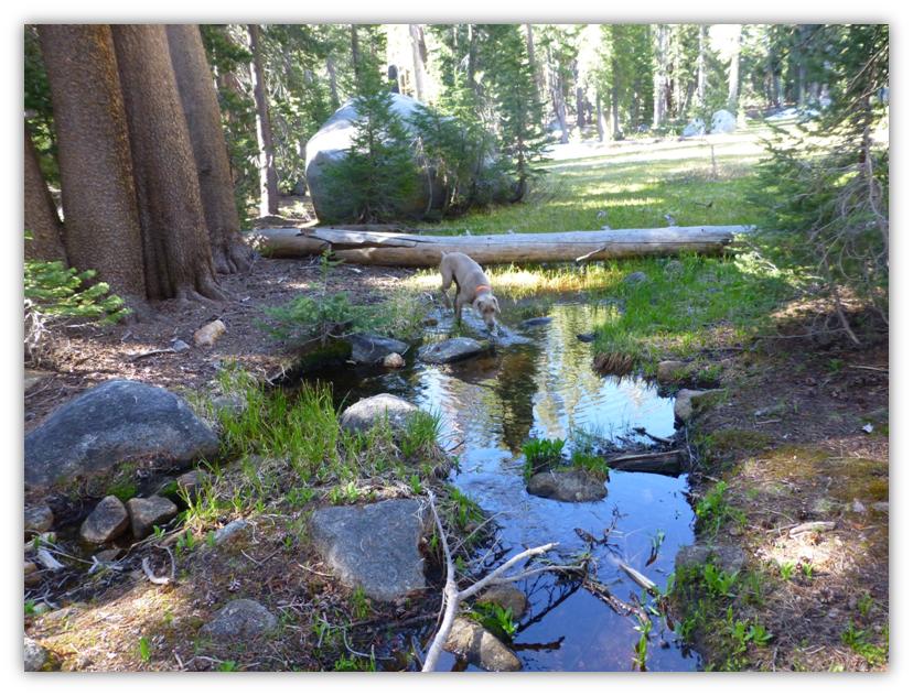
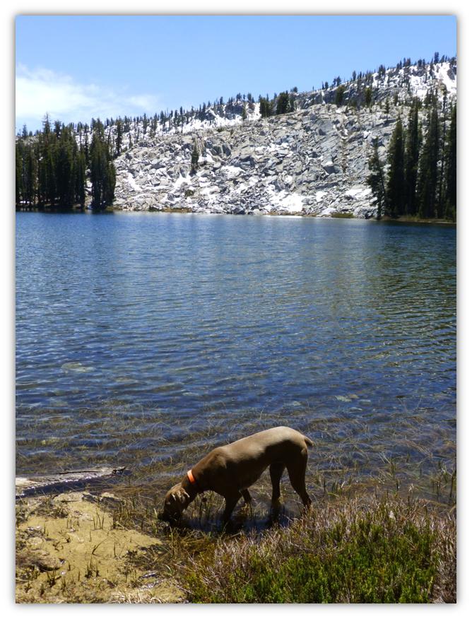
It was time to start heading back down the hill and we swung by Vandenberg Lake on the way down the hill where Sally got herself a drink. There were too many ripples on the water from the wind get a good picture of the lake this day.
Madera Creek was a little lower in the afternoon when we had to get back over it and we were able to rock hop across it. Watch the trail signs on your way down. There is a place where the trail forks. The heavier used fork may look like the one you want to take but you would be wrong. There is a sign on the tree and if you don’t pay attention at this point, you will end up in Clover Meadow. I know someone who did (not us though).
In my humble opinion, Lady Lake is the prettiest Lake up here. If you hike up to Lady Lake, be sure to follow the stream that feeds it to find the upper lake and pools uphill along the stream. I didn’t bring my fishing pole on this hike but I could see some nice pan-sized trout in there. I sure regretted not having that fishing pole.
http://www.sierranevadageotourism.org/content/jones-store-at-beasore-meadow/sie76EB8C581159269AB
Distance: About 12 Miles
Difficulty: Moderate
Elevation Range: 7,503′ – 8,994
Date: May 29, 2014
Maps: Merced Peak Topog
E Clampus Vitus
Grub Gulch Chapter 41-49
 Sources:
http://www.eclampusvitus.com/?page_id=99


Candace,
I enjoyed your (Gail’s) photos and narrative–good job! I have hiked Norris Trail many times up to Jackass Lakes. You captured it just as I remember it. I have not been to Lady Lake, but was planning on it maybe this year, or to Vandenberg Lake. My ex-boyfriend and I have backpacked up to Jackass several times and spent the night–the best scenery ever. I forward this article to him. He will be nostalgic when he sees it. Oh, well, his loss—he was cheating on me for four years and I finally found out.
Happy hiking,
Sharon
Sharon;
You will LOVE Lady Lake! It is gorgeous and well worth the hike.