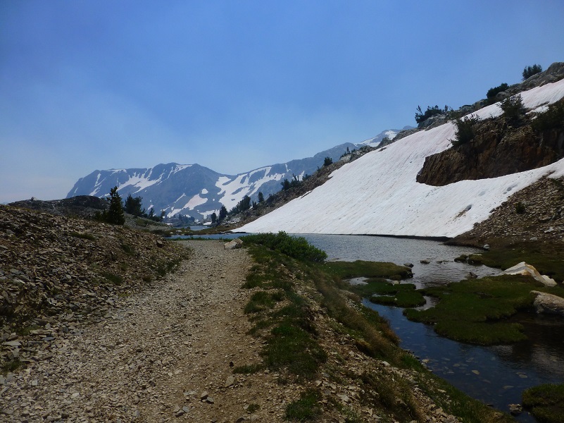
It is hard to believe that it is the middle of August and the snow up at the higher elevations is really hanging in there. Sally and I wandered our way through that snow in the Twenty Lakes Basin by beautiful lakes in the Hoover Wilderness.
Where: Hoover Wilderness I love the Saddlebag Lake area and just got back from camping for a week up there. To get to Saddlebag Lake, I exited the east entrance to Yosemite National Park at Tioga Pass, then drove east on Hwy 120 about 2 miles to Saddlebag Road. Heading up the mostly dirt road to Saddlebag Lake, I stayed at the Saddlebag Lake Campground in the Inyo National Forest above the resort. If you are daytripping it, there is parking at the resort or at the adjacent backpacker parking lot.
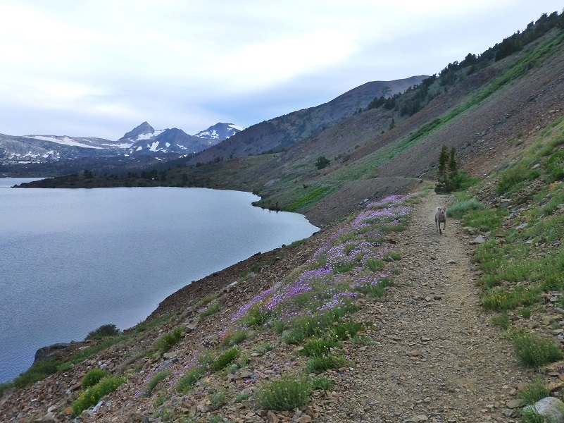
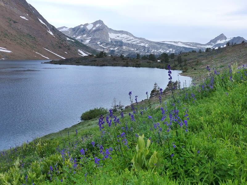
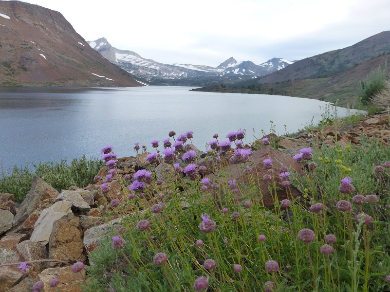
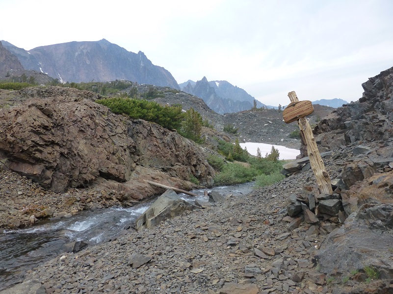
There is a trail on either side of the lake that you can take for this hike. Taking the water taxi that has been operated by Saddlebag Lake Resort was not an option this year because they are not open this summer. The wind was already up as Sally and I headed along the east side of the lake. There was also a bit of smoke that became heavier during the afternoon and it turned out that there were multiple fires causing this, including the South Fork Fire near Wawona. Quite the variety of wildflowers lined the trail, which is really an old mining road.
Distance: 10 Miles
Difficulty: Moderate
Elevation Range: 10,108′ – 10,342′
Date: August 15, 2017
Maps: Falls Ridge and June Lake Topogs
Dog Hike? Yes
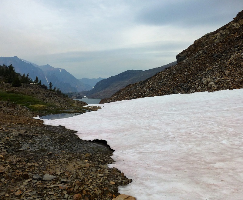
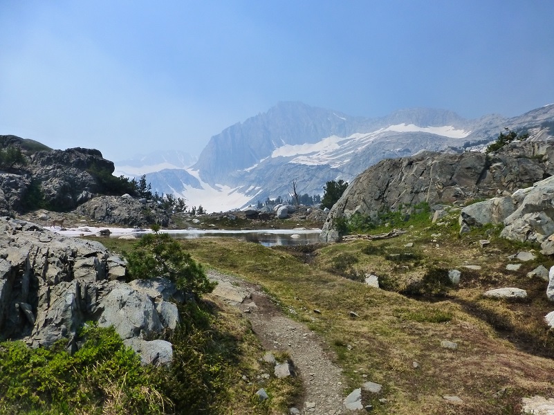
As I reached the north end of Saddlebag Lake, I looked back toward the dam and campground.

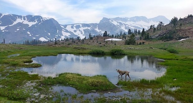
The trail led us by several small seasonal tarns.
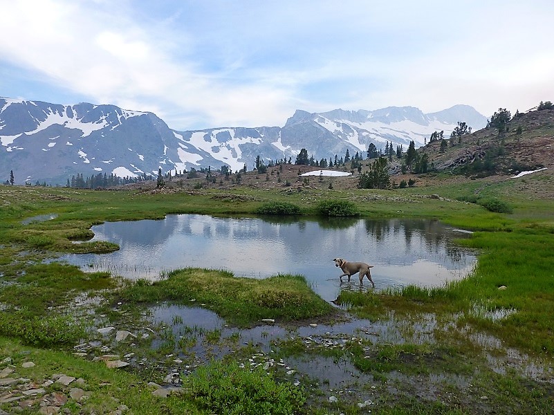
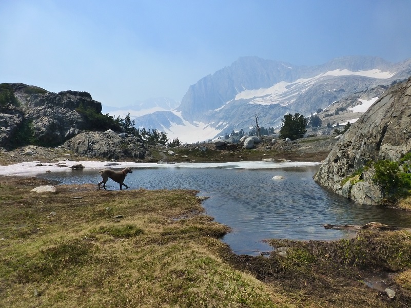
We took a short detour over to Hummingbird Lake (10,255′ elevation).
We got back on the main trail which led us toward Lundy Pass (10,320′ elevation).
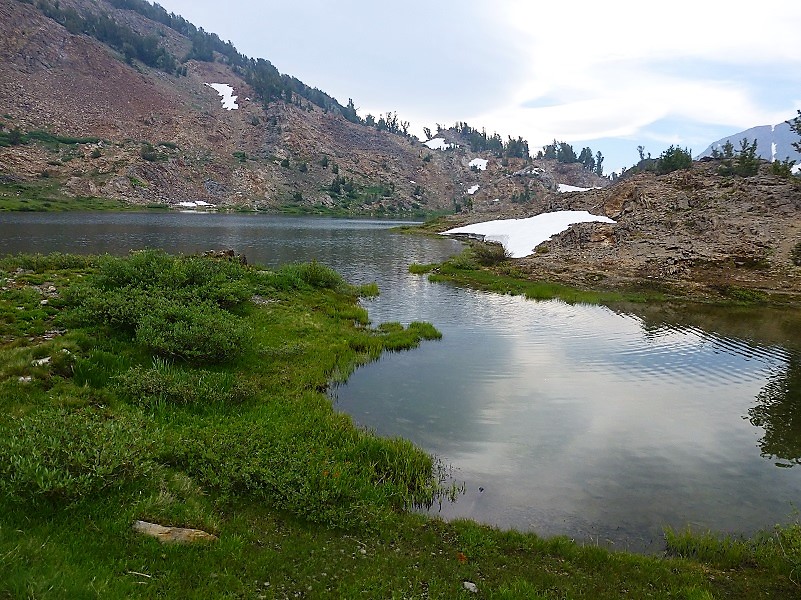
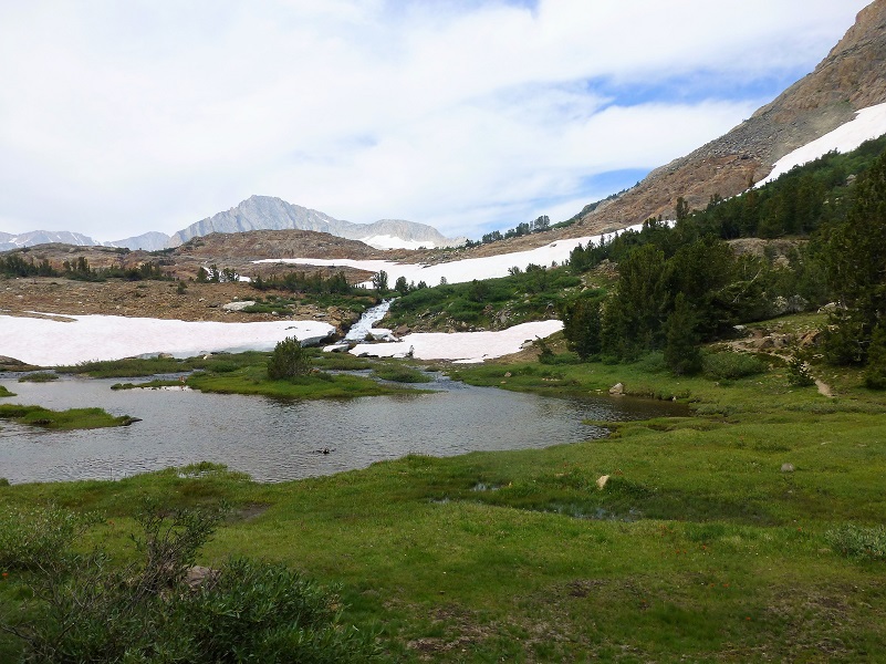
Then we started heading the north side of Lundy Pass down toward ODell Lake (10,280′ elevation).
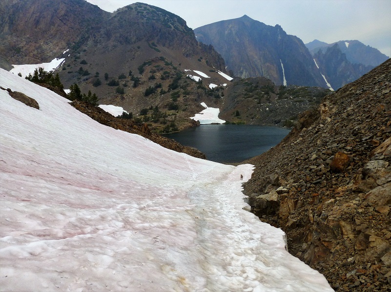
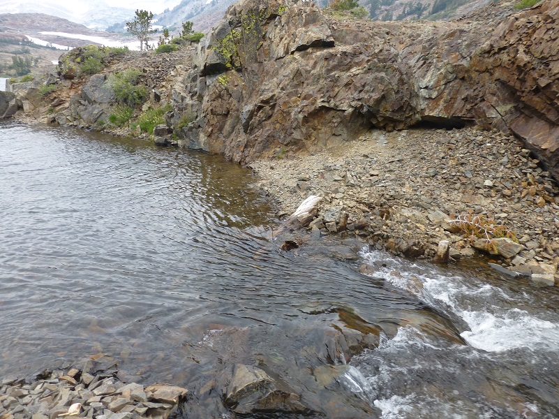
The next stretch of the trail down to Lake Helen followed a rocky trail along a small creek, but there was still quite a bit of snow with that creek flowing underneath all of that snow. We hugged the snow to the right, staying away from the creek.

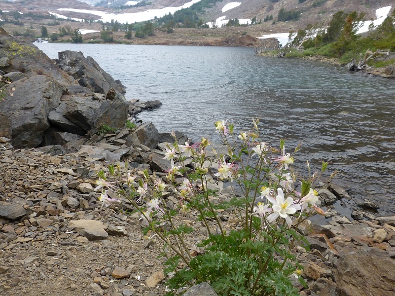
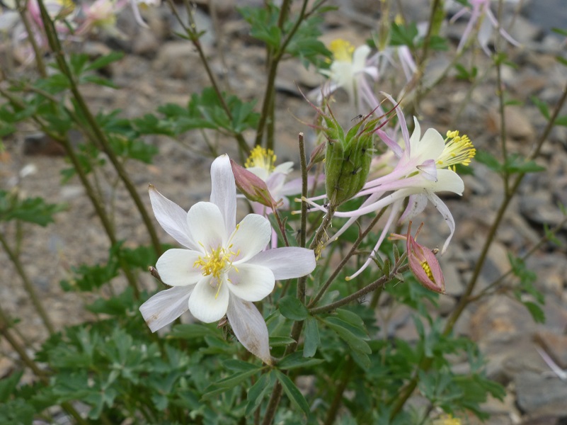
The trail magically appeared once we got down to Lake Helen (10,102′ elevation), following the edge of the lake and what a surprise to find columbine blooming in these conditions.
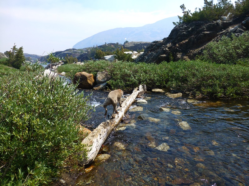
OK, this next part was what I was a little uncomfortable about because I knew the water from the outlet of Lake Helen would be flowing deeper and faster than what we normally have when we do this hike. I didn’t know if I would be able to get across it safely and just may need to turn back and return the same way I had came.
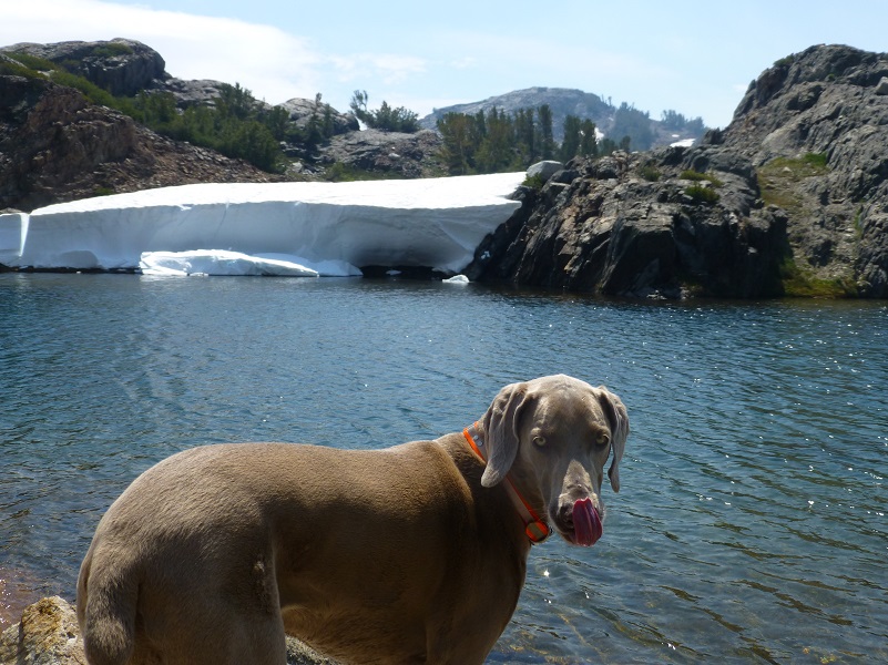
Sally had no problem getting over to the other side.

I had a couple of choices. I could try and walk on the rocks, hoping that I didn’t fall in the middle where it was deeper and faster. Or I could try this skinny, wobbly combination of logs?
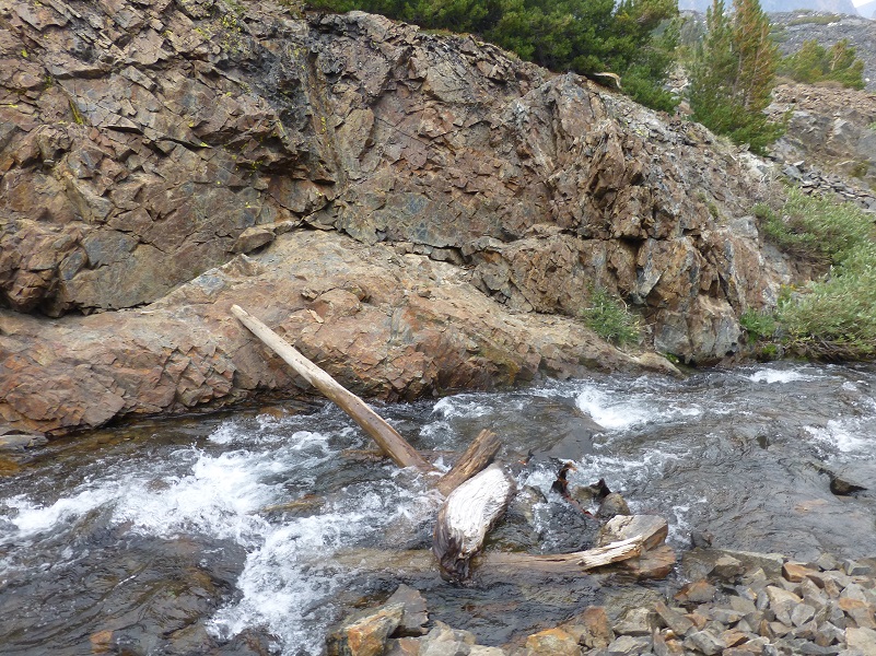
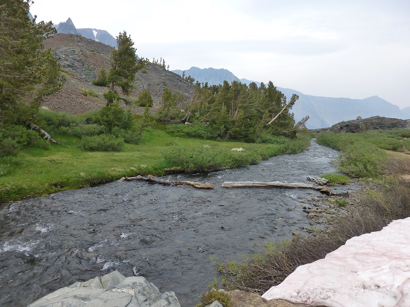
I decided to walk downstream a little and see if I could find a better option and I sure did! Easy peasy!
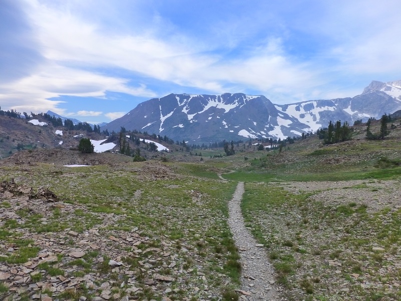
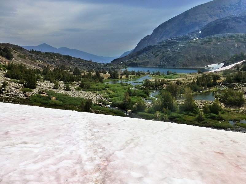
The trail ran across a good snow bank as it circled the south end of Lake Helen and I had a great view of the snowy chute that I had come down to reach Lake Helen.


Then we topped out over a small unnamed lake. What a surprise to see quite a bit of fireweed blooming along the trail.
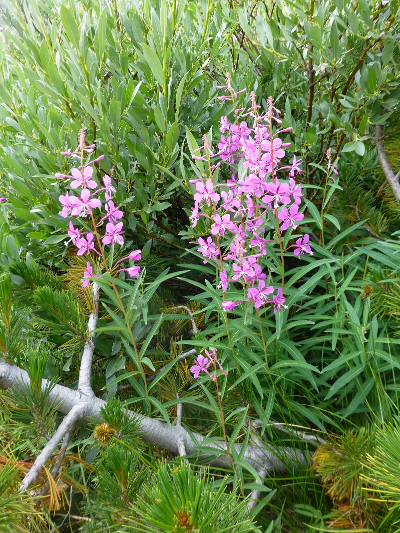
Fireweed
Looking back the way that I had come from Lake Helen.
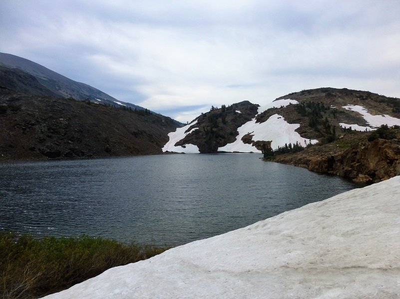
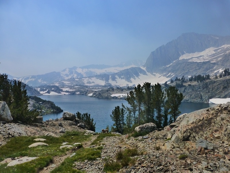
Then I topped over to get my first view of Shamrock Lake.

Sally and I found a good rock to stop for our lunch and try our hand at fishing.

We didn’t have any luck with that fishing. It was pretty windy where we were and I knew a good spot that I might be able to get around to but snowbanks over a couple of creeks just did not give me a warm fuzzy feeling to attempt it. But they were really good spots for Sally to get a drink of that fresh snow water.
We headed back to the trail. I always like to try and follow some of these old mining roads out when I stumble across them and one took us along a small unnamed lake.
We headed down toward Steelhead Lake (10,279′ elevation) along an old mining road.
Another creek crossing and Sally showed me how it was done.
We explored some unnamed lakes.

Back to the trail along Steelhead Lake and just in time to take in these waterfalls spilling into the lake with that magnificent backdrop of North Peak.

The trail follows the outlet of Steelhead Lake, then led us toward Wasco Lake (10,322′ elevation).

Then we headed back down to Saddlebag Lake and the trail along the east side of the lake.

I hadn’t received any reports on conditions on the 20 Lakes Loop and really didn’t know what to expect. I have done this hike several times and explored the country between the loop, so was was ready for what unfolded. When I started out, I was prepared to turn around should I not feel comfortable with the trail but I never felt anything too wild. But I know plenty of folks who would not have felt comfortable with these conditions.
I should add that I could have taken Sally on last week’s hike to the Great Sierra Mine, but I knew that she had a big week ahead of her of hiking and didn’t want to wear her paw pads down before the 20 Lakes Loop. Those rocks can be very tough on a dog.
Dog Hike?
This hike can be a good dog hike if your dog is up to it. The rocky terrain is very rough on a dog’s feet and I packed Sally’s boots just in case she got a sore spot on her paw or sliced her foot on one of those sharp rocks. Even if you think your dog’s feet are toughened up enough for this hike, you can have surprises so please be prepared. Sally hiked for 6 days on this trip and I alternated easy days and longer days with her hiking. By the 4th day, one of her feet was a little worn so I made her wear her boot on one of her front feet and we took it easy on our remaining camping days.
This is a good hike for Sally. It is above tree line so I can keep a good eye on her and let her run a little. There aren’t any rattlesnakes or poison oak and there is plenty of good, fresh drinking water for her all along the way. That means I don’t have to pack her water and that is a good thing! Sally has never had any problems drinking the water out of these higher elevations but some dogs may not be as easy as Sally on this issue. I think you need to know your dog and you may need to carry some water for them. This area also has bubonic plague and if you dog gets a hold of a critter such as a squirrel or mouse, this could be something to watch for after a trip in this area.
Here is some information from Inyo National Forest regarding their dog rules:
Traditionally, National Forests have welcomed dogs. However there are a few rules that apply to assure that you and other National Forest visitors have an enjoyable outdoor recreation experience. If you are camping with your pet, please practice the following:
- Leave vicious or unusually noisy dogs at home.
- During the day keep your dog on a leash no more than 6 feet long, or otherwise restrict its freedom to roam at will.
- At night keep your dogs and other pets inside an enclosed vehicle or in a tent.
- Developed campgrounds are for people, not animals. Please do not bring more than two dogs or other pet to any one campsite.
Maps and Profile:
I had some GPS challenges on this trip, so don’t have a good track to share with you on my wanderings. I put together a route that I mapped of my hike and the profile of that hike, along with a track, profile and Doarama of last year’s hike in this area, although the 2016 is not exactly the same.

August 15, 2017 Route of my 20 Lakes Hike
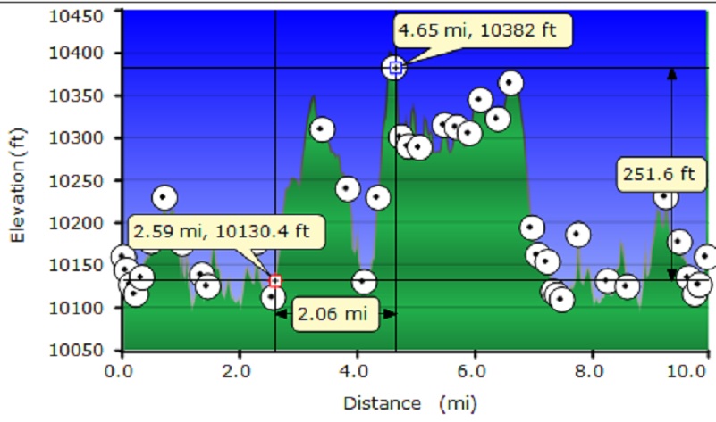
August 15, 2017 Profile of the Route of my 20 Lakes Hike
20 Lakes Loop Doarama from 2016 Hike
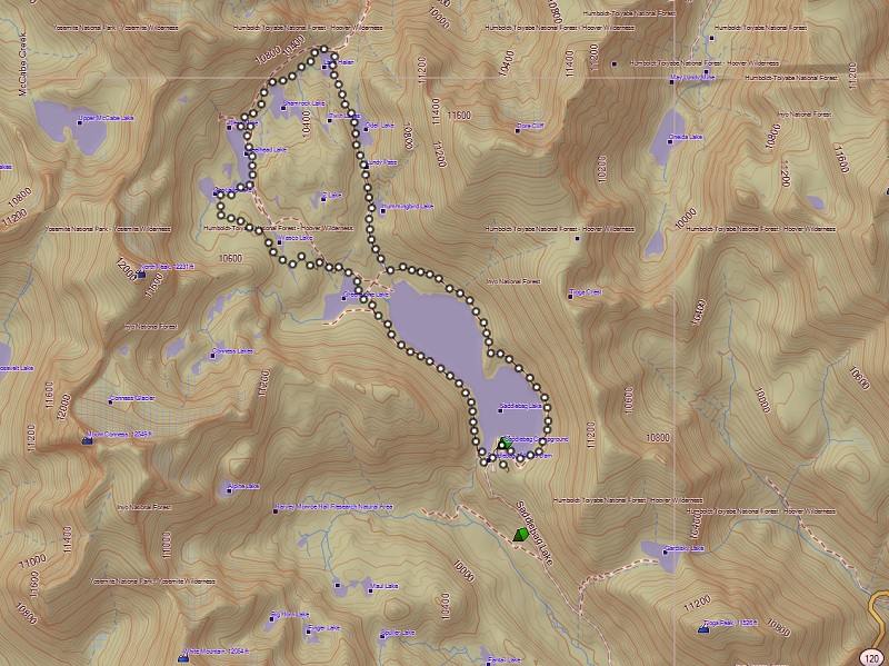
20 Lakes Loop from 2016 Topographic Map
20 Lakes Loop Topographic Map
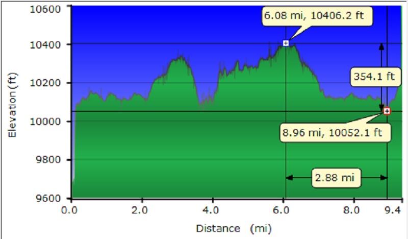
20 Lakes Loop Profile from 2016 Topographic Map
20 Lakes Loop Profile
Sources:
Saddlebag Lake Resort Home Page
Prior Blogs in the Area:
Hiking with Sally in the 20 Lakes Basin July 12, 2016
Hiking with Sally up to the Hess Mine in the Tioga Pass Area October 26 2016
Hiking with Sally on the 20 Lakes Basin Loop August 22, 2013

