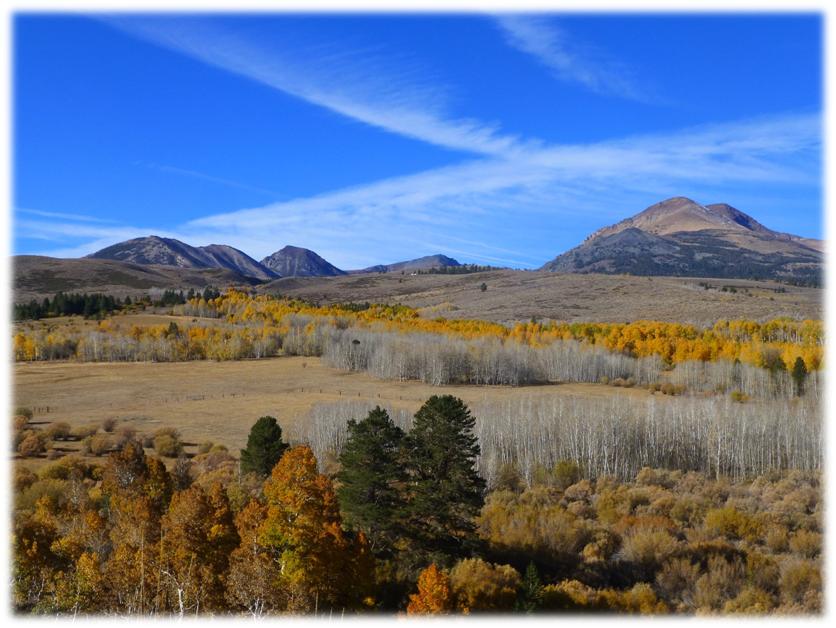
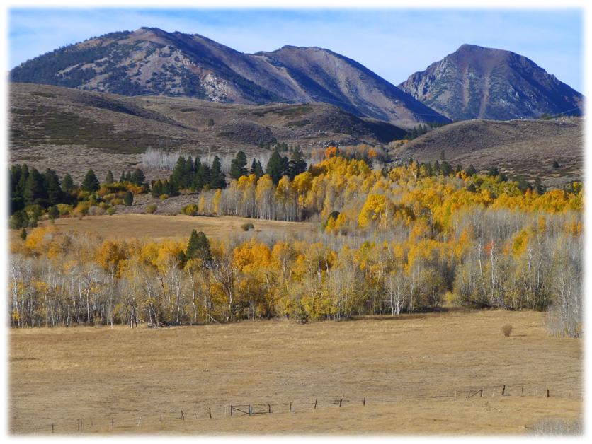
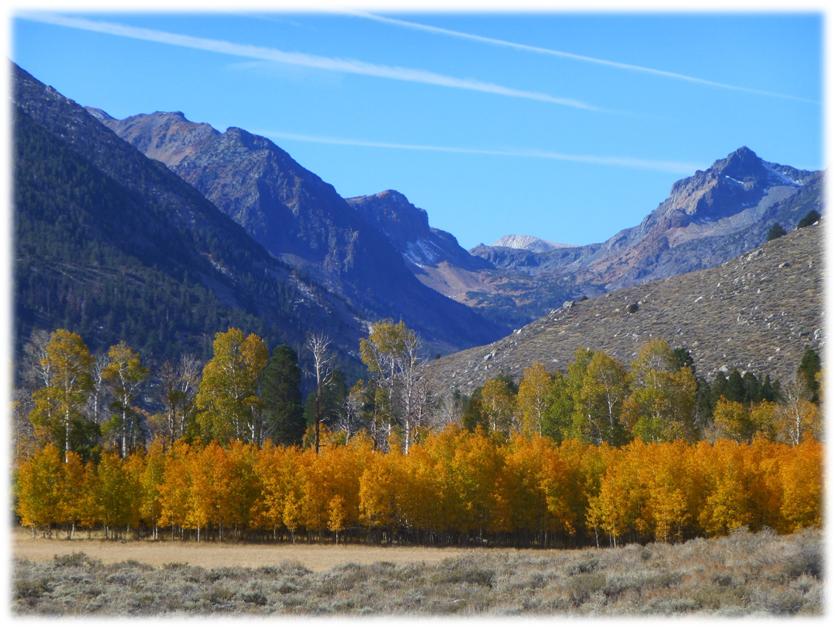
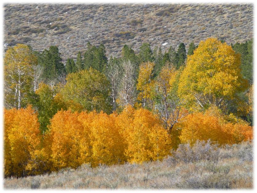
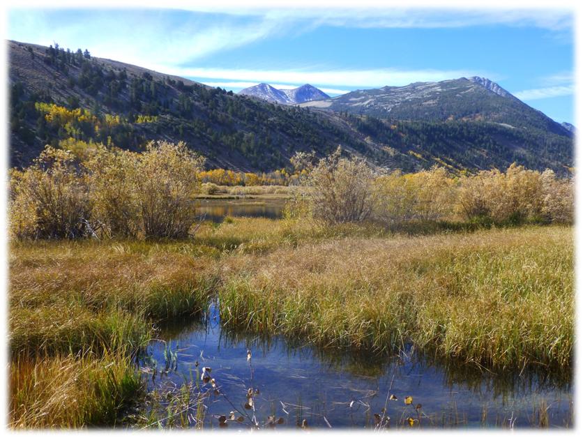
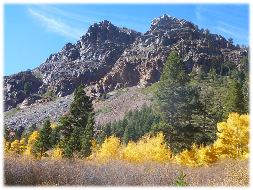
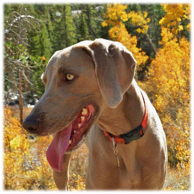
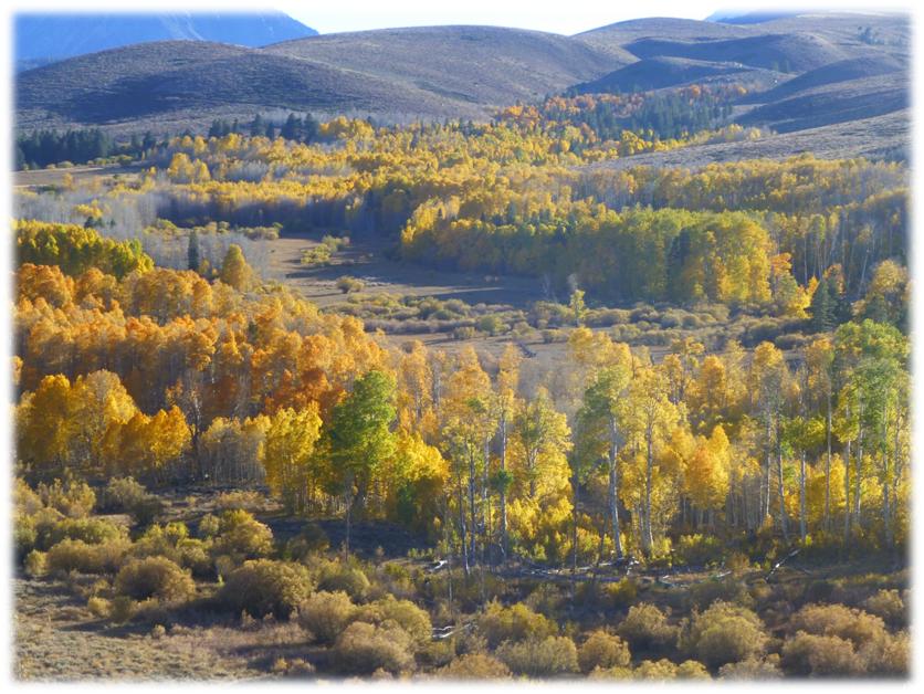
We loaded up the dogs and headed over to the east side to see what kind of fall colors we might discover. We planned on visiting Green Creek, about four miles south of Bridgeport, and we hit the jackpot with prime aspen floors of yellow and gold, set against gorgeous mountains and reflecting in the beaver ponds.
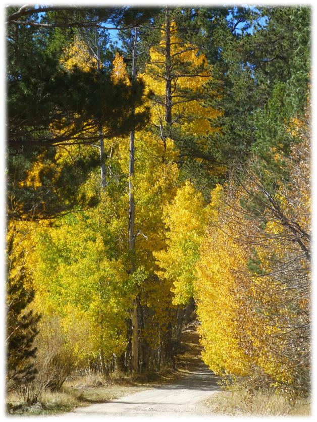
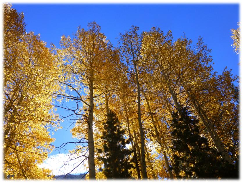
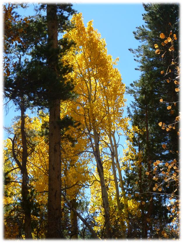
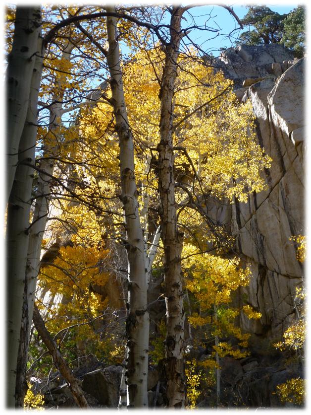
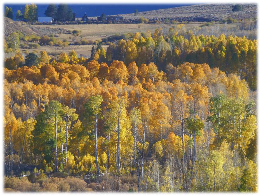
Where: Toiyabe National Forest, Hoover Wilderness We headed east on Tioga Road, then north on Hwy 395, making a stop along Conway Summit to take a few morning pictures. The yellow and golden colors of the aspen were gorgeous in the morning light and we hoped that we could revisit this spot when the afternoon light would be backlighting these trees.
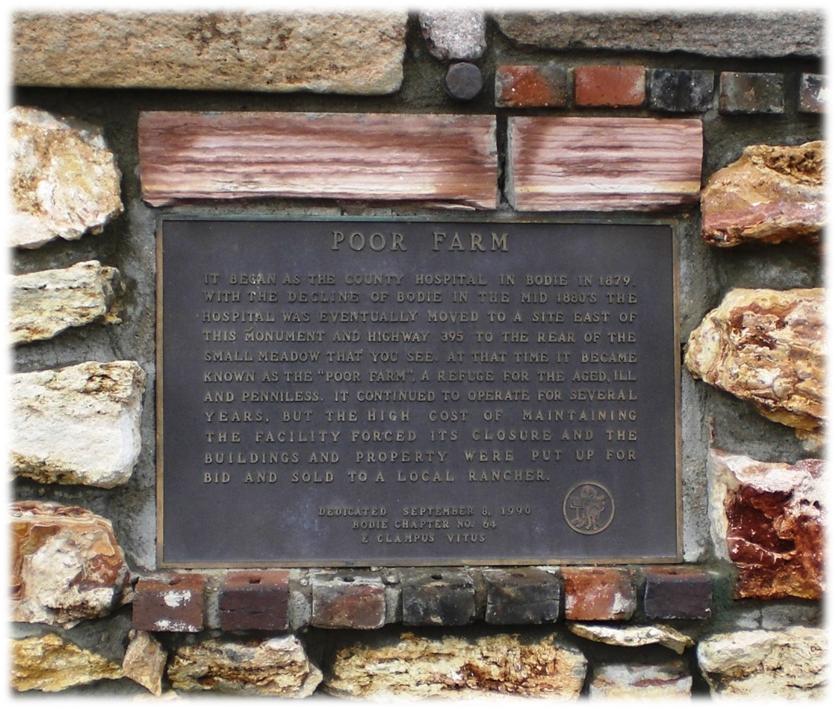
We continued north along Hwy 395 until we reached Green Creek Rd., which was missing its sign. There is a monument on the north side of the road for the Poor Farm to help guide you in though.
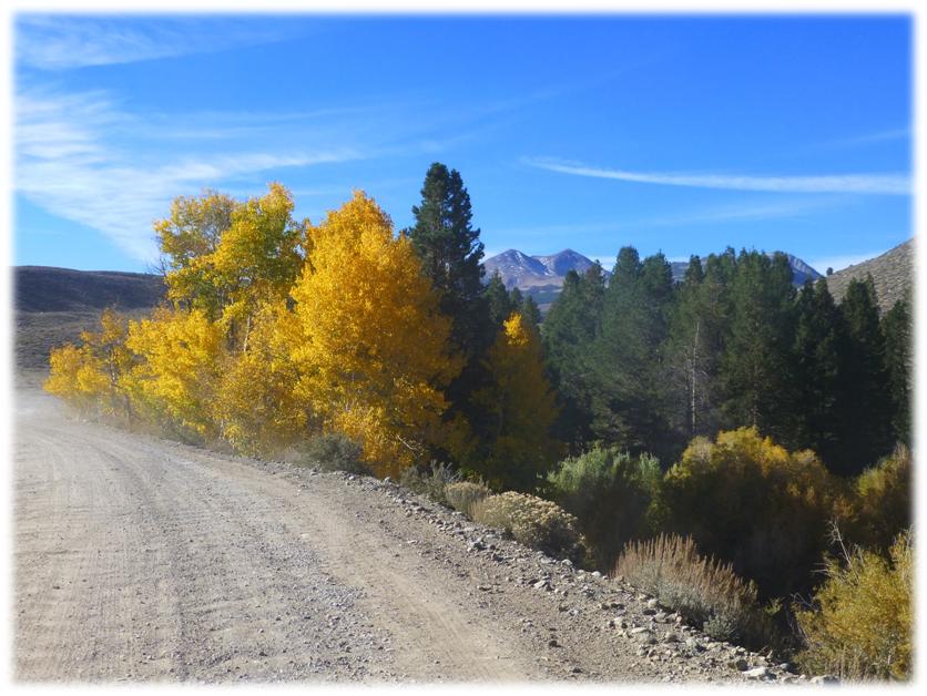
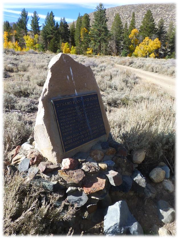
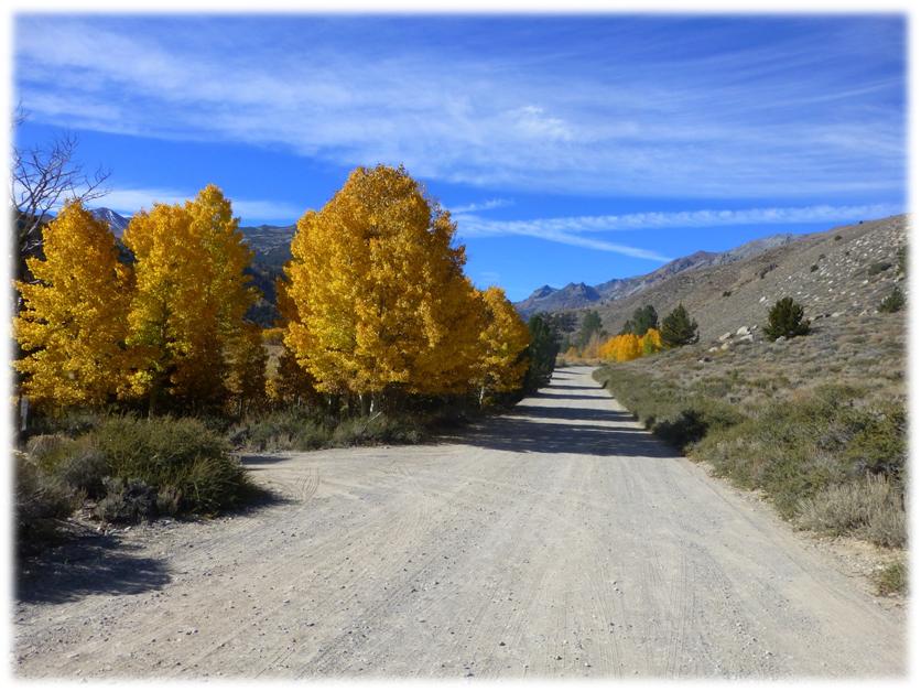
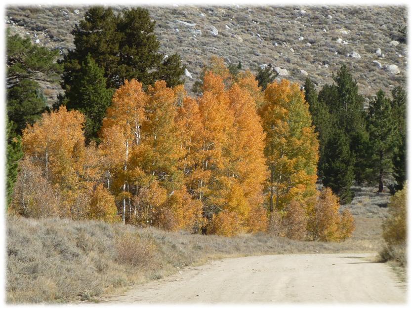
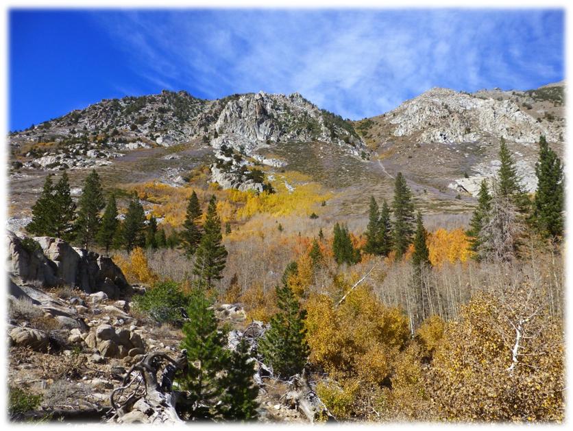
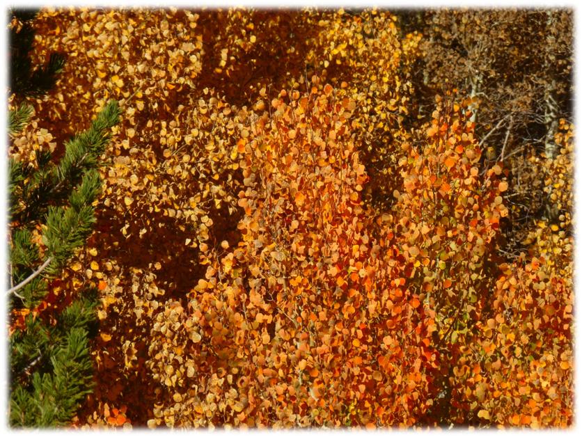
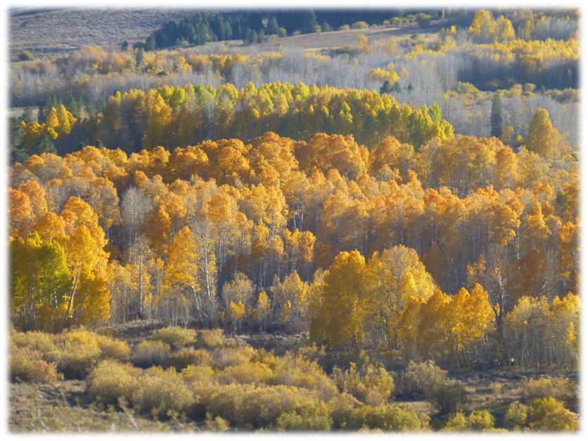
We hadn’t gone too far up the gravel road when we began to see some color. There is a really bad washboard section of this road. I tried driving faster, then slower and no speed I could find could smooth out those washboards, just a warning to you. We continued up to the Dynamo Pond where there is a nice monument by the Bodie Chapter of E. Clampus Vitus
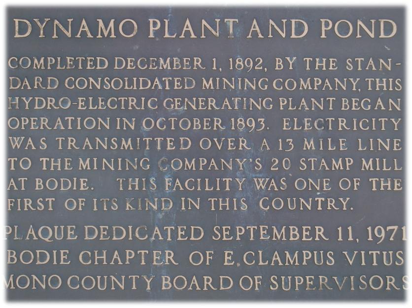
This area has some wonderful history related to the booming gold mining at Bodie. Did you know that this is the site of the first hydro-electrical generating plant in the United States? 13 miles away from Bodie, back around 1890 the town was using a tremendous amount of wood to produce the steam for the mines, in addition to the homes and businesses.The Chinese provided this by the “mule load” until the Bodie-Benton Railroad was completed to transport heavy loads of lumber and firewood.
Tom Legett, the Superintendent of the Standard Mine, trying to find ways to reduce the $22,000 costs related to cordwood, was confident that “free” electricity could power the mine. He convinced stockholders to invest in the idea and the Standard Mining Company bought up the land they needed to capture the flow from Green Creek, with the construction of the plant completed in 1892. Green Creek already had a ditch that had been constructed for mining, long abandoned though. What did this groundbreaking power plant look like? The following was abstracted from a report of the Standard Consolidated Mining Company: The pipe leads into a steel receiver, 40 in. in diameter by 9 ft. 8 in. long, from which four taper pipes lead the water under pressure of 350 ft. vertical head on to as many 21-in. Pelton water wheels, each pipe being fitted with two nozzles, and each wheel capable of developing 62 ½ H.P. (head pressure). The wheels run at 825 revolutions, and the wheel shaft will be connected by a patent insulating coupling to the armature shaft of a Westinghouse 120-kilowatt alternating dynamo, generating current at 3,530 volts. A Doolittle governor is attached to the wheels, and a No. 2 Pelton motor has also been put in to run the exciter required for generating the initial current in the fields of the large machine.
The poles of the line are of round tamarack timber 21 ft. long, 5 in. in diameter at the top, 25 ft. poles being used through the town and where the ground required it. They are spaced 100 ft. apart, and fitted each with a 4 in. by 6 in. by 4 ft. cross-arm, boxed into the top of the pole, and fastened with one bolt and one lag screw. The wire is of No. 1 B. & S. gauge soft drawn bare copper, and is attached to standard double petticoat, deep grooved glass insulators carried on Klein ¾ in. by 8 in. iron pins. The wire used is of large section, but the distance of transmission is just at that midway point where the cost of converters about equals the difference in cost between a No. 1 and a No. 6 wire; hence it was considered better to use a higher potential and large wire and avoid the complicated and often troublesome converter. The loss of potential on the line is estimated at 15% and the current delivered to the motor will therefore be of 3,000 volts tension. The motor is of 120 H. P., and will be brought up to speed by a small motor of 3 to 4 H. P., which is built on the same bedplate with the larger, and thrown out of circuit as soon as the latter is running at the proper speed, or in synchronism with the generator at the power-house. Two transformers, ratio 30 to 1, of a capacity of 100 incandescent lights each, will be used for lighting the mill and offices at Bodie.
The cost of this plant is given as follows: Water-power, including ditch, pipe, water-wheels, etc., $8,915; wire line, 12.46 miles, $10,474, or $840.63 per mile; motor-room, countershafts and pulleys at mill, $1,791; telephone line, 14 miles, $1,099, or $78.52 per mile; sundry expenses, $305; total, $22,584. This does not include the dynamos and motors, which had not been put in at date of the report. The cost of the work was somewhat reduced by the use of material from the old mill, as stated.”
When the power line was surveyed, the surveyers were instructed to make sure it was absolutely straight and had no angles or curves because there was the fear that the power might “jump off into space.” The Standard Mill was shut down and equipped with agitators, motors, generators and everything needed to change from steam to electricity. It worked!
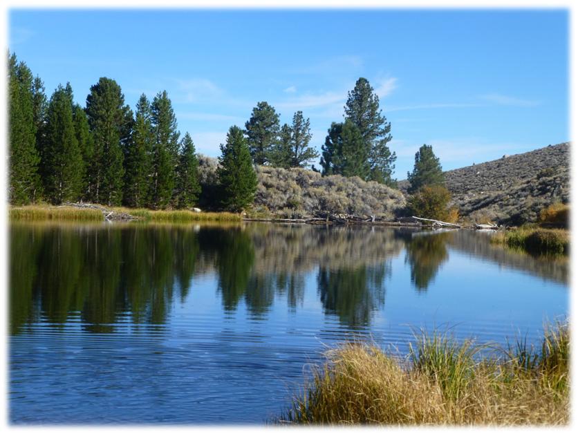
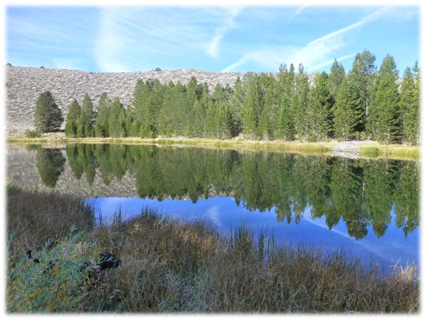
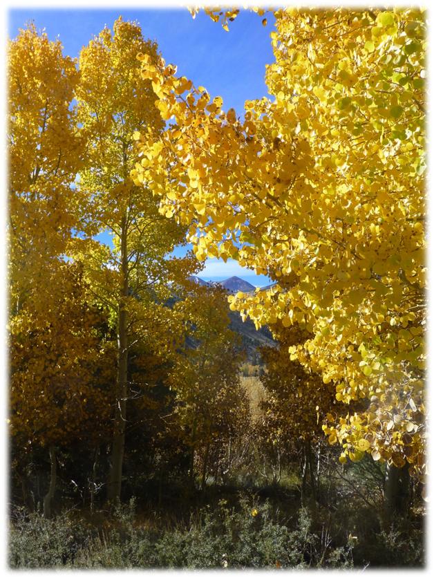
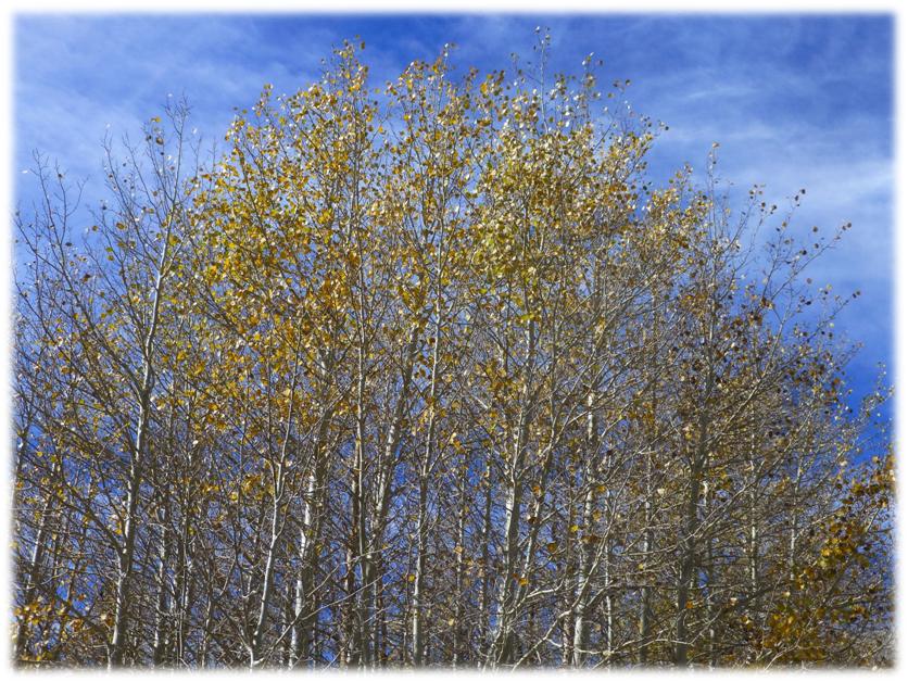
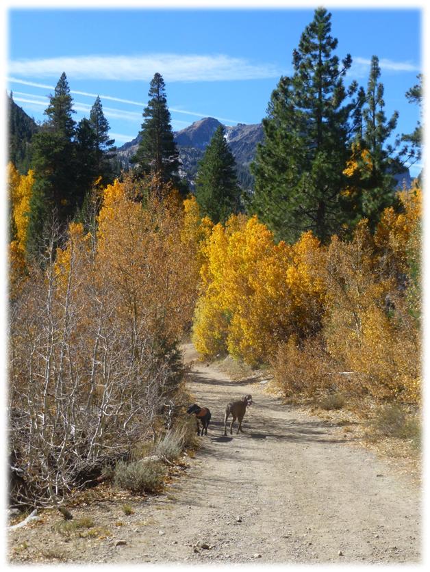
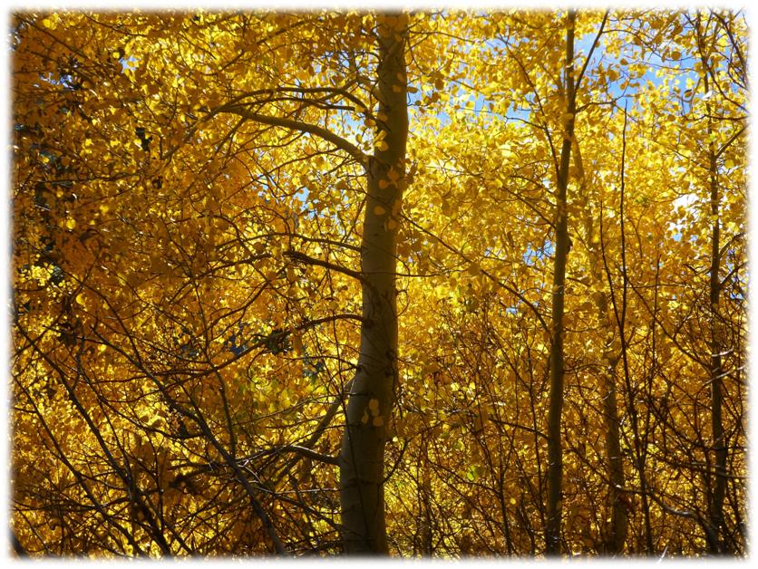
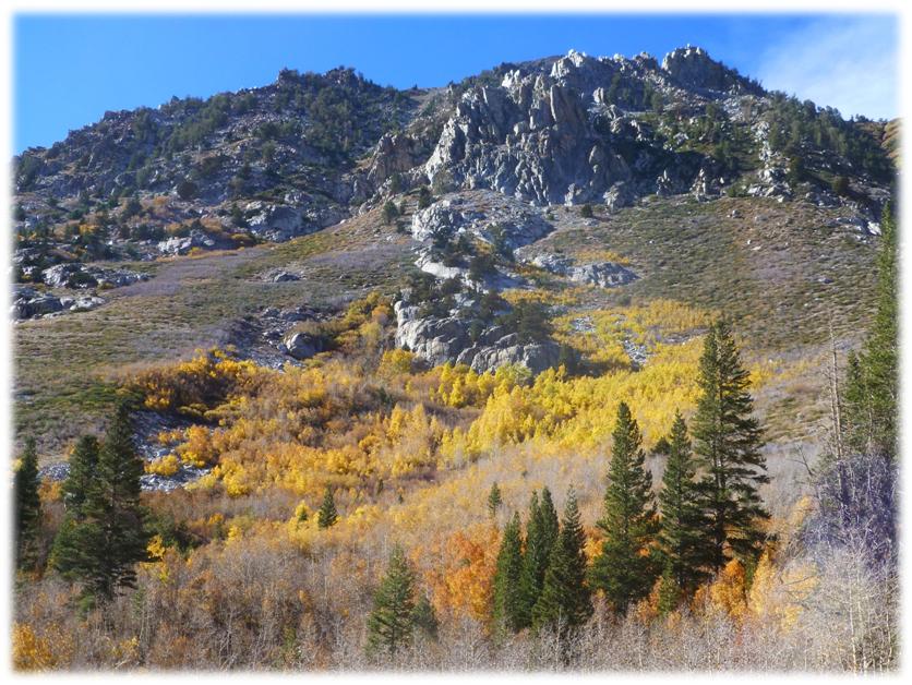
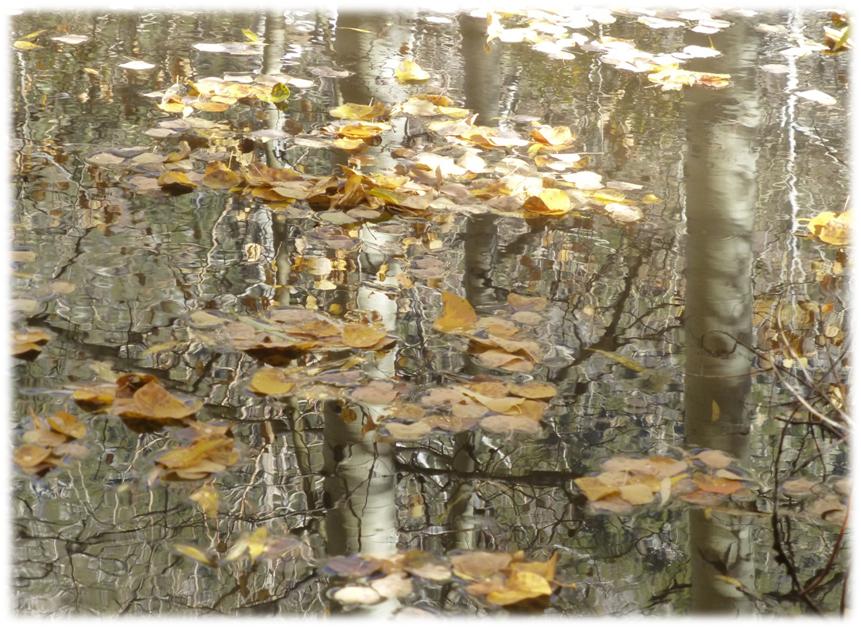
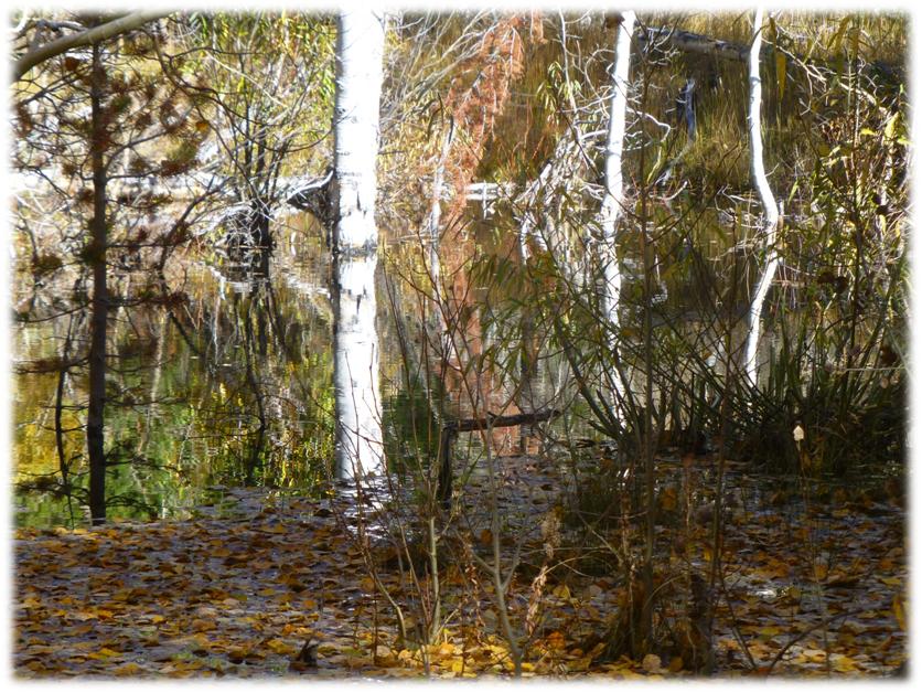
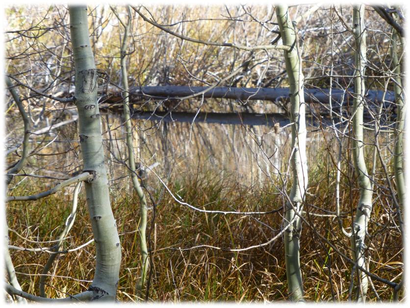
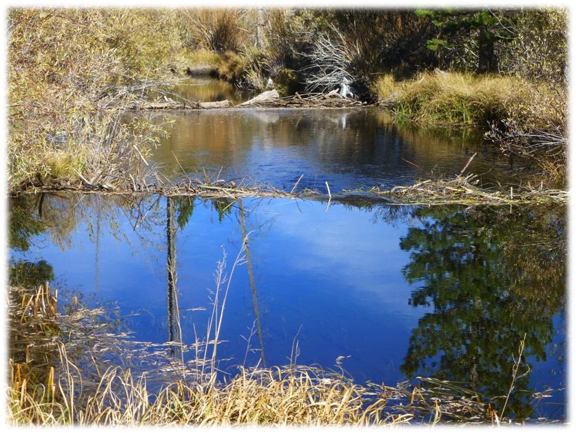
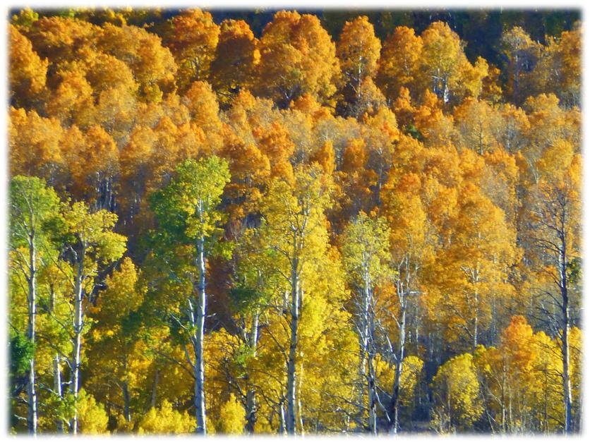
We continued driving up the road past clumps of colorful aspens. When we reached some beaver ponds, we stopped to take a closer look. There were more beaver ponds that I could count. These were small ones that helped created so many different opportunities for views and reflections. We had beaver ponds on one side of the road and artistic clumps of whispy lines of aspens on the other side of the road.
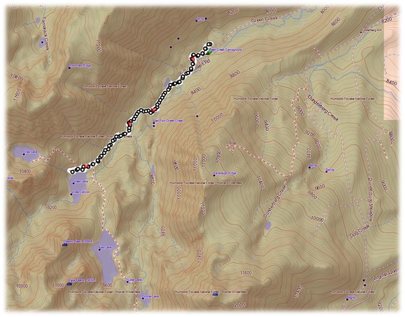
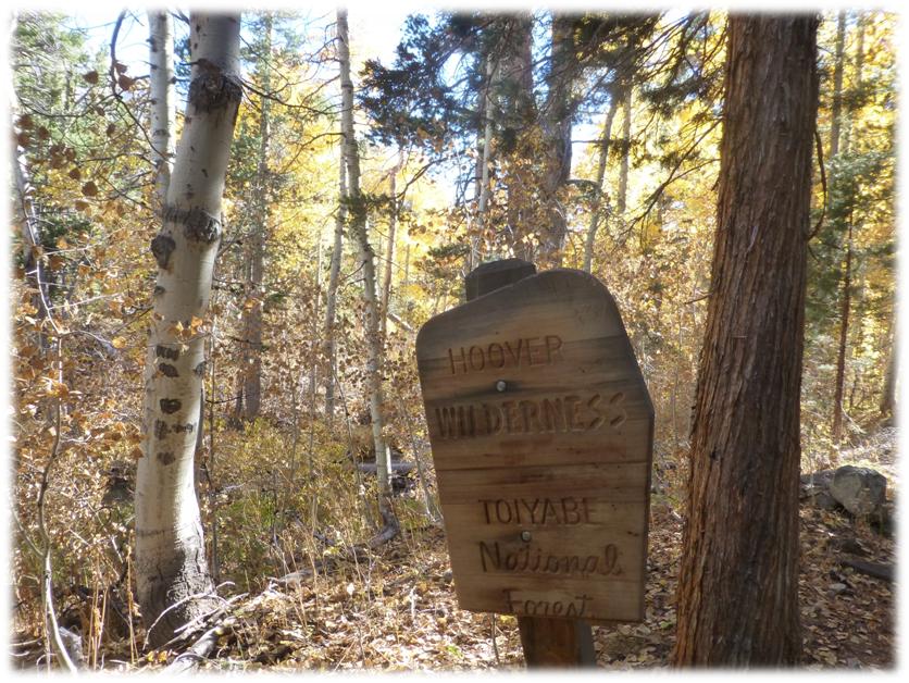
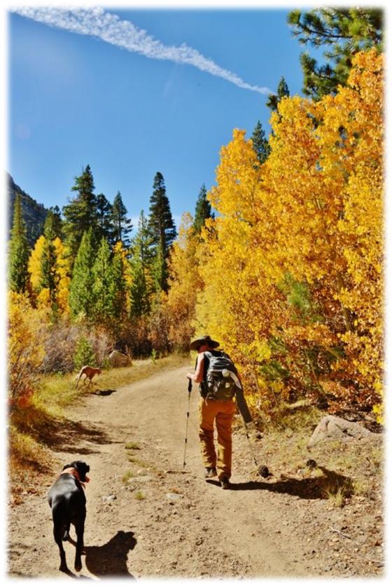
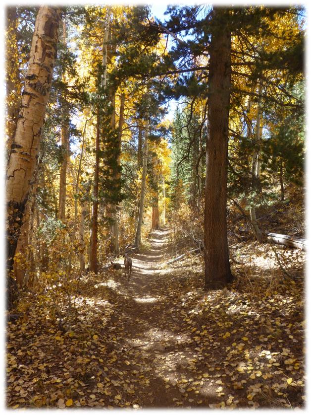
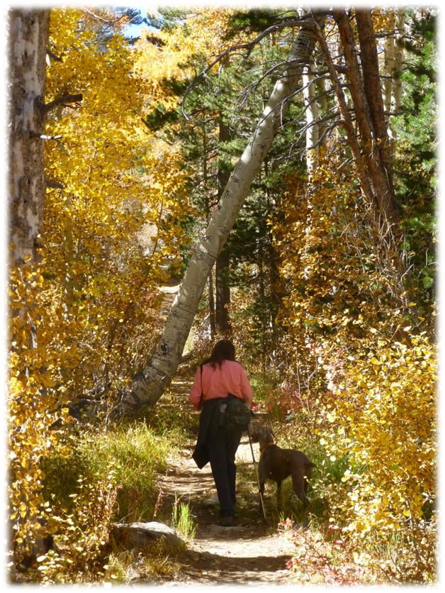
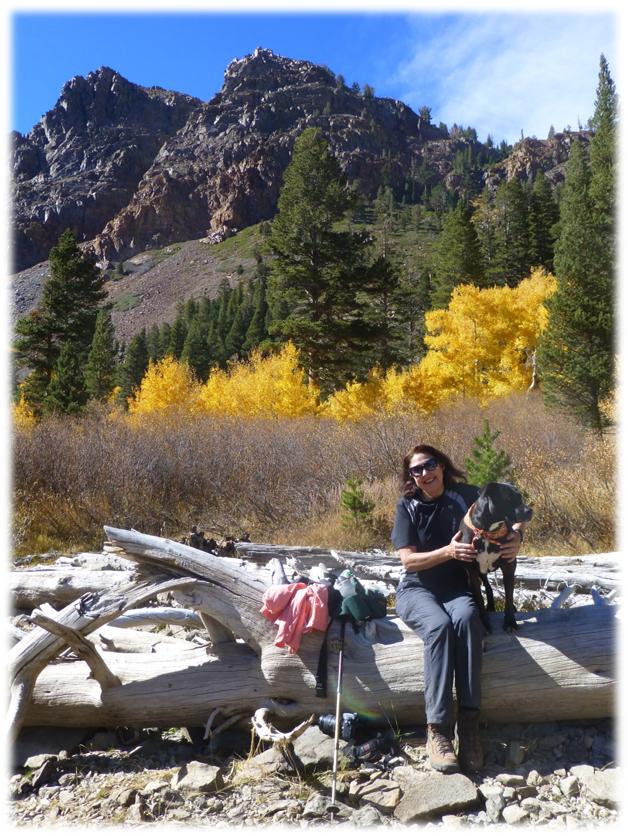
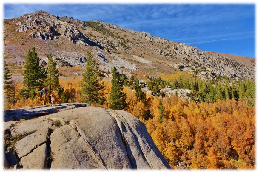
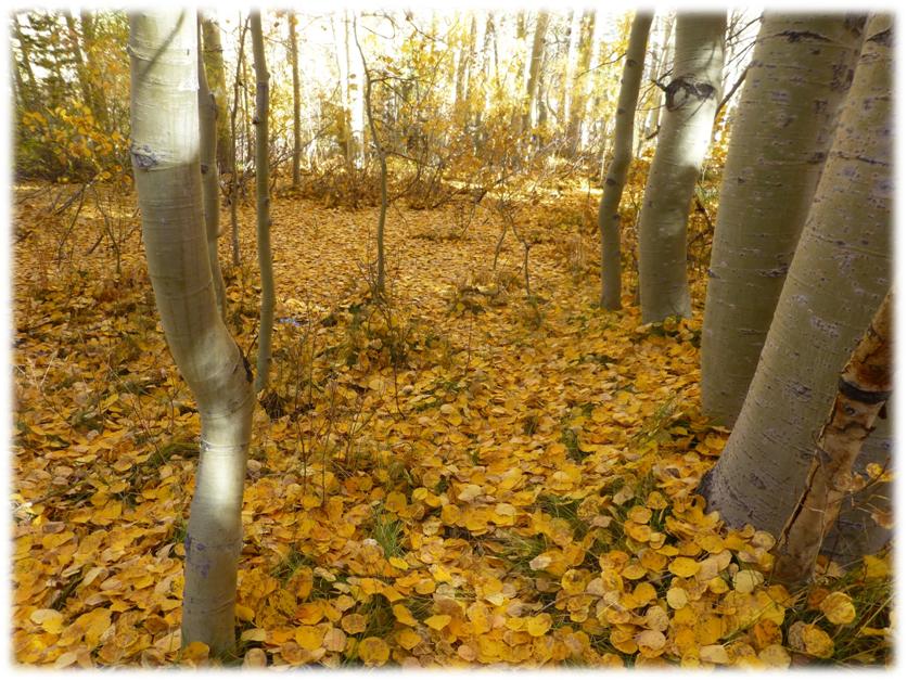
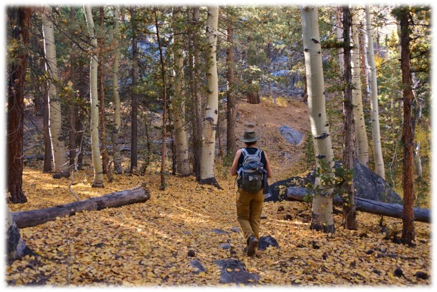
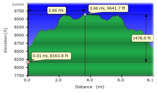
It took us about 8.6 miles to reach the end of the road where the Green Creek Trailhead was located. It had a parking lot, dumpsters, and a bathroom. Since we were getting a later start on this hike, we had decided to head for the closest lake, which turned out to be Green Lake. The trail followed what looked to me to be old roads in places. We even passed areas where the old road crossed the creek and some old foundations along the way. After about a mile, we entered the Hoover Wilderness. What a beautiful bright yellowed lined trail we had! (Photo of my walking up the road by Debra Sutherland)
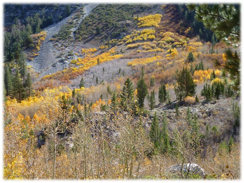
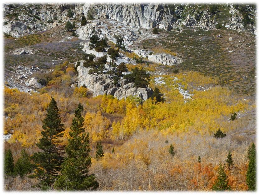
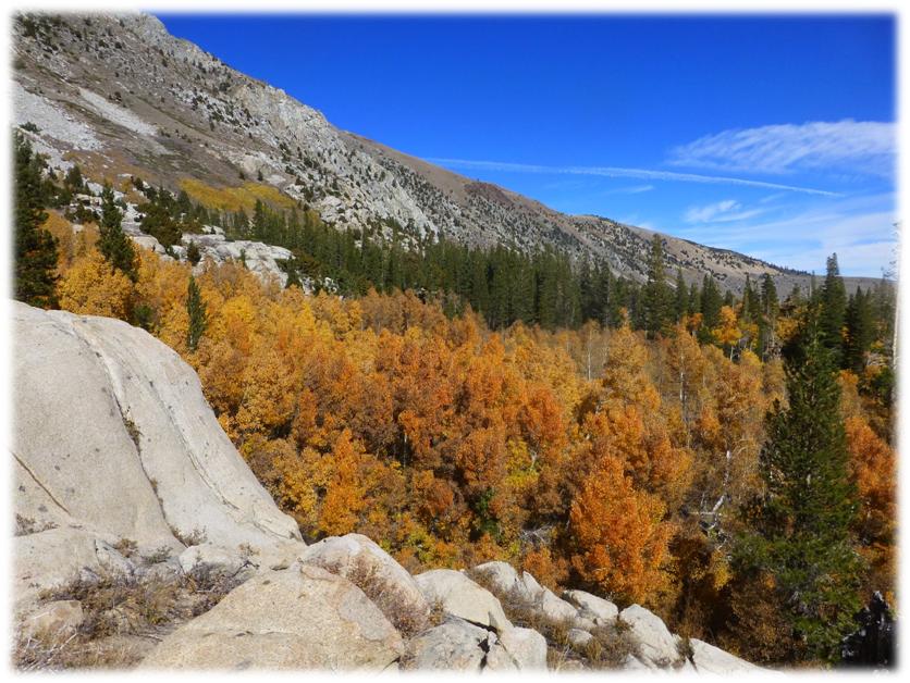
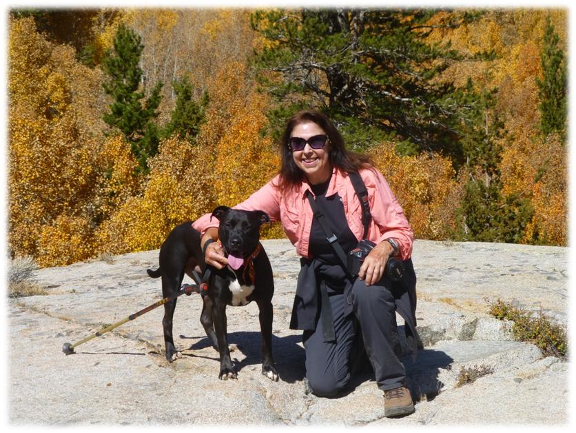
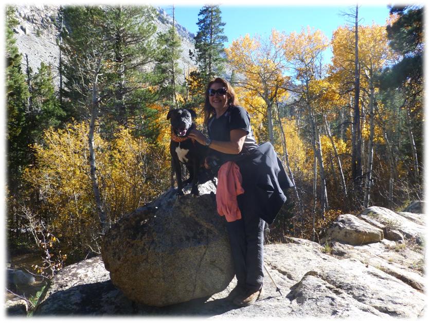
After we had climbed some switchbacks, we arrived at a cool large rocky area that overlooked where we had traveled and what a view we had of the yellow and orange aspens! It was also a great place to us some pictures of us with our dogs.
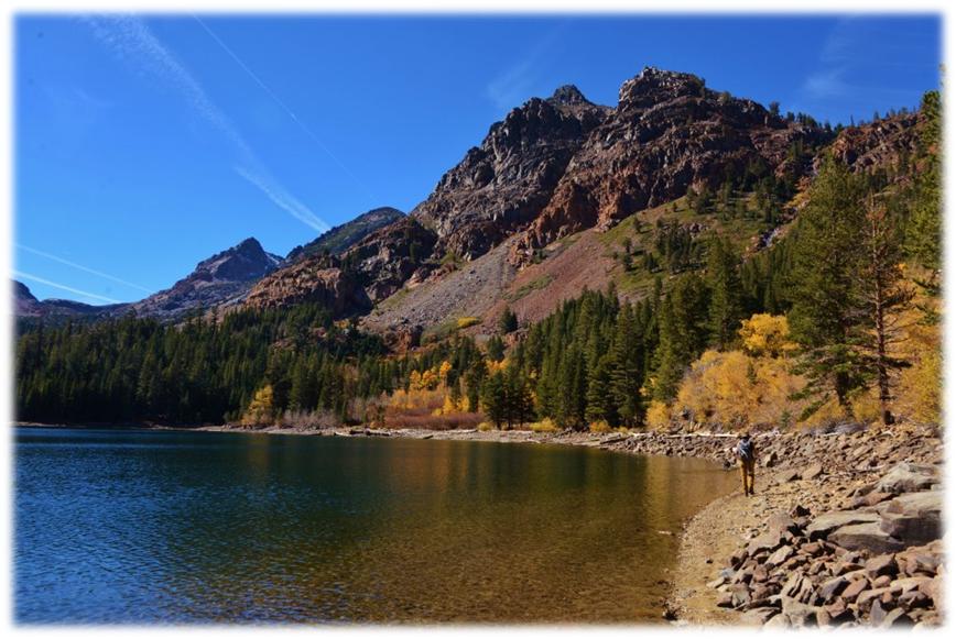
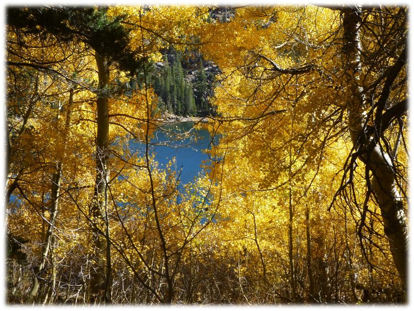
We continued up the trail, arriving for a late lunch at Green Lake. Deb found the perfect lunch log! (Photo of me walking along Green Lake by Debra Sutherland)
After lunch, we wandered up the hill to see what new photo opportunities we might see as the afternoon light was now casting a backlight on the aspens.
Heading back down the trail.
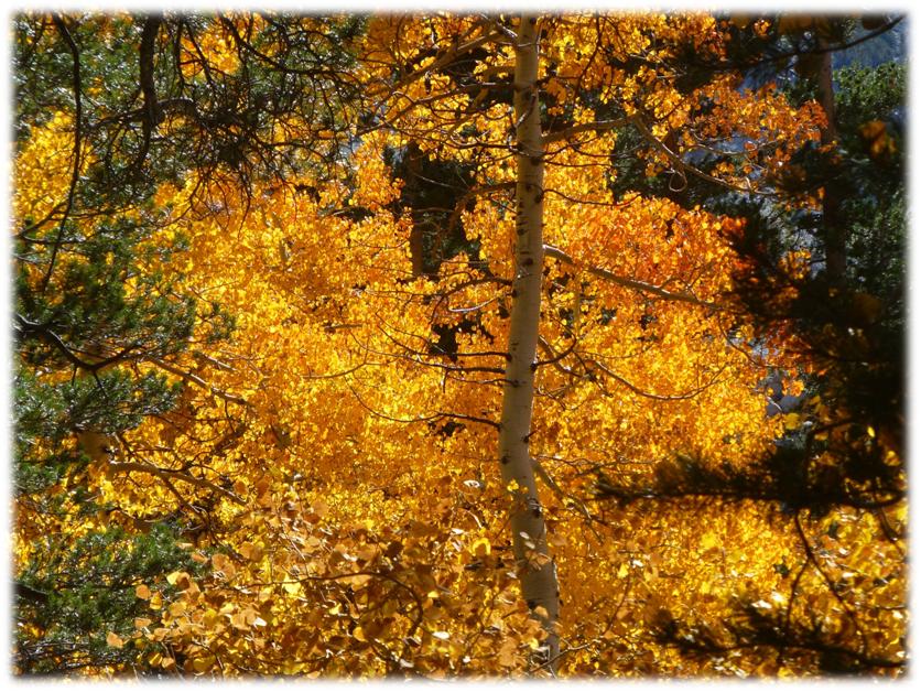
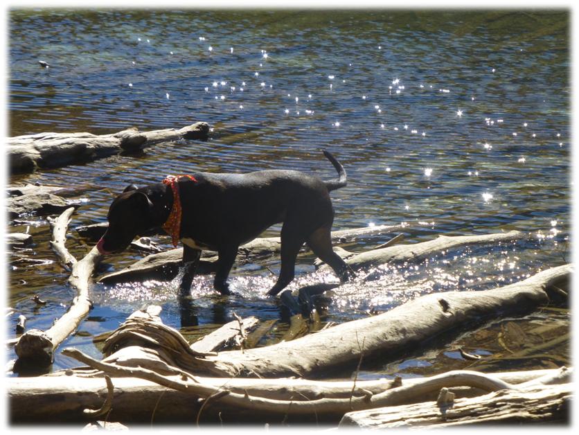
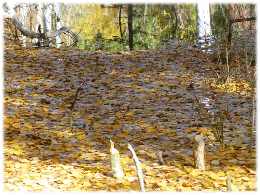
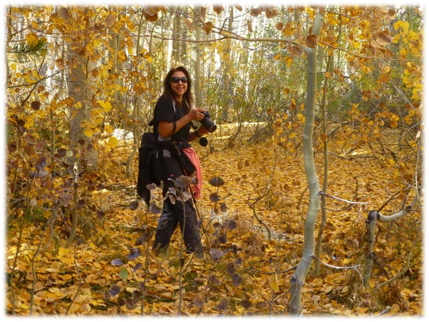
We discovered a gorgeous area just a little bit off the trail that led to a small beaver pond. The ground was covered in golden aspen leaves and you can even see some of the beaver-chewed aspens in one of the pictures. It was a aspen wonderland! (Photo of Sally by Debra Sutherland)
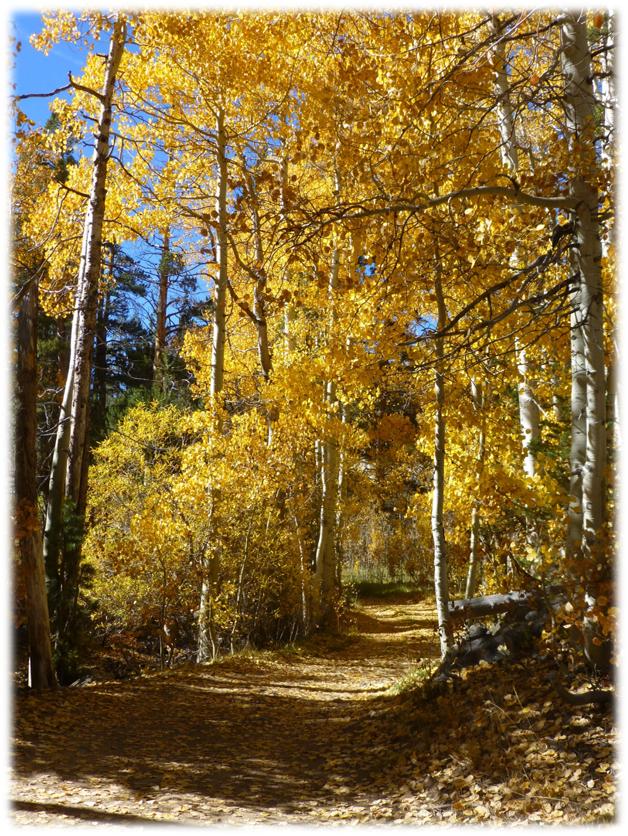
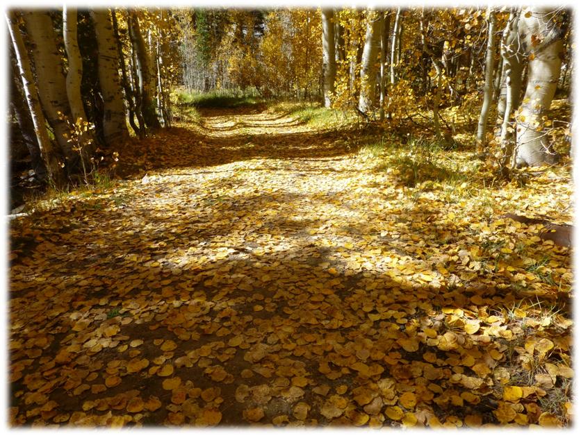
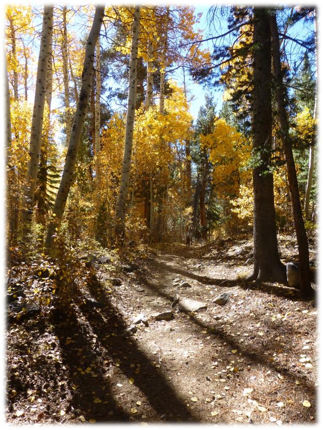
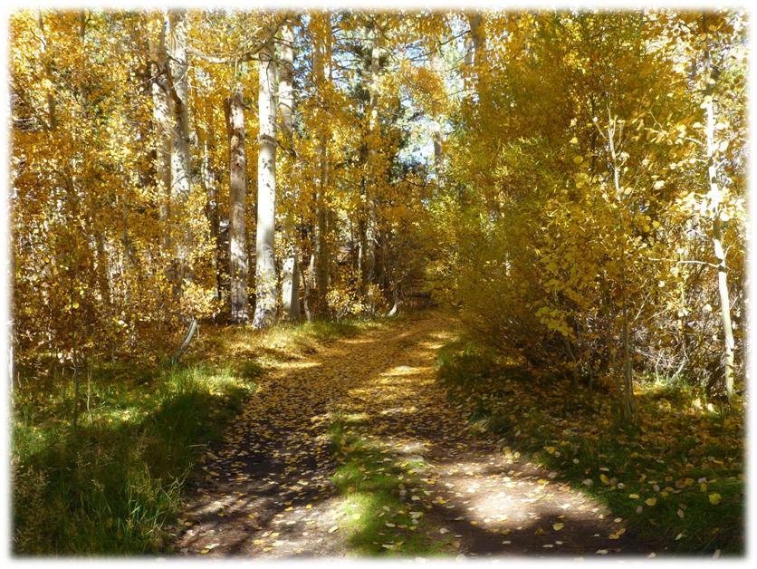
We continued back down the leafy trail which was incredibly gorgeous. (First photo by Debra Sutherland)
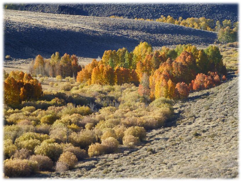
We made it back down to the car and continued to meander our way down the road, stopping to take a look at an area with beaver ponds. This one is a double beaver pond!
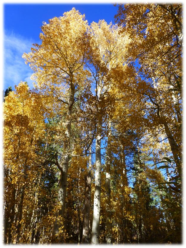
We just had to stop at Conway Summit on our way home because the late afternoon was so pretty as it backlit those aspens.
It was a very long day and we stopped at Whoa Nellie Deli for a hamburger before heading home. This was one of those days that we were on sensory overload from all of the gorgeous fall color.
Sources:
The Story of Bodie, Ella M. Cain, Fearon Publishers, 1956
Distance: 6.75 Miles
Difficulty: Easy to Moderate
Elevation Range: 8,003′ – 9,128′
Date: October 13, 2014
Maps: Buckeye Ridge Topographic Quad
 .
.
“Lumber and other material from the old Bulwer-Standard Mill was used in construction at Green Creek, thereby greatly reducing the cost. The power-house, 30 by 40 ft. in size, was the former salt house, and the penstock, or pressure tank, was one of the water tanks at that mill, while the steel receiver at the lower end of the pipe was made at the mine from an unused steam-drum. The ditch is 4,558 ft. long and is connected with the penstock by a short piece of flume fitted with the usual screen, sand-box, waste-weir and flushing-off gate.

Engineering and Mining Journal, Volume 55, Western & Company, 1893, Pages 439-440.
http://www.bodiehistory.com/power.htm
http://www.parks.ca.gov/?page_id=21622
Exploring Eastern Sierra Canyons Sonora Pass to Pine Creek, Sharon Giacomazzi, Bored Feet Press, 2009