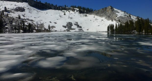
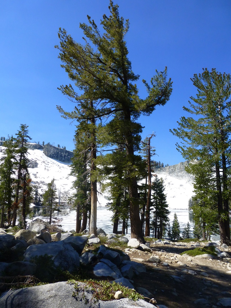
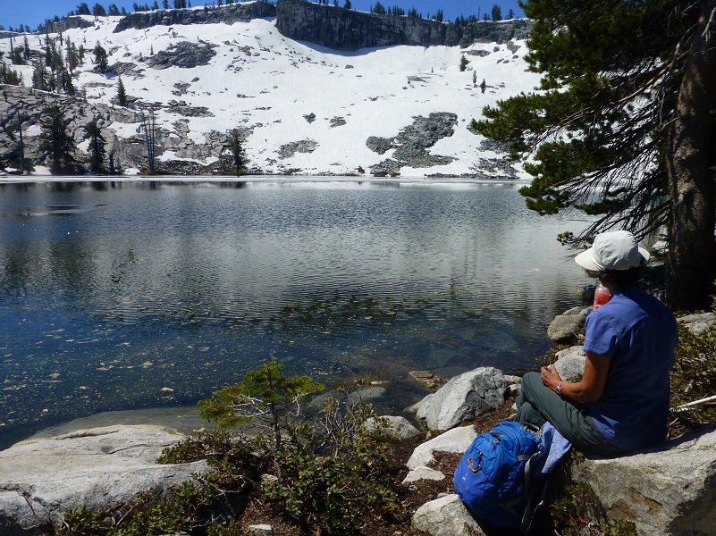
Picture escaping the heat to icy Ostrander Lake, bordered by a snowy, rocky ledge. That is exactly what we did in the middle of June, watching the last of the winter ice melt away, creating beautiful reflections.
Where: Yosemite National Park
Distance: 12.56 Miles
Difficulty: Moderate to Strenuous
Elevation Range: 6,998′ – 8,613′
Date: June 20, 2017
Maps: El Capitan, Merced Peak Topographic Quad Maps
Dog Hike? No
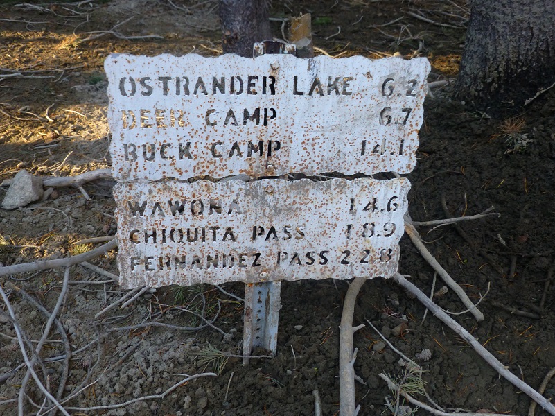
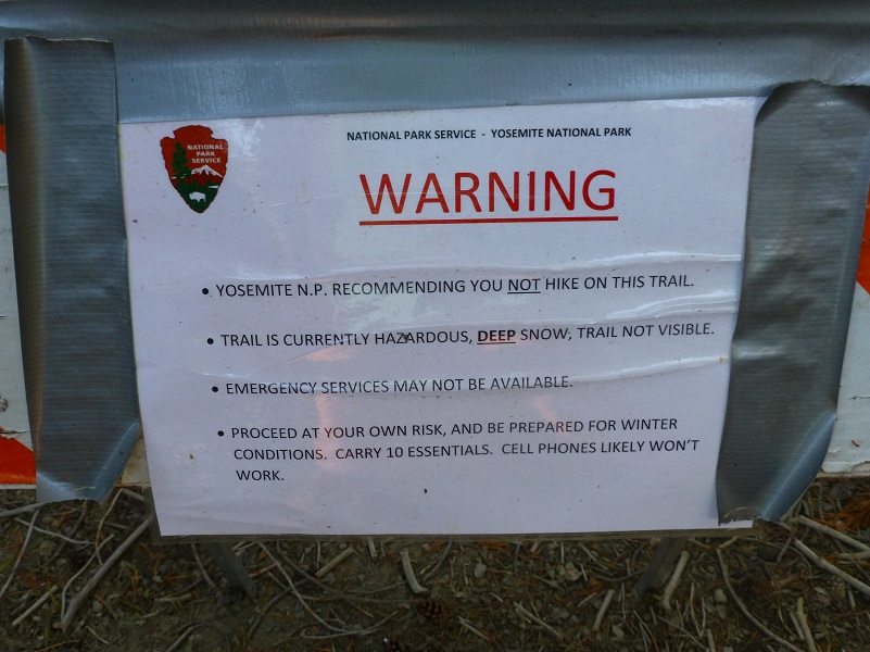
We headed up Highway 41 through the South Entrance to Yosemite near Mariposa Grove, then up Glacier Point Rd. We continued about 9 miles to the wide parking area that is just off the road on the right hand side, just past where Glacier Point Rd. crosses Bridalveil Creek. The sign that says “Ostrander Lake” was along the right side of the road where you turn into this parking lot. We sprayed down for mosquitos and ticks, put our goodies in the bear box and used the restroom before heading up the trail, following the signs along the way. We were surprised to see the sign warning about deep snow and had already decided to not carry our snowshoes. We sure hoped we hadn’t made a mistake.
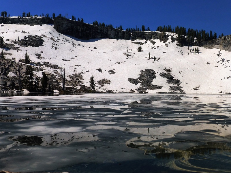
Ostrander Lake is a beautiful lake at about 8,500′ elevation with one side of it is bordered by a higher rim or rock named Horse Ridge. The lake is the primary source of Bridalveil Creek, which feeds Bridalveil Falls. I have found 3 different stories about how Ostrander Lake got its name. Wikipedia says that the lake is named for a descendant of Alexander Ostrander (1783) of Smithfield NY and that this branch of Ostrander family settled in Colorado (Georgetown, Granby, Hot Sulphur Springs, Golden) prior to 1872, some moving from Colorado to California. Yosemite National Park’s website says that is named for a Sheepman.
We started up the trail which wound its way through green grass and small creeks.

Photo by Gail Gilbert
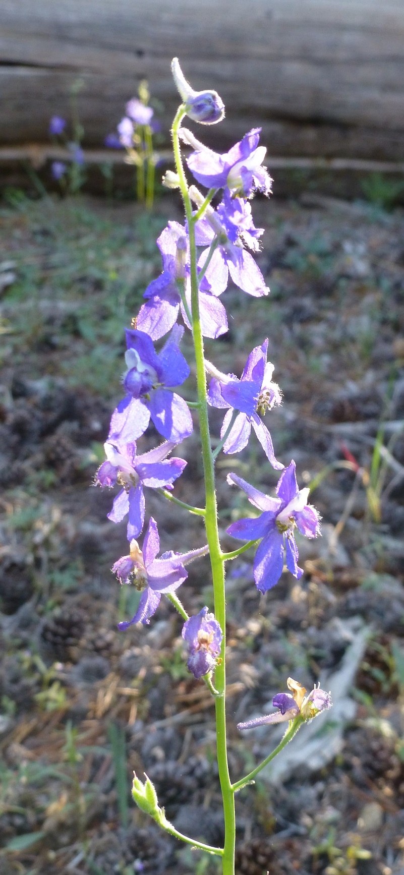
We followed the signs to Ostrander Lake, walking by wildflowers.
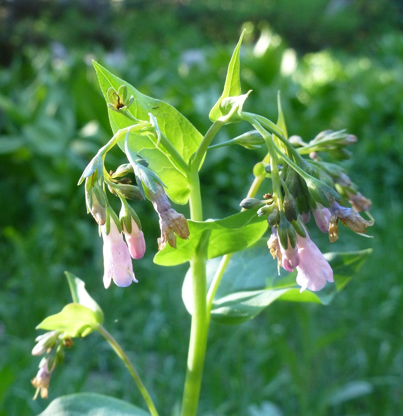
The corn lilys were looking very nice with that morning light hitting those newly formed leaves.
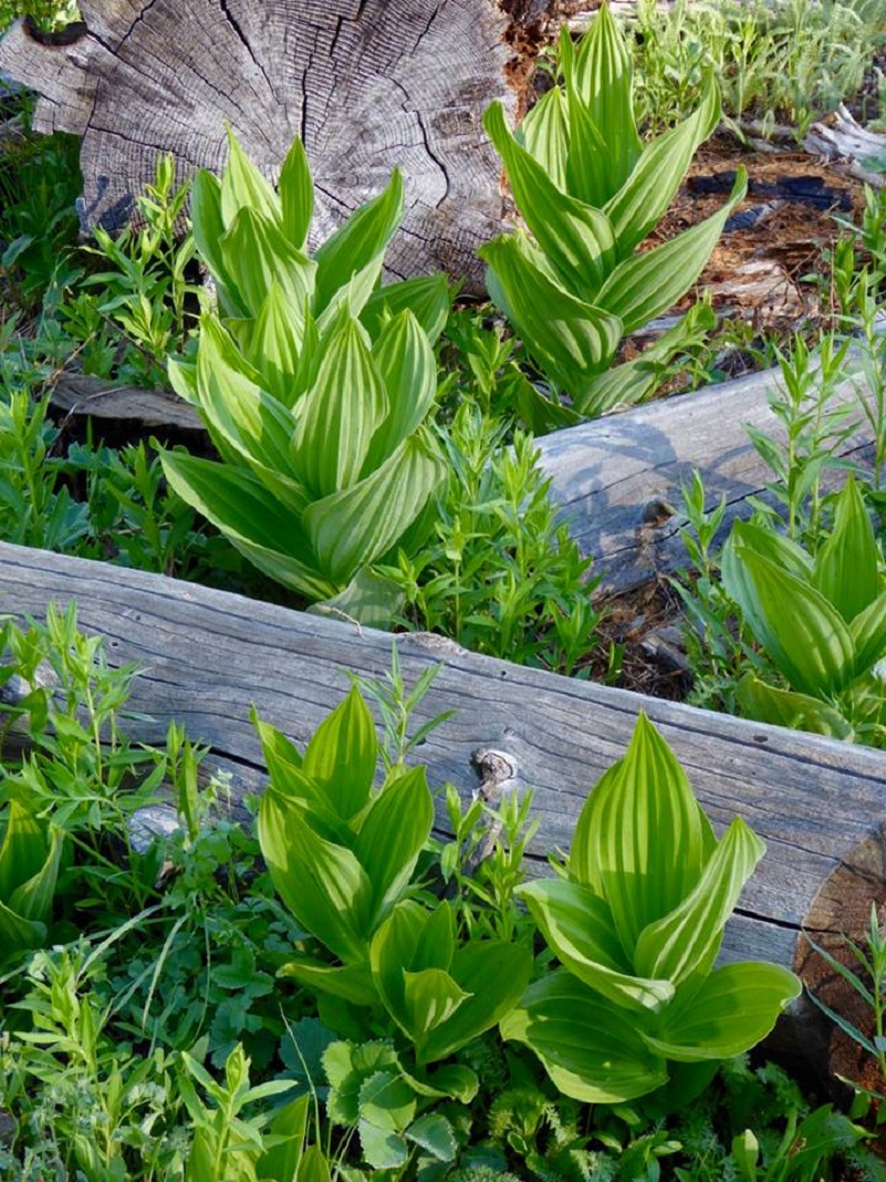
Photo by Gail Gilbert
Winter was not kind to the trail as we climbed. Some areas had some pretty good ruts down it.
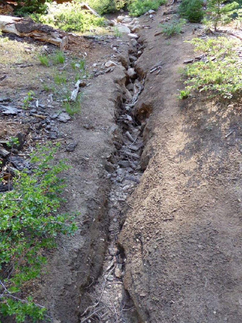
Photo by Gail Gilbert
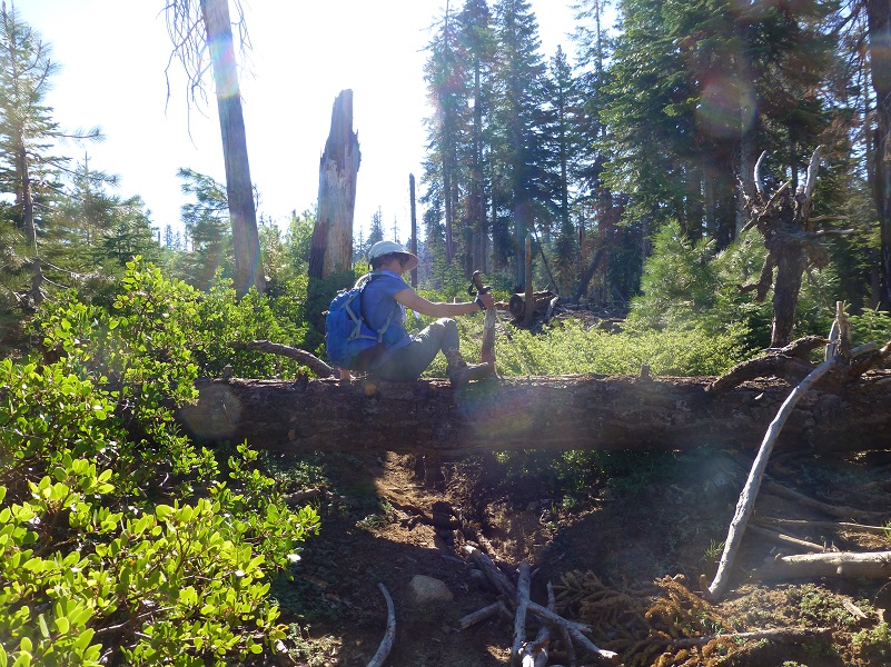
There were several trees across the trail and a couple of these trees will be a barrier to stock making it up to Ostrander Lake until they are removed. We were able to work our way over, under or around all of them fairly easily.


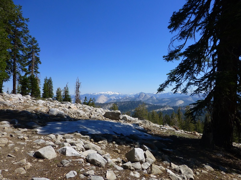
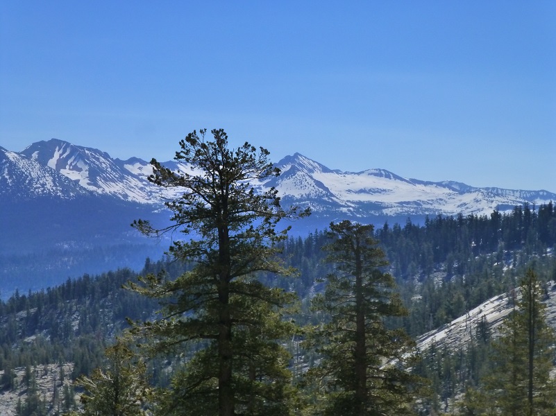
There is a stretch of the trail that is in the sun and we chose to get an early start to tackle “Heart Attack Hill” in the morning. One of the rewards we like to treat ourselves to after getting that part over is to take a small detour off the trail at the top to check out the views of the high country.
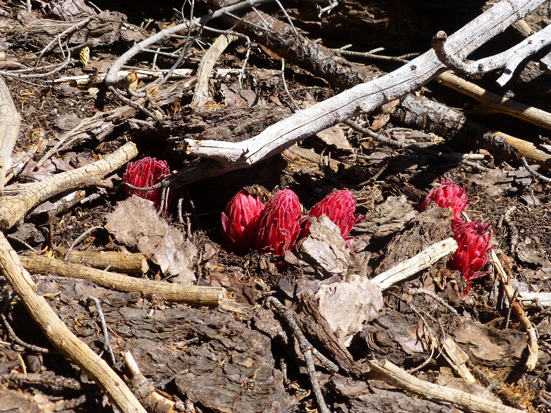
As we headed back to the trail, we spotted some snow plants just starting to work their way up through the soil.
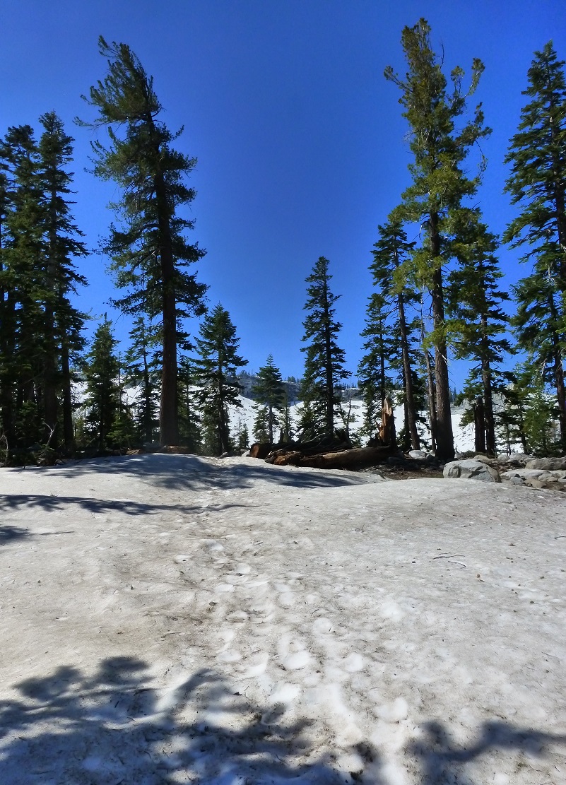
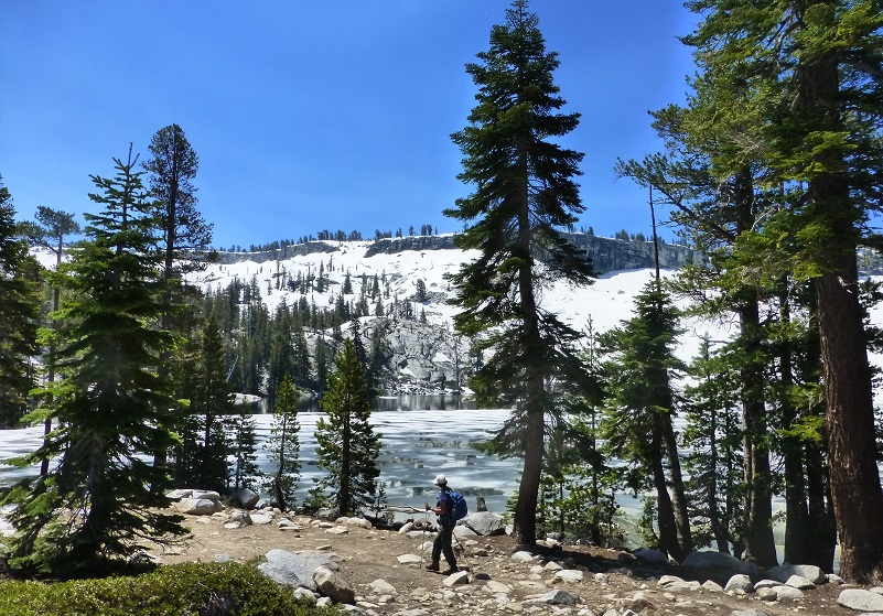
We reached snow just as we topped out to head down to Ostrander Lake.
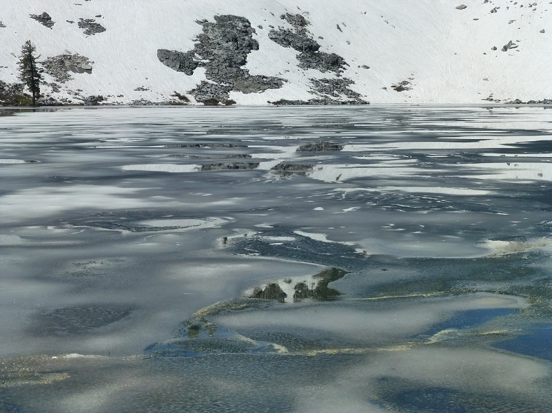
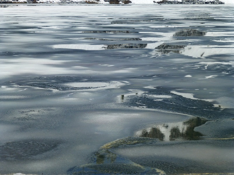
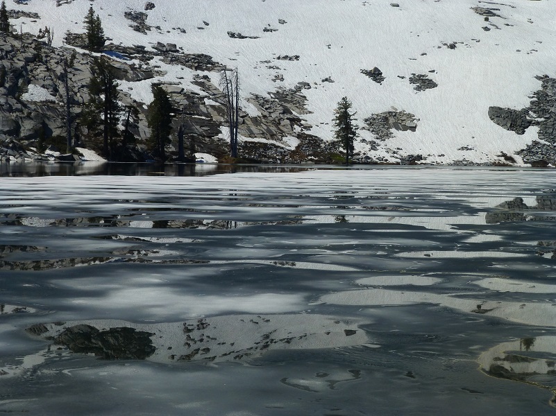
Gail spotted the ice on the lake first. I thought that with this hot weather, maybe it had melted off. I was so happy that the ice was still on the lake.
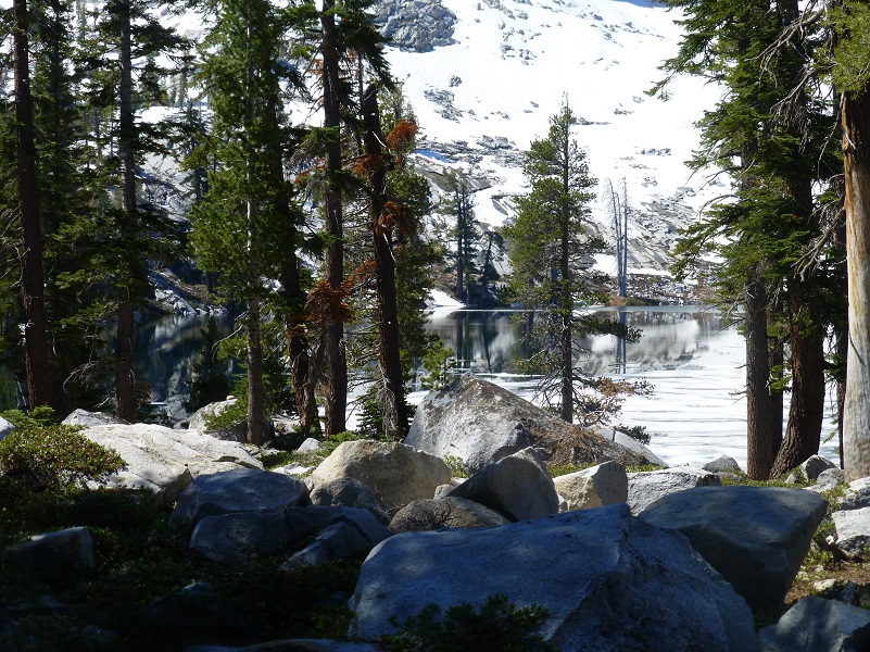
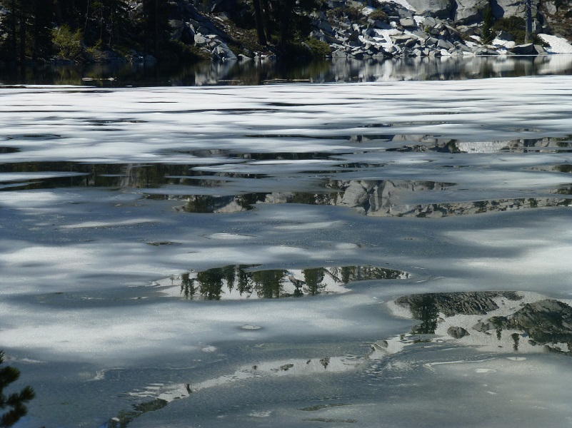
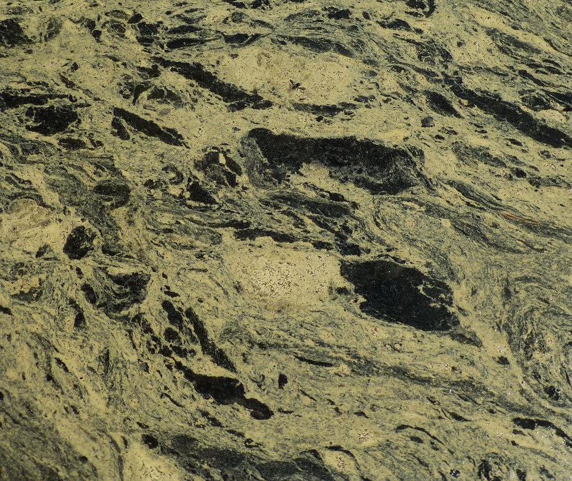
We headed down to take a closer look. As the ice melted, it was creating incredible patterns of ice and reflections.
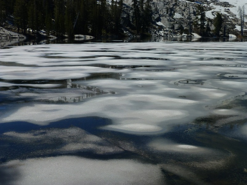
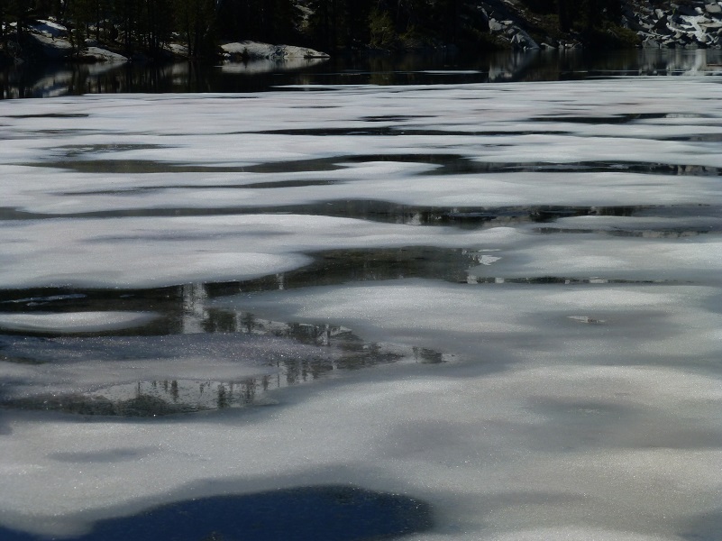

I could not get enough of the patterns that the melting ice made.
We crossed an outlet of the lake on logs, some of them surprisingly wobbly, then walked along the western side of the lake.
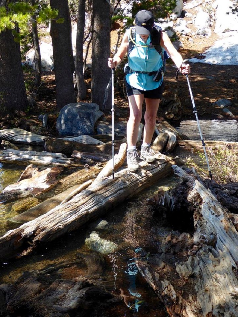
Photo by Gail Gilbert
As we worked our way along the shore, it was like watching an art gallery of patterns.
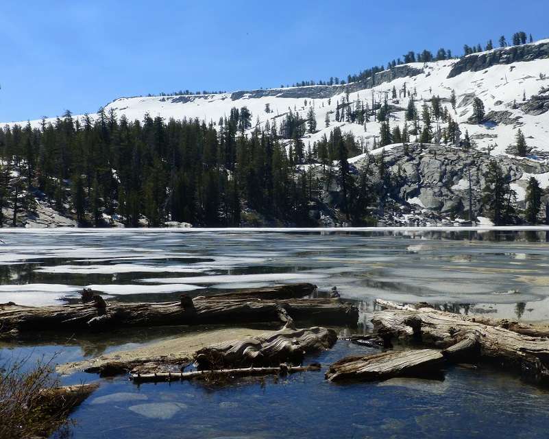
We found some nice rocks for our lunch spot.
As we headed back along the lake, I took a closer look at the patterns that the pollen made on the lake.
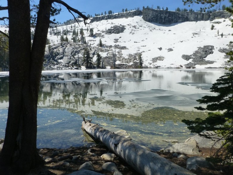
Is this an amazing view or what?
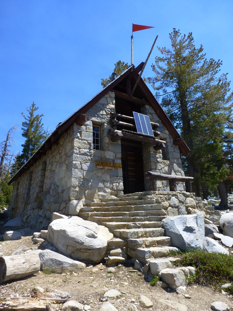
As I wandered back up to the trail, I walked by the Ostrander Ski Hut, a two story stone building that was built in 1941 by the Civilian Conservation Corps for cross-country skiers. It was originally intended to be part of a larger system of winter trails and huts along the Sierra Crest that never were developed. It is operated by the Yosemite Conservancy, a non-profit educational organization in Yosemite National Park and is staffed with a hutmaster during the winter months.
It sleeps 25 people and has bunks, mattresses, wood stove, a kitchen with a gas stove for cooking and assorted pots and pans available for the visitor’s use. Drinking and wash water is hauled from the lake in buckets and that water treatment is the individual visitor’s responsibility. Light is from solar powered lights.
National Park Service rangers staffed the cabin starting in the 1960s, but by 1974, demand for the hut grew too large, and Yosemite Conservancy, in conjunction with NPS, took over its stewardship and management.
All revenue from overnight fees is used to operate the ski hut. The Conservancy has also established a reserve account to ensure essential maintenance is carried out. The Ostrander Ski Hut is just one of many projects that the Conservancy supports with money and personnel. You can access the link to Yosemite Conservancy at the end of this Blog to learn more and about how you can help.
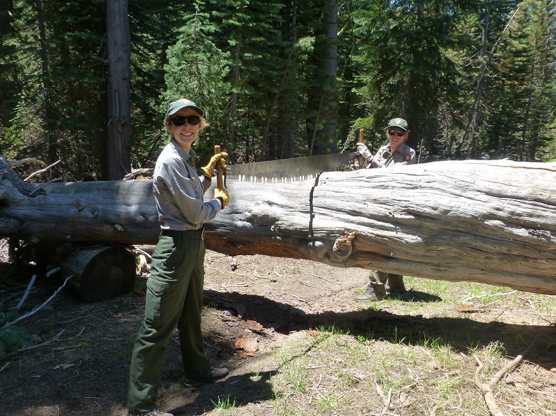
We came across a Trail Crew working on clearing those down trees we crawled over, under or around our way up the trail in the morning. There were actual two groups of two people working in different locations. I really appreciate their hard work removing these. Thank you!
We were very happy that we hadn’t packed our snowshoes because we sure didn’t need them. The short stretches of snow on this trail didn’t require it but if you are heading past Ostrander Lake, you may come across more snow than we did. You do want to be prepared for more snow than you are used to at this time of the year. This is one of those hikes that I like to do when it is cooler, preferably when there is some snow and ice. We made sure that we not only brought plenty of water but drank it. I have also taken my fishing pole along with me on this hike in the past and caught Brook Trout. We talked to backpackers staying at the lake that had done a little fishing and they said they did quite well. Sounds like those trout are hungry!
Dog Hike? No, dogs are not allowed on this trail in Yosemite National Park.
Map and Profile:
Ostrander Lake Hike Doarama Link
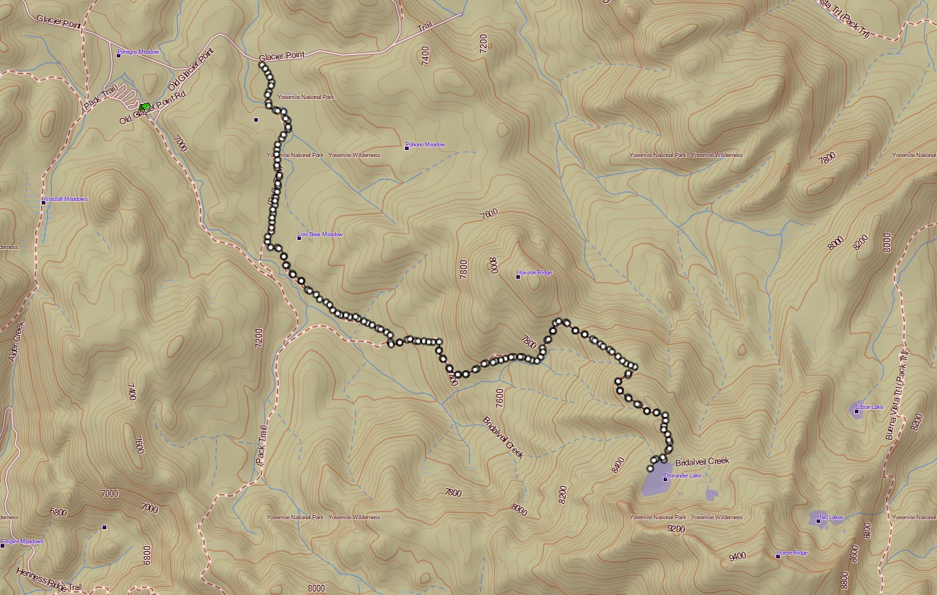
Ostrander Lake Hike Topographic Map
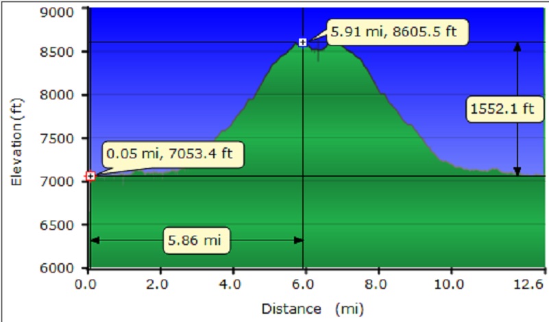
Ostrander Lake Hike Profile
Prior Blogs in the Area:
Hiking to Ostrander Lake May 16, 2016
Ostrander and Heart Lakes Hike April 4, 2015
Glacier Point Road to Ostrander Lake Hike April 23, 2014
Ostrander Lake Hike May 29, 2013
Sources:
Yosemite Valley Place Names (1955) by Richard J. Hartesveldt
Ostrander Ski Hut Yosemite Conservancy