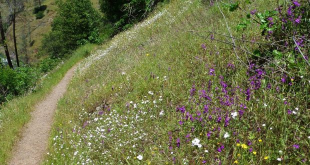
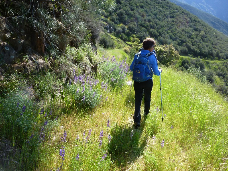
Not the amazing display of poppies in the Hite Cove area this year, but plenty of other wildflowers were showing off as we hiked where miners walked as they searched for their fortunes in those gold mines long ago.
Where: Sierra National Forest with some stretches through private property
Distance: 8.21 Miles
Difficulty: Moderate
Elevation Range: 1,412′ to 3,187′
Date: April 21, 2017
Map: Buckingham Mountain Topographic Quad, Sierra National Forest
Dog Hike? Maybe
 This hike required us to take two vehicles, staging one at the parking area across from the Hite Cove Trailhead. We drove the other vehicle up above Indian Flat RV Park. We were able to drive up the dirt road from the trailer park, following the sign, about a mile and a half, following the old rutty dirt road through a stretch of private property. Please be respectful of the private property in this area.
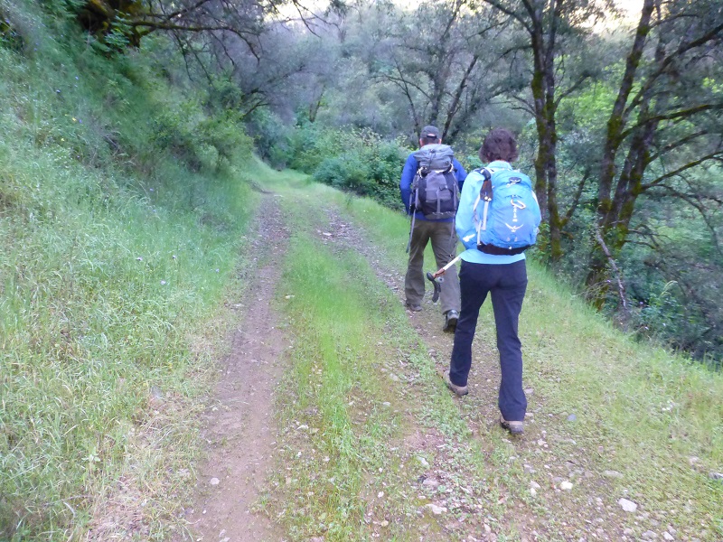
We started walking up the road which narrowed to the point where only motorcycles and 4 wheelers were using it. At about the 1 mile point, we came across a large tree across the road and this limited the possibility of any vehicles other than motorcycles using it after this point.
I located a 1909 topog map that shows the trail at Indian Flat and Savage’s Trading Post, with a branch continuing up Snyder Gulch to Jerseydale. The 1947 topog map even shows a trail branching off of the trail heading up Pinoche Ridge called the Pinoche Peak Trail, along with giving a name for the trail that is coming from the Indian Flat Guard Station as Hite Cove Trail. The 1949 topog map still has these trails but they start dropping off the maps in later years. If you click on the maps below, you will be able to see an enlarged view.
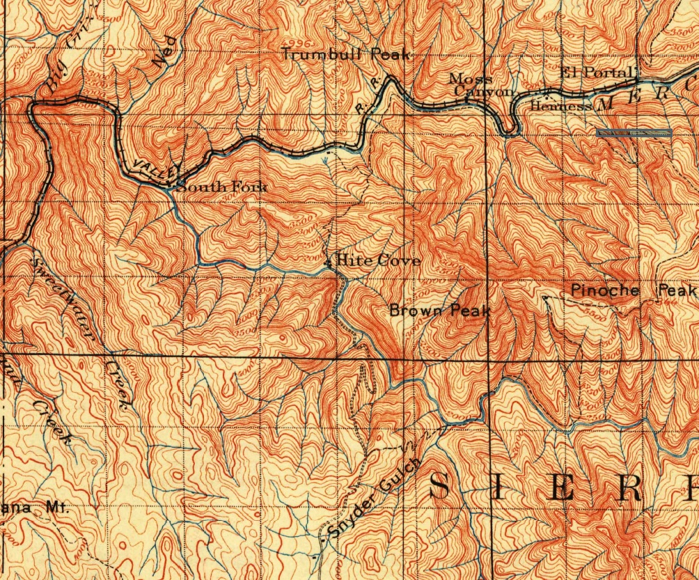
1909 Topographic Map
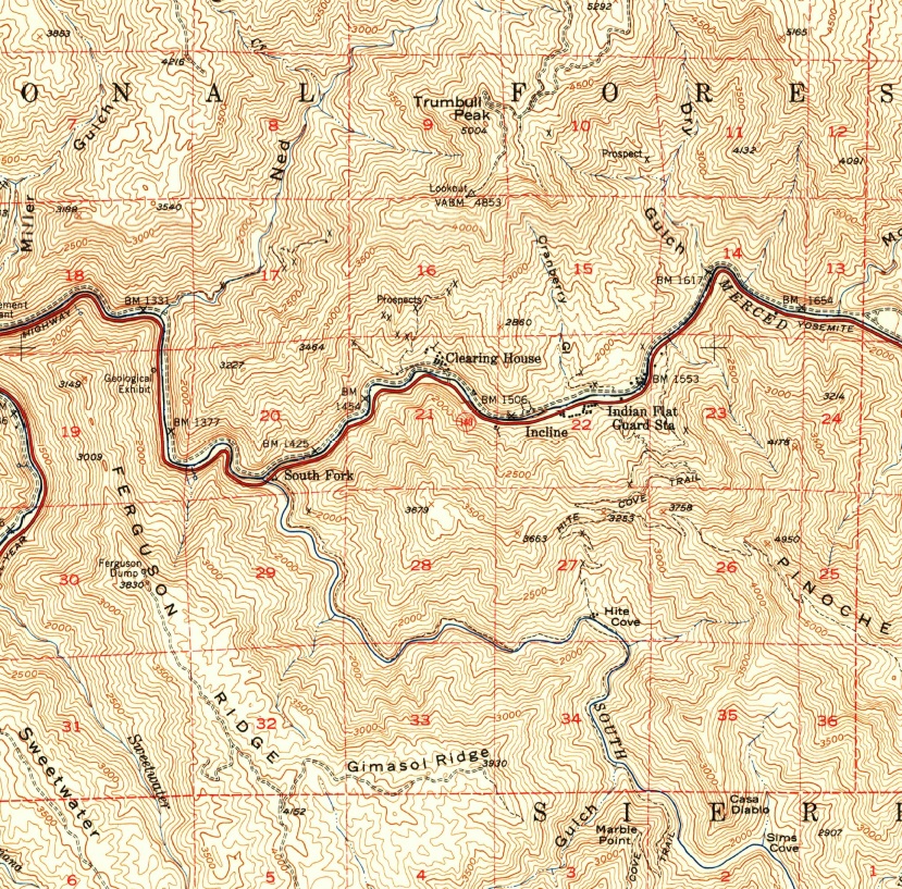
1947 Topographic Map
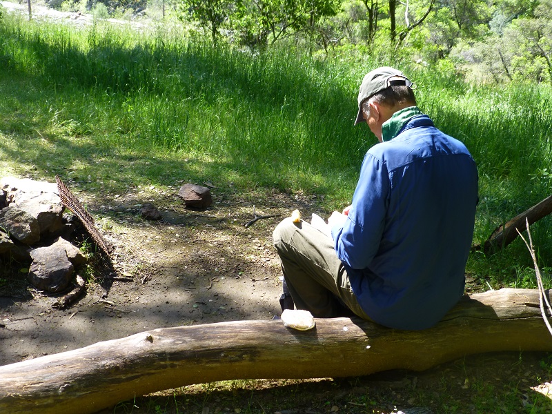
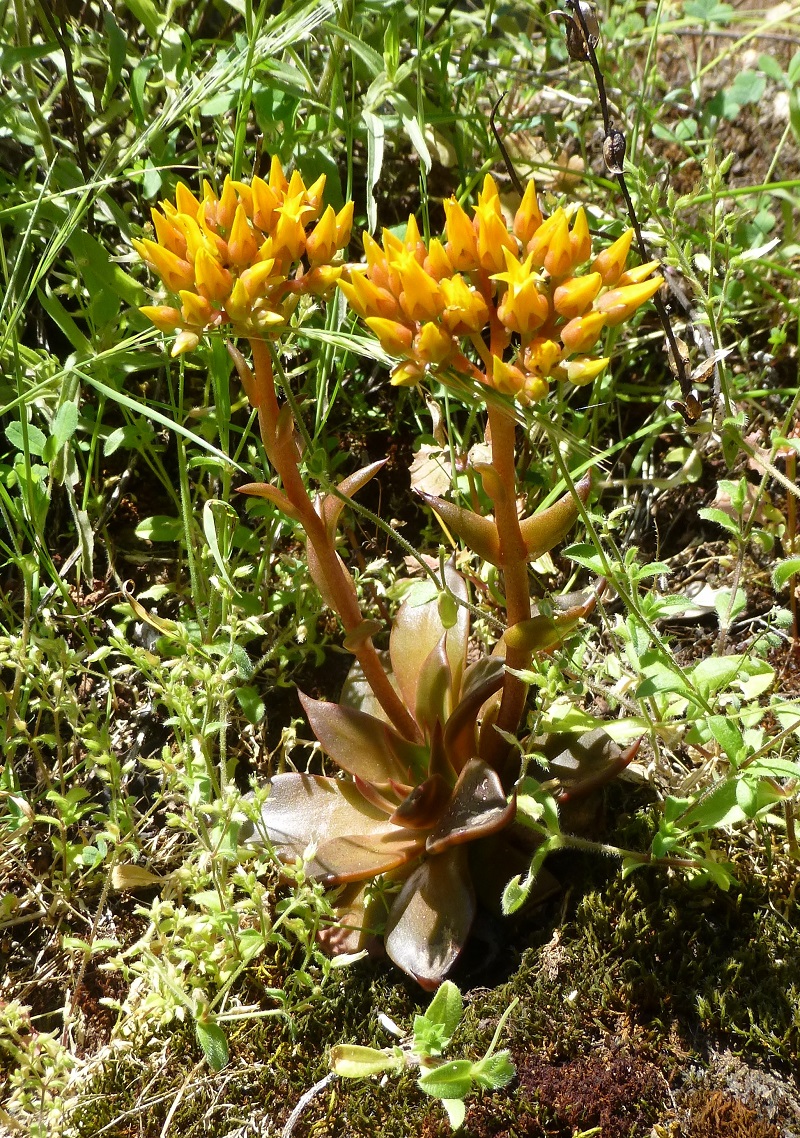
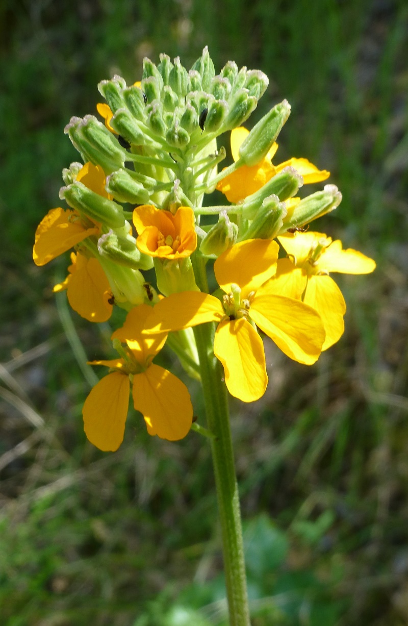
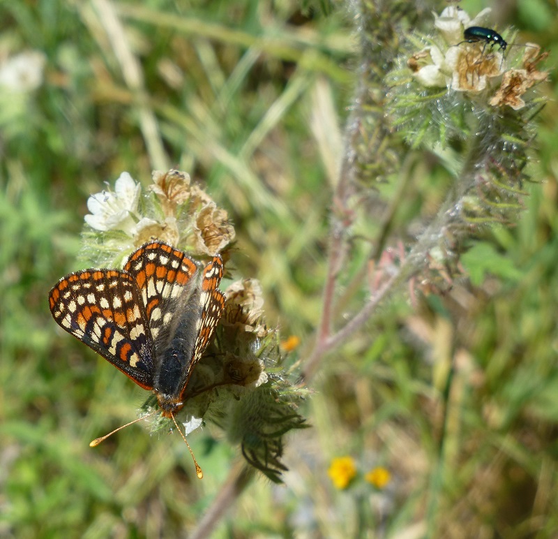
We started seeing flowers right away and insects were very busy working on the flowers.
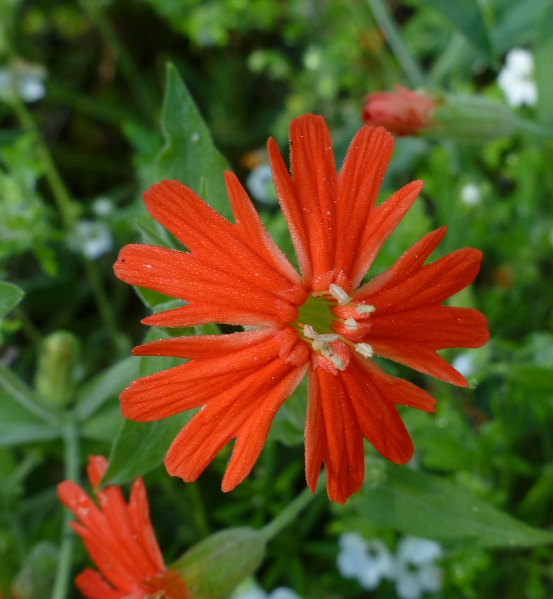
California pink – aka Indian pink
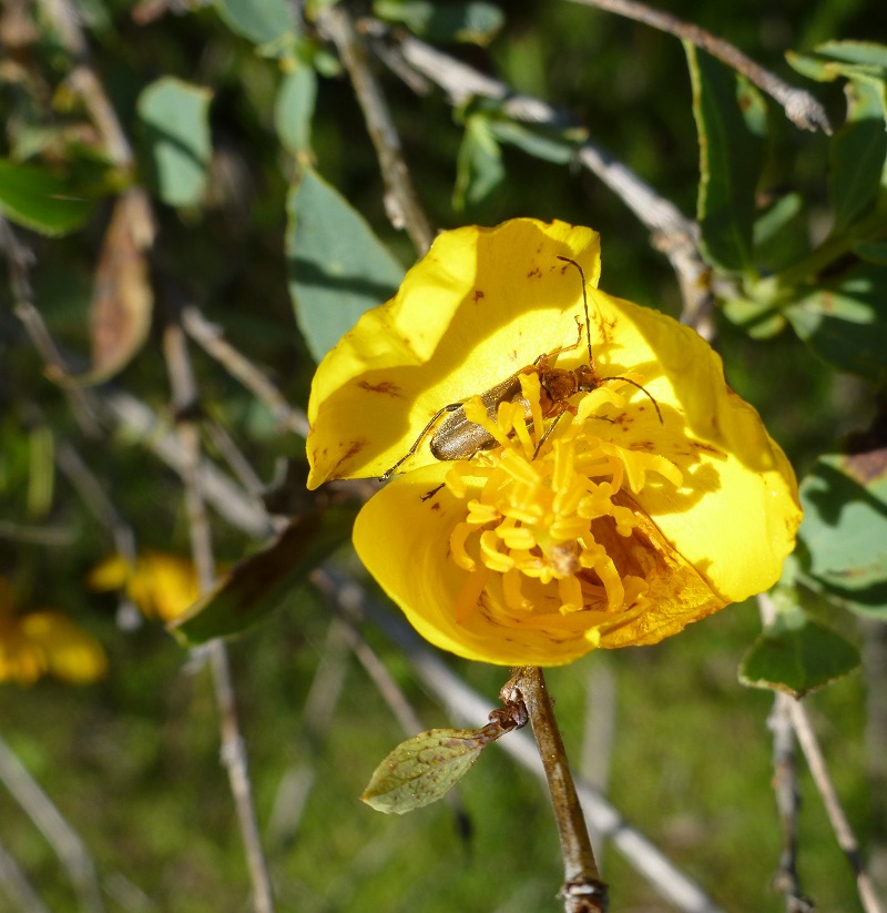
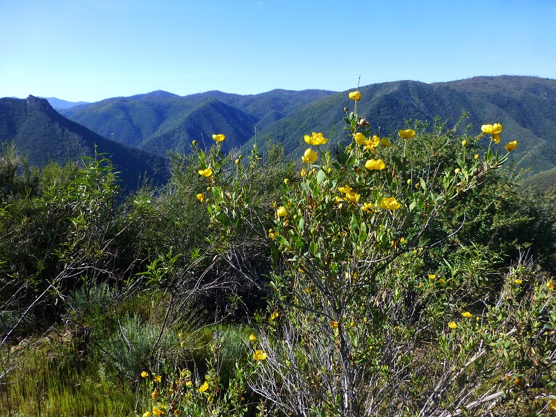
Bush poppy
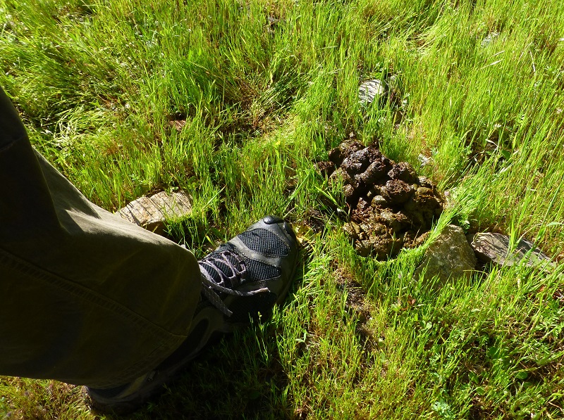 We saw the freshest bear scat that we had seen in a while and we could also make out where the grass parted on the road ahead of us where that bear probably walked.
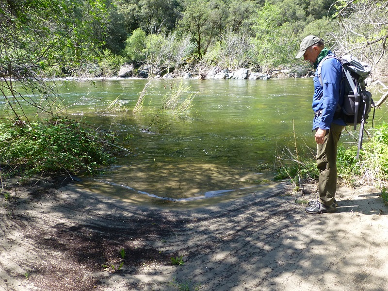
When we reached the top of the crest, we had a great view up the South Fork of the Merced River and into Hite Cove. We turned around and could look up the Merced River towards El Portal.
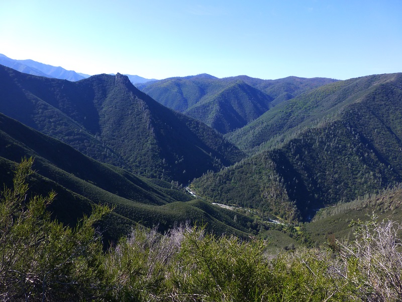
Looking South towards Hite Cove and the South Fork of the Merced River
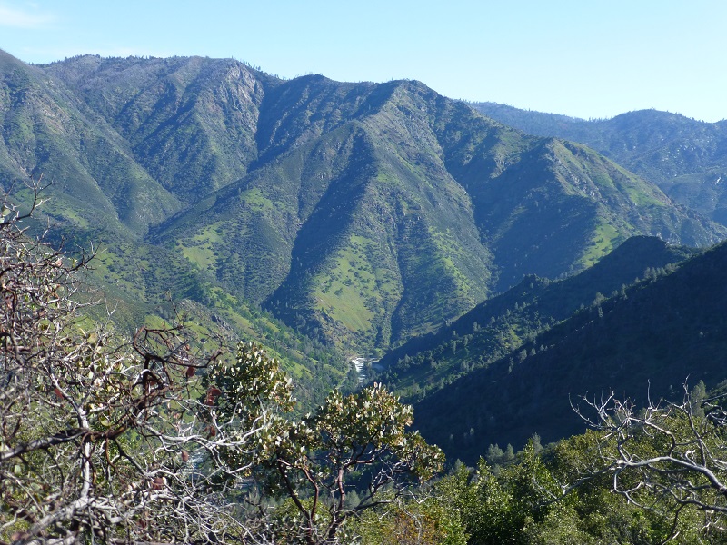
Looking Northeast Upstream at the Merced River
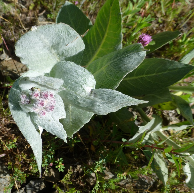
This shrub was really blooming and we didn’t know what it was until we got back and Joanna Clines, Botanist for the Sierra National Forest, told us that is a Bush Poppy and it is a “fire follower.” An occasional fire is good for bush poppies because it increases the ability for their seeds to germinate. We had also seen a knobcone pine branch that had fallen on the trail on the way up, another species dependent on fire to reproduce. Thank you Joanna!
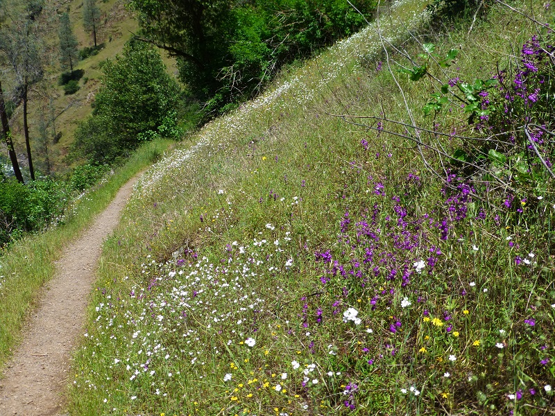
The trail was lined with wildflowers in places and we watched where we walked because we knew the rattlesnakes would be out.
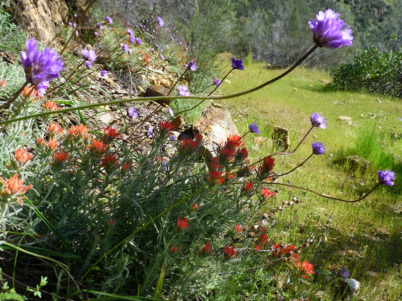
Blue Dicks and Paintbrush Line the Old Road

Photo by Gail Gilbert
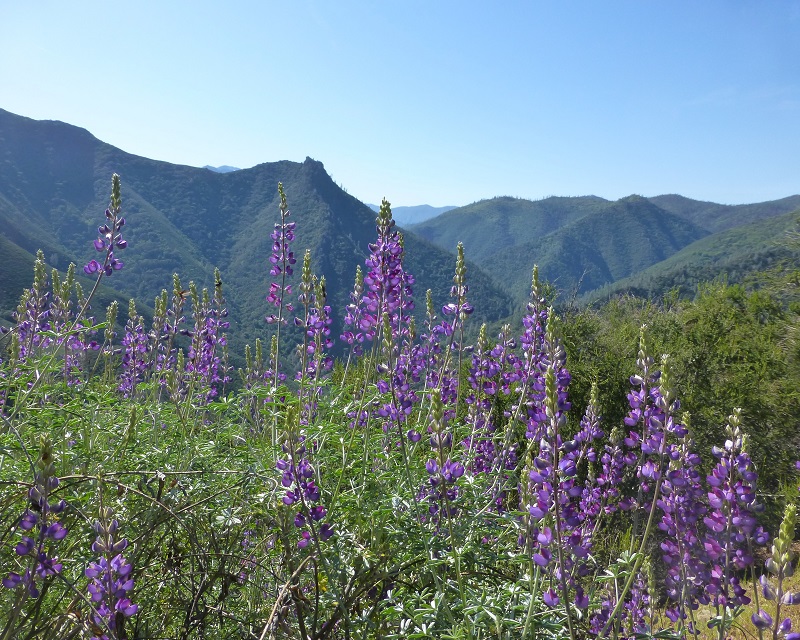
The lupine were beautiful.

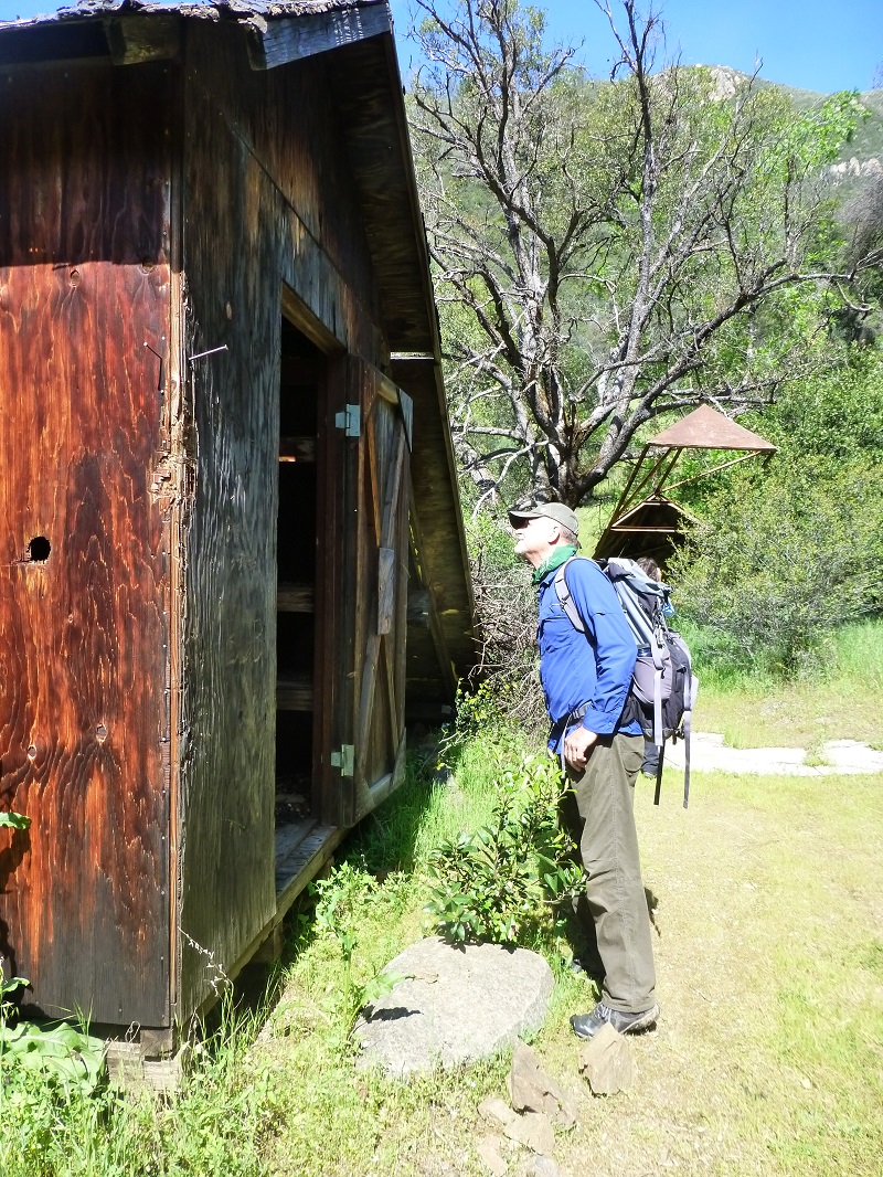
We reached one of the tunnels, known as adits, associated with one of the Hite Mines. At the end of this blog, I have much more detailed information on the Hite Mines.

Mine above Hite Cove
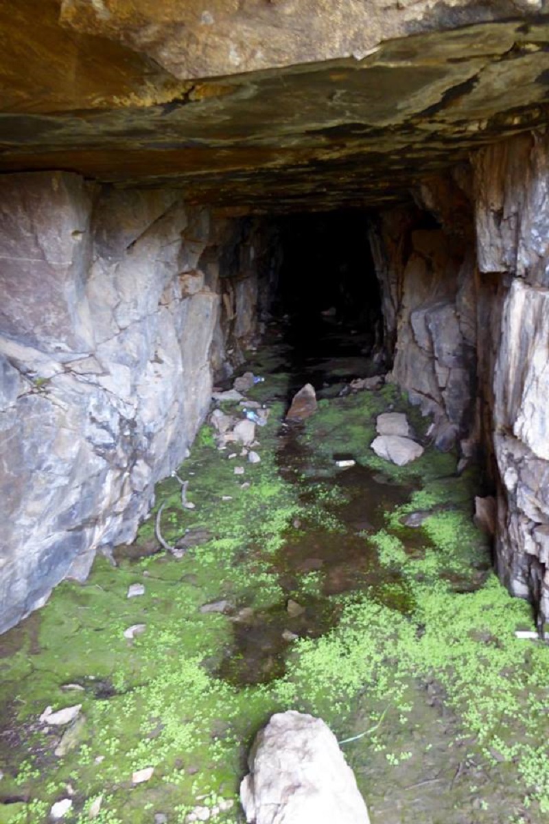
Looking into the Mine Adit (Photo by Gail Gilbert)
There was much more mining going on in the area besides the Hite Mine. There were at least 14 mines located in the Hite Cove District including:
- Albany Lode Mine (Liberty Lode Mine)
- Amboy-Nest Egg Placer Mine
- Blossom No. 1 prospect
- Bunker Hill Mine (Squirrel Mine)
- Desario group
- Emma I Mine
- Eureka III Mine (Eureka Sky High; Eureka High)
- Georgia Point Mine (Spring Tunnel claim; Georgia Point claim; South Side claim)
- Hite Mine (Hite and Wynant; Hite Hite & Wynant Mine; Hite Central Mine; Hites Cove Mine; Arkell Mine; Priest and Coleman claim; Hite claim; Giltner claim; McConley claim; Old Dominion claim; Summit claim)
- Mexican II Mine (Carmen Mine)
- Patricia Mine
- Spring Tunnel Mine
- Unnamed Au placer
- Unnamed placer Au prospect
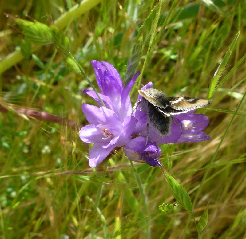
As we headed down the old road, we came across patches of blue dick and those insects were busy working.
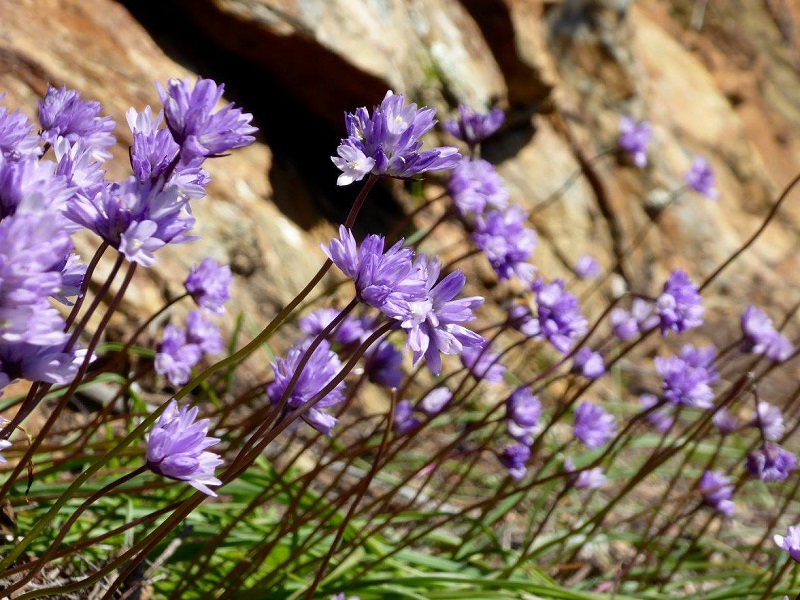
Photo by Gail Gilbert
There were many other beautiful blooms along the road.
California Milkweed
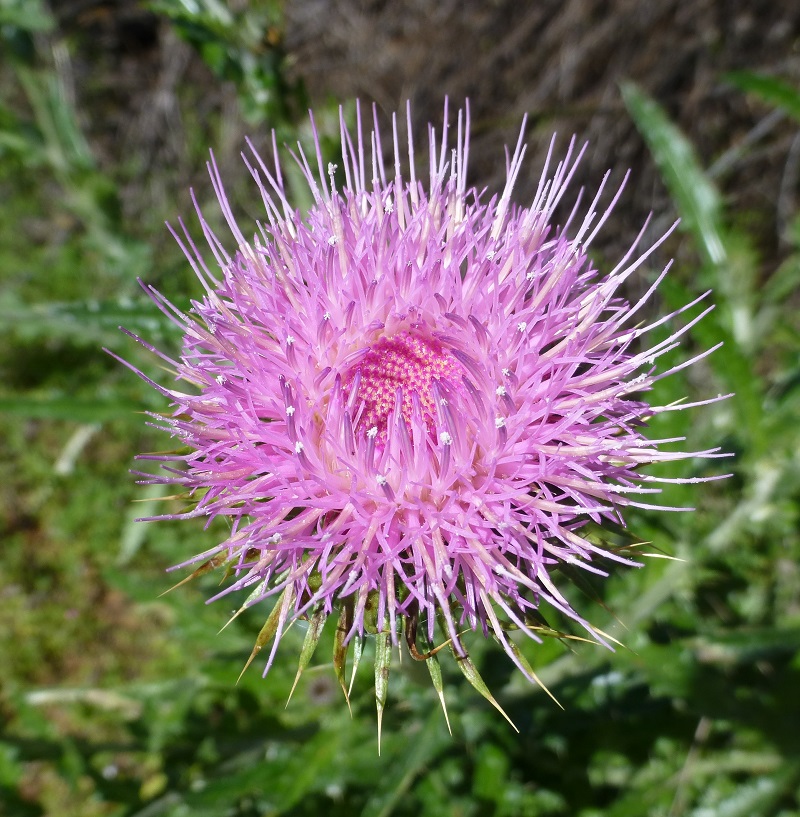
Thistle
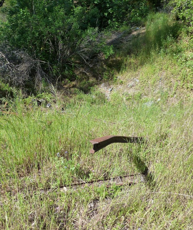
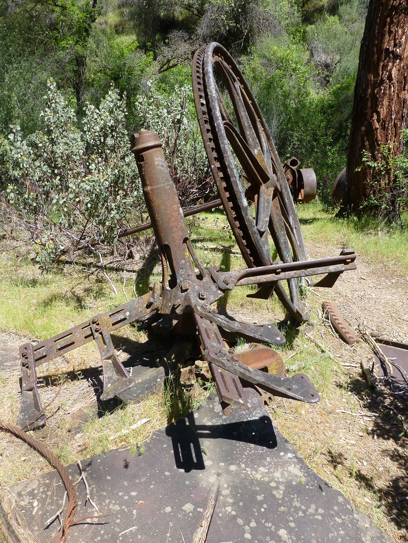
Ore Cart Railing
We saw quite a bit of pieces and parts of old mining things along the road. When we reached the lower of the Hite Mine adits, old ore cart rails were strewn out alongside the tailings.
We headed down to the old mining town of Hite (also formerly known as Hite’s Cove), which was named after John Hite who discovered gold there. Placer mining began in the area shortly after the beginning of the gold rush, and the Hite Mine was discovered in 1862 by John R. Hite. He operated the property for 17 years and became quite rich. The mine was active again during the early 1900s and there has been some prospecting in the area in recent years. The Hites Cove post office operated from 1868 to 1869, and from 1878 to 1889. The Hite post office operated from 1901 to 1902. The town burned down in 1924.
We checked out the area where John Hite had his gardens, stone foundations where buildings once stood, remains of a spring-fed water system and newer old buildings where the hotel once stood. The town of Hite actually had 2 hotels and its own Chinatown. Because of its isolated location, drinking and gambling were popular diversions.
Near the Location of the Old Hite Hotel
We wandered onward down the hill past an old road and rock foundations of buildings long lost to history. Usually there are many poppies blooming in this area but not this year. There were only a few. We stopped for a snack at a fire ring underneath locust trees that were planted in the 1870’s and to check out the high level of the South Fork of the Merced River.
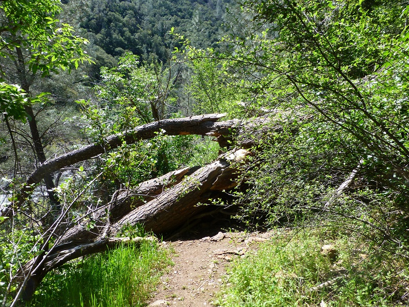
As we headed down the trail toward Savage’s Trading Post, there was a big tree across the trail but we were able to crawl through it.
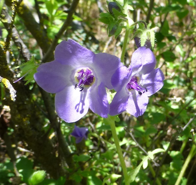
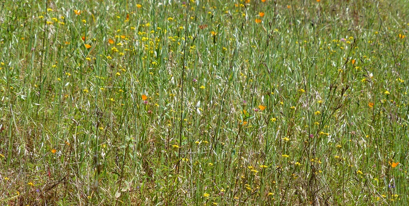
The diverse display of wildflowers along the trail was very colorful.

 We walked by old mining equipment that included flumes that supplied the water to the crushers. It is hard to believe that in 1864, the town of Hite Cove had a population of about 100 and a ten stamp milling operation.
We admired the flowers along the trail.
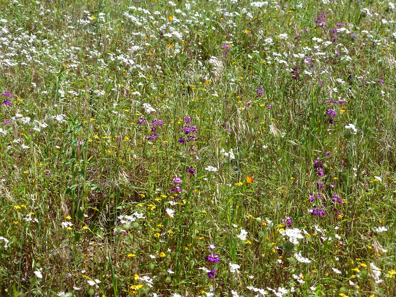
 As we reached the final 3/4 mile or so of the trail, we usually see masses of poppies blooming but not his year. We were not disappointed though because there were plenty of other wildflowers of different colors that created beautiful mosaics.
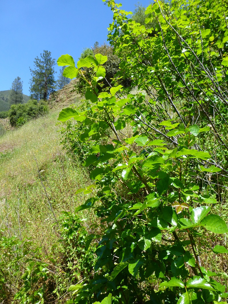
I almost forgot to mention that is a healthy crop of poison oak also.
We had a great hike with beautiful views, old mining stuff which I love and the flowers were amazing. If you want to see the flower displays, you don’t need to walk as far as we did. If you come in from Savage’s Trading Post, you can see some beautiful flowers in that first 3/4 mile stretch. The flower display is short-lived and if you want to see it this year, I recommend you get out there soon. Note that once fire danger increases, this trail is closed. Bring plenty of drinking water and watch for those rattlesnakes.
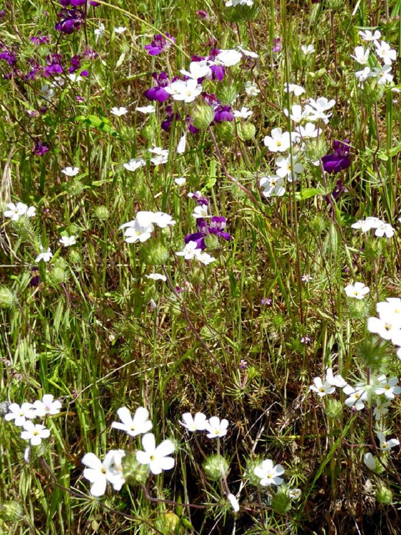
Photo by Gail Gilbert

Photo by Gail Gilbert
More Information on the Hite Mine from Minedat.org:
Hite Mine (Hite and Wynant; Hite Hite & Wynant Mine; Hite Central Mine; Hites Cove Mine; Arkell Mine; Priest and Coleman claim; Hite claim; Giltner claim; McConley claim; Old Dominion claim; Summit claim)
A former Au-Ag (Gold-Silver) mine located in secs. 22, 26 & 27, T3S, R19E, MDM, 1.0 km (3,400 feet) N of Hite Cove (approximately 13 miles NE of the town of Mariposa), on private (patented) land within a National Forest. Discovered in 1862. Property consists of 6 patented claims. Operated by Cyrus Bell. MRDS database stated accuracy for this location is 1,000 meters.
One of the most colorful and productive mines in the county. Worked by various operators from 1862 to 1938. Plans were made to reopen the mine in 1956.
Opened in 1862-1863, this mine was worked continuously to 1879 by Hite and Company, initially by hand methods and an arrastra, and later with a stamp mill. It is possible that most production came from the mine during this period as the mine was only sporadically active subsequently. From 1879 on, the mine passed through various changes in ownership and episodes of litigation. Records indicate that production was minor during this period, although there was still additional ore indicated at depth. Julihn and Horton (1940) reported exploration activity at this mine in the late 1930?s (no reported production from this activity). Bowen and Gray (1957) reported some road-building activity to the mine in 1953-54, but no additional information on activity at the mine since then was obtained during research for this deposit. Amalgamation and cyanide processes were used at this mine.
The deposit at the Hite Mine consists of a typical gold- and sulfide-bearing hydrothermal quartz veins within metamorphic wall rock. The principal (Hite) vein is reportedly in slate and other metamorphic rocks and is associated with a series of dikes. It strikes N50-70W and dips 75-80NE. Gold is present both in native form and in sulfides. The slate is soft and gouge-like near the vein.
Mineralization is a Au-Ag deposit (Deposit model: Model code 273; USGS model code 36a; Deposit model name: Low-sulfide Au-quartz vein; Mark3 model number 27), hosted in Mesozoic-Paleozoic slate and Mesozoic granite. The ore body is tabular. Sulfides reportedly averaged 1½% of the ore. No alteration reported. This deposit may be associated with the Calaveras-Shoo Fly Thrust, a regional feature. Local rocks include Paleozoic marine rocks, undivided, unit 4 (Western Sierra Nevada).
LOCAL GEOLOGY: The Hite Mine is situated in the East Belt of gold mineralization of the Sierra Nevada and is similar in its origin and setting to the nearby Ferguson-Original (Clearinghouse) Mine. The deposit consists of gold-bearing quartz veins in slate, which is part of a complex zone that Bateman and Krauskopf (1987) mapped as a “carbonaceous metapelite” unit of uncertain age. This narrow (about one mile wide), north-northwest-trending unit separates the phyllite and chert of the Hite Cove unit of Triassic age on the west from the quartzite of the Pilot Ridge unit of Paleozoic age on the east. The Hite Cove unit is likely equivalent to the Paleozoic-Mesozoic Calaveras Complex, while the Pilot Ridge unit is tentatively correlated with the Paleozoic Shoo Fly Complex as described by Schweickert and others (1999). Regionally, the Calaveras Complex includes slate, phyllite, metachert, schist, metavolcanic rock, and metacarbonate rock. The Shoo Fly Complex includes quartzite, schist, phyllite, and lesser amounts of metachert, metacarbonate rock, and metavolcanic rock. The intervening metapelite unit also locally contains small masses of metabasalt, metagabbro, limestone, and quartzite. Bateman and Krauskopf (1987) believed that this unit may be a tectonic rather than stratigraphic unit and could be a local segment of the Calaveras-Shoo Fly Thrust (Schweickert and others, 1999). The various lithologies present in the unit could represent the tectonic mixing of the two adjacent along the thrust zone. Besides slate, other reported wall rocks associated with the Hite deposit include graphitic schist, quartzite, metasandstone, and quartz-biotite hornfels. In addition, the wall rocks are cut by a variety of small dikes and sills of granitic rocks that range in character from white aplite to dark biotite-hornblende granodiorite. The main Hite vein generally strikes N50-70W and dips 75-80NE. Other subsidiary veins in the area have similar attitudes all of which conform approximately to the bedding and schistosity of the enclosing metamorphic rocks. At the surface and to a depth of 600 feet, the main Hite vein splits into two branches separated by a lenticular horse of slate and schist about 600 feet long and up to 50 feet thick. Width of the main vein in its two parts varies from a few feet to more than 12 feet; along the borders of the slate-schist horse the vein is reportedly 25 feet thick. Ore minerals are native gold and sulfides.
Workings include underground openings comprised of 2 long adits at 720 and 1,400 feet long, respectively, with levels, a winze, shafts and several mill sites.
Principal workings at this mine consist of two crosscut adits, several shafts, and at least nine drift levels along the vein. The vein was developed mainly through a 1,400-foot crosscut adit that intersected it at a vertical depth of 725 feet below the outcrop; at the end of this adit is a winze 330 feet deep with three levels. Due north of the portal of this adit and 600 feet above it is another adit 720 feet long. Most of the ore in the footwall branch of the vein above the lower adit probably has been stoped. The soft, gouge-like nature of the slate wall rock near the vein made the ground so difficult to support that considerable timbering was required. Bowen and Gray (1957) provide a planar diagram of the mine workings.
The lowest grade of ore mined was during the period 1904 to 1909, when 4,625 tons of ore yielded 788.85 ounces of Au and 849 ounces of Ag. In 1912, a small tonnage yielded nearly 3.5 ounces of Au per ton.
Dog Hike?
I did not bring Sally on this hike because this is not a good one for her but I have seen some people with dogs on this hike. There are some really steep areas at the Save’s Trading Post side of the hike that I feel an active dog could hurt themselves. These steep areas are also narrow in many places. If you had an uncontrollable dog, they could potentially knock into a fellow hiker, causing them to fall in those steep areas.
There is a ton of poison oak and your dog will be bringing it home on their coat for you and your family to enjoy later. There are also many rattlesnakes in this area that an exploring dog could interrupt their siesta. And it can get darn hot in that area.
Maps and Profile:
Indian Flat to Hite Cove Doarama Link
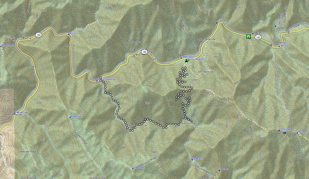
Indian Flat to Hite Cove Hike Topographic Map
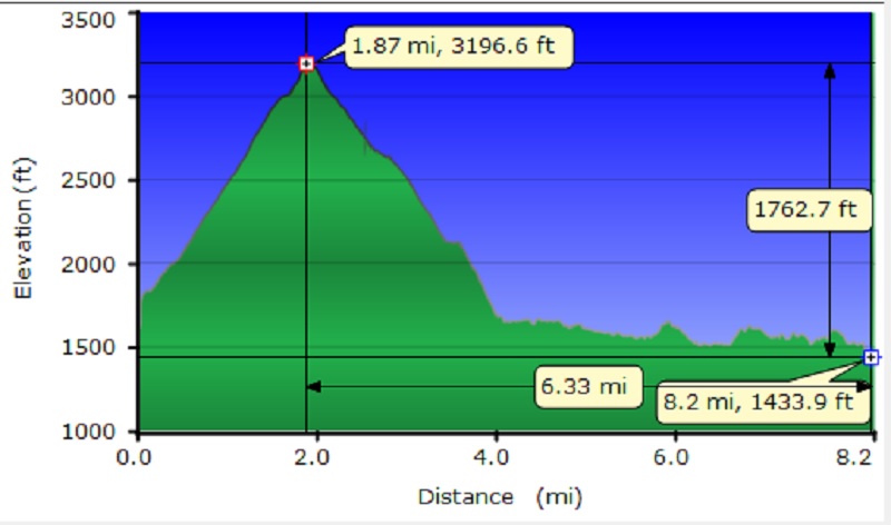
Indian Flat to Hite Cove Hike Profile
Sources:
Favorite Hikes of the Sierra Seniors Book, Jim Putman, July 2010
Gold Districts of California Bulletin 193 California Division of Mines and Geology 1976 Hite Cove District
USGS Map Locator and Downloader
Guide to the Ghost Towns, Mining Camps, and Other Formerly Inhabited Places in Mariposa County, California
Chamberlain, Newell D., The Call of Gold: True Tales on the Gold Road to Yosemite, Valley Publishers, Fresno, California 1972
Dick Etstel’s Old Mariposa 1911 Hite Cove Picture
Prior Blogs in This Area:
Hiking From Indian Flat to the Old Hite Mine January 15, 2016
Hite Cove Wildflower Hike March 22, 2015
Hiking on the Savage Lundy Trail March 7, 2015
Hiking With The Sierra Newt To View Wildflowers At Hite Cove March 22, 2014


Wonderful hike blog with beautiful pictures. I really appreciate the level of detail and enjoyed the geology discussion at the end, even though I had only a vague idea what all the terms means. I had been looking for information on local gold mining on the internet but haven’t come across anything that much detail.
I’ve never done this hike but hope to do so sometime. Note that most of the members of the Sierra Senior Hiking Group would rate this hike strenuous rather that moderate based on the elevation profile.
Thank you for your comment. Minedat.org is a great site to locate information on mines, but since mines change names over the years, it takes some digging to get information sometimes. I aim to show all of my sources when I write a blog about mining in order to make it easy for people to do their own exploring. That is why I put the Hite Mine information at the end–there were many things in it that I don’t think would interest most folks but some would find it very interesting. I appreciate your rating comment also.
Amazingly quick reply from the author. I’ll check out minedat.org.
I shared a link to your article on our group Facebook page.
I saw that share and hike with the Sierra Hiking Seniors every once in a wile and have even written a blog or two about those hikes! TY for sharing the hike.