Imagine visiting Yosemite in the 1870s, before Yosemite had been designated a Park. You just might have come into Yosemite Valley on a horse and wagon from Big Oak Flat down into the valley via the Old Big Oak Flat Road. Parts of this old road have been wiped out by rockslides but much of the road is still accessible by foot. As I walked that old road, I kept daydreaming about what that ride must have been like.
Where: Yosemite National Park
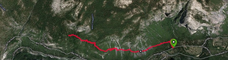
Distance: 6.5 miles
Difficulty: Moderate to Dificult
Elevational Range: 3,984′ to 5,465′
Date: December 7, 2015
Maps: El Capitan Topog
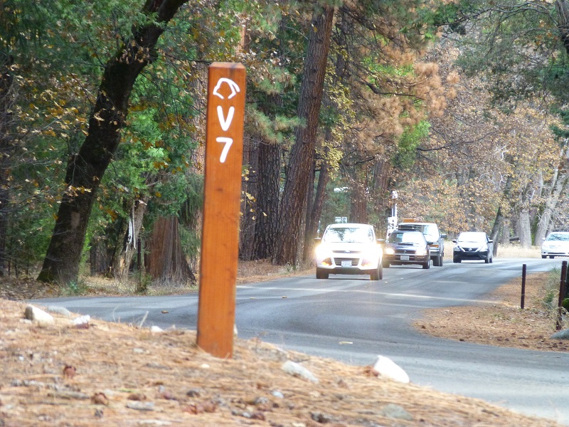
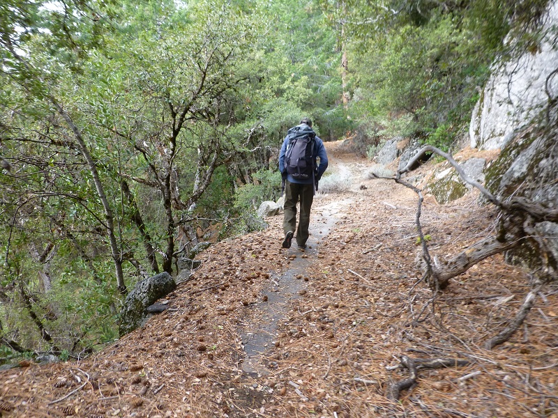
We headed into Yosemite Valley, parking along Northside Dr. where the V7 marker was and headed uphill until we intersected the remains of the Old Big Oak Flat Road, the left and uphill.
Parking Area
Parking Area

Where We Intersected the Trail
Today, we know the community of Big Oak Flat as Groveland but it was originally known as Savage’s Diggings, an early mining community, and was later named for a big oak in the middle of town. The Chinese Camp and Yosemite Turnpike Company began the road in 1869. The entire road was built by hand, using picks, shovels and blasting powder. Originally a toll road, the Big Oak Flat Road was the main road into Yosemite from the north. One highlight of this old road is Rainbow View, which still has some of the old railing around this vista. In 1874, this last stretch of Wagon Road was built from Big Oak Flat down to Yosemite Valley and was known as the “zigzag.” In 1899, the road was 30 miles long, averaging a width of 15 feet and a maximum average grade of .16%.
Big Oak Flat Road opened to automobile traffic in 1914. In 1915, Tuolumne County purchased the road in order to make it toll free and deeded it over to the State of California. The new federal highway was built from Crane Flat to Yosemite Valley in 1940, bypassing the zigzag route. The old route could still be driven by automobile in 1940’s but a couple of huge rockslides wiped out the road and it was closed. A major rockslide during the winter of 1943 took out the area where the largest switchback was and the park didn’t make any efforts to try and clear this slide.
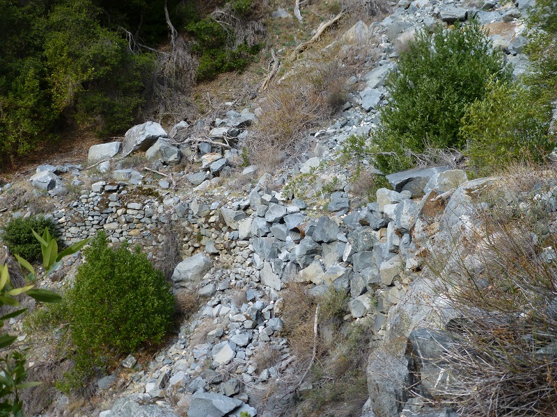
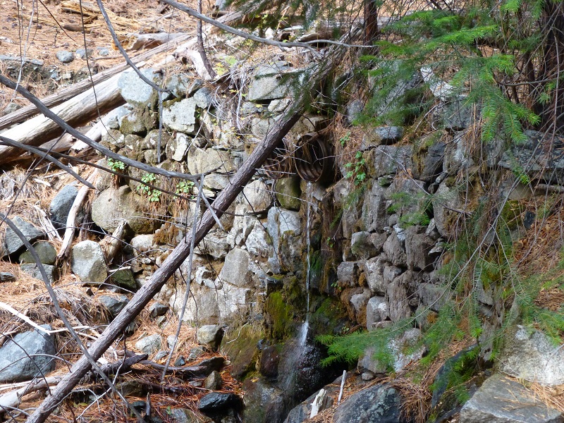
80% of the old road is still intact and we could still see pavement in most of the sections, along with the beautiful rock retaining sections.
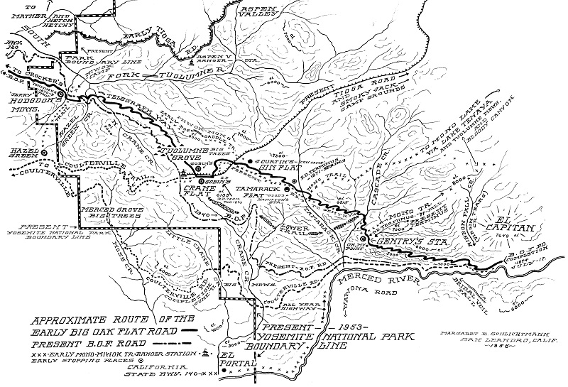
1956 Map of Early Big Oak Flat Road by Margaret Schlichtmann
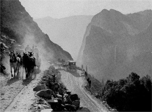
The “Zig Zag” on the Old Big Oak Flat Road Source: Yosemite Roads and Bridges, Yosemite National Park
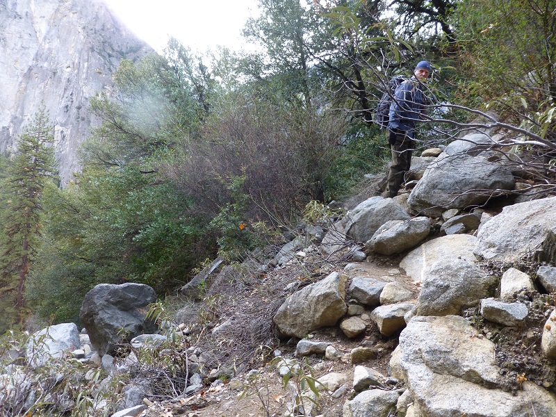
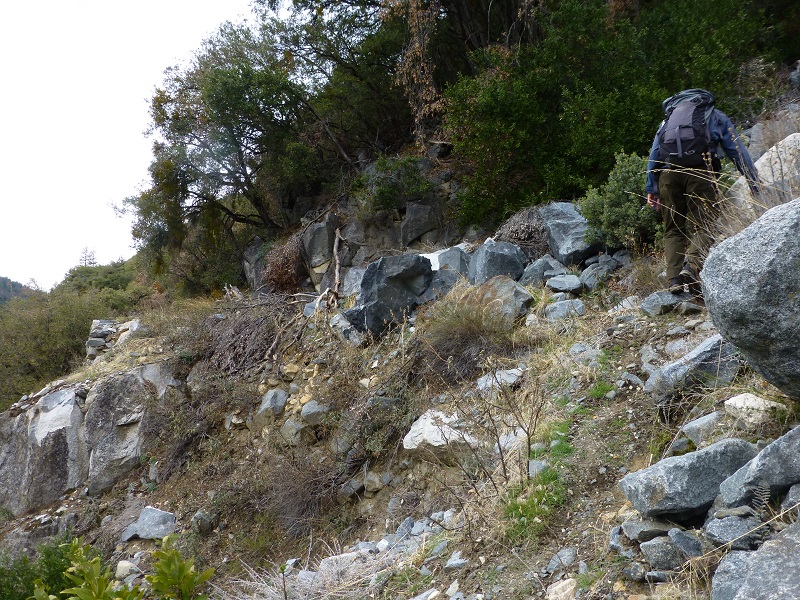
We hadn’t walked along the roadbed too far before we encountered where minor slides had taken out small parts of the road, causing us to work our way through the rocks to get back on the road. Some of these spots had some straight dropoffs with no forgiveness if you slipped or lost your balance.
The road then got much better.
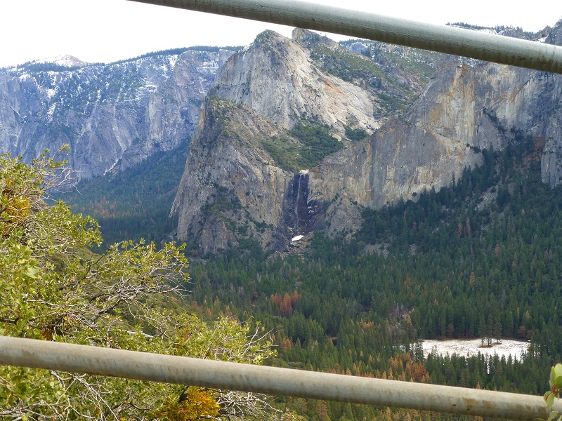
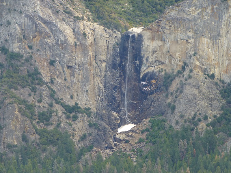
That opening gave us our first view of Bridalveil Fall.

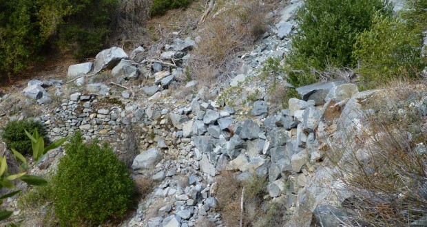
Then the road became worse but we were able to pick our way through the rubble. There was no sign of the road or trail but we could see the other side of the rockslide where the road reappeared. Again, dropoffs were straight down as we worked our way through the rocks.
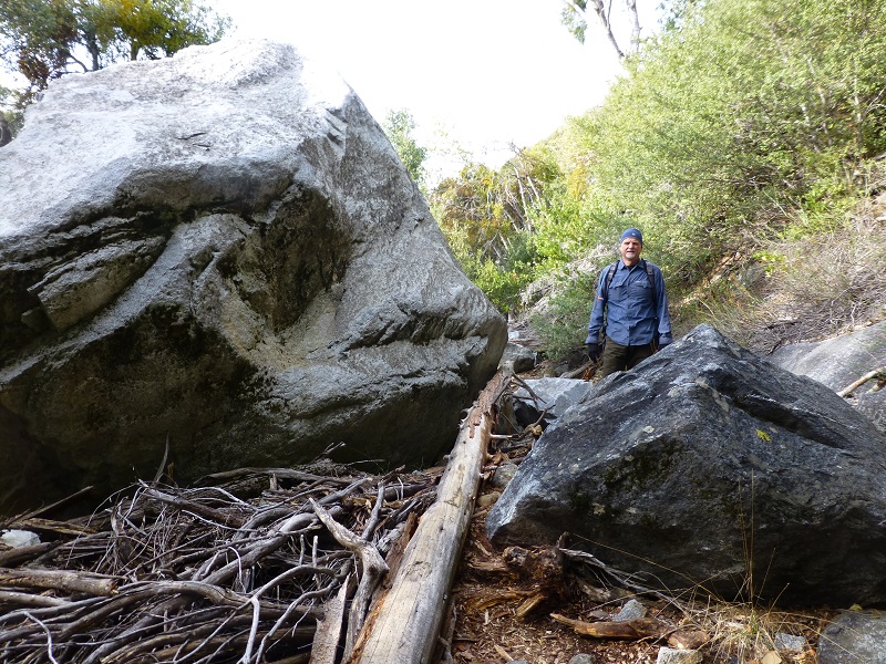
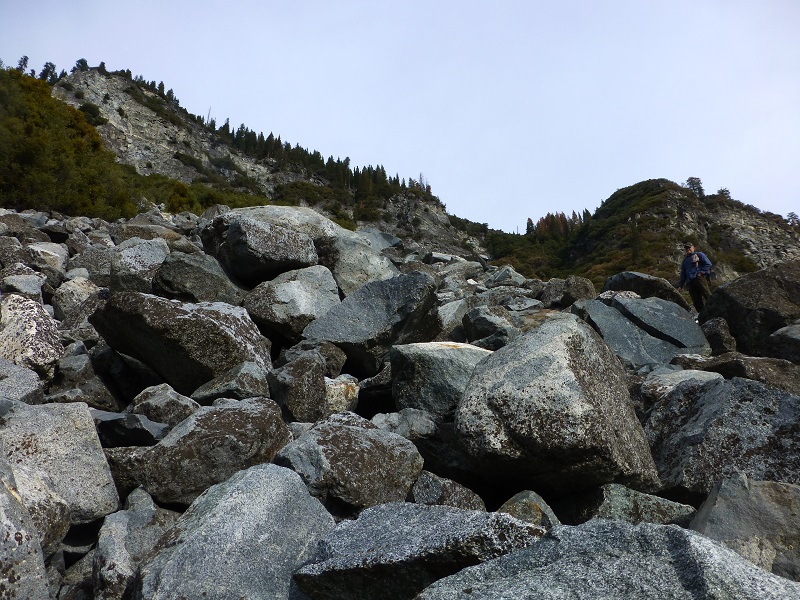
Then the road became much worse. This was the portion where the big rockslide occurred and wiped out two switchbacks worth of road. Big boulders filled a good stretch and we made our way across and up. This was difficult work. We needed to make sure we had good footings and handholds in places and the rocks would sift under our feet. We had to lower ourselves off of some of the boulders with the strength of our arms. The is not for most people and if you decide to do this hike, you might consider turning around before you reach this point.
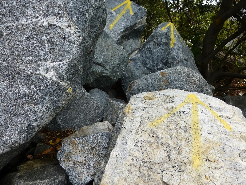
Someone had spray painted yellow arrows on some of the rocks. I guess that they thought they were being helpful but I see this as graffiti and not cool.
After we worked our way through the boulder field, we were able to pick up the remains of the road.
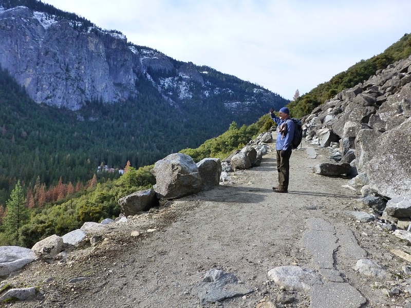
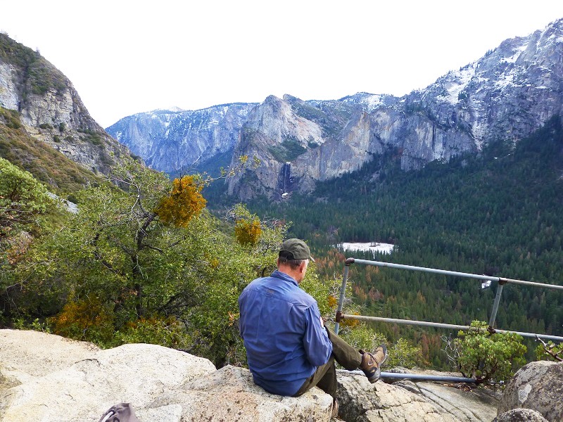
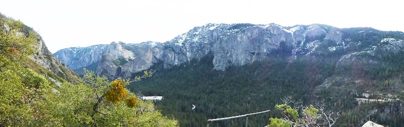
We made it to the area known as Rainbow View and decided to take an early lunch. It was a small pullout back in the day and had a railing which is still intact. It is named because in the late afternoon, a person can see a rainbow in Bridalveil Fall. I didn’t realize it until I researched this blog after our hike, but there are remains of a stone foundation below Rainbow View. No one is really sure what this building’s use was but it is thought that it may have been a storehouse for road maintenance or perhaps, someone was stationed here. The skies were a bit milky on this day and not a great day for picture taking but I did try and capture that view that included Half Dome, Bridalveil Fall and all the way to Tunnel View.
We continued farther up the trail for just shy of an hour until we came across some big trees that had fallen across the road. It seemed like a good place to turn around.
Those boulders were a real workout. Some of them would shift when my weight was on them, making me feel like I was surfing at times to keep my balance. My arms also got a good workout, pulling myself up on those larger boulders and lowering myself down. When I walked across some of the slide areas, I tried to not look down because it was straight down. I am not wild about heights. I wanted to share this with you because I don’t think this hike is for everyone and didn’t want you to get surprised if you attempt it. You can hike the lower portion of this trail and road much more easily than that rockslide area. You can also hike in from the Foresta Trail off of Big Oak Flat Road or from Tamarack Flat, and can say that you walked in those wheel tracks of those old wagons of the past.

Sources:
Big Oak Flat Road to Yosemite – Highway 120
The Big Oak Flat Road (1955) by Irene D. Paden and Margaret E. Schlichtmann
