We headed north to Hetch Hetchy to see what those waterfalls were looking like. We kept a lookout for rattlesnakes and bears along the trail and had a surprising encounter with one of these.
Where: Yosemite National Park
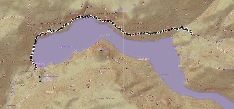
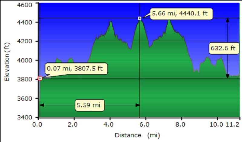
Distance: 11.25 Miles
Difficulty: Moderate
Elevation Range: 3,695′ to 4,459′
Date: April 5, 2016
Maps: Ackerson Mountain and Hetch Hetchy Reservoir Topographic Quads
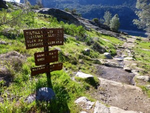
We drove up Big Oak Flat Road to Hwy 120, then about a mile west of Yosemite National Park’s Big Oak Flat Entrance Station, we took the Hetch Hetchy turnoff, following Evergreen Road, then Hetch Hetchy Road 16 miles to its end at the parking lot above O’Shaughnessy Dam and Hetch Hetchy Reservoir. My directions sound complicated, but the signs lead you where you need to go. The Hetch Hetchy Visitor booth on Hetch Hetchy Road was open and they advised us that their hours were 8 to 5, then the gate would be closed, so we made sure we were out by then.
American Indians have lived in Hetch Hetchy Valley for more than 6,000 years, gathering seeds and plants, hunting and trading. In case you were wondering where its name originated, it is thought that it probably derived from the Miwok word hatchhatchie, which means “edible grasses.”
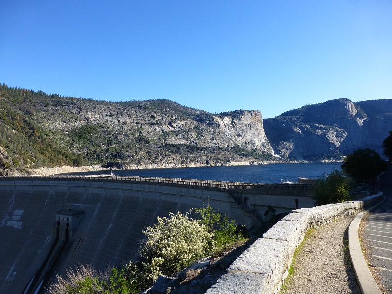
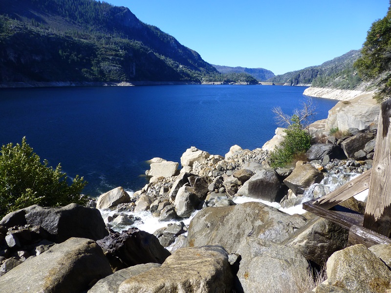
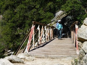
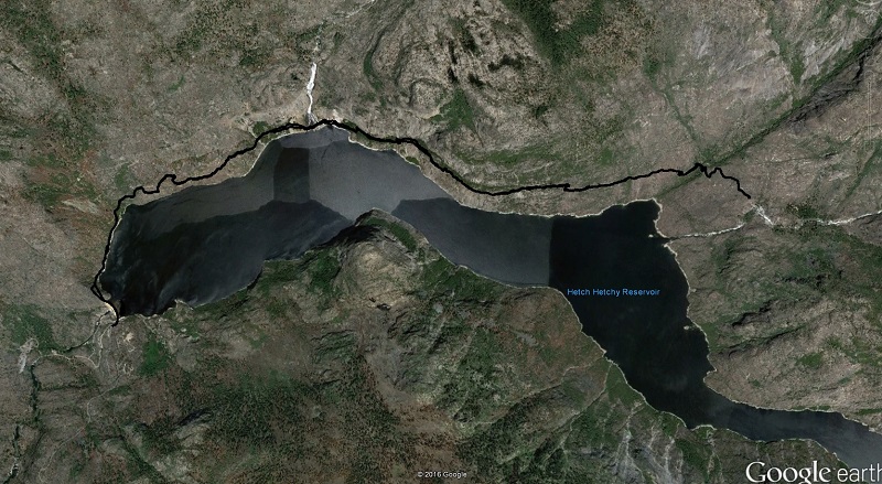
From the parking lot, we walked across the O’Shaughnessy Dam, which is a 430 foot high concrete arch-gravity dam on the Tuolumne River. Hetch Hetchy Reservoir is formed behind the dam which is the source for the Hetch Hetchy Aqueduct, which provides water for over 2 million people in San Francisco and other municipalities of the west Bay Area. The dam is named for engineer Michael O’Shaughnessy, who oversaw its construction.
I did a little reserarch on Michael Maurice O’Shaughnessy and discovered that he was born 1864 in Limerick, Ireland to a farming family that was well off enough to send to school and he graduated with honors from the Royal University in Dublin in 1884.
In 1885, after failing to find work in London, O’Shaughnessy decided to go to the United States in search of employment. He sailed from London to New York and then took the train to San Francisco arriving on March 30, 1885. Below is a copy of Mr. O’Shaughnessy’s passport, along with a picture.

His first job was with the Sierra Valley and Mohawk Railroad as an assistant engineer. In 1886 he was employed by the Southern Pacific Railroad as a surveyor and assisted in laying out the towns of Mill Valley and Sausalito. In 1889 he opened a general engineering office in San Francisco. In 1890 he was appointed chief engineer for the California Midwinter International Exposition in Golden Gate Park. In 1895, he was commissioned by the Mountain Copper Company to draw up plans for their narrow-gauge railroad. At about this same time he also worked on projects for the Spring Valley Water Company.
In 1889 O’Shaughnessy left San Francisco to design and oversee the construction of several major water supply projects in the Hawaiian Islands. Returning to the mainland in 1906 he became involved first in the Morena Dam project for San Diego and then the Merced River Dam for the Crocker Land and Development Company. He also designed and supervised the construction of a water supply system for Port Costa before San Francisco Mayor “Sunny Jim” Rolph selected him to be Chief Engineer for the City of San Francisco on September 1, 1912. O’Shaughnessy was not certain that he wanted the position because, in the past, the city had not always paid him for work done. In this position O’Shaughnessy supervised the construction of the Twin Peaks Reservoir, the Stockton Street Tunnel, the Twin Peaks Tunnel, the Municipal Railway System and numerous streets, avenues and boulevards in the city.
In 1890, he married Mary Spottiswood, probably born at or near San Francisco, and census information showed me that they had 6 children.
O’Shaughnessy’s largest, most famous, and most controversial undertaking was the Hetch Hetchy Project. San Francisco was still recovering from the Great Earthquake and Fire of 1906 and had the sympathy of many, not only in California, but also in Washington D.C. It was obvious that the city would grow rapidly in the years ahead and it was equally obvious that it’s current water supply was inadequate to meet it’s future needs. The Hetch Hetchy Project envisioned a dam in the Sierra Mountains linked by more than 150 miles of tunnels, pumping stations, and pipelines to San Francisco. The fact that the dam was to be built in Yosemite National Park stimulated an enormous amount of opposition. One of the strongest opponents was the Sierra Club and it’s President, John Muir, who felt that the Hetch Hetchy Canyon was one of the major features of Yosemite Park and should not be flooded. In his view the dam could and should be built elsewhere.
The political fight went on for some time but on December 19, 1913, President Woodrow Wilson signed a bill authorizing the necessary land grants. Construction on the huge project commenced in 1914. O’Shaughnessy lost control of the project in 1932 when the Public Utilities Commission was formed. Edward Cahill was appointed to head up the new commission and O’Shaughnessy’s deputy, Lloyd McAfee, was appointed manager and Chief Engineer for the Hetch Hetchy project. O’Shaughnessy died of a heart attack on October 12, 1934, just sixteen days before Yosemite’s water reached San Francisco. The dam that he built in Hetch Hetchy is officially known as O’Shaughnessy Dam. O’Shaughnessy Boulevard in San Francisco is another memorial to the controversial engineer. John Muir never reconciled himself to the project and environmentalists still believe that the dam is a travesty and should never have been built.
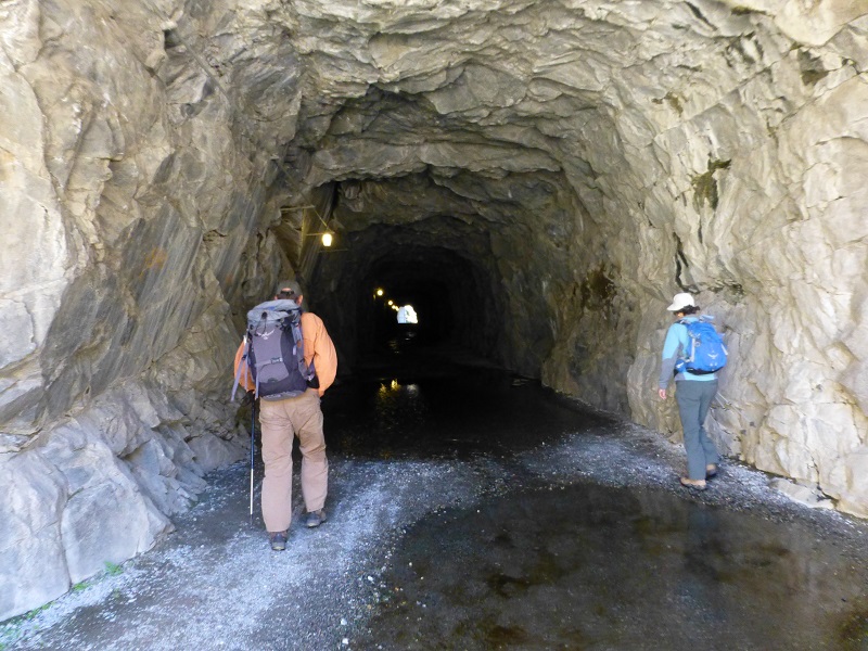
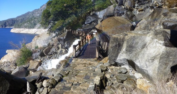
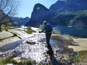
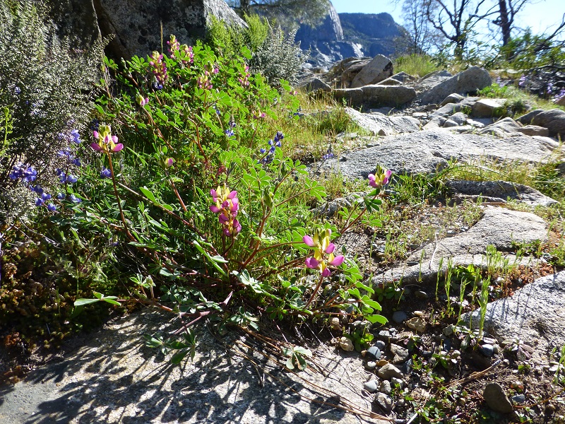
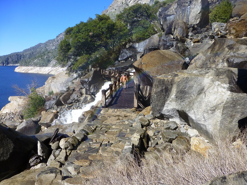
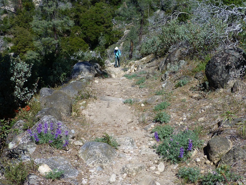
Onward with our hike. After crossing the dam, we headed through a 500 foot long tunnel, then the trail follows an old road. We followed the signs, crossing many small streams on the trail, which was lined with harlequin lupine and other flowers in places. Note that the poison oak was very lush, infringing on the trail in several places.
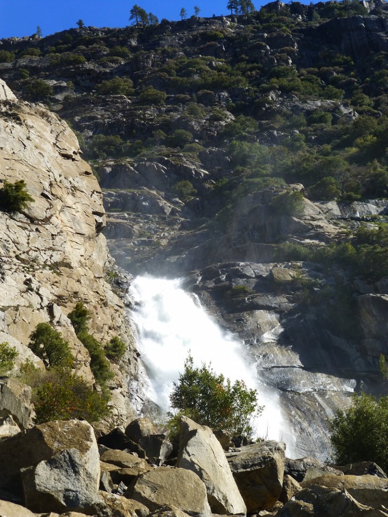
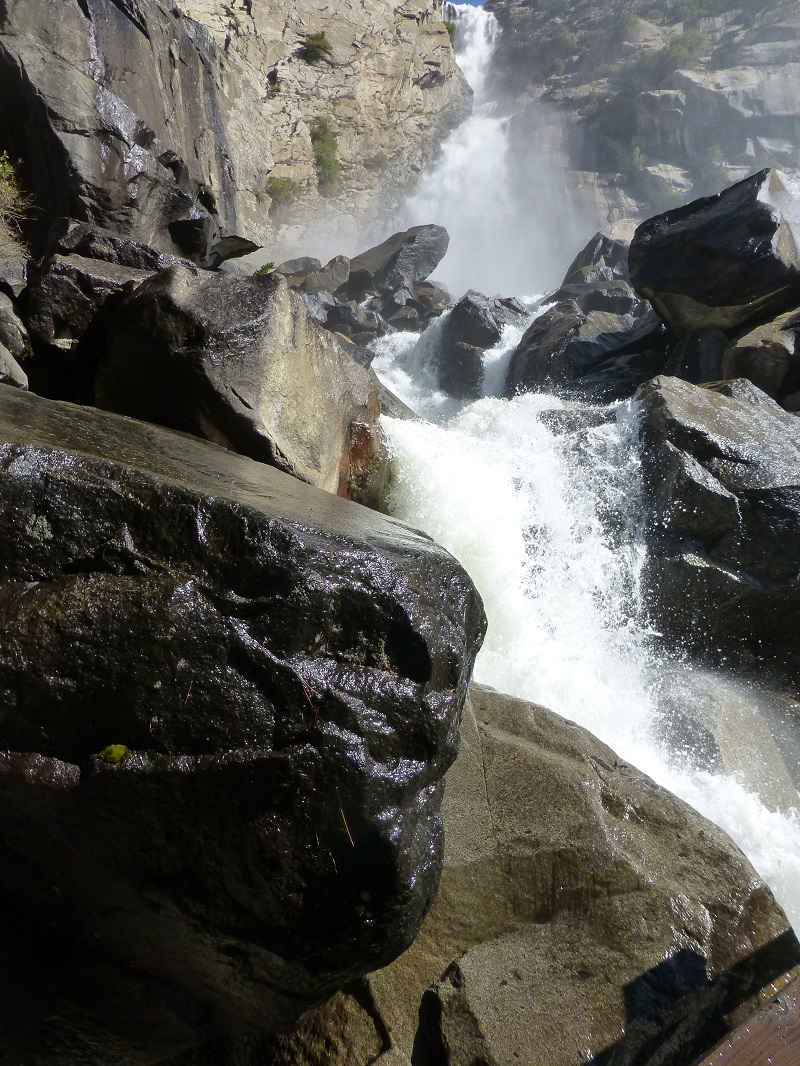
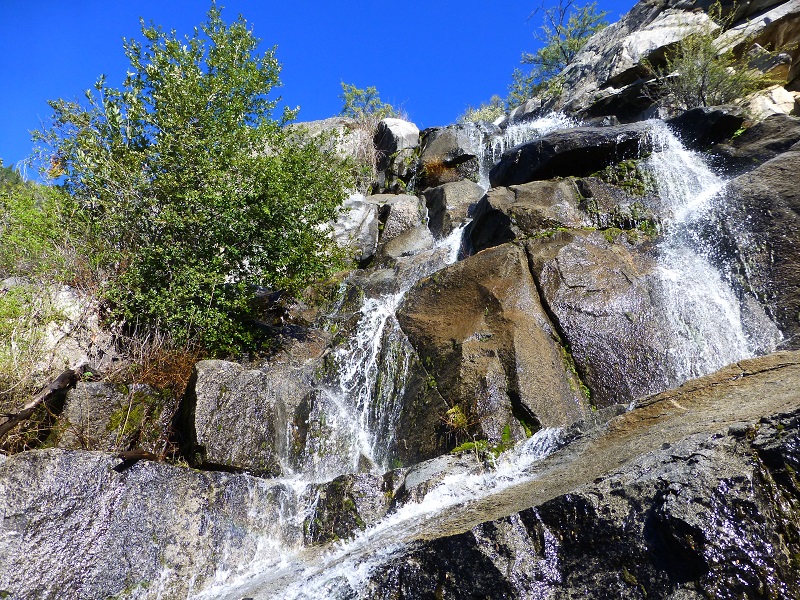
We caught a glimpse of the water spray from Wapuma Falls before we rounded the corner.
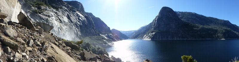
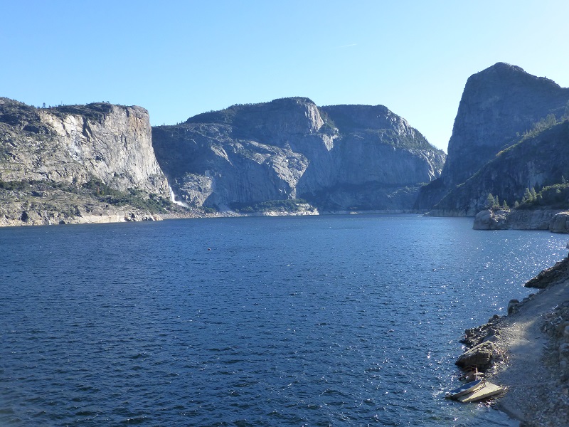
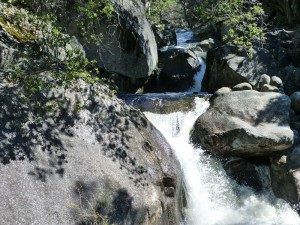
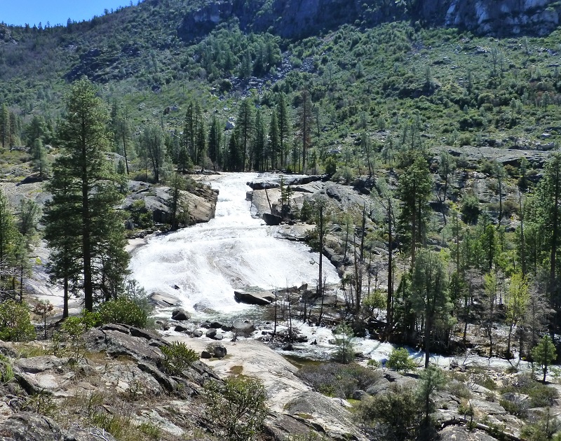
After about 2 1/2 miles, we reached Wapama Falls, which is the larger of the waterfalls that spills into Hetch Hetchy. On occasion the waterflow is so strong that it inundates the trail bridge crossing at its base and the trail is shut down and impassible at that point. On this date, the water was flowing nicely but not too much and we sure enjoyed the misty waterfall as we crossed the bridge. Wapama Falls water comes from Lake Vernon and has two main drops of water, along with a cascade of water as it empties into Hetch Hetchy. Its total drop is about 1,100′, with the top part dropping about 300′, then a 600′ drop through a steep gorge, the bottom dropping about 200′ down an escarpment. You can’t see the whole falls when you are right next to it but you can see it from the dam.
As we continued on, there were many places where small waterfalls spilled down the mountain.
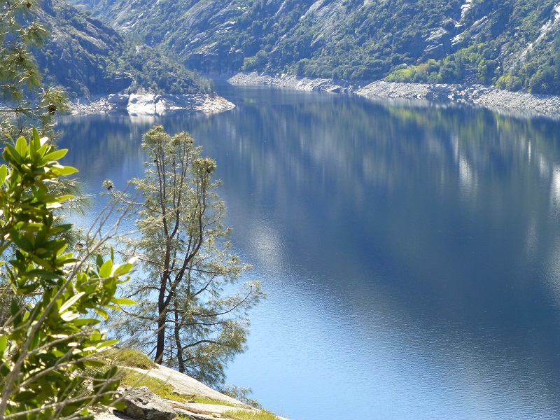
The wind had calmed some since we started our hike and we could catch a glimpse of reflections on the lake.
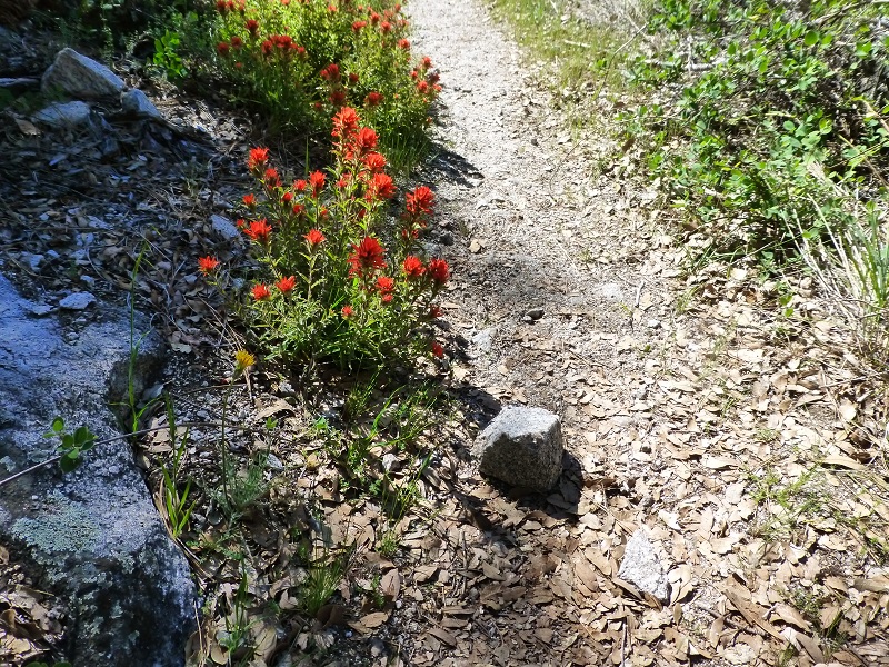
We were heading down the trail, lined in wildflowers such as the paintbrush below.
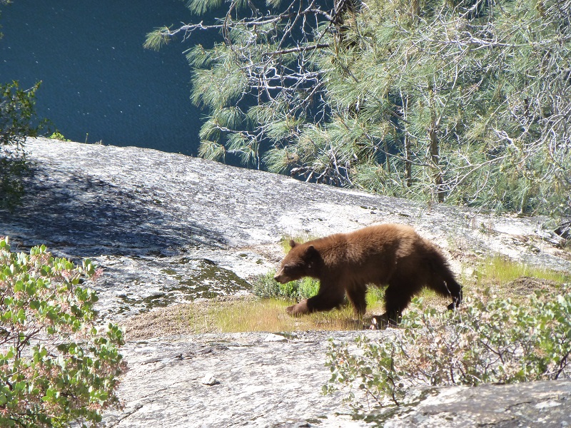
OK, now is the part where things get interesting. I was in front, Gail behind me and Steve behind her. I would guess we were about 20 to 30 feet apart. I heard rocks clanking behind me and slightly above the trail and turned around to see what it was as Gail said “bear.” This smaller bear which we estimated was about a year old or so, came sauntering down the hill right behind Gail and took its time wandering off. We stopped in our tracks and the bear checked out a log for grubs, about 5 feet from Gail. It then checked out a manzanita bush, then grazed some of the nearby the grass. As soon as Gail thought of it, she took out her camera and caught this first shot so you can tell how close the bear came down to her.
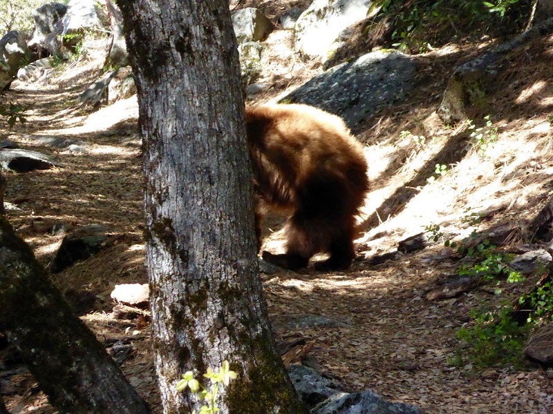
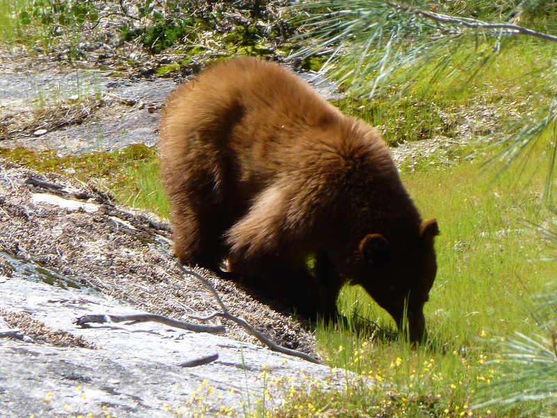
We stood still, just taking in the bear and it’s activities, then moved on down the trail, keeping a closer eye out for other bears.
We headed across another creek, then through a dry stretch.
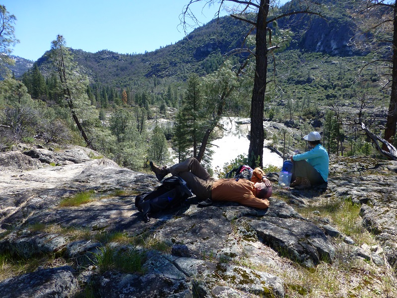
When we came within view of Rancheria Falls, we picked a good spot where we could view it all and ate our lunches. Rancheria Falls is actually a series of cascades, dropping more than more than 1,000 feet though a narrow canyon into Hetch Hetchy. Pretty nice lunch spot!
After lunch, we headed back the same way that we had come in. We didn’t have any more bear sightings on the hike but kept a close eye out for them.
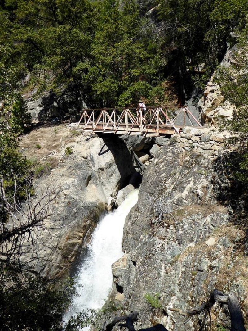
Photo of me by Gail Gilbert
We hadn’t done this hike in a couple of years and we had a good workout, along with a nice view of some beautiful falls. And of course we were still talking about that bear on the way home. Personally I don’t like to do this hike when it is warm. That trail gets awful hot and dusty, plus the falls diminish their flow and aren’t as impressive. We picked a good time to do this one.
Sources:
Michael O’Shaughnessy Wandering Lizard history
Michael O’Shaughnessy Wikipedia
Hetch Hetchy Yosemite National Park Service

