This hike was not for sissies. That is what one of my hiking buddies said to me on the way down the hill from the Dana Glacier as we had just finished descending three glacial moraines while it was hailing. One of the most difficult hikes that I have done, it was also a beautiful one that had white puffy clouds for a while, gorgeous glacial lakes, wildflowers putting on a show and of course one of the few glaciers left in our neck of the woods.
Where: Ansel Adams Wilderness, Inyo National Forest
Distance: About 6 Miles
Difficulty: Strenuous
Elevation Range: 9,648’ – 11,302’
Date: July 11, 2015
Maps: Falls Ridge and June Lake Topogs
 We parked our car at the parking area at Tioga Lake, just east of the eastern entrance to Yosemite National Park, and I took a quick look at the sky. Two small clouds were way north of Mount Conness, the opposite direction of where we were headed for the day.
The National Weather Service was calling for 20% chance of precipitation after 2 pm, so we came prepared for that. We had our rain gear packed but if we heard any rumbling of thunder, we were going to head back because we sure didn’t want to be up there in a lightning storm.
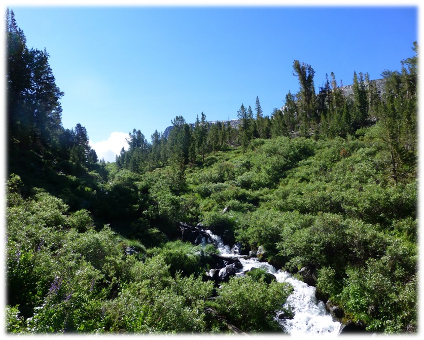
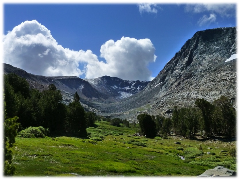
This is a strenuous hike and not for most people but the lower portion of this trail is a moderate hike. It is a pretty hike up along the creek and you can enjoy the wildflowers and views along the way.
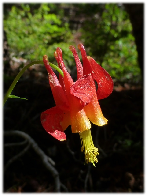
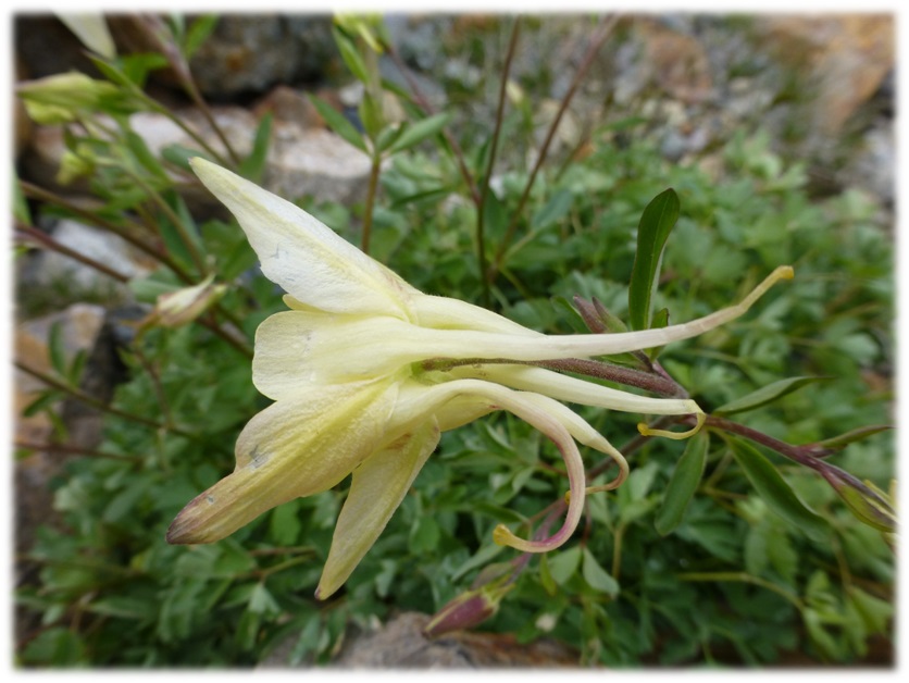
I had hoped to see columbines blooming on this hike and was surprised to see my first one, a crimson columbine, at the very beginning of the trail, right below the restrooms.
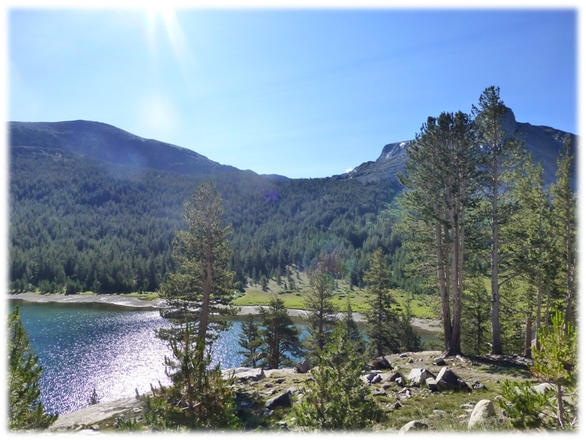
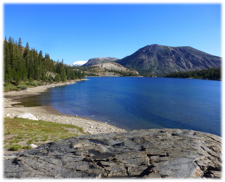
The trail led us along the west side of beautiful Tioga Lake before heading into the Ansel Adams Wilderness.
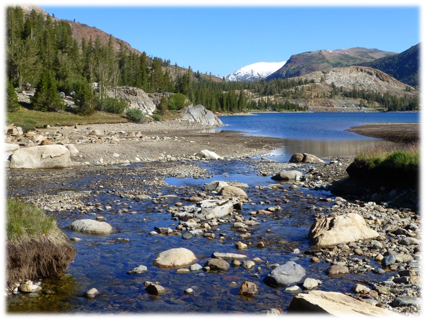
We headed up on the Glacier Canyon Trail, also known as the Dana Lakes Trail, entering the Ansel Adams Wilderness. Following the trail along the glacier-fed Dana Fork, we were treated to a water ouzel dipping in the creek. I am sorry that we weren’t able to get a picture of this bird for you but I did find a nice video for you to watch them in action.
In this video, you can see how the bird dips its head below the water. It is also known as the American dipper and is equipped with an extra eyelid called a “nictitating membrane” that allows it to see underwater, and scales that close its nostrils when submerged. John Muir wrote about the water ouzel in his book, The Mountains of California. If you would like to read his chapter about this unique bird, you are in luck because the Yosemite Online Library has it online and you can access it for free. I have a link at the end of the blog to make it easy.

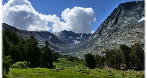
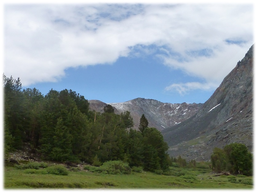
After the trail left the creek, it took us up to a spot with amazing views of Mount Conness and the country to the north.

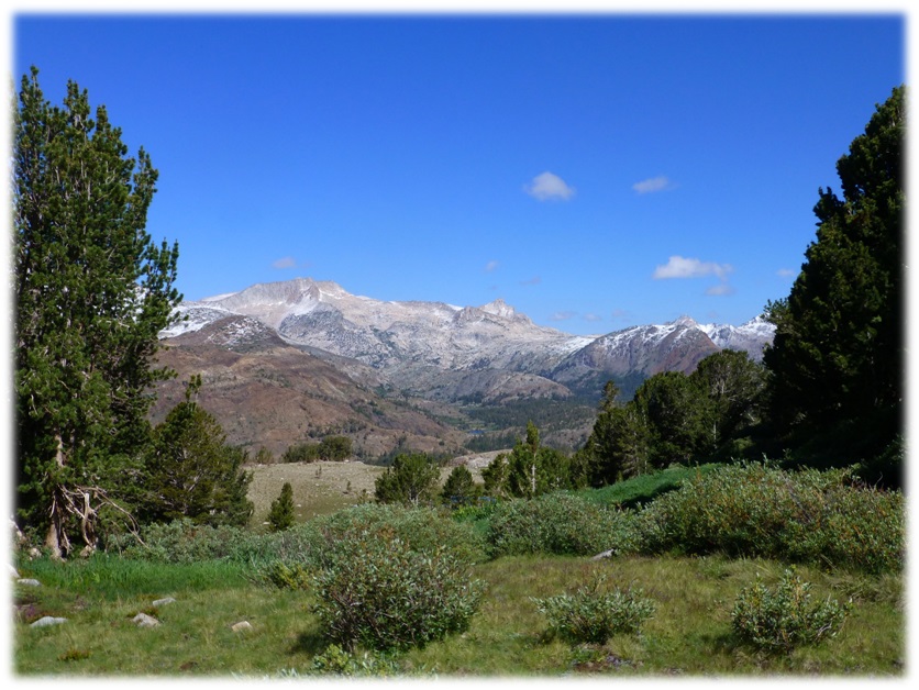
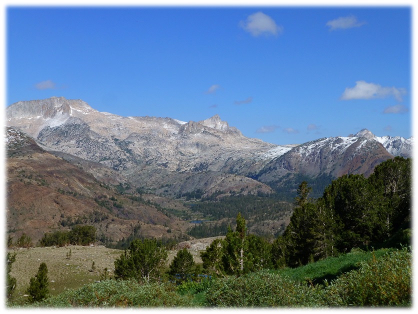
We could also see the off trail route to where we were headed for the day. My strategy was to stay high of the willow patches but below the rocky slabs. A few white puffy clouds had materialized.
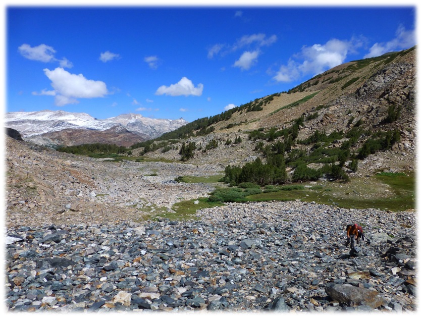
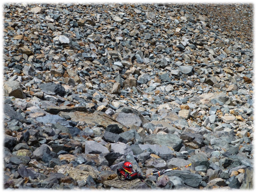
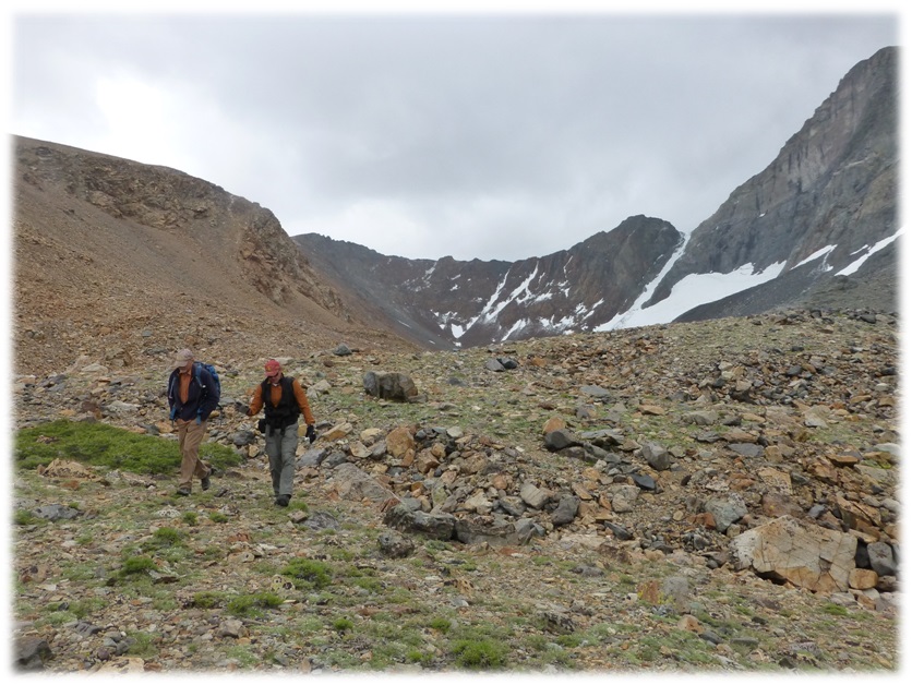
We headed up the first of three glacial moraines, created when the glacier retreated. One of my hiking buddies calls this portion an “ankle killer.”
The rocks are all different sizes and shapes and you just need to pick your way up there the best you can. Sometimes you step on a rock that wobbles or shifts. Another one of my hiking buddies is still on the injured reserve list because of this hike last summer. Be careful and be warned!
We spotted a pack, helmet and skis in the middle of one of the moraines but no person. That was weird. We later learned that they were climbing along side one of the mountains.
Some pretty columbines were nestled in those glacial moraines.
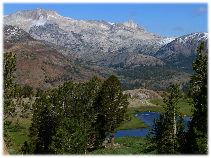
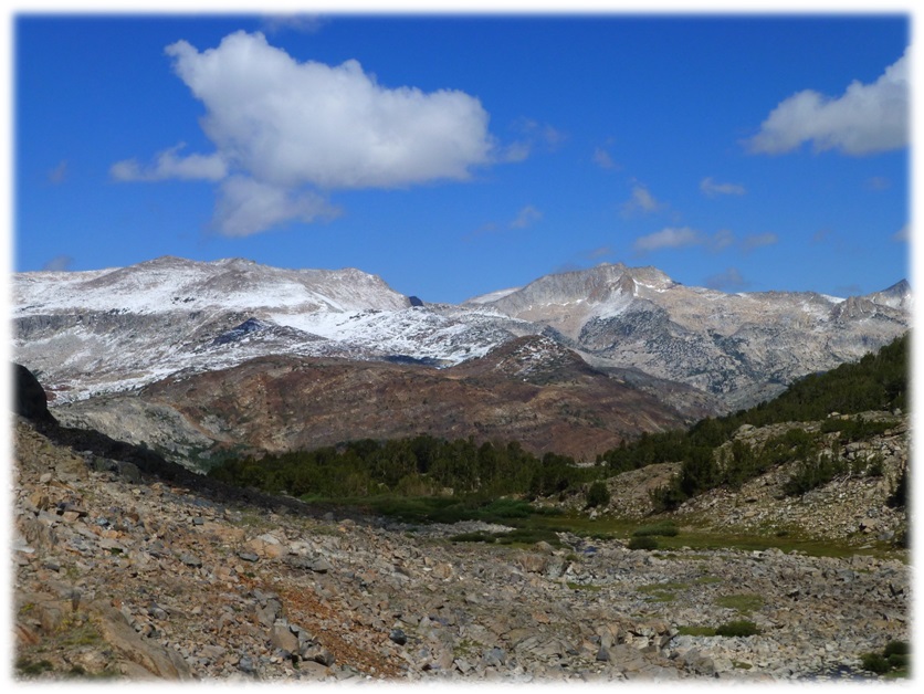
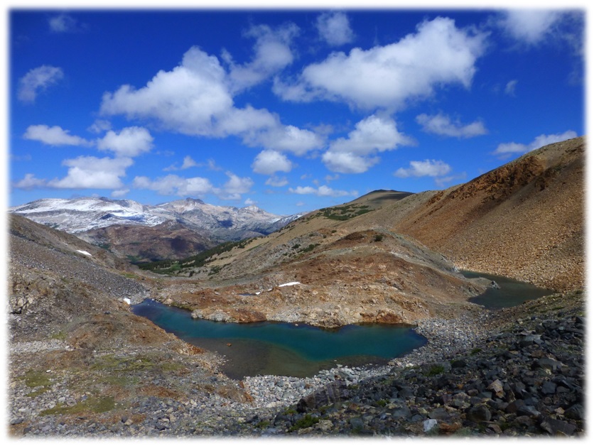
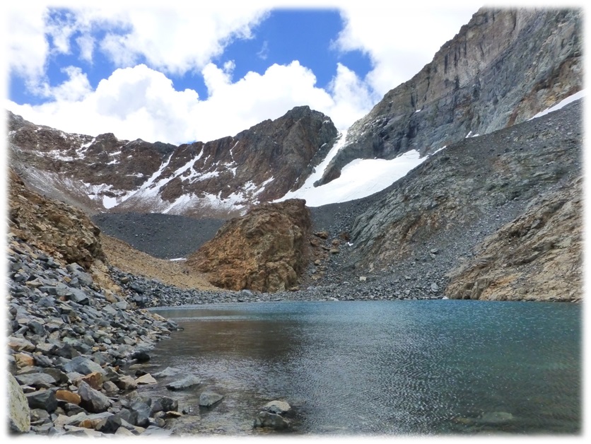
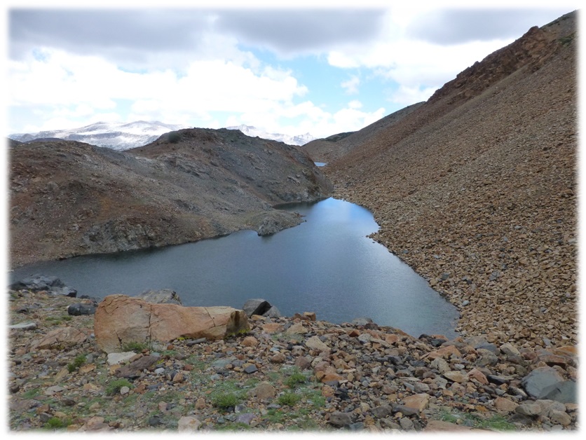
We made it to Upper Dana Lake, which is the largest of the Dana Lakes. Mount Dana, reaching 13,061’ tall,juts up at the southwestern corner of this lake. It is the second highest mountain in Yosemite (after Mount Lyell) and is named after James Dwight Dana, who was a professor of geology at Yale College. You can read more about him in a previous blog linked at the end of this blog.
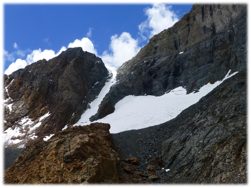
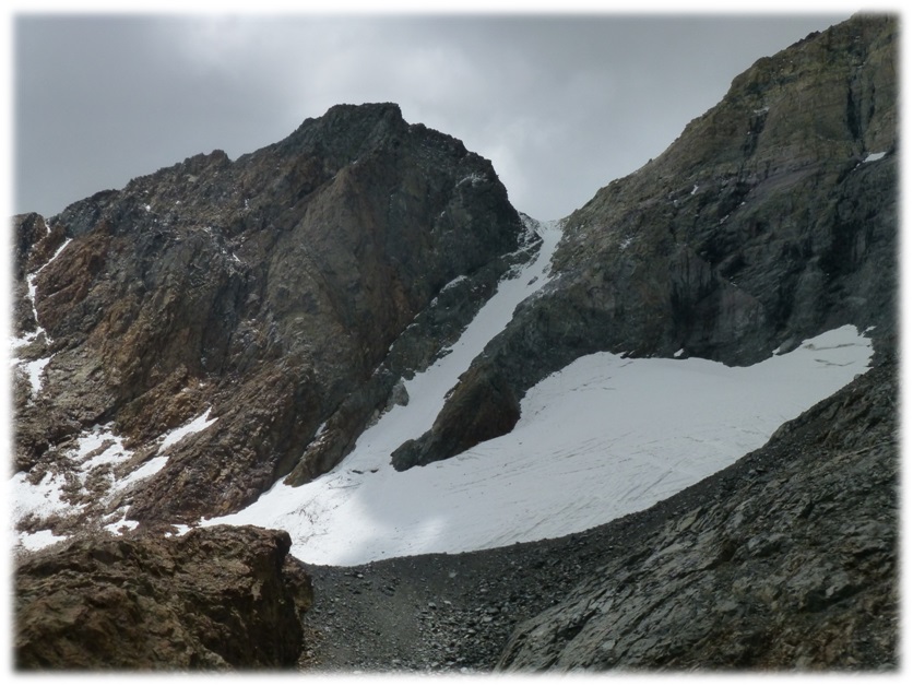
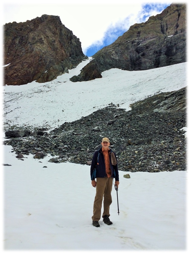
We worked our way along the east shore of the lake where a barely visible trail skirted the lake. It had rock slides in places but was OK. The Dana Glacier was in clear view.


We reached a point toward the upper end of the lake where the marginal trail had broken off or slid away, requiring some Class 3 climbing. We headed high, climbing hand to hand for a small portion where a fall could have been disastrous. I began to feel that this was beyond my comfort level. My legs were already beginning to feel strained from walking up those moraines and if I did make it past this bad spot, I would need to be climbing through much more moraine and back through this rough spot.
I elected to not go further but Steve and Rick continued on. I found a good spot on the shore of the lake, somewhat protected from the wind, bundled up and ate my lunch. It was a beautiful lunch spot underneath the Dana Glacier where I could watch Rick and Steve head up. After I lost sight of them, I watched the white puffy clouds float by.


When we think about glaciers, we have images in our heads from the ice age but there are still glaciers around. There are several glaciers found in the Sierra Nevada, usually above 10,000 elevation and on the north sides of the mountains.
The definition of a glacier is a body of perennial ice or snow that moves. Based on this definition, some have placed the number of glaciers in the Sierra Nevada at over 100 and there are several in the Yosemite area.
Glaciers are important indicators of our climate trends. We are lucky to have historical photos of Dana glaciers taken by Israel Cook Russell while he was conducting surveys for the USFS in 1883 that show how large this glacier was. Multiple pictures of the glacier, known as repeat photographs, help show how it has changed over time.

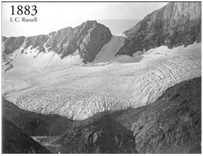
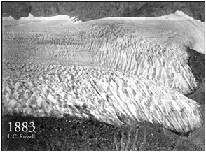
I located a two part video series by Geographer Hassan Basagic where he utilizes these 1883 photographs, along with GPS, to help document their shrinkage. If you would like to learn more, here are the links:
KQED Climate Watch: The Shrinking Glacier, Part 1: https://youtu.be/80Zxixd5IHc
KQED Climate Watch: The Shrinking Glacier, Part 2: https://youtu.be/fCO0NA3Cb
Rick and Steve headed up along the left side of the reddish rocks, then made it to the glacier. They both took some pictures next to the glacier.

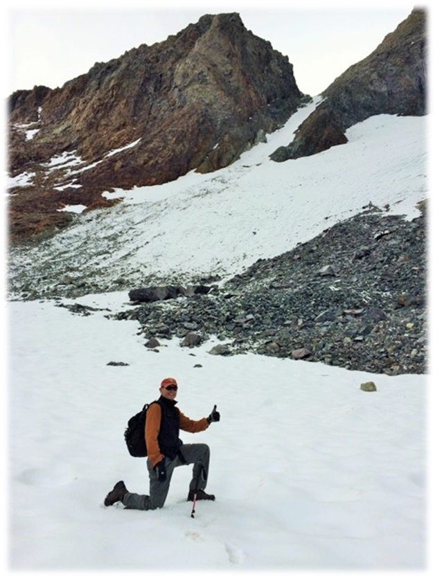
After they made it back, they took a quick rest and ate their lunch. We started heading back with white puffy clouds and blue sky to the north but it was a different picture to the south.

The National Weather Service had forecasted possible rain after 2:00. We could see the cloud cover was really building to our south and figured that we had better get moving off of that mountain. It was 1:55 when the skies opened up with hail and we put our rain jackets on. Since we were above treeline, there was no cover or protection from the hail and if lightning should start hitting, this would be a bad place to be. It hailed for about 45 minutes as we had to work our way down those 3 glacial moraines. They were wet, slippery and coated with hail. The hail was stinging our faces at times as it came down hard.
We made it off the moraines, just as the little weather event started clearing. We didn’t have any thunder or lightning, just the hail.

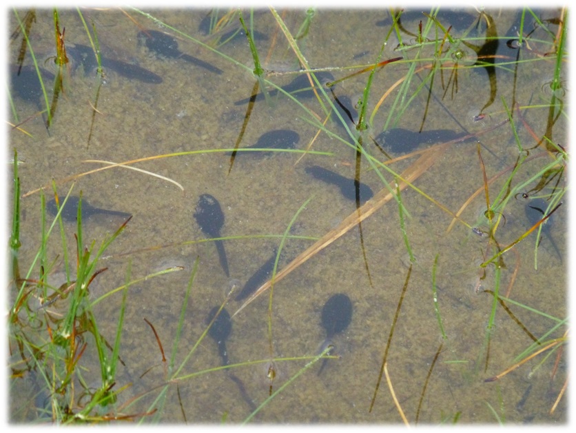
We had skirted large willow patches, then tied in with the main trail to Dana Plateau, then back through a meadow-like area with tarns that had been freshly refilled from the recent rains. They were beautiful with their reflections of the clouds. We looked a little closer and they were also full of tadpoles!

We were still a little wet from the hailstorm when we reached our car. Steve and Rick thought a cup of coffee would hit the spot and suggested stopping by the Tioga Pass Resort. I thought this was a pretty dumb idea. We would have to drive a whole mile or so in the opposite direction from where we needed to be heading home but since I wasn’t driving, I quietly went with the crowd. Since Steve decided to get a cup of hot chocolate, I figured I would get one also. Boy, that was the best hot chocolate that I remember tasting. Now, this was the most brilliant idea that I had heard of in a while. It sure hit the spot as we headed home.
If you haven’t heard of the Tioga Pass Resort or thought they just had cabins for rent, you should check out the café. They are famous for their pies and have all kinds, plus other sweet treats. They make them on site! I have also had many other very good meals there. They are always very friendly and we felt like we were treated extra special by Jed as he rang us up. OK, we were the only people there at the time but they are always super friendly.


Sources:
http://en.wikipedia.org/wiki/James_Dwight_Dana
https://en.wikipedia.org/wiki/American_dipper
http://www.yosemite.ca.us/john_muir_writings/the_mountains_of_california/chapter_13.html
Muir, John, The Mountains of California (1894)
Day Hikes in the Tioga Pass Region, John Carroll O’Neill & Elizabeth Stone O’Neill, 2002
http://www.tiogapassresort.com/
http://www.glaciers.pdx.edu/Thesis/Basagic/mtnclimPOSTER4.pdf
http://sierra-alpinist.typepad.com/sierra_alpinist/2008/11/check-out-the-toll-a-hundred-years-of-global-warming-can-take-on-a-fragile-sierra-glacier-this-photographer-is-going-all-ove.html
http://hassanbasagic.com/tag/dana-glacier/
http://www.glaciers.pdx.edu/Thesis/Basagic/snglac.html
Prior Blogs: