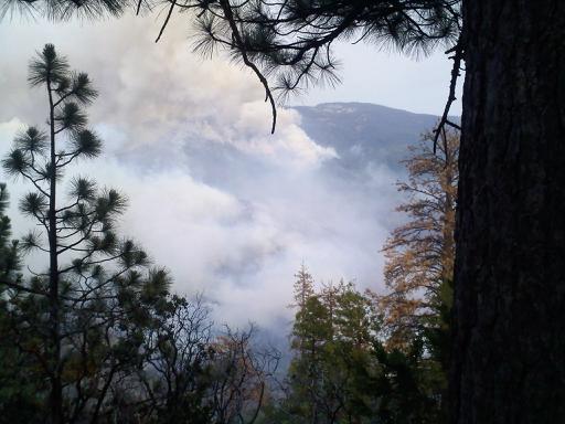
EASTERN MADERA COUNTY – Heavy smoke continues to blanket the area this morning as the Aspen Fire on the east side of the San Joaquin River continues to burn.
The Aspen Fire was discovered just after midnight on Tuesday, July 23, burning below Stump Springs Road north of Aspen Springs in the Sierra National Forest – High Sierra Ranger District. The fire has burned between 2,000 – 3,000 acres and remains active.
Additional resources continue to arrive at staging areas to assisting in fire suppression and give needed relief to crews who have been on the fire since it started on Tuesday.
Initial attack crews from the Sierra National Forest were able to keep the fire from burning into the Kaiser Wilderness, and firefighter and public safety remains the highest priority, say the Forest Service.
Thick, heavy smoke have prevented some aircraft operations over the last two days, and road closures remain in place at Stump Springs Road.
The South Central Sierra Interagency Incident Management Team assumed command of the Aspen Fire at 6 p.m. on July 24, and will work with the Sierra National Forest to manage suppression efforts.
Smoke from the Aspen Fire will impact air quality in local communities. Individuals sensitive to smoke are suggested to remain indoors and keep windows closed, to minimize exposure to smoke.
The fire is in steep, rugged, inaccessible terrain, described by the Forest Service as “extreme.” There is no imminent threat to the community of Big Creek at this time.
The Sierra National Forest has suppressed 15 additional fires related to Monday night’s lightning storm, and all were less than ¼ acre in size.
We continue to contact the Forest Service regularly for more detailed information, but do hear on the radio that patrols are reporting that the fire has not jumped to the Madera County side of the river, but the potential is there, and officials are planning for that contingency.
Radio traffic yesterday also indicated Sierra patrols notifying people in Rock Creek and Fish Creek campgrounds to be aware of a possible evacuation order should the fire cross the canyon.
Location: 37.279 latitude, -119.318 longitude
Road Closure: Stump Springs Road
Evacuations: Sample Meadow and West Kaiser Campgrounds