SIERRA NATIONAL FOREST – Due to the diligence and hard work of crews and aircraft resources, the fire has now reached 67 percent containment. The weather conditions have cooperated with firefighting efforts to allow the increase in containment. Lines continued to be patrolled and mopped up throughout the night.
Total acreage increased to 140,760 acres and the Rough Fire remains the largest active fire in California. There are 3,742 personnel currently assigned to the incident.
Foothill communities west of the fire should see clearing skies and some relief from smoke impacts as the winds move up from the southwest and west today. This will shift the impacts to those areas immediately adjacent to the wildfire, and to the Owens Valley to the east and northeast of the incident.
Mostly moderate impacts are anticipated due to the reduction in active burn areas, with a few areas of higher readings in close proximity. Overall, much improved conditions are expected today throughout the impact area.
SOUTH ZONE
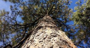
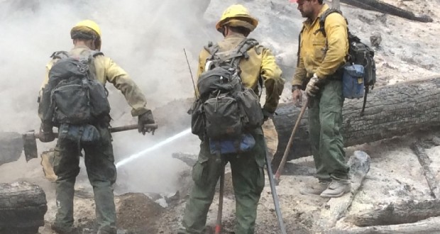
There are still areas of active burning under tree canopies and around the base of trees, which require mop up. Mopping up is a term used for the continued extinguishing and cooling of hot or burning material within the fire perimeter.
Today all structure wraps are being removed as the focus turns to suppression repair. Crews are beginning suppression repair work in the Cedar Grove area.
WEST ZONE
Firefighters remained busy throughout the night mopping up and completing fire control lines. The incomplete fire containment line was strengthened and prepared for a potential burnout operation. The weather assisted firefighters with cooler temperatures and higher humidities. Weather will remain favorable today.
Firefighters will continue to complete fire control lines and evaluate the possibility of a control burn to completely contain the West Zone. Containment levels will continue to increase today. The fire will continue burning toward the Kings River.
NORTH ZONE
Suppression and repair work of the fire line and road system will continue in the area of Crown Valley Creek; creating water bars and pulling out thousands of feet of hose. Crews are poised for defending Balch Camp and the Kirch Flat area, while the West zone prepares for a burnout operation.
On Wednesday, the Fresno County Sheriff’s Office and fire officials made a collaborative decision to lift some of the existing mandatory evacuation orders near the area of the Rough Fire. This decision took effect at 10 a.m.
Removal of Mandatory Evacuation Areas
– All residences north of Highway 180, between Dunlap Road and Highway 245 (Includes Armenian Church Camp and surrounding properties)
– Currently, this does not include the Sequoia Lake area
Road Information
– A closure remains on Highway 180 at Highway 245
– Millwood Road, north of Highway 180 remains closed
Sequoia National Park remains open and visitors can still use the Ash Mountain Entrance Station. Vehicles longer than 22 feet (including trailers) are not advised between Potwisha and Giant Forest Museum.
Forest officials have been forced to close the Hume Lake Ranger District. This includes Forest Service managed land from the southeast side of Pine Flat Reservoir to the boundaries of Kings Canyon National Park, and the Eshom area north of Badger. A closure map can be found on the Sequoia National Forest website www.fs.usda.gov/sequoia/ This closure is expected to continue until the Rough Fire has been contained.
Residents are encouraged to be patient and courteous as they return to their homes. Please drive carefully and be cautious of fire crews and law enforcement officers still working along the roadways.
Fire Officials would like to thank the public for its cooperation during this difficult situation. Please understand the decision to administer evacuation orders and warnings is ultimately carried out by the Sheriff’s Office, however, it is based upon input by the fire officials in charge of the operation. Ensuring the safety of the public is, and will always be, the number one priority.
View the latest information on the Rough Fire at http://inciweb.nwcg.gov/incident/4456/ and www.fresnosheriff.org, where a map of the current evacuation areas can be accessed.
Information regarding returning home after a fire:
The Sierra National Forest, in pursuant to 16 USC 551 and 36 CFR 261.50(a) and (b), and to provide for public safety, implemented a new Forest Closure by Dean Gould, Forest Supervisor on the North Zone of the Rough Fire. The purpose of the closure is to provide safety for the public and for the firefighters who are engaged in fire suppression activities. The closure will remain in effect until the fire fully suppressed.
The Rough Fire was started by lightning on July 31.
For today’s map of the Rough Fire, click here.
Sierra National Forest Closure Orders: http://www.fs.usda.gov/sierra/
Sequoia National Forest Closure Orders: http://www.fs.usda.gov/sequoia/
Sequoia National Park and Kings Canyon National Park: http://www.nps.gov/seki/index.htm
Evacuation Notices: http://www.fresnosheriff.org/