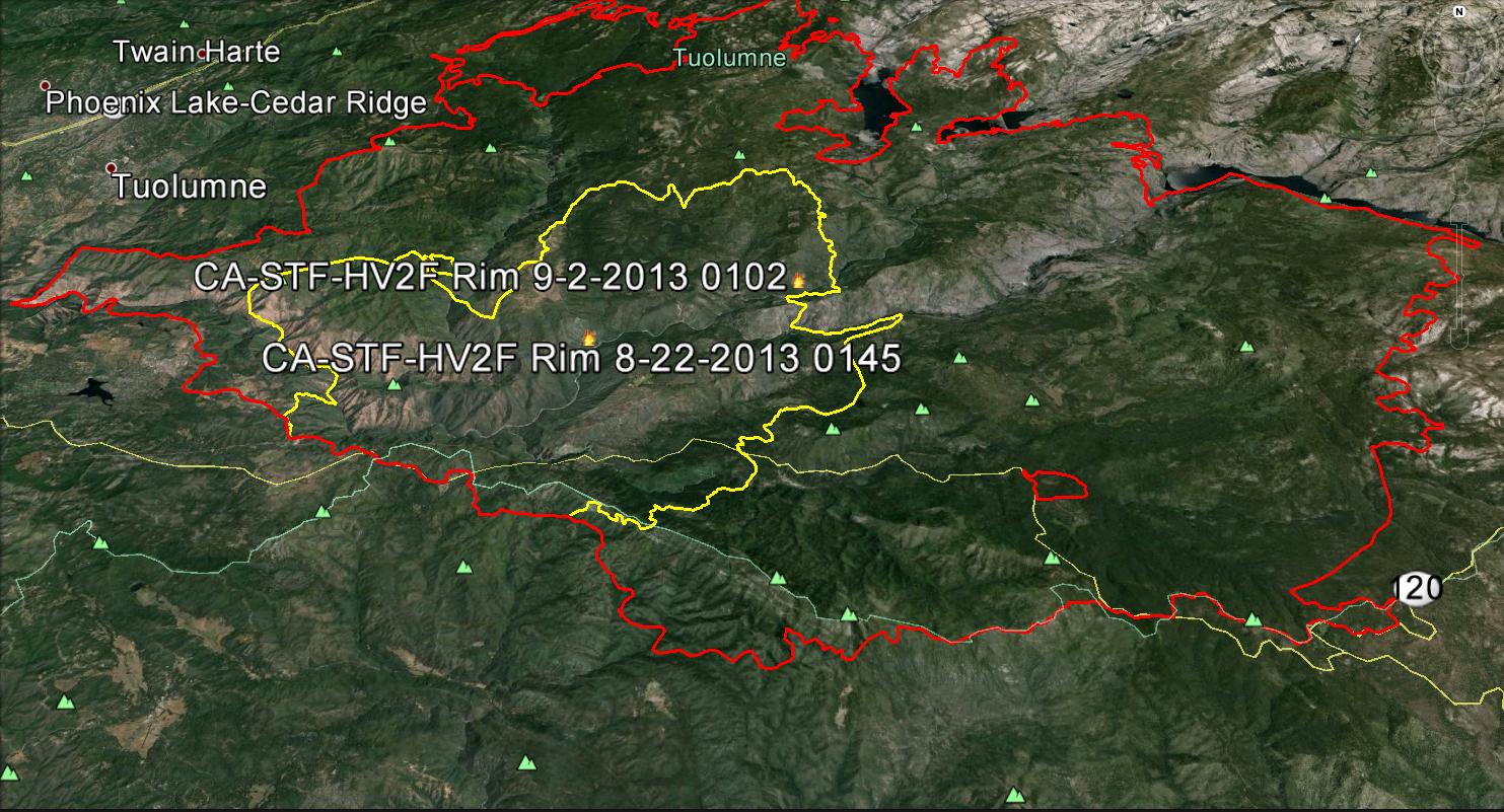
TUOLUMNE COUNTY – Firefighters have gained some ground on the Rim Fire, achieving 60% containment of the 228,670 acre blaze. Click here for a map of the completed fireline.
After several days of dense smoke throughout our area and the San Joaquin Valley, a shift in the winds back to a southwesterly flow has cleared the air and blue skies returned to the Eastern Madera County today.
A slight chance of showers and thunderstorms has been forecast for the fire area Monday and Tuesday.
 Most of Yosemite National Park is open. Winds in the Yosemite area have been variable, causing periods of smoky conditions throughout much of the Park.
The Big Oak Flat Road (the continuation of Highway 120 inside Yosemite) is closed from Big Oak Flat Entrance Station to Crane Flat. The only access to Yosemite Valley is via Highway 140 from Merced or Highway 41 from Oakhurst – click here to view alternate routes.
All facilities and areas along the Big Oak Flat Road west of Crane Flat are closed, including Tuolumne and Merced Groves of Giant Sequoias (which are not in imminent danger), Hodgdon Meadow and Crane Flat Campgrounds, and the Big Oak Flat Information station. The Crane Flat gas station and store are open.
The Tioga Road (Highway 120 through the park) is closed from Crane Flat to Ten Lakes Trailhead just west of Yosemite Creek Picnic Area, at least through Sept. 2. The only access to the Tuolumne Meadows area is via Highway 120 from near Lee Vining.
 All facilities and areas along the Tioga Road west of Ten Lakes Trailhead are closed, including Tamarack Flat, White Wolf, and Yosemite Creek Campgrounds, and White Wolf Lodge. Ten Lakes Trailhead parking is closed, but the Yosemite Creek Picnic Area is open.
The Hetch Hetchy Road, including all areas and facilities along the road, is closed.
The Old Coulterville Road is closed west and north of its junction with 1st Street near Foresta. Old Coulterville Road in the community of Foresta is open. Residential access to Flying Spur Ranch is allowed. View a map of this closure.
Fire Update:
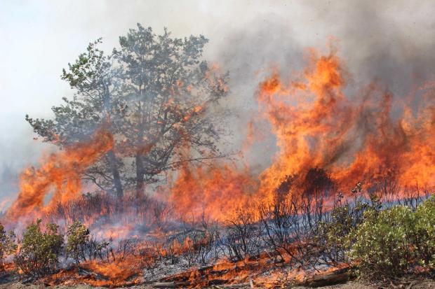
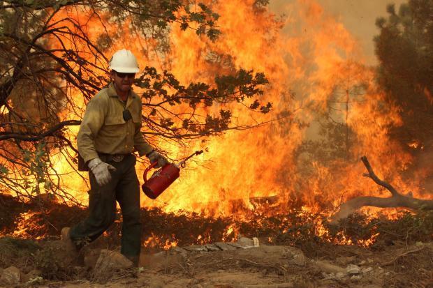
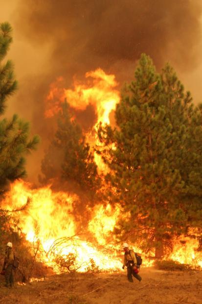
 Firefighters have completed nearly 100 miles of fire line, 5 of those miles done by hand. Line construction combined with burning operations continued overnight where safe conditions and accessibility allowed on the east and southeast flanks of the fire. There has been good progress made on the spot fires occurring near Pilot Peak and along the southern perimeter.
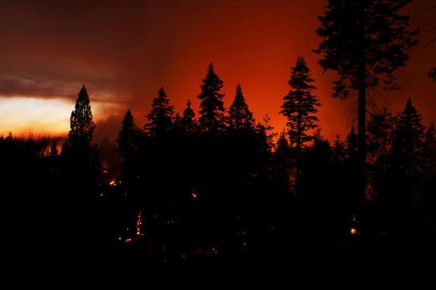
The fire continues to be active in the south and southeast with moderate rates of spread and torching. Today winds will be coming from the south southwest with up to 20mph gusts.
Fire activity has been slow and moderate in the north end of the fire. Today’s fire weather is extreme. Very active fire and extensive spotting continues to hamper suppression efforts and pose risks to firefighters. Air resources continue to be utilized in assistance with spot fires, slowing fire advancement, and control lines in advance of the fire spread.
Wilderness trail closures:
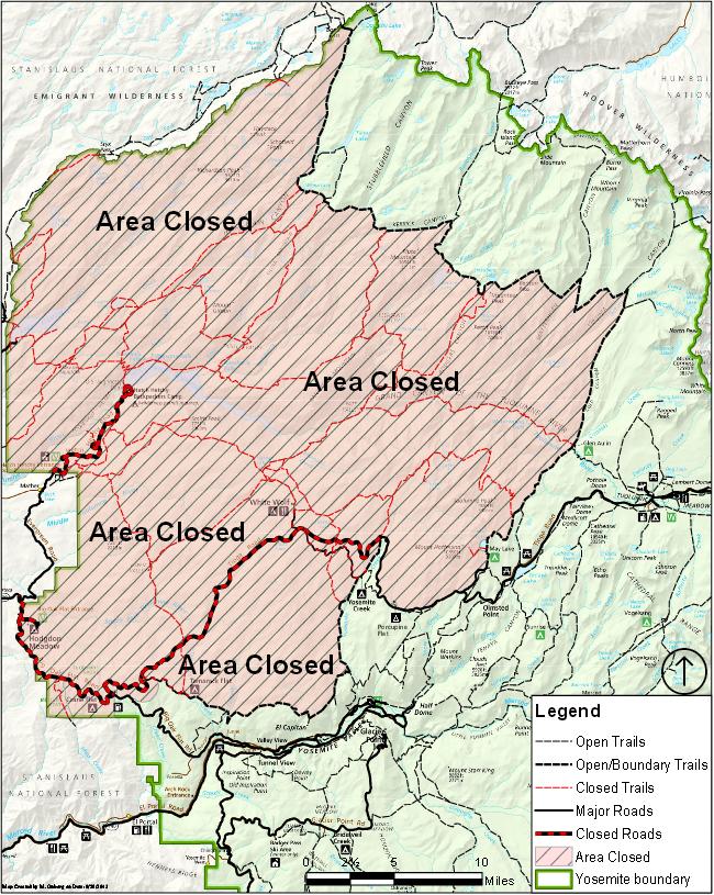
The area west of the May Lake Road and May Lake Trail continuing to the junction with the Pacific Crest Trail (PCT) at Glen Aulin and then north along the PCT to Bond Pass is closed. The park’s boundary serves as the closure’s northern and western edge extending south to the junction of the Big Oak Flat Road and Tioga Road at Crane Flat.
The closure’s boundary continues east from Crane Flat paralleling the Tioga Road a half mile to its south to the Tamarack Flat Campground Road, then follows the Tamarack Flat Campground Road to the campground and continues on the Tamarack Creek trail to the junction with the North Rim Trail, then east along the North Rim trail to the Yosemite Creek trail north to the Tioga Road. The closure then follows the Tioga Road east to the May Lake Road.
The trails serving as the eastern and southern boundary of the closed area remain open. May Lake High Sierra Camp, Glen Aulin High Sierra Camp, and Porcupine Flat Campground are open.
Fire restrictions:
 No smoking and no building, maintaining, attending, or using a fire, campfire, or cooking fire (including charcoal fires) within Yosemite Wilderness or at the High Sierra Camps. Portable stoves using gas or pressurized liquid fuel are allowed. Alcohol and “Sierra” stoves may not be used in wilderness under these restrictions.
Campfires and cooking fires may still be used in designated campgrounds and picnic areas in developed portions of the park in accordance with park regulations.
This includes the following campgrounds, when open: Upper Pines, Lower Pines, North Pines, Camp 4, Wawona, Bridalveil Creek, Hodgdon Meadow, Crane Flat, Tamarack Flat, White Wolf, Yosemite Creek, Porcupine Flat, and Tuolumne Meadows.)
This includes the following picnic areas, when open: Lembert Dome, Tenaya Lake, Yosemite Creek, Wawona, Mariposa Grove, Glacier Point, Cascade, El Capitan, Cathedral Beach, Sentinel Beach, Swinging Bridge, Church Bowl, and Lower Yosemite Fall.
Park and Forest Closures:
 Yosemite National Park has closed Tamarack Flat and Yosemite Creek Campgrounds, both located along Tioga Road. White Wolf Campground and White Wolf Lodge remain closed.
The Stanislaus National Forest has issued an area closure for the entire Groveland Ranger District and for the Mi-Wok Ranger District east of Highway 108. Additional details are available from the Stanislaus Forest Supervisor’s Office, 209-532-3671; Mi-Wok Ranger Station, (209) 586-3234; Summit Ranger Station, 209-965-3434; and Groveland Ranger Station, 209-962-7825.
Road Closures:
Highway 120 remains closed from Buck Meadows to 1 ½ miles east of White Wolf. Highway 120 east/Tioga Road remains open from 1 ½ miles east of White Wolf to the Tioga Pass entrance. Cherry Lake Road is closed at Highway 120. Evergreen Road and Old Yosemite Road are also closed. Highway 120 from Ferretti Road to Buck Meadows remains open for local residents and businesses only.
Evacuations and Advisories:
There are currently no mandatory or advisory evacuation orders effective in Mariposa County. An evacuation advisory remains in effect for Ponderosa Hills and areas east, along the south side of Highway 108 up to Pinecrest. Highway 120 at the Yosemite National Park boundary west to Buck Meadows has been evacuated. Evacuation centers are at the Mother Lode Fairgrounds in Sonora and at the Greeley Hill Community Center.
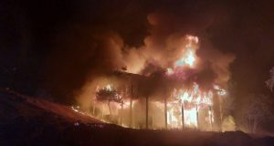
The Rim fire was discovered on Aug. 17. The cause is still under investigation. Over 5,000 personnel are assigned to the incident, and five injuries have been reported. Cost to fight the fire to date is $66 million. For some interesting facts on the Rim Fire, click here.